146 entries match your criteria. The first 100 are listed. ⊳
Defenses of Washington Historical Markers
National Archives
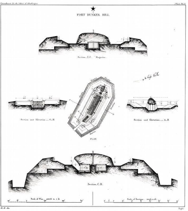
Fort Bunker Hill
| 1 ► District of Columbia, Washington, Northeast Washington, Brookland — Fort Bunker Hill — Civil War Defenses of Washington — 1861-1865 — |
| On 14th Street Northeast at Perry Street Northeast, on the left when traveling north on 14th Street Northeast. | |||
| 2 ► District of Columbia, Washington, Northeast Washington, Brookland — Fort Bunker Hill — |
| Near Otis Street Northeast near 14th Street Northwest, on the right when traveling west. | |||
| 3 ► District of Columbia, Washington, Northeast Washington, Fort Totten — Fort Totten — Civil War Defenses of Washington — 1861-1865 — |
| On Fort Totten Drive Northeast north of Crittenden Street Northeast, on the right when traveling north. | |||
| 4 ► District of Columbia, Washington, Northeast Washington, Fort Totten — Fort Totten — |
| On Fort Totten Drive Northeast north of Allison Street Northeast, on the right when traveling north. | |||
| 5 ► District of Columbia, Washington, Northeast Washington, Mahaning Heights — 15 — "We're Not Forgotten" — A Self-Reliant People — Greater Deanwood Heritage Trail — |
| On Minnesota Avenue Northeast at Grant Street Northeast, on the left when traveling south on Minnesota Avenue Northeast. | |||
| 6 ► District of Columbia, Washington, Northeast Washington, Mahaning Heights — Fort Mahan — Civil War Defenses of Washington — |
| On Benning Road Northeast at 41st Street Northeast, on the right when traveling west on Benning Road Northeast. | |||
| 7 ► District of Columbia, Washington, Northwest Washington, American University Park — 9 — And the Church Goes on — Top of the Town — Tenleytown Heritage Trail — |
| On River Road Northwest just west of Murdock Mill Road, on the right when traveling west. | |||
| 8 ► District of Columbia, Washington, Northwest Washington, American University Park — Fort Bayard — |
| On River Road Northwest at Western Avenue Northwest, on the right when traveling south on River Road Northwest. | |||
| 9 ► District of Columbia, Washington, Northwest Washington, Brightwood — 16 — “Get Down You Fool” — Battleground to Community — Brightwood Heritage Trail — |
| On Quackenbos Street Northwest east of 13th Street Northwest, on the left when traveling west. | |||
| 10 ► District of Columbia, Washington, Northwest Washington, Brightwood — 17 — Aunt Betty's Story — Battleground to Community — Brightwood Heritage Trail — |
| On 13th Street Northwest at Quakenbos Street Northwest, on the right when traveling north on 13th Street Northwest. | |||
| 11 ► District of Columbia, Washington, Northwest Washington, Brightwood — Fort Stevens — |
| On 13th Street Northwest at Quakenbos Street Northwest, on the right when traveling north on 13th Street Northwest. | |||
| 12 ► District of Columbia, Washington, Northwest Washington, Brightwood — Fort Stevens — Rock Creek Park — National Park Service, U.S. Department of the Interior |
| On Quackenbos Street Northwest at 13th Street Northwest, on the left when traveling east on Quackenbos Street Northwest. Reported permanently removed. | |||
| 13 ► District of Columbia, Washington, Northwest Washington, Brightwood — Lincoln Under Fire at Fort Stevens — |
| Near 13th Street Northwest north of Fort Stevens Drive Northwest, on the right when traveling north. | |||
| 14 ► District of Columbia, Washington, Northwest Washington, Brightwood — Scale Model of Fort Stevens — |
| On Quackenbos Street Northwest near 13th Street Northwest, on the left when traveling east. | |||
| 15 ► District of Columbia, Washington, Northwest Washington, Kent — Battery Kemble — One of the Civil War Defenses of Washington — |
| On Chain Bridge Road Northwest, 0.2 miles south of Nebraska Avenue Northwest, on the left when traveling south. | |||
| 16 ► District of Columbia, Washington, Northwest Washington, Kent — Battery Kemble Park — Defense of Washington — |
| On Chain Bridge Road Northwest north of MacArthur Boulevard Northwest, on the right when traveling north. | |||
| 17 ► District of Columbia, Washington, Northwest Washington, Manor Park — Fort Slocum — Civil War Defenses of Washington — 1861-1865 — |
| On Kansas Avenue Northwest at Nicholson Street Northwest, on the right when traveling south on Kansas Avenue Northwest. | |||
| 18 ► District of Columbia, Washington, Northwest Washington, Rock Creek Park — Fort De Russy — Civil War Defenses of Washington — 1861-1865 — |
| On Oregon Avenue Northwest north of Military Road Northwest, on the right when traveling north. | |||
| 19 ► District of Columbia, Washington, Northwest Washington, Rock Creek Park — Fort DeRussy — |
| Near Oregon Avenue Northwest at Military Road Northwest, on the right when traveling north. | |||
| 20 ► District of Columbia, Washington, Northwest Washington, Rock Creek Park — Fort DeRussy — Rock Creek Park — National Park Service, U.S. Department of the Interior — |
| Near Oregon Avenue Northwest at Military Road Northwest, on the right when traveling north. | |||
| 21 ► District of Columbia, Washington, Northwest Washington, Takoma — 98th Pennsylvania Infantry — |
| On Georgia Avenue Northwest (U.S. 29) north of Van Buren Street Northwest, on the right when traveling north. | |||
| 22 ► District of Columbia, Washington, Northwest Washington, Takoma — Battleground National Cemetery — Rock Creek Park — National Park Service, U.S. Department of the Interior — |
| Near Georgia Avenue Northwest (U.S. 29) just north of Van Buren Street Northwest, on the right when traveling north. | |||
| 23 ► District of Columbia, Washington, Northwest Washington, Takoma — 13 — Battleground National Cemetery — Battleground to Community — Brightwood Heritage Trail — |
| On Georgia Avenue Northwest (U.S. 29) north of Van Buren Street Northwest, on the right when traveling north. | |||
| 24 ► District of Columbia, Washington, Northwest Washington, Takoma — Company K, 150th Ohio National Guard Infantry — |
| Near Georgia Avenue Northwest (U.S. 29) north of Van Buren Street Northwest, on the right when traveling north. | |||
| 25 ► District of Columbia, Washington, Northwest Washington, Takoma — Roll Call — Rock Creek Park — National Park Service, U.S. Department of the Interior — |
| Near Georgia Avenue Northwest (U.S. 29) north of Van Buren Street Northwest, on the right when traveling north. | |||
| 26 ► District of Columbia, Washington, Northwest Washington, Takoma — The 122nd New York Volunteer Infantry — |
| Near Georgia Avenue Northwest (U.S. 29) north of Van Buren Street Northwest, on the right when traveling north. | |||
| 27 ► District of Columbia, Washington, Northwest Washington, Takoma — The 25th New York Cavalry — |
| On Georgia Avenue Northwst (U.S. 29) north of Van Buren Street Northwest, on the right when traveling north. | |||
| 28 ► District of Columbia, Washington, Northwest Washington, Tenleytown — Fort Reno — Tenleytown, D.C. — Country Village to City Neighborhood — |
| On Chesapeake Street Northwest west of Nebraska Avenue Northwest, on the left when traveling west. | |||
| 29 ► District of Columbia, Washington, Northwest Washington, Tenleytown — Fort Reno — Civil War Defenses of Washington — 1861-1865 — |
| On Nebraska Avenue Northwest at Chesapeake Street Northwest, on the right when traveling south on Nebraska Avenue Northwest. | |||
| 30 ► District of Columbia, Washington, Northwest Washington, Tenleytown — Fort Reno — Rock Creek Park — National Park Service, U.S. Department of the Interior — |
| Near Chesapeake Street Northwest west of Nebraska Avenue Northwest, on the right when traveling west. | |||
| 31 ► District of Columbia, Washington, Northwest Washington, Tenleytown — Fort Reno — Rock Creek Park — National Park Service, U.S. Department of the Interior — |
| 32 ► District of Columbia, Washington, Northwest Washington, Tenleytown — 5 — Fort Reno — Top of the Town — Tenleytown Heritage Trail — |
| On Chesapeake Street Northwest east of 40th Street Northwest, on the left when traveling east. | |||
| 33 ► District of Columbia, Washington, Northwest Washington, Tenleytown — 6 — Reno City — Top of the Town — Tenleytown Heritage Trail — |
| On 40th Street Northwest at Chesapeake Street Northwest, on the right when traveling south on 40th Street Northwest. | |||
| 34 ► District of Columbia, Washington, Northwest Washington, Tenleytown — Reservoir / Reno City — Tenleytown, DC — Country Village to City Neighborhood — |
| On Chesapeake Street Northwest east of Fort Drive Northwest, on the right when traveling east. | |||
| 35 ► District of Columbia, Washington, Northwest Washington, Tenleytown — Tennally's Town: My, How You've Grown — ©2017, Jarrett Ferrier — Funded by the DC Commission on the Arts and Humanities, Public Art Building Communities Grant Progra — |
| On Wisconsin Avenue Northwest, 0.1 miles north of Tenley Circle Northwest, on the right when traveling north. | |||
| 36 ► District of Columbia, Washington, Northwest Washington, Tenleytown — The Civil War Defenses of Washington — Fort Reno — |
| On Chesapeake Street, 0.1 miles west of Nebraska Avenue when traveling west. | |||
| 37 ► District of Columbia, Washington, Southeast Washington, Anacostia — Fort Stanton — Civil War Defenses of Washington — 1861 – 1865 — |
| Near Morris Road Southeast west of 16th Street Southeast, on the right when traveling west. | |||
| 38 ► District of Columbia, Washington, Southeast Washington, Benning Ridge — Fort Chaplin — Civil War Defenses of Washington — 1861-1865 — |
| On Texas Avenue Southeast at C Street Southeast, on the right when traveling south on Texas Avenue Southeast. | |||
| 39 ► District of Columbia, Washington, Southeast Washington, Buena Vista — 9 — A Museum for the Community — An East-of-the-River View — Anacostia Heritage Trail — |
| On Martin Luther King Jr. Avenue Southeast south of Talbert Street Southeast when traveling north. | |||
| 40 ► District of Columbia, Washington, Southeast Washington, Congress Heights — Fort Carroll — Civil War Defenses of Washington — 1861-1865 — |
| On Martin Luther King, Jr. Avenue Southeast, 0.1 miles north of South Capitol Street Southeast, on the right when traveling west. | |||
| 41 ► District of Columbia, Washington, Southeast Washington, Fort Davis — Fort Davis — Civil War Defenses of Washington — |
| On Alabama Avenue Southeast north of Pennsylvania Avenue Southeast, on the left when traveling north. | |||
| 42 ► District of Columbia, Washington, Southeast Washington, Fort Davis — Fort Davis — Civil War Defenses of Washington — 1861 - 1865 — |
| On Alabama Avenue Southeast north of Pennsylvania Avenue Southeast, on the right when traveling south. | |||
| 43 ► District of Columbia, Washington, Southeast Washington, Fort Dupont — Fort DuPont — Civil War Defenses of Washington — |
| Near Alabama Avenue Southeast east of Massachusetts Avenue Northeast, on the left when traveling east. | |||
| 44 ► District of Columbia, Washington, Southeast Washington, Fort Dupont — Fort DuPont — Civil War Defenses of Washington — 1861 - 1865 — |
| Near Alabama Avenue Southeast west of Beck Street Southeast, on the right when traveling west. | |||
| 45 ► District of Columbia, Washington, Southeast Washington, Woodland — Battery Ricketts — Civil War Defenses of Washington — 1861-1865 — |
| On Bruce Place Southeast at Raynolds Place Southeast, on the right when traveling north on Bruce Place Southeast. | |||
| 46 ► District of Columbia, Washington, Southwest Washington, Bellevue — Fort Greble — Civil War Defenses of Washington — 1861-1865 — |
| On Elmira Street Southwest at Martin Luther King Jr. Avenue Southwest, on the right when traveling west on Elmira Street Southwest. | |||
| 47 ► District of Columbia, Washington, Southwest Washington, Southwest Waterfront — Abraham Lincoln — |
| On District Square Southwest just north of Wharf Street Southwest, on the right when traveling south. | |||
| 48 ► Maryland, Montgomery County, Bethesda — Artist's Conception of Battery Bailey, Circa 1862 — |
| Near Elliott Road, 0.4 miles west of Ashfield Road, on the right when traveling west. | |||
| 49 ► Maryland, Montgomery County, Bethesda — Battery Bailey — |
| On Elliott Road, 0.4 miles west of Ashfield Road, on the right when traveling west. | |||
| 50 ► Maryland, Montgomery County, Bethesda — Col. Guilford Dudley Bailey — The Fallen Union Officer for Whom the Battery Was Named — |
| On Elliott Road, 0.4 miles west of Ashfield Road, on the right when traveling west. | |||
| 51 ► Maryland, Montgomery County, Bethesda — Defending the City of Washington — |
| Near Elliott Road, 0.4 miles west of Ashfield Road, on the right when traveling west. | |||
| 52 ► Maryland, Montgomery County, Bethesda — Fort Sumner — |
| On Sangamore Road at Westpath Way, on the left when traveling north on Sangamore Road. | |||
| 53 ► Maryland, Montgomery County, Bethesda — What is a Battery? — |
| Near Elliott Road, 0.4 miles west of Ashfield Road, on the right when traveling west. | |||
| 54 ► Maryland, Prince George's County, Colmar Manor — Fort Lincoln — |
| Near Bladensburg Road (Maryland Route 450) 0.2 miles west of 38th Avenue, on the left when traveling west. | |||
| 55 ► Maryland, Prince George's County, Colmar Manor — Fort Lincoln — |
| Near Bladensburg Road (Alternate U.S. 1) east of Eastern Avenue, on the right when traveling north. | |||
| 56 ► Maryland, Prince George's County, Colmar Manor — Historic Fort Lincoln — |
| Near Bladensburg Road (Alternate U.S. 1) east of Eastern Avenue, on the right when traveling north. | |||
| 57 ► Maryland, Prince George's County, Colmar Manor — Historic Fort Lincoln Cemetery — |
| On Bladensburg Road, 0.2 miles south of 37th Street, on the left when traveling south. | |||
| 58 ► Maryland, Prince George's County, Fort Washington — 15-inch Rodman Smoothbore |
| Near Fort Foote Road at Jessica Drive, on the right when traveling south. Reported permanently removed. | |||
| 59 ► Maryland, Prince George's County, Fort Washington — Fort Foote — Protecting the Nation’s Capital |
| Near Fort Foote Road. Reported permanently removed. | |||
| 60 ► Maryland, Prince George's County, Fort Washington — Fort Washington Park — |
| On Fort Washington Road, on the right when traveling west. | |||
| 61 ► Maryland, Prince George's County, Fort Washington — King's Depression Carriage |
| Near Fort Foote Road. Reported permanently removed. | |||
| 62 ► Maryland, Prince George's County, Fort Washington — Northwest Bastion |
| Near Fort Foote Road, on the right when traveling west. Reported permanently removed. | |||
| 63 ► Maryland, Prince George's County, Fort Washington — The Defenses of Washington |
| Near Fort Foote Road, on the right when traveling west. Reported permanently removed. | |||
| 64 ► Virginia, Alexandria, Old Town — Battery Rodgers — |
| On South Lee Street at Green Street, on the right on South Lee Street. | |||
| 65 ► Virginia, Alexandria, Seminary Hill — "The Fort" and "Seminary" Community — Civil War to Civil Rights — City of Alexandria, est. 1749 — |
| On West Braddock Road, 0.2 miles west of Marlboro Drive, on the right when traveling west. | |||
| 66 ► Virginia, Alexandria, Seminary Hill — African Americans and the Civil War — Fleeing, Fighting and Working for Freedom — City of Alexandria, est. 1749 — |
| On West Braddock Road, 0.2 miles west of Marlboro Drive, on the right when traveling west. | |||
| 67 ► Virginia, Alexandria, Seminary Hill — Bombproof — |
| Near West Braddock Road, on the right when traveling west. | |||
| 68 ► Virginia, Alexandria, Seminary Hill — Entrance Gate to Fort Ward/Officers' Hut — |
| On West Braddock Road, on the right when traveling east. | |||
| 69 ► Virginia, Alexandria, Seminary Hill — Fort Ward — 1861-1865 — |
| Near West Braddock Road, on the right when traveling west. | |||
| 70 ► Virginia, Alexandria, Seminary Hill — Fort Ward — 1861-1865 — |
| Near West Braddock Road, on the right when traveling west. | |||
| 71 ► Virginia, Alexandria, Seminary Hill — Fort Ward — |
| On West Braddock Road (County Route 420). | |||
| 72 ► Virginia, Alexandria, Seminary Hill — Fort Williams — |
| On North Quaker Lane at Coventry Lane, on the left when traveling north on North Quaker Lane. | |||
| 73 ► Virginia, Alexandria, Seminary Hill — Fort Worth — |
| On St Stephens Road west of North Garland Street, on the left when traveling west. | |||
| 74 ► Virginia, Alexandria, Seminary Hill — Northwest Bastion — |
| On West Braddock Road. | |||
| 75 ► Virginia, Alexandria, Seminary Hill — Outlying Gun Battery — City of Alexandria, Virginia — |
| Near West Braddock Road, 0.1 miles west of Marlboro Drive, on the right when traveling west. | |||
| 76 ► Virginia, Alexandria, Seminary Hill — Powder Magazine and Filling Room — |
| Near West Braddock Road, on the right when traveling west. | |||
| 77 ► Virginia, Alexandria, Seminary Hill — Profile of Fort — |
| Near West Braddock Road, on the right when traveling west. | |||
| 78 ► Virginia, Alexandria, Seminary Hill — Rifle Trench — |
| Near West Braddock Road, on the right when traveling west. | |||
| 79 ► Virginia, Alexandria, Seminary Hill — Southwest Bastion — City of Alexandria, Virginia |
| Near West Braddock Road, 0.2 miles west of Marlboro Drive, on the right when traveling west. Reported damaged. | |||
| 80 ► Virginia, Alexandria, Southwest Quadrant — Alexandria National Cemetery — |
| Near Wilkes Street west of Hamilton Avenue when traveling west. | |||
| 81 ► Virginia, Alexandria, Taylor Run — Fort Ellsworth — |
| On Roberts Lane, 0.3 miles north of Duke Street (Virginia Route 236), on the left when traveling north. | |||
| 82 ► Virginia, Arlington County, Arlington, Arlington Ridge — 6 — Fort Scott — |
| On Fort Scott Drive, on the right when traveling east. | |||
| 83 ► Virginia, Arlington County, Arlington, Army Navy Country Club — 16 — Fort Richardson — Historical Site — Defenses of Washington 1861 - 1865 — |
| Near 18th Street South. | |||
| 84 ► Virginia, Arlington County, Arlington, Court House — 13 — Fort Cass — Historical Site — Defenses of Washington 1861 - 1865 — |
| On Arlington Boulevard (U.S. 50) at 10th Street North, on the right when traveling east on Arlington Boulevard. | |||
| 85 ► Virginia, Arlington County, Arlington, Court House — 11 — Fort Woodbury — Historical Site — Defenses of Washington 1861 - 1865 — |
| On North Courthouse Road at North 14th Street, on the right when traveling south on North Courthouse Road. | |||
| 86 ► Virginia, Arlington County, Arlington, Crystal City — A Historic Junction — |
| Near 6th Street South east of Long Bridge Drive, on the right when traveling east. | |||
| 87 ► Virginia, Arlington County, Arlington, Crystal City — Arlington Transformed by War — |
| On 6th Street South east of Long Bridge Drive, on the right when traveling east. | |||
| 88 ► Virginia, Arlington County, Arlington, Crystal City — Fort Runyon after the Civil War — |
| On 6th Street South east of Long Bridge Drive, on the right when traveling east. | |||
| 89 ► Virginia, Arlington County, Arlington, Crystal City — Fort Runyon: Defending the Capital — |
| On 6th Street South east of Long Bridge Drive, on the right when traveling east. | |||
| 90 ► Virginia, Arlington County, Arlington, Crystal City — Known Units Garrisoned at Fort Runyon — |
| On 6th Street South east of Long Bridge Drive, on the right when traveling east. | |||
| 91 ► Virginia, Arlington County, Arlington, Crystal City — The Defenses of Washington |
| On 6th Street South east of Long Bridge Drive, on the right when traveling east. Reported damaged. | |||
| 92 ► Virginia, Arlington County, Arlington, Crystal City — The March Across the Long Bridge — |
| On 6th Street South east of Long Bridge Drive, on the right when traveling east. | |||
| 93 ► Virginia, Arlington County, Arlington, Crystal City — The Union Soldier — |
| On 6th Street South east of Long Bridge Drive, on the right when traveling east. | |||
| 94 ► Virginia, Arlington County, Arlington, Douglas Park — 17 — Fort Berry — Historical Site — Defenses of Washington 1861 - 1865 — |
| On South Glebe Road (Virginia Route 120) at South Walter Reed Drive, on the right when traveling south on South Glebe Road. | |||
| 95 ► Virginia, Arlington County, Arlington, Fort Myer — 12 — Fort Whipple — Historical Site — Defenses of Washington 1861 - 1865 — |
| On Arlington Boulevard (U.S. 50) at North Pershing Drive, on the right when traveling east on Arlington Boulevard. | |||
| 96 ► Virginia, Arlington County, Arlington, Green Valley — 18 — Fort Barnard — Historical Site — Defenses of Washington 1861 - 1865 — |
| On South Pollard Street at South Walter Reed Drive, on the left when traveling south on South Pollard Street. | |||
| 97 ► Virginia, Arlington County, Arlington, Long Bridge Park — 5 — Fort Runyon — Historical Site — Defenses of Washington 1861 - 1865 — |
| On Clark Street at Boundary Channel Drive, on the right when traveling north on Clark Street. | |||
| 98 ► Virginia, Arlington County, Arlington, Lyon Park — 14 — Fort Tillinghast — Historical Site — Defenses of Washington 1861 - 1865 — |
| On Arlington Boulevard (U.S. 50) at North 2nd Street, on the right when traveling south on Arlington Boulevard. | |||
| 99 ► Virginia, Arlington County, Arlington, North Highland — 1 — Fort Bennett — |
| On 22nd Street North, on the right when traveling east. | |||
| 100 ► Virginia, Arlington County, Arlington, North Highland — 9 — Fort Strong — Historical Site — Defenses of Washington 1861 - 1865 — |
| On Langston Boulevard (U.S. 29) at North Adams Street, on the right when traveling south on Langston Boulevard. | |||
146 entries matched your criteria. The first 100 are listed above. The final 46 ⊳