According to Catholic Church records, approximately 693 early residents of Los Angeles were buried in this cemetery.
This memorial garden honors these early residents.
Words surround this sacred place from the Spanish, English, . . . — — Map (db m164890) HM
On Paseo de la Plaza at Olvera Street on Paseo de la Plaza.
The Founders of the City of Los Angeles Lara · Mesa · Moreno · Rosas · Camero · Rosas · Navarro · Villavicencio · Rodriguez · Quintero · Vanegas
José Fernando de Velasco Lara came from Cadiz, Spain, and his wife, María Antonia . . . — — Map (db m162801) HM
On North Alameda Street, 0.2 miles west of Los Angeles Street, on the left when traveling north.
This site is dedicated to the Latino-American Heroes who received the Congressional Medal of Honor, our nation's highest award for bravery. For love of country, they performed above and beyond the call of duty.
Heroes y . . . — — Map (db m74096) WM
On North Main Street south of West Cesar East Chavez Avenue, on the right when traveling north.
This site was part of the lands originally granted to El Pueblo de la Reina de Los Angeles in 1781 by the King of Spain, Carlos III, under the Spanish Law of the Indies. The first plaza of the pueblo had been located to the southeast, closer to the . . . — — Map (db m120903) HM
On Olvera Street Plaza west of Los Angeles Street.
El Pueblo de la Reina de los Ángeles sobre el Río de la Porcíuncula was founded near this site on or about September 4, 1781, as the first Spanish civilian settlement in Southern California. Eleven families, including twenty-two adults and . . . — — Map (db m162533) HM
On Main Street south of East Cesar Chavez Avenue, on the right when traveling east.
Main Street is one of the oldest streets in Los Angeles. Originally called by its Spanish name, Calle Principal, it was included in the first survey map of Los Angeles, drawn by Lt. E. O. C. Ord in 1849. The street ran from south of . . . — — Map (db m64219) HM
Near North Main Street north of Arcadia Street, on the right when traveling north.
The Merced Theatre was built in 1870 and is one of the oldest structures erected in Los Angeles for the presentation of dramatic performances. It served as the center of theatrical activity in the city from 1871 to 1876. The theatre was built by . . . — — Map (db m120901) HM
On Los Angeles Street at Paseo de la Plaza on Los Angeles Street.
The Founders of the City of Los Angeles Lara · Mesa · Moreno · Rosas · Camero · Rosas · Navarro · Villavicencio · Rodriguez · Quintero · Vanegas
Antonio Mesa and his wife, María Ana Gertrudis López came from Alamos, Sonora. . . . — — Map (db m162806) HM
On Los Angeles Street at Paseo de la Plaza on Los Angeles Street.
The Founders of the City of Los Angeles Lara · Mesa · Moreno · Rosas · Camero · Rosas · Navarro · Villavicencio · Rodriguez · Quintero · Vanegas
José Moreno and his wife, María Guadalupe Pérez, came from Rosario, Sinaloa. José . . . — — Map (db m162803) HM
On Los Angeles Street at Paseo de la Plaza on Los Angeles Street.
The Founders of the City of Los Angeles Lara · Mesa · Moreno · Rosas · Camero · Rosas · Navarro · Villavicencio · Rodriguez · Quintero · Vanegas
José Antonio Navarro and his wife, María Regina Dorotea Soto, came from Rosario, . . . — — Map (db m162805) HM
On Olvera Street at Paseo de la Plaza on Olvera Street.
The first Olvera Street cross was carved by Mrs. Florence Walker in 1929 to honor the city’s 148th birthday. Over time, weather and erosion requires a newly commissioned art work. The current wooden cross was carved by Mr. Jackie Hadnot and . . . — — Map (db m162936) HM
On North Main Street near Arcadia Street, on the right when traveling north.
The Pico House was built by Pio Pico, last Governor of California under Mexican rule, who lived almost the entire length of the nineteenth century from 1801 to 1894. This was the first three story building and the first grand hotel in Los Angeles. . . . — — Map (db m120902) HM
On El Pueblo de Los Angeles Plaza at North Main Street, on the right on El Pueblo de Los Angeles Plaza.
Known as the “finest hotel in Southern California,” the Pico House boasted “bathrooms and water closets for both sexes” on each floor. Pio Pico, the last governor of Mexican California, sold his land in the San Fernando . . . — — Map (db m162865) HM
Near North Alameda Street at Los Angeles Street, on the right when traveling south.
On May 5, 1979, the President of the United States, Jimmy Carter, participated in the dedication of this Placita de Dolores. The following is a memorable excerpt from his remarks:
“... Freedom is never permanently ours, despite the . . . — — Map (db m162117) HM
Near Main Street north of U.S. 101, on the right when traveling north.
Center of the pueblo’s original area of four square leagues. Declared Historic Cultural Monument No. 64 by the Cultural Heritage Board, Municipal Arts Department, City of Los Angeles. — — Map (db m162538) HM
On Los Angeles Street at Paseo de la Plaza on Los Angeles Street.
The Founders of the City of Los Angeles Lara · Mesa · Moreno · Rosas · Camero · Rosas · Navarro · Villavicencio · Rodriguez · Quintero · Vanegas
Luis Quintero came from Guadalajara, Jalisco, and his wife, María Petra Rubio came . . . — — Map (db m162808) HM
On Los Angeles Street at Paseo de la Plaza on Los Angeles Street.
The Founders of the City of Los Angeles Lara · Mesa · Moreno · Rosas · Camero · Rosas · Navarro · Villavicencio · Rodriguez · Quintero · Vanegas
Pablo Rodríguez came from Real de Santa Rosa, Jalisco, and his wife, María Rosalia . . . — — Map (db m162807) HM
On Pueblo de Los Angeles Plaza at Sanchez St on Pueblo de Los Angeles Plaza.
The Founders of the City of Los Angeles Lara · Mesa · Moreno · Rosas · Camero · Rosas · Navarro · Villavicencio · Rodriguez · Quintero · Vanegas
Basilio Rosas came from Nombre de Dios, Durango, and his wife, Maria Manuela . . . — — Map (db m162859) HM
On Pueblo de Los Angeles Plaza at Sanchez St on Pueblo de Los Angeles Plaza.
The Founders of the City of Los Angeles Lara · Mesa · Moreno · Rosas · Camero · Rosas · Navarro · Villavicencio · Rodriguez · Quintero · Vanegas
Alejandro Rosas, son of Basilio Rosas and Manuela Hernández, married Juana Maria . . . — — Map (db m162861) HM
On February 2, 1781, a company of settlers recruited in the states of Sonora and Sinaloa, Mexico, began a historic journey from Los Alamos, Sonora. These were Los Pobladores, whose mission was the founding of El Pueblo de Nuestra Señora la . . . — — Map (db m155431) HM
On February 2, 1781, a company of settlers recruited in the states of Sonora and Sinaloa, Mexico, began a historic journey from Los Alamos, Sonora. These were Los Pobladores, whose mission was the founding of El Pueblo de Nuestra Señora la . . . — — Map (db m227994) HM
On Temple Street at Judge John Aiso Street, on the right when traveling west on Temple Street.
There is no greater monument to Los
Angeles’ ethnic diversity than Little
Tokyo, the one-time commercial center
of the growing little pueblo.
In the neighborhood
originally settled by
French immigrants is
a government . . . — — Map (db m234586) HM
On North Main Street south of Cesar E. Chavez Avenue, on the right when traveling north.
Eloisa Martinez de Sepulveda built this Eastlake Victorian style structure for use as stores and as a boarding house. After Olvera Street had been transformed into a Mexican marketplace in 1930, the cellar and first floor of this building were . . . — — Map (db m163440) HM
On Olvera Street at Paseo de la Plaza, on the left when traveling north on Olvera Street.
In 1870, John Jones bought land formerly owned by Cristobal Aguilar,
Mayor of Los Angeles in 1866, and John G. Downey, governor of California in 1860. Jones lost the east side of his property when North Main
Street was widened in 1886 and the old . . . — — Map (db m162732) HM
On Olvera Street south of East Cesar Estrada Chavez Avenue, on the right when traveling south.
Historic Olvera Street Square
Birthplace of Los Angeles California, U.S.A.
Musical Garibaldi Square
Heart of folklore in Mexico City
Mexican Republic
Sister Squares due to that spirit of Mexican folklore which both of . . . — — Map (db m162940) HM
The Founders of the City of Los Angeles Lara · Mesa · Moreno · Rosas · Camero · Rosas · Navarro · Villavicencio · Rodriguez · Quintero · Vanegas
In 1542, Captain Juan Rodríguez Cabrillo “discovered” California while . . . — — Map (db m162879) HM
On North Main Street north of Arcadia Street, on the left when traveling north.
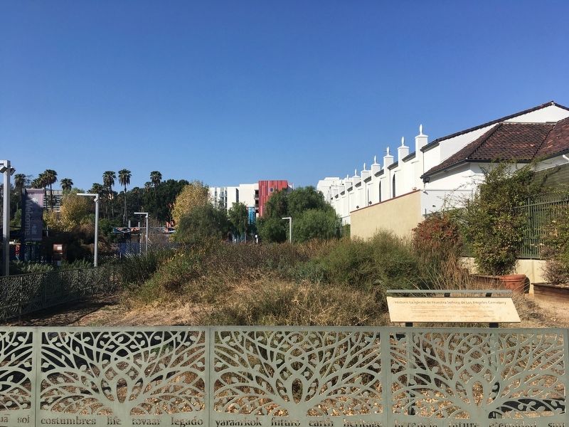
The Annunciation mosaic on the church facade is a reproduction of a detail from the image of Our Lady of the Angels in the Portiúncula Chapel at Assisi. This image provided the inspiration from which the city was named to honor Nuestra Señora de Los . . . — — Map (db m164889) HM
On Paseo de la Plaza at Olvera Street on Paseo de la Plaza.
The Founders of the City of Los Angeles Lara · Mesa · Moreno · Rosas · Camero · Rosas · Navarro · Villavicencio · Rodriguez · Quintero · Vanegas
The names of the eleven founders of Los Angeles, originally known as El Pueblo de la . . . — — Map (db m162787) HM
Near Olvera Street just south of North Main Street.
This plaque marks the end of the Old Spanish Trail, an historic pack trail from Santa Fe to the Pueblo of Los Angeles. This trail was used by Mexican traders who brought woolen goods from New Mexico to trade for highly prized California . . . — — Map (db m113806) HM
On North Main Street at Paseo Luis Olivares and Paseo de la Plaza on North Main Street.
The Founders of the City of Los Angeles Lara · Mesa · Moreno · Rosas · Camero · Rosas · Navarro · Villavicencio · Rodriguez · Quintero · Vanegas
The Los Angeles pueblo encompassed a square of about five and a half miles on each . . . — — Map (db m162882) HM
On North Main Street at El Pueblo de Los Angeles Plaza on North Main Street.
The Founders of the City of Los Angeles Lara · Mesa · Moreno · Rosas · Camero · Rosas · Navarro · Villavicencio · Rodriguez · Quintero · Vanegas
José Vanegas came from Real de Bolaños, Jalisco, and his wife María Bonifanta . . . — — Map (db m162864) HM
The Founders of the City of Los Angeles Lara · Mesa · Moreno · Rosas · Camero · Rosas · Navarro · Villavicencio · Rodriguez · Quintero · Vanegas
Antonio Feliz Clemente Villavicencio was from the city of Chihuahua and his wife . . . — — Map (db m162867) HM
The Founders of the City of Los Angeles Lara · Mesa · Moreno · Rosas · Camero · Rosas · Navarro · Villavicencio · Rodriguez · Quintero · Vanegas
The village of Yangna is most closely associated with the founding of Los . . . — — Map (db m162868) HM
Near Olvera Street south of Cesar E Chavez Avenue, on the left when traveling south.
Through this spot flowed the Zanja Madre (Mother Ditch) which channeled the waters of the Los Angeles River to the citizens
of Los Angeles for 123 years, 1781-1904. — — Map (db m133400) HM
On Glendale Boulevard at Park Avenue, on the right when traveling north on Glendale Boulevard.
José Martí was a citizen of the Americas who fought for the concept of liberty and
brotherhood for all men, without distinction of race, social status, or religion. He was a
poet, writer, teacher, political revolutionary, and great patriot. . . . — — Map (db m229697) HM
On Academy Road, 0.5 miles west of California Route 110, on the right when traveling west.
Louis H. Santillan, "Lou", founder & president of Los Desterrados (The Uprooted), former residents of Chavez Ravine, July 19, 1979.
(PVLBCHA) Palo Verde, Loma, Bishop Cultural Historical Association. — — Map (db m188915) HM
Near Eastern Avenue south of Gambier Street, on the right when traveling south.
On Friday, March 1, 1968, the students of Woodrow Wilson High School, in a spontaneous
and unprecedented act of civil disobedience, walked out of their classrooms to protest the
school's systemic discrimination against its Mexican American . . . — — Map (db m215310) HM
On Crystal Springs Drive, 1.3 miles north of Los Feliz Boulevard, on the right when traveling north.
Granted on March 22, 1843 to Maria Ygnacia Verdugo in confirmation of an earlier Spanish concession made to Vicente Feliz in 1795.
Later owned by famous California pioneers Antonio Coronel and James Lick.
Colonel Griffith Jenkins Griffith, in . . . — — Map (db m167872) HM
On Zoo Drive, 0.2 miles east of Riverside Drive, on the left when traveling east.
After successfully locating an overland passage to Alta California in 1774, Juan Bautista de Anza led 300 people and 1000 head of livestock on the first
overland colonizing expedition into California. This expedition resulted
in the . . . — — Map (db m200331) HM
On Crystal Springs Drive, 1.4 miles north of Los Feliz Boulevard, on the right when traveling north.
Enlisted soldier Jose Vicente Feliz, his wife Maria, and their children were among the thirty Anza Expedition families. Maria was one of eight women who were pregnant. On October 23, 1775, the first night after leaving Tubac, tragedy . . . — — Map (db m142836) HM
Near Highland Avenue south of U.S. 101, on the right when traveling south.
Treasure hunters believe there is 20th-century loot hidden at the Bowl. Many have searched, but the treasure is still a mystery.
The legend of the Cahuenga Pass treasure begins in 1864 when, under Napoleon's rule, France invaded Mexico and . . . — — Map (db m129805) HM
On Wilshire Boulevard east of Ogden Drive, on the right when traveling east.
The Wall Along Wilshire is an installation featuring ten sections of the original Berlin Wall. Measuring nearly forty feet wide, it is the world’s longest stretch of the Wall outside of Berlin. The Wende Museum assembled the Wall Along Wilshire . . . — — Map (db m125316) HM
Near Sepulveda Boulevard at South Brand Boulevard, on the right when traveling north.
Spanish-Mexican period.
Declared Historic Cultural Monument No. 7 by the Cultural Heritage Board, Municipal Art Department, City Of Los Angeles. — — Map (db m165325) HM
Near Sepulveda Boulevard at Brand Boulevard, on the right when traveling north.
Oldest portion built about 1834 by ex-Mission Indians. Enlarged by Eulogio de Celis in 1846. Upper story added by Romulo Pico in 1874. Restored by Mr. & Mrs. M.R. Harrington in 1930. — — Map (db m126815) HM
On North Figueroa Street, 0.4 miles north of Avenue 43.
The Adventures Begin
Charles Fletcher Lummis was a journalist, adventurer, preservationist, librarian, poet, and life-long activist on behalf of Native Americans. He was born in Lynn, Massachusetts, in 1859. His mother died of . . . — — Map (db m135777) HM
Tongva, 10,000 BC.
The first people of Los Angeles used this river as a source for food, materials for daily life, and spiritual renewal.
Spanish, 1769.
The Portola Expedition.
Rancho San Rafael, 1784.
The . . . — — Map (db m145349) HM
On Amalfi Drive at Amalfi Court, on the right when traveling west on Amalfi Drive.
This land was
part of the Mexican
land grant Rancho Boca
de Santa Monica, given
to Francisco Marquez and
Ysidro Reyes in 1839.
Since that year it has been
owned and lived on continuously
by members of the Marquez family.
After the partition . . . — — Map (db m220432) HM
Near Van Nuys Boulevard at Oneida Avenue, on the right when traveling north.
Pacoima means “Rushing Waters”, named by the first occupants of the land: the Gabrielino Native Americans.
Pacoima’s First Elementary School, 1888.
Pacoima’s First Railroad Station, 1888.
Pacoima Flood, 1891. . . . — — Map (db m175733) HM
Pacoima Recreation Center, dedicated in honor of
Private First Class
David M. Gonzales
of Pacoima, who made the supreme sacrifice in
World War II, and was
awarded the Congressional
Medal of Honor. — — Map (db m176142) WM
On West Paseo Del Mar, 0.2 miles east of Western Avenue, on the right when traveling east.
The Catalina Channel, about 25 miles wide and close to 500 fathoms deep (about 3,000 feet), separates Santa Catalina Island from the mainland. This part of the Pacific Ocean was first visited by Juan Rodriguez Cabrillo in 1542, sailing under the . . . — — Map (db m147299) HM
On Paseo Del Mar, 0.3 miles east of Western Avenue, on the left when traveling east.
The land before you has witnessed 5,000 years of human history,
some still etched on the landscape. Once the food gathering land of
the Tongva, the grazing land of Spanish and Mexican ranchers, the
center of an abalone industry, the farmlands . . . — — Map (db m173907) HM
Visited the USC campus in 1982, 1985 and 1989.
“The end of all education should surely be service to others” • “El próposito de toda educacíon verdaderamente deberia servir a otros” — — Map (db m193883) HM
Near Saint Estaban Street east of Haines Canyon Road, on the right when traveling east.
Dug by neophytes on the "Rancho Las Hermanas" (now owned by Philip Begue). Was used by the padres traveling over “Old Mission Trail” during the Spanish regime. — — Map (db m121428) HM
Near Calabasas Road west of Valley Circle Boulevard, on the right when traveling west.
Leonis Adobe, 1844 - 1846.
Declared Historic Cultural Monument No. 1
by the Cultural Heritage Board, Municipal Art Department, City of Los Angeles.
This adobe was built by Miguel Leonis in the early 1870's.
The chain of . . . — — Map (db m145585) HM
On Bonita Avenue at Acacia Street, on the left when traveling east on Bonita Avenue.
To assure an adequate supply of workers, the Orange Growers Association and Lemon
Growers Association partnered to build housing for Mexican workers. They constructed
34 small homes for families and two barracks for single men on this site. At . . . — — Map (db m168909) HM
On Pico Street at South Maclay Avenue, on the right when traveling east on Pico Street.
Erected by Valentine Lopez - 1882.
Occupied by Geronimo Lopez - 1884.
Purchased by City of San Fernando - 1971.
Survived Major Earthquake - 1971.
Restored by San Fernando - 1974-75. — — Map (db m127687) HM
On Wolfskill Street at Truman Street, on the right when traveling east on Wolfskill Street.
Cesar Chavez was a courageous labor leader, community organizer, and a civil rights activist. He organized an international movement to improve the lives of thousands of workers. As co-founder of the United Farm Workers Union, he recognized the . . . — — Map (db m149987) HM
Near Ramona Street, 0.1 miles south of Mission Road, on the left when traveling south.
Erected during mission days, 1792-1805. Second oldest adobe in this region. Originally 'L'-shaped, it is now only half its original size. In 1859, it became the property of Don Jean Vigare. In early 1860’s became San Gabriel's first bakery, and was . . . — — Map (db m127641) HM
Near Huntington Drive west of San Gabriel Boulevard, on the right when traveling west.
Built about 1845 by Michael White or Miguel Blanco as he was
called by the native Californians. One of the early foreigners to settle
in California; sailor and soldier of fortune; a friendly, carefree man
of roving disposition; a colorful and . . . — — Map (db m144994) HM
On Ocean Drive just south of California Avenue / California Incline, on the right when traveling south.
In commemoration of the 400th anniversary of the discovery of Santa Monica by Juan Rodriguez Cabrillo on October 8, 1542, this tablet is erected and dedicated by the Historic Landmarks Committee, Native Sons of the Golden West, with the cooperation . . . — — Map (db m130424) HM
Near San Gabriel Boulevard just west of Rosemead Boulevard, on the right when traveling west.
The Rio Hondo did not always look as it does today. Until the river was put into concrete channels in the 1950's, the Rio Hondo River offered extensive areas to farm, walk, ride horses, play and swim. Channeling the river did prevent the area . . . — — Map (db m228772) HM
On Bluff Road north of Washington Boulevard, on the right when traveling north.
Near this site, on January 3, 1847, was fought the Battle of the Rio San Gabriel between American forces commanded by Capt. Robert F. Stockton, U.S. Navy Commander-in-Chief, Brig. Gen. Stephen W. Kearney, U.S. Army, and Californians commanded by . . . — — Map (db m218759) HM
On Arroyo Drive south of Hermosa Street, on the right when traveling south.
panel 1:
Under this oak — the legend runs — the first Easter Services in California
were held by Father Crespi in 1770.
panel 2:
Near this spot the Cathedral Oak stood. Time destroyed its roots. This monument is . . . — — Map (db m134912) HM
Part of lands occupied by Señora Francisca Perez under preemption law as early as 1869.
Surveyed in 1871 as public lands.
Deeded by Señora Perez to Eugene R. Plummer in 1877.
U.S. patent issued 1880.
Purchased by County of Los . . . — — Map (db m135251) HM
On Whittier Boulevard (California Route 72) west of Pioneer Boulevard, on the right when traveling east.
Following the Mexican War, Pío Pico, last Mexican governor, acquired 9,000-acre Rancho Paso de Bartolo and built here an adobe home that was destroyed by the floods of 1883-1884. His second adobe casa, now known as Pío Pico Mansion, represents a . . . — — Map (db m50933) HM
On Bear Valley Road (County Road J16), on the right when traveling south.
Started in 1850 by outcast Mexicans from nearby Quartzburg and given the name Hornitos, meaning “little ovens”, from the dome like rock and mud bake-ovens being used here by some Germans.
The whites soon gained predominance, the population grew . . . — — Map (db m46904) HM
On High Street near St. Catherine Street, on the left when traveling south.
Historic Jail Museum • History of 1849 • Relics
Gold Rush Day Displays
One of the Nations Most Famous Ghost Towns early population 15,000. Here was the first Wells Fargo Express Office in county. $40000 in gold sent to Mint daily by armed . . . — — Map (db m46936) HM
On Wolfsen Road, on the left when traveling north.
Oldest building in Merced County built in 1848 by Francisco Perez Pacheco and his son on Rancho San Luis Gonzaga. Later a stopping place for vaqueros while driving cattle to the gold fields. Eventually became part of Rancho Santa Rita. Long owned by . . . — — Map (db m68940) HM
At a watering hole on the east side of Pacheco Pass, Juan Pacheco built this adobe for his rancho in the early 1840’s. The gun ports in the walls are visible reminders of the dangers from Yokuts Indians, marauding bands of ex-Mission Indians, and . . . — — Map (db m229347) HM
Near State Highway 152, 6 miles west of Interstate 5.
On June 18, 1805, Lieutenant Gabriel Moraga, on his first exploratory journey into the San Joaquin Valley traversed this pass and recorded it.
Since then it has been trail, toll road, stagecoach road, and freeway -- the principal route between . . . — — Map (db m229397) HM
First Marriage in California took place at this Mission between Juan Maria Ruiz of El Fuerte, Sonora, Mexico, 25 years of age, and Margarita de Cortona, 22, a Salinan woman of Mission San Antonio, on the sixteenth of May in the year of Our Lord 1773 — — Map (db m51561) HM
On Jolon Road (County Road G14) 0.2 miles south of El Camino Real (U.S. 101), on the right when traveling south.
Founded by Father Junipero Serra July 14, 1774. Most picturesque setting. First mass was celebrated in presence of one Indian. Later congregation grew to a thousand neophytes. Famous for its fine horses and expert vaqueros. — — Map (db m154381) HM
On Church Streeet at Figueroa Street, on the left when traveling west on Church Streeet.
The Royal Chapel of San Carlos de Borromeo, founded June 3, 1770, is the only remaining Presidio chapel in California.
Madariaga Adobe * Follow Church St. to Abrego
Cell Phone Tour (831) 718-9123 enter 710 — — Map (db m143524) HM
"Preservation of one's own culture does not require contempt or disrespect of other cultures."
Cesar E. Chavez (1927-1993)
Cesar Chavez was a Mexican American Labor leader & cofounder of the United Farm Worker (UFW). Cesar Chavez was . . . — — Map (db m26874) HM
On Front Street (State Highway 146) near East Street, on the right when traveling east.
[1998]
With the Santa Lucia, Gabilan mountain ranges and Pinnacles National Monument as the backdrop, Soledad has a rich history rooted in the original Spanish Mission land grants of early California. Soledad's original agricultural base was . . . — — Map (db m41124) HM
About 200 feet north of this site, a short distance from the Napa River ford, stood Don Salvador Vallejo’s Casa Las Trancas, headquarters for his Rancho Napa— a land grant of over 3000 acres. Established in the 1840’s and known as “The . . . — — Map (db m84129) HM
On Soscol Avenue at Silverado Trail, on the right when traveling north on Soscol Avenue. Reported missing.
Don Cayetano Juarez, (1809-1883) was given Rancho Tulocay in 1840 by General Mariano Vallejo for his decade of service to the government of Mexico, as a soldier and as mayordomo at Sonoma. He married Maria de Jesus Higuera in 1835 and they raised 11 . . . — — Map (db m123859) HM
On Adams Avenue at Mesa Verde Drive West, on the right when traveling west on Adams Avenue.
This home of early Spanish Californians, erected in the 1820's, once served as an "estancia" or station for mission herdsmen. It was dedicated in 1963 for public use by the Segerstrom Family and restored by the City of Costa Mesa. It is jointly . . . — — Map (db m50306) HM
Near Oso Parkway at South Bend Road when traveling north.
During the Spanish and Mexican rule of California, the governors encouraged the settlement of the territory by establishing large land grants. Many of these were later turned into Ranchos that were devoted to raising cattle and sheep.
Orange . . . — — Map (db m188705) HM
On Ward Street, on the right when traveling south.
Established in 1923 with six streets on lots sized 50 by 300. A complete community with stores, recreation facilities, and churches. (Holy Family Mission still exists). — — Map (db m59056) HM
On Warner Avenue at Newhope Street, on the right when traveling west on Warner Avenue.
In 1944, Frank and Dolores Lucero purchased 40 acres at this intersection. They previously farmed in Seal Beach. Dolores didn't want to leave the house so it was moved to this location while Dolores and a few kids were inside. — — Map (db m59554) HM
On East Wilshire Avenue at North Pomona Avenue, on the right when traveling east on East Wilshire Avenue.
When the Spanish army and missionaries came to California in 1769, they made a route, El Camino Real, for travel between missions they established, stretching from San Diego to Sonoma. In the early 1900s, a group of women's clubs, among others . . . — — Map (db m189668) HM
On Seabluff Drive north of Yorktown Avenue, on the left when traveling east.
Uphill from this marker once stood the Northam Ranch House, a pivotal landmark in the history of Huntington Beach.
Originally part of a vast Spanish land grant known as the Rancho Las Bolsas, the 1400 acres surrounding this hillcrest were . . . — — Map (db m213963) HM
Near Jeffrey Open Space Trail at Parkdale, on the right when traveling south.
Prior to European contact, California's inhabitants established one of the most densely populated regions in North America. When Spanish explorers arrive, bringing with them a variety of diseases, a catastrophic wave of illness and death spreads . . . — — Map (db m195050) HM
Near Old Myford Road near Irvine Boulevard, on the right when traveling east.
Planting, cultivating, harvesting crops and maintaining livestock on the spewing Irvine Ranch was no easy task. The success of the ranch was due in large part to the workforce of superintendent foremen, vaqueros and farm hands who performed the . . . — — Map (db m203548) HM
Near Old Myford Road near Irvine Boulevard, on the right when traveling east.
The Bath House is typical of the 1930s construction used in outbuildings throughout Irvine Ranch. Constructed in 1931, it replaced the restroom facilities within the Bunkhouse when it was converted from an open dormitory to individual rooms. Though . . . — — Map (db m203552) HM
On Aliso Creek Bikeway north of Christina Court, on the right when traveling north.
The land that today includes the cities of Laguna Hills, Laguna Woods, and a portion of Laguna Niguel, was once called Rancho Niguel. This 13,000 acre rancho, named after a Native American village located along Aliso Creek, was once owned by Don . . . — — Map (db m149732) HM
Near Serrano Road at Winding Way, on the right when traveling north.
1769 - Portola Expedition enters what is now Orange County.
1821 - California under Mexican Rule.
1842 - Rancho Canada de los Alisos granted to Don Jose Serrano; future site of Heritage Hill Historical Park.
1850 - California . . . — — Map (db m195046) HM
State of California Historic Landmark No. 199, La Casa de Adobe de Jose Serrano. Home of Jose Serrano, original grantee of Rancho Canada de los Alisos. Restored A.D. 1932. — — Map (db m50117) HM
This spring and the sycamore trees mark the area of an adobe house and outbuilding built in the 1840s by José Serrano, whose Rancho Cañada de los Alisos stretched to the north. Within a short distance were the two adobes of Juan Avila's Rancho . . . — — Map (db m154351) HM
Near Civic Center just west of Marguerite Parkway, on the right when traveling west.
In 1769 Gasper de Portolá led a group of Spanish soldiers on a thousand-mile march from Baja California to San Francisco. His purpose was to locate the ports of San Diego and Monterey and to establish a series of churches and military posts. The . . . — — Map (db m188706) HM
On Charlinda Drive, 0.1 miles north of Argonaut Drive, in the median.
This site was part of Rancho Canada de Los Alisos, a land grant given to Don Jose Serrano by Mexican Governor Pio Pico on May 27, 1846.
Two historical plaques are located at the park's western edge. — — Map (db m188711) HM
Near Modjeska Canyon Road, 2 miles east of Santiago Canyon Road, on the left when traveling east.
The peak before you is named for the outlaw Juan Flores.
Flores led a gang of bandits that terrorized this area in the
late 1850's. In January 1857, the gang murdered a shopkeeper
in San Juan Capistrano. While in pursuit of the gang, LA County . . . — — Map (db m148311) HM
Lured to California by gold, Irish immigrant James Irvine instead made a fortune in real estate. Near the end of the Civil War, he and his partners bought two failing ranchos — one included the Upper Newport Bay estuary totaling 96,000 acres. . . . — — Map (db m148657) HM
1248 entries matched your criteria. Entries 101 through 200 are listed above. ⊲ Previous 100 — Next 100 ⊳