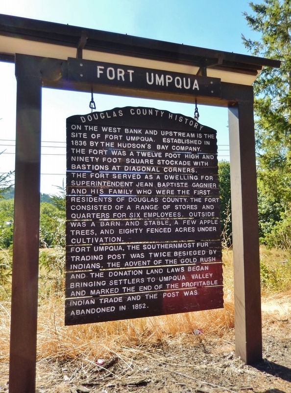
On the west bank and upstream is the site of Fort Umpqua.
Established in 1836 by the Hudson’s Bay Company, the fort was a twelve foot high and ninety foot square stockade with bastions at diagonal corners.
The fort served as a dwelling for . . . — — Map (db m113337) HM
On October 1, 1850, the schooner "Bostonian” owned by a Boston merchant named Gardiner was sent to the Pacific coast in the interest of trade. The ship wrecked on the Umpqua River bar. Most of her cargo was salvaged and brought to this site, known . . . — — Map (db m176983) HM
After construction of a railroad line South from Roseburg in 1881-1883, Solomon Abraham, the local right of way agent, platted the community and named it Julia after his wife. After a dispute with Abraham, A.F. Morris, the Chief Engineer for the . . . — — Map (db m134058) HM
In 1846, Jesse Applegate and fourteen others from near Dallas, Oregon, established a trail south from the Willamette Valley and east to Fort Hall. This route offered emigrants an alternative to the perilous “last leg” of the Oregon Trail . . . — — Map (db m116842) HM
Established in 1851 by Dr. Dorsey S. Baker. The town moved to the present site in 1872 when the O&C Railroad reached this point. Alonzo F. Brown founded the new town. Fires destroyed the wooden buildings. The existing brick buildings were built in . . . — — Map (db m99321) HM
Dedicated to the memory of
Rev. J.A. Cornwall and Family
They built the
First Immigrant Cabin
in Douglas County near
this site hence the name
Cabin Creek
The family wintered here in
1846 1847
Were saved from extreme want
by . . . — — Map (db m99269) HM
Placed on the National Register of Historic Places 1985
The Mill-Pine neighborhood grew out of a need for housing close to the railroad. The Oregon-California railroad line was completed from Portland to Roseburg in 1872 and on to Ashland in . . . — — Map (db m99323) HM
Few Oregon communities have had a more colorful history than Scottsburg. It was named for Levi Scott, a pioneer of 1844, who homesteaded here and founded the town in 1850. There was a lower town at the head of tidewater on the Umpqua River which . . . — — Map (db m113510) HM
(Seven panels dealing with the Columbia Plateau and Columbia River portions of the Oregon Trail are found at this kiosk)
Pathway to the "Garden of the World"
Excitement filled the air May 22, 1843 as nearly one thousand Americans left . . . — — Map (db m111946) HM
Who followed this route across the plains at the age of 17 driving oxen and walking barefoot.
He later settled on Shuttler Flat five miles south of this marker and was the first to engage in wheat farming in Gilliam County — — Map (db m101983) HM
Gold was discovered on Whiskey Flat in June, 1862; Canyon City quickly grew and became the County Seat by 1864. Scenes and Characters from the early years come alive in this 1996 mural by Larry Kangas.
This colorful history is celebrated at "62 . . . — — Map (db m96719) HM
In June 1862, a company of miners from northern California were heading east over the Strawberry Mountain Range, when one of the men discovered gold on Whiskey Flat, half a mile south of here. Miners from all over the area flocked into the area, and . . . — — Map (db m96722) HM
“What is it that urges a man to risk his life in these precipitous fossil beds? I can answer only for myself, but with me there were two motives, the desire to add to human knowledge, which has been a great motive all my life, and the . . . — — Map (db m114115) HM
James and Elizabeth Cant purchased this property in 1910. Over the following five decades they built the ranch before you. The methods used by the Cants in their early operations were replaced with more modern machinery and techniques as they . . . — — Map (db m158007) HM
The Cant Ranch is one of the best-preserved examples of early 20th century ranching operations in the John Day River Valley. The ranch spans three historic development eras: The Officer Homestead Era (1890-1909); the Cant Sheep Ranch Era . . . — — Map (db m158010) HM
Side A:
Granite, Oregon
Albert G. Tabor first struck gold just below the town of Granite on the Fourth of July, 1862. Tabor named his claim the Independence since his strike was made on Independence Day, and the town that sprang up . . . — — Map (db m106791) HM
The mining camp town of Canyon City sprang up soon after the discovery of gold in Canyon Creek in 1861 (Note: actually June of 1862).
When Grant County was formed in 1864 Canyon City became the county seat. Meanwhile, "Lower Town" . . . — — Map (db m107547) HM
Welcome to Kam Wah Chung
In 1890 you would be standing in the middle of a bustling Chinatown.Businesses and homes all around you, the temple in front, and Kam Wah Chung- the core of the community- would be to your left. Why is it the only . . . — — Map (db m112887) HM
Imagine the American Indians first creating trails through these mountains hundreds of years ago. Later, in 1825 and 1826, Hudson Bay Fur Company trappers, led by Peter Skeene Ogden, crossed this very pass. In 1862 more people made this difficult . . . — — Map (db m107101) HM
Weary Oregon Trail emigrants, eager to ease travel or gain mileage, often attempted cutoffs and shortcuts. While many of these alternate routes proved successful, others did not--they became roads to ruin for some and the end of the trail for . . . — — Map (db m63032) HM
Thousands of Oregon Trail emigrant passed this way toward new lives in a place Abigail Scot, emigrant of 1852, called the "Garden of the World" The Willamette Valley was nearly 2,000 miles from Missouri, and by the time emigrants reached this . . . — — Map (db m158539) HM
"The valley opens and we pass some very pretty
locations. Timber in a great many varieties, some
entirely new to me." Virgil K. Pringle, Oct 11, 1846 — — Map (db m152440) HM
"Make 10 miles and camp at a considerable sized creek
[Ashland Creek], the best camp we have had for several
[days.] Road very good. High mountains around."
- Virgil K. Pringle, Oct 11, 1846 — — Map (db m152442) HM
At 7533 feet, Mt. Ashland in the Siskiyou Mountains is the highest point in the headwaters of Ashland Creek. The coarse granitic soils on its steep slopes are highly erodible. Management of the watershed tries to minimize the disturbance to protect . . . — — Map (db m112522) HM
Named for its hundreds of fresh water springs, lush glades and meadows, the Greensprings has for millenia been a seasonal gathering place for Native Americans and later provided refuge for travelers. In 1846, Levi Scott and the Applegate brothers, . . . — — Map (db m113544) HM
This Southern magnolia was planted in front of the home of Captain John M. and Mary Elizabeth “Lizzie” McCall in memory of their daughter, Elsie, who died in 1890. John McCall was a statesman and entrepreneur who opened many businesses including the . . . — — Map (db m244249) HM
First post office in Jackson County established October 15, 1852 in the cabin of Col. William G. T'Vault (1806-1869)
Col. T'Vault was the editor of Oregon's first newspaper "The Oregon Spectator". He was postmaster general of the Oregon . . . — — Map (db m113722) HM
In 1860, Martha Hanley planted this weeping willow to commemorate the birth of her son. The willow cutting was obtained from the pioneer Luelling Nursery in the Willamette Valley and delivered by Martha's friend Kit Kearney, an express rider, who . . . — — Map (db m244248) HM
Dedicated to
John Mathew
Pioneer of 1853
Named Eagle Point for the Eagles that nested on the Bluffs near his home, 1 mile N.E, on Brownsboro Rd. — — Map (db m112578) HM
Gold discovered on hill across Rogue River in 1860. Land for Gold Hill donated by Thomas & Rose Chavner in 1884. Railroad built in 1887. Town Inc. Feb. 12, 1895. First school in Methodist Church in 1889. Electricity came from Gold Rey Dam in 1904. . . . — — Map (db m99286) HM
J.B. White founded the small Community of Rock Point in the early 1850's. John fought in the Rouge Indian Wars. In exchange for his service he received land, and developed a homestead on the north side of the stage road. The land was sold to L. J. . . . — — Map (db m99258) HM
Gold was discovered in the sands of the Rogue River in 1849. Overshadowed by the excitement generated by the gold fields in California, mining did not begin here until 1851-52. The discovery of rich placers on Jackson Creek brought prospectors from . . . — — Map (db m112580) HM
(Seven panels dealing with topics related to the Applegate Trail are found at this kiosk.)
The Applegate Trail
Southern Route to Oregon
In 1846, Jesse Applegate and fourteen others from near Dallas, Oregon, . . . — — Map (db m112656) HM
(Marker 1)
In the 1860s the view from this spot on Main street would have looked much different than it does today. During the the Gold Rush boom of the 1850s, Jacksonville's early merchants and shopkeepers located their businesses along . . . — — Map (db m112901) HM
The first gold miners on this site in 1851 were in the right place at the right time. They found gold on Jackson Creek, possibly along the base of the hill across the parking lot. No one knows for certain; the route of the creek has changed . . . — — Map (db m112895) HM
Peter Britt was an extraordinary man of vision and accomplishment. His curiosity, motivation and experimental nature, matched with a keen business sense, allowed him to merge broad-ranging interests into a wide assortment of successful endeavors. . . . — — Map (db m122890) HM
Destined to become the region’s largest city and a major economic hub, Medford began in 1883 when the railroad came to Southern Oregon.
In the fall of 1883, four property owners deeded part of their land to the Oregon and California . . . — — Map (db m120987) HM
"The roads today were excellent and the face of nature
appeared full as interesting as yesterday Followed
down Rogue River [Bear Creek] about 12 mi[le]s & camp"
-Lester Hulin, Oct 15, 1847 — — Map (db m152444) HM
We continued our journey towards Jacksonville this morning,
designing to find a suitable place to graze our cattle until we
can find a shelter for our families...we then proceeded across
a prairie...where we encamped" - William Hoffman, Oct . . . — — Map (db m152446) HM
On October 27, 1883, C. Mingus, c.w. Broback, I.J. Phipps and C.C. Beekman, deeded in excess of two hundred acres for a townsite plus twenty acres for a railroad depot to the Oregon and California railroad company.
Charles Howard and his father, . . . — — Map (db m113405) HM
Applegate Trail emigrants required up to four days to travel from the Klamath River over the Cascades and Siskiyous to the Rouge River valley. The journey may have challenged those with healthy oxen, but it was a devastating trail for those whose . . . — — Map (db m88403) HM
In July 1846 Jesse Applegate, Levi Scott and thirteen others known as "The South Road Party" located this pioneer trail. It was used by the emigrants traveling from Fort Hall on the Oregon Trail to the Rogue River and Willamette Valleys between . . . — — Map (db m88005) HM
Southern Route to Oregon
In 1846, Jesse Applegate and fourteen others from near Dallas, Oregon, established a trail south from the Willamette Valley and east to Fort Hall. This route offered emigrants an alternative to the perilous . . . — — Map (db m88017) HM
This site has been an important Rogue River crossing since 1851, when Davis "Coyote" Evans began a ferry service. Evans' business, though short-lived, was one of the only three ferries to cross the Rogue River (over 200 miles long) - establishing . . . — — Map (db m112764) HM
Davis Evans established the first ferry this site in 1851. It was known as Jewett's Ferry, 1853-1861. The 1862 flood destroyed the ferry, but it was replaced. The Woodville (Rogue River) Bridge was built in 1909. — — Map (db m112488) HM
In the early 1800s, the Rogue River flowed through a rugged and untamed land - home to a handful of Tutuni and Shasta bands of Native Americans. In the 1840s, thousands of pioneers and fortune-seekers streamed through this land with dreams of . . . — — Map (db m112763) HM
Casper M. Ruch started the Ruch settlement at this cross roads site between Crescent City and Jacksonville in 1896. On ten acres purchased from J.M. McDonough be built a home, blacksmith shop, warehouse, dance hall, store, and smoke house, curing . . . — — Map (db m112485) HM
"The valley is about 3 miles wide here. It is not the main Rogue
River Valley, but a branch of it called Bear Creek...The first
tomatoes and melon patch I found I helped myself to as many as
I could eat being very hungary" - Wellborn Beeson, . . . — — Map (db m152443) HM
This is the site of Fort Wagner, a primitive structure built in 1853-1854 by Captain Alden of Yreka, California. Jacob Wagner, Talent's first settler of European descent, was the property owner. — — Map (db m244164) HM
A refuge for white settlers during the Indian wars of 1855-1856 stood on this site. George E. Briggs took up a donation land claim in February 1854 and built a cabin of squared logs. he farmed and ran a freight packing operation in 1856. Briggs, . . . — — Map (db m112483) HM
Upper plaque:
National Monument
Set aside by
President Taft
July 12, 1909
Lower plaque: Department of the Interior
National Park Service
Regulations require that all persons entering . . . — — Map (db m63167) HM
The utmost good faith shall always be observed towards the Indians; their lands and property shall never be taken from them without their consent; and, in their property, rights, and liberty, they shall never be invaded or disturbed, unless in . . . — — Map (db m112807) HM
The perilous last leg of the Oregon Trail down the Columbia River rapids took lives, including the sons of Jesse and Lindsay Applegate in 1843. The Applegate brothers and others vowed to look for an all-land route into Oregon from Fort Hall (in . . . — — Map (db m167270) HM
Erected by Charles A. Wing in 1949, upon the site of the first brick building in Grants Pass, which was constructed by John W. Howard in 1886. — — Map (db m91926) HM
In 1854, Mr. James Kerby obtained first donation land claim in what became Kerbyville. Nearby gold fields attracted many miners and the town became a center of commerce. Mr. Kerby became the first postmaster in September 1855 when the Kerbyville . . . — — Map (db m105285) HM
(There are two sides to this marker,)
White settlers and miners out numbers the Oregon Indians. The United States proposed treaties with the Oregon Indians moving off their lands onto reservations. Miners started a group of volunteers . . . — — Map (db m141196) HM
This fortified ranch was a donation land claim filed by Wm. B. Hay in 1854. It was attacked by 200 Takelma Indians on March 23, 1856. A battle including hand-to-hand combat raged into the night. The hostiles withdrew in the morning and . . . — — Map (db m91942) HM
This covered bridge is the one remaining covered bridge in Josephine County. It was constructed by Elmer J. Nelson in 1920 as part of the new Pacific Highway project at a cost of $21,128.65. It was built on Josephine County’s first donation land . . . — — Map (db m63153) HM
"Move one mile to camp (on Grave Creek), having none last night, and spent the day burying Mr. Cowley's daughter (Martha), who died yesterday evening, age about 14 years." - Virgil K. Pringle, Oct. 19, 1846 — — Map (db m112854) HM
The narrow gorge of Canyon Creek has long served as a travel corridor. Native Americans likely trekked this canyon for thousands of years. Alexander McLeod of the Hudson's Bay Company provided the first written account of the route in 1829, while . . . — — Map (db m112856) HM
Generations of Oregon school children learned the lyrics of a song: "Hurry up oh pioneers, your faithful little band must never fail." Applegate Trail emigrants struggled to follow this advice, but the mountainous terrain of northern . . . — — Map (db m153823) HM
(Three panels are located at this information kiosk:)
Imagine carrying just a backpack and a pick and hearing the shouts of "Gold!" as they rang through this valley.
It's 1851. You've traveled hundreds of miles to make your . . . — — Map (db m115245) HM
Established in 1890, this mining town was unique in Western annals in that it had two churches and no saloons. The miners went to Placer off Grave Creek for "refreshments".
Rev. William Ruble, leader of a group commonly known as "Campbellites" . . . — — Map (db m114516) HM
In 1846, Jesse Applegate and fourteen others from near Dallas, Oregon, established a trail south from the Williamette Valley and east to Fort Hall. This route offered emigrants an alternative to the perilous “last leg” of the Oregon . . . — — Map (db m63155) HM
Jesse and Lindsay Applegate, members of the first wave of Oregon Trail emigrants, watched their ten-year old sons drown in the Columbia River when a boat overturned in the rapids near The Dalles in 1843. Once their families were settled, the . . . — — Map (db m114483) HM
Wolf Creek Tavern was built c. 1883 by Henry Smith, a highly successful and influential local entrepreneur. The establishment of the hotel, mercantile and post office occurred at the time the Oregon and California Railroad was being completed in . . . — — Map (db m47204) HM
Officially, Bonanza was founded July 11, 1873 when Ira P. Chandler homesteaded the site. Unofficially, Bonanza was founded sometime prior to the beginning of the Modoc War, when John S. Shook pre-empted the land east of Lost River, opposite Big . . . — — Map (db m112933) HM
Fort Klamath
These 58 soldiers and associates were buried in this cemetery, including 22 casualties of the Modoc War. In 1890, after the fort was abandoned, the remains were exhumed and laid to rest at the Presidio in San Francisco.
Pvt. . . . — — Map (db m91782) HM WM
Established for the promotion of peaceful relationships between the Indians and
the early settlers by the Oregon Volunteer Calvary in 1863. The post was abandoned
by the United States Army in 1890. Now preserved
as a
Klamath County Park
for . . . — — Map (db m100288) HM
The first emigrant train over the "Southern Route," including more than fifty wagons under the leadership of Captain Levi Scott and David Goff, left the Oregon Trail at Fall Creek or Raft River, on the Snake River, August 10, 1846. The Klamath River . . . — — Map (db m88002) HM
Formerly the halfway house, between Ashland and
Linkville (Klamath Falls). Henry Duncand first
owner 1871. Sold to Wm. S. Parker 1876.
Abandoned about 1915. — — Map (db m147734) HM
10 miles south of this monument, paths established along the south rim of the Klamath River Canyon by Shasta, Klamath, Pit and Modoc Indians were later followed by Hudson Bay trappers, the U.S. Army pack trains and in the early 1870's, supply . . . — — Map (db m147732) HM
This Memorial is Dedicated to George Nurse
Accomplishments
1867 - 1869 - 1878
Opened First Trading Post
Built the Bridge Across Link River
Platted Town and Called it Linkville
Donated the Land For the First Cemetery
The First . . . — — Map (db m113635) HM
Rafted lumber down Upper Klamath Lake and
built first buildings on this site, 1867.
Registered first official plat of town, 1878.
Was Linkville's first hotel keeper, postmaster,
and livery stable operator. Gave building lots
to people who . . . — — Map (db m113638) HM
Pioneer village founded in 1870. A rival town of Linkville and the first platted in Klamath County. Named after the merganser ducks on Klamath River. A bridge-crossing made it an important trade route. The town served as a settler defense rendezvous . . . — — Map (db m116786) HM
Martin R. Frain born December 17, 1832 in New York, came west in 1850, arrived in Oregon Territory April 30, 1857 crossed Link river and camped under a ledge nearby. Established the first Trading Post at the present area of Payne Alley and Main . . . — — Map (db m100207) HM
The town of Linkville was founded along the lower end of the Link River on March 12, 1867, by pioneer settler George Nurse. By July of 1869, this pioneer used timber to construct the first bridge linking one side of the river to the other. A steel . . . — — Map (db m112877) HM
Southern Route to Oregon
In 1846, Jesse Applegate and fourteen others from near Dallas, Oregon, established a trail south from the Willamette Valley and east to Fort Hall. This route offered emigrants an alternative to the perilous . . . — — Map (db m87946) HM
A party of 15 men, styled the South Road Expedition, as led by Capt. Levi Scott, Jesse Applegate, and David Goff, crossed the 42nd parallel on late July 4, 1846. It was blazing a road on which to lead Americans from harm, free of the impending war . . . — — Map (db m87945) HM
The history of the west is linked with the idea of finding a new home in a challenging land. We call it homesteading.
During the Pleistocene epoch, homesteaders in the Fort Rock Basin were mammoths, camels, horses, flamingos, and . . . — — Map (db m113604) HM
The Homestead Act of 1862 inspired thousands to seek land in the West. The law allowed heads of households, widows, and all single people over 21 years old to purchase 160 acres at $1.25 per acre, or by paying a $15 filing fee after 5 years of . . . — — Map (db m113592) HM
Fort Rock, towering above you to the north and west, is one of Oregon's most interesting geologic features.
Geologists believe it was formed near the end of the Ice Age some 10,000 to 12,000 years ago during a period of frequent volcanic . . . — — Map (db m113575) HM
The Fort Rock Grange was organized in 1930 during the great
depression, a time of hardship, drought, and struggle for those living
in the Fort Rock Valley. There were 17 charter members, whose
names hang on the north wall of the main hall. . . . — — Map (db m189155) HM
The 1909 Enlarged Homestead Act fueled a landrush that began with the Homestead Act of 1862.
The Act allowed qualified individuals to claim 320 acres by building a residence and cultivating 40 acres.
Motivated by dreams of a "Garden of . . . — — Map (db m113590) HM
Having been among the early pioneers in this area, S.B. Chandler became one of the largest land owners in the vicinity during that era (1870 – 1930).
He ran large amounts of sheep and also some cattle.
At the peak of his land ownership . . . — — Map (db m113811) HM
322 entries matched your criteria. Entries 101 through 200 are listed above. ⊲ Previous 100 — Next 100 ⊳