1642 entries match your criteria. Entries 101 through 200 are listed.⊲ Previous 100 — Next 100 ⊳
Landmarks Topic
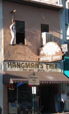
By Syd Whittle, October 30, 2005
The Stump of the Tree is Under this "Establishment"
| 101 ► California, El Dorado County, Placerville — 141 — Hangmans Tree — |
| On Main Street at Center Street on Main Street. | |||
| 102 ► California, El Dorado County, Rescue — 747 — The Coloma Road — |
| On Green Valley Road at Deer Valley Road, on the right when traveling east on Green Valley Road. | |||
| 103 ► California, El Dorado County, Shingle Springs — 456 — Camp Site of Boston-Newton Party — |
| 104 ► California, El Dorado County, Skinners — 703 — Pleasant Grove House — |
| On Green Valley Road, on the left when traveling east. | |||
| 105 ► California, Humboldt County, Trinidad — Spain Claims Northern California — |
| Near Lighthouse Road. | |||
| 106 ► California, Kern County, Bakersfield — B.H.S. Water Tower — |
| On Chester Avenue, on the left when traveling north. | |||
| 107 ► California, Kern County, Bakersfield — Beale Memorial Clock Tower — |
| Near Chester Avenue. | |||
| 108 ► California, Kern County, Bakersfield — 588 — Kern River Slough — |
| On Panama Road, 0.7 miles east of Cottonwood Road, on the right when traveling east. | |||
| 109 ► California, Kern County, Bakersfield — 278 — Rio de San Felipe — California Historical Landmark — |
| On Kern Canyon Road (State Highway 178), on the left when traveling east. | |||
| 110 ► California, Kern County, Glennville — 495 — Glennville Adobe — |
| On Evans Road (State Highway 155), on the left when traveling west. | |||
| 111 ► California, Kern County, Grapevine — 300 — Rose Station — |
| On Grapevine Road West near Interstate 5. | |||
| 112 ► California, Kern County, Grapevine — 133 — Sebastian Indian Reservation — |
| On Grapevine Road West near Interstate 5, on the right when traveling north. | |||
| 113 ► California, Kern County, Lake Isabella — 742 — Campsite of Edward Kern — |
| On California Route 178, on the left when traveling east. | |||
| 114 ► California, Kern County, Tehachapi — 643 — "Old Town" — |
| On Old Town Road at Woodford Tehachapi Road, on the right when traveling north on Old Town Road. | |||
| 115 ► California, Kern County, Tehachapi — Tehachapi Pass Railroad Line — Constructed 1874 – 1876 — Commemorated October 1998 — |
| On Woodford-Tehachapi Road, 3.2 mi E of Keene exit, on the left when traveling east. | |||
| 116 ► California, Lake County, Hidden Valley Lake — 450 — Stone House — State Historical Marker #450 — |
| On State Highway 29, 6 miles north of Middletown, on the right when traveling north. | |||
| 117 ► California, Lake County, Middletown — 467 — Old Bull Trail Road and St. Helena Toll Road — |
| On State Highway 26 at Hill Street, on the left when traveling north on State Highway 26. | |||
| 118 ► California, Lassen County, Litchfield — 677 — Noble Emigrant Trail — |
| On State Highway 395, on the left when traveling south. | |||
| 119 ► California, Lassen County, Susanville — 675 — Noble Emigrant Trail — |
| Near North Street, on the right when traveling north. | |||
| 120 ► California, Lassen County, Susanville — 76 — Roop's Fort — |
| Near North Weatherlow Street, on the right when traveling north. | |||
| 121 ► California, Los Angeles County, Alhambra — Alhambra Clock — |
| On Main Street just west of Garfield Av, on the left when traveling west. | |||
| 122 ► California, Los Angeles County, Beverly Hills, The Flats — Morton Bay Fig — Ficus Macrophylla — |
| On North Beverly Drive at Park Way, on the right when traveling north on North Beverly Drive. | |||
| 123 ► California, Los Angeles County, Beverly Hills, The Flats — The Electric Fountain — |
| On Wilshire Boulevard at Santa Monica Boulevard, on the left when traveling east on Wilshire Boulevard. | |||
| 124 ► California, Los Angeles County, Compton — Eagle Tree — |
| Near Short Avenue at Poppy Avenue. | |||
| 125 ► California, Los Angeles County, Lancaster — 658 — Western Hotel — |
| On Lancaster Boulevard west of Beech Avenue, on the right when traveling west. | |||
| 126 ► California, Los Angeles County, Long Beach, East Village — The Lafayette Complex — 1928, 1929, 1948 — |
| On Linden Avenue, on the right when traveling north. | |||
| 127 ► California, Los Angeles County, Los Angeles, Chatsworth — 132 — Stoney Point — |
| Near Topanga Canyon Boulevard at Santa Susana Pass Road, on the right when traveling north. | |||
| 128 ► California, Los Angeles County, Los Angeles, Downtown Los Angeles — 920 — Aoyama Tree — |
| Near Central Avenue north of 1st Street, on the left when traveling north. | |||
| 129 ► California, Los Angeles County, Los Angeles, Downtown Los Angeles — Avila Adobe — circa 1818 — El Pueblo de Los Angeles — |
| On Olvera Street south of Cesar E. Chavez Avenue, on the right when traveling north. | |||
| 130 ► California, Los Angeles County, Los Angeles, Downtown Los Angeles — Christine Sterling — |
| Near Paseo de la Plaza at Olvera Street. | |||
| 131 ► California, Los Angeles County, Los Angeles, Encino — 24 — Encino Oak Tree — |
| On Louise Avenue just south of Ventura Boulevard, in the median. | |||
| 132 ► California, Los Angeles County, Los Angeles, Hollywood — 617 — The Hollywood Cross — Hollywood Pilgrimage Memorial Monument — |
| Near Cahuenga Boulevard East at Cahuenga Terrace, on the right when traveling north. | |||
| 133 ► California, Los Angeles County, Los Angeles, Hollywood — 194 — This Is Where It All Began — Hollywood Walk of Fame 50 Years, 1960-2010 — |
| On Hollywood Boulevard at Highland Avenue, on the right when traveling west on Hollywood Boulevard. | |||
| 134 ► California, Los Angeles County, Los Angeles, Palms — 19 — Moreton Bay Fig Tree — |
| On National Boulevard at Military Avenue, on the right when traveling east on National Boulevard. | |||
| 135 ► California, Los Angeles County, Los Angeles, San Pedro — Fort MacArthur / 500 Varas Square Historic District — Port of Los Angeles — |
| On South Pacific Avenue south of Meyler Road, on the right when traveling north. | |||
| 136 ► California, Los Angeles County, Los Angeles, South Los Angeles — 1048 — A Gathering Place — USC — University of Southern California — |
| On Childs Way at Trousdale Parkway, on the right when traveling west on Childs Way. | |||
| 137 ► California, Los Angeles County, Monterey Park — Heritage Park Cascades — Built 1928 — |
| On De La Fuente Street at El Portal Place, on the right when traveling south on De La Fuente Street. | |||
| 138 ► California, Los Angeles County, Santa Clarita, Newhall — 688 — Lyons Station — |
| Near Sierra Highway, 0.2 miles south of Newhall Avenue, on the right when traveling south. | |||
| 139 ► California, Los Angeles County, Santa Clarita, Newhall — 168 — Oak of the Golden Dream — |
| Near Placerita Canyon Road, 1.5 miles east of the Antelope Valley Freeway (California Route 14). | |||
| 140 ► California, Mendocino County, Fort Bragg — 615 — Fort Bragg — |
| On Main Street (State Highway 1), on the right when traveling south. | |||
| 141 ► California, Mendocino County, Fort Bragg — Fort Building — |
| On North Franklin Street, on the right when traveling north. | |||
| 142 ► California, Mendocino County, Hopland — 549 — Frog Woman Rock — Qawów Má:ta Qhabé — KA-WHOA MA-THA KA-BEH — |
| On U.S. 101, 6 miles south of Hopland, on the right when traveling south. | |||
| 143 ► California, Mendocino County, Mendocino — 714 — Mendocino Presbyterian Church — |
| On Ukiah Street, on the right when traveling east. | |||
| 144 ► California, Mendocino County, Mendocino — 927 — Temple Kwan Tai — |
| 145 ► California, Modoc County, Fandango Pass — 546 — The Applegate-Lassen Trail — |
| On Fandango Pass Road (County Road 9) 4 miles west of Surprise Valley Road (County Road 1), on the right when traveling east. | |||
| 146 ► California, Modoc County, Newell — 110 — Canby’s Cross — |
| On California Route 139,, 0.2 miles Glendale Street, on the right when traveling south. | |||
| 147 ► California, Modoc County, Newell — 9 — Captain Jack’s Stronghold — ← 11 Miles — |
| On State Highway 139,, 0.2 miles south of Glendale Street, on the right when traveling south. | |||
| 148 ► California, Mono County, Bridgeport — "Bridgeport Inn" — |
| Near Main Street (U.S. 395) at Sinclair Street. | |||
| 149 ► California, Mono County, Mammoth Lakes — Casa Diablo — |
| Near Substation Road at Highway 395. | |||
| 150 ► California, Monterey County, Monterey — 1 — The Custom House — |
| Near Monterey Peninsula Recreational Trail. | |||
| 151 ► California, Monterey County, Salinas — 870 — José Eusebio Boronda Adobe Casa — |
| Near Boronda Road near Calle Del Adobe Road. | |||
| 152 ► California, Napa County, Calistoga — 359 — Bale Grist Mill — |
| Near Saint Helena Highway (State Highway 29/128). | |||
| 153 ► California, Napa County, Calistoga — 561 — Schramsberg — |
| On Schramsberg Road west of California Highway 29. | |||
| 154 ► California, Napa County, Napa — 878 — First Presbyterian Church Building — |
| On Third Street, on the right when traveling east. | |||
| 155 ► California, Napa County, St. Helena — 814 — Beringer Brothers Winery — |
| On St. Helena Highway (State Highway 29/128). | |||
| 156 ► California, Napa County, Yountville — 828 — Veterans Home of California — |
| On California Drive at Solano Avenue, on the left when traveling west on California Drive. | |||
| 157 ► California, Nevada County, Nevada City — Purdon Bridge — 1895 — |
| On Purdon Road, on the right when traveling north. | |||
| 158 ► California, Nevada County, Nevada City — 832 — South Yuba Canal Office — |
| Near Main Street near Coyote Street. | |||
| 159 ► California, Nevada County, Nevada City — 899 — The National Hotel — |
| On Broad Street, on the right when traveling east. | |||
| 160 ► California, Nevada County, Rough and Ready — Fippin's Blacksmith Shop — |
| On Rough and Ready Highway, on the right when traveling west. | |||
| 161 ► California, Nevada County, Rough and Ready — 294 — Rough and Ready — |
| On Rough and Ready Highway at Mountain Rose Road, on the right when traveling west on Rough and Ready Highway. | |||
| 162 ► California, Nevada County, Truckee — First Permanent Emigrant Trail Markers — |
| On Donner Pass Road, on the left when traveling west. | |||
| 163 ► California, Nevada County, Truckee — 780-6 — First Transcontinental Railroad - Truckee — |
| Near Donner Pass Road. | |||
| 164 ► California, Nevada County, Truckee — The Emigrant Trail — |
| On Donner Pass Road near Northwoods Boulevard, on the left when traveling west. | |||
| 165 ► California, Nevada County, Truckee — The Emigrant Trail — |
| On Cold Stream Road, on the right when traveling west. | |||
| 166 ► California, Orange County, Anaheim — 11 — Site of San Pedro Gate — 1857 — |
| On Center Street west of Walnut Street. | |||
| 167 ► California, Orange County, Huntington Beach — 36 — Auditorium and Tower — |
| On Main Street, on the right when traveling south. | |||
| 168 ► California, Orange County, Lake Forest — 32 — Heritage Hill Historic Park — |
| On Serrano Road, on the right when traveling west. | |||
| 169 ► California, Orange County, San Juan Capistrano — 31 — San Juan Capistrano Jail Cell — |
| On Los Rios Street south of River Street, on the right when traveling south. | |||
| 170 ► California, Orange County, Santa Ana — 12 — Santa Ana's Birthplace — |
| On West 5th Street, on the right when traveling east. | |||
| 171 ► California, Orange County, Seal Beach — Water Tower House — Est. Circa 1892 — Historic Landmark — |
| On Anderson Street just west of Pacific Coast Highway, on the right when traveling west. | |||
| 172 ► California, Orange County, Westminster — 24 — Post Brother's Plow — |
| On Brookhurst Street, on the right when traveling south. | |||
| 173 ► California, Placer County, Auburn — Placer County Courthouse — Historical Landmark — |
| On Maple Street at Lincoln Way, on the right when traveling east on Maple Street. | |||
| 174 ► California, Placer County, Granite Bay — 585 — Pioneer Express Trail — |
| Near Folsom-Auburn Road at Beals Point Road. | |||
| 175 ► California, Placer County, Newcastle — 463 — Town of Ophir — |
| On Lozanos Road at Bald Hill Road, on the right when traveling north on Lozanos Road. | |||
| 176 ► California, Placer County, Nyack — 403 — Emigrant Gap — |
| On Highway 80 (Interstate 80), on the right when traveling west. | |||
| 177 ► California, Placer County, Rocklin — 780-2 — Rocklin — First Transcontinental Railroad — |
| On Rocklin Road south of Front Street, on the right when traveling north. | |||
| 178 ► California, Placer County, Roseville — 780-1 — Roseville — First Transcontinental Railroad — |
| On Church Street at Washington Boulevard, on the right when traveling east on Church Street. | |||
| 179 ► California, Riverside County, Riverside — No. 26 — Mount Rubidoux — |
| On Mount Rubidoux Drive at 9th Street, on the right when traveling south on Mount Rubidoux Drive. | |||
| 180 ► California, Sacramento County, Galt — 1 — Galt Water Tower — |
| On C Street east of 5th Street 6th Street Alley, on the right when traveling east. | |||
| 181 ► California, Sacramento County, Sacramento, Central Business District — California State Capitol Park — |
| Near 10th Street. | |||
| 182 ► California, Sacramento County, Sacramento, Central Business District — 872 — California’s Historic Capitol — |
| On 10th Street at Capitol Mall, on the right when traveling north on 10th Street. | |||
| 183 ► California, Sacramento County, Sacramento, Central Business District — 654 — First Synagogue — Owned by Congregation B'nai Israel — |
| On 7th Street south of L Street, on the left when traveling south. | |||
| 184 ► California, Sacramento County, Sacramento, Midtown — 745 — The Coloma Road — |
| On L Street at 28th Street, on the right when traveling west on L Street. | |||
| 185 ► California, Sacramento County, Sacramento, North Sacramento — 780-8 — First Transcontinental Railroad — Western Base of the Sierra Nevada — |
| Near Fulton Avenue. | |||
| 186 ► California, Sacramento County, Sacramento, Old Sacramento — 603 — Lady Adams Building — |
| Near K Street at Commonwealth Avenue. | |||
| 187 ► California, San Bernardino County, Barstow — 892 — Barstow Harvey House — |
| Near North First Avenue at Riverside Drive. | |||
| 188 ► California, San Bernardino County, Fontana — 950 — Site of U.S. Rabbit Experimental Station — |
| On Cypress Avenue at Sierra Avenue, on the right when traveling south on Cypress Avenue. | |||
| 189 ► California, San Bernardino County, Phelan — 577 — Mormon Trail Monument — |
| On California Route 138 at Rastall Road, on the right when traveling west on State Route 138. | |||
| 190 ► California, San Bernardino County, Rancho Cucamonga — 360 — Tapia Adobe Site — |
| On Vineyard Avenue at Foothill Boulevard, on the right when traveling north on Vineyard Avenue. | |||
| 191 ► California, San Bernardino County, San Bernardino — 578 — Stoddard-Waite Monument — |
| Near Interstate 15. | |||
| 192 ► California, San Bernardino County, Trona — 774 — Searles Lake Borax Discovery — |
| On Trona Road at Center Street, on the right when traveling north on Trona Road. | |||
| 193 ► California, San Bernardino County, Yermo — Calico Lives Again — 1881 — |
| Near Ghost Town Road, 4 miles north of Interstate 15. | |||
| 194 ► California, San Bernardino County, Yermo — 782 — Town of Calico — |
| Near Ghost Town Road, 4 miles north of Interstate 15. | |||
| 195 ► California, San Diego County, San Diego — 49 — Adobe Chapel of The Immaculate Conception — |
| On Conde Street, on the left when traveling south. | |||
| 196 ► California, San Diego County, San Diego — 1031 — Ferryboat "Berkeley" — Maritime Museum of San Diego — |
| On North Harbor Drive at Ash Street, on the left when traveling north on North Harbor Drive. | |||
| 197 ► California, San Diego County, San Diego — 59 — San Diego Presidio Site — |
| Near Presidio Drive. | |||
| 198 ► California, San Francisco City and County, San Francisco, Duboce Triangle — Mint Hill — A Trip Through Local History — Clyde Wahrhaftig — |
| On Duboce Avenue near Market Street, on the right when traveling west. | |||
| 199 ► California, San Francisco City and County, San Francisco, Main Post — North West Corner of Original Presidio — |
| On Graham Street, on the right when traveling south. | |||
| 200 ► California, San Francisco City and County, San Francisco, Northern Waterfront — Telegraph Hill — |
| On The Embarcadero, on the left when traveling north. | |||
1642 entries matched your criteria. Entries 101 through 200 are listed above. ⊲ Previous 100 — Next 100 ⊳