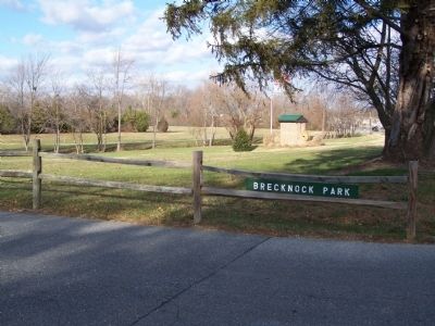
In 1680 Alexander Humphreys received a warrant from the county court for 600 acres of land which he called Brecknock. The tract is believed to have been named for a shire of Wales. A milling operation was established here in the 1740’s. For nearly . . . — — Map (db m39507) HM
1680 Alexander Humphrey obtains title to 600 acres south of Isaac Branch. The tract is called Brecknock.
1740 John Hill builds the first mill at Brecknock.
1746 John Clayton, Jr. purchases the mill at Brecknock from John Hill.
. . . — — Map (db m131998) HM
In 1787 the Golden Fleece Tavern owned by Elizabeth Battell, stood facing Court House Square on a property that included this site and there the Constitution of the United States was ratified by the Delaware state.
"Fully, freely . . . — — Map (db m142494) HM
In 1947 the International Latex Corporation established a specialty products division and chose this site for its location. The company’s rise to prominence as a supplier of aeronautic and aerospace equipment began in 1952 when it was contracted to . . . — — Map (db m39062) HM
The Richardson and Robbins complex began in 1881, twenty-six years after Alden B. Richardson and James W. Robbins started a small cannery at another location in Dover. On this new site Richardson and Robbins prospered as canners of high quality . . . — — Map (db m42760) HM
This was the site of the Golden Fleece Tavern, scene of some of the most important and dramatic events in Delaware history. Built in the 1730s, the Golden Fleece was a center for community and government activities. It was a place of great . . . — — Map (db m39075) HM
The images reproduced here were selected as being representative of all Delaware women who have served our state and our nation in defense plants in wartime, helping to manufacture products that support our Armed Forces. Each woman pictured on . . . — — Map (db m198970) HM
The Lockheed Constellation with its gracefully contoured fuselage is a mixture of beauty, power, and utility.
Constellation or "Connie" began as the 1943 C-69 Constellation prototype. A small number of C-69s were assigned to the Air . . . — — Map (db m142614) HM
During WWII, the military brought or pressed into service all kinds of transport aircraft. Lockheed Lodestars were smaller and faster than the Douglas DC-3 aircraft that had become the industry standard. The USAAF commandeered over 50 early model . . . — — Map (db m142621) HM
The UH-1 Iroquois, nicknamed Huey, was a straightforward single-engine design with a crew of two pilots and a crew chief/door gunner. In combat, the Huey flew three distinct missions as "slicks" (troop transports), "gunships" (armed battleship . . . — — Map (db m142627) HM
The Town of Farmington was first settled in 1851 as Flatiron. In 1855, the Delaware Railroad built a station at a crossroads in the community near the home of Governor William Tharp. When a new post office opened in 1858, the town was officially . . . — — Map (db m229504) HM
Organized on December 9, 1877, the Felton Methodist Protestant Church originally held services for several years in the Knights of Pythias Hall. In 1880, a parcel of land on High Street was deeded to the church trustees by Job Butterworth and his . . . — — Map (db m138267) HM
On September 17, 1740, Thomas Clark received a Proprietary Warrant from Thomas Penn for lands “adjoining his dwellin place” which he named “Clark’s Folly.” By the 1790’s Benjamin Clark and his son Matthew had established an inn and tavern on this . . . — — Map (db m37477) HM
The Town of Little Creek developed in the early 1800s as a wharf on the Little River between two neighboring plantations. Originally known as Little Landing, the community began as a trading and shipping hub for salt marsh hay, agricultural products . . . — — Map (db m141378) HM
History of Goat Island
This nine-acre island was created in 1927 when the Army Corps of Engineers dug a channel removing the oxbow and straighten the river. At that time, shipbuilding and agriculture were important industries in Milford and . . . — — Map (db m198913) HM
On this site stood the home of General Alfred T. A. Torbert who served his country in the War Between the States and later as Consul General at Paris. The building was erected circa 1825 by Benjamin Wadhams for a tavern and later was remodeled for a . . . — — Map (db m142578) HM
In 1764, Thomas Green sold a one-quarter acre lot at this location to his grandson, Charles Green. Some time thereafter, Charles established a facility for the manufacturing of redware pottery on this site. The business is known to have been in . . . — — Map (db m39678) HM
Lums Pond State Park
The pond has existed since 1735 when St. Georges Creek was dammed to power a sawmill. when the Lum family acquired the mill after 1809, they lent their name to the pond. Some twenty years later, Lums Pond provided water . . . — — Map (db m238407) HM
The trail you are standing on is surrounded by clues to this area's history. Some clues are clearly visible. Others are in the ground where you cannot see them. Archaeologists and historians study all these clues along with written records to . . . — — Map (db m227729) HM
This was once the home of John Jakob Raskob (1879-1950), financier, DuPont and General Motors executive, Chairman of the Democratic National Committee, and developer of the Empire State Building. Known as "The Patio," his palatial home was . . . — — Map (db m14697) HM
John Grubb, one of the original English settlers in Delaware, acquired a one-third interest in a 600 acre tract of land at this location in 1680. Several generations passed and the Grubb family greatly increased their land holdings in the area and . . . — — Map (db m146375) HM
The industrial expansion of Brandywine Hundred in the late 19th and early 20th centuries was largely reflective of national trends in the growth and development of heavy industry. As large corporations moved to locations outside of major cities, . . . — — Map (db m154138) HM
Although the idea of a waterway crossing the upper Delmarva peninsula was suggested in the 1600s, the canal did not become a reality until 1829. Over 2,600 workers, including many Irish immigrant and African-American laborers, dug the canal with . . . — — Map (db m174514) HM
The river marshes around Delaware City provided the ideal habitat for fishes, waterfowl and muskrats. In the 1800s, local residents thought this wildlife would always be available and abundant.
The harvesting of fish and birds in excessive . . . — — Map (db m174497) HM
Just a half-mile off Delaware City's Battery Park, Pea Patch Island is home to a large colony of herons in America. While Fort Delaware occupies the southern end of the island, nine species of wading birds have settled on the marshy, forested . . . — — Map (db m189915) HM
Delaware City’s story begins in 1801 when the Newbold brothers, Barzilla, Clayton, and John, of New Jersey, acquired 1600 acres of land on the Delaware River, John Newbold built a wharf that became a center for trading and shipping grain, giving . . . — — Map (db m189478) HM
The African American community known today as Polktown is one of the earliest remaining free black settlements in Delaware and has been continuously occupied for nearly two centuries. It extended on both sides of the historic branch canal and . . . — — Map (db m244709) HM
The Chesapeake and Delaware Canal offered easy passage between Philadelphia and Baltimore for both freight and passengers. By reducing the miles traveled between the two cities, the canal improved access to Pennsylvania's Susquehanna Valley and . . . — — Map (db m174515) HM
Made in Philadelphia 1839 for the Chesapeake and Delaware Canal Company, it was used as an air chamber for workmen to make underwater repairs on the lock gates. The canal was opened in 1829 and was operated until the sea level canal was opened at . . . — — Map (db m189476) HM
This earthbound rectangle of water before you was once the eastern gateway to the Chesapeake and Delaware Canal, one of four locks that regulated water depth along the canal to allow vessels to make the 14-mile journey between the Delaware River . . . — — Map (db m174502) HM
This quiet waterfront promenade was once part of a busy, noisy commercial district that included coal wharves, a steamboat dock, sheds and stores, and broad staging areas for local produce destined for markets in Philadelphia and Baltimore. Piers . . . — — Map (db m174518) HM
1640
Native people welcomed the early explorers
Before the arrival of the first Europeans, this area was occupied by Lenape Indians, who depended on the forests, river valleys and waterways for their survival. When the early Dutch . . . — — Map (db m191668) HM
Welsh Tract Church
William Penn granted a 30,000 acre tract of land to three Welshmen, (David Evans, William Davis, and William Willis) in 1701. They and their followers had left southern Wales in search of religious freedom. In encouraging . . . — — Map (db m140189) HM
Welsh Tract Church
William Penn granted a 30,000 acre tract of land to three Welshmen, (David Evans, William Davis, and William Willis) in 1701. They and their followers had left southern Wales in search of religious freedom. In encouraging . . . — — Map (db m238425) HM
What is iron ore?
Iron is a silvery-white, solid metal, though when found in Pencader Hundred, it commonly appears as a brown and sometimes nearly black oxide of iron. Its chemical symbol Fe, is derived from ferrum, the Latin word for iron. . . . — — Map (db m140211) HM
The majority of the United States population in the early 1800s resided in the Mid-Atlantic area north and south of Delaware. Travelers along the east coast from higher populated areas such as New York and Philadelphia had to pass through . . . — — Map (db m238429) HM
Formerly known as "MudFort," this log structure was built circa 1790. The original two-story building measured 21 x 27 feet, and featured an attic and full stone basement. A later tax assessment describes the house as "large" and cites the presence . . . — — Map (db m168956) HM
Augustine Beach was named after Augustine Herman (c 1621-1686), an explorer and cartographer who mapped the region for Lord Cecil Calvert. Adam Diehl built the brick Augustine Beach Hotel in about 1814. In 1867, owner Simeon Lord expanded the hotel, . . . — — Map (db m205497) HM
David Witherspoon, born in Ireland, built this tavern in 1761 as a midpoint between waterways to the east and west. While traveling to the Continental Congress, Thomas Jefferson lodged here on June 20, 1775. George Washington also dined at the . . . — — Map (db m155564) HM
Settled at the triangular intersection of three roads in the early 19th century by workers from the nearby DuPont Black Powder Mills, this village consisted initially of only 2.4 acres. The Wilmington and Northern Railroad established tracks through . . . — — Map (db m173287) HM
The Delaware River, a mighty highway of commerce, has also been a formidable barrier to travel. Ferries operated sporadically from New Castle from very early days. Modern ferry service didn't begin until 1925 to meet the increasing needs of . . . — — Map (db m191495) HM
The original landing was started during the 17th century of stone filled wood cribs, being enlarged several times. The city acquired ownership from the New Castle Frenchtown Railroad Co. in 1914, and rebuilt the wharf with a concrete face on new . . . — — Map (db m57133) HM
New Castle has a long history as a national transportation link. In the 1820s a turnpike connected ships on the Delaware River with ships on the Chesapeake Bay. However, the turnpike was in poor condition. Progressive town leaders saw . . . — — Map (db m102543) HM
This imaginative 1857 painting by Edward Moran depicts New Castle Harbor at its height. The fishing boat (right center) represents New Castle's critical fishing industry. The tall-masted U.S. Navy brig to its left demonstrations the national . . . — — Map (db m191496) HM
History (circa 1657) reflects that two hundred Italians from the Piedmont region may have immigrated to New Amstel (New Castle) via Holland and New Amsterdam (New York) little is known of his group, Not until the late nineteenth century did . . . — — Map (db m246130) HM
The first house constructed by Guido DeAscanis in 1932. Guido was born in San Omero, Italy in 1900 and arrived in America on July 4, 1920. He founded Guido DeAscanis & Sons, Inc. in 1933. They went on to build many homes and buildings to enhance the . . . — — Map (db m174446) HM
The Rise of Delaware's Railroads
The 19th century saw railroad expansion all over the country. In Delaware, railroads connected New Castle County and Wilmington to points north, south and west. Yet, the need for a direct line between New . . . — — Map (db m168198) HM
In 1783 Thomas Meeteer made a purchase of land in Mill Creek Hundred. By 1797, he owned about 285 acres on both sides of the White Clay Creek. On this land, he develops a farm, a sawmill, a paper mill and housing for his family and his workers. . . . — — Map (db m230055) HM
Since the mid-18th century an establishment for public hospitality has existed here. The first building, of wood construction, was known as St. Patrick's Inn. Famous visitors included surveyors Mason and Dixon. The property was purchased by James S. . . . — — Map (db m154817) HM
This building is named in honor of E. Arthur Trabant, who served two terms as President of the University of Delaware: 1968-87 and 1988-90. During his presidency, enrollment at the University doubled, the Laird Campus was developed, the University . . . — — Map (db m131143) HM
Delaware College, now University of Delaware, might have been a financial casualty of the Civil War period except for the assistance of George Gillespie Evans, a Newark merchant. Indeed, Delaware College did close for 11 years before, during and . . . — — Map (db m131107) HM
George Washington's "General Staff Headquarters" on September 6, 1777. Here Generals Washington, Lafayette, Wayne, Maxwell, Sullivan, and Greene planned defense of Wilmington. House built circa 1750 by Samuel Hale. Owner 1776 - Daniel Byrnes - a . . . — — Map (db m13555) HM
A New Englander born into modest means, Harry Fletcher Brown was a chemist who developed smokeless powder. In 1904, he joined the Du Pont Company and later became a benefactor of education and social services.
Mr. Brown was an intense, . . . — — Map (db m154178) HM
During the height of the Great Depression, Harry Fletcher Brown first came to the aid of the University of Delaware and, over the next decade, became one of the University's most generous benefactors, financing construction of Brown Laboratory, . . . — — Map (db m154179) HM
[caption:] Iron ore like this was mined from Iron Hill and Chestnut Hill
What is iron ore?
Iron is a silvery-white, solid metal, though when found in Pencader Hundred, it commonly appears as a brown, and sometimes nearly black . . . — — Map (db m157343) HM
This laboratory is named for Lammot du Pont (1831-1884), a gifted scientist and grandson of the founder of the DuPont Company. His many talents resulted in new products and enhancements to the company's operation.
Recognized as a skilled . . . — — Map (db m130514) HM
This building is named for the small southern Delaware town of Laurel, the birthplace of Mary Wooten Carpenter. Her Husband, Walter S. Carpenter Jr., who served as President of the University of Delaware Board of Trustees from 1959-62, supported . . . — — Map (db m153415) HM
In the late 18th century a paper mill was established by Thomas Meeteer on the banks of nearby White Clay Creek. In later years Thomas was succeeded in business by his sons Samuel and William. the property on which this house stands was purchased by . . . — — Map (db m154972) HM
What is Milling?
Milling is a process of taking whole bulbs, tubers, nuts, seeds, grains or other foods from its original size to a smaller size by pounding, grinding or rolling it until it is the consistency of a meal, flour or powder. . . . — — Map (db m156797) HM
The origins of the Independent Order of Odd Fellows can be traced to the creation of beneficial trade societies in England. Composed of craftsmen who practiced a variety of different or "odd" occupations, the purpose of these organizations was to . . . — — Map (db m9898) HM
Pierre S. du Pont can fairly be described as the founder of the modern University of Delaware. In 1915, he donated the money to purchase the land that is now The Green, which physically unified Delaware College and Women's College.
President of . . . — — Map (db m131108) HM
Completed in 1886, this was the home and place of business of Theodore F. Armstrong, a prominent local merchant and civic leader. Reflecting the growing prosperity of the community and its residents, this hybrid of Queen Anne and Gothic architecture . . . — — Map (db m130149) HM
Robert ("Bob") Gore was a University of Delaware undergraduate studying chemical engineering when he invented GoreTexⓇ. This polymer material became key to the success of W.L. Gore and Associates, a company that Bob's father, Wilbert L. . . . — — Map (db m154281) HM
A historic house leaves, then returns to the family. The story of the Chambers House begins in 1775 when Benjamin Chambers bought 250 acres of land and set up a sawmill on nearby White Clay Creek. His son Joseph built this house about 1820 . . . — — Map (db m72723) HM
Newark was once the home of several factories producing paper, wood laminates and a variety of textiles. Some were located on the White Clay Creek. Harnessing its water flow to generate power. The Pomeroy and Newark Railroad service these . . . — — Map (db m174922) HM
Welsh Tract Church
William Penn granted a 30,000 acre tract of land to three Welshmen, (David Evans, William Davis, and William Willis) in 1701. They and their followers had left southern Wales in search of religious . . . — — Map (db m156971) HM
Welsh Tract Church
William Penn granted a 30,000 acre tract of land to three Welshmen, (David Evans, William Davis, and William Willis) in 1701. They and their followers had left southern Wales in search of religious freedom. In encouraging . . . — — Map (db m238421) HM
[caption:] Iron ore like this was mined from Iron Hill and Chestnut Hill
What is iron ore?
Iron is a silvery-white, solid metal, though when found in Pencader Hundred, it commonly appears as a brown, and sometimes nearly black . . . — — Map (db m158219) HM
Historic Roads of Newark, Delaware
1. Old Baltimore Pike
The Old Baltimore Pike was built before 1720 and connected Elkton, Maryland to Christiana. It followed the path of an east-west Indian trail over the south side of Iron Hill. . . . — — Map (db m214020) HM
Originally called "Marettico", meaning hill of hard stone, by the Indians who inhabited this area. Known as Iron Hill as early as 1661 when three Englishmen were reportedly killed there by Minquas Indians. Indians frequented Iron Hill to obtain . . . — — Map (db m155424) HM
In 1701, William Penn granted 30,000 acres of land to a group of Welsh settlers who were attracted to the area by the iron on Iron Hill. An iron mining and smelting industry grew up around both Iron and Chestnut hills and continued until 1891 when . . . — — Map (db m155426) HM
1701
40,000 acres of land called "The Welsh Tract" was granted by William Penn to Welsh Baptists to build a new church and to mine for iron.
1702- James James, the 1st of the Welsh settlers to select land, chose 1,244 acres: from Iron . . . — — Map (db m238408) HM
The majority of the United States population in the early 1800s resided in the Mid-Atlantic area north and south of Delaware. Travelers along the east coast from highly populated areas such as New York and Philadelphia had to pass through . . . — — Map (db m203676) HM
The civil war officially began on April 12, 1861 when Confederate forces bombarded the Union controlled Fort Sumter.
Delaware was a Border . . . — — Map (db m238413) HM
One of the first tasks the Welsh performed was the establishment of two houses of worship. Among the Welsh were both Baptist and Presbyterian and the Baptist built their church on the north side of Iron Hill in 1703. Rebuilt in 1746, it remains . . . — — Map (db m158217) HM
This is the site of the Eastburn-Jeanes farms and mining industry. Marble from the Cockeysville Formation, found in three quarries in the area, was heated in kilns to produce quick lime for fertilizer and mortar. The lime was transported over . . . — — Map (db m92273) HM
Ashton Richardson built Ashley Mansion in 1804 on land he inherited from his father. A prominent Quaker, Ashton Richardson owned several milling operations and was considered one of the most eligible bachelors in the area. After marrying in 1807, . . . — — Map (db m196413) HM
A fashionable spa and hotel was located on this site from 1827-1853. Distinguished personalities, such as Henry Clay, came for relaxation and enjoyment. T.U. Walter, the architect of the U.S. Capitol, designed and remodeled the hotel buildings. . . . — — Map (db m145424) HM
Constructed in 1749, the area is home to one of the earliest mill sites on the Red Clay Creek. A three-story flour mill once served as the center of activity on the site, and was the location of Oliver Evans’ first automated flour mill operation. In . . . — — Map (db m145422) HM
This frame grist mill, located on the Red Clay Creek, said to be on the site of an old Swedish mill, was operated continuously by water power from 1790 until 1969. The mill race, floodgates and dam are still intact. — — Map (db m169032) HM
Born in Newport, Delaware, September 13, 1755, son of Charles and Ann Stalcop Evans. Invented automatic machinery for flour mills; first high-pressure steam engine adapted to commercial use in America; and first American land vehicle to move under . . . — — Map (db m168199) HM
Delaware clock-maker of great distinction and silversmith lived and labored here for about thirty years until his death in 1797. Was a prominent member of Old Drawyers Presbyterian Church. Made contract with State of Delaware in 1776 for manufacture . . . — — Map (db m236871) HM
Canary-Naudine House & Store
is listed in the
National Register
of Historic Places
by the United States
Department of the Interior
c. 1785
— — Map (db m174828) HM
Left Panel The European Markets Port Penn once figured prominently in world markets. As the supply of beaver fur in the American West declined, European demand for quality fur remained high. Toward the end of the 19th century, muskrat . . . — — Map (db m10435) HM
The Presbyterian Church, on the opposite corner across the intersection, now occupies the site originally intended as Port Penn's market square. Dr. David Stewart, Sr., believed to be the founder of Port Penn, envisioned a central market similar . . . — — Map (db m10395) HM
Site of Harper Carey Store
is listed in the
National Register
of Historic Places
by the United States
Department of the Interior
c. Early-20th Century
— — Map (db m174835) HM
The W.B. & J.S. Zacheis, Inc. cannery operation stood across the street from the schoolhouse from the early 1900s until after World War II. When the Chesapeake and Delaware Canal and the railroad diverted most commercial shipping away from the . . . — — Map (db m10396) HM
In 1834, Joseph Cleaver built this house near the river and what was then the region's biggest port. He called it Linden Hall. As one of Port Penn's best-known merchants, he hoped to dominate the trade between the Delaware River and the farmlands . . . — — Map (db m10388) HM
This house was ordered by mail and delivered in pieces by railroad to Delaware City and then brought to Port Penn by wagon. Houses could be ordered from Sears, Roebuck and Company, Montgomery Ward, and other sources. During the growth of mass . . . — — Map (db m10391) HM
The Stewart House built in the mid-1700's, was owned by at least six generations of the family. David Stewart, Sr., credited with founding Port Penn, planned for the town to become a shipping port that could compete with the firmly established . . . — — Map (db m10392) HM
Port Penn’s name is attributed to a visit that William Penn made to the area in 1682. Dr. David Stewart founded Port Penn in the 1760s and laid out the town in a grid pattern. A protected deep water harbor and access to an active peach and grain . . . — — Map (db m140576) HM
W.H. Miller Rental Property
is listed in the
National Register
of Historic Places
by the United States
Department of the Interior
c. Mid-19th Century
— — Map (db m174841) HM
Port Penn is a community connected to its wetland landscape. Seasonal changes bring about changes in the lifestyles of Port Penners themselves. Autumn waterfowl hunting and winter muskrat trapping lead into spring shad runs and summer sturgeon . . . — — Map (db m10438) HM
This bridge is named in honor and remembrance of
Joseph C. Pennington, Jr.
A man who dedicated over 45 years of his life helping build the infrastructure of Delaware. In 2002 he was inducted into the American Society of Highway . . . — — Map (db m184906) HM
The site of the Rockland Mill Village is one of the earliest and longest-functioning mill seats on the Brandywine. Grist milling commenced c.1724 and was replaced by a fulling and cotton mill c.1735. Paper was the primary product of the mill . . . — — Map (db m128082) HM
These buildings and dam complex were once pan of the community of Rockland, built over 200 years ago on the banks of the Brandywine River. The Brandywine supplied water power to the Rockland Mill and a dozen others in the Wilmington region. . . . — — Map (db m184946) HM
Woodlawn Trustees, Inc. ~ The Land as Legacy
In 1981, Woodlawn Trustees, Incorporated helped the State of Delaware to add the land you see around you to Brandywine Creek State Park. Woodlawn owned 350 acres of this land, . . . — — Map (db m184950) HM
Site of famous tavern of Revolutionary days known as "The Sign of the Ship." John Marshall was then innkeeper. Officers of Continental Army were quartered here. Washington, Lafayette, Aaron Burr and Commodore Perry were among its distinguished . . . — — Map (db m140394) HM WM
In August 1958, Wilmington City Councilman and Civil Rights activist William “Dutch” Burton worked with the NAACP to expose the racially discriminatory practices of the Eagle Coffee Shoppe. The restaurant was located on this site in a . . . — — Map (db m140547) HM
276 entries matched your criteria. The first 100 are listed above. Next 100 ⊳