By Duane and Tracy Marsteller, October 11, 2023
Champion Grocery and Meat Market Marker
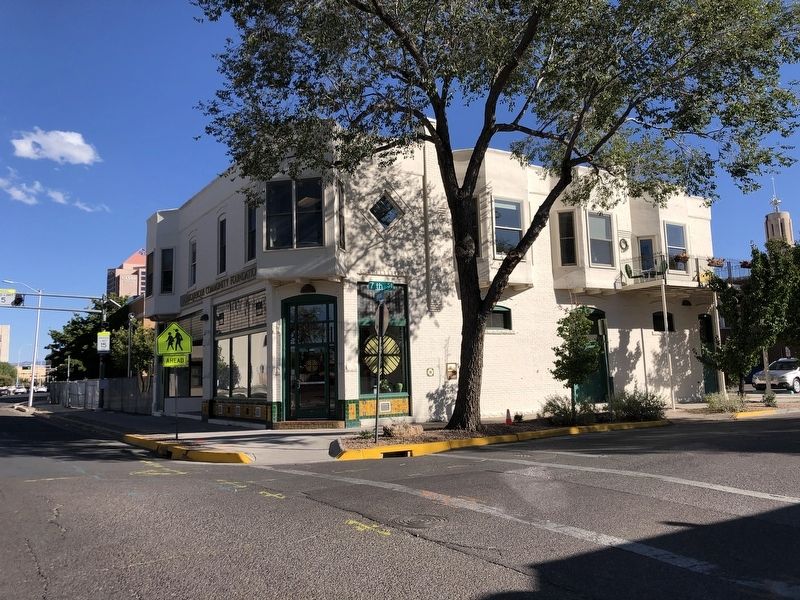
| On 7th Street Northwest at Tijeras Avenue Northwest, on the right when traveling north on 7th Street Northwest. |
| On 7th Street Northwest at Tijeras Avenue Northwest, on the right when traveling north on 7th Street Northwest. |
| On Edith Boulevard Northeast just north of Dr. Martin Luther King Jr. Avenue Northeast, on the right when traveling north. |
| On 10th Street Northwest at Marquette Avenue Northwest, on the left when traveling north on 10th Street Northwest. |
| On California Street NE at Linn Avenue NE, on the left when traveling north on California Street NE. |
| On Central Avenue Northeast (Old U.S. 66) at Wellesley Drive, on the right when traveling east on Central Avenue Northeast. |
| On Gold Avenue Southwest at 2nd Street Southwest, on the right when traveling west on Gold Avenue Southwest. |
| On Gold Avenue Southwest at 1st Street Southwest, on the right when traveling west on Gold Avenue Southwest. |
| On 1st Street SW at Gold Avenue SW, on the right when traveling north on 1st Street SW. |
| On 1st Street SW, on the right when traveling north. |
| On Central Avenue Southwest at 3rd Street Northwest, on the right when traveling east on Central Avenue Southwest. |
| On 1st Street Southwest at Central Avenue Southwest, on the right when traveling south on 1st Street Southwest. |
| On Central Avenue Southeast (U.S. 66) east of Buena Vista Drive Southeast, on the right when traveling east. |
| Near Central Avenue SW north of Tingley Drive SW, on the left when traveling north. |
| Near Central Avenue SW north of Tingley Drive SW, on the left when traveling north. |
| Near Grand Enchantment Trail. |
| Near Bridge Boulevard Southwest (New Mexico Route 314) at Isleta Boulevard SW (New Mexico Route 314). |
| Near Isleta Boulevard Southwest south of Appleton Road SW. |
| Near Isleta Boulevard Southwest (New Mexico Route 314) south of Appleton Road SW. |
| On Isleta Boulevard Southwest (New Mexico Route 314) south of Las Rosa Road, on the right when traveling south. |
| Near Isleta Boulevard Southwest (New Mexico Route 314) south of Appleton Road SW. |
| On Isleta Boulevard Southwest (New Mexico Route 314) north of Pajarito Road Southwest, on the right when traveling north. |
| Near Isleta Boulevard SW (New Mexico Route 314) near Bridge Boulevard SW. |
| Near U.S. 60 just west of Mud Pie Lane, on the right when traveling west. |
| On North Main Street, on the right when traveling south. |
| On North Virginia Avenue, on the left when traveling south. |
| On North Richardson Avenue, on the right when traveling north. |
| On Main Street near E. 4th Street, on the left when traveling north. |
| On West Santa Fe Avenue (Historic Route 66), 0.1 miles east of State Road 53, on the right when traveling east. |
| On State Road 117, 0.3 miles north of Interstate 40, on the right when traveling north. |
| On Iron Avenue just north of U.S. 66, on the right when traveling north. |
| On U.S. 66 at Iron Avenue, on the right when traveling west on U.S. 66. |
| On U.S. 66 at Iron Avenue, on the right when traveling west on U.S. 66. |
| On U.S. 66 at Iron Avenue, on the right when traveling west on U.S. 66. |
| Near New Mexico Route 124 at Old Route 66 Road. |
| Near New Mexico Route 124 at Old Route 66 Road. |
| On State Road 21, 0.4 miles south of U.S. 64, on the left when traveling south. |
| On Therma Way (U.S. 64) at State Road 38, on the left when traveling east on Therma Way. |
| On South 1st Street at Cook Avenue, on the right when traveling south on South 1st Street. |
| On Maxwell Avenue (Business Interstate 25) north of 6th Street, on the right when traveling north. |
| Near Billy the Kid Road (State Road 272) 0.1 miles south of State Road 212. |
| On Calle Principal at Calle De Parian, on the right when traveling south on Calle Principal. |
| On West Main Street (U.S. 82) east of South 6th Street, on the right when traveling east. |
| On West Main Street (U.S. 82) east of South 6th Street, on the right when traveling east. |
| On West Main Street (U.S. 82) at South 6th Street, on the right when traveling east on West Main Street. |
| On West Main Street at South 6th Street, on the right when traveling east on West Main Street. |
| On West Main Street (U.S. 82) at South 6th Street, on the right when traveling east on West Main Street. |
| On West Main Street (U.S. 82) east of South 6th Street, on the right when traveling east. |
| On West Main Street (U.S. 82) at South 6th Street on West Main Street. |
| On Westridge Drive (U.S. 285) at Callaway Drive, on the right when traveling east on Westridge Drive. |
| On City of Rocks (Park Road), 1.8 miles north of State Highway 61. |
| On U.S. 180 at milepost 120.7, on the right when traveling south. |
| On State Road 15 at milepost 6.2, on the right when traveling north. |
| On Scenic State Road 152, 1.1 miles east of State Highway 356, on the right when traveling east. |
| On Scenic State Road 152, 1.1 miles east of State Highway 356, on the right when traveling east. |
| On Scenic State Road 152, 1.1 miles east of State Highway 356, on the right when traveling east. |
| On State Road 152, on the right when traveling east. |
| On Scenic State Road 152, 1.1 miles east of State Highway 356, on the right when traveling east. |
| On Scenic State Road 152, 1.1 miles east of State Highway 356, on the right when traveling east. |
| On Scenic State Road 152, 1.1 miles east of State Highway 356, on the right when traveling east. |
| Near North Hudson Street (New Mexico Route 90) at East Yankie Street, on the left when traveling north. |
| Near North Hudson Street (New Mexico Route 90) at East Market Street, on the left when traveling north. |
| On West Broadway Street at North Bullard Street, on the right when traveling east on West Broadway Street. |
| On U.S. 180 at milepost 111.5, on the right when traveling east. |
| On Business Interstate 40 west of Greig Avenue, on the right when traveling west. Reported permanently removed. |
| On U.S. Route 66 (Business Interstate 40) west of Will Rogers Drive, on the right when traveling west. |
| On State Road 338 at milepost 24.4 at State Road 9, on the right when traveling south on State Road 338. |
| On State Road 338 at milepost 24.4 at State Road 9, on the left when traveling north on State Road 338. |
| Near Interstate 10 at milepost 20. |
| On 1st Street (State Road 80) at Hickory Street, on the right when traveling south on 1st Street. |
| On North Marland Boulevard (U.S. 62/180 at milepost 105.9) at East Snyder Street, on the right when traveling north on North Marland Boulevard. |
| On U.S. 62, 1.2 miles west of State Line Road, on the right when traveling west. |
| On South Love Street at East Central Avenue, on the right when traveling north on South Love Street. |
| On Avenue A at 1st Street, on the left when traveling south on Avenue A. |
| On Main Street (U.S. 54 at milepost 168.5) at Mayeux Road, on the right when traveling south on Main Street. |
| On Just north of Kit Carson Road north of State Road 220, on the right when traveling north. |
| Near Parade Ground near State Road 220. |
| On U.S. 70 at milepost 273.5, on the right when traveling east. |
| On U.S. 380 at milepost 97.9, on the right when traveling east. |
| On Billy the Kid Trail (U.S. 380 at milepost 97.9), on the right when traveling east. |
| On Billy the Kid Trail (U.S. 380 at milepost 97.5), on the right when traveling east. |
| On Billy the Kid Trail (U.S. 380 at milepost 97.5), on the right when traveling east. |
| On U.S. 380 at milepost 97.7, on the right when traveling east. |
| On U.S. 380 at milepost 97.7, on the right when traveling west. |
| On Sudderth Drive, 1.4 miles west of U.S. 70, on the left when traveling west. |
| On U.S. 70 at milepost 264, on the right when traveling west. |
| Near Juniper Street just west of 19th Street. |
| Near Juniper Street just west of 19th Street. |
| On Trinity Drive (New Mexico Route 502) 0.1 miles west of 20th Street, on the right when traveling west. |
| Near New Mexico Route 118 east of South 1st Street. |
| On New Mexico Route 118 west of South 1st Street, on the right when traveling west. |
| Near New Mexico Route 118 east of South 1st Street. |
| On New Mexico Route 118 west of South 1st Street, on the right when traveling west. |
| Near New Mexico Route 118 east of South 1st Street. |
| Near New Mexico Route 118 east of South 1st Street. |
| On West Historic Highway 66 (State Road 118) at South 3rd Street, on the left when traveling west on West Historic Highway 66. |
| On State Road 442 just east of State Road 518, on the right when traveling east. |
| On State Road 518 at State Road 442 on State Road 518. |
191 entries matched your criteria. The first 100 are listed above.
The final 91 ⊳