Elegant Design
The Lewes railroad swing bridge, originally designated Bridge No. 38.71 by the Pennsylvania Railroad, carried the Delaware Coast Line Railroad and predecessor railroads over the Lewes-Rehoboth Canal. Built in 1916 by the . . . — — Map (db m244755) HM
Last Stop: Lewes Station!
The Junction & Breakwater Railroad's (J&BRR) Lewes Station once stood near where the Lewes Public Library is now located. The railroad station served as a stop on the J&BRR route to and from Georgetown and . . . — — Map (db m244756) HM
On Lewes Georgetown Trail just south of Gills Neck Road (Local Road 267), on the right when traveling north.
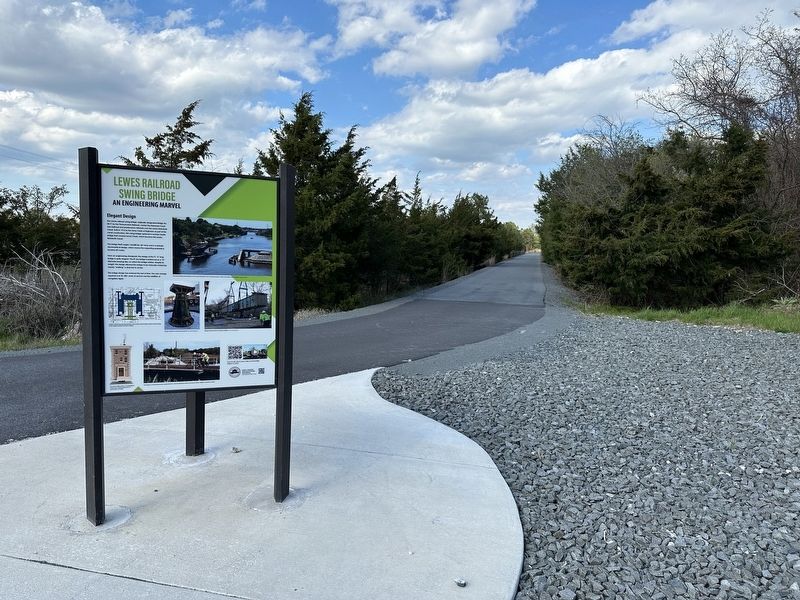
Bridging History
The Junction & Breakwater Railroad (J&BRR) was founded in 1857 but because it was built in stages, it took more than a decade for the railroad to link Harrington with Lewes, with trains finally running to Lewes in early . . . — — Map (db m244426) HM
On Lewes Georgetown Trail just south of Gills Neck Road (Local Road 267), on the right when traveling north.
Bridge Mechanics
The Lewes Swing Bridge (Bridge 3-928R) was a center-bearing bobtail swing bridge. The bobtail name comes from the bridge span's asymmetrical design, where the span's longer "arm" extended approximately 60 feet while the . . . — — Map (db m244433) HM
On Lewes Georgetown Trail south of Gills Neck Road (Local Road 267), on the right when traveling east.
Preservation of the Bridge
The federal government is frequently engaged with projects that affect historic properties. Sometimes these projects result in the deconstruction or altering of properties. In 1966 Congress established the . . . — — Map (db m244447) HM
This railroad swing bridge, No. 3-928R, was built in 1916 to carry the Delaware, Maryland & Virginia Railroad over the newly constructed Lewes-Rehoboth Canal. The railroad was originally built to service menhaden fish processing factories in Lewes; . . . — — Map (db m244754) HM
A rare example of a hand-cranked, bobtail swing bridge. Built in 1916 by the Pennsylvania RR, it remained in service until 2017. It was moved to this site in February 2022.
[Third Panel]
The bridge and grounds are . . . — — Map (db m244751) HM
On County Road 280B west of Robinsonville Road (County Road 277), on the left when traveling west.
On February 9, 1838, a meeting was held at the Angola Schoolhouse for the purpose of formally organizing a Methodist Episcopal Church to serve the needs of local residents. On that same day the congregation's newly-elected trustees received a deed . . . — — Map (db m232972) HM
Near Savannah Road (Business U.S. 9) 0.1 miles east of North Village Main Boulevard, on the right when traveling east.
Theodore C. Freeman – Lewes Native
Ted Freeman was born in Haverford, Pennsylvania on February 18, 1930 but his family moved to Lewes, Delaware before he was 18 months old. Freeman was educated at Lewes schools and graduated in 1948 from . . . — — Map (db m227859) HM
In 1840, Israel United Methodist Church formed in the Belltown community west of Lewes. Israel established a cemetery in 1854 and formally incorporated in 1877. The congregation rebuilt the church in 1890 and again in 1916. Over time, the 1916 . . . — — Map (db m227870) HM
On Eagle Point Drive, on the right when traveling south.
Located within this neighborhood, a short distance south of here, is the burial ground of the Coursey and Daisey families, members of the Nanticoke Indian tribe.
The graveside is unmarked except for a family tombstone noting the site.
It . . . — — Map (db m104206) HM
In 1769, an international scientific effort was organized to observe a transit of Venus in order to determine the size of the solar system. This rare event, when Venus passes in front of the Sun's disk, makes such calculations possible when measured . . . — — Map (db m228456) HM
Near Dune Road, 0.5 miles east of Campground Road, on the left when traveling east.
Guns such as these were used as field artillery. There were four 155mm guns placed at Fort Miles and four more placed across the Delaware Bay at Cape May, NJ to limit access to the bay. The concrete pads the were placed on were called "Panama . . . — — Map (db m150111) HM
Near Dune Road, 0.5 miles east of Campground Road, on the left when traveling east.
When Fort Miles was completed, its two 16-inch guns were some of the largest artillery ever engineered by the United States and were placed here to defend the coastline from enemy battleships.
This particular gun barrel is Barrel 371, . . . — — Map (db m150114) HM
Near Dune Road, 0.5 miles east of Campground Road, on the left when traveling east.
This gun is known as a 3"/50, which specifies diameter of the gun's bore and it's caliber. The 3-inch guns that were placed at Fort Miles were mounted on a pedestal to allow them to be easily aimed and follow the target. Throughout their use, . . . — — Map (db m150104) HM
Near Dune Road, 0.5 miles east of Campground Road, on the left when traveling east.
The gun before you is a 6-inch pedestal-mounted deck gun. This gun could fire two types of rounds, a 105-lb. armor-piercing round and a 90 lb. high-explosive round.
The model 1903-A2 guns that were at Fort Miles would have been mounted on . . . — — Map (db m150115) HM
Near Dune Road, 0.5 miles east of Campground Road, on the left when traveling east.
The 8-inch guns placed at Fort Miles were each mounted on a railcar, making the large guns very mobile and easy to position for firing. The gun was able to turn in a 360° circle at an elevation of 45°. This made them difficult targets for enemy . . . — — Map (db m150112) HM
Near Dune Road, 0.5 miles east of Campground Road, on the left when traveling east.
From the end of World War I until the beginning of World War II, advances in design and engineering led to advances in aircraft and military transportation in general. This progress created more versatile vessels such as aircraft carriers and . . . — — Map (db m150107) HM
Many of the European immigrants who came to this country at the end of the nineteenth century brought with them a variety of epidemic diseases including cholera, typhus, smallpox and bubonic plague. This posed a serious threat to urban areas such as . . . — — Map (db m39387) HM
Each spring, upon arrival from their Central and South American wintering grounds, Delaware beachnesters establish colonies and take part in courtship rituals. The birds lay their eggs in shallow nests scraped into the sand mostly between the . . . — — Map (db m94322)
On Ocean Drive (County Road 300) 0.4 miles north of Robins Lane, on the right when traveling north.
Long ago, this area was a freshwater marsh. It lay protected from ocean storms by the Great Dune and barrier beaches. As sea levels rose, saltwater marshes replaced freshwater marshes.
Starting in the 1800s, locals extracted salt from . . . — — Map (db m232983) HM
Near Dune Road, 0.5 miles east of Campground Road, on the left when traveling east.
The guns in this park serve as representations of the artillery that was here throughout Fort Miles' World War II years; these are not the actual guns and not the same models as the guns that were placed here.
Fort Miles was part of the . . . — — Map (db m150109) HM
Near Dune Road, 0.5 miles east of Campground Road, on the left when traveling east.
This small group of buildings, or cantonment, provided living space and necessary services for the troops assigned to operate the guns of Fort Miles. Concrete barracks were more comfortable than the canvas and wood structures that were . . . — — Map (db m150102) HM
Near Dune Road, 0.5 miles east of Campground Road, on the left when traveling east.
The troops stationed here during World War II were part of the nation's coastal defense system that protected the mouth of the Delaware Bay and industries located up the Delaware River. Later the U.S. Army used the area as a recreation center . . . — — Map (db m150103) HM
Near Dune Road, 0.5 miles Campground Road, on the left when traveling east.
Just before World War II, the U.S. War Department began upgrades of the harbor defenses that protect the Delaware Bay. They built new fortifications here at Cape Henlopen that became known as Fort Miles. The fort grew as the members of the . . . — — Map (db m150101) HM
On May 14, 1945, the officers and crew of the German submarine, U-858 gave themselves up to U.S. Marines after hearing of Germany's surrender to Allied troops. They and their vessel were escorted here to the Fort Miles Army dock. Crew members . . . — — Map (db m39382) HM
Near Dune Road, 0.5 miles west of Campground Road, on the left when traveling east.
The piece of steel before you is a 48-inch section of armor plate that is 17.5 inches thick. The hole in it was created by a Mark 8, 16-inch armor piercing shell weighing 2,700 lbs. fired at point blank range. Firing shells at a piece of . . . — — Map (db m150113) HM
In 1880, the fear that foreigners were bringing epidemic diseases to the United States led the federal government to create the National Quarantine System. Around the country, from stations like the one that was here, doctors were dispatched to . . . — — Map (db m39385) HM
Near Dune Road, 0.5 miles east of Campground Road, on the left when traveling east.
Civilian volunteers of the U.S. Army Ground Observers Corps (GOC), a branch of the Aircraft Warning System (AWS) used buildings like this during World War II. The AWS used different types of buildings, including dedicated office buildings, . . . — — Map (db m150106) HM
Near Dune Road, on the right when traveling south.
Built from 1939 to 1942, the 11 concrete observation towers along Delaware's coast were built to protect the shores during World War II - and to last about 20 years. They are still standing after 60 years. The towers were the eyes for the guns of . . . — — Map (db m39595) HM
On Gordons Pond Trail, 0.2 miles west of Ocean Drive (County Road 300), on the right when traveling north.
Built from 1939 to 1942, the 11 concrete observation towers along Delaware's coast were built to protect the shores during World War II - and to last about 20 years. They are still standing after 60 years. The towers were the eyes for the guns of . . . — — Map (db m232986) HM
For more than 150 years, the Cape Henlopen Lighthouse guided ships into Delaware Bay on their way to the ports of Wilmington and Philadelphia.
The Cape Henlopen Lighthouse had its beginnings in 1761. Philadelphia merchants and ship owners . . . — — Map (db m79167) HM
Cape: a piece of land jutting into a body of water beyond the rest of the coast line; a headland; a promontory. Delaware's coastline is constantly changing. The daily effects of wind, tidal currents, and wave action are reshaping and redesigning the . . . — — Map (db m39388) HM
You are standing on the Great Dune, the largest sand hill between Cape Cod, Massachusetts, and Cape Hatteras, North Carolina. This is the dune's highest point, about 80 feet above the Atlantic Ocean.
It took thousands of years and the . . . — — Map (db m79166) HM
The Osprey or Fish Hawk is found April through October in both salt and freshwater areas of the state. Almost as large as a Bald Eagle, the Osprey looks like a cross between a hawk and a gull.
Osprey can spot fish from extreme heights. . . . — — Map (db m94323)
The United States Navy's ties to Cape Henlopen spanned nearly 100 years. The Navy first came to the Cape in 1898 to build a signal tower during the Spanish American War. In the 20th century, the Navy kept a communications station he, beginning with . . . — — Map (db m79201) HM
Near Ocean Drive (County Road 300) 0.4 miles north of Robins Lane, on the right when traveling north.
This stretch of shoreline is known to many as "Whiskey Beach." The history behind that name is a little cloudy. Some say that during Prohibition days in the 1920s, this was a rendezvous for rumrunners. Such an isolated site could have been an . . . — — Map (db m232978) HM
On Bay Road, 0.2 miles north of Post Lane, on the right when traveling north.
When Bill Hopkins came to Delaware in 1964 as the first superintendent for Cape Henlopen State Park, he brought with him a vision that would shape preservation in the state for years to come. For more than forty years he has been a driving force . . . — — Map (db m150116) HM
On Log Cabin Hill Road (Local Road 247) just west of Local Road 281, on the right when traveling west.
Named for the river branch which runs along its northwest edge, Cool Spring Presbyterian Church was established circa 1726. Many of its members were Ulster Scots who had come to America from Ireland seeking religious freedom and economic . . . — — Map (db m150096) HM
On Lewes Georgetown Trail just east of Minos Conaway Road (Delaware Route 265), on the left when traveling west.
Established in 1870, the Cool Spring Station operated as a freight stop on the Junction & Breakwater Railroad (J&BRR) at the northeast corner of the present-day intersection of Cool Spring Road and Lewes Georgetown Highway. During the late . . . — — Map (db m190425) HM
On Johnson Avenue just east of Dupont Avenue, on the right when traveling east.
Block House Pond, a natural spring-fed pond, has provided fresh water, ice, and recreation to the City of Lewes for several centuries. The pond was likely named for a nearby blockhouse built to protect Lewes in the 1670s, where the town residents . . . — — Map (db m232744) HM
On Robinsonville Road (Local Road 277) 0.1 miles north of Long Lane, on the left when traveling north.
Rabbit's Ferry School educated Native American and African American students of the Robinsville area from 1920-1965. Built in 1919 through Pierre S. du Pont's school rebuilding program, the school served students in grades 1-8 and later, grades 1-6. . . . — — Map (db m150097) HM
On Adams Avenue just east of Kings Highway (State Route 9), on the right when traveling east.
Built in 1917 for the Pennsylvania Railroad, this vintage caboose was operated by Delaware Coast Line Railroad between Georgetown and Lewes from around 1982 until 2017. It was on the last train to leave Lewes in December 2017. Restoration . . . — — Map (db m222499) HM
On Savannah Road, 0.1 miles north of County Road 263, on the right when traveling south.
All Aboard!
Chartered in 1857, the Junction & Breakwater Railroad (J&BRR) ran the 38 miles from a junction with the Delaware Railroad in Harrington to the Delaware Breakwater in Lewes. The portion of the line from Georgetown . . . — — Map (db m198907) HM
On Savannah Road (Business U.S. 9) just north of Beebe Avenue, on the left when traveling north.
In 1916, two brothers, Drs. James Beebe, Sr. and Richard C. Beebe, had a shared vision to bring modern-day medicine to Southern Delaware. The Beebe brothers started the first hospital in Sussex County on Savannah Road in Lewes. The hospital began as . . . — — Map (db m190352) HM
On Savannah Road at Sussex Drive, on the right when traveling south on Savannah Road.
As a community-owned, not-for-profit hospital, Beebe Hospital depends on the generous support of individuals, foundations, and businesses. In 1921, Mr. and Mrs. Benjamin F. Shaw were responsible for the first major philanthropic gift to Beebe . . . — — Map (db m199263) HM
On Pilottown Road (Front Street), on the right when traveling north.
Erected By The
State of Delaware
To Commemorate The Settlement
On This Spot, Of The First
Dutch Colony, Under De Vries,
A.D. 1631.
Here was the cradling of a state.
"That Delaware exists as a separate
Commonwealth is due to . . . — — Map (db m37400) HM
On Pilottown Road (Delaware Route 267) close to Rodney Ave..
A native and lifelong resident of this community, Henry Fisher (1735-1792) was one of Delaware's foremost leaders in the struggle for American Independence. His prominence as a skilled pilot and his firm support of the Patriot cause resulted in his . . . — — Map (db m39377) HM
On Savannah Road (U.S. 9) south of Nassau Commons, on the right when traveling south.
The Dutch in 1673 established a court in Hoorn Kil for the inhabitants “on the east and west sides of Cape Henlopen unto Bomties (Bombay) Hook.” Governor Andros of New York in 1676 established an English court at Whorekill, the . . . — — Map (db m19408) HM
On Savannah Road (U.S. 9) north of Sussex Drive, on the right when traveling south.
Here lived Ryves Holt, colonial chief justice; and four governors, David Hall, who commanded a Delaware regiment in the Revolution, Daniel Rodney and Caleb Rodney, sons of John Rodney, and Ebe W. Tunnell; also Colonel Henry Fisher, Revolutionary . . . — — Map (db m19409) HM
On Savannah Road (U.S. 9) north of Donovan Road/N. Atlantic Drive (Delaware Route 263), on the right when traveling north.
Under orders from Peter Stuyvesant the Dutch erected Fort at Hoorn Kil (Lewes Creek) 1659 but were soon dispossessed by the Marylanders. Here was also a communistic settlement established in 1662 by Mennonites from Holland under Peter Cornelius . . . — — Map (db m152856) HM
On Kings Highway (U.S. 9N), on the right when traveling north.
The origin of this church can be traced to the earliest days of Presbyterianism in America. A congregation was established here in 1692 under the leadership of the Reverend Samuel Davis. The steady flow of immigrants from Scotland and Ireland . . . — — Map (db m38573) HM
On Pilottown Road near Harborview Road, on the right when traveling east.
This house is believed to have been built by Samuel Paynter, a carpenter who purchased this property in 1737. Following its completion, the house and surrounding land was sold in 1741 to Luke Shields, a prominent bay and river pilot. The close . . . — — Map (db m48920) HM
On East Savannah Road (U.S. 9) 0.2 miles south of Massachusetts Avenue, on the right when traveling south.
Otis Smith was born in Brooklyn, NY, on December 6, 1909. During his lifetime, he became a "captain of industry" whose complex of family companies extended along the east coast of the US and as far away as Peru and Chile. He was motivated to come . . . — — Map (db m198891) HM
On Pilottown Road just west of Queen Anne Avenue, on the left when traveling west.
Station Master's House
342 Pilottown Road
has been entered on the
National Register of Historic Places
as part of the Lewes Historic District
by the United States Department of Interior
under the provisions of the
National . . . — — Map (db m150099) HM
On Pilottown Road (Front Street), on the right when traveling north.
Commemorates the establishment of the first permanent European presence on the Delaware Bay
1631
In 1631, a group of settlers under David Pietersz de Vries landed near this spot to form a whale hunting station and agricultural . . . — — Map (db m38631) HM
On Theo C. Freeman Memorial Highway (U.S. 9) 0.2 miles north of County Road 268, on the right when traveling north.
Theodore C. Freeman was born in Haverford, Pennsylvania on February 18, 1930.
When he was fifteen months old, Ted's family moved to Lewes, Delaware.
As Ted grew up, aviation became his passion. On his 16th birthday, Ted earned his pilot's . . . — — Map (db m198890) HM
Two massive breakwaters shield Lewes Harbor from the punishing seas where Delaware Bay and the Atlantic Ocean meet. They create an 800-acre anchorage that is nearly empty now, but in the early 1900s it was capable of sheltering 1,000 vessels from . . . — — Map (db m39380) HM
Honorable Christopher J. Christie, Governor of New Jersey
Honorable Jack A Markwell, Governor of Delaware
Celebrating the Cap May-Lewes Ferry's 50 years of continuous
service and to the men and women who have volunteered their . . . — — Map (db m176162) HM
Located on the eastern end of the Delaware Breakwater, this brown conical structure was built in 1885. The tower is composed of four tiers of cast iron plates lined with two feet of brick. It is twenty-two feet in diameter at the base and is set . . . — — Map (db m39378) HM
Marine pilots know the shoals, lumps, and ledges of the Delaware intimately. They know the bends of the dredged channel, the characteristics of every lighthouse and range light, and the location of wrecks. They understand tides and currents and . . . — — Map (db m39379) HM
A temporary light was established on the south end of the recently completed National Harbor of Refuge Breakwater on January 1, 1902. It was replaced in 1908 by a three-story frame lighthouse. A series of storms damaged the structure, resulting in . . . — — Map (db m39374) HM
Near Cape Henlopen Drive (U.S. 9) north of Cape Henlopen Drive.
Theodore C. Freeman was born in Haverford, Pennsylvania on February 18, 1930.
When he was fifteen months old, Ted's family moved to Lewes, Delaware.
As Ted grew up, aviation became his passion. On his 16th birthday, Ted earned his pilot's . . . — — Map (db m114560) HM
Lewes has been a Port-of-Call and a Harbor-of-Refuge since the 17th century. For generations during the ages of sail, a public burial ground in this immediate locality became the final resting place for hundred of sailors who lost their lives and . . . — — Map (db m176163) HM
On West 3rd Street just east of Park Avenue, on the right when traveling east.
• James Beebe purchased this property in 1838 from George Julius of Philadelphia, PA. James later sold it to George Beebe, who in turn sold it to Clarence Beebe.
• Some time between the years 1868 - 1891, this house was built, and in 1894 . . . — — Map (db m190353) HM
Near Shipcarpenter Street north of 3rd Street, on the left when traveling north.
c.1800. Contains hand-hewn timbers, cypress shingles, fine stairway, interior and exterior moulding. Cellar walls are made of sailing-ship ballast stones and brick. Moved & restored in 1962 by the Lewes Historical Society. — — Map (db m113692) HM
Near Shipcarpenter Street north of 3rd Street, on the left when traveling north.
Late 18th century house which replaces original wing burnt in 1922. Donated by the Town of Milton in 1965. Moved and restored by the Lewes Historical Society. — — Map (db m113693) HM
On West 3rd Street just east of Park Avenue, on the right when traveling east.
Originally built in Pilottown c. 1800, one of the few remaining Dutch-styled homes typical of 18th c. Lewes. Named for George Peter Chambers, renowned sea captain and early resident. — — Map (db m190355) HM
This house was the home of Colonel David Hall (1752-1817), patriot of the Revolution and Governor of Delaware. Devoted to the struggle for American Independence, he enlisted in the Continental Army in 1776 and was commissioned as a Captain in the . . . — — Map (db m38011) HM
Serving Lewes with a general store and its harbor
as ship chandlers, the Dodd family occupied this
site from the latter part of the 18th Century until
it was acquired in 1929 by Benjamin Ableman of
Georgetown from one Joseph Frank Dodd, the . . . — — Map (db m37099) HM
On West 3rd Street just east of Park Avenue, on the right when traveling east.
Built on the banks of the Lewes Canal, this original cottage has a corner fireplace, floor timbers made from salvaged shipwrecks, and an original, and an original cypress shingle exterior. Also, much of the interior is original.
Likely a . . . — — Map (db m190354) HM
Near Shipcarpenter Street north of 2nd Street, on the left.
Born in Ocean View, Delaware, Fred attended Lord Baltimore School and with his friends often explored the natural and historic scenery of Old Sussex. Fred proudly served his country in World War II in the U.S. Army 1059th Signal Company Service . . . — — Map (db m113697) HM
On Kings Highway (U.S. 9N) near 3rd Street, on the left when traveling north.
On May 25, 1798 at 4:00 pm, H.M. Brig DeBraak capsized and sank off the coast of Cape Henlopen, Delaware during a sudden squall. This memorial honors the thirty-three members of the eighty-five man crew who were lost at sea.
James . . . — — Map (db m38436) HM
Near Shipcarpenter Street north of 3rd Street, on the left when traveling north.
Established c. 1870 as Broadkin Station, the Harbeson Railroad Station served first the Junction & Breakwater and later the Pennsylvania Railroads as a passenger depot for nearly sixty years. After that time, the station continued to serve as a . . . — — Map (db m113696) HM
On Shipcarpenter Street near 2nd Street, on the left when traveling north.
The land upon which this house now stands was acquired in 1675 by Helmanus Wiltbank, a prominent early resident and property owner of Lewes. The oldest portion of the present structure is believed to have been constructed by Cornelius Wiltbank . . . — — Map (db m48936) HM
On 2nd Street near Mulberry Street, on the right when traveling west.
John Penrose Virden, Delaware River Pilot, built this house in 1888. He was a co-founder & the first President of the Pilots Association. Virden died in 1934 and is buried across the street in St. Peters Cemetery. — — Map (db m49591) HM
Near Bank Street west of Front Street, on the left when traveling east.
Used to take Del. Bay and River Pilots
from pilot boat Philadelphia and
pilot boat Delaware
to and from ships in Del. Bay
before World War II
Rowed by 4 apprentice pilots
Built by
Dave Watson
Lewes
Master Small Boat . . . — — Map (db m114550) HM
On Savannah Road (U.S. 9) south of 3rd Street & Kings Highway, on the right when traveling north.
On north side of town was Zwaanendael, first Dutch settlement on Delaware soil. Founded 1631 on creek, named by settlers Hoorn Kil in honor of town of Hoorn in Holland. Colony was destroyed by Indians same year. DeVries, a director of company which . . . — — Map (db m19407) HM
On Kingshighway (U.S. 9) just south of 3rd Street, on the right when traveling south.
Lewes began as a colony established by the Dutch West India Company in the spring of 1631. Twenty-eight men were sent to establish a whaling station, grow tobacco and engage in fur trade with Native Americans. It was the first European settlement in . . . — — Map (db m198895) HM
On Front Street near West Market Street, on the left when traveling north.
Under orders from Peter Stuyvesant the Dutch erected Fort At Hoorn Kil (Lewes Creek) 1659 but were soon dispossessed by the Marylanders. Here was also a communistic settlement established in 1662 by Mennonites from Holland under Peter Cornelis . . . — — Map (db m38194) HM
Near Front Street (Delaware Route 267) 0 miles north of Savannah Road.
The Lewes-Rehoboth Canal connecting Rehoboth Bay and Delaware Bay was authorized by the U.S. River and Harbor Act of 1912. Initially, the canal was envisioned as a means of access to the sea for farmers and saw mills along the Indian River and Bay. . . . — — Map (db m19307) HM
On Shipcarpenter Street near Pilottown Road when traveling north.
The United States Life Saving Service (U.S.L.S.S.) was commissioned to rescue shipwrecked mariners along our nation's coast. Established in 1876 and 1884, respectively, the Cape Henlopen and Lewes stations worked together to save thousands of . . . — — Map (db m38472) HM
Near Shipcarpenter Street north of PIlottown Road, on the right when traveling north.
Lightship LV-118
Overfalls
has been designated a
National Historic Landmark
This vessel possesses national significance in commemorating the history of the United States of America
Used from 1820 to 1983, lightships . . . — — Map (db m232749) HM
On Shipcarpenter Street, on the left when traveling north.
Responsible for establishing aids for the navigation of our nation’s waterways, the United States government initiated the use of manned lightships or “floating lighthouses" in 1820. These vessels addressed many needs. They could be placed in . . . — — Map (db m19312) HM
On Shipscarpenter Street north of Front Street/Pilottown Road (Delaware Route 267).
The Atlantic Menhaden is a small herring-like fish found in the coastal waters of the Eastern United States. Used by Native Americans to fertilize crops, these oily fish were also used by European settlers to produce fuel for lamps. In the mid-19th . . . — — Map (db m19428) HM
On Shipcarpenter Street north of Pilottown Road, on the right when traveling north.
The Monomoy story and the story of the Lightship Overfalls are about saving the lives of seamen. The twenty-six foot Monomoy rowboat is constructed of oak and cedar and was designed in the perilous days of early WWII. Then, in the greatest . . . — — Map (db m232753) HM
On Mulberry Street near 3rd Street, on the right when traveling west.
Built in 1790 as a meeting place for Methodists, this structure originally stood at third and Market Streets and
consisted of one large room with an end gallery (slave box). In 1828 it was moved to Church and Mulberry Streets
and enlarged to . . . — — Map (db m48916) HM
In 1680, Governor Andros authorized
the erection of a court house of logs
to cost 5000 pounds of tobacco.
Near this wall was the second building
used from 1740 to 1791, when the county
seat was moved to Georgetown.
The church rented building . . . — — Map (db m37347) HM
On Front Street near Neils Alley, on the right when traveling north.
In Honor of Otis H. Smith
Entrepreneur, Civil Servent
Mayor, City of Lewes
1950-1968
Otis H. Smith was the founder and President of
Fish Products Co., one of the country's largest
menhaden processing operations.
During his long . . . — — Map (db m38597) HM
On Shipcarpenter Street near Pilottown Road, on the right when traveling north.
The Lightship Overfalls is one of the 179 ships that served as floating lighthouses on America's three coasts and the Great Lakes between 1820 and 1985. Lightships were used where it was not feasible to build a lighthouse, possibly because the . . . — — Map (db m38840) HM
On Second Street near Mulberry Sreet, on the right when traveling east.
In this house lived Ryves Holt
Chief Justice
of “Three Lower Counties On Delaware,”
1745 to 1763
Member of Assembly
of “Three Lower Counties On Delaware,”
1734-1737, 1742-1744, 1746-1755,
And Speaker of Assembly . . . — — Map (db m221639) HM
On Pilottown Road (County Road 267) west of West Market Street, on the right.
For nearly 200 years, towns along the Delaware Bay were renowned for shipbuilding centers.
In Lewes, one of the earliest-known shipcarpenters was William Beverly in 1683. Among the last were John and Peter Maull, whose final boat left their . . . — — Map (db m232845) HM
On 2nd Street near Market Street, on the left when traveling north.
In 1680, the Justices of the County petitioned Governor Edmond Andros for the right to grant lands. Under this authority, a lot of ground at this location was reserved for “publick use.” Many of the settlers who came to this area . . . — — Map (db m38630) HM
On Shipcarpenter Road, 0.1 miles north of Delaware Route 267, on the left when traveling north.
Known as the “Great White Hurricane,” the Blizzard of 1888 was one of the most devastating weather events in recorded history. Affecting coastal states from Virginia to Maine, this paralyzing storm resulted in widespread death and destruction. With . . . — — Map (db m19316) HM
On Front Street (Delaware Route 267) 0.1 miles Savannah Road (U.S. 9). Reported permanently removed.
In March of 1813, the Royal Navy established a blockade of the Delaware Bay and River. The British squadron, under the command of Commodore John P. Beresford, RN, took up stations off Lewes and the Delaware Capes, and began to conduct raids along . . . — — Map (db m19308) HM
On Front Street at Neils Alley, on the right when traveling west on Front Street.
In March 1813, the Royal Navy under the command of Commodore John P. Beresford established a blockade of the Delaware Bay and River, conducting raids along the coast to disrupt maritime commerce and shipping. On this location was one of two . . . — — Map (db m244907) HM
On Front Street (Local Road 267) at Bank Street, on the left when traveling west on Front Street.
Last remaining Lewes House bearing the scar of the War of 1812. Patch on foundation shows where a cannonball struck on April 6th or 7th, in the year 1813. Restored by Lewes Historical Society. — — Map (db m164152) HM
The War of 1812 had a major impact on the town of Lewes and surrounding area. The naval blockade that was initiated by the British in March of 1813 lasted for most of the next two years. With maritime commerce limited, the local economy suffered. . . . — — Map (db m30358) HM
122 entries matched your criteria. The first 100 are listed above. The final 22 ⊳