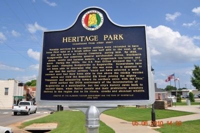
Side A
The settlement of what is now eastern Lauderdale County (known as "Over Elk)" by non-Native Americans commenced by 1807.
Federal land sales were held in Huntsville during the spring of 1818.
Although much of the land was described . . . — — Map (db m281246) HM
(Side 1)
From about 1775 until his death on August 9, 1807, Chickamauga Cherokee Chief Doublehead controlled the Muscle Shoals of the Tennessee River. Two major Indian trails, Sipsie Trail and an east-west trail, intersected in the . . . — — Map (db m99972) HM
Thousands of Cherokee Indians passed through Waterloo in the 1830s when they were forced by the U.S. government to move West on the "Trail of Tears". Most came by boat from Tuscumbia and camped here to await transfer to larger steamboats. During the . . . — — Map (db m84301) HM
Created by Territorial Legislature
in 1818 from lands ceded by
Cherokee and Chickasaw Indians
Named for U.S, Navy hero of War of 1812
Capt. James Lawrence
Fatally wounded, his famous command was
"Don't Give Up The Ship"
County . . . — — Map (db m69672) HM
The High Town Path was an Indian Trail extending from Charles Town, SC to
Chickasaw Bluffs at Memphis, TN. The Path was named after High Town located at the forks of the Etowah and Oostenalla Rivers near
Rome, Georgia.
The path traversed the . . . — — Map (db m179053) HM
This area was the home to Indians, settlers, people of mixed ancestry and their descendants. Local bluff shelters contain evidence of occupation from Paleo Indian (10,000 BC) through the Mississippian Period (1540 AD). Chief Tuscaloosa (Black . . . — — Map (db m84313) HM
The Oakville Indian Mounds Museum is based on a seven sided Cherokee council house. This type of council house was used during the cooler months and an open sided rectangular pavilion during warmer weather. The descriptions used for the museum's . . . — — Map (db m84314) HM
In the early 1800's Cherokees of this area were under the leadership of Doublehead and Tahlonteskee. After Doublehead's assassination in 1807, Tahlonteskee notified President Jefferson that he and his people were ready to move west. In 1808 . . . — — Map (db m36030) HM
Copena Indians built this mound with baskets of dirt some 2000 years ago. The Copena name was derived from their use of copper and galena (lead ore) found in their burials along with gorgets and celts. The mounds were a burial site with the dead . . . — — Map (db m84315) HM
Black Warriors' Path played a critical role as a route for Creek Removal. On December 19, 1835, some 511 Creek emigrants passed along the path through present ~ day Oakville Indian Mounds Park. In September 1836, a group of Creeks left Tallassee in . . . — — Map (db m36027) HM
Doublehead, (c1744-1807), aka Dsugweladegi or Chuqualatague, was the son of Great Eagle (Willenawah) and grandson of Moytoy. Among his siblings were Pumpkin Boy, Old Tassel and the unnamed grandmother of Sequoyah. After his sister's son John Watts . . . — — Map (db m84316) HM
Five Historic Indian tribes lived in this area. By 1701, The Yuchi were living at the shoals on the Tennessee River. In early 1700s the Yuchi left, some moving to the Cherokee Nation on the Hiwassee River, TN and others to Chattahoochee River, GA. . . . — — Map (db m36040) HM
Rising 27 feet high, this is the largest woodland mound in Alabama, with a base covering 1.8 acres and a flat top of over one acre. Built by prehistoric Copena Indians, the mound is 2,000 years old and constructed from earth probably carried one . . . — — Map (db m84317) HM
Based on the large number of local mounds and artifacts, this site shows evidence of Indian occupation over 2000 years ago. According to tradition about 1780, Oakville became a Cherokee town located on Black Warriors' Path. By the early 1820's, . . . — — Map (db m36036) HM
Form the late 1700's to 1807 a Cherokee Chief named Doublehead guarded this area, that was claimed by both the Cherokee and Chickasaw Nations as sacred hunting grounds against encroachment of white settlers.
Chief Doublehead had the reputation . . . — — Map (db m84646) HM
Settled by Judge J. J. Harper and others from Harris County, Georgia, in 1836.
This region was opened to settlement
in 1836-37 by the removal of the
Creek Indians to lands west
of the Mississippi River.
Erected by
The Alabama . . . — — Map (db m39830) HM
Facing relentless pressure to dissolve their sovereign status as the Creek Nation, Creeks ceded large tracts of their ancestral homeland to the United States of America in 1832, retaining individual allotments, believing that was the best way to . . . — — Map (db m278236) HM
One of the larger settlements of the Upper Creeks at the time of Indian removal to the west, 1835-1837. Their last council fire was held here before their forced migration to Oklahoma. Pioneer families began pouring in after 1836. Today's cemetery . . . — — Map (db m85169) HM
created Feb. 6, 1818 by Alabama Territorial Legislature from lands ceded by Cherokee Nation 1806 and by Chickasaw Nation in 1816. Named for creek (and its limestone bed), which runs through county.
Few settlers here until Indian treaties.
Athens . . . — — Map (db m29109) HM
This burial mound is one of hundreds constructed during the Middle Woodland period between 100 BC and AD 500 by native people who shared burial practices with other similar cultural groups extending from the Gulf and Atlantic coasts to Canada. . . . — — Map (db m154232) HM
Approx. ¼ mile North is the site of Ft. Hampton, built in 1810 and named in honor of
Brig. General Wade Hampton of Revolutionary War fame. Two Companies of soldiers were
stationed here in log buildings. The purpose of the fort, and its garrison . . . — — Map (db m154231) HM
Lucy's Branch This site is named for Lucy Bedingfield, daughter of a slave and a Cherokee Indian. She was born 1832, and her Indian name was Finch. She married Meredith Bedingfield, a slave and had 9 children. Lucy was an astute and avid . . . — — Map (db m85421) HM
Side A
A church older than the county and state. First meeting house built in the fall of 1816, on Indian land, a few miles south of here along Round Island Creek. The first Govt. Land sales were in Feb. 1818 after treaties with the . . . — — Map (db m85422) HM
In the fall of 1806 a group of settlers led by William and James Sims, traveled from east Tennessee on flatboats down the Tennessee River and up the Elk River to this area. They landed near Buck Island and spread out into the surrounding . . . — — Map (db m250556) HM
Franklin School, originally constructed on this lot, was in operation as early as the 1890s teaching grades 1-11. By the mid 1930s, it was downsized to grades 1-6. There were northern and southern classrooms adjoined by a common auditorium. The . . . — — Map (db m68028) HM
Unmarked grave in Cubahatchie Baptist Church Cemetery. Half-blooded Creek Indian, planter, soldier, Indian agent,
and historian, Stiggins lived on a nearby farm fronting the Federal Road from 1831 until his death. There he wrote "A . . . — — Map (db m60534) HM
Shorter was originally called Cross Keys for the birthplace in South Carolina of an early settler, J.H. Howard. It was later named Shorter for former Alabama Governor John Gill Shorter. The town embodies the memories of the proud Creek Indian . . . — — Map (db m85463) HM
In May 1838 soldiers, under the command of U.S. Army General Winfield Scott, began rounding up Cherokee Indians in this area who had refused to move to Indian Territory in Oklahoma. About 16,000 Cherokees were placed in stockades in Tennessee and . . . — — Map (db m33318) HM
Tennessee. Lincoln County. Established 1809; named in honor of MAJOR GEN. BENJAMIN LINCOLN of the Revolutionary Army. After service at Saratoga, he was put in Chief Command in the Southern Colonies. Later, he was Secretary of War under the . . . — — Map (db m30570) HM
On this spot, camped his army, October 11, 1813, after marching from Fayetteville, Tenn.,~"32 miles without halting,"~ enroute to the Battle of Horseshoe Bend. — — Map (db m30382) HM
After the Civil War, the future of African-Americans in the United States Army was in doubt. In July 1866, Congress passed legislation establishing two cavalry and four infantry regiments to be made up of African-American soldiers. The mounted . . . — — Map (db m75092) HM WM
Brahan Spring Park, formerly Beaty's Spring, was the site of Camp Beaty, the encampment of Andrew Jackson's army of volunteers and militia after their celebrated non-stop march of "32 miles in 5 hours" from Fayetteville, Tennessee on October 11, . . . — — Map (db m105131) HM
(Preface) Welcome to the Huntsville Water Trail at Big Spring Park, a celebration of our city's history, spirit, and ingenuity. Follow these signs to learn how the Big Spring helped shape Huntsville's creation, and how it's still helping us . . . — — Map (db m167110) HM
Made a county in 1808 by order of Governor of Mississippi Territory.
Area ceded 1805, 1806 by Cherokees, Chickasaws.
This was the first land in Alabama ceded by these great civilized tribes. — — Map (db m27848) HM
Early in the 1800's gold was found from Virginia to Alabama including a rich belt on Cherokee Indian land in what is now Dahlonega, GA.
causing a huge influx of miners and a land grab by new settlers.
Pressure and greed from politicians led to . . . — — Map (db m85838) HM
Built 1842-1860 by Gen. Nathan Bryan Whitfield 1799-1868 accomplished planter of the Canebrake
using imported materials and artisans Glorifying the Greek Revival Architecture by combining Doric exterior
Corinthian grand ballroom Ionic parlor . . . — — Map (db m38068) HM
Composed of limestone or “Selma
chalk” which abounds in fossils.
Called “Ecor Blanc” by
eighteenth-century French explorers
and cartographers.
Named “Chickasaw Gallery” because
early Indian inhabitants . . . — — Map (db m38001) HM
Hamilton was established on November 17, 1882 and was named in honor of Capt. Albert James Hamilton. Hamilton was first known as "Toll Gate," named for a toll gate on the Jackson Military Road. The original county seat of Marion County was . . . — — Map (db m96479) HM
The cluster of three mounds known as the
Hamilton Mounds site is the largest
indigenous mound site in Marion County,
Alabama. The site includes three mounds
along the Buttahatchee River: a large
mound with a two-tiered summit, another
smaller . . . — — Map (db m174428) HM
Starting as an ancient Indian trail, the north–south road through Arab in 1816 was known as Bear Meat Cabin Road. By 1818, it had become an important Federal trade route through the Alabama Territory known as the St. Stephens – . . . — — Map (db m40134) HM
(Side A) This area's proximity to the Tennessee River and Indian trails made it a crossroads for early habitation, settlement, and trade. Archaeological studies reveal it was first inhabited about 12,000 years ago by Paleo-Indians. They . . . — — Map (db m33305) HM
Promoting Your Prosperity
From the beginning, TVA was charged with giving the people of the Tennessee Valley region a better
opportunity to prosper. Today that means delivering low-cost electricity and bringing good jobs to the
region. TVA . . . — — Map (db m281061) HM
The name Chickasaw originated from Native Americans living in the area prior to the arrival of the French settlement at Twenty-Seven Mile Bluff in 1702. Native Americans from the Apalachee and Choctaw Tribes referred to the creek running through . . . — — Map (db m111286) HM
This park and bird refuge dates from the Mississippian Period (AD 1100 to 1550). Native Americans, who roasted oysters and fished in adjacent Dauphin Island Bay, visited the shell mounds for centuries. From excavations carried out in 1990, . . . — — Map (db m122350) HM
(front side)
The origin of this Cathedral was established on July 20, 1703, by Jean-Baptiste de La Croix de Chevrieres de Saint Vallier, Bishop of Quebec at Fort Louis de la Mobile, the city’s first permanent settlement. The Bishop also . . . — — Map (db m117245) HM
The UNESCO Slave Route: Resistance, Liberty, Heritage
Launched in 1994, the international and inter-regional project ‘The Slave Route: Resistance, Liberty, Heritage’ addresses the history of the slave trade and slavery through the prism of . . . — — Map (db m298395) HM
The cannon in front of you, buried muzzle-down during an
1873 land survey to mark a corner of the Mount Vernon
Military Reservation, is just one of many reminders that Mount
Vernon hosted important U.S. Army posts throughout the 19th
century. . . . — — Map (db m149304) HM
(obverse)
Mt. Vernon Arsenal and Barracks
Established 1828 by Congress to store arms and munitions for U. S. Army. Original structures completed 1830's.
Arsenal appropriated by Confederacy 1861; equipment moved to Selma . . . — — Map (db m70593) HM
In 1811, the Mount Vernon Cantonment, located on a hill about three miles west of the Mobile River, was laid out by Col. Thomas H. Cushing. The cantonment was on the site of a spring called Mount Vernon Springs. In 1814, the garrison at Mt. Vernon . . . — — Map (db m85911) HM
The historical Burnt Corn Spring is located near this point on the Old Federal Road - the spring poured into the west branch of the creek that took its name. James Cornells had a residence at the spring before 1813. In the summer of 1813, a war . . . — — Map (db m203710) HM
Burnt Corn, Monroe County's earliest settlement, became the crossroads of the Great Pensacola Trading Path and The Federal Road. Settler Jim Cornells returned from Pensacola in 1813, finding his home destroyed and his wife kidnapped by a Creek . . . — — Map (db m47687) HM
During the westward expansion of the United States in the early 1800’s, those whose destination was the new Mississippi Territory took a right fork off the Federal Road which led to the Alabama River ferry at Claiborne. After the land cessions of . . . — — Map (db m47638) HM
Built by Gen. Ferdinand L. Claiborne as a base for his invasion of the Alabama country with U.S. Regulars, Lower Tombigbee Militia, and friendly Choctaws. Claiborne’s campaign culminated in the American victory over the Creeks at the Holy Ground. — — Map (db m47641) HM
Piache, an Indian town visited by DeSoto in 1540 was near here.
DeLuna made a settlement here, Nanipacna in 1560.
Fort Claiborne was erected on the south bluff, in 1813.
LaFayette was entertained here, 1825.
. . . — — Map (db m47639) HM
The Old Federal Road was the major highway connecting Washington,
D.C. to New Orleans from 1806 through the late 1830s. Only horse
paths existed until there was need for the US Government to
get mail, munitions and troops to New Orleans. A . . . — — Map (db m305882) HM
Little River was the home of Creek Chief William Weatherford, also known as War Chief Red Eagle. This was the area of much discussion and debate, bringing the Creeks into the War of 1812 and the Creek Civil War of 1813-1814. These events weighed . . . — — Map (db m86271) HM
Following their defeat at the Battle of Horseshoe Bend in 1814, the Creek Indians ceded millions of acres to the U.S. government. Within the cession, two rival towns soon sprang up on the south bank of the Alabama River's "Big Bend": New . . . — — Map (db m143118) HM
Twelve miles above Montgomery the Coosa and Tallapoosa rivers unite to form the Alabama which meanders over four hundred miles on its way to Mobile Bay. This river has played major role in region's history, being a thoroughfare for Native Americans, . . . — — Map (db m26591) HM
Alabama's First Peoples
Humans arrived in what is now Alabama near the end of
the last Ice Age. Waves of people migrated through the area
for centuries before some of them established settlements.
Over time, their culture advanced through . . . — — Map (db m182568) HM
Augusta, home of Old Augusta Cemetery, was built on the site of a former Indian village, “Sawanogi,” on high ground close to the Tallapoosa River. In 1824 a disastrous flood swept over the plateau, invading shops and residences. A year . . . — — Map (db m68260) HM
Here at the Indian village of Encanchata, future site of Montgomery, Col. John Tate, last British agent to the Muscogee Nation, recruited and drilled Creek warriors in 1780 to relieve Tories in Augusta, Ga. being besieged by American . . . — — Map (db m310814) HM
Several cultures have occupied this region including
Woodland, Mississippian and, later, Muskogeans.
Called "Creeks" by Europeans, the latter made
their homes along banks of streams. A loose
confederation of tribes, Creeks developed a . . . — — Map (db m146977) HM
Resistance and War
In the 1790s and early 1800s, U.S. treaties recognized Creek
land ownership, but illegal encroachment by whites began
cycles of violence and revenge by both sides.
The Creeks disagreed on how to respond. Those who . . . — — Map (db m182573) HM
Here on May 24, 1703, Alabama Indians ambushed the first French explorers from Mobile, killing three and wounding two critically. The Indians were armed and were used as pawns by British agents from Carolina in the European struggle for dominion . . . — — Map (db m67999) HM
[Top Row - Left to Right:]
Many more than 200 years ago, Montgomery's history began along a hard bend of
the Alabama River in south central Alabama. Long before it was the capital, indeed
before the founding of the country, the area was home . . . — — Map (db m244537) HM
Side 1
The Federal Road
The 1803 Louisiana Purchase acquired 828,000 sq. mi. for the U.S., doubling its size. The Federal Road was built to provide a shorter route from Washington to New Orleans and the new territory. The Treaty . . . — — Map (db m71535) HM
Alabama Territorial Legislature created this county in 1818 from lands ceded by Cherokee Indians in 1816. County first named Cotaco, for large creek in county.
Named Morgan County in 1821 for Maj. Gen. Daniel Morgan, . . . — — Map (db m27759) HM
Black Fox (c. 1746-1811) lived west of Decatur and east of Courtland near Fox's Creek, his namesake. A principal chief of the Cherokee who, under the treaty of Jan. 7, 1806, by which the Cherokee ceded nearly 7,000 sq. m. of their lands in . . . — — Map (db m280663) HM
Of the various detachments that removed the Cherokee People from their home lands in the southeastern United States, three of them landed in Decatur at what became Rhodes Ferry Park. Due to the difficulty of navigating the Muscle Shoals portion of . . . — — Map (db m140846) HM
Doublehead (c. 1744-1807) was a very influential Cherokee leader in the Decatur area and controlled this country with an iron fist. He lived for a long time at the old Browns Ferry crossing just west of Decatur.
He and his last wife Katelia . . . — — Map (db m280656) HM
The Cherokee people resisted the government's order to leave the Tennessee Valley. They signed petitions and lobbied Congress. Yet the Indian Removal Act of 1830 still passed. In March 1837, the first detachment—a group of Cherokee families, slaves, . . . — — Map (db m140851) HM
1838
Trail of Tears: The discovery of gold in Georgia and thirst for land expansion prompted the U.S. Government and white communities to force the Cherokee nation from their ancestral lands. During the summer and winter of 1838, the first . . . — — Map (db m113290) HM
On this river in front of you, 2,300 Cherokee people arrived in waves, forced from their Tennessee Valley homeland in 1837 to 1838. The steamer Knoxville towed flat boats loaded with Cherokee families. Heavy rains soaked their clothes. Cold . . . — — Map (db m140855) HM
In 1773, the future site of Decatur lay in the southern part of a large hunting territory held jointly by the Chickasaw and Cherokee Indians. This "Great Hunting Ground" was made up of the vast, middle region of what is now Tennessee, Kentucky, and . . . — — Map (db m269608) HM
This is a site of painful memory, a place of upheaval. Decatur was just one stop on a deadly journey over 1,000 miles — the forced removal of the Cherokee people from the Tennessee Valley.
Along the edge of the Tennessee River, this town bore . . . — — Map (db m189597) HM
Oral tradition—stories passed from one generation to the next—long told the history of the Cherokee people. Sequoyah was the first to write it down. In 1921, about 90 miles east of Decatur, he created the Cherokee syllabary, a set of 85 . . . — — Map (db m140861) HM
The Second Creek War of 1836 broke out when many Creek Indians resisted forced removal after an 1832 treaty ceded the last of their tribal lands in Alabama. As hostility increased between white settlers pouring into the area and Creeks who were . . . — — Map (db m111577) HM
In the early 1800s, south Alabama was still inhabited by many groups of Native Americans: Creek, Chickasaw, and Choctaw among others. They traveled, hunted, traded, and made war on the many ancient trails here. European settlers improved these roads . . . — — Map (db m95359) HM
Near this site soon after Threat of Cusseta 1832, Peter A. Hogg built a grist mill on Wehadkee Creek, named for local Indian tribe. Settlement first called Prothro's Mill for James Prothro, who, with John McPherson, obtained a U.S. land patent in . . . — — Map (db m118127) HM
While several written historical accounts of life among the Creeks inform our understanding of their culture, many details of daily life can only be corroborated or verify through archaeology.
Foodways
One of the most important aspects . . . — — Map (db m309619) HM
Archaeology is the scientific study of the past through analysis of physical traces of daily life discovered through excavation. It enables us to extend our knowledge of human history beyond the limits of written records and to learn details about . . . — — Map (db m101816) HM
In September 1821 Rev. William Capers was sent to Fort Mitchell, by the South Carolina Conference of the Methodist Episcopal Church, to negotiate with the chiefs of the Creek Indian Nations for a mission which would teach their children reading, . . . — — Map (db m26121) HM
Creek Towns At its height, the Creek Nation consisted of about 20,000 people living in more
than seventy townships, or talwas (tvlwv), scattered throughout modern-day Alabama and Georgia. Creek townships commonly consisted of a primary . . . — — Map (db m120007) HM
Cultural Exchange and Cooperation Though significant cultural conflict characterized Creek-American relations in the Chattahoochee Valley, and Creeks faced numerous forms of exploitation, not all relationships between Creeks and settlers were . . . — — Map (db m120019) HM
Built during Creek War 1813 by Georgia Militia on main Indian trade route to Tombigbee River
U.S. Troops stationed here until 1837 1836 Lower Creeks corralled here for forced removal to the West — — Map (db m26069) HM
Fort Mitchell
Fort Mitchell is located on the Federal Road on the West bank overlooking the Chattahoochee River.
General John Floyd received orders from Governor David B. Mitchell to pick up supplies, cross the Chattahoochee River and . . . — — Map (db m120003) HM
Originally a major path Creek Indians and indigenous tribes who preceded
them, the Federal Road became a postal route as a result of a treaty between
the Creeks and the United States government in 1805. The widening of the
Federal Road occurred . . . — — Map (db m241205) HM
Fort Mitchell served as a primary point of concentration for creeks being sent westward to Indian Territory before, during, and after the Second Creek War (1836-1837). By the terms of the 1832 Treaty of Washington, Creek heads of household and . . . — — Map (db m101840) HM
This military graveyard was established soon after Fort Mitchell was built by General John Floyd of the Georgia Militia. Located just south of the stockade, the cemetery was used between 1813 and 1840 during the fort's occupation by Georgia and . . . — — Map (db m26122) HM
The most popular game among the Indians of this region was "stick ball." This field has been constructed so that the game may be enjoyed again in the Chattahoochee Valley where it was played for hundreds of years. Sometimes known as "little brother . . . — — Map (db m26020) HM
Native plants played a significant role in the daily life of the Creek Indian civilization that inhabited the Chattahoochee Valley until relocation to Oklahoma in the 19th century. During the Woodland Period, the local inhabitants were skilled . . . — — Map (db m48166) HM
Near here is the site where John Crowell lived, died, and is interred. Colonel Crowell was born in Halifax County, North Carolina, on September 18, 1780; moved to Alabama in 1815, having been appointed as Agent of the United States to the . . . — — Map (db m26116) HM
Pokkecheta, or the ball play, was an ancient and vital part of the social life of the Creeks and a popular game among many groups of Southeastern Indians. The game enhanced
interaction between towns and provided highly ritualized sport and . . . — — Map (db m101817) HM
The Creek Indians and their neighbors, the Yuchi, once lived in these woods in harmony with nature and in accordance with their beliefs and customs. During the 1700s and early 1800s, they were progressively dispossessed of their lands by . . . — — Map (db m101282) HM
In 1832, a treaty with the United States allotted parcels of land to every Indian household in the Valley. A government census enumerated, according to tribal towns, every Indian head of household, along with the number of males, females, and slaves . . . — — Map (db m101415) HM
14580 entries matched your criteria. Entries 201 through 300 are listed above. ⊲ Previous 100 — Next 100 ⊳