In 1873, Albert Guiser and others located in a fertile meadow which they named Grass Valley. Surveyors camped on a stream, lassoed a young coyote and called the place Coyote Creek. The first L.D.S. settlers were Isaac Riddle and family who took up . . . — — Map (db m137023) HM
In 1866, a group of Mormon Cavalrymen noted this valley, while in pursuit of Indians during the Black Hawk War.
In February, 1875, a company of men came from Beaver, Utah and explored the valley. The first permanent settlers came from Beaver, . . . — — Map (db m74744) HM
This structure, the second public building in Escalante, was erected in 1884 of native stone by Mormon pioneers under the direction of Bishop Andrew P. Schow, Edwin Twitchell and Thomas Heaps. The stone mason was Morgan Richards. It was used to . . . — — Map (db m74746) HM
About 1872 Joseph Asay with his family settled about 3/4 mile west and a little south of this spot. Soon other homesteaders settled in the locality. Tom Jessup and Dan LeRoy erected a water power saw mill. A shingle mill was also placed on the . . . — — Map (db m74676) HM
In 1872 Meltiar Hatch settled at the head of the Sevier River, near the junction of Mammoth and Asay Creeks. He engaged in stock raising and operated a water-power saw mill. Soon other settlers came. Land was surveyed and irrigation ditches dug. . . . — — Map (db m74677) HM
Visitors to Panguitch, Utah will enjoy the opportunity to view many of the historic structures in this community which was settled by Mormon pioneers.
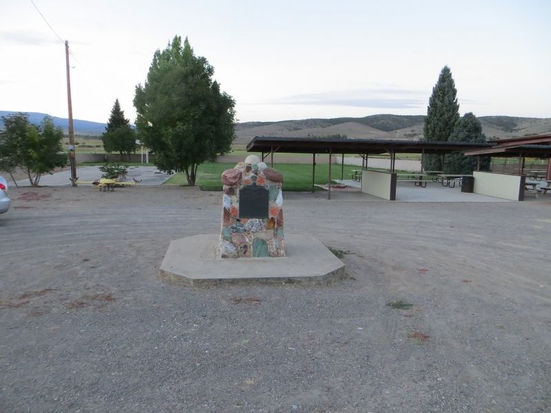
Famously creative survival skills are not the only heritage the early settlers left behind. . . . — — Map (db m146764) HM
In March, 1864, about fifty pioneers under the leadership of Jens Nielson settled Panguitch. They built a fort of logs, enclosing their homes and a building used for church, school and recreation. The town was abandoned in 1867, because of Indian . . . — — Map (db m27020) HM
The first group of pioneers came to Panguitch on March 16, 1864, from Parowan under the leadership of Jens Nielson. They followed the route over the rugged Bear Valley, a part of the Spanish Trail. Crops were planted, but the season was short and . . . — — Map (db m27046) HM
Clifton (Loseeville) was situated in East Valley one mile east of the Pahreah River and four miles North of Cannonville. The first settlers were Ebenezer Bryce in 1876 and Daniel Goulding in 1878. They built a ditch to bring water to the valley from . . . — — Map (db m74743) HM
John Wesley Wolfe settled here in the late 1800s with his oldest son Fred. A nagging leg injury from the Civil War prompted John to move west from Ohio, looking for a drier climate. He chose this tract of more than 100 acres along Salt Wash for . . . — — Map (db m132029) HM
Born in Wrenbury, England, Henry Lunt immigrated to Utah in 1850. He was the first person named to settle Cedar City and was the president of the company of 36 men and 11 wagons that first arrived here on Tuesday, November 11, 1851, in a blinding . . . — — Map (db m149523) HM
Cedar City's Iron Heritage
Cedar City's rich deposits of iron ore were first recorded by Spanish explorers Dominguez & Escalante in 1776. In 1850, Mormon leader Brigham Young sent a group of colonists to mine these deposits to provide needed iron . . . — — Map (db m240279) HM
In 1866 Louis R. Chaffin, at the request of Apostle Erastus Snow, placed a gristmill in Cedar City. His son, Henry, ran it until 1868 when Louis returned from "The Muddy." Adjoining land was purchased in 1875. Excavation by Alva Matheson proved the . . . — — Map (db m59538) HM
Father Silvestre Velez de Escalante with Father Dominguez and eight others, first white men to enter the Great Basin, left Santa Fe July 29, 1776 in attempt to reach Monterey. Abandoning attempt, party passed thru Cedar Valley October 12 on return . . . — — Map (db m241635) HM
Iron ore having been discovered at Iron Springs, Brigham Young called missionaries to Iron County to make iron. A militia of 35 men was organized in Parowan, Nov. 5, 1851, under Captain Henry Lunt. Part of the company left Nov. 10th in 11 wagons and . . . — — Map (db m59546) HM
In 1852 Peter Shirts located a ranch on Sidon Creek, later known as Shirts Creek. He offered John Hamilton half the water to come and settle there. Hamilton came with his family and Peter Fife. When Walker Indian War broke out they moved to Cedar . . . — — Map (db m59513) HM
Iron County exists because those who lived here developed the resources necessary for survival in this desert climate. The three legacies passed down by early settlers and their descendants — agriculture, mining, and railroads — are . . . — — Map (db m130593) HM
Established 1868 by Ebenezer Hanks and others who organized the Great Western Iron Manufacturing Co., a cooperative enterprise. Officers were E. Hanks, President, Homer Duncan, Vice President, Seth M. Blair, Secretary. 800 pounds of iron of good . . . — — Map (db m150259) HM
This is the oldest log cabin in Southern Utah. It was built in 1851 in Parowan by George Wood, one of the founders of Iron County, who later moved it to the Old Fort in Cedar City and then to his lot on North Main Street. Through the years it was . . . — — Map (db m239742) HM
To satisfy an urgent need for manufactured iron products, a small group of English, Welch, Scotch, Irish and American pioneers answered a call from Brigham Young to become "Iron Missionaries" to settle Iron County and to make iron. They arrived in . . . — — Map (db m59545) HM
Born in England, Francis Webster traveled to Utah in 1856 and played an important role in the early development of Cedar City. A leader in the sheep industry, he was among the first to begin shipping sheep and wool to the Chicago markets. An early . . . — — Map (db m75620) HM
Born in Springshire, England, and an iron-molder by trade, Richard Harrison served as superintendent of the world’s largest iron foundry, located in Liverpool. He immigrated to Nauvoo, Illinois, in 1843 then on to Utah in 1849. He arrived in Cedar . . . — — Map (db m130595) HM
There are five plaques across the base of the statue
In the annals of American higher education, there is no more dramatic founding of a school than that accorded Southern Utah University, nor a more striking example of the extent of the . . . — — Map (db m59516) HM
Hay for livestock in a horse-driven society was as important as gasoline or electricity is today. The oldest technology for stacking hay in Iron County was the hay derrick that allowed farmers to build haystacks in their fields.
Hay derricks, . . . — — Map (db m130599) HM
This monument commemorates the enduring strength of the Southern Paiute people and invites harmony among all that live upon or visit their homelands.
Today, the Southern Paiutes are organized in several Federally recognized Tribes (see map), . . . — — Map (db m241703) HM
Schoolhouse - The second schoolhouse in Enoch was a two-story structure built on this site in 1917-1918. It was a brick building containing two classrooms, two libraries, two bathrooms and a furnace room. Only one room served as a classroom, and . . . — — Map (db m59568) HM
During the summer of 1851, a small company of men was exploring this area and discovered the springs on the bench one-fourth mile to the east. Joel H. Johnson was so impressed with the spot, that he sought and received permission from George A. . . . — — Map (db m59571) HM
In 1869, John P. Jones and sons moved from the fort at Johnson Springs and purchased land and springs on the east bench of the community. Jones, who was an iron worker, built a coke oven and blast furnace where scrap iron was melted and molded to . . . — — Map (db m59960) HM
Old Kanarra, as it was called by early inhabitants, was founded in the spring of 1861 by settlers who moved from Fort Harmony. The town was situated on Kanarra Creek about one mile north and east of the present location. Later, a group from . . . — — Map (db m59472) HM
This area, a part of the Great Basin, has evolved from the time of Lake Bonneville. It has known Anasazi Indian civilizations as evidenced by nearby ruins. It has seen the Dominguez-Escalante expedition of 1776 which passed west of this valley. It . . . — — Map (db m59620) HM
"I commenced a grammar school in my wickiup by the light of the fire and only one grammar book." Diary of George A. Smith, February 25, 1851.
The first school house, 18 x 24 feet, was built west of the Council House and dedicated December 25, . . . — — Map (db m59611) HM
Dedicated to the memory of
Mary Aikens Smith
and her sons
Jesse Nathaniel and Silas Sanford
and to the memory of
All the pioneer settlers
who founded Parowan in 1851
Constructed 1856-58 by Jesse N. Smith
Restored 1967 by . . . — — Map (db m59602) HM
Dr. Priddy Meeks
1795-1886
Meeks/Green Pioneer Farmstead
The Meeks/Green Farmstead is Parowan's sole surviving pioneer-era farmstead, an integral element of the town's early agricultural history. The construction of the Meeks cabin and . . . — — Map (db m240474) HM
Early Settlers of Parowan. Horace Fish born 6 Jan 1799 Hatley, Stanstead, Quebec, Son of joseph and Sally Spear Fish. Married Hannah Leavitt on 18 July 1825. Hannah Leavitt born 26 Dec 1850 in Johnsbury, Caledonia County, Vermont, daughter of . . . — — Map (db m2253) HM
This site marks the southwest corner of the old Parowan adobe fort. It was constructed at the direction of LDS leader Brigham Young, to help secure the new pioneers as they developed the mother town of Southern Utah. Conceptualized in 1851, the . . . — — Map (db m240472) HM
Parowan was founded January 13, 1851 by settlers from northern communities under the leadership of George A. Smith. Among the early structures were a large liberty pole and a sundial.
This marker designates the site of the community sundial . . . — — Map (db m59612) HM
At Parowan, a pioneer industrial center was settled in 1851. Water for manufacturing and industry was carried by wooden flume from the canyon to the fort. Along this water line industries were established known as the Public Works. Among these were . . . — — Map (db m59574) HM
Southern Utah Expedition of 1849
Realizing the limited resources for pioneer settlements in the Salt Lake Valley and surrounding settlements in 1849, and the potential of many more immigrants arriving in the next few years, Brigham Young . . . — — Map (db m59582) HM
“Iron we must have. We cannot well do without it,” pronounced Mormon President Brigham Young as he called for the colonization of Iron
County. The original boundaries of Iron County included a strip of
territory approximately 100 miles from . . . — — Map (db m240471) HM
A convert of 1831
Utah Pioneer 1850
Settled in Springville
Called to the Dixie Mission 1861
Moved to Summit 1872
Children by Catherine Stoker
John Riley - Sarah Ann
Barbara Adlinda - Sylvanus Cyrus
Sylvester Silas - Cathryn . . . — — Map (db m59572) HM
The discovery of the outcrop of the Sunbeam Lode and the subsequent organization of the Tintic Mining District on December 13, 1869, was the beginning of a mining district which ultimately became world-famous. The name is in honor of the Ute Indian . . . — — Map (db m75338) HM
Spring 1867, Church leader Erastus Snow helped select a new site for Chicken Creek Settlement, relocated due to unfavorable living conditions. Brigham Young named it Levan. Snow appointed Wm. Morgan and James Wilson as supervisors. Early in 1868, . . . — — Map (db m75457) HM
The first settlers arrived here in 1851. A one room building was erected and used for Church and School in 1852. Candice Smith and George Spencer and wife were teachers. In 1855 a schoolhouse was erected inside the fort and early teachers were: . . . — — Map (db m75271) HM
Jonathan Heaton, who became known as “The Father of Alton,” owned the land known as Oak Flats. He hired Lysander Porter to survey the land into nine ten-acre blocks, dividing each into four lots or thirty-six two-acre lots. Jonathan . . . — — Map (db m130620) HM
In 1864 John, Joseph and Robert Berry, their families and others settled in Berryville. The church called more families in 1865. The town was abandoned because of Indian depredations in 1886 when Robert, his wife, Isabell, and Joseph Berry were . . . — — Map (db m74644) HM
In the late 1800s, travelers who wanted to go to Kanab or Panguitch accompanied the mail carrier. In the early years, they traveled with him on horseback; in later years, they hitched a ride in his two-wheeled mailcart.
"No one who . . . — — Map (db m40467) HM
These millstones were used to grind wheat and corn into flour. Glendale oral histories tell us that in 1870 these burrs, as they were called, were brought here from Toquerville, Utah, 100 miles away.
Histories written about this area report that . . . — — Map (db m40475) HM
Prehistoric people survived in this semi-arid region by making the best of what the landscape offered. The Anasazi, or Ancestral Puebloans, found tillable soil and enough water to grow corn, squash, and beans. They lived in this area from . . . — — Map (db m130590) HM
Four early Church pioneers, sons of Jesse Woods and Amelia Shanks Berry, were the founders of Berryville, now Glendale, Utah. Joseph S. and Robert M. and his wife Isabelle Hale Berry, were killed by Indians April 2, 1856. They are burried in . . . — — Map (db m74646) HM
The Ancient Ones
Evidence of the Anasazi's footsteps across the high plateaus of the area date back 2000 years. They were cliff dwellers who hunted deer and mountain sheep, and farmed the land. The Anasazi reached the peak of their culture . . . — — Map (db m41366) HM
On June 14, 1870 Levi Stewart, who had been called from Salt Lake County by President Brigham Young to head a group of pioneers in settling this area, brought a party with seven wagons from Pipe Springs, where they had camped temporarily, to Fort . . . — — Map (db m41252) HM
From 1877 to 1927, members of the Church of Jesus Christ of Latter-day Saints traveled this route to be united in eternal marriage in the St. George Utah Temple. Thus, the route was named the “Honeymoon Trail.”
Families came from . . . — — Map (db m95008) HM
On this corner stood the Grand Old House with its beautiful flower garden. It was built and planted by Israel and Charlotte Cox Heaton in 1913.
This couple are of elite pioneer heritage. In the Grand Old House they hosted many family gatherings . . . — — Map (db m130687) HM
The great Mormon frontiersman and Indian missionary settled in Tooele Valley, Utah in 1850 and began peaceful negotiations with the Red Men. He was so successful that the officials of the Church of Jesus Christ of Latter-Day Saints sent him to . . . — — Map (db m41254) HM
In the spring of 1870 Brigham Young, President of the Church of Jesus Christ of Latter-day Saints and former Governor of the Territory of Utah, passed through the area on a tour of southern Utah settlements. Upon his return to Salt Lake City, . . . — — Map (db m94945) HM
For the people of Kanab, this bell represents schools and the importance of learning. From its founding in 1870, Kanab citizens have been encouraged to obtain as much education as possible and to use it for the benefit of all. For the first two . . . — — Map (db m41304) HM
For the people of Kanab, this bell represents schools and the importance of learning. From its founding in 1870, Kanab citizens have been encouraged to obtain as much education as possible and to use it for the benefit of all. For the first two . . . — — Map (db m94986) HM
In memory of Isaac Behunin,
Mormon Pioneer, Early Utah Settler and
Credited with the naming of Zion Canyon
Early Mormon Pioneer
Isaac Behunin was born October 20, 1803 in Richland, New York to Albert and Nancy Lord Bohanan (Bohannon). . . . — — Map (db m40465) HM
Settlement of Long Valley and Mt. Carmel
The first written account of the exploration of Long Valley was given by John D. Lee in 1852. Coming from Parowan, the explorers were under the direction of Bishop John R. Smith. James Lewis kept the . . . — — Map (db m40584) HM
In 1886-1887 after the United Order terminated, a public building was erected of native limestone and lumber from the canyon sawmill. It was used for school and church purposes. In 1938 a new schoolhouse was built and the Old Rock Building given to . . . — — Map (db m74642) HM
On March 20, 1874, the Church of Jesus Christ of Latter-day Saints organized a modern Order of Enoch, called the United Order, Israel Hoyt, first president. A community dining hall with bakery was constructed, also a garden house for seeds and . . . — — Map (db m74640) HM
In 1865 Peter Shirts made the first settlement in this area. Other pioneers followed but were forced to vacate because of Indian raids. The town was resettled upstream in 1870; church and school buildings were erected under the direction of William . . . — — Map (db m40379) HM
What you can do here
Down this rough road, you'll find breathtaking scenery, a re-built movie set, picnic area and toilet. This is a great place to stretch your legs, reenact your favorite Westerns and capture the incredible rock formations . . . — — Map (db m40407) HM
Father Escalante camped here October 2, 1776. His exploring party of ten men headed by Father Francisco Dominguez and map-maker Pacheco preached to the Indians and charted a northern route between Santa Fe, New Mexico and Monterey, California. They . . . — — Map (db m1439) HM
This pioneer cabin was built in December 1907 by Henry J. McCullough and was the second house in the town of Melville. One month later January 18, 1908, the first Post Office was established and the name changed to Burtner. Adjoining this cabin, on . . . — — Map (db m69546) HM
Fifteen miles west at Abraham is the location of the bleak desert site of a concentration camp, one of ten in Western America, in which 110,000 persons of Japanese ancestry were interned against their will during World War II. They were the victims . . . — — Map (db m1438) HM
Site of Topaz Internment Camp.
Over 120,000 Japanese-American, two thirds of whom are U.S. citizens, are uprooted from their west coast homes and incarcerated by their own government. It is 1942, wartime hysteria is at a peak. They are . . . — — Map (db m144120) HM
In 1849, after a peace treaty was signed between Mexico and the United States, Congress was petitioned to admit the State of Desert to the Union. However, this petition was denied and the Organic Act of September 9, 1850, created the Utah Territory. . . . — — Map (db m69578) HM
The written history of the Intermountain Region begins in 1776 with the remarkably accurate diary of Father Escalante, a Spanish Franciscan priest. He and Father Dominguez, together with eight companions, were the first white men known to have been . . . — — Map (db m69579) HM
This marks the Southwest corner of the Fort, built in October and November 1851 as protection from Indians, by first 17 families under direction of Anson Call, Jesse W. Fox, surveyor. About 2 city blocks in size, the front wall 8 to 10 feet high was . . . — — Map (db m69583) HM
There are three markers on this kioskCenter Marker
The Ute Domain
First described by Spanish explorers as the YUTA Indians (pronounced Ute-ah), the ancestors of the Ute people are thought to have migrated from the . . . — — Map (db m75470) HM
Creating Fillmore City and Millard County the Territorial Legislature of Utah selected Pahvant Valley, as Capitol site October 29, 1851. This spot was selected by Governor Brigham Young. Construction work began in 1852. Truman O. Angell, architect . . . — — Map (db m1277) HM
In 1889 the first school was held in the Benjamin W. Scott home located a mile south of the Hinckley Park. It was often referred to as "The Old Mud Temple." In 1934 this monument was placed on the site of the building by the Boy Scouts and the . . . — — Map (db m69540) HM
Erected 1855-56, was 150 feet long north and south by 75 feet wide. Facing each other and standing 30 feet apart were two rows of adobe houses. The gateways were in the north and south walls.
Richard Johnson and William Stevens, Sr. and families . . . — — Map (db m69575) HM
Established by Mormon Pioneers in 1855, as Fort Cedar Springs. Church President Brigham Young gave permit for the families of William Stevens Sr. and Richard Johnson to start a settlement near these grassy, spring-fed cedar hills.
Joined that . . . — — Map (db m233843) HM
The townsite of Kanosh selected by Brigham Young was surveyed in 1867. The first settlers were Noah Avery, William Penney and Baldwin Watts. Upon advice from Brigham Young, families from Petersburg, Corn Creek, added strength to the new settlement. . . . — — Map (db m75517) HM
The first settlers, James and Janet Duncan with four other families came in 1857, lived in dugouts on the ridge one mile west. In 1859 a culinary water problem caused them to move east where ten families began the settlement of Meadow, so named for . . . — — Map (db m75515) HM
Charles Taysom built this cabin at this location in 1866. •
Restored by the descendants of Charles & Mariah Taysom. •
Dedicated in memory of their pioneer sacrifices and endurance, 2002. — — Map (db m69585) HM
Marker A:
Oak City
Oak City was named after Oak Creek, a sparkling mountain stream meandering through scrub oak and gray sagebrush. It provided water, the lifeblood of this community.
Founded in 1868 by pioneers who had formerly . . . — — Map (db m69573) HM
In 1860, thirteen Latter-day Saint families settled Round Valley. Brigham Young visited them in May, 1863, and advised, because of Indians, they move their settlement away from the mountain area. He accompanied the men to the center of the valley, . . . — — Map (db m75459) HM
Porterville was settled by the members of the Porter Family. Sanford Porter Jr., while on duty as a scout in the winter of 1857-58, rode into a canyon so rocky and difficult to travel that he named it Hardscrabble. Here he found a stream of water . . . — — Map (db m48980) HM
Circleville was settled in 1864 by a group of pioneers from Sanpete County. The
Church of Jesus Christ of Latter-day Saints organized a branch, William J. Allred,
Presiding Elder. Land was cultivated and homes erected. In 1865 the Black Hawk . . . — — Map (db m74778) HM
(front of monument)
To the Memory of the
Koosharem Band
Paiute Indian Tribe of Utah
Massacred by local Mormon Settlers April 22–24, 1866
during Utah's Black Hawk War (1865–1872)
In remembrance of the innocent who were lost in . . . — — Map (db m154070) HM WM
During the Black Hawk War, on November 26, 1865, Ute Chief Tamaritz's band of around twelve warriors raided the thinly populated settlement of Circleville—ill-prepared to defend itself—killing four citizens.
Believing that Paiutes had . . . — — Map (db m154071) HM WM
In 1864 several families of Latter-day Saints settled in this valley but were forced to evacuate because of Indian troubles. Here in 1868 miners discovered precious metal, and took possession of the area. April 15, 1883, a branch of the L.D.S. . . . — — Map (db m74781) HM
The first covered wagons came into the Rocky Mts. in 1830, they
made their way as far west as Fort Washakie in Wyoming. Efforts
were made to find passable wagon trails through the Mountains to
the Pacific Coast, which goal was finally reached. At . . . — — Map (db m99320) HM
On the 14th of March, 1870, the first settlers came into this valley, responding to a call from the General Authorities of the Church of Jesus Christ of Latter Day Saints. Coming from St. Charles, Idaho, were: Randolph H. Stewart, Robert and Charles . . . — — Map (db m149639) HM
Randolph lies in the shadow of the Crawford Mountains against the western foothills of the Upper Bear River between two creeks, Big Creek on the south and Little Creek on the north. In answer to a call from the general authorities of The Church of . . . — — Map (db m149640) HM
On March 14, 1870, the first pioneers arrived to establish a settlement in Bear River Valley. The townsite was surveyed in the summer of 1870 and named in honor of Randolph H. Stewart, the first Bishop. Heavy snows, early frosts and Indian troubles . . . — — Map (db m149615) HM
Born in Connecticut, Wilford Woodruff was a son of Aphek and Beulah (Thompson) Woodruff; he learned the miller's trade and farming from his father. Wilford was a life-long student of scripture. As a teenager he began reading histories and keeping a . . . — — Map (db m149638) HM
The history of the town began in August 1848 when two young Mormon pioneers, Sanford and Thomas Bingham, settled in this narrow wilderness canyon to herd cattle. Within a few years the area became a supplier of timber for local saw mills. Much of . . . — — Map (db m1365) HM
A short time after the pioneers arrived in the Salt Lake Valley in 1847, many began settling other areas of the Territory of Deseret. In 1858 Orrin Porter Rockwell bought sixteen acres of land near Crystal Hot Springs, south of Salt Lake City, which . . . — — Map (db m223829) HM
About 1800 feet due west
prominent on the overland stage and
Pony Express route 1858 to 1868.
Kept by Orrin Porter Rockwell.
This monument was constructed of the stone from the old station. — — Map (db m150035) HM
Headed by Brigham Young, the company reaching here July 23d numbered 2,587 persons, with 464 carriages & wagons, 1,028 horses & mules, and 332 oxen & cows.
A program of addresses, six brass bands, singing, athletic events, drills by six . . . — — Map (db m153210) HM
During their first 20-plus years in the Salt Lake Valley, people who settled this area did so at the mouth of Big Cottonwood Canyon. They depended on the sawmills and later the mines as a means of support. Following the joining of the . . . — — Map (db m123647) HM
The lone cedar tree, located east of here, was planted by Leander Neri Bulter at the birth of his daughter, Eva, in 1894. This cedar is one of the earliest trees planted in the area. Leander Neri Butler was the son of Leander Butler. Leander Butler . . . — — Map (db m123713) HM
Ernest Green was the son of Alvin Washington Green and Alice Maria Jane White. His family lived on the hillside northwest of the “Old Mill.” His wife, Molly, was the daughter of Neri Bulter and Mary Elizabeth McGhie. During the early . . . — — Map (db m123712) HM
Mormon pioneers followed their church's teachings of donating one-tenth of their annual increase to the Church. Because cash was scarce, people most often paid their tithing with goods they had grown or produced. The contributions were collected and . . . — — Map (db m123708) HM
548 entries matched your criteria. Entries 101 through 200 are listed above. ⊲ Previous 100 — Next 100 ⊳