373 entries match your criteria. Entries 201 through 300 are listed.⊲ Previous 100 — The final 73 ⊳
Historical Markers and War Memorials in Ireland
By William Fischer, Jr., May 20, 2019
World Wars Memorial
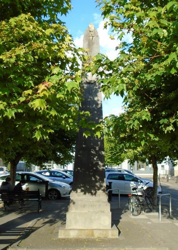
| 201 ► Ireland, Leinster, County Offaly, Tullamore — World Wars Memorial — |
| On High Street/Main Street (Leinster Route 421), on the right when traveling north. | |||
| 202 ► Ireland, Leinster, County Wexford, Ferrybank South — U.S. Naval Air Station — Wexford, Ireland — |
| Near Paul Quay (County Road R730) just north of King Street (County Road R733), on the right when traveling north. | |||
| 203 ► Ireland, Leinster, County Wicklow, Athgreany — Clocha an Phiobaíre / Piper's Stones — |
| On National Route N81, 3 kilometers south of Leinster Route R756, on the left when traveling south. | |||
| 204 ► Ireland, Leinster, County Wicklow, Baltinglass — Jennie Wyse Power — (nee O'Toole) — 1858-1941 — |
| On Main Street (Leinster Route R747), on the right when traveling east. | |||
| 205 ► Ireland, Leinster, County Wicklow, Baltinglass — Mainistir Bhealach Conglais / Baltinglass Abbey — |
| On Church Lane, 0.3 kilometers north of Main Street (Leinster Route R747), on the right when traveling north. | |||
| 206 ► Ireland, Leinster, County Wicklow, Baltinglass — Michael Dwyer, Sam MacAllister, and the Insurrectionists — |
| On Main Street (Leinster Route R747) at Market Square, on the left when traveling east on Main Street. | |||
| 207 ► Ireland, Leinster, County Wicklow, Baltinglass — Private Michael McGuinn — |
| On Main Street (Leinster Route R747) at Market Square, on the left when traveling east on Main Street. | |||
| 208 ► Ireland, Leinster, County Wicklow, Blessington — Dwyer's Brook — 1798 - 1998 — |
| Near Lake Drive, on the left when traveling south. | |||
| 209 ► Ireland, Leinster, County Wicklow, Castleruddery Upper — Ciorcal Cloch le Claífort Chaisleán an Ridire — Castleruddery Embanked Stone Circle — |
| On Local Route L4321, 1.2 kilometers east of National Route N81, on the right when traveling east. | |||
| 210 ► Ireland, Leinster, County Wicklow, Enniskerry — Powerscourt Estate Terraces — |
| 211 ► Ireland, Leinster, County Wicklow, Enniskerry — Tiny and Teddy and Eugenie and Princess — |
| 212 ► Ireland, Leinster, County Wicklow, Glencree — The German Military Cemetery, Glencree — Der Deutsche Soldatenfriedhof Glencree — Reilig Mhíleata Gearmánach i nGleann Criothaigh — |
| On Local Route L1011, 0.6 kilometers east of Leinster Route R115, on the left when traveling east. | |||
| 213 ► Ireland, Leinster, County Wicklow, Glencree — The German Military Cemetery, Glencree — Der Deutsche Soldatenfriedhof Glencree — Reilig Mhíleata Gearmánach i nGleann Criothaigh — |
| On Local Route L1011, 0.6 kilometers east of Leinster Route R115, on the left when traveling east. | |||
| 214 ► Ireland, Leinster, County Wicklow, Glendalough — 841.871 — An Ardeaglais / The Cathedral — |
| 215 ► Ireland, Leinster, County Wicklow, Glendalough — 833.371 — An Cloigtheach / The Round Tower — |
| 216 ► Ireland, Leinster, County Wicklow, Glendalough — 832:371 — An Geata / The Gateway — |
| On Leinster Route R757, on the right when traveling east. | |||
| 217 ► Ireland, Leinster, County Wicklow, Glendalough — Revd Edward Rowan — |
| 218 ► Ireland, Leinster, County Wicklow, Glendalough — St. Kevin's Way — |
| On Leinster Route R757, on the left when traveling east. | |||
| 219 ► Ireland, Leinster, County Wicklow, Glendalough — 839.371 — 'Teach na Sagart' / The 'Priest's House' — |
| 220 ► Ireland, Leinster, County Wicklow, Glendasan — Mianach Hero agus Urláir Chóireála / Hero Mine and Dressing Floors — |
| On Wicklow Gap Road (Leinster Route R756), on the left when traveling west. | |||
| 221 ► Ireland, Munster, County Clare, Kilfenora — Historic Kilfenora / Cill Fhionnúrach Stairiúil — |
| 222 ► Ireland, Munster, County Clare, Kilfenora — Kilfenora Cathedral and High Crosses — Ardeaglais agus Ardchrosanna Chill Fhionnúrach — |
| 223 ► Ireland, Munster, County Cork, Béal na mBláth — Béal na mBláth Ambush Site — |
| On Local Route L2011, 1 kilometer south of Munster Route R585, on the left when traveling south. | |||
| 224 ► Ireland, Munster, County Cork, Cobh — Bishop Roche Park/ Cove Fort — Páircan Easpaig De Róiste/Dún An Cóibh — Titanic Memorial Garden — |
| Near The Mall. | |||
| 225 ► Ireland, Munster, County Cork, Cobh — Old Church Cemetery — Titanic Trail — Lusitania Victims Mass Graves — |
| Near Hilltop Park at Tay Road. | |||
| 226 ► Ireland, Munster, County Cork, Cobh — S.S. Lusitania — |
| On Strand Road. | |||
| 227 ► Ireland, Munster, County Cork, Cobh — United States Naval Headquarters — Cobh (Queenstown), Co. Cork, 1917-1919 — |
| On Beechmount, 0.1 kilometers east of Thomas Kent Street, on the right when traveling east. | |||
| 228 ► Ireland, Munster, County Cork, Enniskeane — First Meeting of Ból Chumann na hÉireann — (Irish Road Bowling Association) — |
| On Munster Route R588 at Main Street (Munster Route R586), on the left when traveling north on State Route R588. | |||
| 229 ► Ireland, Munster, County Cork, Kilbrittain — Kilbrittain Castle — |
| On Munster Route R603, on the right when traveling north. | |||
| 230 ► Ireland, Munster, County Cork, Kilbrittain — The Book of Lismore — |
| On Munster Route R603, on the right when traveling north. | |||
| 231 ► Ireland, Munster, County Cork, Kilgarvan — Annie Moore Statue — |
| On Lower Road. | |||
| 232 ► Ireland, Munster, County Cork, Killumney — Bride Park Cottage — Birthplace of Major General Patrick Ronayne Cleburne — |
| On Grange Terrace. | |||
| 233 ► Ireland, Munster, County Cork, Kinsale — 4 — Caisleán Deasúnaigh / Desmond Castle — Ceann t-Sáile Baile Stairiúil / Kinsale Historic Town — |
| On Cork Street at Chairmans Lane, on the left when traveling north on Cork Street. | |||
| 234 ► Ireland, Munster, County Cork, Kinsale — 5 — Eaglais Eoin Naofa / St. Johns Parish Church — Ceann t-Sáile Baile Stairiúil / Kinsale Historic Town — |
| On Friar Street just west of Cork Street, on the right when traveling west. | |||
| 235 ► Ireland, Munster, County Cork, Kinsale — 6 — Múseum / Museum — Ceann t-Sáile Baile Stairiúil / Kinsale Historic Town — |
| On Market Lane, on the right when traveling north. | |||
| 236 ► Ireland, Munster, County Cork, Kinsale — Blue Haven Old Fish Market Wall Restoration — |
| On Pearse Street (Munster Route R605) at Market Lane/The Glen, on the right when traveling north on Pearse Street. | |||
| 237 ► Ireland, Munster, County Cork, Kinsale — 12 — Crann Seoil / 1601 Galleon Mast — |
| On Pier Road (Munster Route R600) 0.3 kilometers south of Emmet Place, on the left when traveling south. | |||
| 238 ► Ireland, Munster, County Cork, Kinsale — 16 — Dún Cathal / Charles Fort — |
| On Cork Street (Munster Route R600) at Market Lane, on the left when traveling south on Cork Street. | |||
| 239 ► Ireland, Munster, County Cork, Kinsale — 15 — Dún Shéamais / James Fort — |
| On Pier Road (Munster Route R600) just south of Emmet Place, on the right when traveling north. | |||
| 240 ► Ireland, Munster, County Cork, Kinsale — 1 — Eaglais Multose Naofa / St. Multose Church — |
| On Church Square just west of Cork Street, on the right when traveling west. | |||
| 241 ► Ireland, Munster, County Cork, Kinsale — Fish Shed / Bothán na nÉisc — |
| On Pier Road (Munster Route R600) at Emmet Place, on the right when traveling south on Pier Road. | |||
| 242 ► Ireland, Munster, County Cork, Kinsale — Kinsale — With the Villages of Cove and Scilly — 1846 — |
| On Market Square at Guardwell, on the right when traveling east on Market Square. | |||
| 243 ► Ireland, Munster, County Cork, Kinsale — Kinsale - A Walled Town — |
| On Market Lane at Milk Market, on the right when traveling west on Market Lane. | |||
| 244 ► Ireland, Munster, County Cork, Kinsale — Kinsale Town Wall — Kinsale Tidy Towns 2014 — 3 Year 1601 Wall Town Project — |
| On Market Street at Milk Market, on the right when traveling west on Market Street. | |||
| 245 ► Ireland, Munster, County Cork, Kinsale — Kinsale-Cionn TSáile and Antibes-Juan Les Pins Twinning — |
| On The Glen (Munster Route R605) just north of Market Lane/Pearse Street, on the left when traveling north. | |||
| 246 ► Ireland, Munster, County Cork, Kinsale — Lost Seafarers Memorial — |
| On Pier Road (Munster Route R600) 0.3 kilometers south of Emmet Place, on the left when traveling south. | |||
| 247 ► Ireland, Munster, County Cork, Kinsale — Lt Michael P Murphy — |
| On Pearse Street (Munster Route R605) at Market Lane/The Glen, on the left when traveling north on Pearse Street. | |||
| 248 ► Ireland, Munster, County Cork, Kinsale — Nautical Artefacts at Kinsale Museum — |
| On Market Lane, on the left when traveling east. | |||
| 249 ► Ireland, Munster, County Cork, Kinsale — Peter Barry — |
| On Market Lane, on the right when traveling north. | |||
| 250 ► Ireland, Munster, County Cork, Kinsale — Seafarers Memorial — |
| On Pier Road (Munster Route R600) 0.3 kilometers south of Emmet Place, on the left when traveling south. | |||
| 251 ► Ireland, Munster, County Cork, Kinsale — The History of The Tumble Cart — |
| On Market Lane at Milk Market, on the right when traveling west on Market Lane. | |||
| 252 ► Ireland, Munster, County Cork, Kinsale — The James O'Neill Memorial Building — |
| On Church Street just west of Cork Street, on the right when traveling west. | |||
| 253 ► Ireland, Munster, County Cork, Kinsale — The Pauper's Well / Tobar na mbocht — |
| On Church Square just west of Cork Street, on the right when traveling west. | |||
| 254 ► Ireland, Munster, County Cork, Kinsale — The Town Pound — |
| On Market Square at Guardwell, on the right when traveling east on Market Square. | |||
| 255 ► Ireland, Munster, County Cork, Kinsale — The White House — |
| On Pearse Street (Munster Route R605) at Market Lane/The Glen, on the left when traveling north on Pearse Street. | |||
| 256 ► Ireland, Munster, County Cork, Macroom — ~ The Family ~ — Spirit of Macroom — |
| On West Square just south of Castle Street (National Route N22), on the left when traveling south. | |||
| 257 ► Ireland, Munster, County Cork, Macroom — 300th Anniversary of the Granting of Market Rights to Macroom Town — |
| On West Square just south of Castle Street (National Route N22), on the left when traveling south. | |||
| 258 ► Ireland, Munster, County Cork, Macroom — Macroom and the Beautiful Lee Valley — County Cork • Ireland — |
| On West Square just north of South Square, on the left when traveling north. | |||
| 259 ► Ireland, Munster, County Cork, Macroom — Macroom Castle Demesne — |
| 260 ► Ireland, Munster, County Cork, Macroom — United Irishmen 1798 - 1803 — Grateful Remembrance — Ar dheis Dé raibh a n-anamacha. — |
| 261 ► Ireland, Munster, County Cork, Macroom — War Memorial — For God and Country — |
| On Castle Street (National Route N22) at West Square, on the left when traveling west on Castle Street. | |||
| 262 ► Ireland, Munster, County Cork, Old Head — Bina Fitzgerald — |
| On Old Head Ring Route, on the right when traveling south. | |||
| 263 ► Ireland, Munster, County Cork, Old Head — Lusitania Memorial Garden — |
| On Old Head Ring Route, on the right when traveling south. | |||
| 264 ► Ireland, Munster, County Cork, Old Head — Nineteenth Century Ship's Bollard — |
| On Old Head Ring Route, on the right when traveling south. | |||
| 265 ► Ireland, Munster, County Cork, Old Head — Old Head of Kinsale / An Seancheann — |
| On Old Head Ring Route, on the right when traveling south. | |||
| 266 ► Ireland, Munster, County Cork, Old Head — R. M. S. Lusitania — |
| On Old Head Ring Route, on the right when traveling south. | |||
| 267 ► Ireland, Munster, County Cork, Old Head — RMS Lusitania Lifeboat Davit — gifted to The Lusitania Museum at the Old Head — by Gerry Doyle, his wife Josie and their family — |
| On Old Head Ring Route, on the right when traveling south. | |||
| 268 ► Ireland, Munster, County Cork, Old Head — Triangulation Pillar — Grid Reference No W624409 — |
| On Old Head Ring Route, on the right when traveling south. | |||
| 269 ► Ireland, Munster, County Cork, Old Head — Victims of the RMS Lusitania Sinking — |
| On Old Head Ring Route, on the right when traveling south. | |||
| 270 ► Ireland, Munster, County Kerry, Anascaul — Jerome Connor — Dealbhoir Cumdubh Abhanascaul — 1876 - 1943 — |
| On National Road 86, on the right when traveling west. | |||
| 271 ► Ireland, Munster, County Kerry, Anascaul — Tom Crean — Antarctic Explorer — 1877 - 1938 — |
| 272 ► Ireland, Munster, County Kerry, Beenarourke — Colonel Patrick J. Quinlan — |
| On Ring of Kerry (National Route N70), on the left when traveling west. | |||
| 273 ► Ireland, Munster, County Kerry, Beenarourke — Com an Chiste — |
| On National Route N70, on the left when traveling west. | |||
| 274 ► Ireland, Munster, County Kerry, Caherdaniel — Bóthar an Ime / Bóthar an Chuinsailéara — Butter Road / Daniel O'Connell's Road — |
| On Ring of Kerry (National Route N70) at Butter Road, on the right when traveling north on Ring of Kerry. | |||
| 275 ► Ireland, Munster, County Kerry, Caherdaniel — The Sun / An ghrian — |
| On Ring of Kerry (National Route N70) at Butter Road, on the right when traveling north on Ring of Kerry. | |||
| 276 ► Ireland, Munster, County Kerry, Cahersiveen — Atlantic College of Wireless & Cable Telegraphy — 1911 • 1919 — Atlantic Telegraph Cables Trail .1857-1966. Stop C5 — |
| On Brendan's Terrace, 0.2 kilometers east of Bridge Street, on the right when traveling east. | |||
| 277 ► Ireland, Munster, County Kerry, Cahersiveen — Monsignor Hugh O'Flaherty — 1898 - 1963 — |
| On O'Connell Street just north of Church Street/Ring of Kerry (National Route N70), on the right when traveling north. | |||
| 278 ► Ireland, Munster, County Kerry, Cahersiveen — O'Connell — |
| On National Route N70 at Carhan Road, on the right when traveling east on National Route N70. | |||
| 279 ► Ireland, Munster, County Kerry, Cahersiveen — O'Connell Memorial Church — Daniel O'Connell Heritage Trail Stop 9 — |
| On Church Street/Ring of Kerry (National Route N70) just east of O'Connell Street, on the left when traveling east. | |||
| 280 ► Ireland, Munster, County Kerry, Cahersiveen — O'Connell's Birth Place — |
| On Ring of Kerry (National Route N70) at Carhan Road, on the right when traveling east on Ring of Kerry. | |||
| 281 ► Ireland, Munster, County Kerry, Cahersiveen — Presentation Convent — Daniel O'Connell Heritage Trail Stop 10 — |
| On O'Connell Street, 0.1 kilometers north of Church Street/Ring of Kerry (National Route N70), on the right when traveling north. | |||
| 282 ► Ireland, Munster, County Kerry, Cahersiveen — Primrose Walk — Daniel O'Connell Heritage Trail Stop 4 — 4A Carraig na gConnaill, 4B-D The Race Course, National School & O'Connell Church — |
| On Reenrusheen Road just east of Cois Uisce, on the left when traveling east. | |||
| 283 ► Ireland, Munster, County Kerry, Cahersiveen — Railway and O'Connell — Daniel O'Connell Heritage Trail Stop 2 — |
| 284 ► Ireland, Munster, County Kerry, Cahersiveen — Ringforts — |
| On Brendan's Terrace, 0.3 kilometers east of Bridge Street, on the left when traveling east. | |||
| 285 ► Ireland, Munster, County Kerry, Cahersiveen — Sive Fort — Daniel O'Connell Heritage Trail Stop 3 — |
| 286 ► Ireland, Munster, County Kerry, Cahersiveen — The Abbey of the Holy Cross — |
| On Carhan Road just south of Ring of Kerry (National Route N70), on the left when traveling south. | |||
| 287 ► Ireland, Munster, County Kerry, Cahersiveen — The Barracks Heritage Centre — Daniel O'Connell Heritage Trail Stop 1 — |
| On Bridge Street, 0.3 kilometers north of Church Street/Ring of Kerry (National Route N70), on the right when traveling north. | |||
| 288 ► Ireland, Munster, County Kerry, Cahersiveen — The Daniel O'Connell Memorial Park — Cahersiveen - Cathair Saidhbhin (the Town or Fort of Little Sive) — Twinned with Pluvigner, France. — |
| On National Route N70 at Carhan Road, on the right when traveling east on National Route N70. | |||
| 289 ► Ireland, Munster, County Kerry, Cahersiveen — The Daniel O'Connell Memorial Park — |
| On Ring of Kerry (National Route N70) just east of Carhan Road, on the left when traveling west. | |||
| 290 ► Ireland, Munster, County Kerry, Cahersiveen — The Railway — |
| 291 ► Ireland, Munster, County Kerry, Cahersiveen — War Memorial — |
| On Church Street (National Route N70) just west of Bridge Street, on the left when traveling east. | |||
| 292 ► Ireland, Munster, County Kerry, Castlecove — Church of the Most Precious Blood — |
| On Ring of Kerry (National Route N70), on the right when traveling west. | |||
| 293 ► Ireland, Munster, County Kerry, Castlemaine — Proclamation of the Irish Republic — |
| On National Route N70 at the River Maine, on the left when traveling north on National Route N70. | |||
| 294 ► Ireland, Munster, County Kerry, Coomanaspig Pass — Our Lady of Grace Grotto at Tobairin Holy Well — |
| On Skellig Ring Route, on the left when traveling north. | |||
| 295 ► Ireland, Munster, County Kerry, Derrynane More — Teach do laoch / Home for a hero — Teach Dhoire Fhíonáin / Derrynane House — |
| 296 ► Ireland, Munster, County Kerry, Dunquin — The Blaskets — |
| On Road 559, on the left when traveling north. | |||
| 297 ► Ireland, Munster, County Kerry, Fahan — Dunbeg Promontory Fort / An Dún Beag — |
| 298 ► Ireland, Munster, County Kerry, Gallarus — Gallarus Oratory / Séipéilín Ghallarais — |
| 299 ► Ireland, Munster, County Kerry, Glenbeigh — Glenbeigh — |
| On Ring of Kerry (National Route N70) at Munster Route R564, on the right when traveling east on Ring of Kerry. | |||
| 300 ► Ireland, Munster, County Kerry, Kells — John Golden and the South Kerry Fenians — 1867 - 2017 — Walk of the Ancestors — |
| On Ring of Kerry (National Route N70), on the left when traveling south. | |||
373 entries matched your criteria. Entries 201 through 300 are listed above. ⊲ Previous 100 — The final 73 ⊳