117 entries match your criteria. The first 100 are listed. The final 17 ⊳
Pennsylvania Railroad (PRR) Historical Markers
Markers related to America's largest railroad by traffic/revenue throughout the twentieth century and at one time the world's largest publicly-traded corporation.
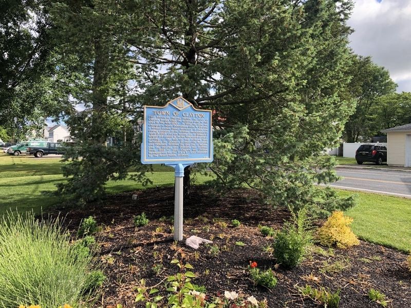
First known as Smyrna Station, the Town of Clayton began when the railroad came to this area in the mid-1850s. In 1860, the name was changed to honor Delawarean John M. Clayton, a former United States Secretary of State and strong advocate of the . . . — — Map (db m39023) HM
Fox Point State Park is unique in Delaware's system of state parks. The park and its surroundings have a colorful history. As home to the Lenape Indians, the Swedes, Dutch, and English, it has been a hunting ground, farmland, a resort, and an . . . — — Map (db m191848) HM
Designed by Furness, Evans & Company
Opened by the Pennsylvania Railroad Company
January 28, 1907
Station renovated 2009 - 2011
and
Rededicated March 19, 2011 — — Map (db m215945) HM
Completed in 1905
Pennsylvania Railroad, Owner
Furness and Evans, Architects
Restored in 1984
under the Northeast Corridor Improvement Project — — Map (db m240826) HM
Union Station
Architecture by
Daniel Burnham, 1908
Designed in the Beaux-Arts style, this was the world's largest train station when it opened - the station and terminal zone originally covered approximately 200 acres and included 75 . . . — — Map (db m8442) HM
Union Station, across First Street, was the world’s largest railroad terminal when it opened in 1907. Its construction took five years and displaced hundreds of small houses and businesses. Architect Daniel Burnham’s Beaux-Arts masterpiece, . . . — — Map (db m71678) HM
The Pennsylvania Railroad used this railroad transfer bridge to land cars that were transported on ferries between Locust Point and Canton. Known as "carfloating," this activity occurred in the Baltimore Harbor from 1871 to 1969. This two-story . . . — — Map (db m212895) HM
The Gwynns Falls Trail follows a valley that has served as both a transportation avenue and an obstacle since the days of American Indians and European colonists. Early roads were privately owned turnpikes that charged tolls; they became public . . . — — Map (db m6352) HM
1867 - 1887
The railroad was completed to Ridgely in 1867. At that time there were two houses in the place — the Vernon property and the Ridgely Hotel. One of the factors getting the railroad to come. Mr. Thomas Bell had to give an area of . . . — — Map (db m205474) HM
In 1918, the United States purchased Perry Point as the proposed site for an ammonium nitrate plant to assist in the war effort. The federal government signed a contract with the Atlas Powder Company on February 1, 1918 to oversee construction . . . — — Map (db m184954) HM
In the early 1900's this site was the location of a large railroad freight yard with roundhouse. It was an important transportation hub, linking East-West rail lines with North-South lines. It was the largest business enterprise in the Town of . . . — — Map (db m184951) HM
The Baltimore and Potomac Railroad, chartered in 1853, inaugurated train service on July 2, 1872 with a line to Washington, and on January 1, 1873 opened the Pope's Creek line to southern Maryland. At the junction of the two lines the town of . . . — — Map (db m646) HM
This is one of two class P-5 prototypes built at the railroad's Altoona, PA, shops. They led to the construction of 90 additional, class P-5a locomotives which were built for electrified passenger service between New York City, Philadelphia, PA, . . . — — Map (db m132960) HM
First movement by steam on a railroad in the state of New Jersey, November 12, 1831, by the original locomotive "John Bull" now deposited in the United States National Museum at Washington. The first piece of railroad track in New Jersey was laid . . . — — Map (db m5195) HM
English Quakers first settled Bordentown in 1682 and during the 18th century, the community became a center of commerce with stagecoach and ferry connections to New York and Philadelphia. The Camden and Amboy (C&A) Railroad began construction in . . . — — Map (db m212538) HM
Safety has always been the primary concern of the railroads to protect the pedestrians and vehicles crossing railroad tracks. The Camden and Amboy Railroad began operating on these tracks in 1835 and after 1871, became a part of the vast . . . — — Map (db m212541) HM
Safety has always been the primary concern of the railroads to protect the pedestrians and vehicles crossing railroad tracks. The Camden and Amboy Railroad began operating on these tracks in 1835 and after 1871, became a part of the vast . . . — — Map (db m194840) HM
Prior to the 1800s ferries and stagecoaches were critical to the transport of passengers in and out of the City of Camden, and this transportation network continued to grow during the 19th century. Once the Camden and Amboy Railroad (C&A) had . . . — — Map (db m208368) HM
These were the last years of the Atlantic City Railroad. What began as an amazing accomplishment ended heroically some 124 years later and spanned a century and a quarter 1877 to 1001. Hundreds of passengers a week had been carried "express" at . . . — — Map (db m146747) HM
The Camden and Amboy Railroad, incorporated in 1830, was the first commercially successful railroad constructed in New Jersey. In 1871, the Pennsylvania Railroad took control of the alignment. The Pennsylvania Railroad was often called "The . . . — — Map (db m245137) HM
Safety has always been the primary concern of pedestrians and vehicles crossing railroad tracks. The Camden and Amboy Railroad operated on these tracks from 1835 until 1871, when they became a part of the vast Pennsylvania Railroad. From the . . . — — Map (db m245135) HM
Penn Station, designed by the architectural firm of McKim, Mead and White, opened in 1935 and is an outstanding example of Art Deco exterior and interior design. Penn Station replaced the Pennsylvania Railroad's old Market Street station which had . . . — — Map (db m527) HM
In 1830 the State of New Jersey granted its first railroad charter to the Camden and Amboy (C&A) Railroad and a similar charter to the Delaware and Raritan (D&R) Canal. The original C&A, linking Camden, Bordentown, Trenton and South Amboy, was . . . — — Map (db m160174) HM
Beginning in the mid-1800s and extending to this day passenger rail transport has been an important part of the life of the City of Trenton. As a major destination on the original Camden and Amboy (C&A) Railroad line from Camden and Bordentown, . . . — — Map (db m208123) HM
Delaware and Raritan Canal State Park
The 66 mile long Delaware and Raritan Canal was dug by hand from 1830 until 1834. It was built to provide a safe, fast inland passage between New York City and Philadelphia. The main channel . . . — — Map (db m208082) HM
As the United States began to feel the full force of the Industrial Revolution and expand its own manufacturing and commercial base, cities like Trenton that were blessed with an advantageous location were in the forefront of transportation . . . — — Map (db m166171) HM
In memory of the 85 people who perished on February 6, 1951, when a Pennsylvania Railroad Commuter Train derailed ¼ of a mile (1300 feet) south of this station, and in recognition of the Woodbridge residents and those of the surrounding communities . . . — — Map (db m125814) HM
The railroad Station came to Manahawkin as part of the post Civil War railroad boom. The Tuckerton Railroad (1871-1940) developed 28.9 miles of track between Whiting and Tuckerton providing a transportation corridor between Philadelphia and the . . . — — Map (db m209215) HM
The railroad Station came to Manahawkin as part of the post Civil War railroad boom. The Tuckerton Railroad (1871-1940) developed 28.9 miles of track between Whiting and Tuckerton providing a transportation corridor between Philadelphia and the . . . — — Map (db m209267) HM
[Coshocton Tribune, Oct. 7, 1952] - Sen. Richard Nixon addressed a crowed of 3,000 at Coshocton from the rear platform of his special campaign train on the Pennsylvania Railroad. It was the biggest audience the Republican candidate for . . . — — Map (db m208267) HM
Troop Train Accident
On the morning of September 11th, 1950, a Pennsylvania Railroad passenger train collided with the rear of a train carrying troops near West Lafayette, Ohio.
The collision killed 73 members of the Pennsylvania . . . — — Map (db m208270) HM
The original Port Columbus Airport terminal was founded by the people of Columbus and was one of the first airport facilities in the United States. Dedicated on July 8, 1929, Port Columbus was the first transfer point in the westbound . . . — — Map (db m12731) HM
This spot was once a bustling railroad junction, where the Pennsylvania Railroad’s main line from Columbus split into two- north to Chicago and south to St. Louis. Operators at this tower were responsible for safely directing syt traffic, as well . . . — — Map (db m206208) HM
Pennsylvania Steel Cabin Car Class N8. The 1951 N8 Caboose was the last major design by the Pennsy. Introduced in 1950. Restored 1990. — — Map (db m191140) HM
By 1851 the railroad had arrived at Rochester. Rail transit had been developed in the year before and had finally spread through Pittsburgh and surrounding western Pennsylvania towns.
Railroads were built on flat surfaces - one commonly flat . . . — — Map (db m55185) HM
This is one of the original service plazas for the nation's first long-distance superhighway. On October 1, 1940, the Turnpike opened, stretching 160 miles from Irwin to Carlisle. The Turnpike Commission had been created in 1937; construction . . . — — Map (db m8188) HM
This is one of the original service plazas for the nation's first long-distance superhighway. On October 1, 1940, the Turnpike opened, stretching 160 miles from Irwin to Carlisle. The Turnpike Commission had been created in 1937; construction . . . — — Map (db m8816) HM
The Rise of the Railroads
Established in 1833 as the Philadelphia and Reading Railroad, the Reading finished its initial 94-mile Main Line between the coal fields of Schuylkill County and Philadelphia in 1842. It fueled Philadelphia's . . . — — Map (db m160520) HM
Founded 1849 as a terminal for westward expansion of the Pennsylvania Railroad. It soon became a major railroad center of the nation. Scene of the War Governors' Conference, 1867. — — Map (db m52337) HM
Here stands foundation stones, a piece of the upper corner truss and the dedication plaque from the 7th Street Bridge that was constructed at this location from 1912 to 1913. This bridge served Altoona for 91 years and became part of many . . . — — Map (db m135588) HM
At this location
March 16 1867
First P•R•R• Y•M•C•A• organized
Second railroad Y•M•C•A• in U•S•A•
Erected March 16 1951
75th anniversary — — Map (db m135591) HM
The PRR built its first repair facilities here in 1850 and opened its first track to Altoona during the same year. By 1925, Altoona was home to the nation's largest concentration of railroad shops, with 16,500 people employed in several locations. — — Map (db m20998) HM
"You had to be a waiter - a good one - to work in the Dining Department. You worked 16 and 17 hours a day. Half the time we had to sleep in the dining car."
- James Corbett, Dining Car Waiter
For passengers, eating aboard a train was always an . . . — — Map (db m53730) HM
"Freight was different. The railroad started doubling up on the trains something fierce - 160-car trains. It would take you a week to get to the other end of them."
- Vince Farabaugh, Locomotive Engineer
Yardmaster John Conlon remembers one . . . — — Map (db m52629) HM
One of the more unusual pieces of railroad equipment is the "scale test weight car" such as displayed here. Railroads charged their customers based upon the weight of goods shipped. After a car was loaded, the railroad moved the car to a railroad . . . — — Map (db m53750) HM
You are standing at the center of what was once the greatest railroad shop complex in the world - the Altoona Works of the Pennsylvania Railroad.
Established in 1850 along with the town of Altoona, the railroad shops eventually sprawled across . . . — — Map (db m53725) HM
The Juniata Shops
By 1889, the Pennsylvania Railroad had outgrown the capacity of the shop complex here at 12th street. Soon the facilities here would be complemented by new buildings in the nearby borough of Juniata, not yet a part of the . . . — — Map (db m135585) HM
Built in 1882, this Master Mechanics Building housed then, as it does again today, stories of what made the Pennsylvania the most important railroad in America and a cornerstone of the industry.
First-Rate Mechanics
Each Pennsy operating . . . — — Map (db m52604) HM
"The Pennsy wanted to make the track areas and stations look good. They gave out prizes to different sections for beauty and upkeep."
- Lou Johnston, Posy Gang member
A Hint of Nature in a Mechanical World
Among the hundreds of jobs on . . . — — Map (db m53728) HM
Designed and built under the direction [of] Pennsylvania Railroad chief engineer and, later, company president, J. Edgar Thomson. Horseshoe Curve opened February 15, 1854. It was 366 meters across and 1310 meters long with a 1.8 percent grade. . . . — — Map (db m52488) HM
has been placed on the
National Register of
Historic Railroad Landmarks
1854 - 2004
The first railroad to cross the
Allegheny Mountains between
Harrisburg and Pittsburgn,
with a maximum grade of 1.87%,
was engineered by J. Edgar . . . — — Map (db m52526) HM
This was the original (1850-54) PRR main line. After Horseshoe Curve was opened, this became the Hollidaysburg Branch (now Conrail's Cove Secondary Track).
From 1850 to 1854, the original PRR main line extended through what is now Altoona to a . . . — — Map (db m52528) HM
The spot where Lock 2 once stood is located in front of this sign. It is outlined with concrete. By the lock were a locktender's house and shanty, as well as a blacksmith shop and mule barn.
The Delaware Canal not only served as a route for . . . — — Map (db m160053) HM
Railroad signals are an essential part of a complex transportation network that allow for multiple trains to operate safely and efficiently on shared tracks. Signals date back to the birth of the industry itself and some basic design elements . . . — — Map (db m242186) HM
The coming of the railroad to Harrisburg in 1836 led to the construction of the first bridges to span the Susquehanna, since the building of the Camelback Bridge in 1817, which planted the seed for what would become the city's trademark of . . . — — Map (db m44405) HM
By 1929, Harrisburg's growth as a freight and passenger rail hub in the eastern United States necessitated the introduction of new rail interlocking technologies to guide the convergence of high volume locomotive traffic through the city. At that . . . — — Map (db m6849) HM
Harrisburg grew from its earliest days due to its strategic location as a gateway to western expansion, becoming one of the most important inland centers of U.S. transportation and trade. The development of rail lines along the same routes as the . . . — — Map (db m6687) HM
The evolution of the English and German-speaking Lutheran congregations in Harrisburg resulted in the establishment of a number of churches that has helped to enhance the city's fabric of sacred architecture and history. From the oldest site at . . . — — Map (db m6730) HM
Here was born the first chief engineer, Pennsylvania Railroad, 1847~52, and its third president, 1852~74. He was responsible for construction of the main line, Harrisburg to Pittsburgh, and for the system’s expansion to the Mississippi River. — — Map (db m68587) HM
Built in June 1942 in Altoona as number 477951, this caboose (known as a cabin car to PRR employees) served the PRR as well as the Penn Central and Conrail into the mid 1980s. After being retired, it was purchased by . . . — — Map (db m152349) HM
This station served the town of Quincy, Pennsylvania on the Mont Alto Railroad, later the Cumberland Valley and Pennsylvania Railroads. The building was acquired by Guilford Township from James Fouchard in 2008, moved to Norlo Park and restored to . . . — — Map (db m152346) HM
The Juniata Division of the Pennsylvania Canal was completed to Huntingdon in 1830, and regular shipping to and from this point got underway in the Spring of 1831. The canal ran beside the river, on the right-of-way now occupied by the railroad. . . . — — Map (db m177058) HM
When the railroad came to Huntingdon in 1850, its tracks were laid down the middle of Allegheny Street. The Pennsylvania Canal occupied the right-of-way now used by Conrail freight and Amtrak passenger trains. The rather narrow width of Allegheny . . . — — Map (db m177062) HM
This miniature Victorian house was built for a parade float that the Cottage Planing Mill entered in one of the Huntingdon County Centennial parades. The three-day celebration of the county's 100th anniversary included several parades featuring . . . — — Map (db m177060) HM
This Stone Arch Bridge, recently restored by the Huntingdon Rotary Club, was part of the original single-track line that brought the Pennsylvania Railroad Company service to Huntingdon in 1850. The steam engine "Henry Clay" completed its journey . . . — — Map (db m177102) HM
The Pennsylvania Railroad was the dominant railroad with predecessor railroads converging on Columbia from four directions.
East—Philadelphia and Columbia reached Columbia in 1834.
West—Wrightsvile, York and Gettysburg crossed the . . . — — Map (db m136294) HM
During the mid-nineteenth century, Columbia was a bustling transportation hub. Turnpikes, ferries, bridges, canals, wharves, and railroads made Columbia a major transshipment point in the movement of lumber, coal, grains, pig iron, and people. . . . — — Map (db m161072) HM
Columbia's strategic position would have made it a fine prize for an invading Southern army bent on disrupting vital communications and supply lines in the North. Railroads connected Columbia with Philadelphia, York, and Harrisburg, and canal . . . — — Map (db m167923) HM
"Wood and coal produced steam that powered passenger trains through Elizabethtown for over 100 years. The 'Golden Age' of steam ended in 1938 when the Pennsylvania Railroad purchased safer, faster, cleaner electric locomotives."
—Pat . . . — — Map (db m136605) HM
The 80-mile Philadelphia & Columbia Railroad was the first state-financed and constructed rail line in the U.S. (1823-1834); Pennsylvania Railroad precursor. Original cost estimate: $5,000 per mile in 1823. On completion, actual cost: $34,500 per . . . — — Map (db m177348) HM
With the arrival of the Pennsylvania Railroad, raw materials were delivered to the furnace by rail. The concrete piers were used to elevate the rails so all ore and coal could be dumped between the piers and from there to be transported to the stock . . . — — Map (db m136362) HM
This station located at Furnace Road and Donegal Place was built in 1871 by the Pennsylvania Railroad to their specifications for rural/freight stations. It was smaller than the Marietta Upper Station (Perry Street), that was built in 1869. It had . . . — — Map (db m136314) HM
No other section of the eastern A&S more fully demonstrated the Pennsylvania Railroad's (PRR) commitment to re-shape the landscape for an optimum freight road than its seven miles through Providence Township. The gentle compound curve (on paper) . . . — — Map (db m160853) HM
In 1891, George Brooke Roberts, a Bala Cynwyd resident and president of the Pennsylvania Railroad (PRR), ordered the construction of the Pencoyd Bridge off the Schuylkill Valley Division to the Pencoyd Iron Works. Up until that . . . — — Map (db m146632) HM
The original Pennsylvania Railroad bridge across the Schuylkill River, known as the "S" Bridge due to its shape, was constructed in 1884 as a double-track iron truss bridge that connected the West Manayunk community in Lower Merion to the . . . — — Map (db m146628) HM
The Philadelphia & Columbia Railroad was one of America's first railways. By the late 1820s, Philadelphia, the second largest city in the nation, lacked access to western markets. New York had the Erie Canal and Baltimore would soon have the . . . — — Map (db m146368) HM
The Spaventa Switchback refers to the section of the Cynwyd Heritage Trail running from the Manayunk Bridge to Rock Hill Road.
The property was formerly owned by the Pennsylvania Railroad (PRR) as a spur/switchback to serve the Pencoyd Iron . . . — — Map (db m146626) HM
[The plaque consists of two photos with captions:]
Above: This image from the 1950s depicts a unique time in history when the three transportation corridors of this area operated concurrently. A Pennsylvania Railroad passenger train led . . . — — Map (db m146624) HM
Clegg's Mill was located in Vine Creek's deep ravine to provide maximum water power. By 1851, three millponds were built to regulate the flow of the creek to turn the waterwheels that powered the mills. You are standing at the point on the map . . . — — Map (db m146366) HM
1821: Harrisburg & Millerstown Turnpike chartered.
1829: Pennsylvania Canal opened through Perry County.
1849: Pennsylvania Railroad completed through Perry County.
The building of turnpikes, . . . — — Map (db m242054) HM
On this site in 1800 brothers William, Caleb and Joshua North of a prominent local family, constructed the Rock Oak Tannery the town's first industry. After a business sojourn in Thompsontown, the brothers returned in 1814, enlarged the . . . — — Map (db m241853) HM
Landmarks
❶ [Unreadable] Hospital of Philadelphia
[Unreadable] the 1860's to train women as doctors and nurses. It is now Sarah Allen Senior Housing Project.
❷ Pennsylvania Railroad YMCA
Originally the . . . — — Map (db m211003) HM
In Pennsylvania's rolling hills lay the resources to fuel the Industrial Revolution. Coal and iron ore rode the rails to factories, foundries and faraway cities. Philadelphia became the "workshop of the world," sending products to Delaware River . . . — — Map (db m214199) HM
Biscuits to Bicycles
Philadelphia was once home to a broad spectrum of manufacturing, earning its nickname as "Workshop of the World." The area north of Vine Street had a high concentration of innovative and influential businesses, . . . — — Map (db m214200) HM
By the 1850s, railroads surpassed waterways as the most efficient mode of transportation and shipping. Trains could haul up to three times as much cargo as boats in a fraction of the time. The many trains that chugged through and around . . . — — Map (db m212821) HM
Philadelphia's reputation as a thriving center of production earned it the nickname "Workshop of the World." Beginning in the early 1800s, the city supported diverse businesses ranging from small workshops to large, well-known companies such as . . . — — Map (db m212822) HM
Before 1867, the Pennsylvania Railroad could not provide ground service for the produce and goods of the rich American West. [unreadable] The Pennsylvania's rival, the Reading Railroad carried the New York traffic from the West over its lines . . . — — Map (db m192648) HM
117 entries matched your criteria. The first 100 are listed above. The final 17 ⊳