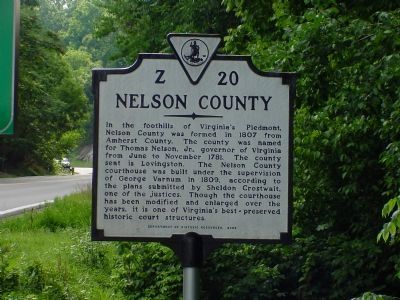
On Rockfish Gap Turnpike (U.S. 250) east of Afton Mountain Road (Virginia Route 6), on the right when traveling west.
Albemarle County. Albemarle County was formed in 1744 from Goochland County and named for William Anne Keppel, the second Earl of Albemarle, titular governor of Virginia from 1737 to 1754. A portion of Louisa County was later added to . . . — — Map (db m4030) HM
On Rockfish Gap Turnpike (U.S. 250) close to Critzer Shop Road (Virginia Route 151), on the right when traveling west.
Built during the nineteen-thirties, Rockfish Gap Country Store was first
used as a peach packing shed by Chesly A. Hayden. Not only was it the
biggest warehouse distribution center in the county, but it also ranked
among the top three in the . . . — — Map (db m234295) HM
On Seminole Trail (U.S. 29) north of Frays Mill Road / Burnley Station Road, in the median. Reported missing.
Albemarle County. Albemarle County was formed in 1744 from Goochland County and named for William Anne Keppel, the second Earl of Albemarle, titular governor of Virginia from 1747 to 1754. A portion of Louisa County was later added to . . . — — Map (db m21585) HM
On Stony Point Road (State Highway 20) at Turkey Sag Road (County Road 640), on the right when traveling west on Stony Point Road.
Extending from the Orange County line on the north to the outskirts of Charlottesville with the Southwest Mountains forming its spine, this historic district encompasses more than 31,000 acres and contains some of the Piedmont’s most pristine and . . . — — Map (db m40775) HM
On Plank Road (County Route 692) just west of Miller School Road (County Route 635), on the right when traveling west.
The Staunton and James River Turnpike ran
through here at Batesville and stretched for
43½ miles from Staunton to Scottsville.
Construction began in 1826 and was completed
by 1830. The turnpike provided a direct
route for Shenandoah Valley . . . — — Map (db m21696) HM
On Rockfish Gap Turnpike (U.S. 250) west of Crozet Avenue / Miller School Road (Virginia Route 240), on the right when traveling east.
The Rothwell Family of Albemarle County Virginia.
Claiborne one of the first of the Rothwells to live in this county, was born about 1741 as reported in The Virginia Advocate, Saturday Oct. 11, 1828 and “died on Oct. 6 in his 87th . . . — — Map (db m3996) HM
On Gordonsville Road (Virginia Route 231) 1.5 miles Route 640, on the left when traveling north.
The original house was built in 1765 by Thomas Walker, explorer and pioneer. Tarleton, raiding Charlottesville to capture Jefferson and the legislature, stopped here for breakfast, June 4, 1781. This delay aided the patriots to escape. Castle Hill . . . — — Map (db m22439) HM
On North Milton Road (County Route 729) 0.1 miles south of Richmond Road (U.S. 250).
On 3 Sept. 1963, nine years after the U.S. Supreme Court declared racial segregation of public schools unconstitutional, 26 African-American students desegregated Albemarle High, Stone-Robinson Elementary, and Greenwood School. With the . . . — — Map (db m170122) HM
Near Monticello Loop 0.4 miles north of Thomas Jefferson Parkway ( Route 53), on the left when traveling north.
Such relationships ranged from acknowledged affairs that...were familial in every sense but a legally recognized one to brutal acts of rape and sexual assault where slave owners showed the inhumanity for which slavery was notorious. . . . — — Map (db m231159) HM
Near Ashlawn-Highland Drive 0.4 miles west of James Monroe Parkway, on the right when traveling north.
Plantation industry at Highland included a threshing machine, grist mill, saw mill, blacksmith shop, and wool spinning. Nonetheless, James Monroe expressed frustration that Highland "has run me into debt considerably."
By the 1820s, cotton . . . — — Map (db m261921) HM
Near Ashlawn-Highland Drive 0.4 miles west of James Monroe Parkway, on the right when traveling north.
Archaeological investigations in 2014 revealed buried architectural debris in this area, which led to the discovery of well-preserved stone foundations. Further research identified these as the remains of the Monroes' main house.
Artifacts . . . — — Map (db m261922) HM
Ash Lawn - Highland
Home of James Monroe from 1799-1823
Dedicated on July 20, 1985
by
Virginia Daughters of the American Revolution
State Regent
Mrs. G.E. Honts, Jr. — — Map (db m63671) HM
In 1814 a ditch 500 yards long was dug to keep grazing animals off the west lawn.
The rails that were laid across the banks reminded a visitor in 1823 of "a common post and rail fence, blown down across a ditch." — — Map (db m100002) HM
On Stony Point Road at Winding River Lane, on the right when traveling north on Stony Point Road.
George Rogers Clark was born a mile northeast of here on 19 Nov. 1752. He grew up on a farm in Caroline County. Clark explored the Ohio River Valley, fought in Dunmore's War in 1774, and helped convince the General Assembly to organize Kentucky as a . . . — — Map (db m165405) HM
Near Monticello Loop 0.2 miles north of Thomas Jefferson Parkway ( Route 53), on the right.
When we came from Virginia we brought one daughter with us, leaving the dust of a son in the soil near Monticello. Madison Hemings, 1873
Many burial grounds for enslaved people remain unknown. Separation of families . . . — — Map (db m261930) HM
Wood charcoal fueled the forges in the nailery on Mulberry Row and heated the stoves in the kitchen. Charcoal was stored under lock and key in wooden sheds that once stood here. Built about 1794, these "coal sheds" likely resembled temporary . . . — — Map (db m100442) HM
Near Monticello Loop 0.4 miles north of Thomas Jefferson Parkway ( Route 53), on the left when traveling north.
Despite the horrors of slavery, African Americans forged enduring family and community connections, and cultural and spiritual practices. The Contemplative Site is a space to reflect upon their lives and legacies.
Thomas Jefferson held at . . . — — Map (db m231012) HM
Near Monticello Loop north of Thomas Jefferson Parkway ( Route 53), on the left when traveling north.
Mulberry Row’s buildings have all but disappeared—only the remains of four survive. Before re-creating lost buildings and roads, we look at information from many sources. How do we know about this important place and the history of its people, . . . — — Map (db m80863) HM
On McCormick Road south of University Avenue (Business U.S. 250), on the left when traveling south.
Edgar Allan Poe (1809-1849)—writer, poet, and
critic—was born in Boston, Mass. Orphaned at a
young age, Poe was raised by John and Frances Allan of Richmond. He attended schools in
England and Richmond before enrolling at the University of . . . — — Map (db m8765) HM
On Richmond Road (U.S. 250) 0.1 miles west of Louisa Road ( Route 22), on the right when traveling west.
William Randolph patented the Edgehill plantation just to the north, in 1735. His grandson, Thomas Mann Randolph, married Thomas Jefferson's daughter Martha, acquired Edgehill in 1792, and was later governor of Virginia. The couple built a frame . . . — — Map (db m170657) HM
Near Monticello Loop 0.4 miles north of Thomas Jefferson Parkway ( Route 53), on the left when traveling north.
Isaac Granger Jefferson worked the forge in the original building on this site, which housed a "storehouse for iron" in 1796, a short-lived tinsmithing operation, a small nail-making shop, and also served as quarters for enslaved people. The use . . . — — Map (db m231059) HM
Born in slavery at Monticello on July 4, 1826, the day of Thomas Jefferson's death, Henry Martin worked at the University in various capacities from about 1847 until his retirement in 1910. In late 1868 or early 1869, he was employed as head . . . — — Map (db m75526) HM
Near Thomas Jefferson Parkway (Virginia Route 53) at Jefferson Lake Drive, on the right when traveling east.
Historic Michie Tavern, established in 1784 by Scotsman William Michie, served as a social center of its community and accommodated travelers with food, drink and lodging.
◇ Highlights of the Tavern Tour
◇ . . . — — Map (db m170646) HM
The Eagle. Peacemaker. Tecumseh. Bremo. Wellington. Diomede. These were the six carriage and saddle horses, plus one mule, stabled here in 1821. As many as 30 riding and carriage horses, workhorses, and mules were stabled at various locations on . . . — — Map (db m100157) HM
Master carpenter James Dinsmore oversaw construction of this Ice House to Jefferson's design in 1802. Enslaved and hired workers filled it each year between November and February with ice cut from the nearby Rivanna River, shallow ponds, or snow . . . — — Map (db m68174) HM
Near Ashlawn-Highland Drive 0.4 miles west of James Monroe Parkway, on the right when traveling north.
Iron casting of a mileage marker on Highway 40, the first federally-supported interstate roadway, created during James Monroe's presidency.
This marker was given by the state of Pennsylvania to Pennsylvania native Jay Winston Johns, who . . . — — Map (db m261925) HM
On McCormick Road south of University Avenue (Business U.S. 250), on the left when traveling south.
In 1788 James Monroe purchased an 800-acre farm here to be close to his friend Thomas Jefferson and to establish a law office. In 1799 the Monroes moved to their new Highland plantation adjacent to Monticello and sold the first farm. In 1817 the . . . — — Map (db m8762) HM
Near Thomas Jefferson Parkway (Virginia Route 53) west of James Monroe Parkway (County Route 795), on the right when traveling east.
Here in 1774, Thomas Jefferson and Philip Mazzei planted Virginia's first commercial vineyard, intending to export their wine back to Europe. The Vineyard was abandon in 1776 with the advent of the Revolutionary War. Jefferson's efforts to grow . . . — — Map (db m188548) HM
Near Monticello Loop 0.4 miles north of Thomas Jefferson Parkway ( Route 53), on the left when traveling north.
Jefferson's elaborate design for Monticello could not have been achieved without the superior craftsmanship of hired free and enslaved woodworkers working closely together. Joiners, the most skilled, produced Monticello's classically inspired . . . — — Map (db m230977) HM
Here on December the tenth MDCCCLXIX the Kappa Sigma Fraternity was founded by William Grisby McCormick • George Miles Arnold • John Covert Boyd • Edmund Law Rogers • Frank Courtney Nicodemus. Manet Mansuraque Est. — — Map (db m8812) HM
Near Monticello Loop 0.4 miles north of Thomas Jefferson Parkway ( Route 53), on the left when traveling north.
... architecture is my delight, and putting up, and pulling down, one of my favourite amusements.
Thomas Jefferson quoted by Margaret Bayard Smith, 1809
Thomas Jefferson shaped American architecture with his neoclassical designs . . . — — Map (db m231048) HM
On Thomas Jefferson Parkway (Virginia Route 53) at Michie Tavern Lane ( Route 1102), on the right when traveling east on Thomas Jefferson Parkway.
Not far from the Tavern on its original site, the Michie family once owned and operated a mill and general store. At the turn of the century, their mill fell from decay. The Meadow Run Grist Mill from nearby Laurel Hill, Virginia was relocated to . . . — — Map (db m170643) HM
On Thomas Jefferson Parkway (Route 53) 0.1 miles east of Michie Tavern Lane ( Route 1102), on the right when traveling east.
Michie Tavern is recognized as a Virginia Landmark for its leading role in the 1920's Preservation Movement. In continuing efforts towards preservation, this historic attraction has worked towards saving significant rural Virginia structures. . . . — — Map (db m170644) HM
Every article is made on his farm; his negroes are cabinet makers, carpenters, masons, bricklayers, smith, etc. Duc de La Rochefoucauld Liancourt, 1796
You are standing on Mulberry Row, a road once lined with more . . . — — Map (db m68171) HM
Jefferson attempted to create an efficient plantation based on new approaches to agriculture and manufacturing. To realize his goals, dozens of enslaved and free workers lived and worked here on Mulberry Row. Jefferson added a series of dwellings . . . — — Map (db m100132) HM
Near Monticello Loop north of Thomas Jefferson Parkway ( Route 53), on the left when traveling north.
Jefferson set up a nail-making operation in 1794 to provide income until he could “put my farms into a course of yielding profit.” He calculated the nailers’ daily output, the waste of nailrod, and profits. In its first years, the . . . — — Map (db m80862) HM
Near Monticello Loop 0.4 miles north of Thomas Jefferson Parkway ( Route 53), on the left when traveling north.
Although both the North and South Pavilions were elements in Jefferson's designs of the 1770's for Monticello, it was not until 1808 that his scheme was fully realized with the completion of this structure. After Jefferson's daughter Martha and . . . — — Map (db m231029) HM
What you see here is a reconstruction of the North Terrace wing. The original wing, built 1801-05, housed Jefferson's carriages and the horses and carriages of visitors; most of Jefferson's horses were stabled at the east end of Mulberry Row. Horses . . . — — Map (db m100469) HM
This was the general site of the "old nursery," where Jefferson grafted and sowed the seed of special garden plants. He propagated thirteen kinds of shrubs, forty—one species of ornamental trees, twenty—six vegetable varieties, six kinds . . . — — Map (db m100003) HM
Near Thomas Jefferson Parkway (Virginia Route 53) at Mitchie Tavern Lane (County Road 1102), on the right when traveling east. Reported permanently removed.
Virginia's virgin forest provided materials for the settlers' most basic shelter. Centuries ago, first growth trees were felled and the wood hewn to form this single-room log cabin in Piney River, Virginia, 45 minutes south of here. The structure is . . . — — Map (db m53613) HM
Near Thomas Jefferson Parkway (Virginia Route 53) 0.1 miles east of Michie Tavern Lane ( Route 1102), on the right when traveling east.
Virginia's virgin forest provided materials for the settlers' most basic shelter. Centuries ago, first growth trees were felled and hewn to form the single room log cabin in Piney River, Virginia, 45 minutes south from here. This 18th century . . . — — Map (db m170649) HM
Near Ashlawn-Highland Drive 0.4 miles west of James Monroe Parkway, on the right when traveling north.
This building is a 1980s reconstruction of an 1840s or 1850s triplex, or three-room house. Archaeology and historic documents suggest a house for three enslaved families stood in the same spot during Monroe's tenure here.
Vivienda . . . — — Map (db m261937) HM
On Ivy Road (Business U.S. 250) near Colonnade Drive.
Jesse Pitman Lewis (d. March 8, 1849), of the Virginia Militia, and Taliaferro Lewis (d. July 12, 1810), of the Continental Line, two of several brothers who fought in the War for Independence, are buried in the Lewis family cemetery 100 yards south . . . — — Map (db m3994) HM
Near Monticello Loop 0.4 miles north of Thomas Jefferson Parkway ( Route 53), on the left when traveling north.
Though enslaved, Sally Hemings helped shape her life and the lives of her children, who got an almost 50-year head start on emancipation, escaping the system that had engulfed their ancestors and millions of others. Whatever we may feel about . . . — — Map (db m231286) HM
Over 200 years ago, four log dwellings stood here. The first, constructed in the 1770s and destroyed by fire ca. 1790. was the "Negro quarter," a large 17 x 34 foot structure intended for multiple enslaved individuals or families. Three identical, . . . — — Map (db m100176) HM
In the long, three-celled wooden structure that stood here between ca. 1790 and 1809, Jefferson combined two of what he considered "indispensable" elements of a Virginia plantation, the "smoke house" and "dairy." His unusual design placed "two . . . — — Map (db m100440) HM
Near Monticello Loop 0.4 miles north of Thomas Jefferson Parkway ( Route 53), on the left when traveling north.
Jefferson called this brick structure, the first building on the mountaintop, his "outchamber." Erected in 1770, it contained one room over a kitchen. Jefferson lived here alone until his marriage to Martha Wayles Skelton in January 1772. They . . . — — Map (db m231033) HM
Panel 1 Jefferson introduced mechanized cloth production to his plantation when trade embargoes and looming war cut off the supply of imported British cloth. In 1811, he hired William McLure, a free white artisan and "a very ingenious man," . . . — — Map (db m68175) HM
After Jefferson's death in 1826, his heirs sold his property, including his slaves, to pay his debts. Naval officer Uriah Phillips Levy, who admired Jefferson for his support of religious liberty, purchased Monticello in 1834 to preserve it. This is . . . — — Map (db m80808) HM
On Thomas Jefferson Parkway (Virginia Route 53) at Michie Tavern Lane (County Road 1102), on the right when traveling east on Thomas Jefferson Parkway. Reported permanently removed.
Not far from the Tavern, the Michie family owned and operated a mill and general store. At the turn of the century the mill fell from decay. In order to recreate the Michie's Tavern-plantation (which stretched for several miles) Historic Michie . . . — — Map (db m53611) HM
Near Monticello Loop 0.3 miles north of Thomas Jefferson Parkway ( Route 53), on the left when traveling south.
This graveyard had its beginning in an agreement between two young men, Thomas Jefferson and Dabney Carr, who were school-mates and friends. They agreed that they would be buried under a great oak which stood here.
Carr, who married Jefferson's . . . — — Map (db m80807) HM
Near Thomas Jefferson Parkway (Virginia Route 53) 0.1 miles east of Michie Tavern Lane ( Route 1102), on the right when traveling east.
Above your head, part of the ceiling has been left exposed. Here in the crawl space, we found evidence that explained how Pleasant Sowell finished the exterior of his house. Along the wall, closest to the ceiling, three boards of the original siding . . . — — Map (db m170651) HM
Near Thomas Jefferson Parkway (Virginia Route 53) 0.1 miles east of Michie Tavern Lane ( Route 1102), on the right when traveling east.
At the age of 23, Pleasant Sowell began building his house on a 100-acre tract six miles south from here. This structure became his family's home for 173 years. For six generations, the Sowells' choice of materials, craftsmanship and alterations . . . — — Map (db m170650) HM
Near Thomas Jefferson Parkway (Virginia Route 53) 0.1 miles east of Michie Tavern Lane ( Route 1102), on the right when traveling east.
[The marker features floor plans of the house at different points of its history:]
1822 - This is how the house appeared when Pleasant and Sarah moved in towards the end of 1822. We do not know if at this time a staircase led to the . . . — — Map (db m170653) HM
Near Monticello Loop 0.6 miles north of Thomas Jefferson Parkway ( Route 53), on the left when traveling north.
Nothing conduces more to the health of a horse then a good and whole stable. Richard Mason, The Gentleman's New Pocket Companion...of the Noble and Useful Animal the Horse, 1811 (from Jefferson's library)
These . . . — — Map (db m263667) HM
On University Avenue (Business U.S. 250) at Hospital Drive, on the right when traveling west on University Avenue.
In the early 1900s “The Corner,” so named by the University crowd, was but a sparse collection of businesses at the entrance to the University Grounds—literally just a corner. In the intervening years “The Corner” . . . — — Map (db m86177) HM
On East Market Street (County Road 1105) 0.3 miles south of Riverside Drive, on the right when traveling east.
Charlottesville wool also outfitted the US Postal Service and most railroad workers from coast to coast. In the early 1900s, the Mill employed some 130 people and had established a national reputation, supplying uniform cloths worn by police . . . — — Map (db m172977) HM
On East Market Street (County Road 1105) 0.2 miles south of Broadway Street, on the right when traveling east.
With business growing, new buildings were constructed to keep up the demand as they not only produced uniform cloth, but also sold to high end tailors like Brooks Brothers.
The two "saw-tooth" (so-called because of their roof structure) . . . — — Map (db m172980) HM
Near College Drive just west of Scottsville Road ( Route 20), on the right when traveling west.
These willow oaks were planted by Her Majesty Queen Elizabeth II & Prince Philip in ceremonies honoring the royal visit to the Western Virginia Bicentennial Center July 10, 1976. — — Map (db m21950) HM
Near Monticello Loop 0.3 miles east of Thomas Jefferson Parkway, on the right when traveling east.
The greatest advocate of human liberty
Opposing special privileges
He loved and trusted The People
To commemorate his
Purchase of Louisiana
Erected by
The Jefferson Club
of St. Louis MO
on their pilgrimage Oct 12, 1901
to . . . — — Map (db m99849) HM
On University Avenue (Virginia Route 250) east of McCormick Road, on the left when traveling west.
Proclaim Liberty throughtout the land unto the inhabitants thereof —Leviticus XXIV.
This monument to Thomas Jefferson was presented to the people to perpetuate the teachings and examples of the Founders of the . . . — — Map (db m8805) HM
Near Thomas Jefferson Parkway (Virginia Route 53) just east of Michie Tavern Lane ( Route 1102), on the right when traveling east.
This barn was once a place to hang and dry harvested tobacco plants. Tobacco was the primary cash crop in early Virginia. Many large landowners including the Michies grew tobacco as their principle money-making crop.
However, in time, the . . . — — Map (db m170654) HM
Near Thomas Jefferson Parkway (Virginia Route 53) at Mitchie Tavern Lane (County Road 1102), on the right when traveling east. Reported permanently removed.
This barn was once a place to hang and dry harvested tobacco plants. Tobacco was the primary cash crop in early Virginia. Many large landholders, including the Michies, grew tobacco as their principal money-making crop.
However, in time, . . . — — Map (db m53612) HM
On Ivy Road (Business U.S. 250) near Colonnade Drive. Reported permanently removed.
On 3 Mar. 1865, Maj. Gen. Philip H. Sheridan’s Union Army of the Shenandoah entered Charlottesville to destroy railroad facilities as the 3rd Cavalry Division led by Bvt. Maj. Gen. George A. Custer arrived from Waynesboro. Mayor Christopher H. . . . — — Map (db m95140) HM
On Ivy Road (Business U.S. 250) just west of Colonnade Drive, on the right when traveling east.
On 3 Mar. 1865, after the Battle of Waynesboro, Maj. Gen. Philip H. Sheridan's Union Army of the Shenandoah entered Charlottesville. As Bvt. Maj. Gen. George A. Custer's 3d Cavalry Division arrived, Mayor Christopher L. Fowler, local officials, and . . . — — Map (db m170640) HM
Near College Drive just west of Scottsville Road ( Route 20), on the right when traveling west.
Citizens of central and western Virginia have contributed significantly to national defense and to the U.S. Army throughout its 200-year history.
During the Revolutionary War, Virginians fought valiantly as members of the militia and the . . . — — Map (db m21890) HM
Near Monticello Loop 0.4 miles north of Thomas Jefferson Parkway ( Route 53), on the left when traveling north.
Thomas Jefferson's garden was a massive, edible laboratory. He tested new plants to record which fruit and vegetable varieties thrived. Like his neighbors, Jefferson designed a robust vegetable garden to provide food for his household. . . . — — Map (db m231112) HM
Near Ashlawn-Highland Drive 0.4 miles west of James Monroe Parkway, on the right when traveling north.
The house was destroyed by fire after Monroe sold Highland in 1826, advertising a "commodious dwelling house" on the property. While the exact date is unknown, one tantalizing clue comes in a letter from later owner Edward Goodwyn to a neighbor on . . . — — Map (db m261924) HM
Near Ashlawn-Highland Drive 0.4 miles west of James Monroe Parkway, on the right when traveling north.
James Monroe's main house burned after he sold it in the 1820s. This yellow house was built by John E. Massey, a Baptist minister and politician, in the 1870s. Its boxwood gardens gave the property a new orientation and formal layout. The 1818 . . . — — Map (db m261907) HM
William Holding Echols (1859–1934), Professor of Mathematics, lived in this pavilion. By precept and example, he taught many generations of students with ruthless insistence that the supreme values are self respect, integrity of mind, contempt . . . — — Map (db m62645) HM
Near Ashlawn-Highland Drive 0.4 miles west of James Monroe Parkway, on the right when traveling north.
In the decades following the American Revolution, James Monroe and other leaders set out to define and expand the new nation. Highland offers a window into what this meant for the many lives that intersected here—political elites, enslaved . . . — — Map (db m261909) HM
Near Monticello Loop at Thomas Jefferson Parkway ( Route 53), on the left when traveling north.
This chimney and foundation are all that remain of the “joiner’s shop”, one of the first structures on Mulberry Row. From about 1775, free and enslaved workmen produced some of the finest woodwork in Virginia. Sawyers and carpenters felled oak, . . . — — Map (db m80860) HM
Near University Avenue (Business U.S. 250) east of McCormick Road, on the left when traveling west.
In memory of
Woodrow Wilson
student of this university 1879-1881
President of the United States 1913-1921
Founder of the League of Nations 1919 — — Map (db m230788) HM
Near University Avenue (Business U.S. 250) east of McCormick Road, on the left when traveling west.
In memory of the sons of this University who gave their lives for freedom in the World War
Robert Dunaway Adams •
George Wayne Anderson, Jr. •
Adair Pleasants Archer •
Samuel Chandler Baker •
Andrew Beirne Blair, Jr. •
William Ewing . . . — — Map (db m230736) WM
On Advance Mills Road (County Route 743) at Frays Mill Road (County Route 641), on the left when traveling west on Advance Mills Road.
Villages such as Advance Mills were once common features of rural Virginia, serving as economic and social centers. Advance Mills grew around a single mill that John Fray constructed in 1833 on the north fork of the Rivanna River. By the twentieth . . . — — Map (db m55785) HM
Near Hydraulic Road (County Road 743) at Hydraulic Ridge Road, on the left when traveling north.
On 3 Sept. 1963, nine years after the U.S. Supreme Court declared racial segregation of public schools unconstitutional, 26 African-American students formerly enrolled at all-black schools desegregated Albemarle High School, Stone-Robinson . . . — — Map (db m170167) HM
On Belvedere Boulevard 0.1 miles east of Belvedere Place, on the right when traveling east.
Free State, a community of free African Americans, stood here. Its nucleus was a 224-acre tract that Amy Farrow, a free black woman, purchased in 1788. Her son Zachariah Bowles lived here and married Critta Hemings of Monticello, an older sister of . . . — — Map (db m170663) HM
On Belvedere Boulevard east of Free State Road, on the right when traveling east.
Shadrach Battles, a free person of color born probably in Albemarle County, was a Revolutionary War soldier. By June 1775 he had joined the Albemarle Independent Company, a local militia unit. In Dec. 1776 he enlisted in the 10th Virginia Regiment . . . — — Map (db m288504) HM
On Barracks Farm Road (County Route 658) east of Garthfield Lane, on the right when traveling east.
In Jan. 1779, during the American Revolution, 4,000 British troops and German mercenaries (commonly known as “Hessians”) captured following the Battle of Saratoga in New York arrived here after marching from Massachusetts. It was called . . . — — Map (db m55784) HM
On Ivy Farm Road (County Route 1015), on the left when traveling east. Reported missing.
"In 1779 4,000 prisoners, British and their German auxiliaries, captured at the Battle of Saratoga in 1777, marched over 600 miles to quarters, called 'The Barracks', situated a half mile north of this site. Traditionally, some of these prisoners . . . — — Map (db m271356) HM
On Emmet Street (Business U.S. 29) at Sprigg Lane, on the right when traveling south on Emmet Street.
W. W. Yen (also known as Yan Huiqing). Chinese diplomat and political leader, was born in Shanghai. He graduated in 1900 from the University of Virginia as the first international student to earn a bachelor of arts degree and the first Chinese . . . — — Map (db m208960) HM
On Emmet Street North (Business U.S. 29) at University Avenue and Ivy Road (Business U.S. 250), on the left when traveling south on Emmet Street North.
Born at Esmont on 10 April 1915, Frank D. Peregory enlisted in May 1931 in Charlottesville’s Co. K (Monticello Guard), 116th Inf. Regt., 29th Inf. Div. On D-Day, 6 June 1944, T. Sgt. Peregory landed in the assault on Omaha Beach, Normandy, France. . . . — — Map (db m18584) HM
On East Jefferson Street just east of 4th Street Northeast, on the left when traveling east.
Between 1762 and 1865, auctioneers sold enslaved men, women, and children at various locations in
Court Square: outside taverns, at the Jefferson Hotel, at the "Number Nothing" building. in front of the Albemarle Co. Courthouse (where sales were . . . — — Map (db m291733) HM
On Tyree Lane at Bowles Alley, on the left when traveling west on Tyree Lane.
During initial planning of the Belvedere Neighborhood in late 2004, awareness of the existence of buildings and other sites, including a possible family cemetery, associated with the historically African American community of Free State raised . . . — — Map (db m289042) HM
On Oak Street west of 1st Street South, on the left when traveling west.
Oakwood Cemetery has served as Charlottesville's primary public cemetery since the early 1860s when Maplewood, the City's other public cemetery at that time, began to reach capacity. This 14-acre area was formerly part of Alexander Garrett's . . . — — Map (db m291737) HM
Near Earlysville Road at Woodlands Road, on the right when traveling south.
This is a spring that was used by the Carr family when they lived here in 1870. The spring provided a source of clean drinking water and was also used as a storage location to keep perishable foods cool — — Map (db m170175) HM
On Preston Avenue just west of Albemarle Street, on the right when traveling west.
The Carver Inn (ca. 1947) on this site was among the few lodging places in Charlottesville where
African Americans could stay during segregation. Featuring fine dining, a private social club, and
a beauty salon. the inn was host to famous guests . . . — — Map (db m291730) HM
On Earlysville Road 0.2 miles south of Woodlands Road, on the right when traveling south.
Legacy of Hugh Carr
The Ivy Creek Natural Area was once the home of Hugh Carr, born into slavery around 1840 in Albemarle County. The end of the Civil War in 1865 was for Hugh the start of a new life founded in freedom.
In 1870, Hugh . . . — — Map (db m170172) HM
Near Earlysville Road (County Road 743) 0.3 miles south of Woodlands Road, on the right when traveling south.
A network of more than six miles of walking trails leaves large areas of natural habitat undisturbed. The 1.5 mile Central Red Trail leads back to the parking lot and barn. All other trails stem from the Red Trail.
A 0.75-mile paved trail . . . — — Map (db m170174) HM
Near Earlysville Road 0.3 miles south of Woodlands Road, on the right when traveling south.
1975: Red Flags
For years, Elizabeth (Babs) Conant had canoed the relatively new South Fork Rivanna Reservoir and enjoyed its abundant wildlife. Then one autumn day in 1975, she rounded a bend and saw something ominous. Survey stakes . . . — — Map (db m170170) HM
On McCormick Road at Poe Alley, on the right when traveling south on McCormick Road.
"I feel fortunate to have had the opportunity to be a part of this suit and to watch it unfold. I am grateful for the outcome which enabled me to receive an education that enriched my life across many dimensions."
-Virginia . . . — — Map (db m246897) HM
Near West Pavilion just north of Constantine Path, on the left when traveling north.
In a Washington Post article covering the Rebellion, Hayes said "we want to preserve…the dignity of those who work here… We must end racism, we must end bigotry. In this school, in Virginia and in the country.
Near McCormick Road north of Mews Alley, on the right when traveling south.
Au Sergent pilote aviatéur Américain
Jacques Mac Connell
engagé volontaire
dans l'Aviation Française le 27 décembre
tombé au Champ d'Honneur
le 19 mars 1917
don un combat aérien
La France Reconnaissante . . . — — Map (db m246899) HM WM
On Rotunda Drive west of Hospital Drive, on the right when traveling west.
As it enters its third century, the University of Virginia remembers the enslaved people whose labor and talents made possible the construction and operation of the Academical Village. Forced labor, incalculable suffering, and the struggle to . . . — — Map (db m256889) HM
3987 entries matched your criteria. The first 100 are listed above. Next 100 ⊳