4005 entries match your criteria. Entries 101 through 200 are listed.⊲ Previous 100 — Next 100 ⊳
Historical Markers and War Memorials in Alabama
By Mark Hilton, August 22, 2018
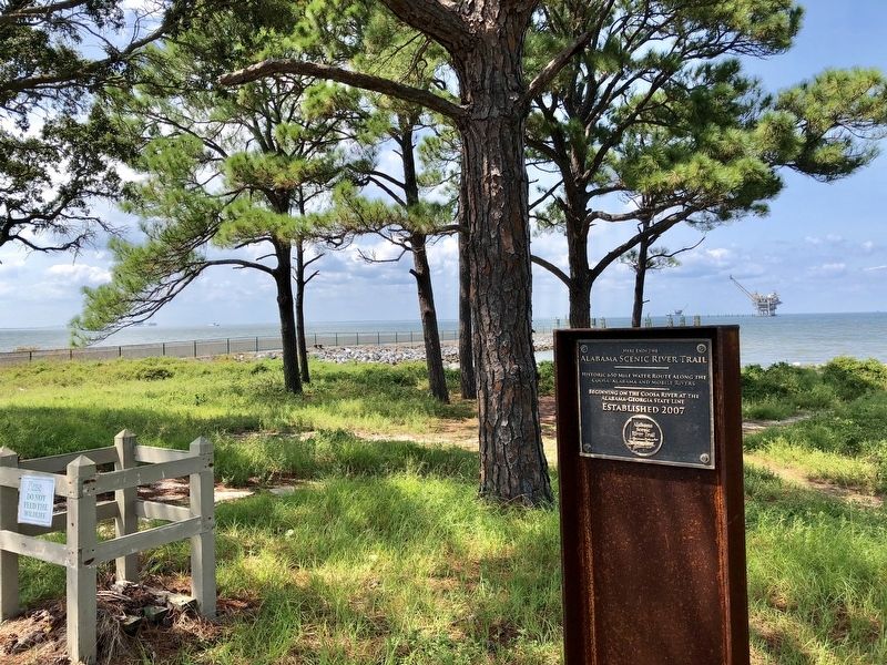
Looking west from marker into Mobile Bay.
| 101 ► Alabama, Baldwin County, Gulf Shores — Here ends the Alabama Scenic River Trail — |
| Near Fort Morgan Road (Alabama Route 180) 1.2 miles west of Dune Drive, on the right when traveling west. | |||
| 102 ► Alabama, Baldwin County, Gulf Shores — Indian Village Achuse — |
| On Alabama Route 180 east of Gasque Lane, on the right when traveling west. | |||
| 103 ► Alabama, Baldwin County, Gulf Shores — Navy Cove / Pilot Town — |
| On Fort Morgan Road (Alabama Route 180) west of Pontoon Lane, on the right when traveling west. | |||
| 104 ► Alabama, Baldwin County, Gulf Shores — Officer’s Row — |
| On Fort Morgan Road (State Road 180) 1.3 miles west of Dune Drive, on the left when traveling west. | |||
| 105 ► Alabama, Baldwin County, Gulf Shores — Panama Mount — |
| Near Fort Morgan Road (Alabama Route 180) 1.7 miles west of Dune Drive (Route 180). | |||
| 106 ► Alabama, Baldwin County, Gulf Shores — Peace Magazine (1902-1924) — |
| Near Fort Morgan Road (State Road 180) 1 mile west of Dune Drive, on the left when traveling west. | |||
| 107 ► Alabama, Baldwin County, Gulf Shores — Post Hospital Complex — |
| Near Fort Morgan Road (Alabama Route 180) 1.2 miles west of Dune Road, on the right when traveling west. | |||
| 108 ► Alabama, Baldwin County, Gulf Shores — The Battery Lincoln — Position of Company “C” of the 20th Iowa Infantry — |
| Near Fort Morgan Road (State Road 180) 1.3 miles west of Dune Drive, on the left when traveling west. | |||
| 109 ► Alabama, Baldwin County, Gulf Shores — Stop C1 — The Battle of Mobile Bay — “A Deadly Rain of Shot and Shell” — Civil War Trail, Battle for Mobile Bay — |
| Near Fort Morgan Road (State Highway 180) 1.7 miles west of Dune Drive. | |||
| 110 ► Alabama, Baldwin County, Gulf Shores — Stop C2 — The Battle of Mobile Bay — “Now I Am In The Humor, I Will Have It Out!” — Civil War Trail, Battle for Mobile Bay — |
| Near Fort Morgan Road (State Highway 180) 1.7 miles west of Dune Drive. | |||
| 111 ► Alabama, Baldwin County, Gulf Shores — Stop C3 — The Battle of Mobile Bay — “Damn the Torpedoes!” — Civil War Trail, Battle for Mobile Bay — |
| Near Fort Morgan Road (Alabama Route 180) 1.7 miles west of Dune Drive when traveling west. | |||
| 112 ► Alabama, Baldwin County, Gulf Shores — The Citadel — (1821-1865) — |
| Near Fort Morgan Road (Alabama Route 180) 1.7 miles west of Dune Drive when traveling west. | |||
| 113 ► Alabama, Baldwin County, Gulf Shores — The Overland Campaign — Storm Clouds Gather — Civil War Trail, Battle for Mobile Bay — |
| On Fort Morgan Road (State Road 180) 1.7 miles west of Dune Drive, on the left when traveling west. | |||
| 114 ► Alabama, Baldwin County, Gulf Shores — U.S. Model 1918M1 155mm Gun and Model 1918A1 Carriage — |
| On Fort Morgan Road (State Road 180) 1.7 miles west of Dune Drive, on the right when traveling west. | |||
| 115 ► Alabama, Baldwin County, Josephine — Josephine — |
| On Josephine Drive, on the right when traveling east. | |||
| 116 ► Alabama, Baldwin County, Little River — “The Red Eagle” William Weatherford - Sehoy Tate Weatherford Princess — |
| On Red Eagle Road, 0.1 miles west of T.J. Earle Road, in the median. | |||
| 117 ► Alabama, Baldwin County, Lottie — History of Lottie, Alabama — |
| On Jack Springs Road at Lottie Road (County Road 61), on the right when traveling south on Jack Springs Road. | |||
| 118 ► Alabama, Baldwin County, Loxley — Dedicated by the Town of Loxley — |
| On North Hickory Street (U.S. 90) at Municipal Park Drive on North Hickory Street. | |||
| 119 ► Alabama, Baldwin County, Loxley — Jenkins Farm / Jenkins Farmhouse — |
| On Jenkins Farm Road, 0.2 miles east of U.S. 90, on the right when traveling east. | |||
| 120 ► Alabama, Baldwin County, Loxley — The Town of Loxley — |
| On North Hickory Street at Municipal Park Drive, on the right when traveling south on North Hickory Street. | |||
| 121 ► Alabama, Baldwin County, Magnolia Springs — Magnolia Springs, Alabama — |
| On Oak Street west of Magnolia Springs Highway, on the right when traveling west. | |||
| 122 ► Alabama, Baldwin County, Magnolia Springs — The Springs — |
| Near Magnolia Springs Highway (County Route 49) 0.1 miles east of Oak Street. | |||
| 123 ► Alabama, Baldwin County, Montrose — The Village of Montrose / Montrose — |
| On Sibley Street, 0.1 miles west of U.S. 98, on the left when traveling west. | |||
| 124 ► Alabama, Baldwin County, Orange Beach — Bay Circle — |
| On Canal Road at Bay Circle, on the right when traveling west on Canal Road. | |||
| 125 ► Alabama, Baldwin County, Orange Beach — Orange Beach Community Cemetery — “Bear Point Cemetery” — Baldwin County — |
| On Canal Road (Alabama Route 180) at Pensacola Avenue, on the right when traveling east on Canal Road. | |||
| 126 ► Alabama, Baldwin County, Orange Beach — Orange Beach Municipal Complex — |
| On Orange Beach Boulevard (Alabama Route 161) at John M Snook Drive, on the right when traveling south on Orange Beach Boulevard. | |||
| 127 ► Alabama, Baldwin County, Orange Beach — Orange Beach, Alabama — |
| On Canal Road east of Nancy Lane, on the left when traveling east. | |||
| 128 ► Alabama, Baldwin County, Orange Beach — Perdido Pass — |
| On Perdido Beach Boulevard (Alabama Route 182) east of Parkway Drive, on the right when traveling east. | |||
| 129 ► Alabama, Baldwin County, Orange Beach — Romar Beach — |
| On Perdido Beach Boulevard (Alabama Route 182) 0.1 miles east of Tannin Boulevard, on the right when traveling east. | |||
| 130 ► Alabama, Baldwin County, Perdido — Perdido Vineyards — |
| On County Road 47, 0.4 miles east of Interstate 65, on the right when traveling east. | |||
| 131 ► Alabama, Baldwin County, Spanish Fort — “Damn The Torpedoes!” — The Campaigns for Mobile, 1864-1965 — |
| On Larry Dee Cawyer Drive. | |||
| 132 ► Alabama, Baldwin County, Spanish Fort — 173d Airborne Brigade (Sep) — 1963 — 1971 — |
| On Alabama Route 225, 0.3 miles north of Upper Shay Branch Road. | |||
| 133 ► Alabama, Baldwin County, Spanish Fort — 1st Division, U.S. Colored Troops — |
| On Speckle Trout Route, 0.1 miles north of General Canby Drive, in the median. | |||
| 134 ► Alabama, Baldwin County, Spanish Fort — Albert Carey Danner — 1843~1921 — |
| On Danner Circle west of Confederate Drive, in the median. | |||
| 135 ► Alabama, Baldwin County, Spanish Fort — Bay of the Holy Spirit — |
| On Battleship Parkway (U.S. 98) near Interstate 10, on the right when traveling east. | |||
| 136 ► Alabama, Baldwin County, Spanish Fort — Caisson Trace — |
| On Caisson Trace at Spanish Main Street, on the left when traveling west on Caisson Trace. | |||
| 137 ► Alabama, Baldwin County, Spanish Fort — Confederate Drive — |
| On Confederate Drive at Danner Circle, on the left when traveling south on Confederate Drive. | |||
| 138 ► Alabama, Baldwin County, Spanish Fort — Confederate Main Line of Resistance — (The Battle of Spanish Fort, March 26-April 9, 1865) — |
| On Bull Run Road east of Spanish Main Street, on the right when traveling east. | |||
| 139 ► Alabama, Baldwin County, Spanish Fort — Confederate Redoubt No. 3 / Gibson’s Brigade — |
| On General Gibson Road, 0.1 miles west of Lancers Lane, on the right when traveling east. | |||
| 140 ► Alabama, Baldwin County, Spanish Fort — Confederate Redoubt No. 4 / Holtzclaw's Brigade — |
| On Spanish Main Street west of Cavalry Charge, on the right when traveling west. | |||
| 141 ► Alabama, Baldwin County, Spanish Fort — Confederate Redoubt No. 5 / Ector's Brigade — |
| On Artillery Range Street north of Yankee Trove, on the right when traveling north. | |||
| 142 ► Alabama, Baldwin County, Spanish Fort — Fort McDermott — |
| On Confederate Drive, on the right when traveling north. | |||
| 143 ► Alabama, Baldwin County, Spanish Fort — Fort McDermott — |
| On Spanish Main Street south of Cannonade Boulevard, on the right when traveling south. | |||
| 144 ► Alabama, Baldwin County, Spanish Fort — Ft. McDermott Confederate Memorial Park — |
| On Spanish Main Street south of Cannonade Boulevard, on the right when traveling south. | |||
| 145 ► Alabama, Baldwin County, Spanish Fort — 70 — Legendary Oaks — Legends & Lore — |
| On Franklin Street, 0.1 miles Washington Street, on the left when traveling north. | |||
| 146 ► Alabama, Baldwin County, Spanish Fort — Red Fort — |
| On Lancers Lane east of Spanish Main Street, on the left when traveling west. | |||
| 147 ► Alabama, Baldwin County, Spanish Fort — Revolutionary War Battlefield and Burial Ground at Spanish Fort (1780-1781) — |
| On Larry Dee Cawyer Drive at Old Spanish Trail (U.S. 98), on the left when traveling north on Larry Dee Cawyer Drive. | |||
| 148 ► Alabama, Baldwin County, Spanish Fort — Saluda Hill Cemetery — |
| On Alabama Route 225, 4.7 miles north of Spanish Fort Blvd (U.S. 31), on the right when traveling north. | |||
| 149 ► Alabama, Baldwin County, Spanish Fort — Site Of The Naval Battery — |
| On Union Pass east of Spanish Main Street, on the left when traveling east. | |||
| 150 ► Alabama, Baldwin County, Spanish Fort — Spanish Fort — |
| On Spanish Main Street north of Spanish Fort Boulevard (U.S. 31), on the right when traveling north. | |||
| 151 ► Alabama, Baldwin County, Spanish Fort — Spanish Fort — Alabama — |
| Near Spanish Fort Boulevard at Blakeley Way (County Road 72). | |||
| 152 ► Alabama, Baldwin County, Spanish Fort — Stop 7 Fort McDermott: — "The Men Dig,Dig,Dig" — Civil War Trail — |
| On Larry Dee Cawyer Drive. | |||
| 153 ► Alabama, Baldwin County, Spanish Fort — Stop 8 The Eighth Iowa Line: — “The Very Air Was Hot” — |
| On Larry Dee Cawyer Drive. | |||
| 154 ► Alabama, Baldwin County, Spanish Fort — The 8th Iowa Infantry — Battle of Spanish Fort — |
| On Monroe Lane north of Southern Way, in the median. | |||
| 155 ► Alabama, Baldwin County, Spanish Fort — The Final Assault — |
| On Cora Slocomb Drive, 0.3 miles north of General Canby Drive. | |||
| 156 ► Alabama, Baldwin County, Spanish Fort — The Union First Parallel / Union Siege Battery No. 16 — |
| On Southern Way north of Pirates Lane, on the right when traveling north. | |||
| 157 ► Alabama, Baldwin County, Spanish Fort — Union Siege Battery No. 1 — |
| On Patrician Drive South west of Patrician Drive East, on the right when traveling south. | |||
| 158 ► Alabama, Baldwin County, Spanish Fort — Union Siege Battery No. 21 / 3rd Brigade of Carr's Division — |
| On General Canby Loop, 0.2 miles north of General Canby Drive, on the right. | |||
| 159 ► Alabama, Baldwin County, Spanish Fort — Women's Veterans Memorial — Alabama State Veterans Memorial Cemetery — |
| Near Alabama Route 225, 0.3 miles north of Upper Shay Branch Road. | |||
| 160 ► Alabama, Baldwin County, Stockton — All Gave Some - Some Gave All — The Fallen Soldier — Lest We Forget — |
| Near Alabama Route 225, on the left when traveling north. | |||
| 161 ► Alabama, Baldwin County, Stockton — Baldwin County Korean War Monument — |
| Near Alabama Route 225, on the left when traveling north. | |||
| 162 ► Alabama, Baldwin County, Stockton — Baldwin County Vietnam War Memorial — |
| Near Alabama Route 225, on the left when traveling north. | |||
| 163 ► Alabama, Baldwin County, Stockton — Baldwin County World War II Memorial — |
| Near Alabama Route 225, on the left when traveling north. | |||
| 164 ► Alabama, Baldwin County, Stockton — Baldwin County WWI Monument — |
| On Alabama Route 225, on the left when traveling north. | |||
| 165 ► Alabama, Baldwin County, Stockton — Bartram’s Trail — |
| On Alabama Route 59 at milepost 56, on the right when traveling north. | |||
| 166 ► Alabama, Baldwin County, Stockton — First Creek War — Battles in Alabama & Baldwin County — |
| Near Alabama Route 225, on the left when traveling north. | |||
| 167 ► Alabama, Baldwin County, Stockton — Gen. Bernardo de Galvez — 1746 - 1786 — |
| Near Alabama Route 225, on the left when traveling north. | |||
| 168 ► Alabama, Baldwin County, Stockton — Historic Stockton / Old Schoolyard Park — |
| On Alabama Route 59, on the right. | |||
| 169 ► Alabama, Baldwin County, Stockton — Kennedy Mill, c.1811 — |
| On Alabama Route 225, 1.2 miles north of Interstate 65, on the right when traveling north. | |||
| 170 ► Alabama, Baldwin County, Stockton — Major Robert Farmar Plantation — |
| On Alabama Route 225 just north of Lower Bryants Landing Road, on the left when traveling north. | |||
| 171 ► Alabama, Baldwin County, Stockton — Public Education in Baldwin County / Little Red Schoolhouse Historic Site — |
| On Alabama Route 225, on the left when traveling north. | |||
| 172 ► Alabama, Baldwin County, Stockton — Sea Coast Mortar — Union Weapon from the Civil War — |
| Near Alabama Route 225, on the left when traveling north. | |||
| 173 ► Alabama, Baldwin County, Stockton — Stockton Presbyterian Church — Organized 1847 — |
| On Old Stage Road north of Alabama Route 59, on the left when traveling north. | |||
| 174 ► Alabama, Baldwin County, Stockton — The Mound Line — (Ellicot Line) — Mile Mound No. 216 located 1200 feet East — |
| On Alabama Route 59 north of Hodgson Road, on the right when traveling north. | |||
| 175 ► Alabama, Baldwin County, Stockton — The Society War of 1812 in the State of Alabama — |
| Near Alabama Route 225, on the left when traveling north. | |||
| 176 ► Alabama, Baldwin County, Summerdale — Sonora Community / Sonora School and Community Hall — |
| On County Road 32, 0.2 miles west of Sherman Road, on the right when traveling west. | |||
| 177 ► Alabama, Baldwin County, Summerdale — Summerdale / Summerdale's Turpentine Still — |
| On County Road 32 at State Route 59, on the right when traveling west on County Road 32. | |||
| 178 ► Alabama, Baldwin County, Tensaw — Boatyard Landing and Aaron Burr Spring / Peirce's School and Mill — |
| On Boatyard Road (County Road 80) 0.2 miles west of Fort Mims Road, on the left when traveling west. | |||
| 179 ► Alabama, Baldwin County, Tensaw — Fort Mims — « 500 yards — — |
| On Boatyard Road (County Road 80) at Fort Mims Road, on the left when traveling west on Boatyard Road. | |||
| 180 ► Alabama, Baldwin County, Tensaw — Fort Mims And The Creek Indian War, 1813-14 — |
| On Fort Mims Road, 0.4 miles north of Boatyard Road (County Road 80), on the right. | |||
| 181 ► Alabama, Baldwin County, Tensaw — Fort Mims Massacre — |
| Near Fort Sims Road, 0.3 miles north of Boatyard Road (County Road 80). | |||
| 182 ► Alabama, Baldwin County, Tensaw — Main Compound — Fort Mims Historical and Archaeological Site — |
| On Fort Mims Road, 0.4 miles north of Boatyard Road (County Road 80), on the right when traveling west. | |||
| 183 ► Alabama, Baldwin County, Tensaw — Mims Plantation — Fort Mims Historical and Archaeological Site — |
| Near Fort Mims Road, 0.4 miles Boatyard Road, on the right when traveling west. | |||
| 184 ► Alabama, Baldwin County, Tensaw — Montgomery Hill Landing / Mims Ferry and Holley Creek — |
| On Holly Creek Landing Road, 1.1 miles west of Holly Creek Road, on the right when traveling west. | |||
| 185 ► Alabama, Baldwin County, Tensaw — Tensaw / Early History of Tensaw — |
| On Boatyard Road (County Road 80) west of State Route 59, on the left when traveling west. | |||
| 186 ► Alabama, Baldwin County, Tensaw — The Battle of Fort Mims — Fort Mims Historical and Archaeological Site — |
| Near Fort Mims Road, 0.4 miles Boatyard Road, on the right when traveling west. | |||
| 187 ► Alabama, Baldwin County, Tensaw — The Blockhouse — Fort Mims Historical and Archaeological Site — |
| Near Fort Mims Road, 0.4 miles Boatyard Road, on the right when traveling west. | |||
| 188 ► Alabama, Baldwin County, Tensaw — The Kitchen — Fort Mims Historical and Archaeological Site — |
| Near Fort Mims Road, 0.4 miles Boatyard Road, on the right when traveling west. | |||
| 189 ► Alabama, Baldwin County, Tensaw — The North Wall and Loom House — Fort Mims Historical and Archaeological Site — |
| Near Fort Mims Road, 0.5 miles north of Boatyard Road, on the right when traveling west. | |||
| 190 ► Alabama, Baldwin County, Tensaw — The Old Federal Road / The Black Crossing — |
| On Boatyard Road (County Road 80) 0.5 miles west of Burnt Car Road, on the right when traveling west. | |||
| 191 ► Alabama, Baldwin County, Tensaw — The South Wall — Fort Mims Historical and Archaeological Site — |
| Near Fort Mims Road, 0.4 miles north of Boatyard Road (County Road 80), on the right when traveling west. | |||
| 192 ► Alabama, Baldwin County, Tensaw — War in the Tensaw, 1813 — Fort Mims Historical and Archaeological Site — |
| Near Fort Mims Road, 0.4 miles Boatyard Road, on the right when traveling west. | |||
| 193 ► Alabama, Baldwin County, Tensaw — Wells — Fort Mims Historical and Archaeological Site — |
| Near Fort Mims Road, 0.4 miles north of Boatyard Road, on the right when traveling west. | |||
| 194 ► Alabama, Barbour County, Baker Hill — McGee~Reeder Home — Barbour County — |
| On Alabama Route 131 at County Road 79, on the right when traveling south on State Route 131. | |||
| 195 ► Alabama, Barbour County, Bakerhill — Freemount Junior High School — |
| On Alabama Route 131 at Dennis Road, on the left when traveling west on State Route 131. | |||
| 196 ► Alabama, Barbour County, Batesville — Providence Methodist Church & Schoolhouse — |
| On U.S. 82 at County Route 79, on the right when traveling east on U.S. 82. | |||
| 197 ► Alabama, Barbour County, Blue Springs — Bethel Primitive Baptist Church — |
| On John Scott Road near Bethel Road, on the left when traveling south. | |||
| 198 ► Alabama, Barbour County, Blue Springs — Blue Springs School 1920-1969 — |
| On Alabama Route 10, on the right when traveling west. | |||
| 199 ► Alabama, Barbour County, Blue Springs — Pea River Electric Membership Corporation — |
| On Alabama Route 10, 0.3 miles west of County Road 41, on the right when traveling west. | |||
| 200 ► Alabama, Barbour County, Clayton — Barbour County / Early Barbour County Commissioners — |
| On Nern Street, on the right when traveling east. | |||
4005 entries matched your criteria. Entries 101 through 200 are listed above. ⊲ Previous 100 — Next 100 ⊳