197 entries match your criteria. The first 100 are listed. ⊳
Chesapeake and Ohio (C&O) Canal Historical Markers
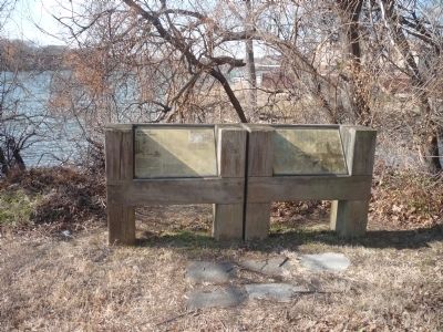
By Richard E. Miller, February 12, 2011
A Canal to the West - Tide Lock Marker Panels
1 ► District of Columbia, Washington, Northwest Washington, Foggy Bottom — A Canal to the West —  |
| On Rock Creek and Potomac Parkway Northwest 0.1 miles south of Virginia Avenue Northwest, on the right when traveling south. | |||
| 2 ► District of Columbia, Washington, Northwest Washington, Foggy Bottom — Godey's Lime Kilns — 1833 - 1908 — |
| Near L Street Northwest west of 26th Street Northwest, on the left when traveling west. | |||
| 3 ► District of Columbia, Washington, Northwest Washington, Foggy Bottom — Tide Lock — |
| On Rock Creek Trail Northwest 0.2 miles south of Virginia Avenue Northwest, on the right when traveling south. | |||
| 4 ► District of Columbia, Washington, Northwest Washington, Georgetown — A Long Stretch of Quiet and Peace… — |
| On Chesapeake and Ohio Canal Towpath at 31st Street Northwest, on the right when traveling west on Chesapeake and Ohio Canal Towpath. | |||
| 5 ► District of Columbia, Washington, Northwest Washington, Georgetown — An Industrial Georgetown — Chesapeake and Ohio Canal National Historical Park — National Park Service, U.S. Department of the Interior — |
| Near Chesapeake and Ohio Canal Towpath at Thomas Jefferson Street Northwest, on the left when traveling west. | |||
| 6 ► District of Columbia, Washington, Northwest Washington, Georgetown — At All Hours — Chesapeake and Ohio Canal National Historical Park — National Park Service, U.S. Department of the Interior — |
| On C&O Canal Towpath Northwest west of Thomas Jefferson Street Northwest, on the left when traveling west. | |||
| 7 ► District of Columbia, Washington, Northwest Washington, Georgetown — Canal House — |
| On Grace Street Northwest at Paper Mill Court Northwest, on the right when traveling west on Grace Street Northwest. | |||
| 8 ► District of Columbia, Washington, Northwest Washington, Georgetown — Canal Square — The history of Canal Square — |
| On M Street Northwest west of 31st Street Northwest, on the right when traveling east. | |||
| 9 ► District of Columbia, Washington, Northwest Washington, Georgetown — Chesapeake & Ohio Canal — |
| On Wisconsin Avenue Northwest at C&O Canal Towpath Northwest, on the right when traveling south on Wisconsin Avenue Northwest. | |||
| 10 ► District of Columbia, Washington, Northwest Washington, Georgetown — Chesapeake and Ohio Canal — National Historical Marker — |
| Near Rock Creek and Potomac Parkway Northwest south of Pennsylvania Avenue Northwest, on the right when traveling south. | |||
| 11 ► District of Columbia, Washington, Northwest Washington, Georgetown — Creating a National Park — Chesapeake and Ohio Canal National Historical Park — National Park Service, U.S. Department of the Interior — |
| On C&O Canal Towpath Northwest west of Thomas Jefferson Street Northwest, on the left when traveling west. | |||
| 12 ► District of Columbia, Washington, Northwest Washington, Georgetown — Francis Scott Key Park — A Place With It Own History |
| On M Street Northwest at 34th Street Northwest, on the left when traveling west on M Street Northwest. Reported permanently removed. | |||
| 13 ► District of Columbia, Washington, Northwest Washington, Georgetown — Georgetown and the Chesapeake & Ohio Canal — |
| Near C&O Canal Towpath Northwest east of Thomas Jefferson Street Northwest, on the left when traveling east. | |||
| 14 ► District of Columbia, Washington, Northwest Washington, Georgetown — Mule Power — Chesapeake and Ohio Canal National Historical Park — National Park Service, U.S. Department of the Interior — |
| On Thomas Jefferson Street Northwest south of M Street Northwest, on the left when traveling north. | |||
| 15 ► District of Columbia, Washington, Northwest Washington, Georgetown — The Duvall Foundry — 1050-30th Street, N.W. — |
| On 30th Street Northwest 0.1 miles south of M Street Northwest, on the right when traveling south. | |||
| 16 ► District of Columbia, Washington, Northwest Washington, Georgetown — The Georgetown House |
| On 31st Street Northwest at C&O Canal Towpath Northwest, on the left when traveling south on 31st Street Northwest. Reported permanently removed. | |||
| 17 ► District of Columbia, Washington, Northwest Washington, Georgetown — The Georgetown House — |
| On Chesapeake and Ohio Canal Towpath just east of 31st Street Northwest, on the right when traveling west. | |||
| 18 ► District of Columbia, Washington, Northwest Washington, Georgetown — The Georgetown House — |
| On 31st Street Northwest at Chesapeake and Ohio Canal Towpath, on the right when traveling north on 31st Street Northwest. | |||
| 19 ► District of Columbia, Washington, Northwest Washington, Georgetown — The History of Canal Square |
| On 31st Street Northwest south of M Street Northwest, on the left when traveling north. Reported permanently removed. | |||
| 20 ► District of Columbia, Washington, Northwest Washington, Georgetown — Tide Lock and Rock Creek Basin — Chesapeake and Ohio National Historical Park — National Park Service, U.S. Department of the Interior — |
| Near Virginia Avenue Northwest just west of Rock Creek and Potomac Parkway Northwest, on the right when traveling west. | |||
| 21 ► District of Columbia, Washington, Northwest Washington, Georgetown — William O. Douglas — |
| On Chesapeake & Ohio Canal Towpath at 30th Street Northwest when traveling west on Chesapeake & Ohio Canal Towpath. | |||
| 22 ► District of Columbia, Washington, Northwest Washington, Glover Park — Holy Rood Cemetery — Established 1832 — |
| On Wisconsin Avenue Northwest just south of W Place Northwest, on the right when traveling south. | |||
| 23 ► District of Columbia, Washington, Northwest Washington, The National Mall — A Family Affair — National Mall and Memorial Parks, Lincoln Memorial — National Park Service, U.S. Department of the Interior — |
| On 17th Street Northwest just south of Constitution Avenue Northwest (U.S. 50), on the right when traveling south. | |||
| 24 ► District of Columbia, Washington, Northwest Washington, The National Mall — Lock Keeper’s House — Formerly the Eastern Terminal of the Chesapeake and Ohio Canal — Erected about 1835 — |
| On Constitution Avenue Northwest (U.S. 50) at 17th Street Northwest, on the right when traveling east on Constitution Avenue Northwest. | |||
| 25 ► District of Columbia, Washington, Northwest Washington, The National Mall — The Canal Connection |
| On Constitution Avenue Northwest (U.S. 50) at 17th Street Northwest, on the right when traveling east on Constitution Avenue Northwest. Reported permanently removed. | |||
| 26 ► District of Columbia, Washington, Northwest Washington, The Palisades — Abner Cloud House — Chesapeake and Ohio Canal National Historical Park — National Park Service, U.S. Department of the Interior |
| Near Canal Road Northwest north of Reservoir Road Northwest, on the left when traveling north. Reported permanently removed. | |||
| 27 ► District of Columbia, Washington, Northwest Washington, The Palisades — Abner Cloud House — Chesapeake and Ohio Canal National Historical Park — National Park Service, U.S. Department of the Interior — |
| Near Canal Road Northwest north of Reservoir Road Northwest, on the left when traveling north. | |||
| 28 ► District of Columbia, Washington, Northwest Washington, The Palisades — Abner Cloud Mill — Echoes of Millstones — Chesapeake and Ohio Canal National Historical Park, National Park Service |
| On Capital Crescent Trail. Reported permanently removed. | |||
| 29 ► District of Columbia, Washington, Northwest Washington, The Palisades — Georgetown Incline Plane — Chesapeake and Ohio Canal National Historical Park — National Park Service, U.S. Department of the Interior — |
| On Capital Crescent Trail (at milepost 9), on the right when traveling east. | |||
| 30 ► District of Columbia, Washington, Northwest Washington, The Palisades — 6 — MacArthur Boulevard and the Washington Aqueduct — |
| On Q Street Northwest at MacArthur Boulevard, on the right when traveling west on Q Street Northwest. | |||
| 31 ► District of Columbia, Washington, Northwest Washington, The Palisades — Navigation of the Potomac — Chesapeake and Ohio Canal National Historical Park — National Park Service, U.S. Department of the Interior — |
| Near Canal Road Northwest north of Reservoir Road Northwest, on the right when traveling south. | |||
| 32 ► Maryland, Allegany County, Cumberland — A Canal Boat Replica—The Cumberland — |
| Near Canal Street 0.1 miles west of Wineow Street. | |||
| 33 ► Maryland, Allegany County, Cumberland — A Home on the Boat—The Captain's Cabin — |
| Near Canal Street 0.1 miles west of Wineow Street. | |||
| 34 ► Maryland, Allegany County, Cumberland — Alteration of the Site — Fort Cumberland Trail — |
| On Washington St., on the left when traveling west. | |||
| 35 ► Maryland, Allegany County, Cumberland — Boat Building at the Cumberland Basin — Chesapeake and Ohio Canal National Historical Park — National Park Service, U.S. Department of the Interior — |
| On W. Harrison Street, on the right when traveling south. | |||
| 36 ► Maryland, Allegany County, Cumberland — C&O Canal Terminus — C&O Canal N.H.P., Maryland — National Park Service, U.S. Department of the Interior — |
| Near Canal Street 0.1 miles west of Wineow Street. | |||
| 37 ► Maryland, Allegany County, Cumberland — Church of St. Patrick, Cumberland — |
| On North Centre Street at Market Street, on the right when traveling west on North Centre Street. | |||
| 38 ► Maryland, Allegany County, Cumberland — Civil War in Allegany County — Strategic Location — |
| On Canal Street south of Baltimore Street, on the left when traveling south. | |||
| 39 ► Maryland, Allegany County, Cumberland — Crossroads of America Mural — |
| On Canal Street 0.1 miles north of West Harrison Street, on the left when traveling north. | |||
| 40 ► Maryland, Allegany County, Cumberland — Cumberland — Strategic Center |
| Near Fort Avenue. Reported damaged. | |||
| 41 ► Maryland, Allegany County, Cumberland — Cumberland — Strategic Center |
| On Prospect Square at Washington Street, on the left when traveling north on Prospect Square. Reported permanently removed. | |||
| 42 ► Maryland, Allegany County, Cumberland — Cumberland — Town Map and Directory — Cumberland - The Place To Visit, The Place To Live |
| On Baltimore Street at Canal Street, on the right when traveling west on Baltimore Street. Reported damaged. | |||
| 43 ► Maryland, Allegany County, Cumberland — Cumberland — |
| On Great Allegheny Passage 0.1 miles north of Baltimore Street, on the left when traveling north. | |||
| 44 ► Maryland, Allegany County, Cumberland — Cumberland — Town Map and Directory — |
| On Canal Street just north of West Harrison Street, on the left when traveling north. | |||
| 45 ► Maryland, Allegany County, Cumberland — Cumberland — Historic City Center — |
| On Baltimore Street at North Liberty Street on Baltimore Street. | |||
| 46 ► Maryland, Allegany County, Cumberland — Cumberland — Historic City Center — |
| On Baltimore Street east of North Centre Street, on the left when traveling east. | |||
| 47 ► Maryland, Allegany County, Cumberland — Cumberland — |
| On Baltimore Street at South George Street, on the right when traveling east on Baltimore Street. | |||
| 48 ► Maryland, Allegany County, Cumberland — Cumberland — Historic City Center — |
| On Baltimore Street at North Liberty Street, on the right on Baltimore Street. | |||
| 49 ► Maryland, Allegany County, Cumberland — Cumberland — Historic City Center — |
| On Baltimore Street at South Mechanic Street, on the left when traveling west on Baltimore Street. | |||
| 50 ► Maryland, Allegany County, Cumberland — Cumberland — Historic City Center — |
| On Baltimore Street at North Mechanic Street, on the left when traveling east on Baltimore Street. | |||
| 51 ► Maryland, Allegany County, Cumberland — Cumberland Gateway Westward — Fort Cumberland Trail — |
| Near Greene Street. | |||
| 52 ► Maryland, Allegany County, Cumberland — Cumberland Terminus: Yesterday and Today — Chesapeake and Ohio Canal National Historical Park — National Park Service, U.S. Department of the Interior — |
| On W. Harrison Street, on the right when traveling south. | |||
| 53 ► Maryland, Allegany County, Cumberland — Cumberland Terminus: Yesterday and Today — Chesapeake and Ohio Canal National Historical Park — National Park Service, U.S. Department of the Interior — |
| On Howard St at Canal street on Howard St. | |||
| 54 ► Maryland, Allegany County, Cumberland — Explore a Trail Network — Chesapeake & Ohio Canal Towpath Cumberland Maryland — Chesapeake and Ohio Canal National Historical Park, National Park Service — |
| Near Canal Street 0.3 miles west of Wineow Street. | |||
| 55 ► Maryland, Allegany County, Cumberland — Irish Laborers — |
| Near Canal Street 0.2 miles Wineow Street. | |||
| 56 ► Maryland, Allegany County, Cumberland — Life on the Canal — Chesapeake and Ohio Canal National Historical Park — National Park Service, U.S. Department of the Interior — |
| On W. Harrison Street, on the right when traveling south. | |||
| 57 ► Maryland, Allegany County, Cumberland — McNeill’s Raid — Capture of Crook and Kelly — |
| On Baltimore Street at Queen City Drive, on the left when traveling east on Baltimore Street. | |||
| 58 ► Maryland, Allegany County, Keifers — Breaking Through a Mountain — Chesapeake and Ohio Canal National Historical Park — National Park Service, U.S. Department of the Interior — |
| Near Old Town Road (State Highway 51), on the right when traveling east. | |||
| 59 ► Maryland, Allegany County, Keifers — Paw Paw Tunnel Hill Trail — Chesapeake and Ohio Canal National Historical Park — |
| Near Tunnel Hill Road 0 miles north of Oldtown Road SE. | |||
| 60 ► Maryland, Allegany County, Oldtown — Oldtown and Lock 70 — Chesapeake and Ohio Canal National Historical Park — National Park Service, U.S. Department of the Interior — |
| On Green Spring Rd SE 0.1 miles south of Opessa St. | |||
| 61 ► Maryland, Frederick County, Brunswick — "The Town Between the Tracks" — |
| On Gross Alley west of South Maryland Avenue, on the left when traveling west. | |||
| 62 ► Maryland, Frederick County, Brunswick — Aqueduct Stones — |
| Near C & O Canal Towpath. | |||
| 63 ► Maryland, Frederick County, Brunswick — Berlin — Chesapeake and Ohio Canal National Historical Park — National Park Service, U.S. Department of the Interior |
| On South Maple Avenue, on the left when traveling west. Reported damaged. | |||
| 64 ► Maryland, Frederick County, Brunswick — Brunswick — Formerly Berlin — Gettysburg Campaign — |
| On Railroad Square, on the right when traveling east. | |||
| 65 ► Maryland, Frederick County, Brunswick — Brunswick — (Berlin) — |
| On West Potomac Street just east of North Virginia Avenue, on the right when traveling west. | |||
| 66 ► Maryland, Frederick County, Brunswick — Catoctin Aqueduct — Chesapeake and Ohio Canal National Historical Park — National Park Service, U.S. Department of the Interior — |
| On Lander Road (at milepost 51.5). | |||
| 67 ► Maryland, Frederick County, Brunswick — Explore a Trail Network — Chesapeake and Ohio Canal Towpath: Brunswick Maryland — Chesapeake & Ohio Canal National Historical Park, National Park Service, Department of the Interior — |
| On Chesapeake and Ohio Canal Towpath 0.3 miles west of South Maple Avenue, on the right when traveling east. | |||
| 68 ► Maryland, Frederick County, Brunswick — One Time Rivals — B&O Railroad and C&O Canal — |
| On North Maryland Avenue at West Potomac Street, on the right when traveling north on North Maryland Avenue. | |||
| 69 ► Maryland, Frederick County, Brunswick — The Beautiful Aqueduct — Chesapeake and Ohio Canal National Historical Park — National Park Service, U.S. Department of the Interior — |
| Near C & O Canal Towpath (at milepost 51.5). | |||
| 70 ► Maryland, Frederick County, Brunswick — Water Power — Chesapeake and Ohio Canal National Historical Park — National Park Service, U.S. Department of the Interior |
| Near South Maple Avenue, on the right. Reported damaged. | |||
| 71 ► Maryland, Frederick County, Brunswick — Welcome to Chesapeake and Ohio Canal National Historical Park TRACK Trail — Chesapeake and Ohio Canal National Historical Park — National Park Service, U.S. Department of the Interior — |
| On Chesapeake and Ohio Canal Towpath 0.2 miles west of South Maple Avenue, on the left when traveling west. | |||
| 72 ► Maryland, Frederick County, Myersville — C&O Canal — |
| Near Dwight D. Eisenhower Highway (Interstate 70), on the right. | |||
| 73 ► Maryland, Frederick County, Myersville — C&O Canal — |
| Near Dwight D. Eisenhower Highway (Interstate 70) 2 miles west of Maryland Route 17, on the right when traveling west. | |||
| 74 ► Maryland, Frederick County, Myersville — Explore Maryland In Search of Adventure — |
| Near Dwight D. Eisenhower Highway (Interstate 70) south of Baltimore National Pike (U.S. 40), on the right when traveling east. | |||
| 75 ► Maryland, Frederick County, Myersville — Explore Maryland in Search of Adventure — |
| On Dwight D. Eisenhower Highway. | |||
| 76 ► Maryland, Frederick County, Point of Rocks — A Lockkeeper's Life — |
| Near C & O Canal Towpath. | |||
| 77 ► Maryland, Frederick County, Point of Rocks — Battle at Point of Rocks — |
| On Canal Street, on the right when traveling west. | |||
| 78 ► Maryland, Frederick County, Point of Rocks — Lockhouse 28 — |
| Near C&O Canal Towpath. | |||
| 79 ► Maryland, Frederick County, Point of Rocks — Point of Rocks — Point of Rocks During the War — |
| On Clay Street (Maryland Route 28) east of Catoctin Mountain Road (U.S. 15). | |||
| 80 ► Maryland, Frederick County, Point of Rocks — Point of Rocks — Chesapeake and Ohio Canal National Historical Park — National Park Service, U.S. Department of the Interior — |
| On Canal Street. | |||
| 81 ► Maryland, Frederick County, Point of Rocks — Point of Rocks — A "Landmark" Community — Canal Towns • Point of Rocks — |
| On Monroe Street at Clay Street ( Route 28), on the right when traveling south on Monroe Street. | |||
| 82 ► Maryland, Frederick County, Point of Rocks — Point of Rocks — The C&O Canal — Canal Towns • Point of Rocks — |
| On Clay Street (Maryland Route 28) east of Monroe Street, on the right when traveling east. | |||
| 83 ► Maryland, Frederick County, Point of Rocks — Point of Rocks — Changes Over Time — Canal Towns • Point of Rocks — |
| On Clay Street (Maryland Route 28) just east of Commerce Street, on the right when traveling east. | |||
| 84 ► Maryland, Frederick County, Point of Rocks — Point of Rocks — |
| On Commerce Street at Clay Street ( Route 28), on the right when traveling north on Commerce Street. | |||
| 85 ► Maryland, Frederick County, Point of Rocks — Point of Rocks — The B&O Railroad — Canal Towns • Point of Rocks — |
| On Commerce Street 0.1 miles east of Monroe Street, on the right when traveling east. | |||
| 86 ► Maryland, Montgomery County, Bethesda — A Way for Fish — Chesapeake and Ohio Canal National Historical Park — National Park Service, U.S. Department of the Interior — |
| On Chesapeake and Ohio Canal Towpath, on the right when traveling south. | |||
| 87 ► Maryland, Montgomery County, Bethesda — Inlet Locks — Chesapeake and Ohio Canal National Historical Park — National Park Service, U.S. Department of the Interior — |
| On Chesapeake and Ohio Canal Towpath, on the right when traveling south. | |||
| 88 ► Maryland, Montgomery County, Bethesda — Lockhouse 6 — Chesapeake and Ohio Canal National Historical Park — National Park Service, U.S. Department of the Interior — |
| On Clara Barton Parkway. | |||
| 89 ► Maryland, Montgomery County, Bethesda, Brookmont — A Canal Home — Chesapeake and Ohio Canal National Historical Park — National Park Service, U.S. Department of the Interior |
| Near Clara Barton Parkway south of the Glen Echo Exit. Reported permanently removed. | |||
| 90 ► Maryland, Montgomery County, Cabin John — "The best scenery lies beyond the city, especially in the neighborhood of Cabin John Creek…" — Report of the McMillan Commission, 1902. — |
| On MacArthur Boulevard, on the right when traveling east. | |||
| 91 ► Maryland, Montgomery County, Cabin John — At All Hours — Chesapeake and Ohio Canal National Historical Park — National Park Service, U.S. Department of the Interior — |
| Near Clara Barton Parkway 1 mile east of Capital Beltway Inner Loop (Interstate 495). | |||
| 92 ► Maryland, Montgomery County, Cabin John — Building The Cabin John Bridge — |
| On MacArthur Boulevard, on the right when traveling east. | |||
| 93 ► Maryland, Montgomery County, Cabin John — Drop Gate Locks — |
| Near Clara Barton Parkway. | |||
| 94 ► Maryland, Montgomery County, Cabin John — Lockhouse 10 — Chesapeake and Ohio Canal National Historical Park — National Park Service, U.S. Department of the Interior — |
| Near Clara Barton Parkway 1.5 miles Capital Beltway Inner Loop (Interstate 495), on the right when traveling east. | |||
| 95 ► Maryland, Montgomery County, Cabin John — The Lock-Keepers — |
| Near Clara Barton Parkway 2 miles east of Capital Beltway Inner Loop (Interstate 495), on the right. | |||
| 96 ► Maryland, Montgomery County, Darnestown — Darnestown — Confederate Visit — Gettysburg Campaign — |
| On Darnestown Road (Maryland Route 28) 0.4 miles west of Seneca Road ( Route 112), on the right when traveling west. | |||
| 97 ► Maryland, Montgomery County, Darnestown — Darnestown: A Strategic Point of Defense — The Civil War — |
| Near Darnestown Road (Maryland Route 28) at Seneca Road (Route 112), on the right when traveling west. | |||
| 98 ► Maryland, Montgomery County, Darnestown — The Origins of Darnestown — Darnestown — |
| Near Darnestown Road (Route 28) just east of Seneca Road (Route 112), on the left when traveling east. | |||
| 99 ► Maryland, Montgomery County, Dickerson — Chesapeake & Ohio Canal — National Historical Park — |
| On Whites Ferry Road (Maryland Route 107) at River Road, on the left when traveling west on Whites Ferry Road. | |||
| 100 ► Maryland, Montgomery County, Dickerson — Chesapeake and Ohio Aqueduct — Across the Monocacy River — |
| On Dickerson Road (Maryland Route 28) at Mouth of the Monocacy Road, on the left when traveling north on Dickerson Road. | |||
197 entries matched your criteria. The first 100 are listed above. The final 97 ⊳