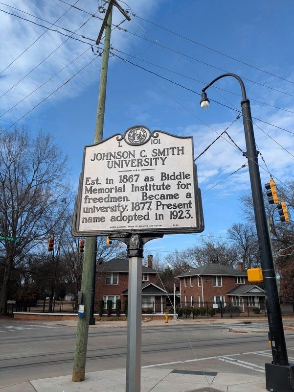
By Bruce InCharlotte, December 26, 2024
Johnson C. Smith University Marker
GEOGRAPHIC SORT Title Sort Marker Number Sort Marker Number Sort for Trails Publication Order Sort Publication Order Sort A Erected Year Sort Most Viewed Sort Most Recent-Interest Sort Most Recently Changed Sort SEE FAQ #33 FOR DESCRIPTIONS
On Beatties Ford Road at Dixon Street, on the right when traveling north on Beatties Ford Road.
On Greenville Street Northwest at Barnwell Avenue Northwest, on the right when traveling north on Greenville Street Northwest.
On Richland Avenue West (U.S. 1) near Morgan Street, on the right when traveling west.
On Whiskey Road (State Highway 19) near Colleton Ave Southeast, on the right when traveling north.
On Barnwell Avenue Northwest east of Lancaster Street, on the right when traveling east.
On Newberry Street Southwest north of First Avenue Southwest, on the right when traveling south.
On Gregg Avenue north of Augustus Drive, on the right when traveling north.
On South Boundary Avenue SE at Newberry Street, on the right when traveling east on South Boundary Avenue SE.
On Highland Park Drive near Highland Park Terrace SW, in the median.
On Laurens Street SW near S Boundry Avenue SW.
On Newberry Street Southwest north of South Boundary Avenue Southwest, on the right when traveling north.
On Highland Park Avenue Southwest at Highland Park Terrace Southwest, on the left when traveling west on Highland Park Avenue Southwest.
On Richland Avenue (U.S. 78) at Gregg Avenue, on the left when traveling east on Richland Avenue.
On Laurens Street Southwest at Downing Street Southwest, on the right when traveling south on Laurens Street Southwest.
On Richland Avenue West at Newberry Street Southwest, on the right when traveling east on Richland Avenue West.
Paid Advertisement
On East Pine Log Road (State Highway 302) at Notch Road Southeast, on the right when traveling east on East Pine Log Road.
Near Scholar Loop south of College Station Drive, on the right when traveling south.
On Mead Avenue east of Magnolia Street Southeast, on the right when traveling east.
On Laurens St. SW near Park Ave SW, on the right when traveling south.
On Park Avenue Southwest at Laurens Street Southwest, in the median on Park Avenue Southwest. Reported permanently removed.
On Pendleton Street SW (U.S. 1) at Hayne Avenue, on the right when traveling south on Pendleton Street SW.
On Newberry Street Southwest at Park Avenue Southwest, in the median on Newberry Street Southwest.
On S Boundary Ave SE at Chesterfield St. S, on the right when traveling west on S Boundary Ave SE.
On Magnolia Street Southeast north of Grace Avenue Southeast, on the left when traveling north.
On York Street Southeast south of Ray Lane, on the right when traveling south.
On Laurens Street Southwest south of Augusta Aiken Road (U.S. 78), on the left when traveling south.
On Carolina Avenue north of West Arlington Heights, on the right when traveling north.
On West Forest Avenue at Carolina Avenue on West Forest Avenue.
On W Forest Avenue, on the right when traveling east.
On Carolina Avenue south of Butler Avenue, on the right when traveling north.
On John Nunn Highway (State Highway 389) 0.5 miles east of Poole Road, on the right when traveling east.
Paid Advertisement
On Sand Dam Road (South Carolina Route 113) at A.L. Corbett Circle, on the right when traveling south on Sand Dam Road.
On Railroad Avenue E (State Highway 39) near Park Street NE, on the right when traveling west.
On River Road (South Carolina Route 3).
On Old Greenville Highway (State Highway 88), on the left when traveling north.
On Carolina Highway (U.S. 321), on the right when traveling north.
On Mt Pleasant Road (State Highway S-5-25) near Jager Road.
On Calhoun Street near Pope Lane, on the right when traveling south.
On Gumtree Road, on the right when traveling north.
On Seven Farms Drive near Indian Park Drive, on the right when traveling north.
On Brandywine Boulevard east of North Goose Creek Boulevard (U.S. 52).
On Old US 52 at Lewisfield Plantation Road, on the right when traveling north on Old US 52.
On Old State Road (U.S. 176) at Jericho Road (State Highway 9-26), on the right when traveling north on Old State Road.
On Mt. Lebanon Road 0.5 miles west of Old State Road (U.S. 176), on the right when traveling west.
On Cameron Road (State Highway 33) near Nate's Store Road (State Highway 9-27), on the right when traveling east.
On Old State Road (U.S. 176) north of Old Orangeburg Road, on the left when traveling north.
On Old Number 6 Highway (State Highway 6) near Sherlock Road, on the left when traveling north.
Paid Advertisement
On Fort Motte Road at Red Clay Road, on the right when traveling north on Fort Motte Road.
On Old State Road (U.S. 176) at Old Swamp Road (State Highway 9-353), on the right when traveling west on Old State Road.
On F R Huff Drive (State Road 9-46) south of Mill Road, on the right when traveling south.
On South Railroad Avenue (State Highway 9-48) at Dantzier Street, on the right when traveling south on South Railroad Avenue.
On Old Number 6 Highway (State Highway 6) near Bluebird Trail, on the right when traveling south.
On Agnes Street at Buyck Street, on the right when traveling west on Agnes Street.
On Old Belleville Road (County Route 24) north of Road 9-25, on the right when traveling north.
On Calhoun Road (State Road o-21) at Carr Street, on the right when traveling east on Calhoun Road.
On 3380 Ashley River Road (SC-61), on the right when traveling north.
On Riverland Drive west of Grimball Road, on the left when traveling west.
On Ashley River Road (South Carolina Route 61) 0.1 miles south of Plainview Road, on the right when traveling north.
On Ashley River Road (SC Highway 61) near Plainview Rd, on the right when traveling north. Reported permanently removed.
On Center Street (State Highway 171) near East Indian Avenue, on the left when traveling south.
On Rifle Range Road near Highway 10-51, on the right when traveling south. Reported missing.
On Long Point Road west of Garden Way, on the right when traveling west.
On Mathis Ferry Road (State Highway 10-56) near North Shelmore Blvd., on the right when traveling south.
Paid Advertisement
On Ben Sawyer Boulevard (State Highway 703) at Rifle Range Road on Ben Sawyer Boulevard.
On South Rhett Avenue (State Highway 10-60) near Buist Avenue, in the median. Reported permanently removed.
On Savannah Highway (U.S. 17), on the right when traveling south.
On Seaside Plantation Drive near Opposite Planters Trace Drive, on the right when traveling east.
On Poe Avenue near Palmetto Street, on the right when traveling east.
On Old Richburg Road (County Route 56) 0.6 miles east of Meador Road (County Route 74), on the right when traveling east.
On Main Street (State Highway 72) 0.1 miles west of Wylie Street, on the left when traveling east.
On West End Road (South Carolina Route 72/121) south of Carter Road ( Route 121), on the left when traveling east.
On West End Road (State Highway 215) 0.5 miles west of Store Road, on the left when traveling east.
On West Pine Avenue at South Sixth Street, on the right when traveling west on West Pine Avenue.
On Charleston Hwy (State Highway 64), on the right when traveling north.
On East Lynches River Road, on the right when traveling east.
On East Main Street at Pearl Street, on the right when traveling south on East Main Street.
On State Highway 38 near Exit 181 A (Interstate 95), on the right when traveling east.
On Ashley Phosphate Road near Windsor Hill Blvd., on the right when traveling west.
Paid Advertisement
On Ashley River Road (State Highway 61), on the right when traveling north.
On Landis Road 0.8 miles south of Highway 213, on the left when traveling south.
On State Highway 34, on the left when traveling west.
On Washington Street at Zion Street, on the left when traveling east on Washington Street.
On Congress Street 0.1 miles north of Moultrie Street, on the right when traveling south.
On Congress Street close to Washington Street, on the left when traveling north.
Near Congress Street at Washington Street, on the right when traveling south.
On Congress Street 0.1 miles north of Palmer Street, on the right when traveling south.
On Washington Street at Zion Street, on the right when traveling east on Washington Street.
On West Liberty Street at South Gadsden Street, on the left when traveling west on West Liberty Street.
On Congress Street 0.1 miles south of College Street, on the left when traveling south.
On E. Palmetto St. (U.S. 76), on the left when traveling east.
On East Palmetto Street (U.S. 76) at University Road, on the right when traveling west on East Palmetto Street.
On West Evans Street west of North Dargan Street, on the right when traveling west.
On East Maxwell Street east of Oakland Avenue ( Road S-21-24), on the right when traveling east.
Paid Advertisement
On Wilson Street south of Road 21-1508, on the right when traveling north.
On South Dargan St at East Palmetto Street (U.S. 76), on the left when traveling south on South Dargan St.
On South Dargan Street (State Road 21-354) south of East Elm Street (State Road 21-175), on the right when traveling north.
On North Price Road 0.2 miles east of Fore Road.
On State Highway 76 at Wallace Woods Road, on the right when traveling east on State Highway 76.
︽
286 entries matched your criteria. The first 100 are listed above.
Next 100 ⊳