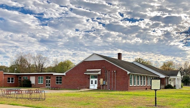
On East Military Road at Cherry Avenue, on the right when traveling east on East Military Road.
May 10, 1869, a petition was submitted the county court for established of School District No. One the Marion district. The formation of the district was approved by the circuit superintendent of public schools. The school operated by the original . . . — — Map (db m116779) HM
Near Arkansas Route 77 north of East Military Road, on the right when traveling south.
First Highway constructed in Arkansas, Hopefield
to Little Rock, extended to Fort Smith and into Indian Territory, (Oklahoma). Built by the United States under supervision of the Quartermasters Department of the United States Army. Survey was . . . — — Map (db m116549) HM
When the Mississippi River changed its course in the 1860's and moved East of
mound City, the boat landing
was moved to this spot.
Hopefield Lake was then the
main channel of the river where boats uploaded. — — Map (db m296521) HM
This fourth County Jail building was originally a two-story brick framed structure. Some of its hardware and cell materials were used in the construction of the 1911 jail built west of the courthouse. Abandoned and vacant from 1919, it was purchased . . . — — Map (db m234418) HM
On Court Street north of East Military Road, on the left when traveling north.
One of the city's biggest fires occurred
in the early 1900's when a series of
businesses in frame buildings on the
east side of Court Street were destroyed
by fire. Volunteer firefighters brought
water from Harvard yards by train to
help . . . — — Map (db m116545) HM
Near Arkansas Route 77 north of East Military Road, on the right when traveling south.
On April 27, 1865, the steamboat Sultana exploded on the Mississippi River. She was heading north, dangerously overloaded with some 2,200 passengers, most of them freed Union prisoners of war from the Andersonville and Cahaba camps. A . . . — — Map (db m116352) HM
Near Arkansas Route 77 north of Military Road, on the right when traveling south.
Early on April 27, 1865, the overcrowded steamboat Sultana exploded on the Mississippi River near Marion, Arkansas. The vast majority of the Sultana's passengers, believed to number over 2000, were Federal soldiers, recently released . . . — — Map (db m116356) HM
On East Military Road at Sycamore Street, on the right when traveling north on East Military Road.
News of the assassination of Abraham Lincoln on April 14, 1865 overshadowed the tragedy of the Sultana, which happened two weeks later.
The actual number of casualties from the SS Sultana is unknown, but some estimates are as high as 1,800. . . . — — Map (db m242015) HM
In 1831, a group of Native Americans collectively referred to as the Five Civilized Tribes: the Cherokee, Chickasaw, Choctaw, Muscogee, and Seminole, were living as autonomous nations in what would be later called the American Deep South. The . . . — — Map (db m234416) HM
On Pirani Headquarters Road near Dacus Road, on the left when traveling east.
About 100 yds. due North lies the bed of "A Lake Called Cayman", which once
ran into the Mississippi at
Mound City. In Spanish, Cayman means "Alligator". The
later named Lake Grandee is
now known as Marion Lake. — — Map (db m299211) HM
On Dacus Road 0.1 miles east of County Route 27, on the right when traveling east.
In North America, the Indians
were building mounds such as
these from before the time
of Christ until after DeSoto
explored this area. These are
believed to be villages of
the Aquixo or Pacaha, 1541. — — Map (db m221347) HM
On East Broadway Boulevard (U.S. 70) at South 2nd Street, on the right when traveling east on East Broadway Boulevard.
The inaugural broadcast of West Memphis' KWEM radio station on February 23, 1947, set the stage for what would become one of the pioneering platforms for Delta blues and the beginnings of the rock 'n' roll sound.
Here at 231 Broadway Boulevard in . . . — — Map (db m221358) HM
On Dacus Road at Wheeler Road, on the left when traveling west on Dacus Road.
An old river town, once located on the banks of the Mississippi River, deriving its name from Indian mounds. Federal troops burned it January 15, 1863. — — Map (db m221342) HM
On East Broadway Avenue (U.S. 70) near Route 38, on the left when traveling east.
In 1943, Morris Berger opened his legendary Plantation Inn
nightclub on this site in a former West Memphis gambling hall.
Billed as having the largest dance floor in the South, it became an
electrifying live-music destination for the region until . . . — — Map (db m221350) HM
Near State Highway 184 0.6 miles north of U.S. 64, on the left when traveling north.
The Ott family of Parkin purchased the
Northern Ohio School from the Kelly family in
1959. The Kellys had been using the school
for a hay barn. The Ott family transformed
the old "barn" into a home by portioning
rooms and designing a living . . . — — Map (db m221318) HM
Near State Highway 184 0.6 miles north of U.S. 64, on the left when traveling north.
Step into the school gently. It's filled with history
and memories … maybe some from your school days.
As you enter the school you will see the
classroom as it was on any given school day
between 1936 and 1948. The school was . . . — — Map (db m221320) HM
On State Highway 184 0.6 miles north of U.S. 64, on the left when traveling north.
Much of what is known about the Northern
Ohio School came from first-hand accounts
known as oral histories. People interviewed
were former students, teachers, children of
the sawmill owners and workers, persons who
lived in Sawdust Hill, or . . . — — Map (db m221319) HM
On Arkansas Route 184 0.4 miles north of U.S. 64, on the left when traveling north.
The legacy of the Mississippian culture lives forever through the Three Sisters Garden, like the one you see planted here.
The American Indians who lived here over 500 years ago were expert farmers whose most important crops were corn, beans, . . . — — Map (db m116605) HM
On State Highway 184 at U.S. 64 on State Highway 184.
Welcome to Northeast Arkansas Pick up your Discovery our guide in the part visitor for center.
From pre-history to today, people have come here for a variety of reasons. Settlers found a state rich in wildlife and wilderness. Ancient . . . — — Map (db m232112) HM
On State Highway 184 0.2 miles north of U.S.64, on the left when traveling north.
Ongoing warfare with other
Native American groups
led villagers to construct a
defensive ditch around their
town. The depression before
you was a formidable obstacle
to anyone trying to attack. You
will cross this ditch several
more times . . . — — Map (db m231813) HM
Near State Highway 184 0.6 miles north of U.S. 64, on the left when traveling north.
As northern timberlands were depleted,
timber buyers looked to the dense forests in
the south. In March 1902, S.W. Sterling, a
timber buyer for a firm in Grafton, Ohio,
was buying timber in Missouri when he
heard about the fine timber at . . . — — Map (db m221310) HM
Near State Highway 184 0.6 miles north of U.S. 64, on the left when traveling north.
Rural education in the Delta was no easy task
for students or teachers. There were many
obstacles to overcome, such as weather,
walking distances, and family responsibilities.
Plus, being an African-American school,
students and teachers were . . . — — Map (db m221316) HM
Near State Highway 184 0.6 miles north of U.S. 64, on the left when traveling north.
Daily lessons revolved around the "three R's:"
reading, writing and arithmetic. The Child's
World Reader, a basic math book, and a
speller were the textbooks used.
Class was in session from 8AM through 3PM
except in September and . . . — — Map (db m221317) HM
On Wilson Street at Lake Street, on the left when traveling south on Wilson Street.
The flood of 1912 was the greatest disaster ever suffered by Parkin. Breaks in the St. Francis and Mississippi levees covered the land and into our homes from 4 to 30 feet in depth in April and part remained until summer. Most of the people fled to . . . — — Map (db m234421) HM
Near State Highway 184 0.6 miles north of U.S. 64, on the left when traveling north.
Around 1900, there were about 16 one-room
schoolhouses in and around Parkin. Most
were on plantations for the education of the
sharecroppers' and farm workers' children.
The Northern Ohio School, built around 1910,
was no different. The school . . . — — Map (db m221314) HM
On State Highway 184 0.2 miles U.S. 64, on the left when traveling north.
The Parkin archeological site was preserved better than most because it was reoccupied during most of the 20th century. The residents who lived on the ancient village site. In the 1900s came to call their neighborhood Sawdust Hill or simply “The . . . — — Map (db m231817) HM
Near State Highway 184 0.6 miles north of U.S. 64, on the left when traveling north.
As the Northern Ohio Cooperage and Lumber
Company expanded, so did the need for housing and
services for its workers. Out of this came the Sawdust
Hill community. At its peak, over 60 structures,
including shotgun-style houses, a Baptist church, . . . — — Map (db m221309) HM
Near State Highway 184 0.6 miles north of U.S. 64, on the left when traveling north.
Arkansas experienced a number of economic
advances in the first quarter of the 20th
Century. Extensive railroad building in the
late 1800s set the stage for economic growth.
Although the Delta's popular economic image
is King Cotton, . . . — — Map (db m221313) HM
On Ark. State Hwy 184 0.1 miles Us Hwy 64, on the left.
In 1541 Chief Casqui
greeted Hernando
de Soto not far from.
where you are standing.
This trail highlights the unique
history of the archeological site.
The fully accessible 1/4 mile trail
will take you approximately 30
minutes to walk. . . . — — Map (db m233181) HM
On State Highway 163 2.2 miles south of Highway 64, on the left when traveling south.
After Arkansas seceded from the Union in May 1861, Confederate officers began to recruit in the Wittsburg area. Companies B, D, F and K of the 5th Arkansas Infantry Regiment were organized at Wittsburg June 12-14, 1861. David Cross, for whom Cross . . . — — Map (db m116179) HM
When the north-south line of the Iron Mountain Railroad was completed in 1882 the town of Wynne was located when a train derailed leaving one boxcar, without wheels, off the track. The car was placed upright and called Wynne Station in
compliment . . . — — Map (db m256099) HM
On South Falls Boulevard (State Highway 1) at East Union Avenue, on the right when traveling north on South Falls Boulevard.
The county was named for Col. David C. Cross. First seat of justice, Cleburne 1865. Moved to Wittsburg 1865 where it remained until 1884 when it was removed to Vanndale and later in 1903 the county seat was established at Wynne, where it has since . . . — — Map (db m158125) HM
Down the trail from where you are standing is the most well-preserved remaining section of the historic Trail of Tears in Arkansas.
Tradition and heritage run deep jn the collective souls of the Five Southeastern Tribes (Choctaw, Chickasaw, . . . — — Map (db m142034) HM
On Desoto Avenue at Sprague Street, on the right when traveling east on Desoto Avenue.
Between the years of 1873 and 1927, Arkansas
City had one of the most important ports on the
Mississippi River. Before being an established
port, a steamboat landing was located at this
site as early as 1834, This port was also known
as the . . . — — Map (db m299004) HM
On Robert S Moore Avenue at Natchez Street, on the left when traveling east on Robert S Moore Avenue.
The county seat of Desha County, named for Captain Ben Desha. Was located in 1838, soon after the creation of the county, at Napoleon where it remained until 1874. — — Map (db m299001) HM
On Capitol Street near Kate Adams Avenue, on the right when traveling east.
Accompanied by Henri de Tonti on their way down the Mississippi River in 1682. Landed near the mouth of the Arkansas River. They spent several days at a nearby village of Quapaw or Arkansas Indians. — — Map (db m299688) HM
On Capitol Street close to Kate Adams Avenue, on the left when traveling south.
The Flood of 1927 was the greatest disaster
ever suffered by the county. Breaks in the
Arkansas and Mississippi River levees, within
the county covered the land with water from
4 to 30 feet in depth in April and part
remained until summer. Most . . . — — Map (db m299003) HM
On Morning Star Avenue, on the right when traveling west.
Johnny Johnson was born January 19,
1918 to Leroy and Gertrude Johnson in
Arkansas City, Arkansas. This house is his
boyhood home. Johnny Johnson and his
mother relocated to Chicago, Illinois in
1933. He was a renowned
entrepreneur , . . . — — Map (db m299919) HM
On Capitol Street at Kate Adams Avenue on Capitol Street.
The X.O. Pindall Law Office was built
Circa 1882 and is on the National Register of Historic Places.
The law office of the former Arkansas Governor was given to the
University of Arkansas at Monticello by Robert and Beverly Moore on December 13, . . . — — Map (db m299918) HM
On Pickens Street (U.S. 165) east of Jack Dante Drive, on the right when traveling east.
The Arkansas Indians (the down stream people), a branch of the Quapaw tribe, lived in Desha County. Their presence was first recorded by Marquette and Joliet, French explorers, in 1673. They were known as les Beaux Hommes. La Salle while . . . — — Map (db m107809) HM
This important river port, county seat of Desha County from 1838 to 1874, was located 24 miles east at the junction of the Arkansas River with the Mississippi. The town was finally abandoned after most of it washed into the Mississippi River. — — Map (db m107758) HM
On Kelso Road 0.3 miles east of State Route 1, on the right when traveling east.
In mid-February 1863, Confederate troops at Cypress Bend fired on Union transports on the Mississippi River. On Feb. 19, a force of Union cavalry and mule-mounted infantry set out in pursuit. The Union troops drove off enemy pickets before . . . — — Map (db m107693) HM
On North 2nd Street just north of Oak Street, on the left when traveling north.
The first school in McGehee was started about 1903 in a one room frame building at this location, with Miss Puntney as teacher. In 1905, in this building Reverend J. L. Cannon organized the McGehee First Methodist Episcopal Church. There were ten . . . — — Map (db m229500) HM
On North First Street (U.S. 278) at East Seamans Drive, on the right when traveling north on North First Street.
In memory of each serviceman in Desha County, who gave their lives for their country in World War II. The American Legion Auxiliary Unit of the Claude E. Jaynes American Legion Post 79, passed a resolution to make Seamans Drive the site for this . . . — — Map (db m229497) WM
Near State Highway 1 0.5 miles north of Rohwer Road, on the left when traveling north.
Where you now see cotton fields, 432 barracks once housed about 8,000 Japanese Americans.The Camp was surrounded by a barbed wire fence linking eight guard towers from which armed guards watched the camp and internees. The cam was divided by . . . — — Map (db m170077) HM
Near State Highway 1 0.5 miles north of Rohwer Road, on the left when traveling north.
Years of discrimination and the Japanese attack on Pearl Harbor led to the forced removal and imprisonment of Japanese Americans. All Japanese Americans on the West Coast were affected by the forced evacuation - including women and . . . — — Map (db m169429) HM
Near State Highway 1 0.5 miles north of Rohwer Road, on the left when traveling north.
Internees tried to re-create a life they might have lived
outside of confinement.
Earning money in camp was a constant struggle for internees, bills still had
to be paid on property left behind and everyone needed to buy clothes, . . . — — Map (db m169434) HM
Near State Highway 1 0.5 miles north of Rohwer Road, on the left when traveling north.
Dedicated to the Patriotic Japanese-American men from Rohwer Internment Camp who sacrificed their lives in the service of their country in World War II.
U.S. Fifth Army - 100 Battalion - 442 Regiment
Cassino Anzio . . . — — Map (db m170092) HM WM
Near State Highway 1 north of Rohwer Road, on the left when traveling north.
The Rohwer internment camp included a 500-acre area for internee living quarters and more than 10,000 acres of surrounding land for farming and timber harvesting. Officially labeled a relocation center, the internment camps for Japanese . . . — — Map (db m167628) HM
Near Arkansas Route 1 north of Rohwer Road, on the left when traveling north.
The U.S. entry into World War II led to the forced removal of-
nearly 120,000 Japanese Americans from the West Coast
The Japanese Navy attacked Pearl Harbor, Hawaii on December 7,
1941, and America declared war on Japan the next day. . . . — — Map (db m167967) HM
Near State Highway 1 0.5 miles north of Rohwer Road, on the left when traveling north.
Babies were born, children went to school, adults had jobs, and some people died here during the three years that the Rohwer camp operated. The traditional Japanese family structure was threatened by the camp's communal living conditions: . . . — — Map (db m170078) HM
Near State Highway 1 0.5 miles north of Rohwer Road, on the left when traveling north.
"Let's teach (our children) that even in a life such as this, our hearts do not despair, that,
although wwe left behind many material things, we did not leave our courage, our fortitude,
and our ability to do the best with the least." . . . — — Map (db m169055) HM
Near State Highway 1 0.5 miles north of Rohwer Road, on the left when traveling north.
The relocation center sites were chosen because of their distance from the West
Coast and for their suitability and isolation as secured, closed camps. Inside The Relocation Center The loss of their former lives was profound for the . . . — — Map (db m169430) HM
Local Ingenuity
Most communities along today's Delta Heritage Trail were once railway town-settlements created near rail routes where none existed before. One exception is Laconia Circle, an area close to Snow Lake with an
18-mile levee . . . — — Map (db m299923) HM
A Brief History of this Railroad
1873 New York financier Jay Gould purchases Union Pacific Railroad stock.
1879 Gould buys controlling interest in Missouri Pacific Railroad.
1881 Missouri Pacific buys control of St . . . — — Map (db m299926) HM
Walk or bike this trail
into the heart of the
Arkansas Delta.
Your journey on this
historic rail route
transports you through
time, connects you with
communities, and reveals
rich Delta heritage.
The State of Arkansas acquired this . . . — — Map (db m299927) HM
Era Ends, Era Begins
Large-scale farm and businesses were established here during the early 1800s, when people relied heavily on riverboats for transportation. As a formal community, Snow Lake was established with the arrival of the railroad . . . — — Map (db m299922) HM
On Arkansas Route 1 at Front Street, on the right when traveling east on Arkansas Route 1.
Watson became the county seat of Desha County after Napoleon was abandoned to the Mississippi River. Lewis W. Watson donated the land and built the courthouse near this site. The county seat was moved to Arkansas City in 1880. Watson remained the . . . — — Map (db m107757) HM
On U.S. 165 near Ellington Farm Road (County Road 210), on the right when traveling north.
On February 19, 1942, Pres. Franklin
Roosevelt signed into law Executive
Order No. 9066, interning over 120,000
persons of Japanese ancestry, and
this act irrevocably changed their
lives. The majority of these people
were American citizens. As . . . — — Map (db m170318) HM
Near South Main Street (State Highway 83) south of East Shelton Avenue, on the right when traveling south.
Drew County, named for Governor Thomas S. Drew, was organized in 1845 and Monticello was laid out in 1849 as the county seat. Many pioneer families whose sons and daughters became prominent in the affairs of State and Nation lived here. — — Map (db m85085) HM
On South Main Street (State Highway 83) south of East Shelton Street, on the right when traveling south.
(side 1)
Sixteen Confederate companies were raised in Drew County during the Civil War. Two, the "Confederate Stars" and "Selma Rifles," joined the 3rd Arkansas Infantry and fought with the Army of Northern Virginia. Three, the "Cut-off . . . — — Map (db m85087) HM
Near West Oakland Avenue at North Hyatt Street, in the median.
To the
Confederate
Soldiers
of Drew County.
1861—1865
Furl that banner! True,
'tis gory,
yet 'tis wreathed around
with glory,
and 'twill live in song
and story,
though its folds are
in the dust.
Father Ryan . . . — — Map (db m85093) WM
Erected by the citizens of Drew County in honor of all who served or who may serve and dedicated to those who gave their lives that we might be free. Veterans Day 1988.
World War I
B.C. Bast, George F. Cater, Chisley Garrison, Forrest . . . — — Map (db m85089) WM
On Gym Street just west of State Highway 135, on the left when traveling west.
Lafe School Bell Lafe & Marmaduke Annex 1984 Lafe School burned 1989 Bell donated by: Sally Shepard Installed by: Mayor Ralph "Huck" Oglesby 1-15-2024 — — Map (db m297389) HM
On County Road 628 south of White Road, on the right when traveling south.
The 5th Arkansas Infantry Regiment was organized on June 28, 1861, at Gainesville about 7 miles northwest of modern-day Paragould. Men from Greene County served in Companies C, D, E and H. The soldiers trained and camped near the springs at Camp . . . — — Map (db m170413) HM
On W. Court Street at N Third Street, on the left when traveling west on W. Court Street.
In memory of
SPC. Steven Glen Mason
Sept. 27,1967 - Feb. 25, 1991
SFC. Earnest F. Mitchen Jr.
Sept. 14, 1949 - Apr. 13, 1991
"It is a worthy thing to fight for one's freedom. It is another sight finer to fight for another . . . — — Map (db m227816) WM
On West Court Street at South 3rd Street, on the right when traveling east on West Court Street.
Let us hold in honored memory those men from Greene County who gave their lives that mankind might hope for a better world. World War I
Ranzi Adams • Lon Austin • Charles J. Barnett • Jimmie Bonds • Arlin Boone • Luther F. Bowlin • William B. . . . — — Map (db m151233) WM
Near Arkansas Route 168 0.6 miles north of Route 141, on the right when traveling north.
Crowley's Ridge State Park is here today due to the hard work, dedication, and
ingenuity of the local community and the Civilian Conservation Corps.
Crowley's Ridge State Park is home to log and stone structures
built by the Civilian . . . — — Map (db m170555) HM
On Arkansas Route 168 0.6 miles north of Route 141, on the right when traveling north.
Crowley's Ridge State Park is here today due to the hard work, dedication, and ingenuity of the local community and the Civilian Conservation Corps.
Roosevelt's Tree Army
The men of Civilian Conservation Corps (CCC) companies
1729, 2736, . . . — — Map (db m170556) HM
On East Chestnut Street at North Poplar Street, on the right when traveling east on East Chestnut Street.
The site of Marianna was acquired through a deed from Mary Ann Harland and the heirs of her first husband, Daniel Martin. The town was named in her memory. She was born in Kentucky May 6, 1802: died October 25, 1857. The first court house in Lee . . . — — Map (db m116135) HM
Near East Main Street at North Poplar Street when traveling south.
South face
“Fidelis
Fortissimus.”
1861
1865
Erected by
D. G. Govan Chapter
U. D. C.
In loving memory, of
Lee County's
Confederate
Soldiers.
______
"No braver bled for a
brighter land . . . — — Map (db m117504) WM
Home site and grave of John Patterson, son of William Patterson, Born 1790; died 1886; Arkansas' first native born child of Anglo-Saxon parentage. The following riddle was often asked by John Patterson: I was born in a kingdom--Spain, reared in an . . . — — Map (db m258081) HM
On East Chestnut Street at Court Street, on the left when traveling east on East Chestnut Street.
East Side
Greater love hath no man than to lay down his life for his country.
Dedicated by the citizens of Lee County to those who made the ultimate sacrifice in defense of their country.
North Side
Korean War . . . — — Map (db m117251) WM
Near Court Street north of East Main Street, on the left when traveling north.
Marianna named in honor of
Maryann Martin Harland
Town established 1858 A.D.
Incorporated Oct. 24, 1870 A.D.
1870 Agriculture, Timber
Population 165
1970 Agriculture, Industry
Population 6215 — — Map (db m117262) HM
On Front Street at South Main Street, on the right when traveling east on Front Street.
Moro in the Civil War
The town of Moro was established in 1850 and about 700 people lived here and nearby when the Civil War began in 1861. Union troops from the 1st Indiana, 1st Missouri, 9th Illinois, 5th Kansas, 2nd Wisconsin, and 3rd . . . — — Map (db m116247) HM
On Main Street near US 61/ Blues Highway, on the left when traveling north.
Flag pole erected to commemorate the 200th anniversary of the United States of America Bassett Arkansas Calvin Williams Mayor · Larry Joe Bell Alderman · Hugh Arue Jr. Alderman · Nardie Westbrook Alderman · Joe W Felts Alderman · Jewell Ryals . . . — — Map (db m298907) WM
On Great River Road (U.S. 61) 0.7 miles east of State Highway 181, on the left when traveling east.
One of eight prisoner of war camps in Mississippi County, the Bassett camp housed German soldiers captured and shipped to the United States. POWs worked in the cotton fields during their captivity, several taking up agriculture after returning to . . . — — Map (db m170720) HM
On W Ash Street, on the right when traveling west.
During segregation in the twentieth century, Ash Street was the social and commercial heart of the Black community of Blytheville. On Saturdays, when sharecropper families would dress up and come to town, Ash could be so crowded that people would . . . — — Map (db m213826) HM
On West Walnut Street at N 3rd St, on the left when traveling east on West Walnut Street.
1st Lt. Larry Gene Moody · Sgt. Ephron Wallace Jr. · SFC. Jerald Dozier · Sgt. Everett Langston · PFC Arthur Ray Keeling · PFC Freddy Friar · Lt David F. "Rick" Taylor · Sgt. Samuel Lee Modesitt · Sgt. John H. Stout · PFC Joel Crockett · Sp4 . . . — — Map (db m212027) WM
On West Walnut Street at N. 3rd Street, on the left when traveling east on West Walnut Street.
The White House
Washington The president of the United States takes pride in awarding the Medal of Honor posthumously to
First Lieutenant Edgar H. Lloyd
Infantry U. S. Army Citation For conspicuous gallantry and intrepidity at . . . — — Map (db m215338) WM
On West Walnut Street at North 3rd Street, on the right when traveling east on West Walnut Street.
In memoriam to those men from Mississippi County who gave their lives in the Korean War 1950-1953 Capt. William O. Boyd · Pvt. William H. Charles · Sgt. Louis A. Webb · Cpl. Billy L. Crain · PFC. Duane Brown · Pvt. Billy L. Hopper · PFC. Gerald . . . — — Map (db m212140) WM
On W Vine Street at S. 3rd Street, in the median on W Vine Street.
Before 1776 this area was inhabited by Indian Mound builders, bayous were the only drainage and there was no flood control, there was an immense forest that consisted mostly of hardwoods and cypress, in the early 1900's drainage districts began to . . . — — Map (db m212074) HM
On Center Drive at Main Street (County Road 297) on Center Drive.
A variety of colony services were housed in the original building on this site. When it burned in 1944, the theater and pop shop took its place. — — Map (db m207512) HM
On Center Drive at Main Street (State Highway 297), on the right when traveling north on Center Drive.
Also called the Co-op Store, Trading Post, or The Big Store, this building carried everything colonist families needed. It burned in June 1957. — — Map (db m207494) HM
On Church Street west of Main Street (County Highway 297), on the right when traveling south.
This Dyess Colony gathering place included an auditorium, a library, and space for community meetings and activities. Joint church services also were held here until the various denominations could build their own churches. Ministers from three . . . — — Map (db m207904) HM
On Center Drive at Main Street, on the right when traveling south on Center Drive.
In commemoration of
W.R. Dyess
whose vision and effort
as relief administrator
of Arkansas
fostered into a reality
Dyess Colony — — Map (db m296109) HM
On Center Drive at Main Street (County Road 297), on the right when traveling south on Center Drive.
Established in 1934 by President Roosevelt, Dyess Colony, named for W.R. Dyess of Luxora, became home to 500 families stricken by the Great Depression. Selected on the bases of need, farming knowledge, and physical fitness, these pioneers each . . . — — Map (db m207238) HM
On County Road 924 0.3 miles east of State Route 77, on the right when traveling east.
Johnny Cash (1932-2003) was one of the most influential musicians of the
20th century. Successful with country, rock & roll, folk, blues, and gospel music, Cash sold over 90 million albums during his long career. Several of his songs reflect his . . . — — Map (db m160373) HM
On East 4th Street at North Oak Street, on the left when traveling east on East 4th Street.
Vacant homes or buildings served as elementary classrooms during the colony's early years, while secondary students were bused to neighboring school districts. Dyess School, accommodating high school and elementary students, was completed by the . . . — — Map (db m207903) HM
An expedition of about 100 soldiers of the Second Missouri Artillery (U.S.) set out from Osceola on April 5, 1864, in pursuit of guerrillas who had just robbed the town. Marching through dense swamps with water from 1 to 3 feet deep, the Missouri . . . — — Map (db m170408) HM
On State Highway 140 east of State Route 136, on the left when traveling east.
Dedicated in loving memory to those brave and honorable veterans who unselfishly sacrificed for love of country and freedom.
May 29, 2000 — — Map (db m221254) WM
On Arkansas Route 140 east of Route 136, on the left when traveling east.
On this site in 1934, Garden Point Methodist Church was founded. Sam Wiggins, a Methodist preacher from the Jonesboro district, held a tent revival here and from that revival evolved the Garden Point church. On September 2, 1935, land was deeded to . . . — — Map (db m221257) HM
On Route 140 east of Route 136, on the left when traveling east.
In loving memory of my brother
Joseph Allen Sisco
Technical Sergeant
AF1412 1721
Nov. 11, 1922 – Aug. 20, 1948
Son of Brownie and Daisy (Swift) Sisco
Brother to Earl, Clara, Lee, Sue, Anna and Mary Lou
Joe was born and raised in . . . — — Map (db m221255) WM
On Memorial Drive at Chestnut Drive, on the right when traveling east on Memorial Drive.
To honor the memory of these brave men from the 97th Bombardment Wing at Blytheville Air Force Base who did not return after their B-52 aircraft was shot down over Hanoi, North Vietnam in December 1972
Col. Keith R. Heggen • Lt. Col. Donald . . . — — Map (db m24056) HM WM
371 entries matched your criteria. Entries 101 through 200 are listed above. ⊲ Previous 100 — Next 100 ⊳