932 entries match your criteria. Entries 301 through 400 are listed.⊲ Previous 100 — Next 100 ⊳
Lewis & Clark Expedition Historical Markers
Sent by Jefferson to explore the far west, the Corps of Discovery left Pittsburgh August 31st, 1803 and reached the mouth of the Columbia River in the Pacific Northwest on November 15th, 1805.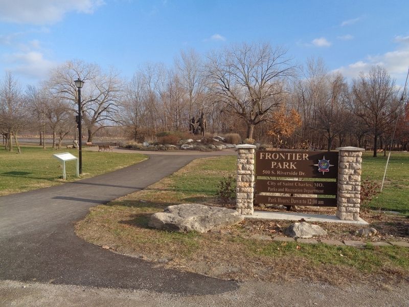
By Jason Voigt, December 16, 2020
The Lewis and Clark Expedition Across Missouri Marker
| 301 ► Missouri, St. Charles County, St. Charles — The Lewis and Clark Expedition Across Missouri |
| On South Riverside Drive, on the right when traveling north. Reported missing. | |||
302 ► Missouri, St. Charles County, St. Charles — The Lewis and Clark Expedition Across Missouri —  |
| Near South Riverside Drive east of Boone's Lick Road. | |||
| 303 ► Missouri, St. Charles County, St. Charles — The Lewis and Clark Expedition Rendezvous Site — May 16-21, 1804 — |
| On South Main Street at Water Street, on the right when traveling east on South Main Street. | |||
| 304 ► Missouri, St. Charles County, St. Charles — Tracking the Boats — |
| Near South Riverside Drive 0.2 miles south of Boone's Lick Road, on the left when traveling south. | |||
| 305 ► Missouri, St. Charles County, Weldon Spring — Weldon Spring to Matson — Points of Interest — |
| Near State Highway 94 2.1 miles east of State Highway DD, on the right when traveling east. | |||
| 306 ► Missouri, St. Charles County, West Alton — Lewis and Clark at the Confluence Point — |
| Near Trail to Confluence south of Riverlands Way. | |||
| 307 ► Missouri, St. Louis, Bellefontaine Cemetery — William Clark Monument — |
| On W Florissant Ave. | |||
| 308 ► Missouri, St. Louis, Downtown — Lewis and Clark and St. Louis Riverfront |
| On N Leonor K Sullivan Blvd. at Washington Ave., on the left when traveling south on N Leonor K Sullivan Blvd.. Reported missing. | |||
| 309 ► Missouri, St. Louis, Downtown — The Captains' Return — |
| On North Leonor K Sullivan Boulevard 0.3 miles south of Laclede's Landing Boulevard, on the left when traveling south. | |||
| 310 ► Missouri, St. Louis, Downtown — William Clark died at this site — |
| On North Broadway at Olive Street, on the left when traveling south on North Broadway. | |||
| 311 ► Missouri, St. Louis, Near North Riverfront — Biddle Street Trailhead — |
| On North Leonor K Sullivan Boulevard at Biddle Street, on the right when traveling north on North Leonor K Sullivan Boulevard. | |||
| 312 ► Missouri, St. Louis, Near North Riverfront — The Lewis and Clark Expedition Across Missouri — |
| Near St. Louis Riverfront Trail just south of East Prairie Avenue, on the right when traveling south. | |||
| 313 ► Missouri, St. Louis County, Florissant — Sunset Greenway — |
| Near Sunset Park Drive. | |||
| 314 ► Missouri, St. Louis County, Hazelwood — Charbonier Bluff — Saint Stanislaus Conservation Area — Lewis and Clark National Historic Trail — |
| On Old Charbonier Road east of Aubuchon Road, on the right when traveling east. | |||
| 315 ► Missouri, St. Louis County, Lemay — The Lewis and Clark Expedition Across Missouri — |
| Near Bagby Road. | |||
| 316 ► Missouri, St. Louis County, Spanish Lake — Fort Belle Fontaine — |
| On Bellefontaine Road 0.6 miles east of Fountainhead Lane, on the left when traveling east. | |||
| 317 ► Missouri, St. Louis County, Spanish Lake — Lewis and Clark — Confluence — Columbia Bottom, Missouri — |
| On Upper Columbia Bottom Road, in the median. | |||
| 318 ► Missouri, St. Louis County, Spanish Lake — The Lewis and Clark Expedition — Fort Belle Fontaine — 22 September 1806 — |
| On Bellefontaine Road 0.7 miles north of Fountainhead Lane, on the left when traveling east. | |||
| 319 ► Missouri, St. Louis County, Spanish Lake — Welcome to Fort Belle Fontaine — |
| Near Bellefontaine Road 0.4 miles north of Fountainhead Lane, on the left when traveling north. | |||
| 320 ► Missouri, St. Louis County, University City, Delmar Loop — William Clark — Born August 1, 1770 — |
| On Delmar Boulevard at Leland Avenue, on the right when traveling west on Delmar Boulevard. | |||
| 321 ► Missouri, Ste. Genevieve County, Ste. Genevieve — The Lewis and Clark Expedition Across Missouri — |
| On Matthews Drive west of Little Rock Road, on the right when traveling east. | |||
| 322 ► Missouri, Warren County, Marthasville — History of Marthasville — |
| Near Depot Street at 1st Street (State Highway D), on the left when traveling west. | |||
| 323 ► Missouri, Warren County, Marthasville — La Charrette — May 25, 1804 • September 20, 1806 — Marthasville, Mo — |
| On 1st Street 0.1 miles north of Missouri Highway 47/94, on the right when traveling north. | |||
| 324 ► Missouri, Warren County, Marthasville — Lewis and Clark in Missouri — |
| On 1st Street south of Depot Street, on the left when traveling north. | |||
| 325 ► Missouri, Warren County, Marthasville — The Lewis and Clark Expedition Across Missouri — |
| On 1st Street south of Depot Street, on the left when traveling north. | |||
| 326 ► Missouri, Warren County, Marthasville — The Lewis and Clark Expedition Across Missouri — |
| On 1st Street south of Depot Street, on the left when traveling north. | |||
| 327 ► Missouri, Warren County, Treloar — Treloar to Marthasville — Points of Interest — |
| On Market Street at Texas, on the left when traveling west on Market Street. | |||
| 328 ► Montana, Beaverhead County, Dillon — "it was mutually advantageous..." — Lewis and Clark at Camp Fortunate — |
| On State Highway 324 near Interstate 15, on the left when traveling east. | |||
| 329 ► Montana, Beaverhead County, Dillon — it has a singular appearence — Meriwether Lewis, August 10, 1895 — |
| On State Highway 324 near Lake View Road, on the right when traveling east. | |||
| 330 ► Montana, Beaverhead County, Dillon — "…we called them the rattle snake clifts" — Lewis & Clark to the Headwaters — |
| On Interstate 15 Frontage Road near Old Stage Road, on the right when traveling north. | |||
| 331 ► Montana, Beaverhead County, Dillon — …the End of the Northwest Passage? — Change in Topography Across the Great Divide — |
| Near State Highway 324 near Lake View Road when traveling east. | |||
| 332 ► Montana, Beaverhead County, Dillon — Bannack — |
| On Bannack Road. | |||
| 333 ► Montana, Beaverhead County, Dillon — Bannack — |
| On MT 278 West, on the right when traveling north. | |||
| 334 ► Montana, Beaverhead County, Dillon — Beaverhead Rock — |
| On 41 near Diamond O Drive, on the right when traveling south. | |||
| 335 ► Montana, Beaverhead County, Dillon — Beaver's Head Rock: Native Road Sign — Lewis & Clark Seek the Shoshone — |
| On State Highway 41 near Diamond O Drive, on the right when traveling south. | |||
| 336 ► Montana, Beaverhead County, Dillon — Camp Fortunate — To The Headwaters — |
| Near Montana Route 324 near Lake View Road, on the right when traveling east. | |||
| 337 ► Montana, Beaverhead County, Dillon — Clark Pocket Compass Monument — |
| Near Clarks Lookout Road west of State Highway 91. | |||
| 338 ► Montana, Beaverhead County, Dillon — Distant Features — |
| On Clarks Lookout Road west of State Highway 91, on the right when traveling south. | |||
| 339 ► Montana, Beaverhead County, Dillon — Entering the Beaverhead River Canyon — "the river entered the mountain…" |
| Near Interstate 15 Frontage Road near Old Stage Road, on the right when traveling north. Reported unreadable. | |||
| 340 ► Montana, Beaverhead County, Dillon — Fortunate Camp — |
| On State Highway 324 near Interstate 15, on the left when traveling east. | |||
| 341 ► Montana, Beaverhead County, Dillon — Lewis and Clark Pathfinder Tribute — |
| On South Montana Street, on the right when traveling south. | |||
| 342 ► Montana, Beaverhead County, Dillon — Mapping the Way — |
| On Clarks Lookout Road west of State Highway 91, on the right when traveling south. | |||
| 343 ► Montana, Beaverhead County, Dillon — Reliable Landmarks — |
| On Clarks Lookout Road west of State Highway 91, on the right when traveling south. | |||
| 344 ► Montana, Beaverhead County, Dillon — Sacajawea — |
| Near State Highway 324 near State Highway 15, on the left when traveling west. | |||
| 345 ► Montana, Beaverhead County, Dillon — The Lewis and Clark Expedition — |
| Near State Highway 324 near Interstate 15, on the left when traveling east. | |||
| 346 ► Montana, Beaverhead County, Dillon — The Route and Campsites of Lewis and Clark in Montana: A Geologic Perpective — by Robert N. Bergantino and Kenneth L Sandau — |
| Near State Highway 324 near Lake View Road, on the right when traveling east. | |||
| 347 ► Montana, Beaverhead County, Dillon — William Clark — Map Maker — |
| On Clarks Lookout Road west of State Highway 91, on the right when traveling south. | |||
| 348 ► Montana, Beaverhead County, Grant — "Most Distant Fountain" of the Mighty Missouri — |
| Near Lemhi Pass Road near Forest Road 158, on the left when traveling south. | |||
| 349 ► Montana, Beaverhead County, Grant — The Beginning of the "Endless Missouri" — |
| Near Lemhi Pass Road near Forest Road 158, on the left when traveling south. | |||
| 350 ► Montana, Beaverhead County, Jackson — "Hot Spring Valley" — Land of 10,000 Haystacks — |
| Near State Highway 278 near Bull Creek Road, on the right when traveling south. | |||
| 351 ► Montana, Beaverhead County, Jackson — "I now take my leave..." — Clark Heads Toward the Yellowstone |
| On State Highway 278 near County Road 7482, on the right when traveling east. Reported damaged. | |||
| 352 ► Montana, Beaverhead County, Jackson — A Soul-Searching Birthday — Questions about meaning, fulfillment & purpose — |
| Near State Highway 287 near Big Lake Creek Road, on the right when traveling south. | |||
| 353 ► Montana, Beaverhead County, Jackson — Welcome to Hamilton Ranch — Historic Landscapes Endure — |
| On State Highway 278 near Bull Creek Road, on the right when traveling south. | |||
| 354 ► Montana, Beaverhead County, Polaris — The Way It Used To Be... Way Back — |
| On Pioneer Mountains National Forest Scenic Bywayt (Forest Road 73) near State Highway 278, on the right when traveling north. | |||
| 355 ► Montana, Beaverhead County, Wisdom — "this spring...blubbers with heat" — Clark in the Big Hole Valley — |
| On State Highway 278 near Founier Street, on the right when traveling north. | |||
| 356 ► Montana, Beaverhead County, Wisdom — Natural Travel Corridor — On the Eve of Tragedy — Trail Creek — |
| On State Highway 43 at Bitterroot-Big Hole Road, on the left when traveling east on State Highway 43. | |||
| 357 ► Montana, Broadwater County, Toston — Lewis and Clark Trail — |
| On Toston Dam Road. | |||
| 358 ► Montana, Broadwater County, Townsend — Crimson Bluffs — "...a remarkable bluff of a crimson coloured earth...." — |
| On River Road near Deer Path, on the right when traveling north. | |||
| 359 ► Montana, Broadwater County, Townsend — Yorks Islands — Lewis and Clark in Montana — |
| Near State Highway 287 at milepost 81 near Shelly Road, on the left when traveling north. | |||
| 360 ► Montana, Broadwater County, Winston — Winston — |
| On Main Street near U.S. 12, on the right when traveling west. | |||
| 361 ► Montana, Cascade County, Cascade — From Indian Trail to Highways — |
| Near Old U.S. Highway 91 near Hardy Creek Lane, on the left when traveling north. | |||
| 362 ► Montana, Cascade County, Cascade — From Too Much to Not Enough — |
| On Old U.S. Highway 91 near Hardy Creek Lane, on the left when traveling north. | |||
| 363 ► Montana, Cascade County, Cascade — July 17, 1805 & July 17, 1806 — |
| On Seibold Lane near Bighorn Sheep Drive. | |||
| 364 ► Montana, Cascade County, Cascade — Point of Reference — Lewis & Clark Trail — |
| Near Old U.S. Highway 91 near Hardy Creek Lane, on the left when traveling north. | |||
| 365 ► Montana, Cascade County, Cascade — Sentinel of the Rockies — |
| On Old U.S. Highway 91 near Hardy Creek Lane, on the left when traveling north. | |||
| 366 ► Montana, Cascade County, Cascade — The Missouri River Canyon and Old US Highway 91 — |
| On Interstate 15 at milepost 245 near Novak Creek Lane, on the left when traveling south. | |||
| 367 ► Montana, Cascade County, Cascade — Transition Terrain — |
| On Old U.S. Highway 91 near Hardy Creek Lane, on the left when traveling north. | |||
| 368 ► Montana, Cascade County, Cascade — Who was looking for who? — |
| On Russell Drive South near Central Avenue East, on the right when traveling north. | |||
| 369 ► Montana, Cascade County, Great Falls — A "great" Set of Falls — |
| Near Giant Springs Road 0.9 miles north of River Drive North. | |||
| 370 ► Montana, Cascade County, Great Falls — Black Eagle Falls — |
| On River Drive North 0.4 miles east of 25th Street North, on the right when traveling west. | |||
| 371 ► Montana, Cascade County, Great Falls — Captain Lewis Arrives at the Great Falls — |
| Near Ryan Dam Road. | |||
| 372 ► Montana, Cascade County, Great Falls — Commissary of the Plains — |
| Near Overlook Drive south of 10th Avenue South (Business Interstate 15), on the right when traveling west. | |||
| 373 ► Montana, Cascade County, Great Falls — Explorers at the Portage — |
| On Overlook Drive near 10th Avenue South, on the right when traveling west. | |||
| 374 ► Montana, Cascade County, Great Falls — Formation of the Gorge and Falls — |
| Near Ryan Dam Road 1.6 miles south of Morony Dam Road. | |||
| 375 ► Montana, Cascade County, Great Falls — Giant Fountain — |
| Near Giant Springs Road near River Drive North, on the left when traveling east. | |||
| 376 ► Montana, Cascade County, Great Falls — Great Falls of the Missouri River — Minni-Sose-Tanka-Kijn-Ya — |
| On Ryan Dam Road, on the left when traveling west. | |||
| 377 ► Montana, Cascade County, Great Falls — It's All Geometry — |
| Near Ryan Dam Road. | |||
| 378 ► Montana, Cascade County, Great Falls — Lewis & Clark Portage Route — June - July 1805 - July, 1806 — |
| On 10th Avenue South (U.S. 87) near 50th Street South, on the right when traveling west. | |||
| 379 ► Montana, Cascade County, Great Falls — Lewis and Clark Passed Here — 1805 - 08 — |
| On Ryan Dam Road, in the median. | |||
| 380 ► Montana, Cascade County, Great Falls — Lewis's Grand Experiment — A Disappointment Disappears — |
| Near 40th Avenue South near 13th Street South, on the left when traveling west. | |||
| 381 ► Montana, Cascade County, Great Falls — Mobile Villages — |
| On Giant Springs Road near River Drive North. | |||
| 382 ► Montana, Cascade County, Great Falls — Of Special Concern — Lewis and Clark Nature Trail — |
| Near Giant Springs Road near River Drive North, on the left when traveling east. | |||
| 383 ► Montana, Cascade County, Great Falls — One of Many Firsts — Lewis and Clark Nature Trail — |
| Near Giant Springs Road near River Drive North. | |||
| 384 ► Montana, Cascade County, Great Falls — Pure Springs Along the Missouri River — |
| Near Giant Springs Road 1.3 miles north of River Drive North, on the left when traveling north. | |||
| 385 ► Montana, Cascade County, Great Falls — Rocks of the Gorge and Falls — |
| Near Ryan Dam Road. | |||
| 386 ► Montana, Cascade County, Great Falls — Sacajawea Island — |
| On River Drive North near 6th Street North, on the right when traveling west. | |||
| 387 ► Montana, Cascade County, Great Falls — Seaman: Companion to the Corps — |
| Near Giant Springs Road near River Drive North, on the left when traveling east. | |||
| 388 ► Montana, Cascade County, Great Falls — The Falls Undergo a Change — |
| Near Ryan Dam Road. | |||
| 389 ► Montana, Cascade County, Great Falls — The Falls: Obstacle or Opportunity — |
| Near Overlook Drive south of 10th Avenue South (Business Interstate 15), on the right when traveling west. | |||
| 390 ► Montana, Cascade County, Great Falls — The Great Falls of the Missouri River — |
| On Morony Dam Road at U.S. 87, on the left when traveling west on Morony Dam Road. | |||
| 391 ► Montana, Cascade County, Great Falls — The Portage Around the Falls — |
| Near Overlook Drive south of 10th Avenue South (Business Interstate 15), on the right when traveling west. | |||
| 392 ► Montana, Cascade County, Great Falls — The Portage Route — Ancient Landscapes Ancient Obstacles — |
| Near 40th Avenue South near 13th Street South, on the left when traveling west. | |||
| 393 ► Montana, Cascade County, Great Falls — These Springs Have Witnessed... — |
| Near Giant Springs Road 1.3 miles north of River Drive North, on the left when traveling north. | |||
| 394 ► Montana, Cascade County, Great Falls — Upper Portage Camp — Preparation, Celebration, Frustration — |
| Near 40th Avenue South near 13th Street South, on the left when traveling west. | |||
| 395 ► Montana, Cascade County, Great Falls — Welcome to the Upper Portage Overlook — Where the Only Only Constant is Change — |
| Near 40the Avenue South near 13th Street South, on the left when traveling west. | |||
| 396 ► Montana, Cascade County, Great Falls — White Bear Islands — Ever-changing Riverbanks — |
| Near 40th Avenue South near 13th Street South, on the left when traveling west. | |||
| 397 ► Montana, Cascade County, Great Falls, Salem — A Modern, Well-Armed Unit — |
| On Salem Road near Highwood Road, on the left when traveling north. | |||
| 398 ► Montana, Cascade County, Great Falls, Salem — Avenue to the Plains — |
| On Salem Roat near Highwood Road, on the left when traveling north. | |||
| 399 ► Montana, Cascade County, Great Falls, Salem — Deciding the Best Route — |
| On Salem Road near Highwood Road, on the left when traveling north. | |||
| 400 ► Montana, Cascade County, Great Falls, Salem — Keen Observers of Nature — |
| On Salem Road near Highwood Road, on the left when traveling north. | |||
932 entries matched your criteria. Entries 301 through 400 are listed above. ⊲ Previous 100 — Next 100 ⊳