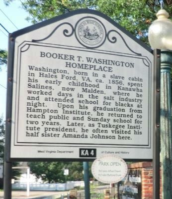
Malden. Early salt-making industry that was centered here peaked in the 1850s. In 1755, Mary Ingles and Betty Draper made salt for their Indian captors here at "Buffalo Salt Licks." John Dickinson bought the site in 1785. Wells sunk by Brooks . . . — — Map (db m76880) HM
In cemetery nearby is grave of Dr. Henry Ruffner, eminent theologian and writer, called father of Presbyterianism in the Kanawha region. After his ministry, he became head of Washington College, Lexington, Va. Wrote Ruffner Pamphlet. — — Map (db m76879) HM
In 1808 David and Joseph Ruffner near here on the bank of the Kanawha completed a well into solid rock to a depth of 59 feet by a method and with drilling tools they devised, which was further developed in this valley by themselves and Billye Morris . . . — — Map (db m76859) HM
Oldest of its kind in nation. Founded in 1902 by William W. Wertz and other Elk River residents to raise the civic, religious and educational standards of the community. The group meets for three days every August at its home site, “Rockwood Glen.” . . . — — Map (db m140132) HM
First settled in early 1780s and incorporated in 1905. Important site in 1912-13 Paint Creek-Cabin Creek Strike. Labor organizer "Mother Jones" spent her 84th birthday imprisoned here. The Pratt Historic District, listed on The National Register . . . — — Map (db m252541) HM
Fayette County. Formed in 1831 from Nicholas, Greenbrier, Kanawha, Logan. Named for General Lafayette. On New River, 1671, Batts and Fallam officially claimed Mississippi Valley for Great Britain in opposition to the claim of France. . . . — — Map (db m252548) HM
In 1883 the Smithsonian Institution excavated the South Charleston or Criel Mound. Thirteen skeletons were found, most of them in a large log tomb at the base of the mound, along with a few grave offerings. The mound was built by the Adena Culture, . . . — — Map (db m45246) HM
This plant was built by the
United States Government
during the World War at
a cost of over ten million
dollars to supply armor plate
for our navy. Nearby is one
of the largest Indian mounds
in the State. — — Map (db m137383) HM
This land, which was owned by George Washington, purchased by Morris Hudson, who in 1819 built a small church on knoll that adjoined this property. As was custom of the times, acres set aside as a cemetery for members of Bangor Parish. The church . . . — — Map (db m171631) HM
Born June 1822 in Kanawha County, Fry served as a lieutenant in the Mexican War and moved to Alabama prior to the Civil War. Appointed colonel of the 13th Alabama, he was wounded at Seven Pines, Antietam, and Chancellorsville. Wounded and captured . . . — — Map (db m137370) HM
Nearby stood Fort Tackett, destroyed by Indians, 1790. Near the fort the day before the attack, Mrs. John Young gave birth to a son, the first white child born in this valley. The Youngs and a few others escaped to Fort Lee. — — Map (db m50410) HM
Constructed in 1846. This cabin served as kitchen house for the 600-acre estate of John Morgan. The day before the Battle of Scary, on July 16, 1861, Union troops commanded by Gen. Jacob D. Cox camped on the Morgan estate and were fed from this . . . — — Map (db m34378) HM
Discovered in 1963 by Sam Kessell. Recognized as one of the oldest and deepest stratified sites of the Early Archaic period (8,000-10,000 BC). Artifacts recovered document early inhabitants who camped here along Kanawha River, were small . . . — — Map (db m34492) HM
Located at the site of the crossing of the James River and Kanawha Turnpike and Coal River. Covered Toll Bridge, built 1831 by Phillip Thompson and James Teays, replaced a ferry which operated in the same location. Bridge, one of the longest in . . . — — Map (db m81411) HM
George Washington's "Cole" River Tract of 2,000 acres was surveyed by John Floyd in 1774 and patented April 12, 1774. Bounded by the Coal and Kanawha Rivers, "5 miles and 88 poles", it embraced the site of St. Albans. — — Map (db m50469) HM
Two miles east stands the Old Harmony Church, built in 1819. In this church in 1829, John Mitchell and David Smith organized the first Methodist Protestant Church. Mitchell was its first pastor. Near the churchyard is his grave. — — Map (db m78396) HM
The Broad Run Baptist Church was organized in 1804. (2 Mi.W.) In its cemetery are buried many early settlers. Here is grave of Gen. Jos. A. Lightburn of the Union Army. After the War between the States, he became a Baptist minister. — — Map (db m78394) HM
Hacker's Creek At mouth of Jesse's Run was home of Jesse Hughes, Indian fighter and scout. About 1770, John Hacker settled here. Near by is scene of Cozad and other border massacres. Several Indian villages and burying grounds were . . . — — Map (db m78395) HM
Fort Pickens
120 yds., northeast, Co. A 10th W. Va. Inf., built Fort Pickens for headquarters and defense. Company raised by Capt. Morgan A. Darnall; mustered into U. S. service March 13, 1862. In several battles down to Appomattox. . . . — — Map (db m37049) HM
Site of boyhood home of Gen. Thomas J. "Stonewall" Jackson. The first mill was built about 1808 by his grandfather, Col. Edward Jackson, who became a leader in border affairs. It is now the site of the W. Va. 4-H Camp for Boys and Girls. — — Map (db m56626) HM
Home of Jonathan M. Bennett built 1875 and used as family home until 1922. Given by Mrs. Louis Bennett to county as public library to honor her husband and son. J.M. Bennett (1816 ~ 87) was active in state political and local business affairs in . . . — — Map (db m64089) HM
Authorized as a western asylum by the state of Virginia in 1858. Construction was started in 1860, completed by the new State, and opened in 1864 as a hospital for mentally ill. This is the largest hand-cut stone building in America. — — Map (db m12115) HM
The oldest State institution in West Virginia was authorized by an act of General Assembly of Virginia, March 22, 1858. The War Between the States delayed construction. It was not opened for patients until October 22, 1864. — — Map (db m12121) HM
In the old Arnold Cemetery on the hill are the graves of Alexander Scott Withers, born 10-12-1792, died 1-23-1865 and his wife, Melinda F., born 6-1-1793, died 9-15-1854. He was the author of “Chronicles of Border Warfare.” — — Map (db m197513) HM
On September 21, 1833, an arm of Upper Falls of Coal River Church met at the forks of Coal River. The group petitioned, May 1834, and on June 21, 1834, became a distinct church, Forks of Coal River Church, with 25 members. A log meeting house was . . . — — Map (db m137393) WM
Several descendants of the Chapman family are buried here, as are some veterans. One of those interred is Captain John Chapman (34th VA Cav, CSA) who was wounded several times — once at Gettysburg — and who led troops in a skirmish at the Curry Farm . . . — — Map (db m178249) HM
Hamlin became county seat, 1869. First court met, 1867, at Hamline Church (1 mile away), where, 1852-53, the Virginia Legislature established town of Hamline, named for Bishop Leonidas Lent Hamline of the Methodist Episcopal Church. — — Map (db m274457) HM
Hamlin became county seat, 1869. First court met, 1867, at Hamline Church (1 Mi. away), where, 1852-53, the Virginia Legislature established town of Hamline, named for Bishop Leonidas Lent Hamline of the Methodist Episcopal Church. — — Map (db m126883) HM
Founded 1975 in a renovated store by people of Lincoln County. First in nation to be federally designated as rural health clinic under PL 95-210. Hailed as model care provider, successfully building on community support, dedicated staff and Marshall . . . — — Map (db m178248) HM
In May 1864, Capt. John Chapman (34th VA Cavalry) headed for Logan and Cabell counties to round up deserters from his battalion. On May 29, the Confederate force came upon elements of the 3rd WV Cavalry along Mud River on the Curry Farm. Fired . . . — — Map (db m178247) HM
Logan County. Formed in 1824 from Cabell, Kanawha, Giles and Tazewell. Named for Logan, the famous chief of the Mingo Indians, whose "Lament" is most noted example of Indian eloquence. Cornstalk's duaghter, Aracoma, is buried in the town of . . . — — Map (db m159924) HM
In August of 1921, 7000 striking miners led by Bill Blizzard met at Marmet for a march on Logan to organize the southern coalfields for the UMWA. Reaching Blair Mt. on August 31, they were repelled by deputies and mine guards, under Sheriff Don . . . — — Map (db m49915) HM
On September 25, 1861, Col. Piatt’s Zouaves of the 34th Ohio marched on Confederate positions around Chapmanville. The Logan militia under Col. J. W. Davis harassed Piatt in the hours preceding his arrival at the Rebel entrenchments but was unable . . . — — Map (db m138444) HM
Built by the Lima Locomotive Works in 1947, the C&O 2755 was integral part of the coal mining and railroad industry West Virginia. Retired from C&O Railway service in 1956. Moved to its present location in March 1961. Placed on the National Register . . . — — Map (db m49919) HM
Here was home of Thomas Dunn English, mayor, 1852 to 1857, and author of "Ben Bolt". Aracoma, daughter of Cornstalk and the wife of Bolling Baker, was killed in 1780 attack by settler, and is buried here. — — Map (db m49917) HM
One of worst floods in US occurred here 26 February 1972, when Buffalo Mining Co. impoundment dam for mine waste broke, releasing over 130 million gallons of black waste water: killed 125; property losses over $50 million; and thousands left . . . — — Map (db m49918) HM
Capt. Anderson "Devil Anse" Hatfield, 1839-1921, is buried here. He was the leader of his clan in the bitter family feud with the McCoys. A life-sized statue, modeled from photographs and imported from Italy, marks his grave. — — Map (db m49912) HM
This covered bridge, built in 1853 by Eli and Lemuel Chenoweth, West Virginia’s pioneer bridge builders, is an excellent example of a modified Burr Truss and is in substantially original condition. The bridge was saved from destruction during Jones’ . . . — — Map (db m75051) HM
Here in 1819, on land purchased from Thomas Barns, Boaz Fleming, pioneer, soldier of the American Revolution, founded this town, which, in 1820, the Virginia General Assembly established as Middletown, under a trustee form of Government.
. . . — — Map (db m29733) HM
Named for Captain James Booth, pioneer soldier and settler. He was killed by Indians, 1778, and his companion, Nathaniel Cochran, wounded and captured. William Grundy, brother of the noted Felix Grundy, was also killed by Indians nearby. — — Map (db m175247) HM
Near this point, in a mass grave, lie the remains of 39 Confederate soldiers from the 6th, 7th, 11th and 12th Virginia cavalry units—part of the force led by Gen. W.E. Jones. Attacked Fairmont April 29, 1863, after raids at Kingwood and . . . — — Map (db m156170) HM
David Morgan (1721–1813). Son of Col. Morgan Morgan. Surveyed with Washington for Fairfax Stone; explored with Boone & Gist. Settled here in 1771. Surveyed Pleasantville (Rivesville) 1776. Upriver on his nearby 361-acre River See, he . . . — — Map (db m164816) HM
Home of Francis H. Pierpont, whose services in the organization of this State are commemorated by his statue in Statuary Hall, Washington. He was governor under the Restored Government of the State of Virginia, 1861–1868. — — Map (db m21313) HM
Founded through private enterprise in 1865. Established as a state institution in 1867 and
known as Fairmont State Normal School. Became Fairmont State Teachers College, 1931. Name Fairmont State College
was adopted in 1943. — — Map (db m172338) HM
Site of Williams Memorial Methodist Episcopal church, now Central United Methodist, where Father’s Day was first observed on July 5, 1908. Reverend Webb conducted the service upon the request of Mrs. Charles Clayton, daughter of Methodist minister . . . — — Map (db m172306) HM
Born 1814, Francis Pierpont was a
respected lawyer and supporter of
the Union. Delegate in 1861 to the
Wheeling conventions, he became
governor of Restored Virginia and
aided efforts to form a new state.
Postwar, he oversaw the rebuilding
of . . . — — Map (db m175079) HM
Completed in 1921, honoring WWI veterans. Designed by Concrete Steel Engineering Co., NY; built by John F. Casey Co., Pittsburgh. Three 250 ft. reinforced concrete arch spans, 90 ft. above river, 1,266 ft. long. Connected Fairmont by trolley, foot . . . — — Map (db m21303) HM
Completed in 1921, honoring WWI veterans. Designed by Concrete Steel Engineering Co., NY; built by John F. Casey Co., Pittsburgh. Three 250 ft. reinforced concrete arch spans, 90 ft. above river, 1,266 ft. long. Connected Fairmont by trolley, foot . . . — — Map (db m21304) HM
To the north stood the fort built, 1774, by Jacob Prickett. In 1777, Captain William Haymond commanded a militia company here which guarded Monongahela Valley. In Prickett Cemetery are graves of Colonel Zackquill Morgan and other pioneers. — — Map (db m172303) HM
Named in honor of local American hero, "Spanky" Roberts (1918-84), grad. of Dunbar H. S. & WV State College. 1st African-Am. aviation cadet, Tuskegee, 1941. Comm. 2nd Lt. & pilot in 1942; flew over 100 missions in Africa, Europe & Mid-East, . . . — — Map (db m174975) HM
Named in honor of local American hero, “Spanky” Roberts (1918–84), graduate of Dunbar H.S. & WV State College, 1st African-American aviation cadet, Tuskegee, 1941. Commissioned 2nd Lieutenant & pilot in 1942; flew over 100 missions in Africa, . . . — — Map (db m40497) HM
Born in 1878 in Basnettville, Marion Co. President of Women's Christian Temperance Union by 1908; led state suffrage movement in 1917, resulting in 1920 passage of 19th Amendment giving women right to vote. She was first woman to chair WV Republican . . . — — Map (db m189043) HM
Explosion in Consolidated Coal No. 9 mine November 20, 1968 resulted in deaths of 78 miners, with only 21 men rescued. Mine sealed ten days later due to fires and explosions. In 1969 recovery efforts began. Over ten year period the bodies of 59 . . . — — Map (db m188586) HM
Here Nicholas Wood and Jacob Straight were killed and Mrs. Elizabeth Dragoo captured during Indian raid in 1786. Mrs. Straight and her daughter made their escape from the Indians by hiding under sheltering rocks near by. — — Map (db m75089) HM
A mile north stood the cabin in which Waitman T. Willey, the State’s first U.S. Senator was born, October 18, 1811. Elected August 4, 1863 by the Legislature, he served until March 3, 1871. Died May 2, 1900; buried in Morgantown. — — Map (db m21130) HM
Mannington. Once called Koontown but renamed in 1856 when chartered as town by Va. Assembly. Incorporated under W. Va. law in 1871. Abundant natural gas attracted diverse industry by 1900. Brick, glass and boiler factories, machine shops, . . . — — Map (db m173922) HM
Marion County
Formed, 1842, from Harrison and Monongalia. Named for hero of the Revolution, Gen. Francis Marion. County was home of Francis H. Pierpont, leader in formation of this State. The Monongahela River forms just above Fairmont.
. . . — — Map (db m71114) HM
On the 6th of Dec., 1907 361 coal miners, many of them from countries far across the sea, perished under these hills in the worst mining disaster of our nation. The four who escaped died of injuries. — — Map (db m237520) HM
Near this spot, 1779, David Morgan killed two Indians, of whose attack on his two children he had been warned in a strange dream. Morgan lived on a farm on the Monongahela River between Paw Paw and Prickett Creeks. — — Map (db m74665) HM
North on high flat, overlooking the junction of Pawpaw Creek and the Monongahela River, was “Pawpaw Fort,” a ninety-foot square stockade-fort erected in 1781. Rangers commanded by Captain Jack Evans garrisoned it. — — Map (db m74667) HM
Over this route through the Monongahela Valley, April 27-29, 1863, Gen. William E. Jones led his division of Gen. John D. Imboden's Confederate army. This raid concluded with the destruction of the oil fields on the Little Kanawha River. — — Map (db m145284) HM
Marion County. Formed 1842, from Harrison and Monongalia. Named for hero of Revolution, Gen. Francis Marion. County was home of Francis H. Pierpont, leader in the formation of this State. The Monongahela River forms just above Fairmont. . . . — — Map (db m173529) HM
To the south, Indian fort built in 1777 under direction of Captain James Booth. It was an important place of refuge for many early settlers in this valley. Near by was the iron furnace built by Benjamin Brice in 1812. — — Map (db m75093) HM
Harrison County. Formed, 1784, from Monongalia. It included all or parts of
17 other counties. Named for Benjamin Harrison, signer of Declaration of Independence,
and governor of Virginia, 1781-1784. Birthplace of General Thomas J. . . . — — Map (db m164985) HM
Nearby mine supplied coal to large Wheeling Steel mill. An explosion here, 28 April 1924, resulted in third worst mine disaster in state history. 119 miners, many natives of Poland, Italy and Greece, were killed. There were no survivors. Led to . . . — — Map (db m59838) HM
Marshall County. Formed in 1835 from Ohio. Named for Chief Justice John Marshall. In Marshall County is Grave Creek Mound, first among remains left by the unknown race which lived in the Ohio Valley centuries before the white man came. . . . — — Map (db m57250) HM
Marshall County. Formed in 1835 from Ohio. Named for Chief Justice John Marshall. In Marshall County is Grave Creek Mound, first among remains left by the unknown race which lived in the Ohio Valley centuries before the white man . . . — — Map (db m189430) HM
Marshall County. Formed in 1835 from Ohio. Named for Chief Justice John Marshall. In Marshall County is Grave Creek Mound, first among remains left by the unknown race which lived in the Ohio Valley centuries before the white men came. . . . — — Map (db m67104) HM
Constructed with PWA grant, 1939, the unique semi-circular pool with underwater lifeguard station was design of Frank Hunter. Beach area once had sand from Lake Michigan. Pool also emergency reservoir for fire protection. Listed in 1993 on National . . . — — Map (db m80388) HM
Site of Indian fort built in 1779 on land of George Beeler. In 1782, an attack of Mohawk and Shawnee Indians was repulsed by its defenders, among whom were Martin and Lewis Wetzel, the celebrated scouts and Indian fighters. — — Map (db m21076) HM
West Virginia (Marshall County)
"The Mountain State" - western part of the Commonwealth of Virginia until June 20, 1863. Settled by the Germans and Scotch-Irish. It became a line of defense between the English and French during the French . . . — — Map (db m296435) HM
Born 3 June 1856, in 1885 was first licensed woman physician in state; opened private practice then hospital in Wheeling, 1892. Jones was active in temperance and women's suffrage; and promoted establishment of state sanitariums in Terra Alta & . . . — — Map (db m257995) HM
The Cockayne Farm
The Cockayne farmhouse was built by Bennett Cockayne around 1850. His son Samuel A.J. was renowned as a sheep breeder. Dubbed Glendale by Samuel's wife Hannah, the farm was the namesake for Glen Dale when it was . . . — — Map (db m102040) HM
John Wetzel and sons, Lewis, Jacob, Martin, John, and George, came with the Zanes in 1769 and built a fort. The Wetzels became famous scouts and Indian fighters. In 1787, the elder Wetzel was killed by Indians at Baker’s Station. — — Map (db m21075) HM
In the "Narrows," September 27, 1777, Capt. Wm. Forman (Foreman) and his Hampshire County troops were ambushed by Indians; 21 were killed. They had joined Fort Henry garrison, located on the Ohio at Wheeling to protect western settlements. — — Map (db m71010) HM
This world-famous burial mound was built by the Adena people sometime before the Christian Era. The mound was originally 69 feet high, 295 feet in diameter, and was encircled by a moat. There were many mounds in the area-hence the city's name: . . . — — Map (db m54886) HM
The “Spirit of St. Louis,” piloted by Charles Lindberg landed in Moundsville .1 mile west at Langin Field, Aug. 4, 1927. Seen by 140,000 locally, he led aviation into the rocket era, creating the U.S. air transportation network. — — Map (db m258029) HM
Moundsville. Named for Grave Creek Mound. This mound, 900 feet around, 70 feet high, is the largest conical mound in America. The inscribed stone found in it has never been deciphered. Near by was the Indian fort built by Joseph Tomlinson.
. . . — — Map (db m20373) HM
At Rosby’s Rock (5 Mi. E.) Dec. 24, 1852, the B. & O. Railroad joined the Baltimore and Wheeling with the first continuous railroad from the Atlantic to the Ohio, after such engineering feats as building 11 tunnels and 113 bridges. — — Map (db m21074) HM
Born January 20, 1820, Trainer worked as a tailor before becoming a Methodist minister. An opponent of secession, he was a delegate to the state's first Constitutional Convention and served as chaplain of the 12th WV Infantry during the Civil War. . . . — — Map (db m189433) HM
This tract of 587 acres in Round Bottom was patented by George Washington in 1784 after a purchase of warrants held by officers of the French and Indian War. Washington sold these lands in 1798 to Archibald McClean. — — Map (db m54819) HM
This tract of 587 acres in Round Bottom was patented by George Washington in 1784 after a purchase of warrants held by officers of the French and Indian War. Washington sold these lands in 1798 to Archibald McClean. — — Map (db m190875) HM
Established, 1866, A prison for men and women convicted of felonies until prison for women was established at Pence Springs, 1947. Capital criminals were hanged here, 1889-1950. Electric chair used until death penalty was abolished, 1965. — — Map (db m54890) HM
Site of blockhouse built by Captain John Baker in 1784. Rendezvous of scouts along Indian war path from Muskingum Valley into Virginia. Near by are buried Captain Baker, John Wetzel, and others killed by Indians in 1787. — — Map (db m54808) HM
In 1772, George Rogers Clark explored the Ohio and Great Kanawha rivers He stayed the winter here, planted and harvested a crop, and carried out much surveying. Riflemen from the region aided him in winning the Northwest in 1778-1779. — — Map (db m257994) HM
Made famous as line between free and slave states before War Between the States. The survey establishing Maryland-Pennsylvania boundary began, 1763; halted by Indian wars, 1767; continued to southwest corner, 1782; marked, 1784. — — Map (db m296722) HM
General Zachary Taylor, on his way to Washington to be inaugurated as the 12th President of the U.S., found his steamer blocked by ice here. He left his boat and completed his trip over the National Pike. — — Map (db m54810) HM
Born in 1820, Clemens studied law at Washington College (PA) and was admitted to the bar in 1843, then established a practice in Wheeling. Serving in the U.S. House, 1852-53 and 1857-61, he was a delegate to the Richmond Convention of 1861, where he . . . — — Map (db m190873) HM
Mercer’s Bottom. This is part of the 16,000 acre tract surveyed by order of Washington for General Hugh Mercer. Nearby are the graves of Adjutant John Hereford and Ensign John Wilson. They were officers in the Revolutionary Army.
Captain . . . — — Map (db m125578) HM
Born 1825 in Wales, he emigrated to U.S. as a child and was working in iron industry when war erupted Commissioned captain of 2nd (West) Virginia Cavalry at Ironton, OH, and won Medal of Honor for actions at Sinking Creek Valley in 1862. Wounded, . . . — — Map (db m124893) HM
This is one of the larger burial mounds in the State. It has never been properly excavated, but was probably built by the Adena people between 500 B.C. and A.D. 1. Several smaller mounds can also be seen in this area. — — Map (db m125577) HM
Born 1755, died 1835. Soldier in
the Revolution and the first white
settler in Cabell County. Blazed
trace from Saint Albans to Chilicothe
which bears his name. This
was the first road that came into
Cabell and Mason Counties. Hannan
owned . . . — — Map (db m125580) HM
Samuel and Pamela Clemens,
grandparents of “Mark Twain,”
settled here in 1803. Samuel
was accidentally killed in 1805 at
a “house-raising.” Their eldest
son, John Marshall, the father
of “Mark Twain,” lived here
until he moved West. — — Map (db m124904) HM
Educator and historian born near West
Columbia, July 6, 1848; died in Mason
City, December 5, 1912; was buried in
Point Pleasant. He founded the Southern
Historical Magazine in 1892; was State
Superintendent of Schools, 1893-97; . . . — — Map (db m124886) HM
Home of General John McCausland, 1836–1927, one of the last officers of the general staff of the Confederate Army. He served in Pennsylvania, the Virginias, and Maryland. He led Lomax’s cavalry against Sheridan in Valley Campaign. — — Map (db m92555) HM
Organized at Barboursville Sept. 18, 1862, with Captain William Gunn as commander. Served with the Guyandotte Battalion until Jan. 1863, then was assigned as Company D 8th Virginia Cavalry, CSA under Col. Albert G. Jenkins. — — Map (db m124164) HM
The nearby highway is part of route traversing W. Va. from Lewisburg to Point Pleasant memorialized by the state to commemorate the march of the American Colonial army of 1,200 men led by Andrew & Charles Lewis. After a month’s march this army . . . — — Map (db m124127) HM
Daniel Boone, noted scout and Indian fighter, operated trading post here, 1790. He was scout for General Lewis enroute to Point Pleasant, 1774. Named County Lieutenant for Kanawha and served in the Virginia General Assembly. — — Map (db m124124) HM
Born 1803 in Palatine, Polsley was
a noted lawyer and publisher of the
Western Transcript in Wellsburg
until he moved to Mason County in
1845. A delegate to the Wheeling
conventions, Polsley served in the
Restored Government of Virginia . . . — — Map (db m125301) HM
1020 entries matched your criteria. Entries 401 through 500 are listed above. ⊲ Previous 100 — Next 100 ⊳