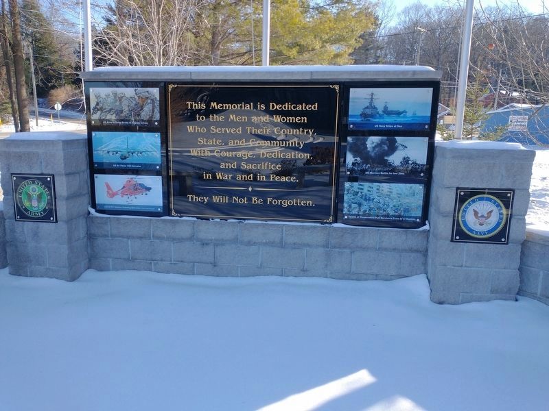
This Memorial is Dedicated
to the Men and Women
Who Served Their Country,
State, and Community
With Courage, Dedication,
and Sacrifice
in War and in Peace.
They Will Not Be Forgotten. — — Map (db m190677) WM
In 1891-92 the Chicago and West Michigan Railway, precursor to the
Pere Marquette Railroad, extended the line between Traverse City and
Petoskey through Spencer Creek. William Alden Smith, the railway's
general counsel, advocated building the . . . — — Map (db m190676) HM
This building began life in 1881 as a print shop and offices for Bellaire's first newspaper, The Bellaire Breeze, run by Albert S. Abbott. It's the oldest standing building in the Bridge Street business area. Alice Jane White was born in Ionia . . . — — Map (db m284962) HM
In 1883, the Kearney Township Hall was built here on land purchased for $100. Township offices were on the first floor. The second floor was the Opera House with space for dances, travelling shows, and other community activities. The Antrim . . . — — Map (db m284957) HM
This block of buildings that now houses Short's Brewery is on the
site of the former Bellaire House Hotel. The hotel was enlarged to meet
the needs of the new county seat and sold in 1901 to Ira Adams.
Adams already had a small general store . . . — — Map (db m284950) HM
Antrim County sheriff Henry Stewart built a small barn here in 1887. It became a livery business, and George Stanley, who acquired it in 1900,
made many improvements. In 1906, Edward Maltby took possession, and it became the most important . . . — — Map (db m284959) HM
Born in 1850, William J. Nixon was raised in southern Michigan. In the 1870s, he moved to Antrim County and partnered in a grocery store with his brother, Allen, becoming sole owner when Allen moved away. He married Emma Richardi in 1883. She . . . — — Map (db m284951) HM
This property was home to the 1st Congregational Church of Bellaire from the 1880s until it disbanded in the early 1920s. In 1922, Harley Smith bought it and built a barn. In 1932, after drilling test wells in several places in town, the village . . . — — Map (db m284953) HM
As the new county seat, the Antrim County Board of Supervisors recognized in 1879 that Bellaire needed a jail and a sheriff's house. They were completed in 1881 at a cost of $5000. The sheriff lived in front and the jail was attached behind. . . . — — Map (db m284960) HM
In Honor of
the Men and Women of Bellaire
who Served in World War II
and
In Memory of
Those who made the Supreme Sacrifice
Girdon Grannis • Leon Rauch
Cleveland Patton • Walter Watrous — — Map (db m284955) WM
The first pioneers of Antrim County
settled along Grand Traverse Bay
near Elk Rapids in the 1850s. Later
settlers moved inland, and urged
that the county seat be transferred
from the bay shore closer to the
geographical center of the . . . — — Map (db m234153) HM
Before America was discovered, indigenous people hunted and fished the Grand Traverse region for thousands of years. As far back as 8,000 B.C., the waters of Grand Traverse Bay, Elk River and the 14 lakes of Antrim County's Chain of Lakes had been . . . — — Map (db m98175) HM
In this photo you are standing on the other side of the Elk River and to the left side of the photograph. This picture of Elk Rapids is from the 1890s and the view is from the top of the Elk Rapids Iron Company's Furnace. What is left of this . . . — — Map (db m98173) HM
In 1856 Dexter and Noble Company began building an empire with their sawmill and mercantile business. In 1872 they built an iron smelting plant, one of the largest charcoal furnaces in the country. At each step of their building that empire, . . . — — Map (db m98125) HM
Elk Rapids thrived in the late
nineteenth century due to the
lumber industry boom and local
iron and chemical manufacturing
plants. When the economy declined,
people left to find work. Between
1910 and 1920. the town lost two-thirds of its . . . — — Map (db m234256) HM
The brick ruin near this marker was
the hearth of the Elk Rapids furnace,
during the 1870s one of the nation's
greatest producers of charcoal iron.
Forty-seven feet high and twelve
feet in diameter, it was begun in
1872 and produced the first . . . — — Map (db m257300) HM
As shown in the above photograph taken in c1910, the Elk River and Chain of Lakes provided a means of transporting logs to the Dexter & Noble sawmill and a shoreline site where cord wood was made into charcoal fuel for the iron furnace. This . . . — — Map (db m98151) HM
In the late 1850s traveling pastors
began to conduct Methodist services in
Elk Rapids and nearby communities.
First Methodist Episcopal Church was
organized in the early 1870s. Services
were held in a former school and then a
former . . . — — Map (db m234753) HM
Native Americans have hunted and fished the Grand Traverse region for thousands of years, perhaps as many as 10,000 years before white settlers appeared. The waters of the Bay, Elk River and the 14 lakes of Antrim County's Chain of Lakes had been . . . — — Map (db m98128) HM
US 31 in its present location was built in 1953. In the 1960s, the Rotary Club of Elk Rapids began to develop the land between the highway and Elk River. With the help of other local organizations, the area became a park, named Rotary Park in . . . — — Map (db m98118) HM
Look carefully westward to see what remains of the Elk Rapids City Dock. This dock was one of
three docks situated within the village limits. It served the community of Elk Rapids from 1905
to 1911. The pier extended 1,440 feet out into East Grand . . . — — Map (db m247432) HM
The Elk Rapids Iron Company began operations at this location in 1873. You are standing in front of the base of the smelting furnace. The tall rectangular
elevator tower was used to dump iron ore, limestone and charcoal into this furnace. . . . — — Map (db m257299) HM
Edwin S. Noble (1838-1922) designed
and built this house for his family in
1865. Noble, an expert accountant,
was associated with the Dexter Noble
Company, first as secretary-treasurer
and later as a full partner. The company
was involved in . . . — — Map (db m234603) HM
Native Americans first came to this area to plant their gardens. Immigrants from many countries were drawn to the Antrim Chain of Lakes
primarily to harvest the vast stands of hardwood growing nearby. The Elk Rapids Iron Company was built on the . . . — — Map (db m257306) HM
Memorial to those who gave their lives in the service of their country.
World War II. John Bachi • Robert Barnes • Donald Banninger • Byron Hassett • Lynn Hansen • Willard Banninger • Ralph Hirt • Mark Mamagona • Wayne Martinek • William . . . — — Map (db m247405) WM
Designed by Charles H.Peale
and built in 1883 near the
site where the earliest
white settler, Abram Wadsworth had lived, the Elk
Rapids Township Hall has
served as a social and
political center
center for over
ninety years. Largely due
to . . . — — Map (db m234752) HM
It has often been asked, "Why the stumps in the river?"
In a way, the stumps tell the story of Elk Rapids. In the beginning the trees grew there while the land was still dry. As one can see in the photograph of the blast furnace, which was . . . — — Map (db m98135) HM
At the beginning of 1901, a
reporter visiting Essex noted thirty to forty houses, a
large sawmill. a stave factory, a shingle mill, one store,
a telephone office, a blacksmith shop, a livery stable
and a post office. A 1902
Central Lake Torch . . . — — Map (db m234152) HM
On November 10, 1881, the Antrim County Herald ran an advertisement about the village of Wetzell that read: "New Town, New Store; Everything New!" Earlier that year the Wetzell brothers had platted the village and opened a sawmill. As the . . . — — Map (db m215768) HM
n 1885 Bohemian immigrants founded Saint John
Nepomucene Catholic Church,
named for the patron saint of
Czechoslovakia. The settlers,
most of whom emigrated from
Prague, named their community Praga. This Gothic
Revival church was built as
a . . . — — Map (db m234149) HM
In 1858, in what was then a remote wilderness, the Rev. Charles E. Bailey and four families from his Ohio Congregational parish founded Benzonia colony. It was to be an "educational Christian colony" modeled after the earlier Congregational . . . — — Map (db m97478) HM
Historian, author, editor, Bruce Catton (1899-1978) is best known for his two Civil War trilogies -- The Army of the Potomac and The Centennial History of the Civil War. Born in Petoskey, Catton spent most of his childhood in Benzonia, . . . — — Map (db m97480) HM
This building was a girls dormitory erected in 1909 for the Benzonia Academy. Named Mills Cottage in honor of the Reverend Harlow S. Mills, pastor of Benzonia Congregational Church from 1896 to 1916, it became property of that church when the . . . — — Map (db m97479) HM
Dedicated to the memory of the pioneers, who, in 1858, came to this region, then an unbroken forest, to establish a Christian community and college. Here they founded the earliest institution of higher learning in northern Michigan which was a . . . — — Map (db m228944) HM
William Davis. the son of
a plantation owner and a
slave woman, came here
with his wife. Mildred
Brand, and their children
in 1863. They were among
the area's first black
landowners. Upon the
death of his daughter in
1870, William Davis . . . — — Map (db m192394) HM
In 1873 an ambitious but ill-advised project was put through in an effort to connect Crystal Lake and Lake Michigan with a navigable channel. The original level of Crystal Lake was, at that time, much higher than its present level. The project was a . . . — — Map (db m97481) HM
On January 26, 1868, twenty-three early Frankfort residents founded First Congregational Church of Frankfort. They received guidance from an established Congregational Church in Benzonia, Michigan. In accordance with the practices of . . . — — Map (db m168222) HM
On December 12, 1891, the Lighthouse Board issued a "Notice to Mariners" informing them that a long sought steam-powered fog signal, featuring two 10-inch whistles similar to those then used on locomotives, had been installed at Point Betsie. . . . — — Map (db m98327) HM
Yes, we have a gravestone at Point Betsie but alas no grave. Edward Wheaton, Keeper 1934 to 1946, made this gravestone to honor his mother, Martha Madsen Wheaton, 1857 to 1941. She died in Cheboygan.
Keeper Edward Wheaton could not lift the . . . — — Map (db m98323) HM
On May 18, 1675, Father Jacques Marquette, the great Jesuit missionary and explorer, died and was buried by two French companions somewhere along the Lake Michigan shore of the lower peninsula. Marquette had been returning to his mission at St. . . . — — Map (db m97466) HM
Prior to 1892, large quantities of kerosene that fueled Point Betsie's beacon and apartment lamps, etc., was kept at the base of the lighthouses tower. As at other light stations, a separate building was erected here in 1892 to provide safer . . . — — Map (db m98330) HM
Thompsonville Junction
Constructed in 1889, Thompsonville Junction’s diamond crossing formed the intersection of the Chicago and Western Michigan Railroad (eventually the Chesapeake and Ohio) and the Frankfort and Southeastern Railroad . . . — — Map (db m228950) HM
99th Bombardment Wing/SAC
Westover Air Force Base, Mass.
346/348 Bombardment Squadrons
The following B-52 crew members gave their lives
on a training mission over Lake Michigan
January 7, 1971
Lt. Col. Wm B. Lemmon • Lt. Col. John . . . — — Map (db m97484) HM
(Side A)
Big Rock Point
Big Rock Point is named for a large boulder used as a landmark by Native Americans. At least as early as the mid-nineteenth century Odawa (Ottawa) Indians used Big Rock, which they called Kitcheossening, as a . . . — — Map (db m97483) HM
Boyne's first regular storekeeper was Alfred J. Beardsley. He was born on a farm in St. Clair County in 1854 and in June 1875, journeyed to Boyne, where he opened a small dry goods store in the Pine Lake House.
In April of 1885, he . . . — — Map (db m230204) HM
Built in 1903 by C.I. Bellamy who came to Boyne from Luther, Mich. An up-to-date place of amusement, it was pronounced by experts as "the handsomest for its size in the state".
The theater opened in 1904 and featured a stage twenty-five feet . . . — — Map (db m230296) HM
When Bergy Bros. opened the doors of their new mercantile establishment, "The public came, saw a fine display of goods and bought liberally". Messrs. Bergy brothers were gentlemen of experience. Previous to coming to Boyne City, M.E. Bergy had . . . — — Map (db m216062) HM
"A popular gathering place for lovers of the weed" was established by C.E. Chase right after the turn of the century. The business was known throughout the City of Boyne.
Mr. Chase, proprietor of the well kept store, produced an excellent . . . — — Map (db m230203) HM
In 1874 the Reverend Andrew
Wiggins and twelve pioneers
organized the Methodist-Episcopal Church of Boyne
City, near Deer Lake. In
1883, Zachariah Morgan and
his wife, Mary, donated land
on which to build a church.
The first church was . . . — — Map (db m234146) HM
From 1890 to the present, Boyne City's commercial center has flanked the south bank of the Boyne River. The late Victorian facades of its earliest buildings were influenced by fashionable turn-of-the-twentieth century architecture. Buildings of . . . — — Map (db m230392) HM
Boyne City's first permanent settlers arrived on the shores of Pine Lake (now Lake Charlevoix) on November 14, 1856 from up state New York. It has been said that they found the place by following a dream. As the story is told, Harriet awoke one . . . — — Map (db m230504) HM
Frank Kaden, one of Boyne's Pioneer merchants was born in 1862 and first came to this area in 1876 from Philadelphia. After operating a business in Boyne Falls for several years and spending some time in California, he returned to Boyne City and . . . — — Map (db m216128) HM
It is not certain when this building was erected, but it was most likely built around 1880. During the past century, it has served a wide variety of businesses. One of the most notable was "La Chapelle Sisters" Millinery Emporium which opened in . . . — — Map (db m216139) HM
This Railroad Office Building served as the Boyne City, Gaylord and Alpena Railroad general office during Boyne's lumbering era.
It is not known when the office building was constructed, but it was first located on the east side of Lake . . . — — Map (db m216179) HM
S. Dosie opened the finest store in Greater Boyne on March 20, 1907 where the stock featuring all the latest and correct styles, was arranged in Metropolitan style.
The two-story building was 25 by 94 feet and was, in every sense of the . . . — — Map (db m216065) HM
Clarence C. Schaub first worked in the meat business with his brother, J.C. Schaub, in 1894 at the corner of Lake and Main.
In 1900, Clarence sold his share of the business and headed west. Three years later he returned to Boyne City and . . . — — Map (db m230285) HM
Sometimes called the Riverside Hotel, the 24 room hotel opened to the public in 1904.
Charles O. Fry, proprietor, ran a comfortable hostlery, where guests were made to feel they had found a home, not just a stopping place.
At all times, . . . — — Map (db m230201) HM
Before the era of the drug store, most folks relied on the patent medicine industry to cure the grevous ills of mankind. A popular medicine of the day was Thedford's Black Drought which claimed to cure everything from bad blood to headaches.
. . . — — Map (db m216127) HM
On May 1, 1907, Frank Meyers became the proprietor of the newly remodeled hotel.
A weary traveler could register at the 52 room hotel for two dollars a day. The rooms were clean, light, airy and well furnished and the cuisine irreproachable . . . — — Map (db m216066) HM
The International Order of Odd Fellows built this grand hall in 1906. It was constructed by J.I. Gee and was Boyne's first poured concrete building. The walls are sixteen inches thick and reinforced with rock and railroad ties.
The I.O.O.F's . . . — — Map (db m216131) HM
This location, at the head of Pine Lake (now Lake Charlevoix), was once the site of the round house for the BCG & A Railroad. Built shortly after the turn of the century, it sheltered and serviced thirteen locomotives. The surrounding railroad . . . — — Map (db m230468) HM
It is the oldest business still operating under the same family management. The first business was operated by James B. Stackus, a Civil War veteran, who came to the Boyne area in 1875. A cabinet maker by trade he soon had a successful business. . . . — — Map (db m230288) HM
Not one, but two, United States Hotels once stood on this corner. The first, a fine three-story hotel, was built by Frank Abraham and George Beardsley and opened in 1878. In 1880, the U.S. Hotel burned and a new hotel was erected in its place. In . . . — — Map (db m215924) HM
This was the address of Amos Fox from the late Eighteen Seventies until the late Eighteen Nineties. Mr. Fox was a pioneer business man of Charlevoix. He and his partner, Hiram Rose, built the wooden dock that ships on Lake Michigan used before a . . . — — Map (db m215864) HM
Manitou Shoal Lightship,
ca. 1934.
Lighships were used to guide vessels
past certain hazardous navigation points
along Lake Michigan’s maritime lanes.
Manitou Shoal west of the Leelanau
Peninsula was one such spot. Until
1935, when a . . . — — Map (db m247384) HM
He survived the sinking of USS Perch (SS-176) and more than 3 years as a Japanese prisoner of war during World War II
He was a native of Charlevoix and was instrumental in building and maintaining this Memorial — — Map (db m98059) HM WM
This flagpole once stood at the site of Consumers Energy's Big Rock Point Nuclear Plant, about 4.5 miles northwest of Charlevoix off of U.S. 31. The plant set several industry records throughout its operating life from 1962 to 1997 and was named a . . . — — Map (db m98098) HM
Built 1892, donated to the Charlevoix Historical Society 1992.
It is a designated Charlevoix Local Historic District.
ca. 1900.
The Charlevoix Train Depot was designed by
Charles Pelton & Company of Grand
Rapids, MI for the Chicago & . . . — — Map (db m257070) HM
The pie crust measured from 14 feet, 4 inches in diameter, 2 feet deep and weighing a total of 7 tons. A total of 1,730 lbs. for the pie crust 850 lbs. of flour 325 lbs. of water 15 lbs. of salt 110 lbs. of milk 375 lbs. of shortening 55 . . . — — Map (db m154653) HM
Completed in the summer of 1912, the concrete paving of the
street from the Depot up the hill to The Inn on Mercer Blvd at the
end of Dixon was scored with lines to prevent slippage by the
horses which were used for hauling luggage and . . . — — Map (db m257263) HM
Fishing and Lumbering - Round Lake, North ShoreTug Loaded with Lake Trout
ca. 1900
When Charlevoix was permanently settled in 1854, Lake Michigan teemed with millions of tons of fish, called "finny . . . — — Map (db m215844) HM
Origins, ca. 12,000 Years Ago.
Indigenous people have been in nearly
continuous residence in this area for the last
12,000 years. Although these are
various origin stories, it is commonly held
that the Odawa and their close kin the . . . — — Map (db m257379) HM
Fish Hatchery,
1930s.
Charlevoix’s US government fish
hatchery was built in 1917. When it
opened, it was the largest Federal
hatchery in the United States.
In recent years the building has served
as the State of Michigan's . . . — — Map (db m247401) HM
Lifetime member of the Charlevoix United Methodist Church.
His path in life was in the true spirit of God’s way.
Scout Master of Troop 11 in Charlevoix for thirty-three years.
He influenced many young lives through his guidance
and . . . — — Map (db m257269) HM
This land was deeded to the City of Charlevoix for
park purposes in 1882 by Amos and Ella Fox for the
sum of $840.00. At some time prior to the year
1900, the City constructed a water works" on the
north end of the property. In 1899 the . . . — — Map (db m257478) HM
Clarence "Odie" Odmark
Charlevoix Band Director
1946 - 1975
"The music that resonated
throughout my life,
Now resounds from my spirit." — — Map (db m98090) HM
Dedicated to Pierre Francois-Xavier de Charlevoix, Jesuit missionary, teacher and historian, 1682 – 1761, who passed these shores in 1721. — — Map (db m257444) HM
This memorial recognizes the instrumental role.
Mayor Robert Bridge played in the development of
the public park areas along round lake, during his
term as Charlevoix’s mayor from 1938-1948.
Mayor Bridge’s visionary approach led to the . . . — — Map (db m247389) HM
U.S. Navy Submarines paid heavily for their success in World War II.
A total of 374 officers and 3131 men are on board these 52 submarines
still on "patrol"
Albacore ·
Amberjack ·
Argonaut ·
Barbel ·
Bonefish ·
Bullhead · . . . — — Map (db m98057) HM WM
Chamber of Commerce
and Parkside Restaurant,
ca. 1938.
Charlevoix’s first Chamber of Commerce
building occupied the curent performance
pavilion site. Built in 1925 originally as an
open-air bandstand, it was soon closed in
to resemble . . . — — Map (db m257275) HM
The First Congregational Church was formed in 1882. Members purchased this lot in 1883, and the building was completed in 1885. Church women held social fundraisers to help finance its cost. The building features rare Stick style motifs. The . . . — — Map (db m98093) HM
[Excerpted historical photo captions read]
Round Lake Harbor, 1950s
Shuffleboard Courts in East Park, 1940s
First Waterfront Art Fair, 1959
North American in Round Lake, 1950s — — Map (db m98031) HM
The last swing bridge to span the outer channel was built in 1901.
When first put into operation it was considered to be far and away
the best in modern bridge construction and design. It was made
entirely of steel, except for the roadbed, which . . . — — Map (db m257298) HM
Hotel Alhambra, ca. 1935
The Lewis Grand Opera House was
constructed on this site, abutting the
channel, in 1883. Served the
community as a theater and meeting place
until the building was converted into
the red brick Hotel Alhambra in . . . — — Map (db m247391) HM
1859-1864 Bridge #1
Built wide enough for two pedestrians to pass, this wooden structure was four feet across and two feet above the water, with removable planks in the middle. If someone wasn't nearby to help, those in a boat . . . — — Map (db m215863) HM
We the US Submarine Veterans of WWII
Michigan Chapter
proudly dedicate this memorial
to the gallant men of the
USS Escolar (SS294)
Lost by enemy action on or about
17 October 1944
while on her first patrol
with the loss of her . . . — — Map (db m98060) HM WM
Wharfside Building Acquisition
The 2002 purchase of the Wharfside Building (formerly known as Neff Brothers Quality Food Store) culminated the City of Charlevoix's one hundred and six year dedicated effort to purchase properties along the . . . — — Map (db m98056) HM
Here in the 1840's the Chippewa Indian missionary, Peter Greensky, established a Protestant mission in an area where legend says Indian chiefs once held their councils. New trees have been planted in an arrangement similar to that of the trees that . . . — — Map (db m215921) HM
Elm Pointe is an eleven-acre estate developed c. 1926 by John J. and Eva Porter. the house, designed by Grand Rapids architect J. Alexander McColl, was constructed of lumber milled by the East Jordan Lumber Company. An unusual, contemporary . . . — — Map (db m215776) HM
Established in 1876, this building has served as a store and post office and as the village's center of business and social life. Hemingway frequented it both as a boy and as a young man. He described its "high false front" in his story "Up in . . . — — Map (db m98008) HM
Jim and Elizabeth Dilworth operated Pinehurst, an inn providing meals and tourist lodging. The Hemingways were family friends and Ernest often stayed here. His wedding reception was held here in 1921 and next door at Shangri-la, a rooming house . . . — — Map (db m98030) HM
Named for pioneer settler Samuel Horton, this village was founded as a lumbering community in 1876, complete with sawmill, shanty boys, boarding house, company store, blacksmith shop, and draft horses. The store and many early buildings still . . . — — Map (db m98027) HM
This plaque is issued by the
Historical Society of Michigan
in recognition of
The Horton Bay General Store
founded in 1876
for more than 100 years of
continuous operation in service
to the people of Michigan
and for contribution . . . — — Map (db m298226) HM
Norwood was settled in 1866 when Orvis Wood, Lucius Pearl, and Orwin Adams built a dock and sawmill on the shore of Lake Michigan. The town thrived as a lumber shipping center with sawmills, a company store, and blacksmith shops. In 1884 the Norwood . . . — — Map (db m98099) HM
Norwood School District
No.1 was organized in 1867,
one year before Orwin and
Eliza P. Adams and Orvis D.
Wood platted this village.
Thirty-five children attended
lessons in a log building. In
1869 a frame schoolhouse
was built on land . . . — — Map (db m234150) HM
188 entries matched your criteria. The first 100 are listed above. The final 88 ⊳