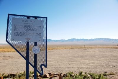
Discovered 1863
Silver Peak is one of the oldest mining areas in Nevada. A 10-stamp mill was built in 1865, and by 1867 a 20-stamp mill was built. Mining camp lawlessness prevailed during the late sixties, and over the next 38 years, Silver . . . — — Map (db m3493) HM
The remnants of Columbus are located on the edge of the Columbus salt marsh, five miles to the southwest.
The town was initially settled in 1865, when a quartz mill was erected at the site. This was a favorable location for a mill, because . . . — — Map (db m240321) HM
This valley was settled when the Palmetto Mining District was discovered in 1866. In the 1870's the Griffing & Wyman's, as well as the Pacific Borax Works, were extracting borax at Fish Lake.
The Carson and Columbus Stage Line ran northward to . . . — — Map (db m135291) HM
Known originally as Lime Point, this area was first settled about 1880. The early camp was abandoned by 1882. In March 1908, a silver strike brought a new camp into existence. Called Hornsilver, it flourished for about a year, boasting about 800 . . . — — Map (db m34251) HM
An original headframe from the Combination Mine, on the Combination No. 1 claim, located by Alva D. Myers and R.C. Earl on May 26, 1903. In 1989 it was moved to this location from approximately 1/4 mile mile east, in the Goldfield Mining District, . . . — — Map (db m116165) HM
This building was the communications center of Goldfield from 1908 until 1963. The Consolidated Telephone – Telegraph Company Building was one of the few spared by a fire that destroyed 53 blocks of the downtown area in 1923. Today, this building . . . — — Map (db m234151) HM
Gold Point was initially called Lime Point for the lime deposits found in 1868. Processing difficulties in the 1880’s discouraged silver mining locally.
Goldfield Ore discoveries in 1902 stimulated area mining interest and high grade hornsilver . . . — — Map (db m35148) HM
Goldfield came to be, and nearly vanished back into the sagebrush of the desert, an almost a decade. From its humble beginnings in 1902 of only three small mining claims, also known as grubstakes, the town exploded and was the largest city in the . . . — — Map (db m116111) HM
For a 20-year period prior to 1900 the mining in Nevada fell into a slump that cast the entire state into a bleak depression and caused the loss of a third of the population.
The picture brightened overnight following the spectacular strikes in . . . — — Map (db m42666) HM
Formerly the Methodist Episcopal Church
Built 1912
Dedicated March 30, 1914
Historical Marker 2
Goldfield Historical Society
Nevada Commission on Tourism — — Map (db m116107) HM
Goldfield, being the largest city in Nevada in 1907, established three railroad lines to accommodate the growing population: the Bullfrog Goldfield Railroad, the Tonopah and Tidewater Railroad, and the Las Vegas and Tonopah Railroad.
The Las . . . — — Map (db m116113) HM
This structure was built in 1907. It was the headquarters of Senator George Nixon's and George Wingfield's Goldfield Consolidated Mines Company. Nixon and Wingfield had merged a number of mine holdings into the new company in 1906 and
eventually . . . — — Map (db m298613) HM
Thinking that local Joshua trees were related to palm trees, the 1866 prospectors named the mining camp Palmetto. Although a local 12-stamp mill worked the silver ore, the town died for lack of profitable material. New discoveries in the late 1860's . . . — — Map (db m35150) HM
This was the communications center of Goldfield from 1906 until 1963. From 1904 to 1920, Goldfield boomed as a gold producing center. It was the largest (20,000+) city in Nevada during that period, having four railroads and other modern . . . — — Map (db m114228) HM
Built in 1905 by Hubert Maxgut, the Santa Fe Saloon is the oldest continually operating business in Goldfield. Maxgut was killed in a gunfight in 1912, but subsequent owners kept the saloon open. It was located outside of the business district to be . . . — — Map (db m65381) HM
Thomas Lockhart lived in this home, though not at this location. He was born in New Jersey in 1848, and by 1899 he was a well-known prospector and miner in Colorado. He met A. D. Parker, who became his friend and began to grubstake him there. In . . . — — Map (db m259480) HM
1908 - West Side Elementary School.
1910 - Manual training & domestic science classes.
1917-1920 - Goldfield School of Mines.
1931 - Was used by Novackclub Inc. as a golf club factory.
1945 - The building & adjacent land was . . . — — Map (db m115936) HM
If you're looking for Grandpa you found him – about 26 miles south of Tonopah on US 95 – where you're standing right now.
Gran Pah, in Shoshone, means “great water,” and was the first name given to the mining district founded by two native . . . — — Map (db m116115) HM
Known as a contact point for Shoshones and Northern Paiute Indians, Lida Valley was the site of early prospecting in the 1860's.
Later prospectors organized a mining district in 1867 and laid out the town in 1872. Soon stores, shops, stables . . . — — Map (db m52961) HM
This area once had a saloon, store and roadhouse. A post office was applied for in 1899, but did not open.
Please respect this site.
Privately owned by Pigeon Spring Ranch. — — Map (db m89557) HM
The Pittsburgh-Silver Peak Gold Mining Company bought the major mines in the area in 1906. Land speculators at nearby Silver Peak bought up the land. As a result, the mining company surveyed a new townsite north of Silver Peak and named it Blair. . . . — — Map (db m89417) HM
As a result of the mining excitement at Tonopah in 1901 and subsequent construction of the Tonopah and Goldfield Railroad, Millers was founded in 1904 as a station and watering stop on that line. The name honors Charles R. Miller, a director of the . . . — — Map (db m240322) HM
Austin, mother town of mining camps, sprang into being after William Talcott discovered silver at this spot on May 2, 1862. Talcott came from Jacobsville, a stage stop six miles to the west on the Reese River, the first Lander County seat. He was . . . — — Map (db m14435) HM
Austin Cemetery
1863
Has Been Placed On The
National Register
Of Historic Places
By The United States Department Of The Interior
& Austin Historical Society
2003 — — Map (db m89531) HM
St. George's Episcopal Church to the east was consecrated in 1878. The Reverend Blackiston swept the congregation with his enthusiasm and eloquence at Easter Service in 1877 to bring forth pledges including the building, retaining wall, pipe organ, . . . — — Map (db m14609) HM
Austin City Hall (1866) Has been placed on the National Register Of Historic Places By the United States Department of the Interior & Austin Historical Society 2003 — — Map (db m89469) HM
In 1880 the Nevada Central Railroad ended at Clifton, just below Austin. Due to exorbitant costs of moving freight to the mining district at the upper end of town, the Superintendent of the Manhattan Silver Mill would be instrumental in developing . . . — — Map (db m156883) HM
Austin Masonic and Oddfellows Hall (1867)
Has Been Placed On The
National Register Of Historic Places By The United States
Department Of The Interior
& Austin Historical Society
2003 — — Map (db m89530) HM
has been placed on the
National Register
of Historic Places
By the United States
Department of the Interior
& Austin Historical Society
2003 — — Map (db m69612) HM
"Went on up the canyon [Simpson Park] which is very wide and
not very steep... on going over the summit the descent was
more abrupt down into the valley... we came to the
Reasses [Reese] River" - Lumin A. Scott, Aug 25, 1859
For guidebook . . . — — Map (db m263656) HM
About one mile northwest lies a natural pass between two low buttes which, prehistorically, the aborigines may have used as a site of ambushing migratory deer herds. Three petroglyph panels are located in this pass. Concerted, cooperative efforts of . . . — — Map (db m14615) HM
Built of lumber from the first International Hotel constructed in Virginia City.
David E. Buel built the hotel after being refused a free lot in Clifton at the mouth of the canyon below.
Buel, Frederick Baker, W.C. Harrington and John E. . . . — — Map (db m69613) HM
Site of the town of Jacobsville is one-half mile north. Founded on the banks of the Reese River in 1859 by George Washington Jacobs who was the first sheriff of Lander County, farmer and businessman, it was the Overland Stage and Mail station and . . . — — Map (db m69649) HM
has been placed on the
National Register
of Historic Places
By the United States
Department of the Interior
& Austin Historical Society
2003 — — Map (db m69610) HM
In 1860, a group of "businessmen" formed the Reese River Navigation Company. The company sent ads and posters back East that showed large streamers on the river towing ore barges up to Battle Mountain. Although nobody knows how the stock was sold, . . . — — Map (db m184153) HM
This simple stone structure, opened to the public in late 1863, was originally operated as a general merchandise store by the firm of Gridley, Hobart and Jacobs. Gridley is best remembered for his 1864 wager which prompted the auctioning of a sack . . . — — Map (db m14612) HM
Standing on this prominent hill is St. Augustine, the oldest Catholic Church in Nevada built in 1866 and is known as the mother church that spawned other catholic churches in Nevada. The church was built from the local quarry and brickyard for . . . — — Map (db m14611) HM
has been placed on the
National Register
of Historic Places
By the United States
Department of the Interior
& Austin Historical Society
2003 — — Map (db m69611) HM
Started in the fall of 1896 and completed in June, 1897, by Ansom Phelps Stokes, mine developer, railroad magnate and member of a prominent eastern family, as a summer home for his sons, principally J.G. Phelps. After the castle (or the tower, as . . . — — Map (db m14436) HM
The Pony Express Trail passed four miles north of Austin through Jacobsville, Simpson's Park and Dry Creek Station. During the Paiute Indian War the stations were burned and two station tenders at Dry Creek were killed and buried there.
. . . — — Map (db m14607) HM
At the heart of every great legend there is a lie, an exaggeration, a falsehood, a distortion, a deception, a myth, or an untruth. Every skilled story teller is a weaver of little lies that form a tale that is worth retelling. Great writers like . . . — — Map (db m184151) HM
The Federal Government historically has supported numerous surveys for the purpose of measuring the domain which extended, after 1848, to the Pacific. These surveys sought railway routes, military relationships, water transport and wagon roads. The . . . — — Map (db m69609) HM
East of the summit, north of the highway, and under a basalt flow lies Toquima Cave. Red, white, and yellow aboriginal drawings (pictographs) decorate its walls.
Usually located near springs, as here, and on migratory big game trails, painted . . . — — Map (db m62126) HM
Frances Williamson, a teacher, helped found and lead the Austin Equal Suffrage League and the Nevada Equal Suffrage Association in 1895. — — Map (db m213135) HM
Battle Mountain's name derives from the mountain range to the southwest, where in 1850 angry California emigrants ambushed a band of Shoshones after the Indians had attacked their wagons.
As a town, it did not spring into existence until . . . — — Map (db m67263) HM
Aurora, founded in 1860, was claimed by both California and Nevada. In 1861, the California legislature created Mono County and fixed the county seat here. In 1863 a border survey showed the camp was in Nevada and the Mono County seat was moved to . . . — — Map (db m49891) HM
This building, the first to be constructed in Hawthorne, is a remnant of the narrow-guage Carson & Colorado Railroad built south from Mound House in 1881. Railroad officials created the town from desert when the first lots were auctioned off on . . . — — Map (db m43175) HM
Formerly known as Six Mile Station, this stage stop and way station provided service between some of the smaller mining camps and Aurora and Bodie, CA during the late 1860's. The area became of greater importance with the arrival of the Carson . . . — — Map (db m37630) HM
Present Mineral Co. Seat -- Former Esmeralda Co. Seat
Townsite selected in 1880 by H. M. Yerington, president of the Carson and Colorado Railroad Co. as a division and distribution site for the new railroad.
The location was adjacent to . . . — — Map (db m44197) HM
Nevada's earliest maps show Walker Lake. Jedediah Smith, the first American into Nevada, passed near here in 1828 during his remarkable trip across the state. Peter Skene Ogden was here in 1829, then Fremont in 1845 with his guide, Joseph Walker for . . . — — Map (db m42358) HM
The history of the Nine Mile Ranch has a long and interesting past, beginning with the Paiute Indians who inhabited this area long before John C. Fremont’s expedition into Nevada in 1843-1844. According to Fremont’s journal he camped in this area . . . — — Map (db m191201) HM
On July 1, 1883 the county seat of Esmeralda County moved from Aurora to Hawthorne. A court house was needed, so a contract to build it for $29125 was awarded. On August 16, 1883 construction began. Corruption and collusion between the contractor . . . — — Map (db m115909) HM
Debuted in the later forties at the Hawthorne Club located at the corner of 5th and E Street, the main intersection of all roads entering Hawthorne. This was a sign of the times with neon lighting. It brightened the intersection with its huge . . . — — Map (db m61068) HM
This memorial dedicated by the Disabled American Veterans and Ladies Auxiliary, Veterans of Foreign Wars and Ladies Auxiliary, American Legion and Ladies Auxiliary and the citizens of Mineral County, Nevada to perpetuate the memory of our valiant . . . — — Map (db m61073) WM
Born July 1840 in Nicaragua. Died February 1, 1915 in Luning, Nevada. Mother of Conchetta, Conception, Juanita, Emma, James A. Marshall, Frank and Frederick Mason.
Ferminia Sarras was born in Nicaragua and immigrated to America in 1867. . . . — — Map (db m189611) HM
Founded in 1873, Belleville flourished by milling the ore from the Northern Belle Mine in Candelaria. The mill located just east of here made its first bullion bar shipment ($9,200) in April, 1875.
Belleville was famous for murders, drunken . . . — — Map (db m89420) HM
Seven miles to the west lie the ghost towns of Candelaria and Metallic City.
Candelaria was presumably named after a mine of that name located in 1885, and also after the Catholic Candelmas Day. Metallic City, the "sin city" of Candelaria, and . . . — — Map (db m42342) HM
Salt pools discovered and developed here in 1862, led to a thriving business by delivering salt to mining mills in Virginia City by camel. Up until this time, the salt was purchased from San Francisco at a rate between 120 & 180 dollars a ton. Sales . . . — — Map (db m89451) HM
Although the area around Walker Lake in the Utah Territory was set aside for “Indian purposes” in 1859, it was not until 15 years later that President Grant signed the executive order formally establishing the Walker River Indian . . . — — Map (db m45076) HM
These photos were
taken not far from where you
are standing. Since that time,
fields of alfalfa and cotton have
been replaced by mesquite trees
and other native plants. Spring
pools and natural flowing streams
have replaced concrete . . . — — Map (db m184840) HM
Near here is the site of the Bradford Siding on the Death Valley Railroad spur of the Tonopah and Tidewater Railroad. This siding was used by the extensive clay quarries active in the Amargosa Valley from the 1920's until 1940. The first clay claim . . . — — Map (db m107073) HM
Why are there holes in the
limestone? They're not old fence posts, or
dinosaur footprints, but the place where Native
Americans ground mesquite beans into flour. The whole
pod was ground up and pounded to powder with a blunt
sturdy piece of . . . — — Map (db m184850) HM
Jack Longstreet's life before 1880 is unknown. In 1880 Longstreet staked mining claims in Northern Arizona, claimed a Native American Wife, and two years later opened a saloon and drug store in Moapa, Nevada. By 1888, Longstreet was in Oasis Valley, . . . — — Map (db m107098) HM
Looking for a protected, isolated place for a home, Jack Longstreet rode into Ash Meadows and found exactly what he was looking for- a clear spring, a cave in a spring mound, and open pasture for his horses. He enlarged the cave and built a stone . . . — — Map (db m89554) HM
The Chapel at Longstreet was constructed
in 2018 and conducted its first service
October 28, 2018, officiated
by Clergyman Sherry Tonegan.
This Chapel is a replica of the St. Stephens Catholic
Church originally built in the mining . . . — — Map (db m245454) HM
The Fordson tractor by the Ford Motor Company was the first
agricultural tractor to be mass-produced. It was a lightweight,
frameless tractor with a vapouriser-fed engine and four metal
wheels. Henry Ford was raised as a farmer and yearned . . . — — Map (db m195540) HM
Beatty was the center of three short-lived, so-called "gold" railroads that were spawned by
early 1900s strikes in Tonopah, Goldfield and Rhyolite. The town was referred to as the
"Chicago of the West".
Between 1906 and 1907, . . . — — Map (db m31924) HM
Beatty's first and only cemetery, the Desert Hills Cemetery dates back to the beginning of the community. Named for Montillus " Old Man" Beatty, the town was the center of the Bullfrog Mining District. The mining district got it's start with a . . . — — Map (db m107010) HM
The 37th Degree North Latitude is marked at this point as the dividing line between the territories of Utah and New Mexico under the provisions of the Compromise of 1850 which originally organized the land ceded by Mexico in 1848.
When the . . . — — Map (db m46382) HM
Once visited by prehistoric man, Shoshone Indians also used this site for jackrabbit drives and for celebrations.
Silver ore discoveries in 1865, the convenience of wood and water and a naturally fine location resulted in the attractive . . . — — Map (db m86419) HM
Belmont sits at an elevation of 7400 feet. A spring flowing year round made this a gathering site of the Shoshone Indians for rabbit drives and celebrations.
In 1865, silver ore discoveries led to the development of an attractive tree-shaded . . . — — Map (db m287507) HM
In February of 1867 the Nye County seat was moved from lone, NV to Belmont. The county offices were scattered around town in different buildings. Due to this inconvenience and a recent jailbreak from the old jail, the county decided to build a . . . — — Map (db m299479) HM
With the location of silver in the Monitor Mountains in 1865, the Silver Bend Mining District was formed in October 1865. The town of Belmont was founded in the same year, and mining was widespread in the area. This mill was a joint effort of . . . — — Map (db m257850) HM
This was a bachelor's quarters in 1906. That year the Italian occupants staged a lively Fourth of July celebration. Accordion music emanated from with, and wine flowed freely. Again and again someone appeared at the door to empty a six shooter . . . — — Map (db m89576) HM
Mrs. Stevens moved into this house after her former home located between the Watson and Phillips houses in the next row below had burned to the ground. She fed boarders to support her family of two boys and two girls living with her. Two other sons . . . — — Map (db m240320) HM
Samples of rock and ore from the mine and samples of concentrates from the mill were processed (assayed) here to determine the amount of values they contained. The furnace in this assay laboratory used charcoal because it was the only clean burning . . . — — Map (db m89578) HM
Thousands of sacks of charcoal were stacked in this area. The charcoal was used to fire the furnace used to assay the ore samples at the nearby assay office, and as fuel for blacksmith forges in the machine shop at the mine. Because charcoal is . . . — — Map (db m89588) HM
The Company-owned boardinghouse that stood here was leased and run by (China) Tom Joe at the turn of the century. From here, China Joe moved to Ione to operate a boardinghouse of his own. From 1905 until the mine and mill shut down in 1907, the . . . — — Map (db m89589) HM
The Company Store stood on this lot. It sold nearly everything needed in everyday living, including clothing, groceries, prospecting supplies, grain, and drugs. The local doctor acted as his own druggist by compounding the drugs he prescribed . . . — — Map (db m240319) HM
Because the area was sparsely settled and his patients were few, Dr. Bruton was a poor man. He walked when he visited the sick in Berlin and Union Canyon, carrying his satchel which contained all the instruments and medicines he might need. If . . . — — Map (db m89594) HM
For sharing his memories of history as he lived them here in Berlin, West Union Canyon, and other parts of Central Nevada during the early years of the twentieth century. His efforts will allow present and future generations to more fully . . . — — Map (db m89591) HM
Bill and Mack Foster moved this building to here from Ellsworth. It was used as a blacksmith shop by them when they were prospecting in this area for about twenty years preceding the year 1954. — — Map (db m89579) HM
This building contained the blacksmith shop, and was equipped with power driven drill presses, and lathes, etc. Therefore, it was called the machine shop. The crew of mechanics that worked here kept all the mine and mill machinery running . . . — — Map (db m89580) HM
Mr. Bowen, the mine superintendent, believed in dealing with his fellow men with justice and understanding, but he could not be deterred from administering his duties for the company conscientiously.
In 1907, when the miners struck for a raise . . . — — Map (db m89585) HM
Mrs. Kate Phillips lived here until 1907. She then moved to Ione and opened a boarding house and lodging house.
Later, Will and Mack Foster resided in this building for about twenty years. During that time they prospected a wide area and also . . . — — Map (db m89581) HM
The stage driver and his horses were housed under one roof in this building. A partition made of lumber separated the dwelling section from the barn. A small corral was attached to the south section and the door leading into the barn could be closed . . . — — Map (db m89582) HM
This building was a beehive of activity while Berlin was in its heyday.
One man tended to the primary crusher and did other odd jobs, another tended the 30 stamps and the concentration tables, and a third man fired the five boilers and looked . . . — — Map (db m89583) HM
The Two-Story building that stood here was called the "Clubhouse". It might have been erected to house the mine and mill office, but during the years from 1906 to 1908, it was used as quarters for visiting company officials and local supervisors . . . — — Map (db m89587) HM
W.J. Watson who was a postmaster and store manager lived in this house with his daughter, Mrs. Reston and his granddaughter Zoe.
Although Mr. Watson was an employee of high rank, and he was aware of the anti-liquor policy of the company, he . . . — — Map (db m89584) HM
Named for its hazy distances, this valley has seen a parade of famous men and stirring events.
Prior to the white men, the valley and its bordering Toiyabe and Toquima Ranges were favorite Shoshone haunts.
Jedediah Smith, intrepid trapper . . . — — Map (db m89413) HM
Well up into the canyon out yonder, one can still see the massive stone foundations of a costly and splendid stamp mill, as well as, the stone walls of an elegant office and mansion. Here was the scene of once busy place, now a ghost town. Ore . . . — — Map (db m89408) HM
Long after the railroads came to Nevada and branch lines were extended towards the heartland of the state, horse-drawn stages transported people and mail from railhead to the hinterlands. The principal routes were covered by such well-known lines . . . — — Map (db m89421) HM
Ione Valley had a dense and permanent aboriginal population, dating back
about 5,000 years. Unusual property arrangements and agricultural methods
were practiced later by the Shoshone and northern Paiute indians.
Silver was discovered . . . — — Map (db m299440) HM
This marker is dedicated in the memory of Lockheed test pilot
Robert Sieker who lost his life when his U-2 test aircraft crashed
near this site on April 4, 1957.
The U-2 was developed in total secrecy in the mid 1950's by
Lockheed . . . — — Map (db m284500) HM
The grand old building to the left, once known as the Philadelphia House was built by the Combination Silver Mining Company of New York in 1866. Constructed of native stone acquired from a nearby quarry, the building served as headquarters for mine . . . — — Map (db m60215) HM
182 entries matched your criteria. The first 100 are listed above. The final 82 ⊳