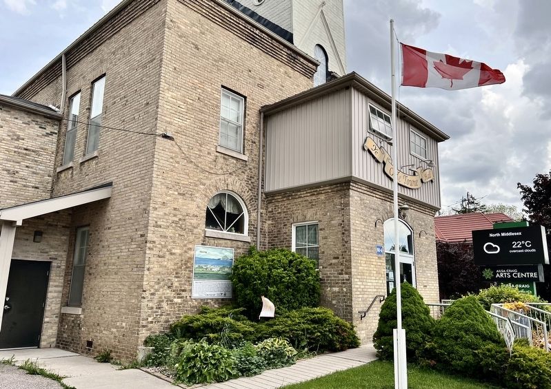
On Ailsa Craig Main Street at Jameson Street, on the right when traveling west on Ailsa Craig Main Street.
Ailsa Craig was named by David Craig, one of the original village founders. He was attracted to the area by the fertile soil of the Ausable river valley and he farmed the land north of what is known today as Middlesex County Road 7. He named the . . . — — Map (db m274346) HM
On Ailsa Craig Main Street at Jameson Street, on the right when traveling west on Ailsa Craig Main Street.
The founding of this community coincided with the construction of the section of the Grand Trunk Railway line from St. Mary's to Point Edward, begun in 1858 and completed a year later. In 1861 David Craig and W. G. Shipley registered subdivisions . . . — — Map (db m274348) HM
On Ailsa Craig Main Street 0.1 kilometers east of Craig Street, on the right when traveling east.
In 1858 with the coming of the Grand Trunk Railway, David Craig, a business man and an engineer by profession, saw the possibilities of his farmland turning into a business centre and William Shipley who owned the adjacent farm assisted and laid out . . . — — Map (db m274344) HM
On Richmond Street at Medway Road, on the left when traveling north on Richmond Street.
The first settlers in this district came from Ireland in 1818 with Captain Richard Talbot. In 1822 some 250 people attended the first Anglican service in the barn of William Geary, three and a half miles from here. The officiant was the Hon. and . . . — — Map (db m296878) HM
On Gideon Drive at Longwoods Road, on the right when traveling north on Gideon Drive.
Born in New Jersey, Allan joined the Loyalist forces in 1777 and served with Butler's Rangers and the Indian Department during the American Revolution. The founder of Rochester, N.Y, he moved to Upper Canada in 1794 and obtained 2,000 acres of land . . . — — Map (db m274123) HM
On Gideon Road (County Road 3) 0.1 kilometers north of Longwoods Road, on the right when traveling north.
A native of New Hampshire who had come to Niagara in 1794, Tiffany was appointed King's Printer and published the official "Upper Canada Gazette" until 1797. He was not a Loyalist and the government, concerned by his American background, forced his . . . — — Map (db m274124) HM
On Longwoods Road (Provincial Highway 2) close to Pratt Siding Road, on the right when traveling east.
English
Here was fought the Battle of Longwoods, 4th March, 1814. United States troops were entrenched on this hill. The British losses were Captain D. Johnson and Lieutenant P. Graeme and twelve men of the Royal Scots Light Company and . . . — — Map (db m78370) HM
On Longwoods Road (Provincial Highway 2) close to Pratt Siding Road, on the right when traveling east.
The view from the British side (left side)
Commanded by Captain James Basden
Royal Scots Light • Western (Caldwell) Rangers • 89th Foot Light • Kent and Middlesex Militia • British Indian Department
On March 3, 1814, the . . . — — Map (db m78369) HM WM
On Dundonald Road 0.1 kilometers south of Walkers Drive, on the left when traveling north.
Founded by twelve families in approximately 1835, the first Presbyterian Church of Mosa was a meager pioneer log building constructed on a site across from the present day church. The original log structure was soon deemed unsuitable and the . . . — — Map (db m274277) HM
On Dundonald Road, on the left when traveling north.
Gaelic-speaking families from
Argyllshire, Scotland settled in this
area as early as 1826. They met for
worship services, and in 1835 began a
log church that was never completed.
A second log church was built in the
early 1840's and a formal . . . — — Map (db m274281) HM
On Concession Drive 0.2 kilometers west of Ewan Avenue, on the right when traveling west.
Situated in Mosa Township at Concession #2, Lot 1, a substantial Georgian style brick home was built in 1854 for Angus Peter McDonald by Nathanial Currie. The main structure of the house measures forty feet by forty feet with a large porch. A grove . . . — — Map (db m274184) HM
On Main Street at McCrae Street, on the right when traveling south on Main Street.
The birth of a settlement here can be attributed to the location; that is,
the intersection of the Great Western Railroad and the town line road between Ekfrid and Mosa townships.
Ekfrid Township was surveyed in 1820 and Mosa, in 1821, and . . . — — Map (db m274218) HM
On Main Street at McCrae Street, on the right when traveling south on Main Street.
Dedicated
to those
who served
their country
by
Land - Sea - Air
World War
I
1914-1918
World
War
II
1939-1945
Korea
Peacekeeping
Forces
Afghanistan
War
2001-2014 — — Map (db m274217) WM
On Main Street at Symes Street, on the left when traveling north on Main Street.
Glencoe's imposing 3-storey brick and stone Dominion Building was constructed on this site in 1909 to house a Post Office, Canada Customs and Caretaker's Quarters.
In 1927, the Hon. J.C. Elliot, M. P. from this area, the Minister of Public Works . . . — — Map (db m274219) HM
On McRae Street 0.1 kilometers west of Main Street (Middlesex Road 14), on the left when traveling west.
With the construction of the Great Western Railway between Toronto and Windsor in 1853, the village of Glencoe became a regular train stop for immigrants settling in the region.
In May 1904, this grand old rail station was built to service the . . . — — Map (db m274213) HM
On Longwoods Road 1.2 kilometers east of Taits Road, on the right when traveling east.
Born near Appin Upper Canada, McArthur attended the University of Toronto and worked briefly for the Toronto Mail before moving to New York in 1890. In 1896 he became editor of Truth and as such encouraged both Canadian and . . . — — Map (db m274125) HM
On Longwoods Road 1.1 kilometers east of Taits Road, on the right when traveling east.
Peter McArthur, the writer known as "the "Sage of Ekfrid" was self described as a writer who "played at farming".
Peter McArthur began life in 1866 on the family homestead at lot 17, concession 1 in Ekfrid Township two miles southwest of Appin. . . . — — Map (db m274127) HM
On McRae Street at Main Street, on the left when traveling west on McRae Street.
Designated as a train stop on the Great Western Railway in 1853, the hamlet of Dundonald was first established by two land owners, John Duncanson and Angus Peter McDonald. In 1854 when the first train stopped at Dundonald, the hamlet was not . . . — — Map (db m274215) HM
On Central Avenue, on the right when traveling east.
Presented to the City of London
by 1st Hussars, 4th June 1950
in memory of the First Hussars who fell
in two World Wars
The only tank of 6th Canadian Armoured
Regiment (1st Hussars) to complete campaign
in North-West Europe
D-Day . . . — — Map (db m18922) WM
On Central Avenue, on the right when traveling east.
This plaque is placed here to commemorate
the 50th anniversary of the Allied Invasion
of Normandy on D Day, 6th June 1944.
It is dedicated to the soldiers of the
First Hussars, to those who took part in the
assault, to those who fought in the . . . — — Map (db m18923) HM
On Adelaide Street at Queens Avenue, on the right when traveling north on Adelaide Street.
Here, in the early morning hours of October 31, 1920, Dr. Frederick Banting conceived an idea for research that led to the discovery of insulin. He believed that diabetes, then a fatal disease, could be treated by a substance extracted from a dog's . . . — — Map (db m18975) HM
On Adelaide Street at Queens Avenue, on the right when traveling north on Adelaide Street.
In 1920, while living and practicing medicine here, Dr. F. G. Banting conceived the idea which eventually led to the discovery of insulin and the saving of millions of lives worldwide. This statue, created by sculptor John Miecznikowski, depicts . . . — — Map (db m18994) HM
On Adelaide Street at Queens Avenue, on the right when traveling north on Adelaide Street.
The Flame of Hope was conceived by His Honour Judge John M. Seneshen, and stands as a symbol for all persons suffering from diabetes around the world. This flame will burn continuously and only be extinguished when it can be declared that a cure for . . . — — Map (db m18996) HM
These cannon were used at the seige of Sebastopol, and were brought to this country after the capture of that city by the British in 1855. Sir John Carling was instrumental in procuring these three pieces for this city. This gun is a British piece. . . . — — Map (db m18928) HM
On Queens Avenue at Richmond Street, on the right when traveling west on Queens Avenue.
[English] The Dominion Public Building was built in 1935-36 by what is now known as Public Works and Government Services Canada in the Classical Moderne style using stylized Art Deco decorative carvings in the masonry. The local architects . . . — — Map (db m198247) HM
On Ridout Street North, on the left when traveling north.
Built in 1834 by Capt. John Harris, R.N., treasurer of the London District, this is London's oldest remaining house. With his wife Amelia, daughter of Samuel Ryerse, Harris came to London after the District offices were moved here from Vittoria. For . . . — — Map (db m18970) HM
On Dundas Street just west of Quebec Street, on the left when traveling west.
Built in 1910 for the Grand Trunk Railway by the Canadian Locomotive Company of Kingston, Ontario, and weighing 135 tons, Engine 86 is one of the last remaining 2-6-0 Mogul engines in Canada. This class of engine was designed specifically for . . . — — Map (db m75960) HM
On Dundas Street at Waterloo Street, on the right when traveling east on Dundas Street.
The founder of Kinsmen & Kinette Clubs of Canada was born and raised at 324 Dundas Street, directly across from the armouries. Seeking the camaraderie he had experienced in the army during the First World War, “Hal” Rogers began the . . . — — Map (db m18933) HM
The King Street Bridge was built in 1897 by Isaac Crouse of London, Ontario. It was designed and fabricated by the Central Bridge and Engineering Co. of Peterborough, Ontario. Featuring a Pratt-type through truss, it originally carried vehicular . . . — — Map (db m198260) HM
On Dundas Street, on the right when traveling east.
Completed in 1905, the London Armouries is attributed to Department of Public Works architect, T. E. Fuller. It was the home of the militia units of the Royal Canadian Regiment, the First Hussars, the Royal Canadian Artillery, Royal Canadian Army . . . — — Map (db m18929) HM
“In Honour of the Men from the London District who Fought for the Empire in South Africa, and in Memory of Those Who Fell.”
1899 - 1902
[First Panel]
Pte. D. L. Moore, R.C.R.- Feb 14th, 1900
Pte. J. A. Donegan, 26th . . . — — Map (db m18927) WM
On Wellington Street at Dufferin Avenue, on the left when traveling north on Wellington Street.
East facade:
MCM
XIV
The Glorious Dead
West facade:MCM
XXXIX
1950 - 1953
Bronze plaque on West facade:
In honour of those who died in war and conflict
Erected 1934 by the Imperial Order Daughters of the . . . — — Map (db m18966) WM
On Clarence Street, on the right when traveling north.
The London Women's Monument was dedicated on December 6, 1994. The 5th anniversary of the Montreal Massacre. It is a place to remember and reflect on violence, particularly violence against women, and all women and men who work to end it. — — Map (db m18932) HM
On Ridout Street North at Dundas Street, on the left when traveling north on Ridout Street North.
[English Translation]
Erected in 1830, this building was modelled after Malahide Castle, near Dublin, Ireland, the ancestral home of Colonel Thomas Talbot, founder of the Talbot Settlement. The site was a part of the town plot set aside . . . — — Map (db m18962) HM
On Central Avenue, on the right when traveling east.
To the everlasting memory
of the members of
THE 1ST HUSSARS
both the living and the dead, who together with
other Canadian and Allied servicemen
participated in the glorious campaign of 1944-1945
that led to the liberation of the . . . — — Map (db m18921) HM
In one of several concentrations of British troops in Upper Canada various infantry and artillery units were stationed on a military reserve here during the mid-19th century. The garrison, which contributed significantly to the economic growth of . . . — — Map (db m18918) HM
On Dundas Street East at Rectory Street, on the right when traveling east on Dundas Street East.
Completed in 1884, restored in 1969 as Aeolian Town Hall, served as a centre for political and social life in London East until 1947. — — Map (db m18963) HM
On Ridout Street North at Dundas Street, on the left when traveling west on Ridout Street North.
In 1793, here on the River Thames, Lieutenant-Governor John Graves Simcoe selected a site for the capital of Upper Canada. York, however, became the seat of government and the townsite of London lay undeveloped until its selection in 1826 as the . . . — — Map (db m18971) HM
On Ridout Street North at Dundas Street, on the left when traveling south on Ridout Street North.
“More change has been caused to the views around London by the cutting down of hills and the building of gullies.”
--Harriet Priddis, in her “Reminiscences” (1902)
In the 1840s George Russell Dartnell . . . — — Map (db m18973) HM
On Ridout Street North, on the left when traveling south.
The Petition of John Ewart of the Town of York:
Humbly Shewith:
That while your Petitioner was performing his contract for building the Court House and Gaol in the town of London, in the London District, he was located by Colonel Talbot upon . . . — — Map (db m18974) HM
On Ridout Street North, on the right when traveling south.
This streetscape includes several of London's earliest buildings and provides a capsule view of the appearance of mid-19th century Ontario cities. These buildings, the earliest of which was begun in 1835, include residential, industrial and . . . — — Map (db m18972) HM
Dedicated November 4, 2005
to remember, honour, and celebrate
our Canadian Veterans.
May the memory of their
achievements and sacrifices
be kept alive.
This garden was made possible thanks to the generous donation by Angus and Mabe . . . — — Map (db m18969) WM
With deepest gratitude to those who so generously
contributed to this visible and resonant
remembrance of our Canadian Veterans
Separate Stone marker nearby:
Thank You Canada
Thank You Veterans
1940 - 1945
This musical . . . — — Map (db m18968) WM
On Clarke Road 0.1 kilometers south of Avalon Street, on the right when traveling south.
Built c1857, this brick homestead housed multiple generations of the Clark family, successful farmers who turned parts of the Upper Canadian wilderness into prosperous mixed farms.
John Clark (1777-1873), a pioneer from Ireland, purchased 100 . . . — — Map (db m285313) HM
On Carling Street at Talbot Street, on the left when traveling east on Carling Street.
Built 1854 for Josiah Blackburn's "London
Free Press"; served as the Queen's Hotel 1871-
1920; became William Weld's "Farmer's Advocate"
1921-1965; opened 1974 as the Marienbad
Restaurant. — — Map (db m296544) HM
On Dundas Street at Clarence Street, on the right when traveling east on Dundas Street.
Built in 1871 as Spettigue Hall by
Joseph Jordan Spettigue and later
acquired by James Colin Duffield.
It served as a concert hall, home
of clubs, and many businesses.
Renovated 1979-81. — — Map (db m296560) HM
On Albert Street at Ridout Street North, on the right when traveling west on Albert Street.
The son of a Congregationalist minister, Blackburn was born in London, England. After some experience in journalism he immigrated to Canada West (now Ontario) in 1850 and joined the staff of The Star in Paris. Two years later he purchased a small . . . — — Map (db m296690) HM
On Dundas Street at Ridout Street North, on the right when traveling west on Dundas Street.
This noted Canadian artist was born in this city and about 1875 had a studio on Richmond Street in the marble works operated by his father. After studying in Philadelphia and at the Royal Academy Schools, London, England, he moved to Paris in 1887 . . . — — Map (db m296548) HM
On Horton Street East 0.1 kilometers east of Richmond Street, on the right when traveling east.
Site of the terminus for the South-Western Traction Line which connected London to Port Stanley via Lambeth and St. Thomas. It served as an electrified commuter and freight service. This inter-urban line used the innovative Ganz System, the only . . . — — Map (db m296496) HM
On Dufferin Avenue at Richmond Street, on the right when traveling west on Dufferin Avenue.
St. Peter’s Cathedral Basilica
Begun in 1880 and dedicated on June 28, 1885, this magnificent structure was built during the episcopate of Bishop John Walsh to serve as the cathedral for the Diocese of London. Designed by the . . . — — Map (db m296597) HM
On Carling Street at Talbot Street, on the left when traveling east on Carling Street.
From 1920-1965 site of the offices of the
"Farmer's Advocate", Canada's foremost
agricultural newspaper. Founded in 1866 as a
monthly by its first editor, William Weld, it
carried reports of fairs, scientific advances
in agriculture, and . . . — — Map (db m296546) HM
On Richmond Street 0.1 kilometers north of Dundas Street, on the right when traveling north.
Founded in 1891 and printed by the London Advertiser adjoining this site, the industrial banner was a monthly newspaper promoting organized labour, education of workers, political action, the union label, and industrial cooperatives. Edited by . . . — — Map (db m296558) HM
[London Public Library Board marker text:]
The "Fugitive Slave Chapel”, one of two churches
built by London's Black community before 1855.
In 1858 the abolitionist, John Brown, addressed
a meeting here, soliciting support for the
movement . . . — — Map (db m285261) HM
African Methodist Episcopal Church,
Original Building
Built: 1848
Thames Street, City of London
In 1847, land was purchased on Thames Street in London, Canada West (now Ontario) by the African Methodist Episcopal (AME) Church to . . . — — Map (db m285262) HM
Alder's Weaving Shed, Original Building
Built: c. 1857, Middlesex County
Con. 5, Lot 32, London Township
Thomas Alder, maternal grandfather to the Village's first curator Wilfrid Jury, immigrated to Canada from England in 1857 and . . . — — Map (db m285260) HM
The Impact of Settlement
The colonization of Upper Canada began in the 1600s with the arrival of the first Europeans.
Before European settlement, a variety of diverse ecosystems existed in southern Ontario, including old-growth forests, . . . — — Map (db m284405) HM
Blacksmith Shop, Replica Building
Built: 1958
Representative of an 1860s Shop
This replica shop was designed by Upper Thames River Conservation Authority Park Superintendent
Rex H. Bishop, and constructed in 1958 by the Conservation . . . — — Map (db m285196) HM
Caverhill House, Original Building
Built: c. 1867, Elgin County
Con. 7, Lot 3, South Dorchester Township
This wood frame structure, originally know as Stirton House, was constructed on Lot 3, Con. 7, in South Dorchester Township. . . . — — Map (db m285111) HM
Caverhill Stable, Original Building
Built: c. 1860, Middlesex County
West Nissouri Township
Originally the log home of the Weekes family, this building was used as a granary for many years after the family constructed a new frame . . . — — Map (db m285112) HM
Caverhill Woodworking Shop,
Original Building
Built: c. 1870, Middlesex County
Lobo-London Township Line
Constructed by William A. Caverhill, the woodworking shop was originally a two-storey building, with an attached blacksmith . . . — — Map (db m285043) HM
Taverns, like this 1840s example, provided accommodation, food and stabling for horses to the traveling public. They became important community meeting centres as well as the local place to go for a pint.
John Corbett (b. 1816, d. 1906) . . . — — Map (db m285193) HM
Denfield General Store, Original Building
Built: c. 1877, Middlesex County
Denfield, Ontario
J.T. Dinsmore built the Denfield General Store in a community originally known as "Brecon." The name of the village was later changed to . . . — — Map (db m284701) HM
Dr. Jones Frame Barn, Original Building
Built: c. 1900, Middlesex County London Township
This big red barn is originally from the farm of Casey Bakema, located on the east shore of Fanshawe Lake at Look-Out Point in London Township. The . . . — — Map (db m285250) HM
Dr. Jones House, Original Building
Built: c. 1880, Perth County
Con. 14, Lots 22 & 23, Downie Township
This house, formerly known as Miller House, was originally built by Keith Lee around 1880. Brothers Robert and Dorrington James . . . — — Map (db m285201) HM
In early 20th century Ontario, rural doctors held an important position in the community. Not simply family physicians, they also acted as surgeons, pharmacists, obstetricians, and dentists.
William Anson Jones was born in Clandeboye, . . . — — Map (db m285249) HM
Elgie Log House, Original Building Built: c. 1865, Middlesex County Con. 7, Lot 24, West Nissouri Township
While the builder of this house has never been identified, it is known that the Log House was the boyhood home of Michael Elgie. . . . — — Map (db m285285) HM
Political, economic, and social conditions in Europe and other parts of North America prompted immigration to Upper Canada, and into what is now southwestern Ontario.
Emigrants from Ireland, Scotland, England, Wales, other British North American . . . — — Map (db m284472) HM
Fanshawe School S.S. #19,
Original Building
Built: 1871, Middlesex County London Township
Built in 1871, S.S. #19 was an improvement over the drafty log school that was its predecessor. Unfortunately, it was designed without . . . — — Map (db m285036) HM
Harmer Sawmill, Original Building
Built: 1885, Perth County
Lot 11, Fullerton Township
Originally located on West Mitchell Road in Fullarton Township, the Harmer Sawmill was a combined grist-and-sawing operation that began production . . . — — Map (db m284874) HM
Building a New Life
The continued arrival of new inhabitants to Upper Canada, greatly impacted the region. The once great forest was cleared, destroying habitats that had existed for centuries. In this area, much of the tree cover was lost . . . — — Map (db m284473) HM
Indigenous Communities
This land has a long history of people moving across it. It has provided food, medicine, tools, hunting grounds, trade routes, and most importantly a home since time immemorial. Many peoples have called this land home . . . — — Map (db m284438) HM
Jury House, Original Building Built: c. 1888, Middlesex County Con. 2, Lot 12, Lobo Township
The Jury Farmhouse was built in 1888 by William Jury Jr. for his son Amos on the occasion of his marriage to Charlotte Julia "Jewel" Alder, the . . . — — Map (db m285026) HM
Carriage Shed, Replica Building
Built: 1987
Representative of an 1880's Shed
Brougham Carriage (right) c. 1875
By the mid 19th-century, Brougham-style carriages were the everyday vehicle of the upper classes. Smaller models were . . . — — Map (db m285117) HM
Lochaber Church, Original Building Built: 1884, Middlesex County
Con. 17, Lot 11, East Williams Township
The founders of Lochaber Church were originally members of the Presbyterian Church. The devout Scottish congregation upheld their . . . — — Map (db m285192) HM
London Brewery, Replica Building
Built: 1967
Representative of the original 1828 London Brewery
This building is a replica of the 1828 London Brewery. It was built in 1967 by Labatt Breweries of Canada to commemorate the Canadian . . . — — Map (db m284827) HM
Mount Moriah Masonic Lodge,
Reconstructed Building
Built: c. 1860, Middlesex County Westminster Township
This structure was once the Pond Mills School, formally known as School Section #7. The school was originally located in the . . . — — Map (db m285115) HM
Born in London, Ontario, Peel became one of the most prominent Canadian painters of the French academic school of painting and among the first to gain an international reputation. He studied art in Philadelphia, London, England, and . . . — — Map (db m285113) HM
Peel House, Original Building
Built: c. 1850
238 Richmond Street, London, Ontario
London-born and internationally renowned artist, Paul Peel (1860-1892), lived in this home during his childhood. Originally located at 238 Richmond Street, . . . — — Map (db m284894) HM
Print Shop, Replica Building
Built: 1967
Representative of an 1890s Print Shop
This replica shop was built and equipped by the London Free Press to celebrate the Canadian Centennial in 1967. Situated on the front lawn of the CFPL-LFP . . . — — Map (db m284691) HM
Purple Hill L.O.L. #817, Original Building
Built: c. 1880, Middlesex County
Con. 5, Lot 8, West Nissouri Township
The first meeting of the Purple Hill Loyal Orange Lodge No. 817 was held in 1857 at the home of Samuel Taylor in West . . . — — Map (db m285194) HM
Replica Building Built 1964
The Tavern Carriage Shed was originally built as a replica fire hall at the museum, which opened to the public in 1966. Although early sketches of the Village show that a fire hall was part of our first curator . . . — — Map (db m285116) HM
The shoe and boot making trade is one of the oldest vocations in Canada. The first census of 1666 recorded 20 shoemakers serving a population of little more than 3,200 people. In the early 19th century, many shoemakers in rural areas worked out of . . . — — Map (db m284703) HM
The Many Uses of Nature
One of the amazing things about the Carolinian forest is what it provides. Native plant and animal species provide not only food and medicine, but resources for furniture, tools, buildings, canoes, snowshoes, baskets, . . . — — Map (db m284577) HM
On Fanshawe Park Road East 0.5 kilometers east of Highbury Avenue North, on the left when traveling east.
Within this cemetery lies George Loveless. He, with his
brother James, John and Thomas Standfield, James Brine
and James Hammett, were condemned to penal servitude in
1834 for organizing in Tolpuddle, Dorsetshire, England, a
union of farm . . . — — Map (db m285303) HM
The harness and saddler trades were essential to the early pioneers, who were expected to fulfill their settlement duties by clearing land for farming and roadways. Harnesses for oxen and horses were especially important, as they allowed for the . . . — — Map (db m284742) HM
Trinity Church, Original Building
Built: c. 1887, Perth County
Sebringville, Ontario
In 1872, Trinity Anglican Church was formed by five families as a mission of Stratford's St. James Anglican Church. Land was eventually obtained to . . . — — Map (db m284877) HM
Replica Building Built 1979/1980
Originally built to house the A.E. Keough Machine Shop collection dating from the early 20th century. It is now used as rental and programming space at the Village.
Machine shops in urban centres marked . . . — — Map (db m284689) HM
On River Road at Veterans Memorial Parkway, on the right when traveling east on River Road.
4 Divisions of the Canadian Corps, fighting together for the first time, attacked and captured the ridge including Gen Arthur Currie commanding 1st Division. Over 10,500 Canadians were killed or wounded. — — Map (db m308444) HM WM
On River Road at Veterans Memorial Parkway when traveling east on River Road.
Years of Service
1915-1919 (Canada)
Only Ukrainian Canadian to receive the Victoria Cross
For most conspicuous Bravery and Leadership
Battle of Hill 70
Commemorated on the Centennial,
2017
Placed by the London Ukrainian . . . — — Map (db m308446) HM WM
On Glenwood Avenue 0.1 kilometers Trafalgar Street, on the right when traveling south.
Founded in 1923 by James and Christina Jenkins (Howson) and for
many years printed weekly on this site, the Dawn of Tomorrow was
the voice of the Canadian League for the Advancement of Colored
People. The aim of the newspaper was to unify the . . . — — Map (db m308534) HM
On River Road at Veterans Memorial Parkway, on the right when traveling east on River Road.
Over 14,000 soloiers assaulted Juno Beach in Normandy, France and thousands more were in the air and sea.
Many would never come back home.
They Fought to Liberate — — Map (db m308338) HM WM
On River Road at Veterans Memorial Parkway, on the right when traveling east on River Road.
The First Canadian Army fought German forces throughout the Netherlands until the German Army surrendered at the end of WWII.
Canada brought freedom and relief to this battered and starving nation after a harsh 5 year occupation
More than 7600 . . . — — Map (db m308442) HM WM
On River Road at Veterans Memorial Parkway, on the right when traveling east on River Road.
During the occupation of the Netherlands, the Nazis confiscated most of the church bells to melt down for ammunition. When the country was liberated by allied forces, the bells that had been spared rang out the joyous celebration that the war had . . . — — Map (db m308439) HM WM
On Western Road 0.1 kilometers south of Elgin Road, on the right when traveling south.
The college was founded by the Right Reverend Benjamin Cronyn who, following his election in 1857 as first Anglican Bishop of Huron, saw the need for a theological school and institution for advanced studies to serve the rapidly expanding population . . . — — Map (db m308538) HM
On Colborne Street 0.1 kilometers north of Oxford Tweet East, on the left when traveling north.
This typical fire station,
erected 1909,
was proposed by Chief John A. Roe,
member of London's first
paid fire department
from 1873 until his death in action 1904. — — Map (db m308535) HM
Near Attawandaron Road south of Aldersbrook Road, on the left when traveling south.
About 1500 A.D. a Prehistoric Neutral (Late OntarioIroquois) Indian village occupied this site. Archaeological excavations suggest that it was an agricultural community covering 4-5 acres and housing approximately 1,000 inhabitants in communal . . . — — Map (db m296876) HM
On Elgin Drive 0.3 kilometers north of Perth Drive, on the right when traveling east.
Near this site, on April 15, 1922, the first sod was turned for the Arts Building (University College) by Governor-General Lord Byng of Vimy. Two years later, The University of Western Ontario moved from St. George Street to this location, its third . . . — — Map (db m308537) HM
On Wellington Street at Cheapside Street, on the right on Wellington Street.
Originally the Anthistle Gravel Pit, this property was
taken over by the City of London in 1937. The Ryerson
Home and School Association turned the site into a
model playground in 1948. Through the efforts of the
North London Community . . . — — Map (db m296835) HM
152 entries matched your criteria. The first 100 are listed above. The final 52 ⊳