157 entries match your criteria. The first 100 are listed. ⊳
The Colonial Dames of America, National Society of Historical Markers
Markers placed or sponsored by any Chapter of the National Society of The Colonial Dames of America, founded in Philadelphia and headquartered in Washington DC. The NSCDA promotes appreciation for the people, places and events that led to the formation and development of our country.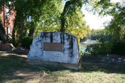
By Tim & Renda Carr, November 6, 2010
Ecor Bienville Marker
| 1 ► Alabama, Dallas County, Selma — Ecor Bienville — 1702-1743 — The first recorded name of Selma — |
| On Water Avenue at Lauderdale Street, on the left when traveling west on Water Avenue. | |||
| 2 ► Alabama, Elmore County, Wetumpka — Here Stood Fort Toulouse — |
| Near West Fort Toulouse Road, 0.3 miles west of Jackson Park Road, on the right when traveling west. | |||
| 3 ► Alabama, Lowndes County, Tyler — Talisi visited by De Soto — Sept. 18, 1540 — |
| On U.S. 80 at County Road 7, on the right when traveling west on U.S. 80. | |||
| 4 ► Alabama, Mobile County, Mobile — U.S. Marine Hospital — |
| On St Anthony Street at North Bayou Street, on the right when traveling west on St Anthony Street. | |||
| 5 ► Alabama, Montgomery County, Maxwell Air Force Base — Site of Indian Town Tawasa — 1540-1814 — |
| Near West Hickory Street at Chennault Circle when traveling west. | |||
| 6 ► Alabama, Montgomery County, Montgomery — Struggle For Colonial Empire — |
| Near Water Streer at Commerce Street, on the right when traveling west. | |||
| 7 ► Alabama, Talladega County, Childersburg — De Soto's Visit — |
| On U.S. 280 at Childersburg Fayettville Highway (State Highway 76), on the right when traveling south on U.S. 280. | |||
| 8 ► Alabama, Tuscaloosa County, Tuscaloosa — Tushkalusa — The Indian Chieftain — Mauvila Oct. 18, 1540 — |
| On Greensboro Avenue (24th Avenue) south of 7th Street, on the right when traveling south. | |||
| 9 ► Arizona, Pima County, Tucson, Mission Valley — Mission San Xavier del Bac — |
| 10 ► Arkansas, Garland County, Hot Springs — Hollywood Cemetery — Entrance presented by National Society Colonial Dames — |
| On Mote Street at Hollywood Street on Mote Street. | |||
| 11 ► California, Placer County, Roseville — Carnegie Museum — |
| On Lincoln Street at Pleasant Street, on the left when traveling west on Lincoln Street. | |||
| 12 ► California, Ventura County, Santa Paula — 65 — Glen Tavern Inn — |
| On Mill Street at Santa Barbara Street, on the right when traveling south on Mill Street. | |||
| 13 ► Delaware, New Castle County, New Castle — Fort Casimir — |
| On Second Street at Chestnut Street on Second Street. | |||
| 14 ► Delaware, New Castle County, Wilmington, Mid-town Brandywine — Presbyterian Meeting House — |
| On North West Street at South Park Drive, on the right when traveling north on North West Street. | |||
| 15 ► Delaware, New Castle County, Wilmington, Old Swedes — 18 — "K. C." and "B. C." Stones — Old Swedes Churchyard Walking Tour — |
| Near North Church Street (U.S. 13) at East 7th Street, on the right when traveling north. | |||
| 16 ► Delaware, New Castle County, Wilmington, Old Swedes — 5 — "M. B." Stone — Old Swedes Churchyard Walking Tour — |
| Near North Church Street (U.S. 13) at East 7th Street, on the right when traveling north. | |||
| 17 ► Delaware, New Castle County, Wilmington, Old Swedes — 11 — Bayard Plot — Old Swedes Churchyard Walking Tour — |
| Near North Church Street (U.S. 13) at East 7th Street, on the right when traveling north. | |||
| 18 ► Delaware, New Castle County, Wilmington, Old Swedes — 22 — Bishop Alfred Lee — Old Swedes Churchyard Walking Tour — |
| Near North Church Street (U.S. 13) at East 7th Street, on the right when traveling north. | |||
| 19 ► Delaware, New Castle County, Wilmington, Old Swedes — 4 — Brinckle Family — Old Swedes Churchyard Walking Tour — |
| Near North Church Street (U.S. 13) at East 7th Street, on the right when traveling north. | |||
| 20 ► Delaware, New Castle County, Wilmington, Old Swedes — 3 — Burr Family Vault — Old Swedes Churchyard Walking Tour — |
| Near North Church Street (U.S. 13) at East 7th Street, on the right when traveling north. | |||
| 21 ► Delaware, New Castle County, Wilmington, Old Swedes — 10 — Charles Springer — Old Swedes Churchyard Walking Tour — |
| Near North Church Street (U.S. 13) at East 7th Street, on the right when traveling north. | |||
| 22 ► Delaware, New Castle County, Wilmington, Old Swedes — 19 — Dr. Joseph Capelle — Old Swedes Churchyard Walking Tour — |
| Near North Church Street (U.S. 13) at East 7th Street, on the right when traveling north. | |||
| 23 ► Delaware, New Castle County, Wilmington, Old Swedes — 17 — East Wall Letters — Old Swedes Churchyard Walking Tour — |
| Near Church Lane (U.S. 13) at East 7th Street, on the right when traveling north. | |||
| 24 ► Delaware, New Castle County, Wilmington, Old Swedes — 21 — Elizabeth Montgomery — Old Swedes Churchyard Walking Tour — |
| Near North Church Street (U.S. 13) at East 7th Street, on the right when traveling north. | |||
| 25 ► Delaware, New Castle County, Wilmington, Old Swedes — 15 — Garesche, Bauduy, Deschappelle Families — Old Swedes Churchyard Walking Tour — |
| Near North Church Street (U.S. 13) at East 7th Street, on the right when traveling north. | |||
| 26 ► Delaware, New Castle County, Wilmington, Old Swedes — 9 — Graffiti Doors — Old Swedes Churchyard Walking Tour — |
| Near North Church Street (U.S. 13) at East 7th Street, on the right when traveling north. | |||
| 27 ► Delaware, New Castle County, Wilmington, Old Swedes — 2 — Hendrickson House — Old Swedes Churchyard Walking Tour — |
| Near North Church Street (U.S. 13) at East 7th Street, on the right when traveling north. | |||
| 28 ► Delaware, New Castle County, Wilmington, Old Swedes — 8 — Iron Letters on the Church — Old Swedes Churchyard Walking Tour — |
| Near North Church Street (U.S. 13) at East 7th Street, on the right when traveling north. | |||
| 29 ► Delaware, New Castle County, Wilmington, Old Swedes — 12 — Judge Ignatius C. Grubb — Old Swedes Churchyard Walking Tour — |
| Near North Church Street (U.S. 13) at East 7th Street, on the right when traveling north. | |||
| 30 ► Delaware, New Castle County, Wilmington, Old Swedes — 24 — Maj. Gen. James H. Wilson — Old Swedes Churchyard Walking Tour — |
| Near North Church Street (U.S. 13) at East 7th Street, on the right when traveling north. | |||
| 31 ► Delaware, New Castle County, Wilmington, Old Swedes — 13 — Major Peter Jaquett — Old Swedes Churchyard Walking Tour — |
| Near North Church Street (U.S. 13) at East 7th Street, on the right when traveling north. | |||
| 32 ► Delaware, New Castle County, Wilmington, Old Swedes — 16 — Mary Vining — Old Swedes Churchyard Walking Tour — |
| Near North Church Street (U.S. 13) at East 7th Street, on the right when traveling north. | |||
| 33 ► Delaware, New Castle County, Wilmington, Old Swedes — 23 — North Porticos — Old Swedes Churchyard Walking Tour — |
| Near North Church Street (U.S. 13) at East 7th Street, on the right when traveling north. | |||
| 34 ► Delaware, New Castle County, Wilmington, Old Swedes — 1 — Old Swedes Church — Old Swedes Churchyard Walking Tour — |
| Near North Church Street (Route 13) at East 7th Street, on the right when traveling north. | |||
| 35 ► Delaware, New Castle County, Wilmington, Old Swedes — 14 — South Portico — Old Swedes Churchyard Walking Tour — |
| Near North Church Street (U.S. 13) at East 7th Street, on the right when traveling north. | |||
| 36 ► Delaware, New Castle County, Wilmington, Old Swedes — 7 — Stidham Family — Old Swedes Churchyard Walking Tour — |
| Near North Church Street (U.S. 13) at East 7th Street, on the right when traveling north. | |||
| 37 ► Delaware, New Castle County, Wilmington, Old Swedes — 20 — The Vandever's — Old Swedes Churchyard Walking Tour — |
| Near North Church Street (U.S. 13) at East 7th Street, on the right when traveling north. | |||
| 38 ► Delaware, New Castle County, Wilmington, Old Swedes — 6 — Thomas and Ann Cole — Old Swedes Churchyard Walking Tour — |
| Near North Church Street (U.S. 13) north of East 6th Street, on the right when traveling north. | |||
| 39 ► District of Columbia, Washington, Northwest Washington, Forest Hills — Pierce Mill |
| On Tilden Street Northwest west of Beach Drive Northwest, on the right when traveling west. Reported missing. | |||
| 40 ► District of Columbia, Washington, Northwest Washington, Georgetown — "…a headquarters to call our own" — NSCDA — 1891 — |
| Near Q Street Northwest west of 27th Street Northwest, on the right when traveling west. | |||
| 41 ► District of Columbia, Washington, Northwest Washington, Georgetown — "Evermay" — Georgetown Historic District — |
| On 28th Street Northwest, 0.1 miles south of R Street Northwest, on the right when traveling north. | |||
| 42 ► District of Columbia, Washington, Northwest Washington, Georgetown — "The bramble and trees…had made them invisible" — |
| Near Q Street Northwest just west of 27th Street Northwest, on the right when traveling west. | |||
| 43 ► District of Columbia, Washington, Northwest Washington, Georgetown — “… on a high, dry, & handsome situation” — |
| Near Q Street Northwest just west of 27th Street Northwest, on the right when traveling west. | |||
| 44 ► District of Columbia, Washington, Northwest Washington, Georgetown — Dumbarton House — Headquarters of the National Society of the Colonial Dames of America — Georgetown Historic District — |
| On Q Street Northwest east of 28th Street Northwest, on the right when traveling west. | |||
| 45 ► District of Columbia, Washington, Northwest Washington, Georgetown — Eastern Redbud — |
| Near Q Street Northwest just west of 27th Street Northwest, on the right when traveling west. | |||
| 46 ► District of Columbia, Washington, Northwest Washington, Georgetown — In Grateful Commemoration of the Signing of the Constitution — 1787 - 1937 — |
| On Q Street Northwest just west of 27th Street Northwest, on the right when traveling west. | |||
| 47 ► District of Columbia, Washington, Northwest Washington, Georgetown — Tulip Poplar — |
| Near Q Street Northwest just west of 27th Street Northwest, on the right when traveling west. | |||
| 48 ► District of Columbia, Washington, Northwest Washington, Petworth — St. Paul's Episcopal — |
| Near Allison Street Northwest east of 3rd Street Northwest, on the right when traveling west. | |||
| 49 ► District of Columbia, Washington, Southeast Washington, Fort Davis — Fort Davis — Civil War Defenses of Washington — |
| On Alabama Avenue Southeast north of Pennsylvania Avenue Southeast, on the left when traveling north. | |||
| 50 ► District of Columbia, Washington, Southeast Washington, Fort Dupont — Fort DuPont — Civil War Defenses of Washington — |
| Near Alabama Avenue Southeast east of Massachusetts Avenue Northeast, on the left when traveling east. | |||
| 51 ► Florida, Manatee County, Bradenton — DeSoto Trail — De Soto National Memorial — |
| On DeSoto Memorial Highway. | |||
| 52 ► Florida, Orange County, Winter Park — Francis Philip Fatio (1724-1811) and Lina L'Engle Barnett (1859-1934) — |
| Near Holt Avenue. | |||
| 53 ► Florida, Palm Beach County, Boynton Beach — F-355 — Boynton Woman's Club — |
| On South Federal Highway (U.S. 1) at Southeast10th Avenue, on the right when traveling north on South Federal Highway. | |||
| 54 ► Florida, Palm Beach County, Palm Beach — F-340 — Sea Gull Cottage — Palm Beach's Oldest House — |
| Near South Lake Trail, 0.1 miles west of Cocoanut Row, on the left when traveling south. | |||
| 55 ► Florida, Palm Beach County, West Palm Beach — F-349 — Seaboard Air Line Station — |
| On South Tamarind Avenue, 0.1 miles north of Evernia Street, on the left when traveling north. | |||
| 56 ► Florida, St. Johns County, St. Augustine — This Gate Opened in 1739 — |
| On Orange Street at St. George Street, on the left when traveling east on Orange Street. | |||
| 57 ► Georgia, Chatham County, Savannah, Historic District - North — 25-38 — Jonathan Bryan — (1708 – 1788) — |
| On Montgomery Street near W. Bryan Street, on the left when traveling north. | |||
| 58 ► Georgia, Chatham County, Savannah, Historic District - North — Oglethorpe Bench — |
| On West Bay Street near Whitaker Street, on the left when traveling east. | |||
| 59 ► Georgia, Chatham County, Savannah, Historic District - North — Oglethorpe's House — |
| On Bay Street at Bull Street, on the right when traveling east on Bay Street. | |||
| 60 ► Georgia, Chatham County, Savannah, Historic District - North — Printing Office of James Johnson — |
| On East Broughton Street, on the right when traveling east. | |||
| 61 ► Georgia, Chatham County, Savannah, Historic District - North — Tondee's Tavern — |
| On W Broughton St, on the right when traveling west. | |||
| 62 ► Georgia, Chatham County, Savannah, Historic District - South — 25-61 — Mary Musgrove — |
| On Abercorn Street south of East Macon Street, on the left when traveling south. | |||
| 63 ► Georgia, Colquitt County, Moultrie — Colonial Dames of America Centennial Sundial — |
| On 2nd Avenue Southeast at 1st Street Southeast (Business U.S. 319), on the right when traveling west on 2nd Avenue Southeast. | |||
| 64 ► Georgia, Glynn County, Brunswick — Wright Square — City of Brunswick — |
| On Egmont Street just north of George Street, on the left when traveling south. | |||
| 65 ► Georgia, Glynn County, St. Simons Island — Battle of Bloody Marsh — |
| On Demere Rd. | |||
| 66 ► Georgia, Glynn County, St. Simons Island — Frederica - Oglethorpe — |
| Near Frederica Drive. | |||
| 67 ► Georgia, McIntosh County, Darien — New Inverness — |
| On Ocean Highway (U.S. 17) at Adams Street (Georgia Route 99), on the left when traveling south on Ocean Highway. | |||
| 68 ► Georgia, Muscogee County, Columbus — Linwood Cemetery — |
| On Linwood Boulevard at 8th Street, on the left when traveling east on Linwood Boulevard. | |||
| 69 ► Georgia, Putnam County, Eatonton — Childhood Home of Joel Chandler Harris — |
| On West Harris Street just east of North Madison Avenue, on the right when traveling east. | |||
| 70 ► Georgia, Richmond County, Augusta — Five Indian Nations — |
| On Washington Street near Reynolds Street. | |||
| 71 ► Georgia, Richmond County, Augusta — Fort Augusta — |
| On Washington Street (6th Street). | |||
| 72 ► Illinois, Cook County, Chicago, Near North Side — Abraham Lincoln — |
| Near North Wabash Street at East Huron Street, on the right when traveling north. | |||
| 73 ► Illinois, Cook County, Chicago, Streeterville — Louis Jolliet & Père Jacques Marquette — |
| On North Michigan Avenue, on the left when traveling north. | |||
| 74 ► Illinois, Cook County, Chicago, The Loop District — Old Fort Dearborn — |
| On North Michigan Avenue at East Wacker Drive, on the right when traveling south on North Michigan Avenue. | |||
| 75 ► Illinois, Cook County, Chicago, The Loop District — Rene Robert Cavalier Sieur de La Salle — |
| On North Michigan Avenue near East Wacker Drive. | |||
| 76 ► Indiana, Marion County, Indianapolis, Crooked Creek Civic League — 49.1961.3 — Toll House - Michigan Road — |
| On North Michigan Road (U.S. 421) north of Cold Spring Road. | |||
| 77 ► Indiana, Morgan County, Waverly — 55.1957.1 — Whetzel Trace — |
| On Old State Road 37 North, 0.1 miles south of Central Avenue, on the right when traveling north. | |||
| 78 ► Indiana, St. Joseph County, South Bend — 71.19??.1 — La Salle's Camp — 1 Mile West — |
| On State Road 933 at Darden Rd, on the right when traveling north on State Road 933. | |||
| 79 ► Kansas, Leavenworth County, Fort Leavenworth — First Capital of Kansas Territory — |
| On McPherson Avenue at Riverside Avenue, on the right when traveling east on McPherson Avenue. | |||
| 80 ► Kentucky, Garrard County, Lancaster — 25 — The Traveling Church — 1781 |
| On Lancaster Road (Kentucky Route 39) at Gilbert Creek Road (Kentucky Route 642), on the right when traveling south on Lancaster Road. Reported missing. | |||
| 81 ► Kentucky, Greenup County, South Portsmouth — 31 — Shannoah — |
| On Kentucky Route 8, 0.7 miles west of the Bridge to Ohio (Kentucky Route 852), on the right when traveling west. | |||
| 82 ► Kentucky, Jefferson County, Louisville, Downtown — George Rogers Clark — 1752 - 1818 — |
| On W Jefferson Street at S 5th Street, on the right when traveling west on W Jefferson Street. | |||
| 83 ► Kentucky, Jefferson County, Louisville, Downtown — The Stockade On Corn Island, 1778 — |
| Near W Main Street at N 7th Street, on the right when traveling west. | |||
| 84 ► Kentucky, Jefferson County, Louisville, Rockcreek Lexington Road — 26 — Spring Fort Built Before 1782 — |
| On McCready Avenue at Trinity Road, on the right when traveling south on McCready Avenue. | |||
| 85 ► Kentucky, Shelby County, Shelbyville — 28 — Squire Boone's Station, 1779 — |
| On Main Street (U.S. 60) at 5th Street, on the left when traveling east on Main Street. | |||
| 86 ► Louisiana, Rapides Parish, Pineville — This Stone Was A Part Of The 1st LA. Seminary — |
| Near Shreveport Highway (U.S. 71) 0.3 miles north of Executive Court, on the right when traveling north. | |||
| 87 ► Maryland, Anne Arundel County, Annapolis — Site of the Annapolis City Gates — 1698-1790 — |
| On West Street (Maryland Route 450) at Calvert Street, on the right when traveling east on West Street. | |||
| 88 ► Maryland, Charles County, La Plata — Old Durham Church, Episcopal - 1692 — |
| On Crain Highway (U.S. 301) at Port Tobacco Road (Maryland Route 6), on the right when traveling south on Crain Highway. | |||
| 89 ► Maryland, Montgomery County, Chevy Chase — Clean Drinking Manor — |
| Near Susanna Lane, 0.2 miles east of Jones Mill Road, on the right when traveling north. | |||
| 90 ► Maryland, St. Mary's County, St. Mary's City — Here Lyeth The Body — |
| Near Trinity Church Road near Point Lookout Road (Maryland Route 5). | |||
| 91 ► Minnesota, Clearwater County, Shevlin — Itasca Lake — Source of the Mississippi River — |
| Near Park Drive, 0.5 miles County Highway 48. | |||
| 92 ► Mississippi, Adams County, Natchez — Kingston — |
| On U.S. 61 at Kingston Road, on the right when traveling north on U.S. 61. | |||
| 93 ► Mississippi, Hinds County, Jackson, Belhaven — Mississippi Governors Memorial — |
| Near North West Street, on the left when traveling north. | |||
| 94 ► Mississippi, Warren County, Vicksburg — Fort Nogales 1791 — |
| On North Washington Street (Business U.S. 61) 1.3 miles 1st East Street when traveling north. | |||
| 95 ► Missouri, St. Louis, Near North Riverfront — Le Grange de Terre (Big Mound) — |
| On Mound Street, on the left when traveling east. | |||
| 96 ► New Jersey, Camden County, Haddonfield — King’s Road / Chew’s Landing Road — |
| On Kings Highway at Chew’s Landing Road, on the left when traveling south on Kings Highway. | |||
| 97 ► New Jersey, Essex County, Newark, Central Ward — First Settlers of Newark — |
| On Broad Street at Branford Place, on the right when traveling north on Broad Street. | |||
| 98 ► New Jersey, Mercer County, Titusville — 200th Birthday of George Washington — 1732 - 1932 — |
| On River Road at Washington Crossing Pe Rd, on the left when traveling north on River Road. | |||
| 99 ► New Jersey, Union County, Elizabeth — First Site of Princeton University — |
| On Broad Street (Route 623) at Caldwell Place, on the right when traveling south on Broad Street. | |||
| 100 ► New York, Essex County, Ticonderoga — Colonel John Brown — |
| Near Sandy Redoubt, on the right when traveling east. | |||
157 entries matched your criteria. The first 100 are listed above. The final 57 ⊳