117 entries match your criteria. The first 100 are listed. ⊳
Pennsylvania Railroad (PRR) Historical Markers
Markers related to America's largest railroad by traffic/revenue throughout the twentieth century and at one time the world's largest publicly-traded corporation.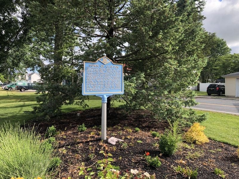
By Devry Becker Jones (CC0), May 31, 2021
Town of Clayton Marker
| 1 ► Delaware, Kent County, Clayton — KC-59 — Town of Clayton — |
| On Main Street at North Bassett Street, on the right when traveling west on Main Street. | |||
| 2 ► Delaware, New Castle County, Wilmington, Edgemoor — Welcome to Fox Point State Park — Unique in many ways — |
| On Lighthouse Road, 1 mile north of Ellerslie Road, on the right when traveling north. | |||
| 3 ► Delaware, New Castle County, Wilmington, Riverfront — Joseph R. Biden, Jr., Railroad Station — |
| On French Street south of East Front Street, on the right when traveling south. | |||
| 4 ► Delaware, New Castle County, Wilmington, Riverfront — Wilmington Station — |
| On French Street. | |||
| 5 ► District of Columbia, Washington, Northeast Washington, Capitol Hill — Delaware Avenue & Columbus Circle, NE — Historical Information — |
| On Columbus Circle Northeast at Delaware Avenue Northeast, on the right when traveling east on Columbus Circle Northeast. | |||
| 6 ► District of Columbia, Washington, Northeast Washington, NoMa/Sursum Corda — 1 — All Aboard! — Hub, Home, Heart — Greater H Street NE Heritage Trail |
| On 1st Street Northeast at Massachusetts Avenue Northeast, on the right when traveling south on 1st Street Northeast. Reported missing. | |||
| 7 ► Maryland, Baltimore, Canton — Historic Canton — The Railroad Transfer Bridge — |
| Near Boston Street at Potomac Street, on the right when traveling east. | |||
| 8 ► Maryland, Baltimore, Shipley Hill — Early Transportation Routes — |
| On West Baltimore Street at Ellicott Driveway, on the left when traveling west on West Baltimore Street. | |||
| 9 ► Maryland, Caroline County, Ridgely — Ridgely Railroad Station — |
| On West Belle Street at North Maryland Avenue, on the right when traveling west on West Belle Street. | |||
| 10 ► Maryland, Cecil County, Perry Point — The War Effort at Home: Perry Point Ammonium Nitrate Plant — Perry Point Village — |
| On 3rd Street at Avenue A, on the left when traveling east on 3rd Street. | |||
| 11 ► Maryland, Cecil County, Perryville — Railroad History — |
| On Roundhouse Drive just south of Smith Lane, on the right when traveling north. | |||
| 12 ► Maryland, Prince George's County, Bowie — Bowie Railroad Station Museum — |
| Near Chestnut Avenue near 11th Street and Old Laurel-Bowie Road (Maryland Route 564). | |||
| 13 ► Missouri, St. Louis County, Kirkwood, National Museum of Transportation — #4700 — Pennsylvania — 1931 — |
| Near Barrett Station Road east of Old Dougherty Ferry Road, on the right when traveling east. | |||
| 14 ► New Jersey, Burlington County, Bordentown — First movement by steam on a railroad in New Jersey — |
| On Farnsworth Avenue at Railroad Avenue, on the right when traveling north on Farnsworth Avenue. | |||
| 15 ► New Jersey, Burlington County, Bordentown — 6 — The "Wye" and the Lower Bordentown Station — |
| Near West Park Street west of Prince Street, on the right when traveling west. | |||
| 16 ► New Jersey, Burlington County, Florence, Florence Township — Look Listen and Live — Evolution of the Grade Crossing — |
| On Hornberger Avenue just north of Alden Avenue, on the right when traveling west. | |||
| 17 ► New Jersey, Burlington County, Riverton — Look Listen and Live — Evolution of the Grade Crossing — |
| On South Broad Street at Lippincott Avenue, on the right when traveling west on South Broad Street. | |||
| 18 ► New Jersey, Camden County, Camden, Cooper Grant — 1 — PRR Federal Street Ferry Terminal — |
| On Jersey Joe Walcott Boulevard, 0.1 miles south of Market Street (County Road 537), on the right when traveling south. | |||
| 19 ► New Jersey, Camden County, Magnolia — Magnolia Station — The Waning Years and a New Beginning — 1940 - 2001 |
| Near Evesham Avenue West at East Atlantic Avenue, on the right when traveling west. Reported unreadable. | |||
| 20 ► New Jersey, Camden County, Pennsauken Township — Advancements in Electrified Railroads — |
| Near 36th Street, 0.3 miles north of Remington Avenue, on the right when traveling north. | |||
| 21 ► New Jersey, Camden County, Pennsauken Township — Look Listen and Live — Vehicular Safety "Blankout" Signals — |
| Near 36th Street, 0.3 miles north of Remington Avenue, on the right when traveling north. | |||
| 22 ► New Jersey, Essex County, Newark, Central Ward — Penn Station — Historic Site — |
| Near Raymond Plaza West north of Market Street. | |||
| 23 ► New Jersey, Mercer County, Trenton, Chestnut Park — 8 — Canals, Trains and Automobiles — |
| On 3rd Street just south of Cass Street, on the right when traveling north. | |||
| 24 ► New Jersey, Mercer County, Trenton, Ewing and Carroll — 10 — The Trenton Connection — |
| On South Clinton Avenue just south of Barlow Street, on the right when traveling south. | |||
| 25 ► New Jersey, Mercer County, Trenton, North 25 — Delaware and Raritan Canal State Park / The Bel-Del |
| On Chauncey Street west of North Warren Street (U.S. 206), on the right when traveling west. Reported damaged. | |||
| 26 ► New Jersey, Mercer County, Trenton, South Trenton — Canals and Railroads – Arteries to the Heart of Industrial Trenton — |
| Near New Jersey Route 29. | |||
| 27 ► New Jersey, Middlesex County, Woodbridge — Great Woodbridge Train Wreck of 1951 — |
| On Main Street at Eleanor Place on Main Street. | |||
| 28 ► New Jersey, Ocean County, Stafford Township, Manahawkin — Manahawkin Railroad Station (1872) — Stafford Township Historic Site — |
| On Stafford Avenue just east of Letts Avenue, on the right when traveling east. | |||
| 29 ► New Jersey, Ocean County, Stafford Township, Manahawkin — Manahawkin Railroad Station (1872) — Stafford Township Historic Site — |
| On West Bay Avenue, 0.2 miles west of South Main Street (U.S. 9), on the left when traveling west. | |||
| 30 ► Ohio, Coshocton County, Coshocton — Richard Nixon addressed a crowed of 3,000 at Coshocton — |
| On Main Street just west of South 5th Street, on the right when traveling east. | |||
| 31 ► Ohio, Coshocton County, Coshocton — Troop Train Accident — |
| On Main Street just east of South 5th Street, on the right when traveling east. | |||
| 32 ► Ohio, Franklin County, Columbus, Airport — 94-25 — Original Port Columbus Airport Terminal — 1929-1958 — |
| On Fifth Avenue, on the right when traveling east. | |||
| 33 ► Ohio, Miami County, Bradford — All Clear at BF Tower — |
| On East Main Street (County Route 88) east of Williams Street, on the right when traveling east. | |||
| 34 ► Ohio, Van Wert County, Van Wert — "Penn Railroad Depot Step" — Van Wert, Ohio — |
| On East 3rd Street just east of North Washington Street (U.S. 127), on the right when traveling west. | |||
| 35 ► Ohio, Van Wert County, Van Wert — Caboose — |
| On East 3rd Street just east of North Washington Street (U.S. 127), on the right when traveling west. | |||
| 36 ► Ohio, Van Wert County, Van Wert — Do Not Turn Warning Flasher — |
| On East 3rd Street just east of North Washington Street (U.S. 127), on the right when traveling west. | |||
| 37 ► Ohio, Van Wert County, Van Wert — Mile Marker Post — |
| On East 3rd Street just east of North Washington Street (U.S. 127), on the right when traveling west. | |||
| 38 ► Ohio, Van Wert County, Van Wert — Original Step — |
| On East 3rd Street just east of North Washington Street (U.S. 127), on the right when traveling west. | |||
| 39 ► Ohio, Van Wert County, Van Wert — Penn RR Track Drill — |
| On East 3rd Street just east of North Washington Street (U.S. 127), on the right when traveling west. | |||
| 40 ► Ohio, Van Wert County, Van Wert — Penn RR Track Gauges — c 1920 — |
| On East 3rd Street just east of North Washington Street (U.S. 127), on the right when traveling west. | |||
| 41 ► Ohio, Van Wert County, Van Wert — Signal Cabinet And Flasher — |
| On East 3rd Street just east of North Washington Street (U.S. 127), on the right when traveling west. | |||
| 42 ► Pennsylvania, Beaver County, Rochester — Make Way for the Railroad — Riverfrontiers — Stories of Beaver County & its Rivers — |
| On Water Street west of Harrison Street, on the left when traveling north. | |||
| 43 ► Pennsylvania, Bedford County, Bedford, Bedford Township — Pennsylvania Turnpike — |
| Near Pennsylvania Turnpike (Interstate 76). | |||
| 44 ► Pennsylvania, Bedford County, Bedford, Bedford Township — Pennsylvania Turnpike — |
| Near Pennsylvania Turnpike (Interstate 76), on the right when traveling west. | |||
| 45 ► Pennsylvania, Berks County, Douglassville, Amity Township — Feuding Railroads — Schuylkill River Trail — |
| On Schuylkill River Trail, on the right when traveling west. | |||
| 46 ► Pennsylvania, Blair County, Altoona — Altoona — |
| On Logan Boulevard, 0.2 miles north of Park Road (U.S. 220), on the left when traveling north. | |||
| 47 ► Pennsylvania, Blair County, Altoona — City of Altoona — [7th Street Bridge] — |
| On 7th Street at 7th Avenue (Route 764), on the right when traveling east on 7th Street. | |||
| 48 ► Pennsylvania, Blair County, Altoona — First Pennsylvania Railroad YMCA — |
| On 13th Street north of 11th Avenue, on the left when traveling north. | |||
| 49 ► Pennsylvania, Blair County, Altoona — Locomotive 790 Bell — |
| On 11th Avenue west of 14th Street, on the left when traveling west. | |||
| 50 ► Pennsylvania, Blair County, Altoona — Pennsylvania Railroad Shops — |
| On 9th Avenue at 13th Street, on the left when traveling north on 9th Avenue. | |||
| 51 ► Pennsylvania, Blair County, Altoona — PRR Class D78F Dining Car No. 4468 — |
| 52 ► Pennsylvania, Blair County, Altoona — PRR Class N5 Cabin Car (or Caboose) No. 477577 — |
| 53 ► Pennsylvania, Blair County, Altoona — PRR Class X29L Steel Boxcar No. 2136 — |
| 54 ► Pennsylvania, Blair County, Altoona — PRR Express Refrigerator Car No. 2561 — |
| Near 9th Avenue south of 12th Street, on the right when traveling south. | |||
| 55 ► Pennsylvania, Blair County, Altoona — Scale Test Weight Car — |
| On 9th Avenue, on the left when traveling north. | |||
| 56 ► Pennsylvania, Blair County, Altoona — The Altoona Works — |
| 57 ► Pennsylvania, Blair County, Altoona — The Juniata Shops — |
| Near 9th Avenue north of 12th Street, on the right when traveling south. | |||
| 58 ► Pennsylvania, Blair County, Altoona — The Master Mechanic — |
| 59 ► Pennsylvania, Blair County, Altoona — The Posy Gang — |
| 60 ► Pennsylvania, Blair County, Altoona, Logan Township — Horseshoe Curve — National Historic Engineering Landmark — |
| On Veterans Memorial Highway, on the right when traveling west. | |||
| 61 ► Pennsylvania, Blair County, Altoona, Logan Township — Horseshoe Curve — |
| On Veterans Memorial Highway, on the right when traveling west. | |||
| 62 ► Pennsylvania, Blair County, Altoona, Logan Township — Over the Hill — How railroads surmounted the spine of the Alleghenies — between Altoona and Johnstown — |
| Near Veterans Memorial Highway. | |||
| 63 ► Pennsylvania, Bucks County, Bristol — Lock 2 — In the Middle — |
| On Old U.S. 13 west of Market Street, on the right when traveling west. | |||
| 64 ► Pennsylvania, Cumberland County, Shippensburg — Railroad Signaling — Cumberland Valley Railroad Museum — Cumberland Valley Rails-to-Trails — |
| On Cumberland Valley Rail Trail north of West Fort Street, on the left when traveling north. | |||
| 65 ► Pennsylvania, Dauphin County, Harrisburg — Cumberland Valley Railroad Bridge — |
| On S. Front Street, on the right when traveling south. | |||
| 66 ► Pennsylvania, Dauphin County, Harrisburg — Harris Switch Tower — |
| On Walnut Street at N. Seventh Street, on the right when traveling east on Walnut Street. | |||
| 67 ► Pennsylvania, Dauphin County, Harrisburg — Old Pennsylvania Railroad Station — |
| 68 ► Pennsylvania, Dauphin County, Harrisburg — St. Michael’s Lutheran Church — |
| On State Street, on the right when traveling east. | |||
| 69 ► Pennsylvania, Delaware County, Springfield, Springfield Township — J. Edgar Thompson — (1808~1874) — |
| On Baltimore Pike at East Thompson Avenue, on the right when traveling west on Baltimore Pike. | |||
| 70 ► Pennsylvania, Franklin County, Fayetteville, Guilford Township — Pennsylvania Railroad Class N5C Cabin Car — |
| Near Lincoln Way East (U.S. 30) 0.7 miles west of Dymond Avenue, on the left when traveling west. | |||
| 71 ► Pennsylvania, Franklin County, Fayetteville, Guilford Township — Quincy Railroad Station — |
| Near Lincoln Way East (U.S. 30) 0.7 miles west of Dymond Avenue, on the left when traveling west. | |||
| 72 ► Pennsylvania, Huntingdon County, Huntingdon — Canal Milepost — |
| On South 4th Street just north of Allegheny Street, on the right when traveling north. | |||
| 73 ► Pennsylvania, Huntingdon County, Huntingdon — Pennsylvania Railroad Artifacts — |
| On South 4th Street just north of Allegheny Street, on the right when traveling north. | |||
| 74 ► Pennsylvania, Huntingdon County, Huntingdon — The Little House — |
| On South 4th Street just north of Allegheny Street, on the right when traveling north. | |||
| 75 ► Pennsylvania, Huntingdon County, Huntingdon — Transition From Canal Era To Railroads At Huntingdon, PA — |
| On Penn Street just west of Stone Creek Ridge Road, on the right when traveling west. | |||
| 76 ► Pennsylvania, Lancaster County, Columbia — Columbia and Its Railroads — |
| Near Walnut Street west of Locust Street, on the right when traveling west. | |||
| 77 ► Pennsylvania, Lancaster County, Columbia — Columbia: a Transportation Hub — Lancaster-York Heritage Region — Susquehanna River Water Trail — |
| Near Walnut Street west of Locust Street, on the right when traveling west. | |||
| 78 ► Pennsylvania, Lancaster County, Columbia — Railroads During the Civil War — Rivertowns — Civil War Trails — |
| On Chestnut Street (Pennsylvania Route 462) south of North 2nd Street, on the right when traveling south. | |||
| 79 ► Pennsylvania, Lancaster County, Elizabethtown — Elizabethtown — Carrier of Change — |
| On West High Street (Pennsylvania Route 241) west of South Market Street (Pennsylvania Route 743), on the left when traveling west. | |||
| 80 ► Pennsylvania, Lancaster County, Lancaster — Working The Line — Constructing an engineering marvel across Southeastern Pennsylvania — Lancastrians make their — Lancaster City — |
| On West James Street just east of North Mulberry Street, on the right when traveling east. | |||
| 81 ► Pennsylvania, Lancaster County, Marietta — 2 — Concrete Railroad Piers — |
| On Robert K Mowrer Drive south of Furnace Road, on the right when traveling south. | |||
| 82 ► Pennsylvania, Lancaster County, Marietta — 8 — Watts Railroad Station — |
| On Furnace Road south of Donegal Place, on the right when traveling south. | |||
| 83 ► Pennsylvania, Lancaster County, New Providence, Providence Township — Big Cut, Big Fill — The Atglen & Susquehanna in Providence Township — |
| On Fairview Road, 0.3 miles west of Beaver Valley Pike (U.S. 222), on the left when traveling west. | |||
| 84 ► Pennsylvania, Montgomery County, Bala Cynwyd, Lower Merion Township — Switchback Bridge — Cynwyd Heritage Trail — |
| On Cynwyd Heritage Trail, 0.2 miles west of Manayunk Bridge Trail, on the right when traveling west. | |||
| 85 ► Pennsylvania, Montgomery County, Bala Cynwyd, Lower Merion Township — The "S" Bridge & The Manayunk Bridge — Cynwyd Heritage Trail — |
| On Cynwyd Heritage Trail at Manayunk Bridge Trail, on the right when traveling west on Cynwyd Heritage Trail. | |||
| 86 ► Pennsylvania, Montgomery County, Bala Cynwyd, Lower Merion Township — The Philadelphia & Columbia Railroad — Lower Merion History — |
| On Conshohocken State Road (Pennsylvania Route 23) at Bala Avenue, on the right when traveling north on Conshohocken State Road. | |||
| 87 ► Pennsylvania, Montgomery County, Bala Cynwyd, Lower Merion Township — The Spaventa Switchback — |
| On Cynwyd Heritage Trail at Manayunk Bridge Trail, on the right when traveling west on Cynwyd Heritage Trail. | |||
| 88 ► Pennsylvania, Montgomery County, Bala Cynwyd, Lower Merion Township — Transportation Corridor in Transition — Cynwyd Heritage Trail — |
| On Cynwyd Heritage Trail at Manayunk Bridge Trail, on the right when traveling east on Cynwyd Heritage Trail. | |||
| 89 ► Pennsylvania, Montgomery County, Bala Cynwyd, Lower Merion Township — William Clegg's Cotton Mill — Cynwyd Heritage Trail — |
| On Cynwyd Heritage Trail, 0.9 miles north of East Levering Mill Road, on the right when traveling north. | |||
| 90 ► Pennsylvania, Perry County, Elliottsburg, Spring Township — 20 — Forces of Change 1945-2020 — Perry County Bicentennial — 1820 - 2020 — |
| On Shermans Valley Road (Pennsylvania Route 274) 0.4 miles east of Veterans Way (Pennsylvania Route 74), on the right when traveling east. | |||
| 91 ► Pennsylvania, Perry County, Elliottsburg, Spring Township — 9 — Pre-Civil War Transportation Development — Perry County Bicentennial — 1820 - 2020 — |
| Near Shermans Valley Road (Pennsylvania Route 274) 0.4 miles east of Veterans Way (Pennsylvania Route 74), on the right when traveling west. | |||
| 92 ► Pennsylvania, Perry County, Elliottsburg, Spring Township — 14 — Transportation and Natural Resources — Perry County Bicentennial — 1820 - 2020 — |
| Near Shermans Valley Road (Pennsylvania Route 274) 0.4 miles east of Veterans Way (Pennsylvania Route 74), on the right when traveling west. | |||
| 93 ► Pennsylvania, Perry County, Elliottsburg, Spring Township — 16 — WW I and Its Aftermath — Perry County Bicentennial — 1820 - 2020 — |
| On Shermans Valley Road (Pennsylvania Route 274) 0.4 miles east of Veterans Way (Pennsylvania Route 74), on the right when traveling west. | |||
| 94 ► Pennsylvania, Perry County, Millerstown — The Millerstown Tannery, 1800-1928 — Perry County Bicentennial — Perry County Heritage Trail — |
| On North Market Street (County Road 1015) just north of Spring Street, on the right when traveling north. | |||
| 95 ► Pennsylvania, Philadelphia County, Philadelphia, Belmont — Belmont |
| On Lancaster Avenue (County Road 3005) at North 40th Street, on the right when traveling west on Lancaster Avenue. Reported unreadable. | |||
| 96 ► Pennsylvania, Philadelphia County, Philadelphia, Callowhill — Rail Park — |
| On Noble Street at North 13th Street, on the right when traveling east on Noble Street. | |||
| 97 ► Pennsylvania, Philadelphia County, Philadelphia, Callowhill — Workshop of the World — |
| On Noble Street at North 13th Street, on the right when traveling east on Noble Street. | |||
| 98 ► Pennsylvania, Philadelphia County, Philadelphia, Devil's Pocket — The arteries of industry — The Schuylkill River shapes early Philadelphia — |
| On South Avenue west of South 27th Street, on the right when traveling east. | |||
| 99 ► Pennsylvania, Philadelphia County, Philadelphia, Devil's Pocket — Workshop of the world — Enterprising Philadelphia companies — |
| On South Street west of South 27th Street, on the right when traveling east. | |||
| 100 ► Pennsylvania, Philadelphia County, Philadelphia, Fairmount Park — Connecting Railroad Bridge |
| On Kelly Drive, 0.1 miles north of Brewery Hill Drive, on the right when traveling south. Reported unreadable. | |||
117 entries matched your criteria. The first 100 are listed above. The final 17 ⊳