After filtering for Montana, 214 entries match your criteria. The first 100 are listed. ⊳
Native Americans Topic
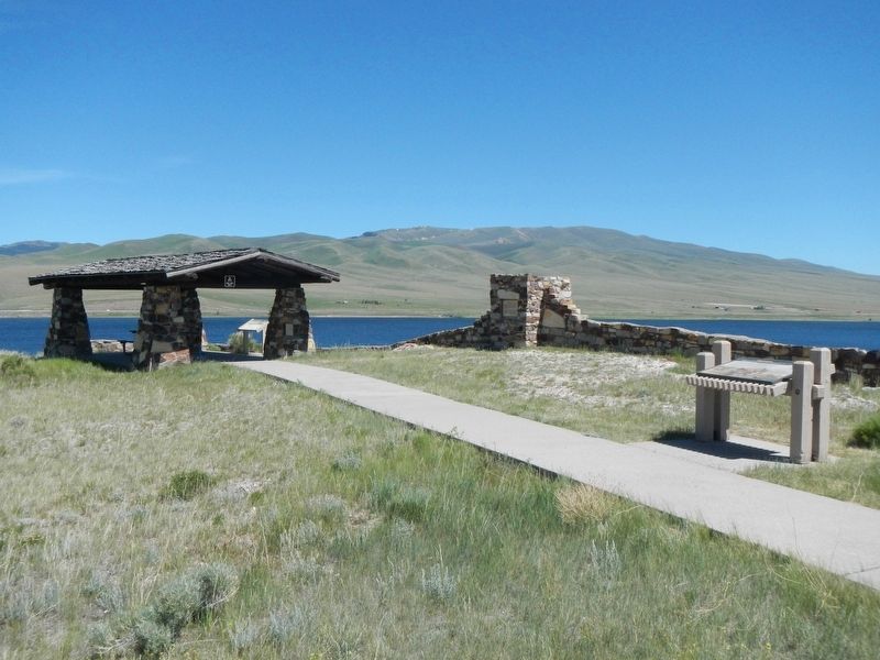
By Barry Swackhamer, May 12, 2018
"it was mutually advantageous..." Marker
| 1 ► Montana, Beaverhead County, Dillon — "it was mutually advantageous..." — Lewis and Clark at Camp Fortunate — |
| On State Highway 324 near Interstate 15, on the left when traveling east. | |||
| 2 ► Montana, Beaverhead County, Dillon — Beaver's Head Rock: Native Road Sign — Lewis & Clark Seek the Shoshone — |
| On State Highway 41 near Diamond O Drive, on the right when traveling south. | |||
| 3 ► Montana, Beaverhead County, Dillon — Mapping the Way — |
| On Clarks Lookout Road west of State Highway 91, on the right when traveling south. | |||
| 4 ► Montana, Beaverhead County, Dillon — Medicine Tree — This is a Sheepeater Shoshoni Medicine Tree — |
| Near South Montana Street near East Glendale Street, on the right when traveling east. | |||
| 5 ► Montana, Beaverhead County, Dillon — Nez Perce Camp — |
| Near Bannack Road. | |||
| 6 ► Montana, Beaverhead County, Dillon — Sacajawea — |
| Near State Highway 324 near State Highway 15, on the left when traveling west. | |||
| 7 ► Montana, Beaverhead County, Wisdom — A Perfect Place to Rest — |
| Near Park Entrance Road near State Highway 43, on the left when traveling east. | |||
| 8 ► Montana, Beaverhead County, Wisdom — Battlefield Landscape — |
| Near Park Entrance Road near State Highway 43, on the left when traveling east. | |||
| 9 ► Montana, Beaverhead County, Wisdom — Brave Warriors — |
| Near Park Entrance Road near State Highway 43, on the left when traveling north. | |||
| 10 ► Montana, Beaverhead County, Wisdom — Natural Travel Corridor — On the Eve of Tragedy — Trail Creek — |
| On State Highway 43 at Bitterroot-Big Hole Road, on the left when traveling east on State Highway 43. | |||
| 11 ► Montana, Beaverhead County, Wisdom — Siege Site — |
| Near Park Entrance Road near State Highway 43, on the left when traveling east. | |||
| 12 ► Montana, Big Horn County, Busby — Rosebud Battlefield — |
| On State Highway 314. | |||
| 13 ► Montana, Big Horn County, Busby — Two Moons — |
| On U.S. 212, 0.2 miles south of Russell Lane, on the right when traveling south. | |||
| 14 ► Montana, Big Horn County, Crow Agency — 1984 Archeological Survey — Little Bighorn Battlefield — |
| On Little Bighorn Battlefield Road, on the right when traveling north. | |||
| 15 ► Montana, Big Horn County, Crow Agency — Bear Paw Memorial — |
| On Little Bighorn Battlefield Road, on the right when traveling south. | |||
| 16 ► Montana, Big Horn County, Crow Agency — Bear Paw Monument — 1881 — |
| Near Little Bighorn Battlefield Road, on the right when traveling south. | |||
| 17 ► Montana, Big Horn County, Crow Agency — Calhoun Hill — (Little Bighorn Battlefield) — |
| On Little Bighorn Battlefield Road. | |||
| 18 ► Montana, Big Horn County, Crow Agency — Calhoun Hill — Little Bighorn Battlefield — |
| On Little Bighorn Battlefield Road, on the right when traveling north. | |||
| 19 ► Montana, Big Horn County, Crow Agency — Cheyenne Warrior Markers — Little Bighorn Battlefield — |
| On Little Bighorn Battlefield Road. | |||
| 20 ► Montana, Big Horn County, Crow Agency — Chief Plenty Coups — Last Chief of the Crows — 1848 - 1932 — |
| On U.S. 212 at Frontage Road, on the right when traveling west on U.S. 212. | |||
| 21 ► Montana, Big Horn County, Crow Agency — Companies C & E — (Little Bighorn Battlefield) — |
| On Little Bighorn Battlefield Road. | |||
| 22 ► Montana, Big Horn County, Crow Agency — Companies F and I — (Little Bighorn Battlefield) — |
| 23 ► Montana, Big Horn County, Crow Agency — Custer Last Seen — (Little Bighorn Battlefield) — |
| On Little Bighorn Battlefield Road. | |||
| 24 ► Montana, Big Horn County, Crow Agency — Custer’s Advance — Little Bighorn Battlefield — |
| On Little Bighorn Battlefield Road, on the right when traveling south. | |||
| 25 ► Montana, Big Horn County, Crow Agency — Deep Coulee — Little Bighorn Battlefield — |
| On Little Bighorn Battlefield Road, on the right when traveling north. | |||
| 26 ► Montana, Big Horn County, Crow Agency — Deep Ravine — Little Bighorn Battlefield — |
| On Little Bighorn Battlefield Road, on the right when traveling north. | |||
| 27 ► Montana, Big Horn County, Crow Agency — Greasy Grass Ridge — Little Bighorn Battlefield — |
| On Little Bighorn Battlefield Road, on the right when traveling north. | |||
| 28 ► Montana, Big Horn County, Crow Agency — Indian Encampment — Little Bighorn Battlefield — |
| On Little Bighorn Battlefield Road, on the right when traveling south. | |||
| 29 ► Montana, Big Horn County, Crow Agency — Indian Memorial — Little Bighorn Battlefield — |
| On Little Bighorn Battlefield Road, on the right when traveling north. | |||
| 30 ► Montana, Big Horn County, Crow Agency — Keogh – Crazy Horse Fight — Little Bighorn Battlefield — |
| On Little Bighorn Battlefield Road, on the right when traveling north. | |||
| 31 ► Montana, Big Horn County, Crow Agency — Lame White Man Charge — Little Bighorn Battlefield — |
| On Little Bighorn Battlefield Road, on the right when traveling north. | |||
| 32 ► Montana, Big Horn County, Crow Agency — Little Bighorn Battlefield — |
| On Little Bighorn Battlefield Road, in the median. | |||
| 33 ► Montana, Big Horn County, Crow Agency — Little Bighorn Battlefield National Monument — |
| Near Interstate 90 at milepost 510 near U.S. 212. | |||
| 34 ► Montana, Big Horn County, Crow Agency — Little Bighorn Indian Memorial — |
| On Little Bighorn Battlefield Road, on the left when traveling north. | |||
| 35 ► Montana, Big Horn County, Crow Agency — Medicine Tail Coulee — Little Bighorn Battlefield — |
| On Little Bighorn Battlefield Road, on the right when traveling north. | |||
| 36 ► Montana, Big Horn County, Crow Agency — Medicine Tail Coulee Ford — (Little Bighorn Battlefield) — |
| On Little Bighorn Battlefield Road. | |||
| 37 ► Montana, Big Horn County, Crow Agency — Medicine Tail Ford — Little Bighorn Battlefield — |
| On Little Bighorn Battlefield Road, on the right when traveling north. | |||
| 38 ► Montana, Big Horn County, Crow Agency — Memorial Markers — Little Bighorn Battlefield — |
| On Little Bighorn Battlefield Road, on the left when traveling north. | |||
| 39 ► Montana, Big Horn County, Crow Agency — Peace Through Unity — Little Bighorn Battlefield — |
| On Little Bighorn Battlefield Road, on the right when traveling north. | |||
| 40 ► Montana, Big Horn County, Crow Agency — Reno’s Retreat — Little Bighorn Battlefield — |
| On Little Bighorn Battlefield Road, on the right when traveling south. | |||
| 41 ► Montana, Big Horn County, Crow Agency — Reno’s Valley Fight — Little Bighorn Battlefield — |
| On Little Bighorn Battlefield Road, on the right when traveling south. | |||
| 42 ► Montana, Big Horn County, Crow Agency — Weir Point — Little Bighorn Battlefield — |
| On Little Bighorn Battlefield Road, on the right when traveling north. | |||
| 43 ► Montana, Big Horn County, Crow Agency — Weir Point Fight — (Little Bighorn Battlefield) — |
| On Little Bighorn Battlefield Road. | |||
| 44 ► Montana, Big Horn County, Crow Agency — Wooden Leg Hill — June 25, 1876 — |
| Near U.S. 212, 1 mile east of Interstate 90. | |||
| 45 ► Montana, Big Horn County, Garryowen — Garryowen, Montana - Sitting Bull’s Camp — |
| On Frontage Road (Interstate 90 at milepost 514), on the left when traveling south. | |||
| 46 ► Montana, Big Horn County, Huntley — Buffalo Country — The Eastern Plains of Montana — |
| On Interstate 90 at milepost 478. | |||
| 47 ► Montana, Blaine County, Chinook — ćáynim?a•lika?spe — Bear Paw Battlefield Trail — |
| On Cleveland Road (County Road 240) near S-B Road, on the left when traveling south. | |||
| 48 ► Montana, Blaine County, Chinook — We will stand our ground! — Roaring Eagle: tipiyeléhne?iléseniń (George Comedown) — |
| Near Cleveland Road (County Road 240) near S-B Road. | |||
| 49 ► Montana, Blaine County, Chinook — Bear Paw Battlefield — C'Aynnim 'Alikinwaaspa — |
| On Cleveland Road (County Road 240) near S-B Road, on the left when traveling south. | |||
| 50 ► Montana, Blaine County, Chinook — Chief Joseph’s Surrender — October 5, 1887 11:00 a.m. — |
| Near Cleveland Road (County Road 240) near S-B Road. | |||
| 51 ► Montana, Blaine County, Chinook — Last Battle — |
| On Cleveland Road (County Road 240) near S-B Road, on the left when traveling south. | |||
| 52 ► Montana, Blaine County, Chinook — Nez Perce Encampment — |
| Near Cleveland Road (County Road 240) near S-B Road. | |||
| 53 ► Montana, Blaine County, Chinook — Nez Perce National Historical Park — |
| On Cleveland Road (County Road 240) near S-B Road, on the left when traveling south. | |||
| 54 ► Montana, Blaine County, Chinook — No Place to Hide — |
| Near Cleveland Road (County Road 240) near S-B Road. | |||
| 55 ► Montana, Blaine County, Chinook — The Battle of Bears Paw — |
| On 1st Street (U.S. 2) near Cleveland Road West, on the right when traveling east. | |||
| 56 ► Montana, Blaine County, Fort Belknap Indian Community — Fort Belknap Reservation — |
| Near Main Street near Assiniboine Avenue. | |||
| 57 ► Montana, Blaine County, Fort Belknap Indian Community — The Vision Quest — |
| On Agency Main Street at Agency Main Street, on the left when traveling west on Agency Main Street. | |||
| 58 ► Montana, Carbon County, Bridger — Jim Bridger, Mountain Man — |
| On U.S. 310. | |||
| 59 ► Montana, Carbon County, Red Lodge — Plenty Coups - Chief Of The Crows — (Circa 1848 - March 4, 1932) — |
| On Broadway Avenue North near 3rd Street East, on the left when traveling north. | |||
| 60 ► Montana, Carbon County, Red Lodge — The Red Lodge Country — |
| On South Broadway Avenue (U.S. 212) at South Hauser Avenue, on the right when traveling east on South Broadway Avenue. | |||
| 61 ► Montana, Carter County, Ekalaka — A Fantastically Beautiful Place: The Medicine Rocks — |
| On Park Entrance Road near State Highway 7, on the right when traveling east. | |||
| 62 ► Montana, Carter County, Ekalaka — Inyan-oka-la-ka — |
| Near Park Entrance Road. | |||
| 63 ► Montana, Cascade County, Cascade — From Indian Trail to Highways — |
| Near Old U.S. Highway 91 near Hardy Creek Lane, on the left when traveling north. | |||
| 64 ► Montana, Cascade County, Fort Shaw — Fort Shaw — |
| On State Highway 200, 0.2 miles west of Dr Russell Road, on the right when traveling west. | |||
| 65 ► Montana, Cascade County, Fort Shaw — Fort Shaw Government Industrial Indian School — |
| On School Loop near Old Fort Shaw Road, on the right when traveling north. | |||
| 66 ► Montana, Cascade County, Fort Shaw — Undisputed Champions — |
| On School Loop near Old Fort Shaw Road, on the right when traveling north. | |||
| 67 ► Montana, Cascade County, Great Falls — One of Many Firsts — Lewis and Clark Nature Trail — |
| Near Giant Springs Road near River Drive North. | |||
| 68 ► Montana, Cascade County, Great Falls — Sacajawea Island — |
| On River Drive North near 6th Street North, on the right when traveling west. | |||
| 69 ► Montana, Cascade County, Great Falls — The Portage Around the Falls — |
| Near Overlook Drive south of 10th Avenue South (Business Interstate 15), on the right when traveling west. | |||
| 70 ► Montana, Cascade County, Great Falls — These Springs Have Witnessed... — |
| Near Giant Springs Road, 1.3 miles north of River Drive North, on the left when traveling north. | |||
| 71 ► Montana, Cascade County, Sun River — Sun River Crossing — |
| On State Highway 200 at Choteau Street, on the right when traveling west on State Highway 200. | |||
| 72 ► Montana, Chouteau County, Big Sandy — Cow Island Trail — |
| On Broadway (U.S. 87) at McNamara Avenue, on the left when traveling north on Broadway. | |||
| 73 ► Montana, Chouteau County, Big Sandy — Tale of Two Treaties — Cultures Clash, Relationships Change — |
| Near Judith Landing Road (State Highway 236). | |||
| 74 ► Montana, Chouteau County, Fort Benton — Cow Island Incident — |
| Near 8th Street near River Street. | |||
| 75 ► Montana, Chouteau County, Fort Benton — Nez Perce War — |
| On Front Street near 18th Street, on the right when traveling east. | |||
| 76 ► Montana, Chouteau County, Fort Benton — The Little Shell Chippewa — Tribe in Search of Recognition — |
| Near 7th Street West near River Street. | |||
| 77 ► Montana, Custer County, Miles City — Photography — 1900 - 1920 — |
| On Main Street near South 5th Street, on the right when traveling east. | |||
| 78 ► Montana, Custer County, Miles City — Powder River — |
| On U.S. 12, 24 miles east of U.S. I-94, on the left when traveling east. | |||
| 79 ► Montana, Custer County, Miles City — The Horse Nation and Native People — |
| On Main Street near South 5th Street, on the right when traveling east. | |||
| 80 ► Montana, Daniels County, Scobey — Wood Mountain Trail — |
| On Main Street (State Highway 13) 3.9 miles south of 1st Avenue (State Highway 5), on the right when traveling south. | |||
| 81 ► Montana, Dawson County, Glendive — Clark's Footprints To Eastern Montana's Future — Clark on the Yellowstone — |
| On Montana Avenue just north of State Street, on the left when traveling north. | |||
| 82 ► Montana, Dawson County, Glendive — Evidence Of The Expedition — Clark on the Yellowstone — |
| On Montana Avenue just north of State Street, on the left when traveling north. | |||
| 83 ► Montana, Dawson County, Glendive — Glendive — |
| On Crisafulli Drive near West Towne Street (Business Highway 94), on the left when traveling west. | |||
| 84 ► Montana, Dawson County, Glendive — Returning To The Plains — Clark on the Yellowstone — |
| On Montana Avenue just north of State Street, on the left when traveling north. | |||
| 85 ► Montana, Fergus County, Lewistown — Abraham and Mary Walton Hogeland House — |
| On West Montana Street near 7th Avenue North, on the left when traveling east. | |||
| 86 ► Montana, Fergus County, Lewistown — Courthouse Historic District — |
| On West Main Street (U.S. 87) near 7th Avenue North, on the right when traveling west. | |||
| 87 ► Montana, Fergus County, Lewistown — Fort Maginnis — |
| On U.S. 87. | |||
| 88 ► Montana, Fergus County, Lewistown — Saint Leo's Catholic Church — Lewistown Central Business Historic District — |
| On West Broadway Street at 2nd Avenue North, on the right when traveling west on West Broadway Street. | |||
| 89 ► Montana, Fergus County, Lewistown — The Nez Perce Conflict of 1877 — Trading Post at Lewistown — The Exile — |
| On U.S. 87 near H Street, on the left when traveling west. | |||
| 90 ► Montana, Flathead County, Hungry Horse — Bad Rock Canyon — |
| On U.S. 2, 0.5 miles east of Berne Road, on the right when traveling east. | |||
| 91 ► Montana, Flathead County, Kalispell — Baldwin House — East Side Historic District — |
| On 3rd Avenue East at 5th Avenue East, on the left when traveling south on 3rd Avenue East. | |||
| 92 ► Montana, Flathead County, Somers — Howse House — |
| On U.S. 93, 0.2 miles south of Forest Hill Road (State Highway 82), on the right when traveling north. | |||
| 93 ► Montana, Gallatin County, Bozeman — Bozeman Pass — |
| On Interstate 90 at milepost 318, on the right when traveling west. | |||
| 94 ► Montana, Gallatin County, Bozeman — First People in the Gallatin Valley — To the Headwaters — |
| Near N. 19th Avenue near I-90 eastbound entrance ramp (at milepost 305), 0.1 miles east of N. 19th Ave. and E. Valley Center Rd., on the left when traveling south. | |||
| 95 ► Montana, Gallatin County, Bozeman — Fort Ellis — To the Headwaters — |
| On 19th Avenue near I-90 eastbound entrance ramp (at milepost 305), 0.1 miles east of N. 19th Ave. and E. Valley Center Rd., on the left when traveling south. | |||
| 96 ► Montana, Gallatin County, Bozeman — Fur Trade — To the Headwaters — |
| On 19th Avenue near I-90 eastbound entrance ramp (at milepost 305), 0.1 miles east of N. 19th Ave. and E. Valley Center Rd., on the left when traveling south. | |||
| 97 ► Montana, Gallatin County, Three Forks — Colter’s Run — |
| On Trident Road (State Highway 296), on the right when traveling north. | |||
| 98 ► Montana, Gallatin County, Three Forks — Colter’s Run — The Second Marker — The Headwaters of the Missouri 1808 — |
| On North Main Street (State Highway 2) at Cottonwood Street, on the right when traveling south on North Main Street. | |||
| 99 ► Montana, Gallatin County, Three Forks — Colter's Run 1808 — |
| On North Main Street (State Highway 2) at Cottonwood, on the left when traveling north on North Main Street. | |||
| 100 ► Montana, Gallatin County, Three Forks — In Patriotic Memory of Sacajawea — In Patriotic Memory of — |
| On North Main Street (State Highway 2) at West Ash Street, in the median on North Main Street. | |||
214 entries matched your criteria. The first 100 are listed above. Next 100 ⊳