11458 entries match your criteria. Entries 101 through 200 are listed.⊲ Previous 100 — Next 100 ⊳
Colonial Era Topic
By Craig Baker, December 18, 2022
The Washington Memorial
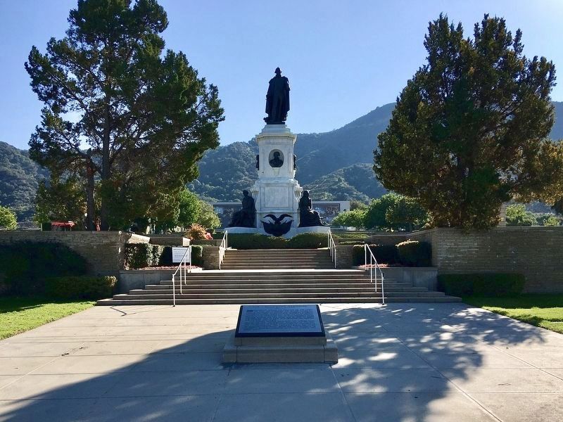
| 101 ► California, Los Angeles County, Los Angeles, Hollywood Hills — The Washington Memorial — Thomas Ball - Sculptor — 1819 - 1911 — |
| On Memory Lane just east of Memorial Drive, on the right when traveling east. | |||
| 102 ► California, Los Angeles County, Santa Monica, Wilshire Montana — The Discovery of Santa Monica — by Juan Rodríguez Cabrillo — on October 8, 1542 — |
| On Ocean Drive just south of California Avenue / California Incline, on the right when traveling south. | |||
| 103 ► California, Monterey County, King City — 232 — Mission San Antonio de Padua — ← 23 Miles — |
| On Jolon Road (County Road G14) 0.2 miles south of El Camino Real (U.S. 101), on the right when traveling south. | |||
| 104 ► California, Monterey County, Monterey — Here ... landed Very Rev. Father Junipero Serra — |
| Near Corporal Ewing Road. | |||
| 105 ► California, Orange County, Fullerton — El Camino Real — |
| On East Wilshire Avenue at North Pomona Avenue, on the right when traveling east on East Wilshire Avenue. | |||
| 106 ► California, Orange County, Orange — Campsite of Anza — |
| On North Cottonwood Street. | |||
| 107 ► California, Orange County, Rancho Mission Viejo — On the Mesa — |
| Near Ortega Highway (California Route 74) 0.1 miles west of Reata Road, on the left when traveling west. | |||
| 108 ► California, Orange County, San Clemente — San Clemente Island & Catalina Island — |
| Near San Clemente Pier, 0.1 miles west of San Clemente Pedestrian Beach Trail, in the median. | |||
| 109 ► California, Orange County, San Juan Capistrano — Don Gaspar de Portola Building — |
| 110 ► California, Orange County, San Juan Capistrano — Don Jose Antonio Yorba Building — |
| Near Rancho Viejo Road north of Ortega Highway (California Route 74), on the right when traveling south. | |||
| 111 ► California, Orange County, San Juan Capistrano — Early People of Capistrano Valley — Stroschein Monument — |
| On Ortega Highway at Del Obispo Street, on the right when traveling west on Ortega Highway. | |||
| 112 ► California, Orange County, San Juan Capistrano — Feliciano Rios Building — |
| Near Rancho Viejo Road north of Ortega Highway (California Route 74), on the right when traveling south. | |||
| 113 ► California, Orange County, San Juan Capistrano — Jose Francisco Ortega Building — |
| Near Rancho Viejo Road north of Ganado Road, on the right when traveling south. | |||
| 114 ► California, Orange County, San Juan Capistrano — Metalworking Furnaces — Mission San Juan Capistrano — Has been Designated an Historical Landmark by ASM International — |
| Near Camino Capistrano. | |||
| 115 ► California, Orange County, San Juan Capistrano — Sergeant Jose Francisco Ortega — |
| On Del Obispo Street, 0.1 miles south of Ortega Highway, on the right when traveling north. | |||
| 116 ► California, Orange County, Seal Beach, Old Towne — San Gabriel River Basin — |
| Near 1st Street near Ocean Place. | |||
| 117 ► California, Orange County, Trabuco Canyon — O'Neill Park — |
| On Trabuco Canyon Road (County Route S19) 0.7 miles west of Trabaco Oaks Drive, on the left when traveling west. | |||
| 118 ► California, Sacramento County, Sacramento, Southside Park — Miguel Hidalgo y Costilla — |
| Near T Street west of 8th Street, on the left when traveling west. | |||
| 119 ► California, San Bernardino County, Hesperia — 7 — Atongai Indian Village — Oldest Known Settlement in Hesperia — Prehistoric — |
| On Arrowhead Lake Road, 0.1 miles north of Welsh Road, on the right when traveling north. | |||
| 120 ► California, San Diego County, San Diego — A San Diego Milestone — |
| Near Broadway Circle at Horton Plaza, on the left when traveling east. | |||
| 121 ► California, San Diego County, San Diego — Buque Escuela Juan Sebastian de Elcano — |
| On Rosecrans Street at Guijarros Road on Rosecrans Street. | |||
| 122 ► California, San Diego County, San Diego — Cabrillo’s Ships — |
| 123 ► California, San Diego County, San Diego — Fray Junipero Serra — |
| Near Presidio Drive. | |||
| 124 ► California, San Diego County, San Diego — João Rodrigues Cabrilho 1542 — Ao-Navegador-Portugues — Homenagen da Marinha de Guerra Portuguesa — |
| 125 ► California, San Diego County, San Diego — Old Town San Diego — Timeline — |
| On San Diego Ave.. | |||
| 126 ► California, San Diego County, San Diego — 67 — Serra Palm — |
| On Taylor Street at Presidio Drive, on the right when traveling north on Taylor Street. | |||
| 127 ► California, San Diego County, San Diego — The Discovery of California — by Juan Rodriquez Cabrillo — |
| Near El Prado, on the left when traveling west. | |||
| 128 ► California, San Francisco City and County, San Francisco, Mission Bay — Chutchui and Sitlintac — |
| On King Street / The Embarcadero near 4th Street, on the right when traveling north. | |||
| 129 ► California, San Francisco City and County, San Francisco, Presidio of San Francisco — Homeland of the Yelamu — |
| Near Mason Street at Halleck Street. | |||
| 130 ► California, San Luis Obispo County, Atascadero — Your American Heritage Monument — |
| Near El Camino Real near Mercedes Avenue (California Route 41), on the right when traveling north. | |||
| 131 ► California, Santa Barbara County, Carpinteria — La Carpinteria — Tile Mural — |
| On Linden Avenue at 8th Street, on the right when traveling north on Linden Avenue. | |||
| 132 ► California, Santa Barbara County, Lompoc — La Purisima Mission State Historic Park — |
| Near Purisima at Mission Gate Road. | |||
| 133 ► California, Santa Barbara County, Lompoc — Lompoc's Mission Vieja — |
| Near South H Street at East Cypress Avenue, on the left when traveling south. | |||
| 134 ► California, Santa Clara County, Gilroy — Arrival of the Spanish — La llegada de los españoles — |
| Near Watsonville Road. | |||
| 135 ► California, Santa Clara County, Morgan Hill — El Camino Real — 1797 — |
| Near Monterey Highway near Wright Avenue. | |||
| 136 ► California, Santa Clara County, Santa Clara — De Anza Expedition 1775 – 1776 — |
| On El Camino Real (State Highway 82), on the right when traveling north. | |||
| 137 ► California, Santa Clara County, Santa Clara — Original Cross — |
| Near Palm Drive. | |||
| 138 ► California, Santa Clara County, Santa Clara — The Five Sites of Santa Clara de Asís Mission — |
| On Palm Drive east of Alvisio Street, on the left when traveling east. | |||
| 139 ► California, Santa Clara County, Sunnyvale, Heritage District — De Anza Expedition 1775 - 1776 — |
| Near North Sunnyvale Avenue east of East California Avenue. | |||
| 140 ► California, Santa Cruz County, Santa Cruz — 469 — Branciforte — |
| On North Branciforte Avenue at Water Street on North Branciforte Avenue. | |||
| 141 ► California, Ventura County, Ventura — 114-1 — Rancho Cañada Larga — Mission Aqueduct — |
| On Cañada Larga Road east of California Route 33, on the left when traveling east. | |||
| 142 ► California, Ventura County, Ventura — 28 — San Buenaventura Mission Aqueduct — |
| On Cañada Larga Road east of Highway 33, on the right when traveling east. | |||
| 143 ► Colorado, Alamosa County, Blanca — Los Caminos Antiguos — Los Caminos Antiguos Scenic & Historic Byway — |
| On State Highway 150, 0.2 miles north of U.S. 160, on the right when traveling north. | |||
| 144 ► Colorado, Alamosa County, Blanca — On Sacred Ground — Los Caminos Antiguos Scenic & Historic Byway — |
| On State Highway 150, 0.2 miles north of U.S. 160, on the right when traveling north. | |||
| 145 ► Colorado, Alamosa County, Blanca — Welcome "Caminante" to ... — Los Caminos Antiguos Scenic & Historic Byway — |
| On State Highway 150, 0.2 miles north of U.S. 160, on the right when traveling north. | |||
| 146 ► Colorado, La Plata County, Hesperus — Dominguez - Escalante Expedition — |
| On U.S. 160, 0.8 miles Cherry Creek Road, on the left when traveling west. | |||
| 147 ► Colorado, La Plata County, Hesperus — Dominguez and Escalante |
| On U.S. 160, 0.8 miles west of Cherry Creek Road, on the left when traveling west. Reported missing. | |||
| 148 ► Colorado, Moffat County, Dinosaur — Are We There Yet? — |
| Near Harpers Corner Road, 8 miles north of U.S. 40. | |||
| 149 ► Colorado, Otero County, La Junta — A Babel-Tongued Multitude — Bent's Old Fort National Historic Site — |
| On Colorado 194 south of State Highway 194. | |||
| 150 ► Colorado, Pueblo County, Colorado City — Cuerno Verde — Colorado — |
| Near State Highway 165 at Interstate 25. | |||
| 151 ► Colorado, Pueblo County, Colorado City — The Story Beneath Your Feet — Colorado — |
| Near State Highway 165 at CanAm Highway (Interstate 25). | |||
| 152 ► Colorado, Pueblo County, Vineland — 161 — San Carlos de los Jupes — |
| On Lane 36 (State Highway 231) at Santa Fe Drive (U.S. 50), on the left when traveling north on Lane 36. | |||
| 153 ► Colorado, Rio Blanco County, Rangely — The Escalante Expedition — |
| On East Main Street (Colorado Route 64) at Escalante Drive, on the right when traveling east on East Main Street. | |||
| 154 ► Connecticut, Fairfield County, Bethel — Bethel — |
| On Main Street at Chestnut Street, on the left when traveling east on Main Street. | |||
| 155 ► Connecticut, Fairfield County, Bridgeport, Beardsley Park — Guinea Hogs — Sus scrofa — |
| Near Noble Avenue north of Crown Street, on the left when traveling north. | |||
| 156 ► Connecticut, Fairfield County, Bridgeport, Beardsley Park — Narragansett Turkey — Meleagris gallopavo — |
| Near Noble Avenue north of Crown Street, on the left when traveling north. | |||
| 157 ► Connecticut, Fairfield County, Bridgeport, Beardsley Park — Persecution of the Wolf — The story of the wolf: past, present and future — 🐾 — |
| Near Noble Avenue north of Crown Street, on the left when traveling north. | |||
| 158 ► Connecticut, Fairfield County, Bridgeport, Beardsley Park — White-Tailed Deer — Odocoileus viginianus — |
| Near Noble Avenue north of Crown Street, on the left when traveling north. | |||
| 159 ► Connecticut, Fairfield County, Bridgeport, Downtown — Bridgeport — |
| On Broad Street at State Street, on the right when traveling south on Broad Street. | |||
| 160 ► Connecticut, Fairfield County, Brookfield — Brookfield — |
| On Whisconier Road (Connecticut Route 25) at Obtuse Hill Road (Connecticut Route 133), on the right when traveling north on Whisconier Road. | |||
| 161 ► Connecticut, Fairfield County, Brookfield — First Settlement 1710 — |
| On Whisconier Road (Connecticut Route 25) at Obtuse Hill Road (Connecticut Route 133), on the right when traveling north on Whisconier Road. | |||
| 162 ► Connecticut, Fairfield County, Danbury — Danbury — |
| On Main Street at Wooster Street, on the left when traveling north on Main Street. | |||
| 163 ► Connecticut, Fairfield County, Danbury — Oldest Cemetery 1684 — |
| On Wooster Street, 0.1 miles Main Street, on the left when traveling west. | |||
| 164 ► Connecticut, Fairfield County, Danbury — 1 — The Settling of Danbury — Danbury, Connecticut — The Museum in the Streets — |
| On Main Street at West Street, on the right when traveling south on Main Street. | |||
| 165 ► Connecticut, Fairfield County, Darien — Darien — |
| On Renshaw Road at Park Place, on the right when traveling west on Renshaw Road. | |||
| 166 ► Connecticut, Fairfield County, Darien — Middlesex Graveyard — |
| On Old Kings Highway North at Brookside Road, on the right when traveling west on Old Kings Highway North. | |||
| 167 ► Connecticut, Fairfield County, Darien — Museum of Darien — Darien Heritage Trail — |
| On Old Kings Highway North south of Pine Brook Lane, on the right when traveling north. | |||
| 168 ► Connecticut, Fairfield County, Darien — Ring’s End Landing — |
| On Rings End Road at Pear Tree Point Road, on the right when traveling east on Rings End Road. | |||
| 169 ► Connecticut, Fairfield County, Darien — The First Congregational Church — Darien Heritage Trail — |
| On Old Kings Highway North just east of Brookside Road, on the right when traveling west. | |||
| 170 ► Connecticut, Fairfield County, Easton — Easton — |
| On Center Road at Morehouse Road, on the right when traveling east on Center Road. | |||
| 171 ► Connecticut, Fairfield County, Fairfield — Andrew Roland House — |
| On Old Post Road at Oldfield Road, on the right when traveling west on Old Post Road. | |||
| 172 ► Connecticut, Fairfield County, Fairfield — Andrew Ward Memorial — |
| Near Beach Road at Sunnieholm Drive, on the left when traveling west. | |||
| 173 ► Connecticut, Fairfield County, Fairfield — Burr Homestead — |
| On Old Post Road, 0.1 miles west of Beach Road, on the right when traveling east. | |||
| 174 ► Connecticut, Fairfield County, Fairfield — David Ogden House — |
| On Bronson Avenue at Cemetery Road, on the right when traveling north on Bronson Avenue. | |||
| 175 ► Connecticut, Fairfield County, Fairfield — Dr. Hosea Hurlburt House — |
| On Hillside Road, 0.1 miles north of Cherry Lane, on the left when traveling north. | |||
| 176 ► Connecticut, Fairfield County, Fairfield — Edward’s Pond — Would You Sink or Swim in Edward's Pond? — |
| Near Old Post Road at Beach Road, on the right when traveling north. | |||
| 177 ► Connecticut, Fairfield County, Fairfield — Fairfield — |
| Near Beach Road, 0.1 miles west of Sunnieholm Drive, on the left when traveling west. | |||
| 178 ► Connecticut, Fairfield County, Fairfield — Fairfield Boulder — |
| On Old Post Road at Beach Road, on the left when traveling south on Old Post Road. | |||
| 179 ► Connecticut, Fairfield County, Fairfield — Fairfield’s Historic Green — |
| Near Old Post Road at Beach Road, on the right when traveling north. | |||
| 180 ► Connecticut, Fairfield County, Fairfield — George Hull Home Lot — |
| On Old Post Road at Oldfield Road, on the left when traveling west on Old Post Road. | |||
| 181 ► Connecticut, Fairfield County, Fairfield — Moorlands — c. 1836 — |
| On Beach Road, 0.1 miles west of Sunnieholm Drive, on the left when traveling west. | |||
| 182 ► Connecticut, Fairfield County, Fairfield — Nathan Bulkley House — |
| On Beach Road at Sunnieholm Drive, on the right when traveling west on Beach Road. | |||
| 183 ► Connecticut, Fairfield County, Fairfield — Readin’, Writin’, and ‘Rithmetic — |
| Near Old Post Road at Beach Road, on the right when traveling north. | |||
| 184 ► Connecticut, Fairfield County, Fairfield — Reverend John Jones Memorial — |
| On Beach Road at Sunnieholm Drive, on the left when traveling west on Beach Road. | |||
| 185 ► Connecticut, Fairfield County, Fairfield — Roger Ludlow — |
| On Post Road (U.S. 1) at North Benson Road, on the right when traveling south on Post Road. | |||
| 186 ► Connecticut, Fairfield County, Fairfield — Site of "Verna" — |
| On Bronson Avenue, 0.1 miles Verna Hill Road, on the right when traveling north. | |||
| 187 ► Connecticut, Fairfield County, Fairfield — Site of Trinity Church — |
| On Mill Plain Road at Sturges Road, on the left when traveling north on Mill Plain Road. | |||
| 188 ► Connecticut, Fairfield County, Fairfield — Thomas Sherwood Memorial — |
| Near Beach Road at Sunnieholm Drive, on the left when traveling west. | |||
| 189 ► Connecticut, Fairfield County, Fairfield, Southport — Pequot Swamp Fountain — |
| On Center Street at Harbor Road, on the left when traveling east on Center Street. | |||
| 190 ► Connecticut, Fairfield County, Greenwich — Founders and Proprietors Monument — 1640 - 1935 — |
| On Maple Avenue at East Putnam Avenue (U.S. 1), on the left when traveling east on Maple Avenue. | |||
| 191 ► Connecticut, Fairfield County, Greenwich, Cos Cob — Second Oldest Cemetery in Greenwich — |
| On Strickland Road at Loughlin Avenue, on the left when traveling south on Strickland Road. | |||
| 192 ► Connecticut, Fairfield County, Greenwich, Old Greenwich — Old Greenwich — |
| On Sound Beach Avenue, on the left when traveling north. | |||
| 193 ► Connecticut, Fairfield County, Greenwich, Old Greenwich — Old Greenwich Yacht Club — |
| On Tods Driftway. | |||
| 194 ► Connecticut, Fairfield County, Monroe — Monroe — |
| On Monroe Turnpike (Route 111) at Church Street, on the left when traveling north on Monroe Turnpike. | |||
| 195 ► Connecticut, Fairfield County, New Canaan — New Canaan — |
| On Main Street (Connecticut Route 124) 0 miles north of East Avenue (Connecticut Route 106), on the left when traveling north. | |||
| 196 ► Connecticut, Fairfield County, New Fairfield — New Fairfield — |
| On Connecticut Route 37, 0.1 miles north of Brush Hill Road (Connecticut Route 39), on the left when traveling north. | |||
| 197 ► Connecticut, Fairfield County, Newtown — Newtown — |
| On Main Street (Connecticut Route 25) at East Street, on the right when traveling south on Main Street. | |||
| 198 ► Connecticut, Fairfield County, Newtown — Newtown Meeting House — |
| On Main Street (Connecticut Route 25) at Church Hill Road (U.S. 6), on the right when traveling south on Main Street. | |||
| 199 ► Connecticut, Fairfield County, Norwalk — St. Paul’s Historic Graveyard — |
| On St. Paul’s Place, on the right when traveling west. | |||
| 200 ► Connecticut, Fairfield County, Norwalk, East Norwalk — A Calf Pasture Primer — |
| On Calf Pasture Beach Road, on the right when traveling north. | |||
11458 entries matched your criteria. Entries 101 through 200 are listed above. ⊲ Previous 100 — Next 100 ⊳