Near St. George Street close to St. Anthony Street, on the left when traveling west.
English
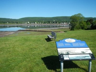
Since the 1740s, three wharves have been built where the ruins of the Queen’s Wharf now lie. Everything the fort needed was landed on the wharf: troops, provisions, weapons and much more. It served the needs of the military until . . . — — Map (db m78445) HM
On St. George Street at Drury Lane, on the right when traveling north on St. George Street.
In the early hours of July 4, 1724, a combined force of Mi’kimaq and Maliseet warriors attacked Annapolis Royal, slipping into the town as its residents slept. They attacked the fort from the cover of the hollow near the east bastion. Although the . . . — — Map (db m78702) HM
Near Havenside Road, on the left when traveling east.
English:
During the first half of the 19th century maritime officials took steps to reduce the many navigational risks and shipwrecks along the eastern seaboard of Canada. One of the new lighthouses put up was at Louisbourg, in 1842. It . . . — — Map (db m79965) HM
Near Havenside Road, on the left when traveling east.
English:
Here are the ruins of Louisbourg’s first light, the earliest to be erected in Canada and the second in North America. Lit in 1734, it was badly damaged in a fire two years later, then quickly repaired. The replacement lantern was . . . — — Map (db m142960) HM
Near Havenside Road, on the left when traveling east.
English:
On this site was erected by France, in 1731, the first Lighthouse Tower, constructed of fireproof materials, in North America.
Near here the British erected batteries to silence the defensive works erected by France. In 1745, . . . — — Map (db m79967) HM
On Havenside Road, on the right when traveling east.
English:
During the 1745 and 1758 sieges the attackers built artillery batteries on Lighthouse Point to silence the Island Battery. This would have allowed warships to enter the harbour for a combined land and sea assault on the town. The . . . — — Map (db m142964) HM
On Havenside Road, on the left when traveling east.
English:
Louisbourg’s destiny has been largely shaped by its harbour. Well-protected, relatively deep and close to the fishing banks, it was the harbour that attracted the French to settle here in the 1700s. In the 19th century ice-free . . . — — Map (db m79963) HM
On Marconi Trail (Nova Scotia Route 255) 0.2 kilometers south of Birch Grove Road, on the right when traveling north.
The history of the village of Port Morien, rooted as it was in mining and fishing, is tightly entwined with Morien Bay itself.
The Mi'kmaq name was "Noolektooch", (Noo-lack-took) meaning "place jammed with ice", or "bivouacking place". Early . . . — — Map (db m144077) HM
On Marconi Trail (Nova Scotia Route 255) 0.2 kilometers south of Birch Grove Road, on the right when traveling north.
The first recorded commercial fishing activity in Cow Bay occurred when the Bourinot family purchased fish, dried them, and supplied the fishermen.
Lobster factories could be found in both Port Morien and South Head. The factory owned by David . . . — — Map (db m144076) HM
On Esplanade at Amelia Street, on the left when traveling north on Esplanade.
[English] On 3 August 1802, the 245 ton ship, “Northern Friends,” arrived in Sydney Harbour with 415 settlers from Scotland. This marked the first emigration directly from Scotland to Cape Breton and formed the vanguard of the . . . — — Map (db m169199) HM
Near Esplanade at Dorchester Street, on the left when traveling north.
English: "Voyage after voyage, men who had seen a dozen ships go down about them, men who had been torpedoed once, twice, three times, sailed and sailed again." —Joseph Schull, Merchant Seaman During the Second World War, . . . — — Map (db m171490) HM
Near Wentworth Street just west of Esplanade (Nova Scotia Route 4), on the left when traveling west.
In the Second World War, Sydney Harbour played a vital role in the Battle of the Atlantic and played a critical role in the conduct of the war. Sydney served as a convoy gathering point for supplies being shipped to the United Kingdom and provided . . . — — Map (db m151606) HM
Near New Waterford Highway (Nova Scotia Route 28) 0.6 kilometers east of Cooks Lane, on the left when traveling east.
English:
During the Second World War the Royal Canadian Navy and the Royal Canadian Air Force protected shipping on vital North Atlantic routes which were the lifeline of the Allies. Army units shared in the defence of the . . . — — Map (db m140130) HM
[1.] Water turbines
the power that ran the mill
This illustration shows one type of
setup for a turbine driven gristmill.
Illustration from "the Red Mill Reborn".
Used with permission of
'Lou Robertella, . . . — — Map (db m108181) HM
This turbine came from a sawmill
located a few hundred yards
upstream of our mill
The saw mill was built ca 1886 by brothers James and Alexander Sutherland. Another brother Robert, built a blacksmith shop on the same property. The mill . . . — — Map (db m108182) HM
Turbines began to become commonplace in the mid-1800's and had virtually replaced vertical waterwheels by the mid 1860's.
Below are a number of illustrations showing typical mill setups and power transfer.
In 1881 the Schoellkopf Power Station . . . — — Map (db m108183) HM
On Glooscap Trail (National Route 2) 0.5 kilometers west of Belmont Road/Fort Belcher Road, on the right when traveling west.
English: This was the chief route of the French and Indians from Cobequid to Isle St. Jean and Louisbourg and later of the British from Halifax to Charlottetown.
Français: C’était la route principale des Français . . . — — Map (db m139192) HM
On Tidal Bore Road, 0.6 kilometers north of Glooscap Trail (Nova Scotia Route 236), on the left when traveling north.
In 1760-62 near this Head of Cobequid Bay the first English speaking settlers of the Townships of Onslow and Truro landed. Of Ulster Irish, Scottish and English stock, these pioneers were among those brought to Nova Scotia from New England by the . . . — — Map (db m108717) HM
On Main Street (Nova Scotia Route 6) at Church Street, on the left when traveling west on Main Street.
In this harbour Capt. David Donahew of New England with three armed vessels surprised Lieut. Paul Marin's allied force en route from Annapolis Royal to Louisbourg. He drove them ashore, disheartened the Canadian Indians and prevented the French . . . — — Map (db m108133) HM
A Manufacturing Town
All major roads and rail-lines run through Amherst, making it a natural gateway into Nova Scotia. The town is also in the middle of a rich agricultural and coal-mining area.
Amherst became a major manufacturing town in . . . — — Map (db m112104) HM
Geology
This area is located in the Carboniferous Lowlands of Nova Scotia. The underlying bedrock is sedimentary with varying proportions of sandstone and mudstone. In some areas where the bedrock has been folded, the sandstone has been . . . — — Map (db m108707) HM
On Water Street at Victoria Street, on the left when traveling north on Water Street.
While lobster boats have filled the local wharves for generations, the community's most unique feature may have been the 130 ft. (39.6m) smoke stack belonging to Nova Scotia Clayworks on the opposite side of the harbour. Started in 1889, the . . . — — Map (db m108078) HM
On Water Street at Victoria Street, on the left when traveling north on Water Street.
The deep harbour of Pugwash has a long and storied seafaring heritage, with many eras of ships carrying lumber and raw materials up and down the Eastern Seaboard.
[Historic Pugwash photos]
"Peace cannot be kept by force; it can only be . . . — — Map (db m108080) HM
Only a century ago the spars of many schooners filled this harbour. Vessels from Lunenburg and the "Boston States" entered to take on bait, ice and water before sailing to the banks offshore.
Canso shipyards constructed smaller coastal . . . — — Map (db m140521) HM
This is a place where seafaring people found shelter from the
harshness of the Northwest Atlantic. It is the most easterly point of mainland Nova Scotia, remote
and exposed upon Chedabucto peninsula, yet close to the fishing banks so . . . — — Map (db m140505) HM
Fishermen sailed to this coast before the earliest explorers. In the early 1600s French and Basque fishermen dropped handlines in the waters.
By 1725 New Englanders were pulling in cod worth 150,000 pounds (New England currency) . . . — — Map (db m140554) HM
On Whitehead Road, on the left when traveling south.
The Whitehead Canal is located between Whitehead Harbour and Witch Cove. Prior to its construction, fishermen had to haul their
boats over a narrow beach between Whitehead and Molasses Harbour (now Port Felix) at a spot known as "The Haulover". . . . — — Map (db m139515) HM
Lake Micmac was smaller
Lake Micmac was considerably smaller before the Canal was begun. Evidence for this can be found in the cove to the west where the remains of a forest and marsh area can be seen under the surface of the Lake. To the . . . — — Map (db m78081) HM
Man-made Bank
You are now walking on a man made bank which forms one side of the canal cut. This wall of earth and stone was necessary to contain the depth of water needed to float the barges. During the first phase of the canal . . . — — Map (db m78100) HM
Canal Camp
You are looking at a part of the remains of what was known as the “Canal Camp.” The row of stones in this area represent the largest feature found to day at Port Wallace. An archeological investigation was carried out . . . — — Map (db m77987) HM
Lock 2
You are now looking at the upper sill of Lock 2. The chambers of the first five Locks on the Canal are approximately 21 meters long and 5.5 meters wide.
Therefore the boats and barges used on the system had to be able to fit . . . — — Map (db m78083) HM
Cutting the Canal
You are now standing about one third of the way between Lake Micmac to the South (left) and Lake Charles to the North (right). Before canal construction began in 1826 there was no flow of water between these two lakes. The . . . — — Map (db m77986) HM
Benching
As you look down the Cut you will see, on the left or East bank, stone walls separated by narrow, flat terraces. This construction technique was used by the canal workers to prevent the earth from sliding down the bank. It was . . . — — Map (db m78117) HM
Hard Digging!
From this location you can begin to appreciate the enormous task which faced the canal workers. Prior to 1826 this canal cut or trench did not exist and all of the earth and rock had to be removed. Unlike the lower part of the . . . — — Map (db m78105) HM
At the point you are approximately 26 meters above sea level, almost at the height of Lake Charles from which the water flows in two directions - south to the Harbour and north to the Bay of Fundy. To get to this point vessels would have traveled . . . — — Map (db m78147) HM
Vessels entering Lock two, traveling northward, were approximately 19 meters above the level of the Harbour. This lock would raise them another three or four meters enabling them the make their way along the canal to Lock three. This present lock . . . — — Map (db m78148) HM
Navvies
The most concentrated number of features belonging to the Canal Camp are located in this area beneath the trees and along the roadway. You can still make out the remains of several stone foundations. A plan of this area prepared in . . . — — Map (db m77988) HM
A Dwelling for Two Families
Imagine this structure on top of the stone foundation in front of you. This home would be similar to the one at Site No. 9. However this structure is larger and contains two small stone hearths. When excavated in . . . — — Map (db m78104) HM
Dwelling Cabin
This feature represents an example of cultural transfer by emigrants to Canada from their homeland. This dwelling cabin strongly resembles the description of the cabins of the working poor in Northern Scotland and Ireland, as . . . — — Map (db m78101) HM
Location of prominent historical characters at the ground breaking ceremony
General location of the official ground breaking ceremony, July 25th, 1826. Looking south from the walking bridge you are viewing the general location of the . . . — — Map (db m78078) HM
Possibly a Storage Building for Powder
This is the only example of this style of structure found anywhere along the canal. While the Archaeologists are uncertain about its use, it may have been a storage area for black powder used to blast the . . . — — Map (db m78106) HM
From 1826 to 1831, canal labourers constructed two locks and the “deep cut” between Lake Charles and Lake Micmac. During these years, upwards of 250 workers and their families lived here. The locks were rebuilt and operated between 1858 . . . — — Map (db m77956) HM
This is the starboard propeller of the Canadian coastguard [sic - Coast Guard] Icebreaker, John A. MacDonald [sic - Macdonald]. The propeller was damaged while the John A. MacDonald was assisting the 115,000 ton oil tanker, SS Manhattan, in her . . . — — Map (db m113082) HM
On Crichton Avenue, 0.1 kilometers Ochterloney Street (Nova Scotia Route 322), on the right when traveling north.
Sullivan’s Pond was a vital feature of the historic Shubenacadie Canal, the traditional water route of Mi’kmaq Indians connecting the harbour at Dartmouth with Minas Pasin and the Bay of Fundy. When the Canal operated, from 1861 to 1870, water . . . — — Map (db m108732) HM
Highest point of the Canal
Ahead you will see Lake Charles which is the highest body of water in the Canal system. From this lake, water flows south to the Halifax Harbour and north to the Bay of Fundy. You are now approx. 29 meters (95 feet) . . . — — Map (db m78115) HM
Lock 3
When first built this lock was made entirely of granite blocks, as represented by the end walls. Like the other structures of the Canal, this lock fell into disrepair between 1831 and 1854. It was completely rebuilt by Charles Fairbanks . . . — — Map (db m77985) HM
The Blacksmith’s Shop
Excavated by Dr. Davis in 1985, this forge operated during both the first construction period (1820s) and the second (1850s). It was here that workers and masons would have their tools repaired and stone picks . . . — — Map (db m77982) HM
Lock 2
Looking north from the walking bridge you see Lock 2. This lock was the first to be constructed on the Canal. Initially the lock was built totally of granite blocks (British construction method), as seen on the east wall. After the . . . — — Map (db m78077) HM
A water control structure
The man-made holding pond in front of you helped to maintain the level of the canal when the lock was in operation. The water in this holding pond had two purposes. It helped maintain the water level in the dry . . . — — Map (db m78102) HM
On Windsor Street, on the right when traveling north.
Established in 1893, this non-denominational burial ground was originally known as the Green Lawn Cemetery. In 1894, the Fairview Lawn Cemetery Ltd. took over management of the cemetery which it operated for 50 years. Unable to fulfill its . . . — — Map (db m77857) HM
On Windsor Street, on the right when traveling south.
English Here, in Halifax, lie the remains of 150 victims of one of history’s most tragic maritime disasters. Just before midnight on 14 April 1912, the White Star liner RMS Titanic struck an iceberg in the North Atlantic. The majestic . . . — — Map (db m77852) HM
The Cable Wharf was purpose built in 1913 by the Western Union Telegraph Company and measures 108 x 17 metres (355 x 54 feet). It is where the company’s cable ships, Minia, Lord Kelvin and Cyrus Field docked and underwent minor . . . — — Map (db m77595) HM
On George Street at the Waterfront, in the median on George Street.
Just inland from this place, Chebucto Landing, 2,576 first permanent settlers of Halifax came ashore from thirteen small ships in June 1749. Here, you are at the shore of one of the great natural harbours of the world, the focus of Halifax's . . . — — Map (db m113185) HM
Open for viewing daily, 10:00am to 5:00PM
Come visit the ship, on the waterfront,
behind the Maritime Museum Of The Atlantic
HMCS Sackville is the last of 267 Flower Class Corvettes
built for the Allied Navies during WWII.
Of . . . — — Map (db m112799) HM
Near Barrington Street close to Spring Garden Road, on the left when traveling south.
On your left near this spot lie the remains of … / À votre gauche, près d’ici se trouvent les restes de ….
Mr. / M. John Samwell
Midshipman / Aspirant de marine • 1797-1813
Mr. / M. William Stevens
Boatswain / Maître de . . . — — Map (db m77897) HM
National Historic
Civil Engineering Site
Ocean Terminals
1912-1928
A tribute to the civil engineers
and contractors who designed and built these
ocean terminals Canadian Society for
Civil Engineering June 1998
Site historique . . . — — Map (db m139330) HM
English
When the Canadian immigration complex known as Pier 21 closed its doors in March of 1971, it marked the end of a more than forty-year saga of human hope, vision, courage and resilience. From its opening on the Halifax waterfront in . . . — — Map (db m77616) HM
English: The Port of Halifax is one of the world’s finest natural harbours. Ice-free year-round, its main channel depth of over 18 metres (60 feet) offers shippers some of the deepest and most navigable waters along the North American . . . — — Map (db m140099) HM
A native son and a great Nova Scotian, he received his early training in this city and became a highly regarded merchant, humanitarian and ship owner. All this was a prelude to his most successful venture, the founding of the British and North . . . — — Map (db m77879) HM
On Marginal Road east of Lower Water Street, on the right when traveling north.
English: Samuel Cunard was born in Halifax, Nova Scotia on November 21, 1787. He was the eldest son of Abraham and Margaret Cunard, United Empire Loyalists who emigrated from Philadelphia (Germantown) to Nova Scotia in 1783. His . . . — — Map (db m139200) HM
Near Marginal Road close to Terminal Road when traveling east.
This memorial was erected
by the
Atlantic Chief and Petty Officies Association
to commemorate the
Ships and Men of the Royal Canadian Navy
who failed to return through enemy action,
stress of weather and accidents during
The Battle of . . . — — Map (db m77646) WM
On Ta39 Road, 0.3 kilometers south of Point Pleasant Drive when traveling south.
English: Born in Halifax of Loyalist parentage, Cunard founded in the maritime provinces a commercial empire embracing banking, lumber, land, coal and, especially, shipping. Involved in transatlantic steam navigation from its early . . . — — Map (db m139202) HM
On George Street at the Waterfront, in the median on George Street.
The Naval Dockyard Clock was fabricated in London, England in 1767 by Ayneth Thwaites. It has kept time in peace and war for generations of sailors and dockyard civilian workers from 1772 to 1993. The Dockyard Clock is the last . . . — — Map (db m113186) HM
On Duke Street just east of Argyle Street, on the left when traveling east.
The hands on the north clock face in the City Hall tower, opposite on Duke Street, are permanently fixed at 9:04:35 the exact moment of the wartime Halifax Explosion the morning of 6 December 1917.
The clock face, a replica of the City Hall . . . — — Map (db m139510) HM
English
For five days beginning on July 20, 2000, Halifax harbour and waterfront was like no other place - wet or dry - on earth. The city was the sole Canadian host of the largest gathering ever of the world’s Tall Ships - majestic . . . — — Map (db m77741) HM
The ex-Admiralty ocean salvage tug FOUNDATION FRANKLIN sailed from the Foundation Maritime piers from the early 1930’s to 1948 on rescue and salvage missions in all kinds of weather, in peace and war to assist ships in distress on the great Western . . . — — Map (db m77598) HM
On Peggy's Point Road, 0.4 kilometers south of Prospect Road (Nova Scotia Route 333), on the right when traveling south.
What would you do with a 30-metre (0.01-mile) outcrop of granite in your backyard? Artist William deGarthe decided to carve a work of art from the granite you see here.
In 1977, at the age of 70, deGarthe picked up his chisels and power tools and . . . — — Map (db m112680) HM
On Peggy's Point Road, 0.4 kilometers south of Prospect Road (Nova Scotia Route 333), on the right when traveling south.
This work of art is a lasting memorial to the gallant men of Peggy's Cove, Nova Scotia, who harvest our oceans. The monument depicts from left to right: Fisherman's Family; Peggy of the Cove; Fishermen at Work.
This monument was donated to the . . . — — Map (db m112691) HM
On Peggy's Point Road, 0.7 kilometers south of Prospect Road (Nova Scotia Route 333), on the right when traveling west.
See the boats [1], sheds [2], nets and traps [3] along the harbour? These are the essential tools of a working fishing community like Peggy's Cove, and a reminder that it was fishermen and their families who established this community . . . — — Map (db m112618) HM
On Peggy's Point Road, 0.4 kilometers south of Prospect Road (Nova Scotia Route 333), on the left when traveling south.
Before Peggy's Cove was a community, it was a popular destination among fishermen. But what inspired these fishermen to make this their permanent home? It was this sheltered cove, which offered close proximity to the large populations of fish in . . . — — Map (db m112570) HM
From the outside it looks like a traditional lighthouse, but looks can be deceiving. Step inside and you'll find yourself in a post office [1], the only one of its kind in Canada and perhaps the world. Every summer since 1975 the Peggy's Cove . . . — — Map (db m112659) HM
On Marine Drive (Nova Scotia Trunk Highway 7), 0.1 kilometers west of Church Point Road, on the left when traveling west.
For almost 150 years, the East and West Rivers provided Sheet Harbour with waterpower for its sawmills. In the 1920s, the East River played an important role in delivering hydroelectric power to Sheet Harbour, as well as other communities in Nova . . . — — Map (db m146158) HM
Near Marine Drive (Nova Scotia Trunk Highway 7), 0.3 kilometers east of Highway 224, on the right when traveling east.
Situated on the Eastern Shore of Nova Scotia, Sheet Harbour lies at the junction of the East and West Rivers. This forested area, with its excellent river systems and natural port, proved ideal for the establishment of a prosperous lumber . . . — — Map (db m146119) HM
Near Marine Drive (Nova Scotia Trunk Highway 7), 0.3 kilometers east of Highway 224, on the right when traveling east.
For centuries, salmon fishing on Sheet Harbour’s East and West Rivers was both a livelihood and leisure activity.
The Mi’kmaq were the first to utilize this rich resource, while Loyalist settlers and their descendents fished salmon for . . . — — Map (db m146120) HM
Near Marine Drive (Nova Scotia Trunk Highway 7), 0.3 kilometers east of Highway 224, on the right when traveling east.
First settled in the 1780's by British veterans and Loyalist refugees from the American Revolution, Sheet Harbour is an important centre on Nova Scotia's eastern shore. West and East Rivers meet near here, and where their waters tumble and froth . . . — — Map (db m146113) HM
On Marine Drive (Nova Scotia Trunk Highway 7), 0.1 kilometers west of Church Point Road, on the left when traveling west.
With few existing roads along the Eastern Shore in the eighteenth century, the only reliable route to Halifax was by sea. During this period, Sheet Harbour’s isolated inhabitants relied on boats and ships for fishing, trade, and travel along the . . . — — Map (db m146116) HM
On Jennings Settlement Road at James Mason Lane, on the left when traveling west on Jennings Settlement Road.
English: Prince Alfred (1844-1900), second son of Queen Victoria, visited Tangier on October 19, 1861, arriving by boat, here in Mason's Cove. The prince and his party of dignitaries were welcomed by the Government Superintendent, . . . — — Map (db m150295) HM
Near Cabot Trail just north of Barren Road, on the left when traveling north.
Français:
Dés l'année suivante, en 1927, M. J. Macfarland engage M. A. Boudreau à temps plein comme directeur-adjoint des opérations à Chéticamp. M. Boudreau s'occupe particulièrement de la comptabilité de la compagnie, . . . — — Map (db m139698) HM
Near Cabot Trail just north of Barren Road, on the left when traveling north.
Français:
Cette bouée ancrée dans le havre de Chéticamp permettait aux grands transatlantiques de tourner sur eux-mêmes. Elle avait été entièrement attachée avec des rivets chauds. Elle servit de 1928 à 1946.
. . . — — Map (db m139797) HM
Near Cabot Trail just north of Barren Road, on the left when traveling north.
Français:
La guerre met cependant fin aux opérations quand l'Angleterre réquisitionne les bateaux pour le ravitaillement des troupes. La dernière cargaison pour l'Angleterre fut déchargée en mer pour permettre au bateau de se . . . — — Map (db m139734) HM
Near Cabot Trail just north of Barren Road, on the left when traveling north.
Français: Les affaires vont bien, on décide d'agrandir. Après le décès du Père Fiset, on emprunte 100,000$ pour construire une voie ferrée entre la carrière et le quai des Fiset. On achète une locomotive à vapeur avec dix wagons de . . . — — Map (db m139695) HM
On Cabot Trail close to Nova Scotia Route 19, on the right when traveling west.
English:
A Canadian Heritage River, the Margaree has carved its way through Cape Breton since ancient times, creating the beautiful landscape and diversity of wildlife that has made this island famous. Essential for fishing, hunting and . . . — — Map (db m80069) HM
On Cabot Trail close to Nova Scotia Route 19, on the right when traveling west.
English:
The Margaree-Lake Ainslie River System, the largest on Cape Breton Island, includes the Margaree River, the Northeast and Southwest Margaree Rivers, and Lake Ainslie. From its origins in the Cape Breton Highlands, it . . . — — Map (db m80068) HM
Near Trans Canada Highway (National Route 104) 0.5 kilometers west of Ceilidh Trail (Route 19), on the right when traveling west.
Making a Living in the Strait of Canso Area since 1784.
Transportation and Communication Early Years: Stage Coach Lines, Ferries, Mail Service Link, Telegraph Offices, American Consular Offices, Railroads, Boston Boats and Coastal . . . — — Map (db m139296) HM
Near Trans Canada Highway (National Route 104) 0.5 kilometers west of Ceilidh Trail (Route 19), on the right when traveling west.
English:
Work began on a causeway and canal complex between Cape Breton Island and mainland Nova Scotia in 1953 under a tri-party agreement between the federal Department of Transport, the Nova Scotia Department of Highways and . . . — — Map (db m139301) HM
Near Trans Canada Highway (National Route 104) 0.5 kilometers west of Ceilidh Trail (Route 19), on the right when traveling west.
English:
The Strait of Canso separates Cape Breton Island from the mainland of Nova Scotia. The Mi'kmaq were the original settlers in the area until the 1780's, when other settlements were established on both shores. Historically, . . . — — Map (db m139299) HM
Near Trans Canada Highway (National Route 104) 0.5 kilometers west of Ceilidh Trail (Route 19), on the right when traveling west.
English:
A canal is a manmade waterway connecting two bodies of water. When one body of water is higher than the other, the canal uses a lock, in this case, a tidal lock consisting of two sets of gates, to compensate for the . . . — — Map (db m139302) HM
Near Trans Canada Highway (National Route 104) 0.5 kilometers west of Ceilidh Trail (Route 19), on the right when traveling west.
English:
The foundation of this massive stone structure rests 66 metres below the Strait of Canso, creating the world’s deepest causeway. More than 9 million tonnes of rock fill were dumped into the strait between 1952 and 1955 . . . — — Map (db m139303) HM
On King Street (County Route 331) at the Old Bridge Street bridge over the LaHave River (Nova Scotia Route 3), on the right when traveling north on King Street.
Bridging the LaHave
It is only fitting that a place named "Bridgewater" should have such a rich history of bridges. Between 1825 and 1983, five bridges have spanned the LaHave River, connecting east and west Bridgewater. Prior to . . . — — Map (db m112428) HM
On Bluenose Drive close to King Street, on the right when traveling west.
English
Seafaring of all kinds, and fishing especially, is one of most dangerous occupations. Lunenburgers have lived with the dangers associated with making a living from the sea. Fishermen in dories would get lost in the fog, unable to . . . — — Map (db m78204) HM
English
On March 26, 1921, Smith & Rhuland’s launched hull number 121, the fishing schooner Bluenose. Built from a design by William J. Roué, Bluenose at 258 tons, was the largest schooner ever launched at Lunenburg. Although . . . — — Map (db m78158) HM
On Bluenose Drive close to King Street, on the right when traveling west.
English
By 1870, Lunenburg schooners abandoned the Labrador fishery and concentrated on the fishing banks off of Nova Scotia and Newfoundland. Instead of handlining from the schooner’s deck, fishermen set out in dories - double-ended, flat . . . — — Map (db m78207) HM
On Bluenose Drive close to King Street, on the right when traveling west.
English
Although efforts were made to use large vessels known as otter trawls in the offshore fishery in the 1920’s, they were not used extensively until after the Second World War. Unlike the long line which used baited hooks to attract . . . — — Map (db m78206) HM
On Bluenose Drive close to Cornwallis Street, on the right when traveling west.
English
Lunenburg’s early settlers, the “Foreign Protestants,” came from a rich agricultural area in Europe and it was planned that they should establish farms which could supply both their own needs and those of the colony’s . . . — — Map (db m78259) HM
On Bluenose Drive close to Hopson Street, on the right when traveling east.
English
Lunenburg’s success in the fishery stimulated the construction of many fishing vessels. Almost all of the schooners fishing out of Lunenburg during the Town’s first 200 years were built in the Town or in other Lunenburg County . . . — — Map (db m78154) HM
On Rum Row at Bluenose Drive, on the right when traveling south on Rum Row.
English
From 1920 until 1933, the sale of alcohol was prohibited due to the strong “Temperance Movement” in the United States. This prompted a demand for smuggled liquor which proved to be a lucrative business for organized crime . . . — — Map (db m78303) HM
On Bluenose Drive close to King Street, on the right when traveling west.
The Labrador whaler Anderson Bros. is the type of boat that was used extensively in the Labrador fishery of the 19th century. Lunenburg County had a large fleet of 40 to 60 ton schooners known as “Labradormen” that went to the . . . — — Map (db m78205) HM
Near Glasgow Street at Dalhousie Street, on the left when traveling north.
Into the East River at New Glasgow between 1821 and 1918 were launched some two hundred and ten sailing ships of 100 to 1400 tons burthen, built by native workmen from native materials.
The locally owned, commanded and manned vessels moved . . . — — Map (db m144793) HM
On Glasgow Street just south of Dalhousie Street, on the right when traveling north.
”One of New Glasgow’s most interesting and notable persons is George Rogers McKenzie. During his lifetime he was a builder of ships, deep water captain, a master mariner and a politician.” —Stories from Pictou County’s . . . — — Map (db m144795) HM
138 entries matched your criteria. The first 100 are listed above. The final 38 ⊳