After filtering for Ohio, 682 entries match your criteria. Entries 201 through 300 are listed.⊲ Previous 100 — Next 100 ⊳
Waterways & Vessels Topic
By J. J. Prats, February 14, 2020
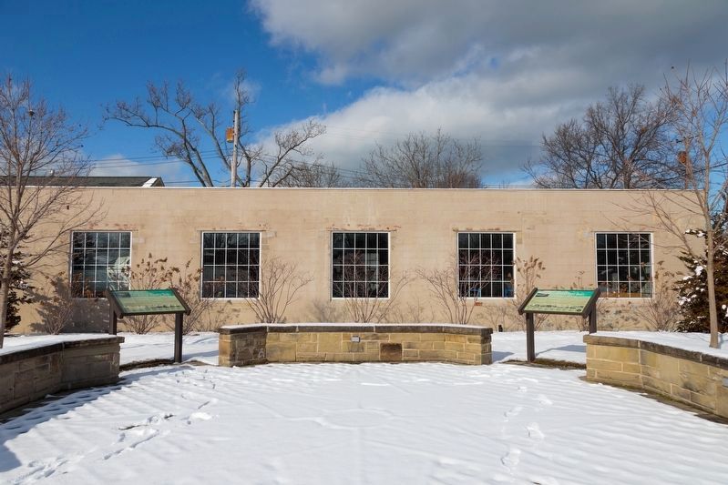
Friendship Park, Vermilion Ohio
| 201 ► Ohio, Erie County, Vermilion — The Days of Steel Boats — Steel Shipbuilding in Vermilion — |
| 202 ► Ohio, Erie County, Vermilion — 2019 — The Lighthouse Lens — |
| 203 ► Ohio, Erie County, Vermilion — Vermilion / Erie County — |
| 204 ► Ohio, Erie County, Vermilion — Vermilion’s Lighthouse — A History — |
| 205 ► Ohio, Fairfield County, Baltimore — 4-23 — The Ohio & Erie Canal and the "Twin Cities" / The Ohio & Erie Canal and the Dry Dock Lock — |
| 206 ► Ohio, Fairfield County, Baltimore, Liberty Township — Neptune P2V-5F (Sp-2E) 131522 — |
| 207 ► Ohio, Fairfield County, Carroll — Carroll — |
| 208 ► Ohio, Fairfield County, Carroll — 7-23 — Junction of the Ohio Erie and Lancaster Lateral Canals — |
| 209 ► Ohio, Fairfield County, Lockville — Ohio's Canal System — |
| 210 ► Ohio, Fairfield County, Millersport — 3-23 — Deep Cut at the Licking Summit / Millersport and the Ohio-Erie Canal — |
| 211 ► Ohio, Franklin County, Canal Winchester, South Columbus — 26-25 — Canal Winchester and the Ohio and Erie Canal — |
| 212 ► Ohio, Franklin County, Canal Winchester, South Columbus — 108-25 — The Interurban Depot — |
| 213 ► Ohio, Franklin County, Columbus, Dennison Place — 51-25 — First Modern Streamflow Measurement in Ohio — |
| 214 ► Ohio, Franklin County, Columbus, Downtown — 120-25 — Columbus Civic Center Historic District — |
| 215 ► Ohio, Franklin County, Columbus, Downtown — Evolution Of The Sioto River — |
| 216 ► Ohio, Franklin County, Columbus, Downtown — The Urban Face of the Scioto River — |
| 217 ► Ohio, Franklin County, Columbus, Downtown — USS Columbus — |
| 218 ► Ohio, Franklin County, Columbus, Franklinton — Lucas Sullivant Home Site — Reported missing |
| 219 ► Ohio, Franklin County, Columbus, Olentangy West — The Lane Avenue Bridge — Opened November 14, 2003 — |
| 220 ► Ohio, Franklin County, Columbus, Olentangy West — The Lane Avenue Bridges — A Brief History — |
| 221 ► Ohio, Franklin County, Columbus, River South District — Battleship U.S.S. Ohio — |
| 222 ► Ohio, Franklin County, Columbus, River South District — Columbus Feeder Canal / The Ohio- Erie Canal — |
| 223 ► Ohio, Franklin County, Columbus, River South District — Riversouth Bioretention Basins — 2009 — |
| 224 ► Ohio, Franklin County, Columbus, West Scioto — James J. Thomas Park — |
| 225 ► Ohio, Franklin County, Gahanna, Bridgeport — Big Walnut Creek Flood of Jan-Feb 1959 — |
| 226 ► Ohio, Franklin County, Grove City, Georgesville — 47-25 — Big Darby and Little Darby Creeks — A Feature of Ohio’s Scenic Rivers — |
| 227 ► Ohio, Franklin County, Groveport, South Columbus — 11-25 — Groveport Log House — |
| 228 ► Ohio, Franklin County, Groveport, South Columbus — 18-25 — Historic Groveport — |
| 229 ► Ohio, Franklin County, Groveport, South Columbus — 40-25 — Ohio and Erie Canal in Groveport / Scioto Valley Interurban — |
| 230 ► Ohio, Franklin County, Groveport, South Columbus — 96-25 — Ohio and Erie Canal Lock 22 — |
| 231 ► Ohio, Franklin County, Lockbourne, South Columbus — 29-25 — Historic Lockbourne — |
| 232 ► Ohio, Franklin County, Lockbourne, South Columbus — 30-25 — Ohio-Erie Canal and Locks / The Columbus Feeder Canal — |
| 233 ► Ohio, Franklin County, Lockbourne, South Columbus — 30-25 — Ohio-Erie Canal and Locks / The Columbus Feeder Canal — |
| 234 ► Ohio, Franklin County, New Albany — 24-25 — Archibald's Mill — Reported missing |
| 235 ► Ohio, Franklin County, Upper Arlington — 55-25 — Scioto Trail — |
| 236 ► Ohio, Franklin County, Westerville, Chatham Ridge — Clarence Boal Hoover / Charles Potter Hoover — |
| 237 ► Ohio, Fulton County, Swanton, Swan Creek Township — Eastern White Pine — Pinus strobus — |
| 238 ► Ohio, Fulton County, Wauseon, Clinton Township — Eastern White Pine — Pinus strobus — |
| 239 ► Ohio, Gallia County, Gallipolis — 14-27 — Gallia County, Gallipolis and the Ohio River — |
| 240 ► Ohio, Gallia County, Gallipolis — High Water Mark — |
| 241 ► Ohio, Gallia County, Gallipolis — High Water Marks — |
| 242 ► Ohio, Gallia County, Gallipolis — 13-27 — The Landing of the Welsh in Gallipolis — |
| 243 ► Ohio, Gallia County, Gallipolis — Yellow Fever Victims — |
| 244 ► Ohio, Greene County, Clifton — Clifton Mill — Since 1802 — |
| 245 ► Ohio, Greene County, Fairborn — Huffman Dam — — |
| 246 ► Ohio, Greene County, Spring Valley — 1-29 — Historic Little Miami River — |
| 247 ► Ohio, Hamilton County, Cincinnati — Albert Bettinger — |
| 248 ► Ohio, Hamilton County, Cincinnati — John L. Vance — |
| 249 ► Ohio, Hamilton County, Cincinnati — Ohio River Monument — A.D. 1670 A.D. 1929 — The Ohio Valley Improvement Association — |
| 250 ► Ohio, Hamilton County, Cincinnati, Avondale — Healthy Oceans = Healthy Penguins & People — |
| 251 ► Ohio, Hamilton County, Cincinnati, Avondale — Koi — (Common Carp) — Cyprinus carpio — |
| 252 ► Ohio, Hamilton County, Cincinnati, Avondale — Meet AP063 — |
| 253 ► Ohio, Hamilton County, Cincinnati, Avondale — The Aqueduct — אקוודוקט — |
| 254 ► Ohio, Hamilton County, Cincinnati, Avondale — The Waterwheel — |
| 255 ► Ohio, Hamilton County, Cincinnati, Central Business District — 12-31 — 1749 French Claims to Ohio River Valley — |
| 256 ► Ohio, Hamilton County, Cincinnati, Central Business District — Bicentennial Commons at Sawyer Point — |
| 257 ► Ohio, Hamilton County, Cincinnati, Central Business District — Bottoms — |
| 258 ► Ohio, Hamilton County, Cincinnati, Central Business District — 22-31 — Cincinnati's German Heritage — |
| 259 ► Ohio, Hamilton County, Cincinnati, Over-The-Rhine — The Miami and Erie Canal — |
| 260 ► Ohio, Hamilton County, Cleves — 20-31 — William Henry Harrison and the Cincinnati & Whitewater Canal — Reported missing |
| 261 ► Ohio, Hamilton County, Lockland — Canal Days in Lockland / Miami & Erie Canal — Anthony Wayne Parkway — |
| 262 ► Ohio, Hancock County, Arlington — Shipwreck History — |
| 263 ► Ohio, Hancock County, Findlay — Down By The Old Mill Stream — Tell Taylor Memorial — |
| 264 ► Ohio, Hancock County, Findlay — The Mighty Blanchard — |
| 265 ► Ohio, Hancock County, Findlay — Welcome to Historic Riverside Waterfront Park — |
| 266 ► Ohio, Hardin County, Dola — 1-33 — Hog-Creek Marsh — 1868 — |
| 267 ► Ohio, Hardin County, McGuffey — 7-33 — Scioto Marsh — Reported missing |
| 268 ► Ohio, Harrison County, Piedmont — Piedmont Dam — |
| 269 ► Ohio, Henry County, Liberty Center — 7-35 — Liberty Center, Ohio / Wabash Depot — |
| 270 ► Ohio, Henry County, Liberty Center — 24 — Lock 43 — |
| 271 ► Ohio, Henry County, Liberty Center — Site of Rice Lock 42 — |
| 272 ► Ohio, Henry County, McClure, Damascus Township — Grand Rapids — |
| 273 ► Ohio, Henry County, Napoleon — 535 North Perry — |
| 274 ► Ohio, Henry County, Napoleon — Flood of 1982 — |
| 275 ► Ohio, Henry County, Napoleon — 5-35 — Miami & Erie Canal And Napoleon's First Cemetery — |
| 276 ► Ohio, Henry County, Napoleon — 6-35 — Riverfront Industries Powered by Canal Water / How Napoleon Kept Its Name — |
| 277 ► Ohio, Henry County, Texas — James Durbin — |
| 278 ► Ohio, Hocking County, Haydenville — 4-37 — Historic Haydenville / Haydenville Historic District — |
| 279 ► Ohio, Hocking County, Hocking Hills State Park — Devil’s Bathtub — Hocking Hills State Park & Forest — |
| 280 ► Ohio, Hocking County, Logan — U.S.S. Hocking — |
| 281 ► Ohio, Hocking County, Rockbridge — 2-37 — Lock No. 12 The Sheep Pen Lock — |
| 282 ► Ohio, Hocking County, South Bloomingville — 3-37 — Salt and Hunting Trails — Reported missing |
| 283 ► Ohio, Holmes County, Walnut Creek, Walnut Creek Township — Peace Bridge — |
| 284 ► Ohio, Huron County, Monroeville — Monroeville Water Supply Reservoir — |
| 285 ► Ohio, Jefferson County, Bergholz — 51 — Bergholz-Overnight at Nebo — John Hunt Morgan Heritage Trail — |
| 286 ► Ohio, Jefferson County, Steubenville — 6-41 — Ohio River Lock and Dam 10 Site — |
| 287 ► Ohio, Knox County, Gambier — Living History Along the Kokosing River — |
| 288 ► Ohio, Knox County, Mount Vernon — 2-42 — Little Indian Fields — |
| 289 ► Ohio, Lake County, Fairport Harbor — 5-43 — Fairport Harbor Lighthouse — |
| 290 ► Ohio, Lake County, Mentor — 17-43 — Mentor Lagoons — |
| 291 ► Ohio, Lake County, Mentor — Mentor Lagoons Water Trail — |
| 292 ► Ohio, Lake County, Wickliffe — Coulby Park — |
| 293 ► Ohio, Lake County, Willowick — 9-43 — The Griffith Disaster, 1850 — |
| 294 ► Ohio, Lawrence County, Ironton — 6-44 — City of Ironton — Founded 1849 — |
| 295 ► Ohio, Licking County, Alexandria — William Mears Dawes Gristmill — |
| 296 ► Ohio, Licking County, Buckeye Lake — 13-45 — Buckeye Lake — |
| 297 ► Ohio, Licking County, Buckeye Lake — 12-45 — Buckeye Lake Park — “The Playground of Ohio” — |
| 298 ► Ohio, Licking County, Heath — 2-45 — Ohio Canal Ground-Breaking — |
| 299 ► Ohio, Licking County, Heath — Ohio Canal Was Started — |
| 300 ► Ohio, Licking County, Hebron — Hebron — The Historic National Road in Ohio — Transportation Crossroad — |
682 entries matched your criteria. Entries 201 through 300 are listed above. ⊲ Previous 100 — Next 100 ⊳