Planned in 1827 as an important trade route between Glasgow on the Ohio River, to the Ohio Canal at Bolivar, passed here. A basin and toll station were located nearby at Lodi, as well as Locks 19 and 20 and a canal dam. This segment of the Western . . . — — Map (db m80716) HM
The Clermont County Fair was held here from 1857 – 1863.
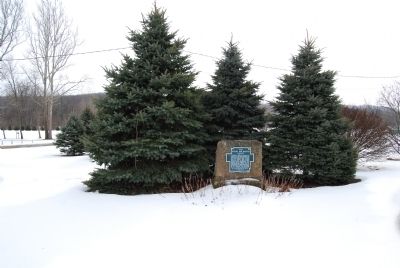
In 1861, Civil War Camps Lucas and Scott were located
here. In 1901 the Cincinnati, Georgetown and Portsmouth
Railroad (CG&P), 1876 – 1935, constructed a ten acre lake
named after the . . . — — Map (db m99692) HM
Chilo Lock & Dam 34 Powerhouse
Built by the
US Army Corps of Engineers
Dedicated October 6, 1925
Renovated by the
Clermont County Park District
August 27, 2005
Board of Park Commissioners
William A. Stearns, Chairman
Kenneth R. . . . — — Map (db m166915) HM
From 1885 to 1929, fifty-one dams were built across the Ohio River. The dams maintained a minimum 9
foot channel depth. To get around a dam, boats passed through a lock.
1. When a boat goes up the river, the upstream gates
(A) ane closed . . . — — Map (db m166913) HM
The Chilo Lock and Dam #34 closed in 1964
with the opening of the new Meldahl Locks and
Dam. The larger high lift dam raised the river's
navigation channel to a minimum of 12 feet.
This eliminated the need for Chilo and three
other upstream . . . — — Map (db m166907) HM
The Wakerobin was built
in 1926-for the US
Lighthouse Service,
which became the Coast
Guard.
Most recently the
Wakerobin was known as
the USS Nightmare, a
haunted Halloween
attraction in Covington,
KY. The . . . — — Map (db m166881) HM
This house was the Assistant Lockmaster's or the Engineer's house. Between it and the powerhouse
stood an identical house belonging to the Lockmaster. Their close proximity to the powerhouse allowed
quick access.
A House with a View . . . — — Map (db m166893) HM
Welcome to the Chilo Lock and Dam #34 Walking Tour.
Imagine the sights and sounds of the Chilo Lock and Dam. Boats sounding their horns, the lock gates rolling closed, workers' shouts
as the wicket dam is raised and lowered…
Other sounds . . . — — Map (db m166896) HM
The brass plaque on the wall marks the high
water mark of the 1937 flood. At that point,
the river had crested at 73 feet - a record that
still stands. — — Map (db m166898) HM
Since its creation, the Ohio River has always changed. Its seasonal floods and dry spells make the Ohio
River both feared and respected.
In 1888, the U.S. snag boat E.A. Woodruff removed 1225 snags,
127 large rocks, 46 new wrecks and 13 . . . — — Map (db m166891) HM
The Esplanade
The ground between the powerhouse and the river was called the esplanade. It was paved and kept immaculately clean. The
area is now under 30 feet of water and the lock wall is 100 yards from the current river . . . — — Map (db m166889) HM
Since the beginning of the western expansion, the Ohio River has moved people and products
into the nation's interior.
Coal is King
After the Civil War, the demand for coal increased. Coal is now by far the
major commodity moving along . . . — — Map (db m166894) HM
25th Anniversary
Lower Little Miami Scenic River
Designated into the National Wide & Scenic River System
January 1980
to protect and enhance the river’s free-flowing character, water quality, & outstandingly remarkable values
Little . . . — — Map (db m120866) HM
Early on July 14, 1863, Confederate Colonel Basil Duke's
brigade was the first of Brigadier General John Hunt
Morgan's cavalry to splash across the Little Miami River
at Porter's Mill. Duke's initial objective was to capture
the . . . — — Map (db m108245) HM
Confederate Brigadier General John Hunt Morgan's
2,000 cavalrymen, laden with artillery and wagons,
began fording the Little Miami River around 7 am
on July 14, 1863. Scouts rode ahead to establish
defensive perimeters. About half a mile . . . — — Map (db m108242) HM
Capt. Ernest Wagner Park
dedicated July 27, 1980
Captain Wagner commanded excursion passenger
steamboats Island Queen, Delta Queen,
Mississippi Queen and Avalon on the
Ohio and Mississippi River Systems
Cap knew every bend, sandbar and . . . — — Map (db m99767) HM
In 1862 slave catchers paraded a captured Leroy Lee in
manacles down Front Street toward the river. A crowd of
New Richmond citizens confronted the armed captors
demanding the release of Lee. Seeing they were greatly
outnumbered, the slave . . . — — Map (db m99706) HM
In recognition of those who serve
their country in war and peace time
to those 250,000 who served in World War II
to those 670 who were taken prisoner
to those 6700 plus who gave their lives
and
to the countless number who served
since this . . . — — Map (db m99764) WM
This monument is dedicated to the pioneers who early in the year 1796 braved many dangers and suffered numerous hardships in order to establish the small settlement of Lytlestown, later to be named Williamsburgh, along the banks of the East Fork of . . . — — Map (db m108602) HM
First Paper Mill
The first paper mill in Ohio and the Northwest Territory was established in the valley below in 1807 by John Coulter of Virginia, Jacob Bowman and John Beaver of Pennsylvania. The mill was in St. Clair Township on the East . . . — — Map (db m62960) HM
Fawcettstown, later to become East Liverpool, marked the first Ohio community to be encountered by early river travelers as they headed toward new challenges and new lives in the expanding nation. Indian canoes, flatboats, and steamboats carried . . . — — Map (db m49713) HM
Southeast of this point are the Big and Little tunnels. They were links in the 73-mile Sandy and Beaver Canal which connected the Ohio River with the Ohio and Erie Canal. Shifts of Irish laborers worked night and day with hand drills and blasting . . . — — Map (db m66538) HM
Stone Lockplate from Sandy & Beaver Canal Lock Number 27,
located at the foot of Market Street in New Lisbon.
Under the later numbering system Lock 27
was assigned to Lusk Lock in Elkrun Township.
Lock No. 27
Erected A.D. 1836
B. . . . — — Map (db m204450) HM
Capt. Bill Smart operated one of the last canal boats, "The Stranger", in this area. He lived in Coshocton and died in 1952, at the age of 102. — — Map (db m206159) HM
The lock your at is for the Wallooding Canal a 25 mile feeder canal off the Ohio-Erie that runs from Cleveland to Portsmouth 305 miles.
The captain and his wife lived on their boat she being the cook there was a "Hoagie" maintained the . . . — — Map (db m206161) HM
The Caldersburgh Pearl was dedicated in 2001 as a full-sized replica of a three-cabin canal freighter (65' x 14'). The name Caldersburgh Pearl has special significance to Roscoe's past. Caldersburgh was the name of the original community (early . . . — — Map (db m217365) HM
This house, built by 1840, was the home of Jacob Welsh. Welsh is on record as having been a toll collector from 1836-1837.
Being a favorite of Mrs. Frances Montgomery, one of the founders of the restoration project, this was the first building . . . — — Map (db m26404) HM
Built in 1831, this “Old Warehouse” was used to store large quantities of grain, hides, wool and produce. There was a dry goods store on the upper level. Known as the “Mill Store” in the 1830's, this was the natural place . . . — — Map (db m27379) HM
Side A:
The acknowledged host of the Underground Railroad in Coshocton County was Prior Foster, a well respected African American who lodged fugitive slaves in his shanty at Harbaugh Corner. He fed, sheltered, and clothed them and then . . . — — Map (db m36227) HM
This cannon, formerly mounted on the U.S.S. Constitution “Old Ironsides” was obtained by the City of Galion from the Boston Navy Yards in 1934.
The Constitution, build in 1797, saw action in the Barbary Coast War and the War of 1812. After many . . . — — Map (db m194245) HM
The Ohio & Erie Canalway celebrates the first 110 miles of a waterway that helped the nation grow.
Dug by hand from 1825 to 1832, the Ohio & Erie Canal was the first canal west of the Appalachian Mountains. It connected Lake Erie to the Ohio . . . — — Map (db m224609) HM
Restoring the Cuyahoga as a healthy, free-flowing river has many challenges. A major goal is removing dams that block fish migrations and degrade natural wildlife habitats. Here two dams diverted water into this section of the Ohio & Erie Canal, . . . — — Map (db m228495) HM
The John J. Donnelly Rocky River nature center is designated to commemorate the distinguished service of the honorable John J. Donnelly to Cleveland Metro parks. During his 17-year tenure (1991-2008) as Senior Probate Judge of Cuyahoga County, Judge . . . — — Map (db m31738) HM
The Chagrin River was named for Francois Seguin, a Frenchman who traded with Native Americans in Northeast Ohio circa 1742. The "High Falls" of the Chagrin River primarily attracted settlers from New England (circa 1833) seeking a location with . . . — — Map (db m103458) HM
[side A] Howard Daniels, who lived from 1815-1863, was a noted architect and landscape gardener. Over the course of his life, he designed six Ohio and New York cemeteries, including Woodland that began in 1852 when he laid out 20 of its 60 . . . — — Map (db m21002) HM
The U.S. Army Corps of Engineers is tasked with federal navigation operation and maintenance of harbors in the United States. As part of this mission, the Buffalo District is responsible for annual channel maintenance and breakwater repair for . . . — — Map (db m192565) HM
Oliver Hazard Perry was only 27 when named commander of the Lake Erie Fleet. His combination of determination and tactical brilliance won him acclaim at home and the lasting respect of the British. "More than any other battle of the time," wrote . . . — — Map (db m17868) HM
On September 10, 1813, during the War of 1812, Oliver Hazard Perry commanded victory for US. Naval forces during the Battle of Lake Erie at Put-In-Bay, Ohio. The battle took place just 5 1/2 miles west of Cleveland. Many historians called the War . . . — — Map (db m213381) HM WM
The decision to locate the northern terminus of the Ohio and Erie Canal on the Cuyahoga River in Cleveland's Flats laid the groundwork for Cleveland's rise as an industrial powerhouse. The calling card for what would become the large commercial . . . — — Map (db m192473) HM
Moses Cleaveland (1754-1806) served during the American Revolution as a captain in one of the three companies of Sappers and Miners in the U.S. Army Corps of Engineers. A native of Connecticut, Cleaveland graduated from Yale University before . . . — — Map (db m192562) HM
In 1796 Moses Cleaveland led a surveying party to the banks of the Cuyahoga River to lay out a new city. The map from the survey is depicted in the pavement below. — — Map (db m192508) HM
At this site was lock 44, the north terminus of the Ohio and Erie Canal from 1829 to 1872.
Lock 44 as the outlet of the canal into the Cuyahoga River and the first stop in the transportation system which linked the Great Lakes with the Ohio River . . . — — Map (db m17906) HM
Isaac Campbell Kidd, Sr. was born in Cleveland in 1884. He entered the United States Naval Academy in 1902 and dedicated his life to the Navy. While an ensign, he sailed around the world with the "Great White Fleet" from 1907 to 1909. During the . . . — — Map (db m172966) HM
The history of our Nation is the history of the U.S. Army Corps of Engineers. Army engineers played a crucial role in the growth of the young republic — surveying routes for canals and railroads and serving as explorers, surveyors, and mapmakers . . . — — Map (db m192551) HM
The Warehouse District of today is arguably the best physical remnant of 19th-century Cleveland. Although none of the residences built in that century remain, the early settlers’ street network is mostly intact.
In Cleveland's development . . . — — Map (db m192432) HM
On October 6, 1683, thirteen German families landed in America from Krefeld, Germany, on the ship Concord. This date is regarded as the beginning of German settlement. The Concord is considered the German Mayflower. Franz Daniel Pastorius, their . . . — — Map (db m182149) HM
Puritas Mineral Spring Company bottled and sold mineral water from
the natural springs in the area. In 1894, the Cleveland and Berea
Street Railway bought Puritas Springs and expanded the area into
a picnic grove with a dance hall and pavilion . . . — — Map (db m136820) HM
(left column:)
The first Cleveland settlers initially settled near the mouth of the Cuyahoga River in the present-day Flats, but moved to higher ground to the current site of Downtown Cleveland due to flooding and weather conditions . . . — — Map (db m147878) HM
Central Viaduct
The location where Interstate 90 spans the Cuyahoga River Valley is currently crossed by its third generation of bridge. While each generation introduced improvements in technology and capacity, the designs drew . . . — — Map (db m156652) HM
For generations, two families have made their livlihoods in the gristmill at Lock 37. The Alexander family built the mill about 1853 to grind wheat into flour. Water from Lock 37’s spillway turned the mill’s wooden waterwheel and grindstones. In the . . . — — Map (db m202347) HM
Canal Engineers did not foresee the intensity of valley floods and later added structures to control water levels. Here a National Park Service worker adjusts a floodgate built in the early 1900s. Look closely at the actual structure. Can you see . . . — — Map (db m202345) HM
Canal locks attracted businesses to serve canal boat crews, locals, and farmers. Here at Lock 37 the Vanouceks ran a tavern and general store, and the Alexander family operated a gristmill. A spillway allowed excess water to flow around the lock. . . . — — Map (db m202342) HM
Hi, I’m Blossom. During the canal days.mules like me
walked the towpath, pulling heavy boats behind us. We
were strong engines, able to haul 60 tons or more of
freight. Mules worked in teams of two or three. Cargo
boats had a middle cabin to . . . — — Map (db m140592) HM
James Abram Garfield, 20th President of the United States, was born here in 1831. His father died when he was two, but the family remained on the farm where James helped when he was not attending school. He continued to live here through his years . . . — — Map (db m118214) HM
Adele Von Ohl Parker was a daredevil stunt rider once starring in Buffalo Bill's shows. Stranded during the Depression, she started a riding school; her flamboyance captivated her young riders. The 34-building ranch was the scene of many rodeos and . . . — — Map (db m11547) HM
Stephen and Mehitable Frazee experience both the challenges and benefits of the Ohio & Erie Canal. They arrived in this area in the early 1800s, when it was sparsely settled. They lived in a log cabin, cleared forests for farmland, and were mostly . . . — — Map (db m202332) HM
You are on the historic Station Road Bridge facing the Pinery Narrows, the Cuyahoga Valley’s thinnest point. Here the river is confined by hard, deeply cut bedrock. Its path is narrower and straighter than where it twists through loose glacial . . . — — Map (db m202248) HM
The 100-mile Cuyahoga River is modest in length but mighty in its impact on the environmental movement. Like many others, the river became badly polluted by industrial waste and sewage. Floating debris and chemicals caught fire near its mouth in . . . — — Map (db m201738) HM
The first steam engine chugged its way down the new Valley Railway in 1880, beginning an era of progress for the Cuyahoga Valley. Regional industrial growth boosted demand for coal and other raw materials. The railway connected mineral fields in the . . . — — Map (db m202330) HM
In 1822, Ralph Russell, a Connecticut pioneer who had settled in Warrensville Township ten years earlier, founded the North Union Shaker Community. The Shakers created Horseshoe Lake in 1852 when they built a dam across Doan Brook and harnessed its . . . — — Map (db m10423) HM
Built in the late 1820s, this structure served at various times as a tavern, general store, and residence. The house acquired a colorful reputation among canal travelers, who sometimes called it “Hell's Half Acre.”
The house doubled in size in . . . — — Map (db m183613) HM
Lock 38 is one of the few restored, working locks
along the historic Ohio & Erie Canal. Locks are like
elevators – they raise and lower boats between levels.
State engineers designed 44 locks to deal with a 395 foot
rise in elevation from . . . — — Map (db m140161) HM
Tinker's Creek is named after Joseph Tinker, a member of Moses Cleveland's survey crew. The creek has been carving this gorge from the surrounding rock for thousands of years. The creek begins its 28.2 mile journey in Portage County, flows . . . — — Map (db m228171) HM
Born in Jefferson, Ohio, Theodore E. Burton graduated from Oberlin
College and became a prominent Cleveland attorney. He was elected
to Congress in 1888 and served from 1889-91, 1895-1909, and
1921-28. He was elected U.S. Senator in 1908 and . . . — — Map (db m134265) HM
The Response – Defiance Crescent-News
Thursday, March 27, 1913
"The great yellow flood of muddy water that swept the Maumee
Valley and seemed to make Defiance its central point was followed by a fall of pure white snow . . . — — Map (db m165820) HM
This area is thought to be the burial place of more than 300 soldiers who once
camped at Fort Winchester, Camp No. 3, also known as Fort Starvation, during the
War of 1812. They were led by Brigadier General James Winchester.
Kentucky . . . — — Map (db m207146) HM
History
Connecting the Maumee, Miami and the Wabash Rivers for economical
transportation was advocated by George Washington as early as 1773. Captain
John Riley surveyed the route in 1820. After further surveys, the Ohio
legislature in . . . — — Map (db m173037) HM
A memorial to all who served in the Navy Armed Guard and Merchant Marine
Our losses
1810 lives from the Armed Guard
6839 lives from the Merchant Marine
731 ships sunk
1941 - 1945
Their motto
"We aim to deliver . . . — — Map (db m173001) WM
Named for the Ottawa Indian chief said to have been born here c. 1712. Site of the largest recorded apple tree "French and Indian" c. 1680 to 1887. Here Oliver Spencer spent his Indian captivity 1792. Bark cabins and cultivated fields fields of the . . . — — Map (db m30297) HM
Follow the Blue Blazes
Ohio's Buckeye Trail (BT) was first envisioned in 1958 as a hiking trail to
connect Lake Erie to the Ohio River through the rugged hills of eastern
and southern Ohio. In 1959 a devoted group of volunteers founded . . . — — Map (db m216952) HM
Lock No. 13 & Independence Dam
Through this lock passed many canal boats carrying produce, goods, and passengers not only from Ohio and Indiana but from as far south as New Orleans and as far east as New York City. Boats were drawn by . . . — — Map (db m195867) HM
This marker is on the trunk line of both the Miami & Erie Canal and the Wabash & Erie Canal. The Miami & Erie Canal, built by Ohio, was begun on July 21, 1825 and completed in 1845. It connected the Ohio River at Cincinnati with Lake Erie at . . . — — Map (db m19438) HM
This storm net structure was developed as a student research project in cooperation with Ohio Wesleyan University, the City of Delaware Public Utilities Department, and StormX Water Systems. The purpose of this project is to determine if the . . . — — Map (db m203320) HM
A convoy of 3 ships and 3 Coast Guard cutters passed through “Torpedo Alley” some 100 miles off the coast of Greenland at about 1 a.m. on February 3, 1943. The submarine U-223 fired 3 torpedoes 1 of which hit the midsection of the . . . — — Map (db m18207) HM WM
• Water temperature determines eating activity: eating stops when temperature drops below 70°.
• Temperature of the nest determines sex of the young.
• Cooler . . . — — Map (db m200900) HM
1978: Listed for protection under the state and federal Endangered Species Act.
1979: Only 4 successful nesting pairs in the state.
1999: 50 nests recorded in the state.
2007: 164 nests were recorded with . . . — — Map (db m200892) HM
💧 Lakes, rivers, streams
🏠 Hollow logs, rocky areas, abandoned beaver dens or dense vegetative areas used for dens
🏞️ Freshwater and coastal marine habitats, including rivers, lakes, marshes, swamps, . . . — — Map (db m200889) HM
💧 In or near the water
🏠 Open water, reeds and cattails to escape predators
🏞️ Found in swamps, marshes, shallow ponds or lakes with abundant aquatic vegetation
🍴 Aquatic plants, seeds and . . . — — Map (db m200863) HM
Freshwater Mussels
Freshwater mussels…
…are bivalve mollusks dating back to the Triassic Period - more than 250 million years ago!
…are in trouble. Over 70% of mussel species are endangered and 37 are already extinct making . . . — — Map (db m200893) HM
Recognizing the importance of Huron’s harbor, a group of Huron and Milan businessmen formed the Huron Harbor Company to make improvements to the harbor. The project was partially funded by the sale at public auction of one half of the town plat of . . . — — Map (db m142343) HM
Huron’s lighthouses have served as beacons to Great Lakes shipping since the early nineteenth century. The first of three Huron lighthouses was built in 1835. Built of wood and ill-equipped to deal with strong Lake Erie winds, it was destroyed . . . — — Map (db m142257) HM
Self-Unloaders.
Business at the ore docks was strong through the 1970s. An all time record was set in 1979 when 151 boats shipped in 2,784,000 tons of ore. As higher grade iron-ore grew scarce it was replaced by lower grade taconite. It became . . . — — Map (db m142291) HM
Early Boats.
In the 1800s, schooners were the main cargo vessels of the Great Lakes, linking the growing towns of the Midwest with the East Coast. One of the largest schooners to sail the Great Lakes was built just a few miles up the Huron . . . — — Map (db m142342) HM
1906 Dock Improvements.
In the early 1900s the lake vessels were getting larger and needed more water and room to turn around when emptied. In 1906 the
Army Corps of Engineers widened Huron Harbor from 120 to 180 feet and extended the west . . . — — Map (db m142256) HM
The Huron Iron Ore and Coal Docks. In 1882 Huron, Ohio became the Wheeling and Lake Erie Railroad’s port on Lake Erie for the shipping of iron ore and coal. For the next 100 years the docks played an integral part in Huron's progress and . . . — — Map (db m150714) HM
The Wright House and the Underground Railroad
In the early 1800s, Jabez Wright, an early Huron County judge, purchased a large tract of lakeside land on the north side of what is now Cleveland Road. There Wright built an eight-room farmhouse . . . — — Map (db m41809) HM
Edison Recalls Milan
My recollections of Milan are somewhat scanty as I left the town when I was not quite seven years old. I remember the wheat elevators on the canal, and Gay shipyard; also the launching of new boats, on which occasion the . . . — — Map (db m90659) HM
Milan was a leading Great Lakes port after the completion of the 3-mile Milan Canal in 1839. Center of activity was the Milan Basin at this site where produce was brought from area farms for shipment to lake and world ports through 14 warehouses by . . . — — Map (db m39910) HM
Birthplace of Thomas A. Edison, February 11, 1847.
A Moravian village, Pequotting, 1804–1809.
First permanent white settlers came in 1816.
Milan village platted, 1817; incorporated February 23, 1833.
Ships' canal to lake . . . — — Map (db m236718) HM
Cedar Point became a popular beach resort in the late 1870s, when visitors traveled to the peninsula by steamboat from Sandusky. The Grand Pavilion (1888), the oldest building in the park, dates from this era. Promoter George Boeckling formed the . . . — — Map (db m3026) HM
Dominating the Put-in-Bay skyline is Perry's Victory & International Peace Memorial, a 352 foot high Greek Doric column erected between 1912 and 1915. The memorial commemorates Oliver Hazard Perry's naval victory over a British squadron at the . . . — — Map (db m204900) HM
Weldon B. Cooke, Thomas W. Benoist, Reinhardt N. Ausmus experimented in early aviation from this site 1912 - 1917
One of Sandusky Shipyard Sites
Sail and Steamboats were built 1864-1933
Among the . . . — — Map (db m242220) HM
Piers were in existence here as early as 1846. Later three long piers were built by the Baltimore and Ohio Railway for commercial use. Iron ore, grain, lumber, sand, crushed stone and packaged freight were shipped from this point. The B&O Railway . . . — — Map (db m90708) HM
Wooden shipbuilding thrived in sheds and shops that dotted the
banks of the Vermilion River. Starting in early 1800s they turned
out countless vessels that served a number of maritime industries;
schooners used for fishing and carrying cargo; . . . — — Map (db m149306) HM
Lester Allan Pelton, "the Father of Hydroelectric Power," was born on September 5, 1829, a quarter of a mile northwest of this site. He spent his childhood on a farm a mile south of this site and received his early education in a one-room . . . — — Map (db m75629) HM
650 entries matched your criteria. Entries 101 through 200 are listed above. ⊲ Previous 100 — Next 100 ⊳