Near Calvary Circle just north of Calvary Road (1st Avenue).
Named in honor of Brevet Major General Joseph Gilbert Totten, Fort Totten protected overland transportation and communication routes from Minnesota to the Missouri River and Montana. In addition, the treaty of February 19, 1867, provided for a . . . — — Map (db m231947) HM
On Fort Dilts Road, on the left when traveling west.
On this site in September 1864 an immigrant train, under the command of Capt. James L. Fisk, bound for the gold fields of Montana, was besieged by hostile Sioux Indians, despite the fact that an armed escort of 50 U. S. Cavalrymen had been provided . . . — — Map (db m33923) HM
Near East Main Avenue at North 1st Street, on the right when traveling east.
The State Historical Society of North Dakota acquired Camp Hancock in 1951 for preservation as a state historic site. Work began to repair fire damage on the lone remaining structure, the officers quarters from the 1870s, used later as the U.S. . . . — — Map (db m154548) HM
Near U.S. 2 at 21st Avenue Northeast, on the right when traveling west.
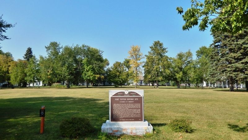
Over this trail the Indians carried freight and mail for the U.S. Govt. from Fisher’s Landing to Fort Totten in the years 1879 to 1882. — — Map (db m155662) HM
On North Dakota Route 65 near 106th Avenue Northwest, on the left when traveling west.
This was the location of a stop-over shelter for the U.S. Army wagoneers who hauled mail, medicine & supplies from Fort Abercrombie to Fort Toten. It was in use from 1867 to 1872. — — Map (db m176687) HM
On North Dakota Route 37 near U.S. 83, on the left when traveling west.
People have lived in the area now called North Dakota for over 12,000 years. The people of prehistoric
times were nomadic hunters and gatherers. More recent Native American tribes of this area include the Mandan, Arikara and Hidatsa. These . . . — — Map (db m164407) HM
Near 8th Street Southwest (County Road 17) near 28th Avenue Southwest (State Road 23), on the right when traveling west.
In December of 1804 the temperature dipped and snow began to fall. Despite waking to an unrelenting cold the Corps of Discovery continued to work on the finishing touches of Fort Mandan, went hunting and preformed the never-ending job of gathering . . . — — Map (db m162597) HM
Near 8th Street Southwest (County Road 17) near 29th Avenue Southwest (County Highway 23), on the left when traveling west.
Winter 1804-1805
Named for the nearby Indians, Fort Mandan was winter quarters for the Lewis and Clark Expedition. Sited by Captain Clark on November 2, 1804, the fort was built in a triangular shape from cottonwood logs cut in . . . — — Map (db m162536) HM
Near 8th Street Southwest (County Road 17) near 28th Avenue Southwest (County Road 23), on the right when traveling west.
Fort Mandan, 1804-05 Winter Quarters of the Lewis and Clark Expedition, also was the birthplace of the son born to Sakakawea and her French husband Charbonneau, interpreter for the explorers. The "Bird Woman" helped guide Lewis and Clark to their . . . — — Map (db m162595) HM
On unnamed paved road, on the right when traveling north.
On this site are the remains of a large earthlodge village originally settled by the Mandan Indians (ca.1822) and the trading forts Clark and Primeau. Previous to the establishment of Fort Clark, an unnamed post was built in the area by James Kipp . . . — — Map (db m33313) HM
Near 37th Avenue Southwest near 12th Street Southwest (State Highway 200), on the right when traveling north.
This location contains the remains of Fort Clark, named in honor of former explorer William Clark, who was Superintendent of Indian Affairs at the time. It was built by James Kipp for trade with the Mitutanka Mandan Indians living in the earthlodge . . . — — Map (db m162387) HM
Near 37th Avenue Southwest near 12th Street Southwest (State Highway 200), on the right when traveling north.
Eighteen years before the establishment of the Mandan Village of Mih-tutta-hang-kush, a settlement of a different kind was being built a few miles northwest of this point. In November 1804, the Lewis and Clark Expedition began construction of their . . . — — Map (db m162530) HM
Near 37th Avenue Southwest near 12th Street Southwest (State Highway 200), on the right when traveling north.
Geophysics is the application of the methods of physics to the study of object or materials beneath the surface of the earth. Archeo-geophysics applies geophysical principles to the study of near-surface archaeological deposits. The goal is to . . . — — Map (db m162461) HM
Near 37th Avenue Southwest near 12th Street Southwest (State Highway 200), on the right when traveling north.
Fort Clark and its opposition post Primeau's Post, as well as that of the nearby Mandan and later Arikara village, were for defense and also served to tap the bountiful natural resources of this stretch of the Missouri River valley. Between 1832 and . . . — — Map (db m162383) HM
Near 37th Avenue Southwest near 12th Street Southwest (State Highway 200), on the right when traveling north.
You are now looking at a portion of the former palisade wall and the ditch that surrounded the Mandan village of Mih-tutta-hang-kush. A palisade is a row of closely spaced vertical posts set together to form a protective wall. Archaeologists belief . . . — — Map (db m162534) HM
Near 37th Avenue Southwest near 12th Street Southwest (State Highway 200), on the right when traveling north.
Fort Clark's most prominent structural features, the enclosure or "palisade" and projecting blockhouses, were built to defend its occupants from attack and the Company's trade goods from theft. Curiously, historic documents and archaeological . . . — — Map (db m162471) HM
Near 37th Avenue Southwest near 12th Street Southwest (State Highway 200), on the right when traveling north.
Fort Clark's citizens were small in number but extremely diverse in cultural origin. This ethnic diversity is reflected in one Company trader's remarks that trading posts were a "Babylonian confusion of languages...Assiniboin, Crow, Herantsa, . . . — — Map (db m162389) HM
Near 37th Avenue Southwest near 12th Street Southwest (State Highway 200), on the right when traveling north.
Shortly after Fort Clark's construction (circa 1830), Prince Maximilian of Wied (Germany) described the post in his journal as "built on the same plan as the other trading posts of the Company. The front and back of the square are forty-four paces . . . — — Map (db m162459) HM
Fort Rice was a United States military post established to provide protection for white settlers who had just commenced to penetrate the territory of Dakota and as a military base for operations against hostile Indian tribes.
The post was . . . — — Map (db m154080) HM WM
In 1866-1868, Indian councils were held at the post. The most important of these was the Great Council with the Sioux bands in July 1886. A key leader of the Lakota, Thathanka Iyotake (Sitting Bull), refused to participate. Father Pierre Jean De . . . — — Map (db m154294) HM WM
Fort Rice was established on July 7, 1864, by General Alfred H. Sully as a field base during his 1864 expedition. The fort was named for Brigadier General James Clay Rice of Massachusetts who was killed in battle during the Civil War. Fort Rice was . . . — — Map (db m154247) HM
The barracks served as quarters for the 123 men of the two companies of the 6th Infantry who built Fort McKeen. Soldiers prepared their meals and dined in the mess hall and kitchen located at the rear of the building. Bunks with bed-sacks filled . . . — — Map (db m153207) HM
Near Fort Lincoln Road, on the right when traveling south.
The Infantry Post was protected by blockhouses and, on the north and west sides, by cottonwood walls called palisades. The rugged terrain to the south and east helped discourage attacks.
The palisades were costly to maintain and were removed . . . — — Map (db m227861) HM
An important daily function at military posts was guard duty. Guards and pickets prevented intruders from entering the post or advancing near enough to shoot at soldiers, steal horses or set fire to buildings.
One such outpost was the . . . — — Map (db m227347) HM
The commanding officer’s quarters was one of seven frame residences (called Officers Row) built n 1873 to house cavalry officers stationed at Fort Abraham Lincoln. The first commanding officer and tenant was Lt. Colonel (Brevet Major General) George . . . — — Map (db m96771) HM
Near Fort Lincoln Road, 1.8 miles north of State Route 1806, on the right when traveling south.
This United States military post was established as Fort KcKeen, June 14, 2872 by companies "B" and "C" of the 6th Infantry under the command of Lieutenant-Colonel Daniel Huston Jr. It was named in commemoration of Colonel H. Boyd McKeen of the 81st . . . — — Map (db m153168) HM
On Fort Lincoln Road, on the left when traveling north.
This hand carved boundary marker was once located along the western edge of the Fort Abraham Lincoln Military Reservation.
President Ulysses S. Grant established the Fort Abraham Lincoln Military Reservation on February 11, 1873. The . . . — — Map (db m227236) HM
Soldiers of the 20th Infantry relax around a Gatling gun at the Fort Abraham Lincoln Infantry Post during the mid 1870s
The remains of these breastworks before you once supported a Gatling gun and a small group of infantry. . . . — — Map (db m227762) HM
Near Fort Lincoln Road, 1.7 miles north of 46th Street (State Highway 1806), on the left when traveling north.
The laundresses were some of the few females officially recognized by the Army. As such, they were afforded housing and rations in return for tending to the soldiers' laundry. The laundresses' quarters, also known as "Suds Row," was a large log . . . — — Map (db m153213) HM
Near Fort Lincoln Road, on the right when traveling south.
Of the 123 soldiers stationed at Fort McKeen in the late summer of 1872, seven were officers. They lived in four Officers' quarters located at the northwestern end of the parade ground. As with the other fort buildings, the officers; quarters were . . . — — Map (db m153201) HM
Charles Page, a civilian worker at Fort Abraham Lincoln who froze to death in the fall of 1873, was the first recorded burial in the cemetery. Freezing, gangrene, gunshot wounds, and other illnesses and injuries were typical causes of death. After . . . — — Map (db m227882) HM
Near Fort Lincoln Road, on the right when traveling south.
Completed on November 8, 1872, the hospital was of wood-frame construction and had two 12 bed wards. To save money, the army used paper board instead of plaster to finish the inside walls. Earth commodes adjoined each ward for use by patients too . . . — — Map (db m153959) HM
Near Fort Lincoln Road, on the right when traveling south.
Storage for ammunition and explosives at any military post was vital. At Fort Abraham Lincoln Infantry Post, three powder magazine stored ammunition for weapons of all types.
Powder and magazines had thick walls or were built into the ground. . . . — — Map (db m153956) HM
Near Fort Lincoln Road, on the left when traveling south.
The schoolhouse provided the basics of reading and writing for children living at the post. Even soldiers sought education within the walls that once stood on this spot. Many of the soldiers serving in the infantry post could not read or write. It . . . — — Map (db m153211) HM
The U.S. Army Quartermaster Department employed both Native Americans and European-Americans as scouts at Fort Abraham Lincoln. Many of these scouts were "Rees" or Arikara who fought the Lakota. Some of the best known scouts at Fort Abraham Lincoln . . . — — Map (db m227764) HM
On Walt Hjelle Parkway near 62nd Street Southeast, on the right when traveling north.
Fort Ransom, a United States Military Post, established on this
site on June 18. 1867, was one of a chain of forts in Dakota
Territory established to protect frontier settlements. All
buildings were of substantial log construction and . . . — — Map (db m175426) HM
On West Hjelle Parkway near 62nd Street Southeast, on the right when traveling north.
Historic Fort Ransom
Fort Ransom (1867-72) was one of several small military outposts established by General Alfred H. Terry to place troops in strategic locations along frontier transportation routes as a defensive measure against Indian . . . — — Map (db m176138) HM
On Walt Hjelle Parkway at Valley Road, on the right when traveling north on Walt Hjelle Parkway.
Pyramid Hill
Pyramid Hill has long been a topic of local debate sometimes heated. The hill's obvious geometric shape begs the question of just how it was formed.
Geologists believe that Pyramid Hill is a natural feature—the result of . . . — — Map (db m177165) HM
Near Broadway North (County Road 4) near Abercrombie Street.
This building is listed on early maps and drawings
of Fort Abercrombie as a barracks. Barracks were
the living quarters for the enlisted soldiers at Fort
Abercrombie. The front of the building had two
squad rooms where the soldiers slept. . . . — — Map (db m177197) HM
Near Broadway North (County Highway 4) south of Abercrombie Street.
The reconstructed cannon
bastion in front of you shows
what the fortifications at Fort
Abercrombie might have looked
like during the siege in 1862.
Prior to the siege, defensive
fortifications around Fort
Abercrombie simply did not exist. . . . — — Map (db m177318) HM
Near Broadway North (County Road 4/22) south of Abercrombie Street, on the right when traveling north.
In 1866 this building was listed on maps as Fort
Abercrombie's carpenter shop. In 1868, Assistant
Surgeon W. H. Gardner described this building
as having rooms for a blacksmith, carpenter, painter
and saddler. By 1871, maps show this being . . . — — Map (db m184217) HM
On Broadway North (County Road 4) near Abercrombie Street.
The commissary storehouse held Fort Abercrombie's
food supply. It was a long, single-story structure
built of hewn logs and covered with clapboard
siding. A storehouse was typically one of the first
buildings constructed at a frontier fort. . . . — — Map (db m177194) HM
Straight ahead of you and down along the bank
of the river is the approximate location of the ferry
crossing that served Fort Abercrombie.
This photograph shows the ferry as it crosses
the Red River. You are in roughly the same spot
as the . . . — — Map (db m176610) HM
On Broadway North (County Road 4) 0.2 miles south of Abercrombie Street, on the left when traveling south.
Fort Abercrombie, the first United States military post to be established
in what is now North Dakota, was authorized at this point in 1857 and was
named in honor of Lt. Col. John J. Abercrombie, The extensive trade
between Canada and the . . . — — Map (db m175574) HM WM
On Broadway at Fourth Avenue East, on the left when traveling west on Broadway.
Fort Abercrombie, the first
military post in North Dakota was established in 1857 as a protection to the settlements in the Red River Valley. It served as a gateway to the northwest for 20 years. Abandoned in 1877. — — Map (db m176536) HM
Near Broadway North (County Road 4) near Abercrombie Street.
The building in front of you was Fort Abercrombie's
guardhouse. It has been restored to look as it would
have in the 1860s and 1870s. The guardhouse
functioned in many ways like a police station.
Soldiers on guard detail provided security . . . — — Map (db m176740) HM
On Broadway North (County Road 4) near Abercrombie Street, on the left when traveling south.
You are standing in roughly the same spot where a photographer
took this picture of Fort Abercrombie's headquarters building.
The headquarters building is in the foreground of the photograph.
It stood one-and-a-half stories tall and had a porch . . . — — Map (db m176709) HM
Near Broadway North (County Road 4) near Abercrombie Street.
Fort Abercrombie's second hospital was built
in 1867. It replaced the hospital building that sat
on the north side of the fort. Assistant Surgeon W.H.
Gardner described this new hospital as a two-story
frame building with clapboard siding.
In . . . — — Map (db m176742) HM
Near Broadway North (County Road 4) near Abercrombie Street.
This building first served as Fort Abercrombie's
hospital. After the completion of a new hospital
in 1867, Assistant Surgeon W.H. Gardner described
this building as having six rooms for Lieutenants'
quarters. Behind this building was a long low . . . — — Map (db m176613) HM
Near Broadway North (County Road 4) near Abercrombie Street.
In front of you was a long row of crude log buildings.
In 1868 Assistant Surgeon W.H. Gardner described
these buildings as quarters for married soldiers.
On later maps of Fort Abercrombie, these log
buildings are listed as laundresses . . . — — Map (db m177141) HM
On Broadway North (County Highway 4) near Abercrombie Street, on the left when traveling north.
A magazine is a building used to store gunpowder
and ammunition. This drawing shows what Fort
Abercrombie's magazine may have looked like
in the mid 1860s. Fort Abercrombie's first
magazine was a brick building 14 feet wide and
34 feet long. . . . — — Map (db m176607) HM
Near Broadway North (County Road 4) south of Abercrombie Street.
Above is a drawing of what Fort Abercrombie's
quartermaster storehouse may have looked like.
It was constructed sometime between 1866
and 1868. The quartermaster storehouse held
things such as tools, clothing, footwear, kitchen
utensils, and . . . — — Map (db m177207) HM
Near Broadway (County Road 4) near Abercrombie Street.
In 1868 Assistant Surgeon W.H. Gardner described
this building as a stable for officers' horses.
It was a log building 36 feet long and 26 feet wide.
This was one of several stables that were used
at Fort Abercrombie. Animals including horses, . . . — — Map (db m176589) HM
On Broadway (County Road 4) near Abercrombie Street, on the left when traveling north.
This two-story building was completed in January
of 1870 as officers' quarters. An 1871 map of Fort
Abercrombie shows this building being used
as quarters by the surgeon and the chaplain.
In addition to treating the sick, the surgeon . . . — — Map (db m176577) HM
On Broadway North (County Road 4) near Abercrombie Street, on the left when traveling north.
The sutler's store was a log building situated on
the southeast side of the fort. Sutlers were civilian
contractors who supplied forts with items the army
would not or could not supply. They sold food
such as eggs, milk, cheese, and vegetables, . . . — — Map (db m176636) HM WM
Fort Seward, formerly Fort Cross, was established June 3, 1872. The post was built on a bluff overlooking the confluence of the James River and Pipestone Creek. Although the Sioux Indians had recently been settled on reservations, occasional . . . — — Map (db m112678) HM
On 4th Street Northwest, 0.2 miles 8th Ave NW, on the right when traveling west.
A United States military post providing quarters for two companies of infantry. It was named for Wm H. Seward, wo served as Secretary of State under Abraham Lincoln.
The post protected workers who were building the Northern Pacific Railway . . . — — Map (db m112683) HM
Established 1872
Abandoned 1877
Officer In Command
Captain John H. Patterson
in the Spring of 1876 two companies of the 7th Cavalry
were encamped in this valley for three weeks.
In the Indian Campaign which followed, these . . . — — Map (db m112671) HM
Near 10th Avenue NW, 0.2 miles south of 8th Street, on the left when traveling south.
Manufactured by the Fort Pitt foundry in 1862.
The original cost paid was $205.50.
It is number 26 of a total of 171 manufactured. Only
73 have survived.
The barrel weight is 2602 pounds. The projectile
weighed 46 pounds and was . . . — — Map (db m112681) HM
Near Mondak Backroad 1 near 143rd Avenue Northwest (State Route 1804).
The was the most elaborate structure on the upper Missouri River during the peak of the fur trade. Guided by elegant and detailed drawings of the artist Rudolph Frederich Kurz, an 1866 photograph of the house by William Illingworth, and . . . — — Map (db m143218) HM
Near 39th Lane Northwest near 153rd Avenue Northwest.
Of the 161 burials in the Fort Buford cemetery, only a handful were directly related to combat. Soldiers as well as military dependents, civilians, Indian scouts employed by the army, and Indians visiting or living near the fort were buried here. . . . — — Map (db m143203) HM
Near Mondak Backroad 1 near 143rd Avenue Northwest (State Route 1804).
Directly in front of you is the site of the Dwelling Range. It was used to house a variety of people – clerks, interpreters, hunters, and employees as well as their Indian wives and children.
The original structure was destroyed by fire in . . . — — Map (db m143217) HM
Near 39th Lane Northwest near 153rd Avenue Northwest.
This building was constructed in 1871 as the post commanding officers' quarters. It served in that capacity until 1889, when a new commanding officers' quarters was built near the north side of the post. The single most important event that . . . — — Map (db m143159) HM
Fort Buford a United States Military Post named in honor of General John Buford of Gettysburg fame was established on this location in the fall of 1866. Preceding it on this site were two trading posts. Fort William erected in 1833 and Fort Mortimer . . . — — Map (db m96746) HM
On 39th Lane Northwest near 153rd Avenue Northwest, on the left when traveling west.
Fort Buford was named for Major General John Buford, a Union commander at the Battle of Gettysburg. The establishment of Fort Buford in 1866 safeguarded the territory surrounding the confluence of the Missouri and Yellowstone Rivers and served as a . . . — — Map (db m143064) HM
Near Mondak Backroad 1 near 143rd Avenue Northwest (State Route 1804).
Visitors entering the Fort from the river side had to pass through outer and inner gates separated by an enclosed area with access to the Indian Trade Room. When the outer gate was closed, trading could be carried on through a wicket (or window) . . . — — Map (db m143221) HM
Near 39th Lane Northwest near 153rd Avenue Northwest.
Fort Williams (1833-1834)
Fort Williams was constructed in late 1833 by the firm of Sublette & Campbell and named for one of its founders. William Sublette and Robert Campbell were St. Louis businessmen involved in the Rocky Mountain fur . . . — — Map (db m143022) HM
Near 39th Lane Northwest near 153rd Avenue Northwest.
The guardhouse (directly in front of you) and the officer of the guard building (the building to your right) were the heart of the fort's readiness and security functions. The officer of the guard supervised the men on guard duty who manned the . . . — — Map (db m143163) HM
Near 39th Lane Northwest near 153rd Avenue Northwest.
Fort Buford had no hospital during the first year of its existence. In the fall of 1867, quarters originally constructed to house the interpreter and mechanic were pressed into service as a hospital. The following summer, the hospital was moved into . . . — — Map (db m143202) HM
Near 39th Lane Northwest near 153rd Avenue Northwest.
The building you are now facing a reconstruction of a mid-1870s infantry barracks. It has been reconstructed where an original barracks once stood.
In 1867, adobe barracks were constructed to house Fort Buford's enlisted men. Adobe, a useful . . . — — Map (db m143160) HM
On 39th Lane Northwest at 153rd Avenue Northwest on 39th Lane Northwest.
Fort Henry
Fort Henry was established in 1822 by the fur trading firm of Ashley and Henry. Intended as a supply depot for trapping expeditions up the Yellowstone and Missouri Rivers, it was deemed too far from the mountains and abandoned in . . . — — Map (db m143011) HM
On 39th Lane Northwest near 153rd Avenue Northwest.
Original location of Yellowstone Lodge No. 88 A.F.&A.M. - Est. Jan. 26, 1871 by the officers and soldiers of the 6th and 7th Infantry, and fort civilians through a dispensation from the Grand Lodge of Minnesota
Eureka Prince Hall Buffalo . . . — — Map (db m143068) HM
Near 39th Lane Northwest near 153rd Avenue Northwest.
At the center of every frontier fort was a parade ground. Fort Buford's parade ground ultimately grew to a rectangular space measuring 800 by 300 feet. At one point in its history, two parade grounds were planned, one for infantry and one for . . . — — Map (db m143161) HM
Near 39th Lane Northwest near 153rd Avenue Northwest.
Post traders supplied forts with items the army would not or could not supply. Post traders could not sell any goods provided through the army's commissary. They
sold food such as eggs, milk, cheese, vegetables, tobacco, and cloth. The post . . . — — Map (db m143067) HM
Near 39th Lane NW, 0.5 miles west of 153rd Avenue Northwest, on the right when traveling north.
This powder magazine was built circa 1875 and housed much of the Fort Buford ammunition supply and other ordnance stores.
Fort Buford has two earlier magazines. This 1875 building replaced a partially underground magazine which had stone-lined . . . — — Map (db m168281) HM
Near Mondak Backroad 1 near 143rd Avenue Northwest (State Route 1804).
During the historic period, Fort Union's busy deep-water landing was located just below where you are now standing. Riverboats and other vessels tied up here to off-load and on-load passengers and cargo.
Over the years, the Missouri River slowly . . . — — Map (db m143220) HM
Near Mondak Backroad 1 near 143rd Avenue Northwest (State Route 1804).
Just in front of you are the stone foundations of the Store Range. This was the principal warehouse and business center at Fort Union.
Here, furs and robes were processed for shipment to St. Louis. Meat was stored in the center room. Visitors . . . — — Map (db m143219) HM
Near 39th Lane Northwest near 153rd Avenue Northwest.
The Telegraph Office was a single-story, wood frame building measuring thirty-six by seventeen feet. Extension of the telegraph line from Fort Stevenson (near Garrison, ND) to Fort Buford was completed in October 1878. The arrival of the telegraph . . . — — Map (db m143076) HM
Near 39th Lane Northwest near 153rd Avenue Northwest.
Site of Yellowstone Lodge #88 Ancient Free and Accepted Masons at Fort Buford, Dakota Territory under dispensation and charter from the Grand Lodge of Minnesota. The Lodge was active from January 26, 1871 to June 6, 1874 and occupied the first . . . — — Map (db m143070) HM