After filtering for North Dakota, 79 entries match your criteria.
Forts and Castles Topic
By Cosmos Mariner, September 1, 2023
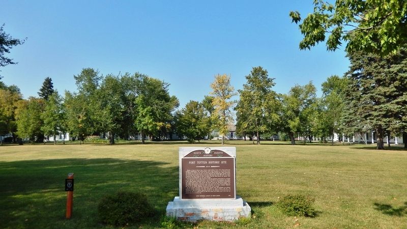
Fort Totten Historic Site Marker
| 1 ► North Dakota, Benson County, Fort Totten — Fort Totten Historic Site — North Dakota History — |
| Near Calvary Circle just north of Calvary Road (1st Avenue). | |||
| 2 ► North Dakota, Bowman County, Rhame — Fort Dilts Historic Site — |
| On Fort Dilts Road, on the left when traveling west. | |||
| 3 ► North Dakota, Burleigh County, Bismarck — Camp Hancock Site Map — Camp Hancock State Historic Site — |
| Near East Main Avenue at North 1st Street, on the right when traveling east. | |||
| 4 ► North Dakota, Grand Forks County, Niagara — Old Fort Totten Trail — |
| Near U.S. 2 at 21st Avenue Northeast, on the right when traveling west. | |||
| 5 ► North Dakota, Griggs County, Binford — U.S. Army Wagoneers — Historic Site — |
| On North Dakota Route 65 near 106th Avenue Northwest, on the left when traveling west. | |||
| 6 ► North Dakota, McLean County, Garrison — Land of Strange Disappearances — |
| On North Dakota Route 37 near U.S. 83, on the left when traveling west. | |||
| 7 ► North Dakota, McLean County, Washburn — Below the Freezing Point — |
| Near 8th Street Southwest (County Road 17) near 28th Avenue Southwest (State Road 23), on the right when traveling west. | |||
| 8 ► North Dakota, McLean County, Washburn — Fort Mandan — Lewis & Clark in North Dakota — McLean County — |
| Near 8th Street Southwest (County Road 17) near 29th Avenue Southwest (County Highway 23), on the left when traveling west. | |||
| 9 ► North Dakota, McLean County, Washburn — Fort Mandan — |
| Near 8th Street Southwest (County Road 17) near 28th Avenue Southwest (County Road 23), on the right when traveling west. | |||
| 10 ► North Dakota, Mercer County, Fort Clark — Fort Clark Historic Site — |
| On unnamed paved road, on the right when traveling north. | |||
| 11 ► North Dakota, Mercer County, Stanton — Fort Clark (circa 1830-1860) — Fort Clark State Historic Site — |
| Near 37th Avenue Southwest near 12th Street Southwest (State Highway 200), on the right when traveling north. | |||
| 12 ► North Dakota, Mercer County, Stanton — Fort Mandan Overlook — Fort Clark State Historic Site — |
| Near 37th Avenue Southwest near 12th Street Southwest (State Highway 200), on the right when traveling north. | |||
| 13 ► North Dakota, Mercer County, Stanton — Geophysics and Archaeology — Fort Clark State Historic Site — |
| Near 37th Avenue Southwest near 12th Street Southwest (State Highway 200), on the right when traveling north. | |||
| 14 ► North Dakota, Mercer County, Stanton — Missouri Valley Environs — Fort Clark State Historic Site — |
| Near 37th Avenue Southwest near 12th Street Southwest (State Highway 200), on the right when traveling north. | |||
| 15 ► North Dakota, Mercer County, Stanton — Palisade Wall — Fort Clark State Historic Site — |
| Near 37th Avenue Southwest near 12th Street Southwest (State Highway 200), on the right when traveling north. | |||
| 16 ► North Dakota, Mercer County, Stanton — The Blockhouses — Fort Clark State Historic Site — |
| Near 37th Avenue Southwest near 12th Street Southwest (State Highway 200), on the right when traveling north. | |||
| 17 ► North Dakota, Mercer County, Stanton — The People — Fort Clark State Historic Site — |
| Near 37th Avenue Southwest near 12th Street Southwest (State Highway 200), on the right when traveling north. | |||
| 18 ► North Dakota, Mercer County, Stanton — Trading Post Plan — Fort Clark State Historic Site — |
| Near 37th Avenue Southwest near 12th Street Southwest (State Highway 200), on the right when traveling north. | |||
| 19 ► North Dakota, Morton County, Fort Rice — Fort Rice — |
| On North Dakota Route 1806. | |||
| 20 ► North Dakota, Morton County, Fort Rice — Fort Rice After General Sully's Expeditions — Fort Rice State Historic Site — |
| Near North Dakota Route 1806. | |||
| 21 ► North Dakota, Morton County, Fort Rice — The Founding of Fort Rice — Fort Rice State Historic Site — |
| Near North Dakota Route 1806. | |||
| 22 ► North Dakota, Morton County, Mandan — Barracks — |
| Near Fort Lincoln Road. | |||
| 23 ► North Dakota, Morton County, Mandan — Blockhouses & Palisades — |
| Near Fort Lincoln Road, on the right when traveling south. | |||
| 24 ► North Dakota, Morton County, Mandan — Breastworks — |
| 25 ► North Dakota, Morton County, Mandan — Commanding Officer’s Quarters — Fort Abraham Lincoln — |
| On Fort Lincoln Road. | |||
| 26 ► North Dakota, Morton County, Mandan — Fort Abraham Lincoln Infantry Post — |
| Near Fort Lincoln Road, 1.8 miles north of State Route 1806, on the right when traveling south. | |||
| 27 ► North Dakota, Morton County, Mandan — Fort Abraham Lincoln Military Reservation Boundary Marker — |
| On Fort Lincoln Road, on the left when traveling north. | |||
| 28 ► North Dakota, Morton County, Mandan — Gatling Gun Emplacement — |
| 29 ► North Dakota, Morton County, Mandan — Laundress' Quarter: "Suds Row" — |
| Near Fort Lincoln Road, 1.7 miles north of 46th Street (State Highway 1806), on the left when traveling north. | |||
| 30 ► North Dakota, Morton County, Mandan — Officers' Quarters — |
| Near Fort Lincoln Road, on the right when traveling south. | |||
| 31 ► North Dakota, Morton County, Mandan — Post Cemetery — |
| 32 ► North Dakota, Morton County, Mandan — Post Hospital — |
| Near Fort Lincoln Road, on the right when traveling south. | |||
| 33 ► North Dakota, Morton County, Mandan — Powder Magazines — |
| Near Fort Lincoln Road, on the right when traveling south. | |||
| 34 ► North Dakota, Morton County, Mandan — Schoolhouse — |
| Near Fort Lincoln Road, on the left when traveling south. | |||
| 35 ► North Dakota, Morton County, Mandan — Scouts — |
| Near Fort Lincoln Road. | |||
| 36 ► North Dakota, Ransom County, Fort Ransom — Fort Ransom Historic Site — |
| On Walt Hjelle Parkway near 62nd Street Southeast, on the right when traveling north. | |||
| 37 ► North Dakota, Ransom County, Fort Ransom — Historic Fort Ransom / Life at the Fort — |
| On West Hjelle Parkway near 62nd Street Southeast, on the right when traveling north. | |||
| 38 ► North Dakota, Ransom County, Fort Ransom — Pyramid Hill / Fort Ransom’s Remarkable Survival — |
| On Walt Hjelle Parkway at Valley Road, on the right when traveling north on Walt Hjelle Parkway. | |||
| 39 ► North Dakota, Richland County, Abercrombie — Barracks — |
| Near Broadway North (County Road 4) near Abercrombie Street. | |||
| 40 ► North Dakota, Richland County, Abercrombie — Cannon Bastion — |
| Near Broadway North (County Highway 4) south of Abercrombie Street. | |||
| 41 ► North Dakota, Richland County, Abercrombie — Carpenter Shop — |
| Near Broadway North (County Road 4/22) south of Abercrombie Street, on the right when traveling north. | |||
| 42 ► North Dakota, Richland County, Abercrombie — Commissary Storehouse — |
| On Broadway North (County Road 4) near Abercrombie Street. | |||
| 43 ► North Dakota, Richland County, Abercrombie — Ferry Crossing — |
| Near Broadway North near Abercrombie Street. | |||
| 44 ► North Dakota, Richland County, Abercrombie — Fort Abercrombie — |
| On Broadway North (County Road 4) 0.2 miles south of Abercrombie Street, on the left when traveling south. | |||
| 45 ► North Dakota, Richland County, Abercrombie — Fort Abercrombie State Park — |
| On Broadway at Fourth Avenue East, on the left when traveling west on Broadway. | |||
| 46 ► North Dakota, Richland County, Abercrombie — Guardhouse — |
| Near Broadway North (County Road 4) near Abercrombie Street. | |||
| 47 ► North Dakota, Richland County, Abercrombie — Headquarters — |
| On Broadway North (County Road 4) near Abercrombie Street, on the left when traveling south. | |||
| 48 ► North Dakota, Richland County, Abercrombie — Hospital — |
| Near Broadway North (County Road 4) near Abercrombie Street. | |||
| 49 ► North Dakota, Richland County, Abercrombie — Hospital / Lieutenant’s Quarters — |
| Near Broadway North (County Road 4) near Abercrombie Street. | |||
| 50 ► North Dakota, Richland County, Abercrombie — Laundresses Quarters — |
| Near Broadway North (County Road 4) near Abercrombie Street. | |||
| 51 ► North Dakota, Richland County, Abercrombie — Magazine — |
| On Broadway North (County Highway 4) near Abercrombie Street, on the left when traveling north. | |||
| 52 ► North Dakota, Richland County, Abercrombie — Quartermaster Storehouse — |
| Near Broadway North (County Road 4) south of Abercrombie Street. | |||
| 53 ► North Dakota, Richland County, Abercrombie — Stable — |
| Near Broadway (County Road 4) near Abercrombie Street. | |||
| 54 ► North Dakota, Richland County, Abercrombie — Surgeon’s & Chaplain’s Quarters — |
| On Broadway (County Road 4) near Abercrombie Street, on the left when traveling north. | |||
| 55 ► North Dakota, Richland County, Abercrombie — Sutler / Post Trader — |
| On Broadway North (County Road 4) near Abercrombie Street, on the left when traveling north. | |||
| 56 ► North Dakota, Stutsman County, Jamestown — Fort Seward — |
| On 10th Avenue Northwest. | |||
| 57 ► North Dakota, Stutsman County, Jamestown — Fort Seward — 1872 - 1877 — |
| On 4th Street Northwest, 0.2 miles 8th Ave NW, on the right when traveling west. | |||
| 58 ► North Dakota, Stutsman County, Jamestown — Fort William H. Seward — Near this Marker is the Site of — |
| On 10th Avenue Northwest. | |||
| 59 ► North Dakota, Stutsman County, Jamestown — Model 1861 8" Siege Howitzer — |
| Near 10th Avenue NW, 0.2 miles south of 8th Street, on the left when traveling south. | |||
| 60 ► North Dakota, Williams County, Williston — Bourgeois House — |
| Near Mondak Backroad 1 near 143rd Avenue Northwest (State Route 1804). | |||
| 61 ► North Dakota, Williams County, Williston — Cemetery — |
| Near 39th Lane Northwest near 153rd Avenue Northwest. | |||
| 62 ► North Dakota, Williams County, Williston — Dwelling Range — |
| Near Mondak Backroad 1 near 143rd Avenue Northwest (State Route 1804). | |||
| 63 ► North Dakota, Williams County, Williston — Field Officers' Quarters — Fort Buford State Historic Site — |
| Near 39th Lane Northwest near 153rd Avenue Northwest. | |||
| 64 ► North Dakota, Williams County, Williston — Fort Buford Historic Site — |
| On 39th Lane NW. | |||
| 65 ► North Dakota, Williams County, Williston — Fort Buford State Historic Site — |
| On 39th Lane Northwest near 153rd Avenue Northwest, on the left when traveling west. | |||
| 66 ► North Dakota, Williams County, Williston — Front Gate — |
| Near Mondak Backroad 1 near 143rd Avenue Northwest (State Route 1804). | |||
| 67 ► North Dakota, Williams County, Williston — Fur Trade Forts — Protecting the Fur Trade — |
| Near 39th Lane Northwest near 153rd Avenue Northwest. | |||
| 68 ► North Dakota, williams County, Williston — Guardhouse and Officer of the Guard Building — Fort Buford State Historic Site — |
| Near 39th Lane Northwest near 153rd Avenue Northwest. | |||
| 69 ► North Dakota, Williams County, Williston — Hospital — |
| Near 39th Lane Northwest near 153rd Avenue Northwest. | |||
| 70 ► North Dakota, Williams County, Williston — Infantry Barracks — Fort Buford State Historic Site — |
| Near 39th Lane Northwest near 153rd Avenue Northwest. | |||
| 71 ► North Dakota, Williams County, Williston — Lesser Known Forts at the Confluence — |
| On 39th Lane Northwest at 153rd Avenue Northwest on 39th Lane Northwest. | |||
| 72 ► North Dakota, Williams County, Williston — North Dakota Masonic Foundation — Ft. Buford Historic Site — (The first chartered Masonic Lodge in North Dakota) — |
| On 39th Lane Northwest near 153rd Avenue Northwest. | |||
| 73 ► North Dakota, Williams County, Williston — Parade Ground — Fort Buford State Historic Site — |
| Near 39th Lane Northwest near 153rd Avenue Northwest. | |||
| 74 ► North Dakota, Williams County, Williston — Post Trader's Complex — Fort Buford State Historic Site — |
| Near 39th Lane Northwest near 153rd Avenue Northwest. | |||
| 75 ► North Dakota, Williams County, Williston — Powder Magazine — |
| Near 39th Lane NW, 0.5 miles west of 153rd Avenue Northwest, on the right when traveling north. | |||
| 76 ► North Dakota, Williams County, Williston — Riverboat Landing — |
| Near Mondak Backroad 1 near 143rd Avenue Northwest (State Route 1804). | |||
| 77 ► North Dakota, Williams County, Williston — Store Range — |
| Near Mondak Backroad 1 near 143rd Avenue Northwest (State Route 1804). | |||
| 78 ► North Dakota, Williams County, Williston — Telegraph Office — Fort Buford State Historic Site — |
| Near 39th Lane Northwest near 153rd Avenue Northwest. | |||
| 79 ► North Dakota, Williams County, Williston — Yellowstone Lodge #88 Ancient Free and Accepted Masons — |
| Near 39th Lane Northwest near 153rd Avenue Northwest. | |||