Near West Main Street (U.S. 3) at Winter Street, on the left when traveling west.
Situated on the Winnipesaukee River, the town of Tilton was a prime location for a variety of mills in the late eighteenth and early nineteenth centuries. The products produced in Tilton during the height of the mill manufacuring period included . . . — — Map (db m97228) HM
On Main Street (U.S. 302) at Albany Avenue, on the left when traveling west on Main Street.
This snow roller, donated by Francis Savard of Intervale Farm, was once used to roll the roads in the Intervale section of Bartlett. Prior to the advent of snowplows, snow rolling was a common method of keeping the snow-covered roads passable in . . . — — Map (db m160823) HM
On White Mountain Road (U.S. 302) at Kearsarge Road, on the right when traveling north on White Mountain Road.
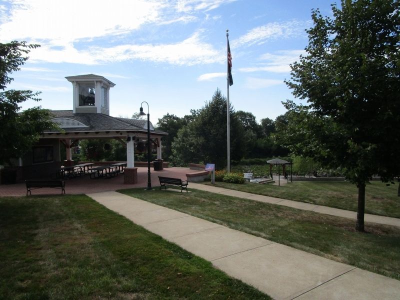
North Conway 5¢ and 10¢ Store is listed on the National Register Of Historic Places by the United States Department of the Interior — — Map (db m78246) HM
Near Center Street (New Hampshire Route 28) 0.1 miles north of Willow Street, on the left when traveling north.
Two photos show the station at very different times. The one above is early on when the area was still called Mill Village and taken perhaps even before 1900 when the station first housed the Post Office. In 1892 the PO was subsequently moved across . . . — — Map (db m152101) HM
On New Hampshire Route 9A at Joslin Street, on the right when traveling west on State Route 9A.
Spofford Village attained national stature in the 19th century for the manufacture of bits, augers, and gimlets in a series of shops powered by Partridge Brook. Beginning about 1825, Benjamin Pierce, members of the Hopkins family, and others also . . . — — Map (db m85874) HM
On Canal Street (New Hampshire Route 119) 0.5 miles east of Chesterfield Road (New Hampshire Route 63), on the left when traveling east.
The Village of Hinsdale From Agriculture to Manufacturing First settled as a farming community, Hinsdale received its New Hampshire charter in 1753. It was named for Col. Ebenezer Hinsdale, a respected early resident who had built a fort . . . — — Map (db m152179) HM
Formed in 1856, the firm Newhall & Stebbins began manufacturing the Granite State Field Mower in 1860. Machined out of cast iron with few bolts, the mowers were intended for use on the uneven terrain of New England farms. In 1870 the company . . . — — Map (db m74562) HM
On Main Street (New Hampshire Route 12) at Manchester Street, on the right when traveling north on Main Street.
About 150 feet north of here stood the famous Hampshire Pottery Works founded by James Scolly Taft for the manufacture of earthenware. In 1878 Majolica ware was a major product, followed in 1883 by the addition of useful and decorative art objects . . . — — Map (db m85873) HM
On Railroad Street just east of Main Street, on the right when traveling east.
The trail segment you are on traverses the heart of Keene's post Civil War industrial activity. Some of the industries still present such as J.A. Wright & Co. date many years back in Keene's history. Many of the buildings, which can be seen along . . . — — Map (db m151896) HM
On Washington St., on the right when traveling south.
The first of two famous Keene glass factories was established near this site in 1814 and produced window glass for the New England area until 1853. Another glass works (1815-1842), 1.5 miles southeast of here on Marlboro Street, made bottles and . . . — — Map (db m74563) HM
On Cheshire Rail Trail at Main Street, on the left when traveling west on Cheshire Rail Trail.
As the nexus of the Cheshire, Manchester & Keene, and the Ashuelot Railroads, the City of Keene became one of the most significant centers of industry in the region. Not only did the railroad provide transportation for passengers and goods, but the . . . — — Map (db m151914) HM
On Franklin Pierce Highway (New Hampshire Route 9), on the right when traveling east.
Glassmaking in this town covered the years 1842-1873. Nearby stood the South Stoddard Glass Works founded by Joseph Foster in 1842. A second works was erected in 1846 at Mill Village two miles north. In its day a major industry of the State, . . . — — Map (db m77059) HM
On Main Street (New Hampshire Route 119) just north of Parker Street, on the right when traveling north.
Incorporated in 1753, the town of Winchester drew upon the vast forest of Mt. Pisgah, copious iron deposits, and the abundant power generated from the Ashuelot River and its tributaries to transcend its agrarian roots and become an influential and . . . — — Map (db m154898) HM
On Main Street (New Hampshire Route 16), on the right when traveling north.
The small man-made 'islands' in the river were used to secure a chain of boom logs which divided the Androscoggin River during the colorful and dramatic annual log drives, when the Brown Paper Company and the International Paper Company shared the . . . — — Map (db m74564) HM
On East Milan Road, 1.5 miles north of 12th Street, on the left when traveling north.
On the knoll north of this site, William Sessions and his nephew, Cyrus Wheeler erected "the first building that could be honored with the name of house" in what is now Berlin, NH. Sessions helped clear many other farms in the area. In the 20th . . . — — Map (db m87972) HM
On U.S. 302 at Mt. Washington Hotel Road, on the left when traveling north on U.S. 302.
"Comfortable Quarters and a Good
Table"... accommodating visitors to the
White Mountains
The rugged mountain
tops, fearful chasms and
beautiful intervals” of the
White Mountains have beckoned
visitors since the early 1800s. . . . — — Map (db m162614) HM
On Base Station Road, 6.2 miles east of U.S. 302 when traveling east.
This is the first engine used on this road. Weight only 4 tons. Cost but $3,000.00. Was brought here in sections through the woods by ox teams from Fabyan Place. It has carried a load of 60 persons up the mountain at once and has worn itself out . . . — — Map (db m125195) HM
On U.S. 302 at Zealand Road, on the right when traveling east on U.S. 302.
The village of Zealand grew up in 1875 to serve the logging industry. Henry owned 10,000 acres in the heart of the White Mtns., with a 10-mile railroad to move logs from forest to sawmill. The village had a post office, school, store, housing, and . . . — — Map (db m74556) HM
On U.S. 302, 0.3 miles east of Mt Clinton Road, on the right when traveling east.
Abel Crawford and son, Ethan Allen Crawford, built the first Crawford House in 1828. It was run by Ethan's brother, Thomas, until sold in 1852. Fires in 1854 and 1859 destroyed the original inn and a replacement. Col. Cyrus Eastman erected the . . . — — Map (db m75236) HM
On U.S. 302, 0.4 miles east of Rosebrook Road, on the right when traveling east.
Mount Washington Hotel
Standing to the east, the Mount Washington Hotel was completed in 1902 as one of the largest, most modern grand hotels in the White Mountains, one of the few built in a single campaign. Designed by New York architect . . . — — Map (db m77641) HM
On U.S. 302 at Base Station Road, on the right when traveling west on U.S. 302.
For whom the Notch is named, included Abel and his sons, Thomas J. and Ethan Allen. They established the first regional hotels and pioneered in opening the White Mountain area to the public. Ethan and his wife, Lucy Howe Crawford, author of an 1846 . . . — — Map (db m44299) HM
On U.S. 3 at Mohawk Road, on the right when traveling north on U.S. 3.
History:
• E. F. Royal built a two-story "two-store” building here after the fire of 1901.
• The north half was occupied by E.F. Royal, as a grocery, confectionery and meat market.
• A clothing store was located on the south side . . . — — Map (db m156731) HM
On Main Street (U.S. 3) at Pleasant Street, on the left when traveling north on Main Street.
History:
• In earlier days, this was referred to as the Drew Block. It was built in 1890 as a two-story building. The third story was added a short time later.
• Like other store fronts in town, it has a north and south side and has housed . . . — — Map (db m157010) HM
On Main Street (U.S. 3) at Pleasant Street, on the right when traveling north on Main Street.
History:
• The original building on this site was the Pitkin's Store, which burned in 1870.
• In 1886, W. E. Drew bought the rebuilt store and refitted the building. It became known as Drew & Churchill. It burned in the fire
of 1901.
• . . . — — Map (db m156942) HM
On Main Street (U.S. 3) north of Mohawk Road, on the left when traveling north.
History:
• In the 1700's, a log block house sat here.
The present structure was built in 1816 and became known as Chamberlain's Tavern.
• For years this was the "center of town” and a frequent gathering place for local militia.
• . . . — — Map (db m157033) HM
On Main Street (U.S. 3) north of Titus Hill Road, on the right when traveling north.
Remick Building
History:
• Constructed by Gustus Remick, after the fire of 1890. He owned it until 1968. In earlier times, many promenades, meetings and walking
marathons were held on the top floor.
• It is believed this building was . . . — — Map (db m156645) HM
On Main Street (U.S. 3) south of Bridge Street (New Hampshire Route 26), on the left when traveling north.
History:
• Believed constructed about 1868 for the Lombard family.
• Seneca Merrill later obtained the house and added the tower to the original building. Mr. Merrill was married to Viola Sutton's grandmother.
• John Pitkin Sutton was . . . — — Map (db m156668) HM
On South Main Street (U.S. 3) at Colby Street, on the right when traveling north on South Main Street.
History
• Before 1927, Karl and Charlotte Edwards ran a grocery store from this site.
• In 1927, Sam & Susie Keach moved their restaurant, originally known as the Legion Square Restaurant, to this site. They changed the name to Legion . . . — — Map (db m156939) HM
On Main Street (U.S. 3) 0.1 miles north of Berlin-Groveton Highway (New Hampshire Route 110), on the right when traveling north.
The waters of the Great North Woods have long been used for travel and transportation. Local bands of Wabanaki, "People of the Dawnland," traveled the Connecticut and Upper Ammonoosuc rivers in dugout, animal skin, and bark canoes. The rivers . . . — — Map (db m151931) HM
Near Main Street (Route 2) north of Mechanic Street, on the left when traveling north.
Top Left Panel:These waters abounded in fish, as did the forests in game
As the English were pushing their settlements up the valleys of the Connecticut and the Merrimack, trappers penetrated the wilderness far above the . . . — — Map (db m158923) HM
On Main Street (U.S. 2) north of Mechanic Street, on the left when traveling west.
Looking NW across Israel's River you will see the remnants of the Thompson Manufacturing Company
Although manufacturing took place here for some years, highly skilled Alexander and Daniel Thompson arrived in 1865. By 1884 the company . . . — — Map (db m155843) HM
On Durand Road East, on the right when traveling west.
In 1876 Abel Watson and his son Laban converted their farm on this site, facing King Ravine on Mt. Adams, into a summer boarding house. Enlarged in 1884 and subsequently, the Ravine House became a key institution in opening up the northern . . . — — Map (db m77634) HM
On Stark Highway (New Hampshire Route 110) 8.5 miles east of U.S. 3, on the right when traveling east.
In the spring of 1944 a high fence and four guard towers transformed a former Civilian Conservation Corps camp on this site into New Hampshire's sole World War II prisoner of war camp. Approximately 250 German and Austrian soldiers, most captured . . . — — Map (db m87928) HM
On U.S. 3, 0.3 miles south of Washburn Road, on the right when traveling south.
The dramatic process of conveying lumber logs and pulpwood from northern New Hampshire forests to manufacturing centers, by driving them down the Connecticut River, spanned the turn into the Twentieth Century. Hardy crews of "white-water men" . . . — — Map (db m75601) HM
On Whitefield Road (New Hampshire Route 116) at Deer Run Road, on the right when traveling west on Whitefield Road.
Alderbrook developed around a sawmill built by H.C. Libbey in 1877. The Village grew to include a post office, a dozen company-owned houses, a boarding house, school and railroad station. The mill employed as many as 40 to 60 men and cut as much as . . . — — Map (db m77642) HM
On Main Street (U.S. 302) at Church Street, on the right when traveling east on Main Street.
This house was built in 1837. I. Gardner Ramsdell sold the home to Isaac Cruft, Bethlehem business leader, for $1300.
Mr. Cruft had built and operated the Maplewood Hotel from 1865 to 1890.
He also built The Cruft Block accoss Main Street from . . . — — Map (db m116521) HM
On Main Street (U.S. 302) at Agassiz Street (New Hampshire Route 142), on the right when traveling east on Main Street.
In 1857, John Sinclair a N.H. politician built a small, but well kept 8-10 room tavern and inn.
In succeeding years, it was enlarged and enlarged again to a capacity of 350 guests.
It was the second largest hotel in the area and boasted a huge . . . — — Map (db m116520) HM
On E. Lost River Road (New Hampshire Route 112) at Tunnel Brook Road, on the right when traveling east on E. Lost River Road.
In this area of Easton (formerly part of Landaff and before that, Lincoln), the settlement of Wildwood once stood. At the turn of the 20th century Wildwood was a center for the "slash and run" logging of Mt. Moosilauke. The Village included a . . . — — Map (db m75773) HM
On Main Street at Blacksmith Alley, on the right when traveling west on Main Street.
Fogg’s Hardware Store
Built in 1901 after fire destroyed the business. Hardware and stoves were sold from the first floor. The second story provided living accomodations. Restored in 2005. — — Map (db m98156) HM
On Main Street at Blacksmith Alley, on the right when traveling west on Main Street.
Frank Williams Department Store
Site of an 1855 tin shop rebuilt in the 1860s as a mercantile store. By 1904 it was known as one of the largest department stores in New Hampshire. — — Map (db m98155) HM
On Main Street at Oak Grove Street, on the left when traveling east on Main Street.
Leviston Tannery
Built adjoining the river in 1848 and rebuilt after a fire two years later. Operated by various owners, including Robert and William Leviston circa 1868-1888 who employed fify men at its peak. — — Map (db m98158) HM
The land you see as you stand here all lies within the township of Lincoln, granted on January 31, 1764 to James Avery and others and named after Henry Clinton, ninth Earl of Lincoln. The original grant contained 32,456 acres. Settlers did not . . . — — Map (db m76422) HM
On Main Street (New Hampshire Route 116) 0.1 miles south of Sugar Hill Road (New Hampshire Route 117), on the left when traveling north.
This quiet site once buzzed with activity as the center of Franconia's economy during the time of the Industrial Revolution.
A dam about 200 feet upstream provided water power for an iron smelter across the river and for grist, saw and . . . — — Map (db m116363) HM
On Main Street (New Hampshire Route 116) 0.1 miles south of Sugar Hill Road (New Hampshire Route 117), on the left when traveling north.
Across the Gale River stands New Hampshire's sole surviving blast furnace. It is unusual, as well, in its octagonal shape and its remarkable condition.
A huge wooden shed protected the furnace and workers from the weather. The shed filled . . . — — Map (db m116364) HM
On Main Street (New Hampshire Route 116) 0.1 miles south of Sugar Hill Road (New Hampshire Route 117), on the right when traveling south.
Due west stands New Hampshire's sole-surviving example of a post-Revolutionary furnace for smelting local iron ore. The industry flourished during first half of 19th century. It produced pig and bar iron for farm tools and cast iron ware, including . . . — — Map (db m116365) HM
On Kancamagus Highway, on the right when traveling east.
Rivers as roads for lumber
In New England, limber and pulp mills traditionally got their wood from logs harvested in the winter and floated downstream during spring floods.
Enterprising lumber baron
J.E. Henry built a railroad that . . . — — Map (db m105956) HM
On North Main Street (U.S. 302) 1.7 miles east of Sugar Hill Road (New Hampshire Route 117), on the right when traveling east.
A reminder of bygone days, this stone structure was used to make wood into charcoal for the nearby iron smelters. Pine knots, a waste material from the adjacent lumber mill, were a prime source for charcoal. Charcoal production through this kiln, . . . — — Map (db m77674) HM
On Main Street (U.S. 302) east of Ammonoosuc Street, on the right when traveling east.
When “Daddy” Thayer’s Hotel opened on January 14, 1850, its intended patrons were rail-borne travelers.
In 1853, train service began, and Thayer’s ornate coach met this new breed of guests at the station.
When tourism boomed, the . . . — — Map (db m116235) HM
On Main Street (U.S. 302) at Westhill Street, on the right when traveling east on Main Street.
Main Street’s oldest surviving commercial building was built of village-hewn timber in 1833 by the Brackett brothers.
William (1785-1859) and Aaron B. (1797-1868) traders in general merchandise.
An upstairs hall hosted meetings, notably in . . . — — Map (db m116309) HM
On Main Street (U.S. 302) east of School Street, on the right when traveling east.
The offices of Dr. Ralph Bugbee, Jr. (1821-1893) occupied this Italianate edifice when it was built in 1857.
Beneath its bracketed cornice and formal frieze, retailers have plied clothing, hardware, books, jewelry, carpets and sporting . . . — — Map (db m116279) HM
On Main Street (U.S. 302) east of Jackson Street, on the right when traveling east.
On this site in 1867, the Kilburn Brothers built a stereograph factory.
When production moved to Cottage Street in 1873, the structure became the Dow Store, then, in 1883, the White Store owned by Rev. Frederick Chutter, former pastor . . . — — Map (db m116267) HM
On Main Street (U.S. 302) west of Mill Street, on the right when traveling east.
In 1850, merchant Fry Gile (1819-1898) built a block here.
When he moved to Kansas in 1854, it was purchased by retailer Nathan McCoy (1813-1886).
The McCoy Block housed studios for the Kilburn Stereoscopic View Factory (1860-68) and in 1879 . . . — — Map (db m116277) HM
On Main Street (U.S. 302) east of Ammonoosuc Street, on the right when traveling east.
Thayers Inn has welcomed countless guests over the years. Among them have been the famous (and the infamous). A brief listing includes visiting Presidents Ulysses S. Grant, Franklin Pierce, Richard Nixon, and Jimmy Carter. Also stopping here were . . . — — Map (db m243268) HM
On Main Street (U.S. 302) west of Union Street (New Hampshire Route 116), on the right when traveling east.
Millions of coin and stamp collectors know Littleton thought the Littleton Stamp & Coin Company, a mail order firm launched in December, 1945 on the second floor of Tilton’s Opera Block.
Fannie Kasper Sundman, impressed by the friendly and . . . — — Map (db m116273) HM
On Main Street (U.S. 302) west of School Street, on the right when traveling west.
Ira Parker (1846-1938) built a house here in 1885.
He had left his family’s tannery in 1866 to make gloves.
By 1889 he had become general manager of the Saranac Buck Glove Company, the town’s major manufacturer.
Parker sold his share in . . . — — Map (db m116280) HM
On Main Street (U.S. 302) at Jackson Street, on the right when traveling west on Main Street.
When erected in 1889, this building housed the Littleton Public Library and the Christian Science Society, in which R.D. Rounsevel was prominent.
Its tenants included diverse retailers, insurance offices, the Republic-Journal newspaper, and . . . — — Map (db m116354) HM
On Cottage Street south of Main Street (U.S. 302), on the right when traveling south.
When fire claimed Jacob M. Salomon’s dry goods store on this site, he built this angled Georgian Revival showpiece in 1912, capping three decades of Main Street development begun by H. L. Tilton.
Salomon (1878-1945) saluted his neighbor with . . . — — Map (db m116308) HM
On Main Street (U.S. 302) east of Ammonoosuc Street, on the right when traveling east.
In 1843, Henry Lowell Thayer (1817-1892), owner of an adjacent general store, secured this lot for a hotel.
By 1850, local builders Andrew Scott and Jonathan Nurs had created an eclectic masterpiece that set a standard of scale and style for . . . — — Map (db m116233) HM
On Riverside Drive north of South Street, on the right when traveling east.
The Curran Suspension Bridge, and its engineer, Kenneth Curran, enjoy a long and rich history in the Town of Littleton, a history that reflects the industrious, self-reliant nature of both town and benefactor.
The Curran Bridge is the . . . — — Map (db m116228) HM
On Main Street (U.S. 302) east of Saranac Street, on the right when traveling east.
On this site in 1930, Eugene and Stella Stone erected a modern parlor car diner with an open kitchen and seating for 25.
Its success prompted the Stones to sell the original diner in 1940 and to replace it with this Sterling Diner manufactured . . . — — Map (db m116248) HM
On Main Street (U.S. 302) east of Mill Street, on the right when traveling east.
Store clerk Henry Lowell Tilton (1828-1909) joined the Californian Gold Rush and returned to make his fortune in timber and real estate.
In 1881, he built this, the town’s largest brick structure and the architectural template for Main Street’s . . . — — Map (db m116274) HM
On Meadow Street (US 302), 2 miles south of Styles Bridges Highway.
Willowdale was established around a sawmill that was built in 1812. The village thrived because sawmills, gristmills, and a factory producing sawmill machinery were powered by the Ammonoosuc River. After the Littleton Lumber Company opened in 1870, . . . — — Map (db m74572) HM
On Main St (New Hampshire Route 3) at High Street, on the left when traveling north on Main St.
Begun in 1840 as one of Plymouth's buckskin glove manufacturers, it became Draper and Maynard after John Maynard joined Jason Draper in 1881. Baseball gloves were added to its product line in 1884, making it among the world's largest sporting goods . . . — — Map (db m245599) HM
This is the site of the longest continuous stream gaging in New Hampshire. Daily measurement of the level of the Pemigewasset River was begun here in 1886 by the Locks and Canals Company of Lowell, Massachusetts, which controlled flowage in the . . . — — Map (db m74576) HM
On Sugar Hill Road (New Hampshire Route 117) at Lovers Lane, on the right when traveling south on Sugar Hill Road.
In 1929, on the slopes of the hill to the east, Austrian-born Sig Buchmayr established the first organized ski school in the United States. Sponsored by Peckett's-on-Sugar Hill, one of the earliest resorts to promote the joys of winter vacationing . . . — — Map (db m77666) HM
On South River Road (U.S. 3) 0.1 miles south of Kilton Road, on the right when traveling south.
This is considered to be the site of Colonel John Goffe's log dwelling. In 1744 Goffe build a gristmill on Bowman's Brook, later run by his son, Major John Goffe (1727–1813), and his grandson, Theodore Atkinson Goffe (1769–1860). The . . . — — Map (db m88052) HM
On Mast Street (New Hampshire Route 114) at High Street (New Hampshire Route 13), on the left when traveling south on Mast Street.
A Goffstown tradition since the 1930s, the popcorn stand was introduced to the town by Louis Prince, who originally operated the cart from the corner of South Mast Street and Wallace Road.
In 1944, the popcorn stand was taken over by "Popcorn . . . — — Map (db m230499) HM
On Canal Street at West Pentacook Street, on the right when traveling north on Canal Street.
Samuel Blodgett began a canal to bypass the steep falls in 1793, with money provided by a lottery. The canal was finished in 1807. Mills then sprang up on both sides of the river below the falls. The world renowned Amoskeag Manufacturing Company . . . — — Map (db m64872) HM
On Commercial Street at Stark Street, on the right when traveling north on Commercial Street.
She stands here, for thousands
of 19th century working women:
Industrial revolutionaries who broke
with the past to earn their living,
making history and creating the future.
In 1880 one third of Manchester's population,
3385 women, . . . — — Map (db m117686) HM
On Notre Dame Avenue near Armory Street, on the right when traveling north.
Marker Front: The first credit union in the U.S. was founded here in 1908, the inspiration of Monsignor Pierre Hevey, the pastor of Sainte-Marie Parish. Monsignor Hevey sought to improve the economic stability of the French-speaking mill . . . — — Map (db m65149) HM
On Valley Road (New Hampshire Route 123) near Cascade Road, on the right when traveling south.
Nearby stands the boyhood home of Samuel Wilson (1766 to 1854) who was generally known as “Uncle Sam.” He supplied beef to the Army in 1812. The brand on his barrel was “U.S.” The transition from U.S. to Uncle Sam followed and became the popular . . . — — Map (db m75238) HM
On Water Street at Factory Street, on the right when traveling south on Water Street.
The Nashua Manufacturing Co., listed on the National Register of Historic Places, was important for the textile industry and early economic development of Nashua. In 1823, a charter was granted to Daniel Abbot, Moses Tyler, and Joseph Greeley to . . . — — Map (db m244316) HM
Near Pearson Avenue, 0.1 miles east of Main Street, on the left when traveling east.
The Nashua River, formed over 15,000 years ago by a glacial flow, is responsible for Nashua's rich industrial history, and is vital to Nashua's transportation, leisure, and community. It served as the town skating rink and annual July 4 Tub Race . . . — — Map (db m243819) HM
On Clocktower Place, on the left when traveling west.
This bell was located in the tower of No 1 Mill from 1881 to 1963. During that time it served as an unofficial timepiece for the citizens of Nashua when it announced each hour of the day.
It is dedicated to the memory of the thousands of men, . . . — — Map (db m243385) HM
On Main Street north of Hollis Street, on the right when traveling north.
The Yankee Flyer Diner, a cornerstone of downtown Nashua,
was located on this site.
The mural captures life in the city in the 1940s and 50s.
Funds were derived from the public sector.
Painted by James Aponovich in 1997, the mural has . . . — — Map (db m230618) HM
TEMPLE GLASS FACTORY
Was located at a secluded site in the southwest portion of Temple township. Founded in 1780 by Robert Hewes who employed Hessian mercenaries from the British Army trained in the art of glass-blowing. This early attempt to . . . — — Map (db m235453) HM
On Concord Stage Road (New Hampshire Route 77) at South Sugar Hill Road, on the right when traveling east on Concord Stage Road.
In 1960 their beautiful community was
sacrificed for the Everett Flood Control
Project. Their village was the home for over
60 families and was a self supporting thriving
community. Farming and lumbering was the way
of life for the . . . — — Map (db m132346) HM
On North Stark Highway (New Hampshire Route 114), on the right when traveling north.
Twenty-two mills in Weare, located along the
Piscataquog River, were the economic life-blood
of the town from 1752-1979. The mills furnished
employment, goods and services locally and afar.
They manufactured toys, textiles, wood and . . . — — Map (db m132357) HM
On Suncook Valley Highway (New Hampshire Route 28), on the right when traveling south.
Robert Frost in Allentown In the summer of 1896, aspiring poet Robert
Frost (1874-1963) and his wife Elinor spent a belated honeymoon in a rented cottage near
the Suncook River in Allenstown. Carl Burell, a high school friend and avid . . . — — Map (db m129668) HM
On Main Street (U.S. 3/202) south of Capitol Street, on the left when traveling south.
Near this site, on land just north of the Governor Hill Block at 58-62 North Main Street, was the first home in Concord of Isaac Hill, printer, bookseller, publisher, U.S. Senator and Governor of New Hampshire. It was here that Hill began his . . . — — Map (db m117580) HM
On North Main Street (U.S. 3) at Capitol Street, on the right when traveling north on North Main Street.
Downtown Emerges
Ever since Concord was first settled in 1726, Main Street has been its principal thoroughfare.
The town's first plan shows an unnamed street that follows the same path as today's Main Street.
The 1-1/2 mile route was . . . — — Map (db m115859) HM
On North Main Street (U.S. 3) south of School Street, on the right when traveling north.
Abolitionists, Suffragists & Philanthropists
Fifteen-year-old Nathaniel White arrived in Concord, virtually penniless, to work as a clerk in a Main Street hotel.
Six years later, in 1832, he had saved sufficiently to become a partner . . . — — Map (db m115905) HM
On South Main Street (U.S. 3), on the right when traveling south.
The Abbot-Downing Company began in 1813
when Lewis Downing founded a "waggon" factory,
located here from 1816 to 1928.
In 1828 he was joined by J. Stephens Abbot.
The next century saw 14 styles of "stage"
coaches, the most famous being the . . . — — Map (db m130017) HM
On Main Street (U.S. 202) at Hopkinton Road (New Hampshire Route 103), on the right when traveling east on Main Street.
The
Stanley Tavern
Hopkinton, New Hampshire
is listed in the
National Register
of Historic Places
by the United States
Department of the Interior
1791 — — Map (db m141432) HM
On Keyser Street at Wadleigh Hill Road, on the right when traveling east on Keyser Street.
The "Summer Business" flourished around Kezar Lake and North Sutton Village from the late 1800's to about 1950. People from the cities came to the rural lands and lakes of Sutton where farmers accepted boarders into their homes. Some of the . . . — — Map (db m161497) HM
On Main Street at Union Street, on the left when traveling north on Main Street.
The waters of Suncook River were harnessed in the 1730’s, eventually powering saw and grist mills, forge shops, and paper mills. The first cotton factory, owned by Major Caleb Stark, was built here in 1811. By 1900, Pembroke Mill, Webster Mill, . . . — — Map (db m115837) HM
On New Hampshire Route 114 at Meetinghouse Hill Road on State Route 114.
Born in a house bordering this common, he migrated to Minneapolis in 1855. There, he, his brother George, and his nephew Charles, established the famous Pillsbury flour milling business. Three times elected Governor of Minnesota and noted . . . — — Map (db m88015) HM
On Chester Street (New Hampshire Route 121) at Raymond Road (New Hampshire Route 102), on the left when traveling east on Chester Street.
Isaac Blasdel, 1738-1791, son and father
of clockmakers, settled in Chester in
1762 and commenced manufacturing
one-day, striking, wall and tall-case
clocks with one weight and metal works.
He was an Association Test signer,
Revolutionary War . . . — — Map (db m159909) HM
The Exeter Gas Works operated on this site beginning in 1862. The gas, produced from coal, supplied street lights in Exeter during the American Civil War. Local homes and businesses were supplied shortly thereafter. Manufactured gas was the . . . — — Map (db m96465) HM
On String Bridge, on the right when traveling south.
A grist mill built by Thomas Wilson in 1640. The island and site were granted to him by the town which reserved the right for canoe landing and the laying of fish. Wilson’s Creek flows on the easterly side. — — Map (db m41156) HM
On Water Street east of Front Street, on the right when traveling east.
Occupied this site until
it was moved in 1929 to
its present location at
Spring and Water
Streets.
President George
Washington was a guest
at the Folsom Tavern in
November, 1789. — — Map (db m180170) HM
On Main Street (New Hampshire Route 107) at Sandown Road, on the right when traveling north on Main Street.
This old Inn/Tavern is one of the most historic landmarks in Fremont.
The first Poplin (now Fremont) Town Meeting was held here at Lovering's Inn on August 27, 1764, as were many other Town Meetings.
The towns' name was changed from Poplin . . . — — Map (db m115814) HM
On Main Street (New Hampshire Route 107) north of Spaulding Road, on the right when traveling north.
The Cooperage was founded here in 1874 by Jonas Spaulding, Jr. After his death in 1900 his sons, two of whom became New Hampshire governors, served as company officers; Stephen Frost, who bought into the firm in 1893, served as manager. Rebuilt . . . — — Map (db m115800) HM
On Portsmouth Avenue at Post Road (New Hampshire Route 151), on the right when traveling west on Portsmouth Avenue. Reported damaged.
In the year 1675, John Johnson was granted a tavern keeper's license. He resided and operated the tavern where the roads meet from Portsmouth, Exeter, and Hampton, at today's 480 Portsmouth Avenue. This is the house immediately in front of you. . . . — — Map (db m186250) HM
On Main Street (Route 1B) east of Atkinson Street, on the left when traveling east.
The Frost Cemetery was a private family burying ground passed down through the Frost and Bell families for many generations. The families lived near the Piscataqua River and the cemetery was located at the end of their properties near the . . . — — Map (db m135323) HM
On this site were leased lots provided by the North Church Parish dating from 1709. One such parcel was the home of Hunking Wentworth, Chairman of the Committee of Public Safety and zealous patriot on behalf of the American Revolution. The site was . . . — — Map (db m76460) HM
Near Marcy Street east of Puddle Lane, on the right when traveling north.
People of African origin or descent have been part of Portsmouth since at least 1645.
This waterfront was an entry port for enslaved people arriving in New Hampshire during the 1600s and 1700s.
Ships brought black children and adults directly . . . — — Map (db m233865) HM
121 entries matched your criteria. The first 100 are listed above. The final 21 ⊳