By Michael Manning, March 27, 2013
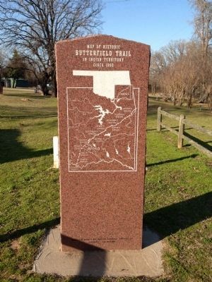
Map of Historic Butterfield Trail in Indian Territory circa 1860
| Near North Mississippi Avenue (U.S. 69) 0.8 miles north of West Liberty Road (U.S. 75), on the right when traveling north. |
| On County Highway 1230 at County Highway 2000, on the left when traveling west on County Highway 1230. |
| On West 2nd Street, on the right when traveling west. |
| On West 3rd Street (Business Interstate 40) west of Pioneer Road, on the right when traveling west. |
| On U.S. 66 near North Pioneer Road, on the left when traveling east. |
| On South Sheb Wooley Street south of West 3rd Street, on the right when traveling south. |
| On Buffalo Street (State Highway 22) west of Main Street, on the right when traveling east. |
| On Buffalo Street (State Highway 22) west of Main Street, on the right when traveling east. |
| On Buffalo Street (State Highway 22) at Main Street, on the right when traveling east on Buffalo Street. |
| On West Broadway Street at South 1st Street, on the left when traveling west on West Broadway Street. |
| On Old U.S. 66 east of South Coleman Avenue, on the right when traveling east. |
| On South Evans Avenue south of West Watts Street, on the left when traveling north. |
| On West Broadway Street at B Street NW, on the right when traveling west on West Broadway Street. |
| On East Main Street at Mill Street NE, on the left when traveling east on East Main Street. |
| On North Washington Street at Paradise Alley, on the left when traveling north on North Washington Street. |
| On West Main Street (Oklahoma Route 199) west of B Street SW, on the left when traveling west. |
| On West Main Street (Oklahoma Route 199) at B Street SW, on the left when traveling west on West Main Street. |
| On West Main Street (Oklahoma Route 199) west of B Street NW, on the right when traveling west. |
| On East Main Street west of SE 5th Street, on the right when traveling west. |
| Near Red Road, 0.8 miles north of Tram Road, on the right when traveling north. |
| Near Red Road, 0.8 miles north of Tram Road, on the right when traveling north. |
| Near North 4355 Road, 0.7 miles north of U.S. 70, on the left when traveling north. |
| On 325, 3.6 miles north of E0190 Road, on the left when traveling north. |
| Near 601 NW Ferris Avenue west of NW 6th Street. |
| On West Missouri Avenue (Oklahoma Route 5) west of North 9th Street, on the right when traveling east. |
| On East Broadway Street (Oklahoma Route 33) east of North Harley Avenue, on the right when traveling west. |
| Near West Gary Boulevard (Business Interstate 40) south of West Modelle Avenue (U.S. 73). |
| Near West Gary Boulevard (Business Interstate 40) south of West Modelle Avenue (State Highway 73). |
| Near West Gary Boulevard (Business Interstate 40) south of West Modelle Avenue (State Highway 73). |
| Near West Gary Boulevard (Business Interstate 40) south of West Modelle Avenue (State Highway 73). |
| Near West Gary Boulevard (Business Interstate 40) south of West Modelle Avenue (State Highway 73). |
| Near West Gary Boulevard (Business Interstate 40) south of West Modelle Avenue (State Highway 73). |
| Near West Gary Boulevard (Business Interstate 40) south of West Modelle Avenue (State Highway 73). |
| Near West Gary Boulevard (Business Interstate 40) south of West Modelle Avenue (State Highway 73). |
| On West Gary Boulevard (Business Interstate 40) west of South Modelle Avenue, on the right when traveling west. |
| Near West Gary Boulevard (Business Interstate 40) south of West Modelle Avenue (State Highway 73). |
| Near West Gary Boulevard (Business Interstate 40) south of West Modelle Avenue (State Highway 73). |
| Near Gott Road, 0.7 miles south of West Southgate Road, on the right when traveling south. |
| On U.S. 64 at County Highway N2010, on the right when traveling east on U.S. 64. |
| On State Highway 9 at Tamaha Road, on the right when traveling west on State Highway 9. |
| On Grant Street west of Main Street, on the right when traveling west. |
| On State Highway 48, 0.3 miles south of Old Highway 12 (County Route D138), on the right when traveling south. |
| On County Road 1910, 1 mile east of U.S. 81, on the left when traveling east. |
| On County Road 1910, 2.5 miles east of U.S. 81, on the right when traveling east. |
| On South Main Street (U.S. 177) south of East Padon Avenue, on the right when traveling south. |
| On Broadway Avenue (U.S. 177) south of Main Street, on the right when traveling south. |
| On Main Street (U.S. 77) at 7th Street, on the left when traveling north on Main Street. |
| On Main Street (U.S. 77) south of 7th Street, on the right when traveling north. |
| On Main Street (U.S. 77) north of 7th Street, on the left when traveling north. |
| On Ranch Road (State Highway 156) 0.5 miles south of White Eagle Road, on the right when traveling south. |
| On Ranch Road (State Highway 156) 0.5 miles south of White Eagle Road, on the right when traveling south. |
| On Ranch Road (State Highway 156) 0.5 miles south of White Eagle Road, on the right when traveling south. |
| On State Highway 33 at U.S. 81, on the right when traveling west on State Highway 33. |
| On Emerald Vista Road north of Talimena National Scenic Byway. (Scenic Highway 1), on the right when traveling north. |
| On Manvel Avenue (State Highway 66) at East 7th Street, on the right when traveling south on Manvel Avenue. |
| On Marvel Avenue (State Highway 18/66) at 9th Street, on the left when traveling south on Marvel Avenue. |
| On Manvel Avenue (State Highway 66) at 7th Street, on the right when traveling south on Manvel Avenue. |
| On Broadway near 3rd Street, on the right when traveling south. |
| On State Highway 66 east of Commercial Street, on the right when traveling west. |
| On South 2nd Street south of West Oklahoma Avenue, on the right when traveling south. |
| On East Oklahoma Avenue east of North Division Street, on the left when traveling east. |
| On West Harrison Avenue west of South Division Street (U.S. 77), on the right when traveling west. |
| On East Columbia at North Division Street, on the left when traveling east on East Columbia. |
| On Adair Street at NE 1st Street, on the right when traveling north on Adair Street. |
| On West Main Street at North 2nd Avenue on West Main Street. |
| On State Highway 59 at U.S. 77, on the right when traveling west on State Highway 59. |
| On U.S. 70 east of Oklahoma Highway N4450, on the left when traveling west. |
| On North 2nd Street near West Main Street, on the right when traveling north. |
| On East Ash Avenue just east of Lee Street, on the left when traveling east. |
| On U.S. 64, 0.7 miles south of Skelly Road (County Route E0830), on the left when traveling south. |
| On 32nd Street (U.S. 54/69) 0.2 miles north of Hancock Street, on the right when traveling north. |
| On Main Street (State Highway 156) 0.2 miles north of West 8th Street, on the right when traveling south. |
| On State Highway 28 south of County Highway E0270, on the right when traveling south. |
| On East Danforth Road (State Highway 66) 0.4 miles west of North Choctaw Road, on the right when traveling west. |
| On West 1st Street east of South Santa Fe Drive, on the right when traveling east. |
| On East 2nd Street (U.S. 77) west of Meline Drive, on the right when traveling east. |
| On Northwest 39th Street (State Highway 66) west of North Tulsa Avenue, on the right when traveling east. Reported permanently removed. |
| On Northwest 4th Street at North Broadway Avenue, on the right when traveling east on Northwest 4th Street. |
| On Northwest 5th Street at North Broadway Avenue, on the right when traveling east on Northwest 5th Street. |
| On Northwest 4th Street at North Broadway Avenue, on the right when traveling east on Northwest 4th Street. |
| On West Sheridan Avenue west of Ron Norick Boulevard, on the left when traveling west. |
| On West Sheridan Avenue at North Broadway Avenue, on the right when traveling east on West Sheridan Avenue. |
| On Nazih Zuhdi Drive west of North Laird Avenue, on the left when traveling east. |
| On West Sheridan Avenue west of Ron Norick Boulevard, on the left when traveling west. |
| On North Broadway Avenue north of Northwest 4th Street, on the right when traveling north. |
| Near Nazih Luhdi Drive west of North Laird Avenue. |
| On Robert S Kerr Avenue at North Broadway Avenue, on the right when traveling east on Robert S Kerr Avenue. |
| Near Nazih Zuhdi Drive west of North Laird Avenue. |
| On North Broadway Avenue north of NW 4th Street, on the right when traveling north. |
| Near Nazih Zuhdi Drive west of North Laird Avenue. |
| On Lincoln Boulevard at NE 21st Street, on the left when traveling north on Lincoln Boulevard. |
| On Northeast 21st Street at North Lincoln Boulevard, on the right when traveling east on Northeast 21st Street. |
| On NE 21st Street west of Lincoln Boulevard, on the right when traveling west. |
| On NE 21st Street at Lincoln Boulevard, on the right when traveling west on NE 21st Street. |
| On Nazih Zuhdi Drive west of North Laird Avenue, on the left when traveling east. |
| On South Agnew Avenue at Southwest 13th Street, on the left when traveling north on South Agnew Avenue. |
| On South Agnew Avenue near Exchange Avenue, on the right when traveling south. |
| On West Sheridan Avenue west of Ron Norick Boulevard, on the left when traveling west. |
197 entries matched your criteria. The first 100 are listed above.
The final 97 ⊳