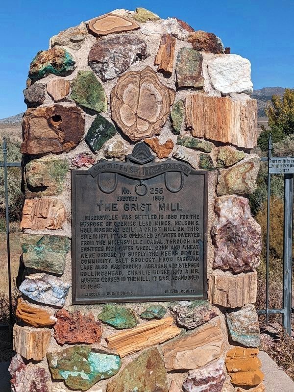
No. 255
Erected 1959
The Grist Mill
Minersville was settled in 1859 for the purpose of opening lead mines. Nelson S. Hollingshead built a grist hill on this site in 1871. It was operated by water diverted from the Minersville . . . — — Map (db m240540) HM
This early sawed log farm cabin (circa 1890-1900) was relocated to this site from the small hamlet of Manderfield located 5 miles north of Beaver. Manderfield was known as Indian Creek in pioneer days. The Beaver Chapter of the sons of The Utah . . . — — Map (db m127201) HM
Hostile Indians raided a small settlement in this vicinity Oct. 27, 1866, centering their attack on the house where Mr. and Mrs. J.P. Lee, their two daughters, and eight year old son, a young Miss Hall and Joseph Lillywhite were barricaded, fighting . . . — — Map (db m75616) HM
Near this site, Feb. 6, 1856, in zero weather, Beaver pioneers made their first camp. Prior to this, the land had been rejected as unfit for cultivation, but the amount of water available gave courage. At a mass meeting in Parowan some of the more . . . — — Map (db m75615) HM
Dedicated to the memory of the valiant pioneers who erected the first woolen mills in Southern Utah in 1870. It was a busy mecca, with wagons coming and going from all over the State with their goods to trade. — — Map (db m75576) HM
The first settlers in this area were the family of Charles W. and Eleanor Willden. They were English converts to the Church of Jesus Christ of Latter-day Saints who had come to Utah in 1849. Because Charles was an iron worker, Brigham Young called . . . — — Map (db m75518) HM
A typical mining town at the foot of the San Francisco Mountain was fed by the fabulously rich Horn Silver Mine. By 1885 over $60,000,000 in zinc, copper, lead, silver, and gold were hauled away by mule train and the Utah Central Railroad. Water was . . . — — Map (db m78264) HM
The Milford stamp or A.G. Campbell mill was erected in the fall of 1873 at a cost of $45,000. It was designed to work the ores of the Old Hickory Mine. In 1873-74 the mill ran successfully for five months. They used a 60 horse power engine, two . . . — — Map (db m240533) HM
The Lincoln Mine
No. 17
Erected March 20, 1937
First lead mine in Utah
Five miles N.E. of here, discovered 1858, by Isaac Grundy, Jesse Smith, Tarlton Lewis and Wm. Barton. These men and Sidney Tanner,
John Blackburn, Edwin . . . — — Map (db m240538) HM
The Box Elder Cooperative Association was established in 1867 -68 by Lorenzo Snow, under direction of Brigham Young. In 1871 a dairy, said to be the first in Utah, was built south of Beaver Dam, near a cold water spring, Christian Hansen, operator. . . . — — Map (db m44467) HM
The Knudsen cabin, built by Porter Squires for Wilhelm and Laura Amelia Knudsen in 1855, was one of the first permanent structures in Brigham City. Located on the corner of First East and First South, the original cabin was 14' x 18'. It had a loft . . . — — Map (db m240501) HM
Site number 55
In July 1853 Brigham Young ordered the people settled in the Brigham City vicinity, construct another fort to provide protection from the Indians. This fort extended North and South about 15 rods and East and West about 8 rods. . . . — — Map (db m240494) HM
SITE NUMBER 74
Brigham City was the first important Mormon community to organize fistle for cooperative activity under a system later incorporated in the United Order of 1874. Approximately 30 or 40 industry branches were established with the . . . — — Map (db m240503) HM
This monument marks the S.E. corner of fort built by Anson Call and associates in 1855 under direction of President Brigham Young as protection against Indians. The fort was the most northerly outpost in Utah. It was one hundred twenty feet . . . — — Map (db m152317) HM
In commemoration of the outstanding service he rendered the intermountain west as Patriot, Pioneer, Colonizer, Church leader, and Statesman on this plot of ground Aug 19th, 1877 he delivered his last public address when he organized the Box Elder . . . — — Map (db m152538) HM
In 1876, Harriet Snow, Box Elder Stake Relief Society President, was asked by the LDS General Relief Society President, Emmeline B. Wells, to join with women's groups throughout the LDS Church to gather and store wheat against a time of need from . . . — — Map (db m240493) HM
Lorenzo Snow was born 3 April, 1814, in Mantua, Ohio, a son of Oliver and
Rosetta Snow. He joined the Church of Jesus Christ of Latter Day Saints in June of 1836 at the age of 22. He crossed the plains, captained his wagon company, and arrived . . . — — Map (db m240492) HM
The same sun, moon and stars shone over these everlasting hills when old Lake
Bonneville's waters reached midway up these mountains. Later, native American
hunters roamed these lands which they called Woebequachee. Here they fished Pe-
Ogway . . . — — Map (db m240491) HM
Soon after the first white families settled at Box Elder, they built a temporary fort to protect themselves from Shoshone Indian attacks.
The Davis Fort was named after their leader, William Davis and consisted of a row of simple log . . . — — Map (db m240496) HM
"We now skirted the north end of the lake, sometimes traveling in a valley and again along the shore of the lake where the mountains jutted down nearly to its shores." -- Nicholas "Cheyenne" Dawson, narrative, August 26, 1841 — — Map (db m105300) HM
Looking toward the immediate completion of the first Transcontinental Railroad, Corinne Townsite was laid out in the Spring of 1869.
Railroad Financiers, Real Estate Promoters, Businessmen & Gambling Sharks, launched a boom to make Corinne the . . . — — Map (db m117001) HM
To settle a wager among the trappers who were making their first winter rendezvous in Cache Valley, Bridger floated alone in a bull boat down Bear River to its outlet to determine the river's course in the late autumn or early winter of 1824, thus . . . — — Map (db m152315) HM
When the railroads were first moving across the country, they needed water for their steam engines. The Lucin ponds were developed in the 1800’s for this purpose. The water to fill the ponds comes through a pipeline from the Pilot Mountain range, . . . — — Map (db m136325) HM
Three Mile Creek, later named Perry, originated in 1853 with the arrival in the Three Mile Creek Valley of the William Plummer Tippetts family and Lorenzo and May Perry. They were soon joined by William Walker, Thomas C. Young, Alex Perry, and . . . — — Map (db m240481) HM
Curlew Valley, named after the curlew snipe that nests here, extends from Snowville, Utah, to the Idaho towns of Stone and Holbrook. The first recorded White men were Peter Skene Ogden's large party of trappers, who camped on Deep Creek . . . — — Map (db m240521) HM
Settled March 31, 1851 by five families followed by six families in the fall. It was first called North Willow Creek and changed to Willard in 1857. The fort was built in 1853 to 1855, constructed of dirt and rock. The first grist mill was begun . . . — — Map (db m240488) HM
The Willard Pioneer Cemetery's first burial was August 1854 with the death of five-day-old John Memorial, Jr., son of John Memorial (Memory) and Samantha Wells
McCrary. This site, selected by Willard's first settlers, is located one block east . . . — — Map (db m240482) HM
Erected in honor of those pioneers who helped settle Hyde Park. This Settlement was founded in 1860 by the following list.
William Hyde, William Higgensen, Robert Daines, Lydia Wilkinson, Anthony Metcalf, James Hancey, Armenius Neeley, Thomas . . . — — Map (db m44498) HM
To commemorate an important episode in the early history of the west and to honor the scouts and explorers of earlier days, this monument was erected. In this vicinity in the winter of 1825-26 a cache containing 75 bales of furs, mostly beaver, . . . — — Map (db m149775) HM
Wells Fargo Bank now occupies the site of the Thatcher Brothers Bank & Opera House, which was constructed in 1890. The Thatcher Brothers Bank was the first one to open in the valley. The Opera House was located on the second floor and could seat 800 . . . — — Map (db m44426) HM
This property was owned in the late 1800’s and early 1900’s by Luna Young Thatcher, a daughter of Brigham Young by his first wife. Luna Young Thatcher owned the entire corner and, by all reports, had the area beautifully landscaped. In 1912 the . . . — — Map (db m44447) HM
Erected in 1861 by Hezekiah Thatcher, assisted by Robert Crookston, Robert Murdock and John Hill, who quarried the building stones in Green Canyon and place them in these walls, hand made shingles covered the roof, the building was originally used . . . — — Map (db m44436) HM
Built in 1914 - 15 by Charles W. Nibley for his third wife, Julia Budge, this two story house is an excellent example of the Prairie School style popular in Utah during 1905-25. The house was reportedly designed by Pope and Burton, architects. C.W. . . . — — Map (db m44427) HM
Thirty feet east of this spot was built, in the winter of 1865-1866, under the leadership of Benget P. Woolfenstein, the first community center of the Logan Fifth Ward. Consisting of but one room, 16 by 20 feet. It served, nevertheless, as church . . . — — Map (db m154443) HM
In 1860 two grist mills were built and operated in this valley. One at Wellsville by Daniel P. Hill and the other at Millville by Esias Edwards and Leroy Kent. The first burrstones obtained from Black Rock, Utah proved to be too soft for grinding so . . . — — Map (db m44471) HM
The Thatcher - Young Mansion was built in 1878 for the banker and industrialist George W. Thatcher and his wife Eunice Caroline (Luna) Young Thatcher. Her brother Brigham Young Jr. lived in it from 1883 - 1885 while he supervised the Brigham Young . . . — — Map (db m44440) HM
The first settlers of Logan encamped near this spot on the bank of the Little Logan early in May 1859
Heads of Families: John R Blanchard, Abraham Caldwell, Griffith Charles, Israel J. Clark, Ann Davis, William Dees, James Demino, Sidney Dibble, . . . — — Map (db m44437) HM
Originally built around 1865, the 1½ story rock home of James G. Willie is typical of the over 40 stone homes that were built in Mendon prior to 1880. Brigham Young encouraged early settlers to use native rocks for home construction as he felt . . . — — Map (db m44482) HM
In the spring of 1860, Apostle Ezra T. Benson and Peter Maughan advised the people living at the Elkhorn Ranch to locate near a sawmill built by Esais Edwards and Roy Kent. This was done to provide better protection. In that same year, Apostle . . . — — Map (db m44456) HM
In July, 1855, the first settlers in Cache Valley, 23 men and 2 women under the leadership of Martin Ensign and Bryant Stringham came to Willow Valley with about 2000 cattle, established Elk Horn Ranch near some fine springs, located about one mile . . . — — Map (db m149769) HM
This marker honors the first settlers of Providence, who camped near here early in May 1859, and those who followed in the years 1860,1861,1862. Included in the groups who pioneered this section are the following families: Alder, Bowen, . . . — — Map (db m44477) HM
Symbol of Heritage
Listed on the National Register of Historical Places in recognition of its architectural and historical significance, and to encourage its preservation.
The 1869 completion of the transcontinental railroad ended an era, that . . . — — Map (db m46302) HM
Pioneer dramatic players entertained early Cache Valley audiences in this rock building. When erected, 1868 - 70, the only assembly hall in Providence. It has the finest dance floor, stage, proscenium, paintings, curtain in the valley. Among the . . . — — Map (db m44435) HM
In July 1859 under the leadership of John Bair, (interpreter and guide) sixteen families settled here, built log cabins and dugouts between City Creek and Brower Springs. The following Spring other families arrived and a permanent fort was built for . . . — — Map (db m105497) HM
First person buried in the Smithfield Cemetery, was born at Alder, Erie County, New York, in 1835, the son of Austin and Laura Wilder Harris Merrill, He was killed in an Indian attack July 29, 1880 as he and his brother Solyman were returning from . . . — — Map (db m44449) HM
Early settlers in Whitmore Canyon, later called Sunnyside, were Jefferson Tidwell, his family and a brother John, who grazed cattle in the area prior to building their home in 1897. They located a vein of coal, sold it to the Utah Fuel Company for . . . — — Map (db m148001) HM
This valley was originally settled in 1881 by Teancum Pratt. The original Pratt Survey still predominates on maps of this area. He sold land to the Rio Grande Western Railroad for a right of way. By the fall of 1887 the railroad had built 27 frame . . . — — Map (db m148214) HM
Pleasant Valley Junction about 1/2 mile So. of this site, began in the early 1880's when the Rio Grande R.R. extended the main line from Tucker over the summit into Carbon County. A round house was built and a branch line extended to the Pleasant . . . — — Map (db m148616) HM
The Rainbow Inn is located at 305 N Mains St, Helper, Utah and was built in 1922. Originally owned by Lena Fodero, the building was used as a hotel, bar, and sporting house. It was known for the bordello on the upper floor. The railroad which . . . — — Map (db m106558) HM
Vincent Paul Anella Troop 296
Eagle Scout Project
Reestablished marker recognizing the first cabin built in Price by Abraham Powell in 1877. Original marker was at 600 South Carbon Avenue.
December 22, 2011
Price Centennial . . . — — Map (db m72728) HM
The settlement of Price began in 1877 when Caleb B. Rhodes and Abraham Powell arrived here. Two years later a number of Later Day Saints and their families strengthened the settlement. A branch of the church was organized in 1881 and in 1882 George . . . — — Map (db m148009) HM
Harding School was named after President Warren G. Harding. Classes started August
1925 with George Fox as the first principal.
It was used as an elementary school until May 1968 when Principal James L. Jensen
called classes to order for the . . . — — Map (db m101032) HM
We hold in sacred memory those sturdy and brave pioneer women, who left their homes in the Eastern United States or sailed from the foreign lands; that trekked across hills, plains, and mountains, forded streams and rivers, birthed and buried loved . . . — — Map (db m148118) HM
The road through Nine Mile Canyon was constructed in 1886 by the Buffalo Soldiers of the U.S. 9th Cavalry to connect Fort Duchesne to the railroad in Carbon County. Most of the stagecoaches, mail and freight passed through Nine Mile into the . . . — — Map (db m72729) HM
In 1919 the Denver and Rio Grande Western Railroad decided to move their operations from Helper to Soldier Summit to cut their operating costs. This proved to be a horrible idea. The first housing provided by the railroad was nothing more than thin . . . — — Map (db m124086) HM
This monument pays tribute to Frances Marion Ewell and the sturdy pioneers who settled here.
Mr. Ewell was born November 3, 1935, the son of William Fletcher and Mary Bland Ewell. William was a member of the famous Mormon Battalion which helped . . . — — Map (db m148294) HM
In 1877, President Brigham Young called on Jefferson Tidwell to explore the country east of the Wasatch Range: which is now Carbon, Emery, and Wayne Counties. President Brigham Young, told him that if he would settle on White River, now Price River, . . . — — Map (db m148006) HM
In 1877 Jefferson Tidwell was called by Brigham Young to find a location for settlement east of the Wasatch Mountains. By 1879 the first pioneers came, built homes, later irrigated their farms with Price River water. This log cabin, built by Robert . . . — — Map (db m148004) HM
The Ashley National Forest, of which Flaming Gorge National Recreation area is a part, was named after William H. Ashley, an early fur trader and trapper. In 1825, Ashley and his party set out to join Jedediah Smith and other mountain men who were . . . — — Map (db m149084) HM
Daniel Davis was born on December 18, 1808, in Amesbury, Essex County, Massachusetts, the third child of Wells Davis and Mary Kelly Davis. As a young man Davis traveled to Nauvoo, Illinois, where he was converted to The Church of Jesus Christ of . . . — — Map (db m127586) HM
Heber C. Kimball was born on June 14, 1801 to Solomon Farnham Kimball and Anna Spaulding Kimball in Sheldon, Franklin County, Vermont. He married Vilate Murray on November 7, 1822.
Kimball was converted to The Church of Jesus Christ of . . . — — Map (db m127584) HM
The first Historic District in Davis County to be listed on the National Register, the Clark Lane National Historic District encompasses the homes on State Street (formerly Clark Lane) between 200 West and 400 West. This neighborhood is significant . . . — — Map (db m225332) HM
Born 18 Feb 1792, Vermont. Died 17 Feb 1886, Layton, Utah.
Married Almira Cadwell 1823 and had 7 children.
Married Malinda Railey 1837 and had 7 children.
Elias was a War of 1812 veteran serving in Colonel Forsyth's regiment of riflemen and . . . — — Map (db m133561) HM
On this spot stood the Layton Stage Coach Station on the Utah Idaho Montana (Virginia City) trail. It was established in 1857 by Ben Holladay, and carried mail and passengers between Salt Lake and points north and west. Isaac Brown was the keeper. . . . — — Map (db m154484) HM
A close look around this area will reveal what remains of the foundation of the Frary's little home. This modest home was the center of life
for the family. Because of their remote island location, this is where the children
received their . . . — — Map (db m172634) HM
Explorers John C. Fremont and Kit Carson observed several antelope on the island during their 1845 journey, thus giving Antelope Island its name. This was the beginning of the island's recorded history.
An Island of Interest
Herdsman, . . . — — Map (db m243429) HM
“On March 4, 1905 we moved to Syracuse with all our possessions laoded in an old iron tired wagon. Our furniture consisted of a new bedstead and dresser, and our other household needs. A cupboard, table, chairs, and kitchen stove were all . . . — — Map (db m123765) HM
Despite living four miles from their nearest neighbor and having no church, school or town, the Frary children lived very happily on Antelope Island. With imaginations as wide and wild as the landscape around them, they found much to explore. . . . — — Map (db m172637) HM
In 1891 George Frary built a house on this 160 acre homestead. Six years later his wife Alice died and lies
at rest in this burial site.
Frary Family
Father-George Isaac Frary B. Nov. 18, 1854 in Madison, Wisconsin . . . — — Map (db m172272) HM
About 1872 the first soil was plowed in this community and in 1876-77 homes were erected. The people attended church services in Kaysville and Farmington prior to 1882 when Pres. Wm. R. Smith of Davis stake organized a branch of the L.D.S. church . . . — — Map (db m123767) HM
Among those who homesteaded Antelope Island were George Issac Frary, his wife Alice Eliza Phillips Frary, and five of their seven children Guy, Grace, Lottie, Dora and Frank. This spot is where the family lived, worked and played from 1891 to . . . — — Map (db m172304) HM
"Following the bluff closely, it [the Hensley Salt Lake Cutoff] intersects Gentile Street, ... from this point the old road is on the location of what is designated as the 'Old Bluff Road'. ... it will continue through lower Syracuse and . . . — — Map (db m169277) HM
East side:
The only existing ruts on the Hensley/Salt Lake Cutoff between Salt Lake City and Tremonton are in the field north of this marker. The easterly route went into Brownsville [Ogden] while the westerly Bluff Road, and center . . . — — Map (db m169180) HM
Explorers, trappers and traders were here before Brigham Young sent a group, in 1861, to prepare the way for Mormon colonization. But in October 1861 the U.S. Government set apart Uintah Valley for Indian Reservation. In 1905 a portion was opened . . . — — Map (db m44051) HM
In commemoration of the Catholic Priest, Father Escalante, who in 1776 came into Utah. He crossed the Green River at Jensen and camped two days at that place. His diary shows that he camped at the junction of the Strawberry and Duchesne rivers . . . — — Map (db m72764) HM
According to one tradition, the Duchesne River was named after Mother Rose Philippine Duchesne.
Mother Duchesne and the Catholic Sisters of the Sacred Heart of Jesus, had started schools in Missouri. The children of many of the early pioneer . . . — — Map (db m72766) HM
In 1866-7, U. S. Army made road to Price and Bridge across Duchesne River. At this point Henderson’s Indian Trading Post, Caldwell’s Stage Station and a blacksmith shop were erected. 1905, Army surveyed townsite named for H. P. Myton, Supt. Indian . . . — — Map (db m72760) HM
Responding to a call from Brigham Young, Orange Seeley organized groups in Sanpete County to settle Castle Valley. Sheep and cattle men had been here earlier. In 1879 the first settlers located in Castle Dale building their first dugouts under a . . . — — Map (db m147917) HM
In 1884 Henry H. Oviatt, Sr. and Samuel N. Alger with their families homesteaded here. When others came, they built a 15 mile irrigation canal, surveying by spirit level and using hand tools. Cleveland Canal & Agricultural Co. organized 1889, to . . . — — Map (db m147925) HM
1981 In Memory Of
Charles William “Bill” Winder and Caroline Elizabeth Mills
William was the 1st boy born in Desert Lake, Utah, June 28, 1888, to Charles Henry Winder & Helen Pilling. Grandparents: Thomas Harrison Winder & . . . — — Map (db m147926) HM
In 1908 the townsite of Elmo was laid out. Each summer a bowery was erected east of
this site where social events were held. In 1911 a group of men purchased the Cleveland
schoolhouse, dragged it with teams and logs to the bowery lot. It was . . . — — Map (db m147941) HM
Before 1890 Thomas E. Davis filed on land in this vicinity. Others followed, erected homes, a schoolhouse and meeting place. June 16, 1912, a branch of The Church of Jesus Christ of Latter-day Saints was organized, George H. Oviatt presiding elder. . . . — — Map (db m147940) HM
When the Mormons fled to Utah in 1847, they were looking for a place nobody else wanted. From Salt Lake City, Brigham Young “called” them to colonize towns and cities all over the great West. The last call came August 22, 1877, when . . . — — Map (db m147829) HM
In the 1870s, the Mormon Settlers came east across the Wasatch Plateau to the high mountain deserts of Castle Valley and the San Rafael Swell. It was the last place Mormon colonizer Brigham Young called his people to settle. They were seeking new . . . — — Map (db m147828) HM
The first permanent settlers of Ferron arrived Dec. 6,1877. They were Swen Larsen and son Niels Christian Larsen, Nicholas Larsen and wife Helena, Peter F. Peterson and wife, Caroline. The first woman with a family of children, Ann Singleton . . . — — Map (db m147842) HM
Desert Lake, about 8 miles east of here, was first settled in 1885 by settlers building an irrigation ditch from Huntington Creek to the townsite and a reservoir to store the water for farming. In 1896 the dam broke, nearly drowning the small town. . . . — — Map (db m129608) HM
In 1875 Leander Lemmon and James McHadden seeking a good range for their horses, found feed plentiful at the mouth of Huntington Canyon and vicinity. Mr. Lemmon brought sheep and cattle from Cottonwood, Salt Lake County. In the autumn of 1876,he . . . — — Map (db m240517) HM
On this site in December 1880, a primitive meeting house was built - a log building which served the community for church, school, dramatic and recreational purposes. Orangeville had been a part of Castle Dale, but in 1882 it was organized as a Ward . . . — — Map (db m147919) HM
Woodside
The area's first resident was a local prospector named Henry H. Hutchinson, who settled there in 1881. Other homesteaders arrived the next year and started digging an irrigation canal. Attracted by relatively abundant water and an . . . — — Map (db m131511) HM
In 1873, Albert Guiser and others located in a fertile meadow which they named Grass Valley. Surveyors camped on a stream, lassoed a young coyote and called the place Coyote Creek. The first L.D.S. settlers were Isaac Riddle and family who took up . . . — — Map (db m137023) HM
In 1866, a group of Mormon Cavalrymen noted this valley, while in pursuit of Indians during the Black Hawk War.
In February, 1875, a company of men came from Beaver, Utah and explored the valley. The first permanent settlers came from Beaver, . . . — — Map (db m74744) HM
This structure, the second public building in Escalante, was erected in 1884 of native stone by Mormon pioneers under the direction of Bishop Andrew P. Schow, Edwin Twitchell and Thomas Heaps. The stone mason was Morgan Richards. It was used to . . . — — Map (db m74746) HM
About 1872 Joseph Asay with his family settled about 3/4 mile west and a little south of this spot. Soon other homesteaders settled in the locality. Tom Jessup and Dan LeRoy erected a water power saw mill. A shingle mill was also placed on the . . . — — Map (db m74676) HM
In 1872 Meltiar Hatch settled at the head of the Sevier River, near the junction of Mammoth and Asay Creeks. He engaged in stock raising and operated a water-power saw mill. Soon other settlers came. Land was surveyed and irrigation ditches dug. . . . — — Map (db m74677) HM
Visitors to Panguitch, Utah will enjoy the opportunity to view many of the historic structures in this community which was settled by Mormon pioneers.
Famously creative survival skills are not the only heritage the early settlers left behind. . . . — — Map (db m146764) HM
In March, 1864, about fifty pioneers under the leadership of Jens Nielson settled Panguitch. They built a fort of logs, enclosing their homes and a building used for church, school and recreation. The town was abandoned in 1867, because of Indian . . . — — Map (db m27020) HM
The first group of pioneers came to Panguitch on March 16, 1864, from Parowan under the leadership of Jens Nielson. They followed the route over the rugged Bear Valley, a part of the Spanish Trail. Crops were planted, but the season was short and . . . — — Map (db m27046) HM
Clifton (Loseeville) was situated in East Valley one mile east of the Pahreah River and four miles North of Cannonville. The first settlers were Ebenezer Bryce in 1876 and Daniel Goulding in 1878. They built a ditch to bring water to the valley from . . . — — Map (db m74743) HM
John Wesley Wolfe settled here in the late 1800s with his oldest son Fred. A nagging leg injury from the Civil War prompted John to move west from Ohio, looking for a drier climate. He chose this tract of more than 100 acres along Salt Wash for . . . — — Map (db m132029) HM
529 entries matched your criteria. The first 100 are listed above. Next 100 ⊳