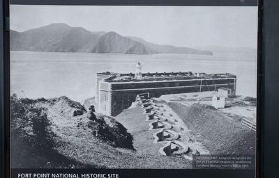
What is Fort Point?
Once called the "Pride of the Pacific" and "Gibraltar of the West Coast," Fort Point is a brick and granite coastal defense fortification built by the U.S. Army between 1853 and 1861. It was part of a seacoast defense . . . — — Map (db m132540) HM
The West Coast's most important harbor was a defense priority for three nations. Beginning in 1776, Spanish, then Mexican, and finally American troops guarded the narrow, highly defensible Golden Gate Strait for two centuries.
From the 1849 . . . — — Map (db m195722) HM
The main idea is, to crown the ridges, border the boundary fences, and cover the areas of sand and marsh waste with a forest. … In order to make the contrast from the city seem as great as possible, and indirectly accentuate the idea of the power . . . — — Map (db m176592) HM
This trail witnessed the passing of Spanish soldiers, Franciscan missionaries and American soldiers of two centuries. It is perhaps the oldest travel corridor in San Francisco.
In 1776 this path connected the Spanish Presidio with the mission, . . . — — Map (db m72484) HM
New additions should be designed and constructed so that the character-defining feautures of the historic building are not radically changed, obscured, damaged, or destroyed in the process of rehabilitaion. New design should always be clearly . . . — — Map (db m132465) HM
God of our fathers, whose almighty hand / Leads forth in beauty all the starry band / Of shining worlds in splendor through the skies / Our grateful songs before Thy throne arise. — United States Army Hymn / Lyrics by Daniel C. . . . — — Map (db m176603) HM
Early in the twentieth century, the Presidio became the Army's most prestigious west coast installation. The Army began constructing Mission style buildings with white walls and red tile roofs to reflect the post's California heritage. This Post . . . — — Map (db m132480) HM
"The efficiency of the Army, and the welfare and contentment of the enlisted men, depend very largely upon the non-commissioned officers. Hence it is very important that the character and dignity of [sergeants] be elevated as much as . . . — — Map (db m176593) HM
Armored vessels and rifled artillery developed during the Civil War could destroy brick forts like Fort Point. As a consequence, these walled forts were replaced by earthen gun emplacements with underground ammunition magazines like Battery East, . . . — — Map (db m131192) HM
Across the street to your left is Building 35. Lives were changed by decisions made here. Originally built as cavalry barracks in 1912, it was converted in 1918 for the School of Bakers and Cooks and then in 1921 to serve as the headquarters of the . . . — — Map (db m132417) HM
Carolands is California Historical Landmark No. 886, and listed on the
National Register of Historic Places.
The 98-room Château completed in 1916 is situated on over five and one
half acres
of land in Hillsborough.
Harriett Pullman . . . — — Map (db m253109) HM
This presidio was established under orders of King Carlos III, April 19-21, 1782, by Governor Felipe De Neve, Padre Junipero Serra and Lieutenant Jose Francisco Ortega, to provide the benefits of government for the inhabitants of the Santa Barbara . . . — — Map (db m50557) HM
Captain Stephens brought the first wagons
over the snow covered Sierra Nevada
Truckee Pass with no casualties in the
Stephens-Murphy-Townsend party of 1844,
arriving at Sutter's Fort with 11 wagons
and 51 people plus 2 infants born on the
way. . . . — — Map (db m24125) HM
Located 80 rods north.
Established May 26, 1852
by Co, E 2nd Infantry U.S.A.
Evacuated June 1867.
Marked by
U.S. Army April 6, 1934.
Sponsored by Shasta Historical Society. — — Map (db m143472) HM
In Commemoration of
Captain Dick and Richard Pugh
The 1850's saw tension and turmoil between the early settlers and the native peoples of the Fall River Valley.
Richard Pugh, a native of Wales, was chosen by Lt. George Crook to be his . . . — — Map (db m10287) HM
In Commemoration of
Fort Crook
Established July 1, 1857 by Lieut' George Crook and Command for the protection of the immigrants and settlers. Later occupied by Capt John W Gardner and Capt McGregor.
The boundaries of this fort were . . . — — Map (db m143473) HM
On this ground there was established on Oct. 16, 1852 a military post by Companies A and B First United States Dragoons. From April 23 1853 until June 28 1858, the date of its abandonment, this fort was garrisoned by Company E 4th US Infantry. . . . — — Map (db m157682) HM
Founded 1812 by Russians from Sitka. When Russians withdrew to Alaska, 1841, Captain Sutter bought the improvements and supplies. Acquired by State in 1906 and remaining buildings restored - Greek Orthodox Chapel, Commandants Quarters and Stockade. . . . — — Map (db m68792) HM
This chapel was a part of the settlement founded by the Russians in 1812 and known as Fort Ross. The fort was in the form of a quadrangle, about 300 feet square, inclosed by a redwood wall, with two blockhouses at opposite corners. Fort Ross . . . — — Map (db m92911) HM
The key to the defense of early frontier forts was the blockhouse. It was from the blockhouse that an attacker could be put under a deadly barrage. In the event that the stockade wall was breached, the defenders could retire to the blockhouse for a . . . — — Map (db m85610) HM
Sandy Beach Cover lies below the fort. The principal port of the settlement was 19 miles to the south at Port Rumiantsev (Bodega Bay), where there was a deep-water anchorage and a warehouse. Russian Navy and Russian-American Company ships . . . — — Map (db m16362) HM
George Washington Call (1829-1907) and his Chilean wife, Mercedes Leiva (1850-1933), bought 2,500 acres including Fort Ross in 1873. While maintaining a house in San Francisco, the family developed a dairy ranch and expanded the transport of local . . . — — Map (db m16357) HM
Native Alaskans, brought to Fort Ross by the Russian-American Company to hunt sea mammals and provide a work force for the colon, established a village on the marine terrace in front of the fort. The neighborhood also included the dwellings of . . . — — Map (db m16361) HM
Across the gulch to the east, a large Russian Orthodox cross marks the site of the settlement's cemetery. In 1990 the University of Wisconsin, Milwaukee, and California State Parks conducted an archaeological investigation of the historic Russian . . . — — Map (db m85607) HM
Most of the inhabitants of Settlement Ross resided outside the fort; only Russian-American Company officials and visitors lived inside. Everyone in the vicinity of Fort Ross worked for the company. Lower-ranking Russian and Creole employees . . . — — Map (db m85614) HM
In the early 1800s, Fort Ross was a thriving international community on the edge of the Spanish frontier. In 1812, the Russian-American Company (RAC) built Fort Ross at Metini, a centuries-old Kashaya village. The Fort had two purposes. The first . . . — — Map (db m115933) HM
On October 6, 1862 Capt. Moses McLaughlin and Lt. Col. George S. Evans commanding 57 men of Company D, 2nd Cavalry, California Volunteers arrived in Visalia. They had come from Camp Independence, Owens Valley over the newly completed Coso Trail. . . . — — Map (db m141739) HM
The fort was originally built in 1947 for John Ford's production
of Fort Apache, which starred John Wayne and Henry Fonda. Over
the years, the set was used for numerous films including Streets
of Laredo (1949), Escape from Fort Bravo (1953), . . . — — Map (db m196188) HM
[ Inscribed on the monument: ]
Side A:
To the Memory of the Pioneers who were buried here between the years
1844 – 1856
Side B:
Erected
1911
By the Grand Parlor
Native Sons of the
Golden West
[ . . . — — Map (db m40633) HM
This region was once buffalo hunting grounds for the Cheyenne, Apache, Arapaho, Kiowa and Comanche. Tribes followed the buffalo throughout the plains and controlled the land. During this time, everything south of the Arkansas river was Mexico and . . . — — Map (db m120709) HM
[left panel] Colorado's vast plains, rugged mountains, and grand plateaus, so magnificent in their beauty and variety, seem at times to overshadow the state's history and people. But look closely. The story of Colorado is . . . — — Map (db m280985) HM
This property was presented to the State Historical Society by the Fort Garland Historical Fair Association, which saved the fort for posterity. Established November 30, 1945, as a memorial to the first Colorado settlers, and the U.S. Army troops . . . — — Map (db m281275) HM
This memorial is the
Property of the State of Colorado
———
Fort Garland
United States military outpost
to protect settlers from
hostile Indians. Named for
Brig. Gen. John Garland . . . — — Map (db m22731) HM
Front
The Soldier’s Life
Fort Garland housed infantry and cavalry units. During the 1870’s the famed Buffalo Soldiers—African-American cavalrymen—were also posted here. For all soldiers—and their families—life at Fort Garland was . . . — — Map (db m71032) HM WM
Western expansion and the need to keep peace between settlers and indigenous people fueled the need for frontier forts. Fort Garland was established in 1858, replacing the earlier Fort Massachusetts, just six miles to the north. Five of the . . . — — Map (db m295462) HM
Two U.S. military forts, only six miles apart, on the fringes of the frontier? What gives? Since the early 1800s, Hispano people from northern New Mexico had attempted to settle in the San Luis Valley on land granted from Spain or Mexico. To . . . — — Map (db m295482) HM
Hispano pioneers founded Colorado's first permanent settlements. Settlers began pushing northward from Taos toward present Colorado in the early 1800s, and in 1844 the Mexican government gave the Sangre de Cristo land grant to two Taos residents. . . . — — Map (db m281598) HM
One of the many trading posts built by
Antoine (Anton French) Robidoux,
First built around 1828 at the juncture of the
Grand (Gunnison) and Uncompahgre Rivers
then a territory of Mexico and Ute Indian country
on the well traveled "Old . . . — — Map (db m120059) HM
Antoine Robidoux and Fort Uncompahgre The Story of a Western Colorado Fur Trader / By Ken Reyher, 1998 Fort Uncompahgre was constructed in 1828 by Antoine Robidoux, a trader based out of Mexican Santa Fe. The post was situated about two miles . . . — — Map (db m290981) HM
This tablet is the property of the State of Colorado ——— This is the southwest corner of Camp Weld Established September 1861 for Colorado Civil War Volunteers. Named for Lewis L. Weld, first Secretary of Colorado . . . — — Map (db m203499) HM
This marks the site of the
Old Fort and Stockade
built by
Pioneers of Colorado City
used in defense against
the Indians in 1864 and 1868
Constructed of logs
set on end
_____
Erected by
Old . . . — — Map (db m96054) HM
This tablet is the
property of the State of Colorado
_____
Due south 610 feet is the
Old Stone Fort
built at the pioneer home of
David McShane. Constructed as a
defense against Arapaho and Cheyenne . . . — — Map (db m104869) HM
Clockwise, from top
• The Pioneer Museum in Florence highlights the town's industrial past. Ample coal and water made the town an optimal site fer processing ore shipped via the Florence and Cripple Creek . . . — — Map (db m153002) HM
Slow down! Take time to taste the Cuchara River Valley Cuisine and enjoy the talents of more than 100 working artists. A remarkable system... of more than 500 igneous dikes that radiate out 25 miles from the Spanish Peaks led to the . . . — — Map (db m281409) HM
In 1911, John Brisben Walker, owner of the property that is now Mount Falcon Park, promoted the idea of a Summer White House. The cornerstone of Colorado yule marble was laid on July 4, 1914 on this proposed site for the building. What you see . . . — — Map (db m141085) HM
Originated on the site of a U.S. Cavalry post established in 1880 at Hesperus. From 1891 until 1956 the old fort was operated as an Indian school, a vocational high school and a junior college.
The first president of the college was Charles . . . — — Map (db m22765) HM
Originated on the site of a U. S. Cavalry post established in 1880 at Hesperus. From 1891 until 1956 the old fort was operated as an Indian School, a vocational high school and a junior college. The first president of the college was Charles Dale . . . — — Map (db m294700) HM
Between 1800 and 1850, the Old Spanish Trail became a regional trade route between Santa Fe and California.
Dominguez and Escalante traveled through this valley in 1776. Within twenty-five years of their expedition this trail became a . . . — — Map (db m301745) HM
World War II
United States Army
Ski Troopers
99th Infantry Battalion
(Separate)
The Viking Battalion
Office of Strategic Services
O.S.S. NORSO
(Rype Group)
Special Forces
The 99th Infantry Battalion (SEP) was:
Activated 10 . . . — — Map (db m112932) HM WM
This two-story cabin is a classic example of American frontier log construction. Sixty-three year old Elizabeth "Auntie" Stone and her second husband Lewis arrived in this area in 1864. The Army granted them permission to build a private . . . — — Map (db m51972) HM
This Memorial Is the
Property Of The State Of Colorado
Namaqua
Home, trading post and fort of
Mariano Modena, early trapper,
scout and pioneer.
First settlement in the
Big Thompson Valley.
Station on Overland . . . — — Map (db m51194) HM
Erected through the cooperation of Federal, State and local governments by Works Progress Administration. Dedicated to the enrichment of human lives. A record of permanent achievement. — — Map (db m282499) HM
This memorial is the
Property of the State of Colorado
The Santa Fe Trail
1840 - 1878
Two roads or forks of the Mountain Branch
of the Santa Fe Trail-Bent's Old Fort to
Taos and Santa Fe-joined . . . — — Map (db m104912) HM
Due west 940 feet stood
“Fort Wicked"
Originally Godfrey’s Ranch
Famous Overland Stage Station
One of the few posts withstanding the Indian uprising of 1864 on the road to Colorado.
Named from the . . . — — Map (db m61998) HM
Sterling's beloved museum began as a joint venture between the Logan County Historical and Natural History Society and the local office of the Works Progress Administration (WPA). Built during the height of the Great Depression and initially called . . . — — Map (db m222403) HM
Built in this valley in 1837 by mountain men Thompson, Craig and Sinclair, was the winter rendezvous of traders, trappers and Indians until 1840, after which it fell into decay and was abandoned. — — Map (db m154044) HM
Following the Meeker Massacre of 1879 and the ambush of Major T.T.
Thornburgh's relief force, Colorado residents demanded the removal of
the Ute Indians. A treaty was signed, but the Uncompahgre Utes proved
defiant, and in July, 1880, the . . . — — Map (db m261621) HM
During the years 1880-1890, a U.S. military fort with over 32 buildings spread across the fields before you...
Tensions were high on the Western Slope of Colorado in 1879: white settlers had been trespassing on treaty-designated Ute . . . — — Map (db m261767) HM
Occupied from 1864 to 1868 and the divergence of the Denver Cut Off from the Overland Trail
This monument is erected by Fort Morgan Chapter, Daughters of the American Revolution
1912 — — Map (db m51213) HM
We have here a happy intermixture of nations and languages. French, Spanish, Indian and English salute your ears at one and the same time, and I am often at my wit's end to understand all the appeals made to me by such a Babel-tongued . . . — — Map (db m191922) HM
John C. Fremont
His name appears on almost any roll of Western pathbreakers. Fremont’s expeditions were instrumental in opening the Southwest. He visited the fort on three of his first four expeditions to the West.
Susan . . . — — Map (db m180971) HM
The Arkansas River sustains a
tree-lined swath across the grasslands.
Making use of the trees and plants
available to them was key to the
survival of people on the Plains.
Groves of cottonwood trees offered shade for
people and . . . — — Map (db m180872) HM
A Mud Castle Rises
In 1833, Bent, St. Vrain & Company built a trading post on the semi-arid reaches of the Arkansas River on the U.S. border with Mexico. Few if any buildings in the American West approached Bent’s Fort in size and . . . — — Map (db m71847) HM
Erected at the request of the Daughters of the American Revolution 1910 by A.E. Reynolds
Bent's Fort Santa Fe Trail as shown by ruins of walls in 1909
1822 The Santa Fe Trail 1875
This stone marks the point of the trail where the . . . — — Map (db m192004) HM
Edward Dorris
Died July 21, 1865
Aged 31 years
2 Ms. 28 Ds.
Edward Thou Hast Gone to Rest
In This Far Country of the West
Brothers and Friends Mourn and Weep
Thou in this Tomb Dost Sweetly Sleep
Edward Dorris, a . . . — — Map (db m71850) HM
I wish I was capable to do Bent and St. Vrain justice for the kindness received at their hands. I can only say their equals were never in the mountains.
- Christopher “Kit” Carson
Charles Bent
Charles Bent led . . . — — Map (db m71848) HM
The land surrounding the Arkansas River teemed with wildlife. Most numerous were the bison or buffalo. They were the dominant species of the high plains, the emblem of the prairie. The fortunes of Bent's Fort and the neighboring tribes were tied . . . — — Map (db m192001) HM
When the Bents first traveled to this area they may have encountered elk, bighorn sheep, pronghorn, deer, grizzly bears, wolves, beaver, river otters, and the huge herds of bison that once lived here. Bison especially, provided the region's native . . . — — Map (db m180856) HM
Imagine traveling in the 1840s on the
Santa Fe Trail. You have just spent weeks
crossing hundreds of miles of lonely and
desolate prairie. There would have been
no help if you broke a wheel or an axle,
no help if you ran out of supplies. . . . — — Map (db m180968) HM
For centuries, the Arkansas River Valley has been an important travel corridor that has shaped our nation’s history.
Long before the fort was built, wildlife, native peoples, European explorers, trappers, and traders traveled through this river . . . — — Map (db m71851) HM
In winters northers howled ... In summer temperatures climbed above the hundred-degree mark ... Spirits shriveled as respiratory organs dried; lips cracked and eyes burned ... it took a particular kind of spiritual iron to survive ... . . . — — Map (db m71846) HM
From cattle kings to cowboys and cow towns to hell on wheels railroad camps, this portion of the Santa Fe Trail encompasses all of the legends of America's Old West. Hiram S. Holly, town founder, arrived here in 1871 with 1,300 cattle. His 50,000 . . . — — Map (db m289600) HM
The Heart of the Old West Colorado's portion of the Santa Fe Trail is a 184-mile section of the Santa Fe National Historic Trail. It is designated as one of America's Byways and a Colorado Scenic and Historic Byway. The trail begins in Missouri . . . — — Map (db m289642) HM
John Martin Reservoir The Southeast Colorado region, including the Big Timbers area, was once a great inland sea. The first transportation routes across the Santa Fe Trail were established by prehistoric migrating groups that . . . — — Map (db m213693) HM
Bent's New Fort links the continuous story of
southeastern Colorado-from the development of the
Santa Fe Trail, to the occupation of Bent's Old Fort, to
the construction of Fort Wise, to the disintegration of
human relationships following the . . . — — Map (db m181871) HM
The site of Bent’s New Fort built by William W. Bent in 1853 as an Indian trading post. Sold to the US Government, 1859. Buildings added one mile west and named Fort Wise in 1860. Re-named Fort Lyon in 1861. Fort moved . . . — — Map (db m180841) HM
Today the image of buffalo herds moving across the
plains is only a memory. For William Bent, buffalo
were a means to an end in which he traded with
Plains Indians and sustained his business. Bent relied
on Arapaho, Cheyenne, Kiowa, and Comanche . . . — — Map (db m180904) HM
In 1859 William Bent once again found the military
on his doorstep. This time the army was charged with
defending emigrants and gold seekers. Tens of thousands of people came to Colorado
seeking gold, then demanded protection along the
Santa . . . — — Map (db m180928) HM
Bent Family Beginnings The entrepreneurial spirit of William
and Charles Bent and Ceran St.
Vrain brought them to the banks of
the Arkansas River where they built
Bent's Old Fort in 1833. Mutual
respect, intermarriage, and . . . — — Map (db m185030) HM
I saw the American flag waving and heard Black Kettle
tell the Indians to stand around the flag. I also saw a
white flag raised. These...were in such a conspicuous
position they could not have been missed.
-Robert Bent, son of William . . . — — Map (db m181015) HM
This memorial commemorating the Old Pueblo Fort Site erected by The Arkansas Valley & Pueblo Chapters, Daughters of the American Revolution. Dedicated Nov. 17, 1923.
On Christmas Day, 1854, a massacre occurred at Fort Pueblo on the . . . — — Map (db m64755) HM
While in Saguache in 1874, Alfred Packer was arrested on murder charges involving cannibalism. He escaped, but was caught, tried twice, sentenced to forty years in prison, and later pardoned. Though Packer was not incarcerated in the Saguache . . . — — Map (db m268123) HM
This Memorial is the
Property of the State of Colorado Established in September, 1864, as a United States Army Post. Called Camp Rankin and Post Julesburg Name changed in November 1865, to honor General John Sedgwick, who was . . . — — Map (db m47365) HM
"We have no business to put men out here unless we give them food and shelter, and all things but sand and water must be hauled from 1 to 400 miles." Lt. Gen. William T. Sherman, Fort Sedgwick, August 1866Camp Rankin was established just . . . — — Map (db m47341) HM
Military records, diaries and letters of those who survived life at the post reveal a saga of fraud and corruption, bravery and daring-do...triumph and tragedy...where conditions were considered unlivable, pleasures were few and the nearest bath . . . — — Map (db m47342) HM
This memorial is the
property of the state of Colorado.
—
Two Hundred feet due east
of this point stood
Fort Junction
a sod enclosure erected in 1864
by the pioneers of Boulder and
St. Vrain Valleys . . . — — Map (db m119519) HM
This memorial is the
property of the State of Colorado
—
Due west ¼ mile is the site of
Fort Lupton
Established in 1836 by
Lieut. Lancaster P. Lupton
A rendezvous of the early fur . . . — — Map (db m119520) HM
In this area along the South Platte River, competing fur companies in the late 1830's established a string of four adobe trading posts -- Fort Vasquez, Fort St. Vrain, Fort Jackson and Fort Lupton traversed by the Old Trapper's Trail which . . . — — Map (db m89596) HM
Established in 1837 by Louis Vasquez and Andrew W. Sublette.
Maintained until 1842 as a post for trade in buffalo robes and beaver skins with Arapahoes and Cheyennes. Rendezvous of early trappers. Emigrant station on Platte River Trail after . . . — — Map (db m89597) HM
Fort Vasquez
As trappers and explorers, Louis Vasquez and Andrew Sublette
helped build the lucrative fur trade. But by 1835, when they raised
Fort Vasquez midway between Fort Laramie and Bent's Old Fort
along Trapper's Trail and . . . — — Map (db m120215) HM
You are standing at the north edge of a historic adobe fort of the fur trade era, founded by Andrew W. Sublette and Pierre Louis Vasquez in 1835 to support trade with the Cheyenne and Arapaho tribes.
These men and their fellow trappers were . . . — — Map (db m89619) HM
On the brow of the hill overlooking the meadow
stood the Old Stone Fort or Stoughton House. It was
in two portions, one stone, probably the older, and one wood. At the north end was a door of heavy oak
timbers studded with iron spikes, which bore . . . — — Map (db m28364) HM
The Pequot War was the first major conflict between Native Americans and Europeans in northeastern North America. It began in September 1636, lasted eleven months, and involved thousands of Native and English peoples who fought several major . . . — — Map (db m181994) HM
The Pequot War was the first major conflict between Native Americans and Europeans in northeastern North America. It began in September 1636, lasted eleven months, and involved thousands of Native and English peoples who fought several major . . . — — Map (db m182709) HM
The Pequot War was the first major conflict between Native Americans and Europeans in northeastern North America. It began in September 1636, lasted eleven months, and involved thousands of Native and English peoples who fought several major . . . — — Map (db m183079) HM
The first fort at Saybrook Point, built in 1630, was similar to other English coastal settlements. Lion Gardiner designed the fort in the European tradition as a square, palisaded fortification containing several structures, surrounded by an . . . — — Map (db m182723) HM
Say Brooke Fort
Commanded by
Colonel George Fenwick
At the mouth of the Great River
Near this place stood the First
English Fort in the Colony of
Connecticut built in 1635
It was destroyed by fire in
1647. Beyond it on the bank
of . . . — — Map (db m183083) HM
Fort Saybrook Monument Park consists of nearly 18 acres, about eleven of which are marshland. The park adjoins the mouth of the Connecticut River, a major New England estuary and tidal river. It has been recognized by an international convention . . . — — Map (db m182308) HM
7963 entries matched your criteria. Entries 401 through 500 are listed above. ⊲ Previous 100 — Next 100 ⊳