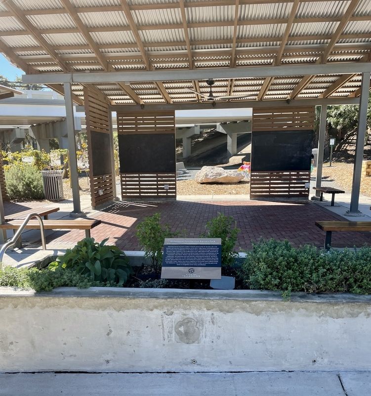
Near South Meridian Street south of East Pensacola Street.
Althemese Barnes has been a leader in historic preservation for decades. She is the founder and Executive Director Emeritus of the John G. Riley House Center/Museum and was central to the establishment of the Florida African American Heritage . . . — — Map (db m211326) HM
Near South Meridian Street south of East Pensacola Street, on the left when traveling south.
Oftentimes, in the studies of urban life, the people who are best able to tell the story are those who experienced it personally. Such is the case with the history of Smokey Hollow in Cascades Park. Thanks to Blueprint 2000, the John G. Riley House . . . — — Map (db m211282) HM
On South Meridian Street south of East Madison Street, on the left when traveling south.
The first Europeans known to have explored Tallahassee accompanied Spanish explorer Hernando de Soto. His entourage of over 600 soldiers, laborers and priests spent the winter of 1539 in a nearby Apalachee village before continuing their journey . . . — — Map (db m211624) HM
On South Meridian Street south of East Madison Street, on the left when traveling south.
Native people inhabited the Tallahassee region for over 12,000 years before European contact. The earliest residents left evidence of seasonal camps, while later natives constructed large earthen mounds that served as civic and ceremonial centers . . . — — Map (db m211605) HM
On Santa Rosa Drive at Old Fort Drive, on the right when traveling east on Santa Rosa Drive.
(Side 1)
This earth work located on ground once part of the plantation of E.A. Houston, father of Captain Patrick Houston (later state adjutant general) who commanded the Confederate artillery at the Battle of Natural Bridge, is a silent . . . — — Map (db m151379) HM
John Muir, noted naturalist and conservation leader, spent several months in Florida in 1867. He arrived at Cedar Key in October, seven weeks after setting out from Indiana on a "thousand-mile walk to the Gulf." Muir's journal account of his . . . — — Map (db m17705) HM
Near NW 115th Street (Florida Route 320) 0.5 miles west of North Young Boulevard (U.S. 98).
Having borrowed a canoe from some Indians, I visited a very grat and most beautiful fountain or spring which boils up from between the hills about 300 yards from the river, throwing up great quantities of white small pieces of shells & white shell . . . — — Map (db m191194) HM
Near NW 115th Street (Florida Route 320) 0.5 miles west of U.S. 98.
Rainfall, which is slightly acidic, dissolves limestone as it passes through the ground. As water travels underground toward the springs, it sometimes creates large cave passages through the porous limestone. On the surface, as this limestone breaks . . . — — Map (db m191209) HM
Near NW 115th Street (U.S. 320) 0.5 miles west of North Young Boulevard (U.S. 98) when traveling west.
"With their abundant food supply and pleasant surroundings, Indians at Manatee Springs probably lived a fairly comfortable life. The village was home to them, a place to which to return for rest and relaxation after the exertions of the . . . — — Map (db m191207) HM
Near Canal Road (Spillway Road), 0.8 miles south of Florida Route 40, on the left when traveling west.
Unintended Consequences In the 1960s, the U.S. Army Corps of Engineers cut through and plugged the Withlacoochee River to make way for the Cross Florida Barge Canal. Blocking the river entirely would have devastated downstream ecosystems. The . . . — — Map (db m167893) HM
Near SE 1st Avenue at SE 6th Street, on the right when traveling east.
An electrical distribution system was purchased for $33,000 on June 11, 1923, from the Williston Manufacturing Company. Included was the generator, ice plant, cold storage plant, water tank, a ten-year-old bay horse named Charlie, and a wagon with a . . . — — Map (db m244277) HM
Near SE 1st Avenue at SE 6th Street, on the right when traveling east.
Williston was incorporated as a town in 1897; charted as a city in 1929.
On October 10, 1914, this area was designated as a public park by the mayor and town council in a deed from J.B. And P.A. Epperson.
An electrical distribution system . . . — — Map (db m244281) HM
Near SE 1st Avenue at SE 6th Street, on the right when traveling east.
This Howitzer 8" M2 Cannon was secured by the City from the Anniston Alabama Army Depot on April 30, 1975.
Williston was incorporated as a town in 1897 and chartered as a city in 1929. On October 10, 1915 this area was designated as a public . . . — — Map (db m244282) HM WM
Near Pine Avenue, 0.1 miles north of Crescent Drive, on the right when traveling south.
In 1911, a group of businessmen from Anna Maria Island and St. Petersburg founded the Anna Maria Beach Company to develop the island into a resort community. The company cleared land, laid out streets and sidewalks, dug wells and laid water . . . — — Map (db m241303) HM
On Gulf Drive at Pine Avenue, on the right when traveling north on Gulf Drive.
The Island Playhouse is one of the oldest buildings on Anna Maria Island. The simple frame vernacular building was once the home of William H. Gillett and was originally located in the Town of Parrish in Manatee County. In 1912, it was barged down . . . — — Map (db m72446) HM
On Pine Avenue north of Crescent Drive, on the left when traveling north.
In 1927, a particularly rowdy tavern and dance hall on the beach near Spring Avenue rapidly disturbed the quiet town of Anna Maria. Town mayor Mitch Davis built a jail to lock up the offenders. The jail was unique. With only bars on the windows, . . . — — Map (db m131307) HM
Near Desoto Memorial Highway (75th Street NW), 0.2 miles north of 24th Avenue NW when traveling north.
The De Soto Trail Monument was placed here by the National Society of Colonial Dames of America. The granite monument was dedicated on May 30, 1939, during the 400th anniversary of the landfall of the Hernando de Soto expedition. In 1948 this . . . — — Map (db m125323) HM
Near 63rd Street East, 0.1 miles west of Linger Lodge Road East.
In August 1944. the United States was engaged in a great struggle in the European and Pacific theaters of World War II. In contrast, standing on the banks of the Braden River were Manatee County residents Al "Jiggs" and Agnes Metcalf. looking over . . . — — Map (db m239216) HM
On Manatee Ave East south of 14th Street East, on the right.
For generations, Old Cabbage
Head symbolized the Old
Manatee and Bradenton
communities. Children,
who climbed aboard in
play, later watched their
own children pretend there.
In 2006, the Bradenton
Kiwanis Club relocated . . . — — Map (db m131004) HM
Near Desoto Memorial Highway (75th Street NW) at 24th Avenue NW, on the right when traveling north.
Riverview Pointe and De Soto National Memorial are part of the Shaw's Point Archeological District. This thirty-five-acre archeological district is on the National Register of Historic Places and preserves a large prehistoric coastal village site . . . — — Map (db m125370) HM
Near Manatee Avenue East (State Road 64) at 14th Street East, on the right when traveling east.
A smokehouse was a necessary part of every rural pioneer home in early American history due to the lack of refrigeration for fresh meat storage. As part of the preservation process, cuts of meat, primarily pork and sausage, were hung on racks in the . . . — — Map (db m131207) HM
On 17th Avenue NW at 99th Street NW, on the right when traveling west on 17th Avenue NW.
Sometimes, a piece of history is just too valuable to lose. When the Valentine House was in danger of loss due to development, the Preston family of Manatee County stepped in to make a generous donation of this house and a second structure to . . . — — Map (db m241299) HM
Near County Highway 484, 5.2 miles east of Williams Street (U.S. 41), on the right when traveling east.
Human Hands Changed the Land A mile east of here, you will encounter some rugged terrain. It's left over from a ship canal dug during the Great Depression. Some 8,000 men shoveled tons of sand and dirt onto mule-drawn carts and trucks, swatting . . . — — Map (db m167503) HM
Near State Road 200, 1.5 miles south of County Road 484, on the left when traveling south.
Welcome to the Summit Ross Prairie is a wetland surrounded by a high-and-dry ecosystem known as sandhills. The plants and animals here live on ancient sand dunes, leftovers from when the ocean was higher. This area's topography presented a . . . — — Map (db m167505) HM
Near Northeast 154th Street east of Northeast 152nd Court Road, on the left when traveling east.
History Hidden in the Trees Across the river, concealed by trees, lies a relic from a largely forgotten episode in Florida's history. The Eureka Lock and Dam were built in the 1960s but never used. They were part of the Cross Florida Barge . . . — — Map (db m167896) HM
Near Southeast 80th Street (County Road 328) at South Pine Avenue (U.S. 441), on the right when traveling east.
"The Island is flat and sandy with abundant wildlife. Numerous lakes and stands of trees also mark the landscape." Alvar Hunez Cabeza deVace Journal Entry, 1536 The geographic area that comprises the present-day Cross Florida Greenway has been . . . — — Map (db m166902) HM
Near Southeast 58th Avenue (Baseline Road) (Florida Route 35) 5 miles south of East Silver Springs Boulevard (Florida Route 40), on the left when traveling south.
From the Gulf — to Golf Imagine playing disc golf surrounded by bulldozers and workers digging! Just north of here, the Ocala Greenway Disc Golf Course sits within the remnants of the Atlantic-Gulf Ship Canal. By 1936, workers had . . . — — Map (db m167506) HM
Near Southeast 80th Street (County Road 328) at South Pine Avenue (U.S. 441), on the right when traveling east.
Roosevelt EraThe Cross Florida Canal got its start during the Great Depression years. President Franklin D. Roosevelt's efforts to revive the nation's ailing economy involved a wide array of projects and jobs funded by tax-payers. The . . . — — Map (db m237438) HM
Near Southeast 80th Street (County Road 328) at South Pine Avenue (U.S. 441), on the right when traveling east.
"I am today ordering a halt to further construction of the Cross Florida Barge Canal to prevent serious environmental damage. "The Council on Environmental Quality has recommended to me that the project be halted, and I accept its advice. The . . . — — Map (db m166909) HM
Near Southeast 80th Street (County Road 328) at South Pine Avenue (U.S. 441), on the right when traveling east.
"...the key to success in any conservation effort: Get the facts and then act… If you get the facts, the press will tell your story, government agencies will take action, legal suits will be documented, and presidents may intervene on your behalf." . . . — — Map (db m166908) HM
Near Southeast 80th Street (County Road 328) at South Pine Avenue (U.S. 441), on the right when traveling east.
The Crusher Green life was a major factor between those who opposed the Cross Florida Canal and those who backed it. The sharpest point of contention was the Ocklawaha River basin, as well as the environmental catastrophe that evolved after . . . — — Map (db m166914) HM
Near Southeast 80th Street (County Road 328) at South Pine Avenue (U.S. 441), on the right when traveling east.
Explorer Ponce de Leon called the panhandle between the Atlantic and the Gulf of Mexico "La Florida" which means "the flowery place." What he saw was untamed wilderness. "Untamed" is a good indicator of the way green things grow here. What . . . — — Map (db m166912) HM
Near Southeast 80th Street (County Road 328) 0.2 miles east of South Pine Avenue (U.S. 301), on the right when traveling east.
In 1882, John A. Cole and his family established the community of Santos and named it for the town in Brazil where he and his family lived following the American Civil War. When Cole and his family returned to the United States, they . . . — — Map (db m166862) HM
Near Southeast 80th Street (County Road 328) at South Pine Avenue (U.S. 441), on the right when traveling east.
Tarzan Did It. A legend has been passed along over the decades that the wild monkeys around Silver Spring State Park got there because of competition swimmer-actor Johnny Weismuller. He starred in Tarzan Finds a Son! (1939), which was . . . — — Map (db m167210) HM
On Florida Trail, 1.4 miles west of SW 16th Avenue, on the left when traveling west.
Transforming the Land — Twice! The land you're standing on was once part of a major engineering feat. Men and machines toiled to move about 13 million cubic yards of dirt. They were building the sea level Atlantic-Gulf Ship Canal. The men . . . — — Map (db m166699) HM
On Florida Trail, 1.4 miles west of SW 16th Avenue, on the left when traveling west.
Where Progress Meets Preservation Imagine a 200-mile channel across Florida, connecting the Gulf of Mexico with the Atlantic Ocean. The Cross Florida Barge Canal would have been like a moat, separating people and wildlife on either side. This . . . — — Map (db m166700) HM
Near County Road 314, 4 miles south of State Route 19, on the left when traveling west.
Imagine This Spot Underwater If the Cross Florida Barge Canal had been built in the 1960s as planned, Marshall Swamp would be 13 feet underwater. The swamp sat in the path of the Dosh Reservoir. Plans called for flooding 20 miles of the . . . — — Map (db m167900) HM
On Florida Trail, 4.5 miles south of Southeast 80th Street (County Road 328), on the left when traveling south.
Landfill Legacy Nearby is a landfill that was used during the construction of a massive canal across Florida. Engineers and workers operating huge machines dug about a third of the canal in the 1960s. The project was never completed, but its . . . — — Map (db m166776) HM
Near Southeast 80th Street (County Road 328) at South Pine Avenue (U.S. 441), on the right when traveling east.
"Even a shallow canal would pollute the aquifer because of the porosity of the underlying rock structure… barge traffic would jeopardize both surface and ground water with the threat of oil spills and leakage from vessels and the wash-off of . . . — — Map (db m166904) HM
Near Southwest 69th Court just north of Southwest 128th Street.
High and Dry in the Sandhill Look around — do you notice sandy soil and pine trees? This habitat is called sandhill. It grows on ancient sand dunes left behind when sea levels were higher. Sandhill is now exceptionally rare. It's ideal . . . — — Map (db m167504) HM
Near Southeast 80th Street (County Road 328) at South Pine Avenue (U.S. 441), on the right when traveling east.
"La Florida" Became Part of World Commerce [panel 1] 1507 • Explorer Ponce de Leon claims "La Florida" for Spain and recommends canal to King to protect gold carrying ships to Spain. 1763-1802 • Eastern Florida passes from Spain . . . — — Map (db m166900) HM
Near East Silver Springs Boulevard (Florida Route 40) at NE 57th Avenue, on the right when traveling east.
Bruce Mozert worked with Silver Springs and visiting production companies for decades, taking publicity shots of stars such as Johnny Weissmuller, Jane Wyman, Gregory Peck, Ginger Stanley, Jayne Mansfield, and Howard Hughes. Silver Springs had been . . . — — Map (db m225994) HM
Near East Silver Springs Boulevard (Florida Route 40) at NE 57th Avenue, on the right when traveling east.
Tourism in Florida started after the Civil War ended in 1865 when thousands of army veterans returned for the warm climate and healing springs waters. Business people saw the opportunity to make a profit from Florida's natural environment-springs, . . . — — Map (db m225866) HM
Near East Silver Springs Boulevard (Florida Route 40) at NE 57th Avenue, on the right when traveling east.
Geologists estimate that there are over 600 springs in Florida producing more than 8 billion gallons of water a day. Thirty-three are First Magnitude springs, each with flow of over 65 million gallons per day. This is the largest concentration of . . . — — Map (db m225873) HM
Near Northeast 29th Place, 0.5 miles south of East Silver Springs Boulevard (State Highway 40).
On June 17, 1955, a fire "of undetermined origin" raced through several of the attractive, 1949 Spanish-style buildings, including the gift shop, café, and offices. Victor A. Lundy, an architect from Sarasota, was selected to design the new . . . — — Map (db m132198) HM
On Baseline Road (Northeast 58th Avenue) (Florida Route 35) at Northeast 24th Street, on the right when traveling north on Baseline Road (Northeast 58th Avenue).
Paradise Park was a theme park for African Americans established in 1949 by Carl Ray and W.M. "Shorty" Davidson, the owners of nearby Silver Springs. The park was located on the south side of the Silver River, about ½ mile away from Silver Springs. . . . — — Map (db m167987) HM
Near East Silver Springs Boulevard (Florida Route 40) at NE 57th Avenue, on the right when traveling east.
Postcards were originally introduced in the 1870s to send a brief message at a lower cost than a letter. In the early 1900s, drawings and black and white photos were added. This was followed by color tinting of black and white photos. The . . . — — Map (db m225880) HM
Near East Silver Springs Boulevard (Florida Route 40) at NE 57th Avenue, on the right when traveling east.
In November 1929, Allen founded the Reptile Institute at the tourist attraction of Silver Springs, Florida. A center for both research and entertainment, he staged reptile demonstrations including alligator wrestling and rattlesnake milking. He . . . — — Map (db m225963) HM
Near East Silver Springs Boulevard (Florida Route 40) near NE 57th Avenue, on the right when traveling east.
Although set in the ocean, the classic 1958-1961 television series "Sea Hunt" starring Lloyd Bridges filmed many of its scenes at Silver Springs. The show inspired many people to take diving on as a hobby for themselves. Ivan Tors directed and . . . — — Map (db m225930) HM
Near East Silver Springs Boulevard (Florida Route 40) at NE 57th Avenue, on the right when traveling east.
Paradise Park was a segregated African-American resort located about a mile down the Silver River from the popular Silver Springs attraction near Ocala, Florida. The park was developed by Carl Ray and W.M. "Shorty" Davidson, co-owners of Silver . . . — — Map (db m225935) HM
Near East Silver Springs Boulevard (Florida Route 40) at NE 57th Avenue, on the right when traveling east.
Train rail tracks and rail beds can still be found throughout Silver Springs State Park. From the 1800's forward Horse and buggy transported goods to train or boat to travel from the center of the state to shipping areas like Palatka. Buggy, trains, . . . — — Map (db m225914) HM
Near East Silver Springs Boulevard (Florida Route 40) at NE 57th Avenue, on the right when traveling east.
Timucuans At least 12,000 years ago, people who later became known as the Timucuans, in the Ocali province, were living here hunting large animals such as mastodon and giant sloths. At that time, the climate was much cooler and drier, sea level . . . — — Map (db m225879) HM
Near Northeast 29th Place, 0.5 miles south of East Silver Springs Boulevard.
The first paddle-wheel steamboat to operate in northeast Florida was the Florida in 1834, running once a week from Savannah, Georgia to Picolata on the St. Johns River. After the Civil War, in late 1860s, travelers from northern states . . . — — Map (db m132199) HM
Near East Silver Springs Boulevard (Florida Route 40) at NE 57th Avenue, on the right when traveling east.
"Creature from the Black Lagoon" was one of many monster movies produced by Universal Studios in the mid-20th century and arguably one of the most influential. "Beauty and the Beast" inspired the basic plot about the half-fish, half-human creature. . . . — — Map (db m225919) HM
In 1942 the federal government opened Camp Murphy. It was the home of the Southern Signal Corps School during World War II and served as a U.S. Army base for instruction in radar operation in the early course of the war. The post was named in honor . . . — — Map (db m14314) HM
Near SE Federal Highway (U.S. 1) at Park Road, on the right when traveling south.
When he arrived from New Jersey in the early 1930s, Vincent Natulkiewicz, also known as Vince “Trapper” Nelson found the area still teeming with wildlife. For decades he lived off the land, supplementing his diet of raccoon, gopher . . . — — Map (db m106565) HM
Near Northeast Indian River Drive (County Route 707) at Northeast Elaine Street, on the left when traveling south.
A Marker for Millennia
A recognizable landmark on the west bank of the Indian River, the prominent rise we know today as Mount Elizabeth, is actually a collection of debris from a Late Archaic village over 4,200 years old. The Archaic . . . — — Map (db m150970) HM
The plant community located around the tower is called sand pine scrub and is found on the higher elevations in the park. It is two-layered, with the sand pine occupying the top layer, and various oaks and shrubs making up a thick understory. This . . . — — Map (db m226873) HM
On Plaza Street at Palmetto Avenue, on the left when traveling north on Plaza Street.
In 1910, Miami’s first registered architect, Walter C. DeGarmo, partnered with Franklin C. Bush and John C. Gramling to form the Cocoanut Grove Development Company. In 1911, the company platted the subdivision in the southern part of the town of . . . — — Map (db m228378) HM
On Southwest 40th Street (Florida Route 976) just west of Southwest 79th Avenue, on the right when traveling east.
Tropical Park’s historical significance stems from its location on the grounds of the former Tropical Park Race Track. As part of the Southern Florida circuit with Hialeah Park and Gulfstream Park, the Tropical Park horse racing track held the first . . . — — Map (db m228600) HM
Near DeSoto Boulevard at Sevilla Avenue, on the right when traveling north.
This pool was originally a quarry from which limestone was taken for the construction of early Coral Gables homes. In 1924, Denman Fink, artist-architect and uncle of Coral Gables founder George Merrick, transformed it into a unique pool . . . — — Map (db m74708) HM
Through the collective recognition of the community of nations
expressed within the principles of the
convention concerning protection of the world,
cultural and natural heritage
Everglades National Park
has been designated a . . . — — Map (db m213490) HM
He laid the foundation of the National Park Service. Defining and establishing the policies under which its areas shall be developed and conserved unimpaired for future generations. There will never come an end to the good that he has done. — — Map (db m213488) HM
Near Southwest 328th Street, 2.8 miles east of Southwest 117th Avenue (Colonial Road) when traveling east.
The Edge of "Progress" (English)
Imagine standing at this spot and watching tanker ships approach an oil refinery directly ahead of you. In the distance to your right, a causeway connects the Florida mainland to a new city on the . . . — — Map (db m131792) HM
Near Southwest 328th Street, 2.8 miles east of Southwest 117th Avenue (Colonial Road) when traveling east.
The Edge of Discovery (English)
Ponce de Leon is said to have named this place after the Bay of Biscay in his native Spain. A reef near the northern end of the park is dubbed “Fowey” after the British warship that wrecked . . . — — Map (db m131794) HM
Near Southwest 328th Street, 2.8 miles east of Southwest 117th Avenue when traveling east.
Israel Lafayette Jones was born in Raleigh, North Carolina in 1858. He was an adventurous soul in search of a life of freedom and independence. He arrived in South Florida in 1892, where he met and married a Bahamian woman named Mozelle Albury. . . . — — Map (db m245790) HM
Near Southwest 328th Street, 2.8 miles east of Southwest 117th Avenue when traveling east.
On November 13, 1955 a segregated beach called Homestead Bayfront North was opened where you stand today. The park was created as the result of many "wade-ins;" public protests for Black Americans to be granted access to the waterfront. With the . . . — — Map (db m245791) HM
Near Cape Florida Park Boulevard when traveling south.
Cause for Conservation "The wild unspoiled beauty of Cape Florida - 510 acres of pines, palms, and beach at the tip of Key Biscayne - has long been hailed...as a natural park and nature reserve." "Eight years ago, The Miami News urged . . . — — Map (db m134818) HM
Near Cape Florida Park Boulevard when traveling south.
Dade Heritage Trust’s Cape Florida Lighthouse Brick Program Dade Heritage Trust is the leading voice for historic preservation in Miami-Dade County. Founded as a nonprofit in 1972, Dade Heritage Trust works to preserve the architectural, . . . — — Map (db m134814) HM
Near Cape Florida Park Boulevard when traveling south.
Road to Restoration Years of weather and wear left the Lighthouse in need of
tender love and care. The road to restoration for the Cape Florida Lighthouse was long, but exciting. First, craftsmen laid approximately 23,000 bricks to repair the . . . — — Map (db m134816) HM
On South Bayshore Drive at Kirk Street, on the right when traveling north on South Bayshore Drive.
David Thomas Kennedy (April 7, 1934 – Sept. 4, 2014) was an attorney and politician born in Baltimore, Maryland. He was elected to the City of Miami’s City Commission in 1961. Kennedy served as Mayor of Miami from 1969-1973. He enjoyed the . . . — — Map (db m228474) HM
On Shark Valley Loop Road south of Tamiami Trail (Southwest 8th Street) (U.S. 41), on the left when traveling south.
The Tamiami Trail changed life in South Florida forever. Crossing the state went from being a multi-day sea and train journey through the Keys to a motor car drive of only a few hours. It opened up access to an area that was considered by most to be . . . — — Map (db m132095) HM
On Brickell Avenue (U.S. 1/41) south of Southeast 5th Street, on the right when traveling north.
The Tequesta Indians were the indigenous people of Miami prior to European contact. Mary Brickell Park encompasses a portion of what was the largest Tequesta village in southeast Florida. Archaeological evidence reveals that this site was in use . . . — — Map (db m65648) HM
On Southwest 15th Road at South Miami Avenue, on the right when traveling east on Southwest 15th Road.
Professor Charles Torrey Simpson
Charles Torrey Simpson was born on June 3, 1846, in Tiskilwa, Illinois. From a young age, Simpson had a love of nature. In his early life, Simpson worked as a farmer, miner, carpenter, and cowboy. During . . . — — Map (db m146361) HM
On Brickell Avenue, 0.2 miles north of Southeast 32nd Road, on the right when traveling north.
In 1961, attorney Alice C. Wainwright became the first woman elected to the Miami City Commission. Four years later, she was Miami’s first woman vice-mayor. All her life, Wainwright was a fierce advocate for environmental issues, and worked . . . — — Map (db m146369) HM
On Hibiscus Street at Percival Avenue, on the left when traveling north on Hibiscus Street.
Elizabeth Virrick was born in Winchester, Kentucky in 1897. After studying architecture and interior design at the University of Wisconsin and Columbia University, she moved to Miami with her husband in 1925. Virrick met Coconut Grove activist and . . . — — Map (db m146364) HM
Near Virginia Beach Drive, 0.4 miles east of Rickenbacker Causeway.
A 1918 map located a "Negro Dance Pavilion" on Virginia Key. When Virginia Key Beach Park opened in 1945, a concrete dance floor was included on this site. Beach visitors danced the Lindy Hop, Foxtrot, Twist, Monkey, Mash Potato, Robot, and Hustle . . . — — Map (db m120688) HM
Near Virginia Key Drive, 0.4 miles east of Rickenbacker Causeway.
When Virginia Beach Park officially opened to the public in 1945, a prefabricated "snack bar" was among the site's first amenities. A 1947 hurricane destroyed it. In 1951, this permanent concession stand was constructed. For decades, park and beach . . . — — Map (db m120685) HM
On SW 72nd Avenue at SW 167th Street, on the right when traveling north on SW 72nd Avenue.
Listed on the National Register of Historic Places since 1986, the Deering Estate at Cutler is a 444 acre environmental, archaeological, historical and architectural preserve owned by the State of Florida and managed by the Miami-Dade County Park . . . — — Map (db m187289) HM
On South Dixie Highway (U.S. 1) 0.1 miles north of Southwest 128th Street, on the right when traveling north.
The Miami Serpentarium, an early Florida roadside tourist attraction, was once located on this site. Operating from 1946 to 1984, the Serpentarium drew as many as 50,000 annual visitors. Founder Bill Haast put on five shows a day in a white lab . . . — — Map (db m146248) HM
On Overseas Highway (U.S. 1 at milepost 79), 0.3 miles north of Davis Lane, on the right when traveling south.
Native Americans began occupying Indian Key by approximately A.D. 1000. It was visited by the Spanish during the 17th century, and a trading post had been established on the island by the early 19th century.
The island was acquired by Jacob . . . — — Map (db m224711) HM
In 1873 Fort Jefferson's armament was modernized to include six 15-inch Rodman smoothbore cannon and four 300-pounder rifled Parrott guns. Of the 141 guns listed at the fort when the garrison left in 1874, only those 10 remain here today. The other . . . — — Map (db m193412) HM
Near Quay Road south of Southard Street, on the left when traveling east.
In 1787, the HMS Bounty set sail from Tahiti fully loaded with sapling Breadfruit Trees headed for the Caribbean Islands to be planted as a cheap food crop for slaves. The tree produces a high energy, nutritious, cantaloupe-sized fruit. The . . . — — Map (db m243887) HM
After the USS Maine battleship was sunk in Havana, Cuba, in February 1898, the US military strengthened its operations in the Gulf of Mexico and Caribbean to protect strategically important shipping lanes. This concrete pad is all that . . . — — Map (db m225119) HM
Look around you. From this vantage point, the sea seems to go on forever. Fort Jefferson appears to be in the middle of nowhere. But it is really at the gateway to some out-of-sight landmasses. To the south, 106 miles away, is Cuba. To the east, 68 . . . — — Map (db m225074) HM
On Catherine Street at Thomas Street, on the left when traveling west on Catherine Street.
This is the only community pool open to the public in Key West. The pool and community center were built during segregation for the residents of black town. It was renamed for Martin Luther King Jr, the leader of the American Civil Rights Movement . . . — — Map (db m243934) HM
On Duval Street, 0.1 miles south of South Street, in the median.
Named in Honor of
A Emma Carrero Cates
Key West City Commissioner 1983-1987
Member of the Monroe County Beach Advisory Board 1988-2001
For her tireless dedication and efforts in renourishment and
preservation of Monroe County . . . — — Map (db m225455) HM
Near South Roosevelt Boulevard (Florida Route A1A) at Faraldo Circle, on the right when traveling south.
This is one of three Civil War era forts on the island. Construction began in 1862 making it part of a chain of fortifications that controlled Key West's maritime waterways. The architectural design is a Martello Tower, a Genoese defense system . . . — — Map (db m232191) HM
The Dry Tortugas keys sit at the crossroads of biologically rich sea currents, migratory bird routes, and strategic shipping lanes that link the eastern United States with Gulf Coast ports like New Orleans, Mobile, and Pensacola. From tiny coral . . . — — Map (db m226169) HM
Fort Jefferson, the largest all-masonry fort in the United States, was built between 1846 and 1875 to protect the nation's gateway to the Gulf of Mexico. Supply and subsidence problems and the Civil War delayed construction. Sections of the fort . . . — — Map (db m225108) HM
National Park Service rangers, researchers, maintenance workers, and their families live here year-round. Most of them live in small apartments built within the fort's casemates and have their own kitchen, bedrooms, living room, and bathroom. Staff . . . — — Map (db m240103) HM
On Fleming Street at White Street, on the left when traveling east on Fleming Street.
Three historic buildings were converted in 1976 to create the resort you see today. Two of the buildings contained apartments for military families living "off base". The buildings may have been moved across the street from the Key West Army . . . — — Map (db m243710) HM
A fort's effectiveness in the 1800s depended in large part on its gunpowder supply. Keeping the powder dry and avoiding explosions were critical. This powder magazine's special features included wooden floors and walls to prevent sparks, and vents . . . — — Map (db m193408) HM
The Dry Tortugas offer a sheltered harbor for ships, but their reefs and shoals have claimed more than 200 wrecks since the 1500s. To warn mariners, the US government built a 70-foot lighthouse in 1825—26 on Garden Key 20 years before work started . . . — — Map (db m225093) HM WM
This vantage point atop Bastion A provides a sweeping view of Fort Jefferson’s parade ground and major historic features.
Traverse Magazine • Harbor Light • Sally Port (exit) • Rodman Cannon
Large Detached Magazine • Soldier’s . . . — — Map (db m225114) WM
Imagine what it was like to heat solid cannonballs in a hot shot furnace like this one, so gun crews could fire red-hot projectiles at wooden warships to set them ablaze. This process involved several soldiers. One soldier maintained the coal fire . . . — — Map (db m193410) HM
The 300-pounder Parrot had spiral grooves, called rifling, which caused its elongated, pointed projectile to spin. This made the Parrotts much more accurate than smoothbore Rodman cannon that fired round cannonballs. The Parrot's muzzle-loaded . . . — — Map (db m225067) HM
Two large, unplastered first and second floor rooms at the north end of the barracks served as post hospital. There was also a makeshift isolation facility on Hospital Key, almost two miles away.
Though Fort Jefferson was considered a healthful . . . — — Map (db m225084) HM
It protected the fort walls from (1) heavy seas, and (2) enemy landings.
Most of the moat wall was built in 1849-1851, but digging the moat to full depth, a task for prisoners, was not completed until 1873.
Beginning in 1861, dozens of . . . — — Map (db m225073) HM
538 entries matched your criteria. Entries 201 through 300 are listed above. ⊲ Previous 100 — Next 100 ⊳