After filtering for Nova Scotia, 102 entries match your criteria. The first 100 are listed. ⊳
Industry & Commerce Topic
By Barry Swackhamer, June 17, 2014
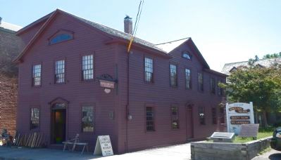
Sinclair Inn Marker
| 1 ► Nova Scotia, Annapolis County, Annapolis Royal — Sinclair Inn — L’auberge Sinclair — |
| On St. George Street, on the right when traveling north. | |||
| 2 ► Nova Scotia, Cape Breton Region, Glace Bay — Marconi Wireless Station / La Station de Communication Sans Fil de Marconi — |
| On McKeen Street north of William Street, on the right when traveling north. | |||
| 3 ► Nova Scotia, Cape Breton Region, Louisbourg — Fizel House — Maison Fizel — |
| Near Kennington Cove Road. | |||
| 4 ► Nova Scotia, Cape Breton Region, Louisbourg — 9 — Sydney and Louisbourg Railway Museum — |
| On Main Street (Nova Scotia Route 22) close to Huntington Avenue, on the left when traveling north. | |||
| 5 ► Nova Scotia, Cape Breton Region, Louisbourg — The Lobster Fishery — Le pêche du homard — |
| On Havenside Road, on the left when traveling east. | |||
| 6 ► Nova Scotia, Cape Breton Region, New Waterford — Anderton Shearer Loader — |
| Near Ellsworth Avenue (Nova Scotia Route 28) at James Street, on the right when traveling east. | |||
| 7 ► Nova Scotia, Cape Breton Region, New Waterford — Armoured Face Conveyor — |
| Near Ellsworth Avenue (Nova Scotia Route 28) at James Street, on the right when traveling east. | |||
| 8 ► Nova Scotia, Cape Breton Region, New Waterford — Joy — Hydraulically Powered Longwall Roof Support — |
| Near Ellsworth Avenue (Nova Scotia Route 28) at James Street, on the right when traveling east. | |||
| 9 ► Nova Scotia, Cape Breton Region, New Waterford — Miner's Monument — |
| On Plummer Avenue east of Baker Avenue, on the right when traveling east. | |||
| 10 ► Nova Scotia, Cape Breton Region, New Waterford — Standing The Gaff — William Davis — 1888-1925 — |
| On Plummer Avenue, 0.03 kilometers east of Baker Avenue, on the right when traveling east. | |||
| 11 ► Nova Scotia, Cape Breton Region, New Waterford — William Davis — Memorial — Colliery Lands Park — |
| Near Ellsworth Avenue (Nova Scotia Route 28) at James Street, on the right when traveling east. | |||
| 12 ► Nova Scotia, Cape Breton Region, Port Morien — Gowrie and North Atlantic Collieries — |
| On Marconi Trail (Nova Scotia Route 255) 0.2 kilometers south of Birch Grove Road, on the right when traveling north. | |||
| 13 ► Nova Scotia, Cape Breton Region, Port Morien — L'industrie du Charbon au Canada / Canada's Coal Industry — |
| On Long Beach Road, 1 kilometer north of Marconi Trail (Route 255), on the left when traveling north. | |||
| 14 ► Nova Scotia, Cape Breton Region, Port Morien — Morien Businesses of the Past — |
| On Marconi Trail (Nova Scotia Route 255) at Breakwater Street, on the right when traveling north on Marconi Trail. | |||
| 15 ► Nova Scotia, Cape Breton Region, Port Morien — The First Coal Workings in North America — |
| On Long Beach Road north of Marconi Trail (Route 255), on the right when traveling north. | |||
| 16 ► Nova Scotia, Cape Breton Region, Port Morien — The Fishery in Port Morien — |
| On Marconi Trail (Nova Scotia Route 255) 0.2 kilometers south of Birch Grove Road, on the right when traveling north. | |||
| 17 ► Nova Scotia, Cape Breton Region, Sydney — Canadian Merchant Navy — World War II — |
| Near Esplanade at Dorchester Street, on the left when traveling north. | |||
| 18 ► Nova Scotia, Cape Breton Region, Sydney — Royal Bank Lion — |
| On Esplanade at York Street, on the left when traveling north on Esplanade. | |||
| 19 ► Nova Scotia, Cape Breton Region, Sydney — The Development of Whitney Pier / L'essor De Whitney Pier — |
| On Victoria Road (Route 28) south of Church Street, on the right when traveling north. | |||
| 20 ► Nova Scotia, Colchester County, Balmoral Mills — Balmoral Grist Mill — |
| 21 ► Nova Scotia, Colchester County, Balmoral Mills — Local Granite Stone — |
| 22 ► Nova Scotia, Colchester County, Balmoral Mills — Sutherland Sawmill Turbine — |
| 23 ► Nova Scotia, Colchester County, Balmoral Mills — Turbines: From Direct to Indirect Power Production — |
| 24 ► Nova Scotia, Colchester County, Truro — The Lumber Jack, circa 1900 — |
| On Prince Street just east of Louise Street, on the right when traveling east. | |||
| 25 ► Nova Scotia, Cumberland County, Fort Lawrence — Amherst – Modern Period 1800s and 1900s — |
| 26 ► Nova Scotia, Cumberland County, Pictou — Willard Sterling Boyle, C.C. — Inventor / Inventeur — Nobel Laureate (Physics, 2009) / Lauréat du prix Nobel (Physique, 2009) — |
| On Sunrise Trail (Nova Scotia Route 6) just east of Kerrs Mill Road, on the right when traveling east. | |||
| 27 ► Nova Scotia, Cumberland County, Pugwash — Evolution of Pugwash Industry — Our Harbour • Our Heritage — |
| On Durham Street at Water Street, on the left when traveling west on Durham Street. | |||
| 28 ► Nova Scotia, Cumberland County, Pugwash — Nova Scotia Clayworks — Our Harbour • Our Heritage — |
| On Water Street at Victoria Street, on the left when traveling north on Water Street. | |||
| 29 ► Nova Scotia, Cumberland County, Pugwash — Pugwash Harbour — Our Harbour • Our Heritage — |
| On Water Street at Victoria Street, on the left when traveling north on Water Street. | |||
| 30 ► Nova Scotia, Guysborough County, Canso — Canso — |
| On School Street, on the right when traveling east. | |||
| 31 ► Nova Scotia, Guysborough County, Canso — Where Fishermen Meet / Lieu de rencontre des pêcheurs — |
| Near Water Street. | |||
| 32 ► Nova Scotia, Guysborough County, Port Felix — Captain Savalette — |
| On Marine Drive (Nova Scotia Route 316) at Port Felix Loop, on the left when traveling west on Marine Drive. | |||
| 33 ► Nova Scotia, Guysborough County, Port Felix — Welcome to Place Savalette — |
| On Marine Street (Nova Scotia Route 316) at Port Felix Loop, on the left when traveling west on Marine Street. | |||
| 34 ► Nova Scotia, Guysborough County, Queensport — Queensport, Guysborough County — |
| On Marine Drive (Nova Scotia Route 16), on the left when traveling east. | |||
| 35 ► Nova Scotia, Halifax Region, Halifax — Cast Iron Facade / Façade en Fonte — |
| Near Granville Street north of Duke Street, in the median. | |||
| 36 ► Nova Scotia, Halifax Region, Halifax — Enos Collins — 1774-1871 — |
| Near Upper Water Street just north of Duke Street, on the right when traveling north. | |||
| 37 ► Nova Scotia, Halifax Region, Halifax — Here We Began — A Marker of Distinction — |
| On George Street at the Waterfront, in the median on George Street. | |||
| 38 ► Nova Scotia, Halifax Region, Halifax — Izaak Walton & Dorothy Johnston Killam — |
| 39 ► Nova Scotia, Halifax Region, Halifax — Ocean Terminals/le terminal ocean terminals — |
| Near Marginal Road. | |||
| 40 ► Nova Scotia, Halifax Region, Halifax — Port of Halifax/Port de Halifax — |
| Near Lower Water Street. | |||
| 41 ► Nova Scotia, Halifax Region, Halifax — Samuel Cunard — 1787-1865 — |
| On Lower Water Street. | |||
| 42 ► Nova Scotia, Halifax Region, Halifax — Samuel Cunard — (1787-1865) — |
| On Marginal Road east of Lower Water Street, on the right when traveling north. | |||
| 43 ► Nova Scotia, Halifax Region, Halifax — Sir Samuel Cunard — 1787-1865 — |
| On Ta39 Road, 0.3 kilometers south of Point Pleasant Drive when traveling south. | |||
| 44 ► Nova Scotia, Halifax Region, Halifax — William Henry Chase — 1852-1933 — |
| Near Castine Way at Lord Dalhousie Drive, on the right when traveling east. | |||
| 45 ► Nova Scotia, Halifax Region, Peggy's Cove — Fishermen's Monument — by William E. deGarthe, Artist and Sculptor — |
| On Peggy's Point Road, 0.4 kilometers south of Prospect Road (Nova Scotia Route 333), on the right when traveling south. | |||
| 46 ► Nova Scotia, Halifax Region, Peggy's Cove — The Lure of Peggy's Cove — |
| On Peggy's Point Road, 0.4 kilometers south of Prospect Road (Nova Scotia Route 333), on the left when traveling south. | |||
| 47 ► Nova Scotia, Halifax Region, Sheet Harbour — Early Settlement — Sheet Harbour — |
| On Marine Drive (Nova Scotia Trunk Highway 7), 0.1 kilometers west of Church Point Road, on the left when traveling west. | |||
| 48 ► Nova Scotia, Halifax Region, Sheet Harbour — Hydroelectric Power — Sheet Harbour — |
| On Marine Drive (Nova Scotia Trunk Highway 7), 0.1 kilometers west of Church Point Road, on the left when traveling west. | |||
| 49 ► Nova Scotia, Halifax Region, Sheet Harbour — Lumbering & Sawmills — Sheet Harbour — |
| Near Marine Drive (Nova Scotia Trunk Highway 7), 0.3 kilometers east of Highway 224, on the right when traveling east. | |||
| 50 ► Nova Scotia, Halifax Region, Sheet Harbour — Salmon — Sheet Harbour — |
| Near Marine Drive (Nova Scotia Trunk Highway 7), 0.3 kilometers east of Highway 224, on the right when traveling east. | |||
| 51 ► Nova Scotia, Halifax Region, Sheet Harbour — Sheet Harbour — |
| Near Marine Drive (Nova Scotia Trunk Highway 7), 0.3 kilometers east of Highway 224, on the right when traveling east. | |||
| 52 ► Nova Scotia, Halifax Region, Sheet Harbour — Shipbuilding & Shipping — Sheet Harbour — |
| On Marine Drive (Nova Scotia Trunk Highway 7), 0.1 kilometers west of Church Point Road, on the left when traveling west. | |||
| 53 ► Nova Scotia, Halifax Region, Sheet Harbour — The Community — Sheet Harbour — |
| Near Marine Drive (Nova Scotia Trunk Highway 7), 0.3 kilometers east of Highway 224, on the right when traveling east. | |||
| 54 ► Nova Scotia, Halifax Region, Sheet Harbour — The Pulp & Paper Industry — Sheet Harbour — |
| Near Marine Drive (Nova Scotia Trunk Highway 7), 0.3 kilometers east of Highway 224, on the right when traveling east. | |||
| 55 ► Nova Scotia, Halifax Region, Tangier — Prince Alfred Arch / L'Arche Prince Alfred — |
| On Jennings Settlement Road at James Mason Lane, on the left when traveling west on Jennings Settlement Road. | |||
| 56 ► Nova Scotia, Inverness County, Chéticamp — Dés l'année suivante, en 1927 / The following year, in 1927 — |
| Near Cabot Trail just north of Barren Road, on the left when traveling north. | |||
| 57 ► Nova Scotia, Inverness County, Chéticamp — La Bouée du havre / The Harbour Bouy — |
| Near Cabot Trail just north of Barren Road, on the left when traveling north. | |||
| 58 ► Nova Scotia, Inverness County, Chéticamp — La fin d'un rêve / The End of a Dream — |
| Near Cabot Trail just north of Barren Road, on the left when traveling north. | |||
| 59 ► Nova Scotia, Inverness County, Chéticamp — M. Joseph Macfarland / Mr. Joseph MacFarland — 1923-1947 — |
| Near Cabot Trail just north of Barren Road, on the left when traveling north. | |||
| 60 ► Nova Scotia, Inverness County, Chéticamp — The Gypsum Mine/La Mine De Plâtre — |
| On Cabot Trail just north of Barren Road, on the left when traveling north. | |||
| 61 ► Nova Scotia, Inverness County, Chéticamp — Tunnel et Quai de la mine / Tunnel and Mine Wharf — |
| Near Cabot Trail just north of Barren Road, on the left when traveling north. | |||
| 62 ► Nova Scotia, Inverness County, Chéticamp — Voie ferrée et « Lu vieille Louise » / The railroad and "The Old Louise" — 1910-1914 — |
| Near Cabot Trail just north of Barren Road, on the left when traveling north. | |||
| 63 ► Nova Scotia, Inverness County, Port Hastings — Canso Causeway — "Air Lorg Nan Eilean," The Road to the Isles — |
| Near Trans Canada Highway (National Route 104) 0.5 kilometers west of Ceilidh Trail (Route 19), on the right when traveling west. | |||
| 64 ► Nova Scotia, Inverness County, Port Hastings — History of the Canso Canal / Historique du Canal de Canso — |
| Near Trans Canada Highway (National Route 104) 0.5 kilometers west of Ceilidh Trail (Route 19), on the right when traveling west. | |||
| 65 ► Nova Scotia, Lunenburg County, Bridgewater — 6 — The Great Fire 1899 / Le grand incendie de 1899 — ***Riverfront Renaissance*** — |
| On King Street (Nova Scotia Route 3) at the Old Bridge Street bridge over the LaHave River (Nova Scotia Route 3), on the right when traveling north on King Street. | |||
| 66 ► Nova Scotia, Lunenburg County, Lunenburg — “…for those in peril on the sea.” — |
| On Bluenose Drive close to King Street, on the right when traveling west. | |||
| 67 ► Nova Scotia, Lunenburg County, Lunenburg — Lunenburg’s Fishing Industry 1870’s - 1940’s — L’industrie de la pêche à Lunenburg de 1870 aux années 1940 — |
| On Bluenose Drive close to King Street, on the right when traveling west. | |||
| 68 ► Nova Scotia, Lunenburg County, Lunenburg — Lunenburg’s Fishing Industry Since 1940’s — L’industrie des pêches de Lunenburg depuis les années 1940 — |
| On Bluenose Drive close to King Street, on the right when traveling west. | |||
| 69 ► Nova Scotia, Lunenburg County, Lunenburg — Lunenburg’s Fishing Industry to the 1870’s — L’industrie de la pêche à Lunenburg avant les années 1870 — |
| On Bluenose Drive close to Cornwallis Street, on the right when traveling west. | |||
| 70 ► Nova Scotia, Lunenburg County, Lunenburg — Lunenburg’s Shipbuilding Tradition — La tradition de la construction navale à Lunenburg — |
| On Bluenose Drive close to Hopson Street, on the right when traveling east. | |||
| 71 ► Nova Scotia, Pictou County, New Glasgow — A Memorial to the Ship Building Industry — |
| Near Glasgow Street at Dalhousie Street, on the left when traveling north. | |||
| 72 ► Nova Scotia, Pictou County, New Glasgow — Bell's Corner — |
| On North Provost Street (Nova Scotia Route 348) at George Street (Nova Scotia Route 289), on the right when traveling south on North Provost Street. | |||
| 73 ► Nova Scotia, Pictou County, New Glasgow — Captain George R. McKenzie — "Father of Pictou County Shipbuilding" — |
| On Glasgow Street just south of Dalhousie Street, on the right when traveling north. | |||
| 74 ► Nova Scotia, Pictou County, New Glasgow — Industrial Centre Lofts — |
| On Archimedes Street (Nova Scotia Route 4) (Nova Scotia Route 289) north of MacLean Street, on the left when traveling north. | |||
| 75 ► Nova Scotia, Pictou County, New Glasgow — New Glasgow — Your Shore to Relax & Reconnect — |
| On Glasgow Street just south of Dalhousie Street, on the right when traveling north. | |||
| 76 ► Nova Scotia, Pictou County, New Glasgow — New Glasgow Heritage — |
| On Archimedes Street (Nova Scotia Route 4) (Nova Scotia Route 289) at Dalhousie Street, on the left when traveling north on Archimedes Street (Nova Scotia Route 4). | |||
| 77 ► Nova Scotia, Pictou County, New Glasgow — Viola Desmond — Educator, Entrepreneur, Human Rights Activist — |
| On Archimedes Street (Nova Scotia Route 4) (Nova Scotia Route 289) just north of Dalhousie Street, on the right when traveling north. | |||
| 78 ► Nova Scotia, Pictou County, Stellarton — Frank H. Sobey — |
| Near South Foord Street (Nova Scotia Route 374) at Union Street, on the left when traveling north. | |||
| 79 ► Nova Scotia, Pictou County, Stellarton — Frank Hoyse Sobey, OC — 1902-1985 — Businessman, Civic Leader, Public Servant, Nova Scotian — |
| Near South Foord Street (Nova Scotia Route 374) at Union Street, on the left when traveling north. | |||
| 80 ► Nova Scotia, Pictou County, Stellarton — The General Mining Association (GMA) — La General Mining Association (GMA) — |
| Near North Foord Street (Nova Scotia Route 374) 0.2 kilometers south of Trans-Canada Highway (National Route 104), on the left when traveling south. | |||
| 81 ► Nova Scotia, Pictou County, Trenton — First Pouring of Steel in Canada — July 25, 1883 — Trenton, Nova Scotia — |
| On Main Street (Route 348) at Forge Street, on the left when traveling north on Main Street. | |||
| 82 ► Nova Scotia, Pictou County, Trenton — Honouring the First Successful Commercial Pouring of Steel in Canada - 1883 — |
| On Main Street (Nova Scotia Route 348) at Pleasant Street, on the left when traveling north on Main Street. | |||
| 83 ► Nova Scotia, Pictou County, Trenton — The First Steel Made in Canada — |
| On Main Street (Nova Scotia Route 348) at Forge Street, on the right when traveling north on Main Street. | |||
| 84 ► Nova Scotia, Pictou County, Trenton — Trenton Works Axle Hammer — "The Heartbeat of Pictou County" — |
| On Main Street (Nova Scotia Route 348) at Pleasant Street, on the left when traveling north on Main Street. | |||
| 85 ► Nova Scotia, Victoria County, Baddeck — Alexander Graham Bell National Historic Park — Parc historique national Alexander Graham Bell — |
| Near Chebucto Street (Nova Scotia Route 205), on the right when traveling west. | |||
| 86 ► Nova Scotia, Yarmouth County, Cape Forchu — A Footstep into the Harbour — |
| 87 ► Nova Scotia, Yarmouth County, Cape Forchu — Pieces of the Past — |
| 88 ► Nova Scotia, Yarmouth County, Cape Forchu — The Tusket Islands — |
| 89 ► Nova Scotia, Yarmouth County, Lower West Pubnico — Recolter la mer / Harvesting the Sea — Quai Dennis Point / Dennis Point Wharf — |
| On Dennis Point Road, 1 kilometer south of D'Entremont Road, on the left when traveling south. | |||
| 90 ► Nova Scotia, Yarmouth County, Middle West Pubnico — Dennis Point — Living Wharves / Tchais Vivants — |
| On Dennis Point Road, 1 kilometer south of D'Entremont Road, on the left when traveling south. | |||
| 91 ► Nova Scotia, Yarmouth County, Yarmouth — Frost Park — |
| On Main Street (Nova Scotia Route 1) just south of Public Street, on the right when traveling south. | |||
| 92 ► Nova Scotia, Yarmouth County, Yarmouth — Lost to the Sea — |
| On Water Street at Glebe Street, on the right when traveling north on Water Street. | |||
| 93 ► Nova Scotia, Yarmouth County, Yarmouth — Lost to the Sea / Perdus en Mer — |
| On Water Street at Glebe Street, on the right when traveling north on Water Street. | |||
| 94 ► Nova Scotia, Yarmouth County, Yarmouth — Manufacturing — Goods & Services for the Marketplace — |
| On Water Street, 0.1 kilometers south of Richards Lane, on the right when traveling south. | |||
| 95 ► Nova Scotia, Yarmouth County, Yarmouth — Rum Running — Rum, Risk, and Riches! — |
| On Water Street, on the right when traveling south. | |||
| 96 ► Nova Scotia, Yarmouth County, Yarmouth — Shipbuilding — Building a Connection to the World — |
| On Water Street, on the right when traveling south. | |||
| 97 ► Nova Scotia, Yarmouth County, Yarmouth — Shipbuilding in Nova Scotia / Construction navale en Nouvelle-Écosse — |
| On Main Street at Marshall Lane, on the right when traveling south on Main Street. | |||
| 98 ► Nova Scotia, Yarmouth County, Yarmouth — the Yarmouth-Boston Ferry — |
| On Water Street at Lovitt Street, on the left when traveling north on Water Street. | |||
| 99 ► Nova Scotia, Yarmouth County, Yarmouth — The Fishery — A Community Mainstay — |
| On Water Street, on the right when traveling south. | |||
| 100 ► Nova Scotia, Yarmouth County, Yarmouth — The Killam Brothers Buildings & Wharf — |
| On Water Street just north of Central Street, on the left when traveling north. | |||
102 entries matched your criteria. The first 100 are listed above. The final 2 ⊳