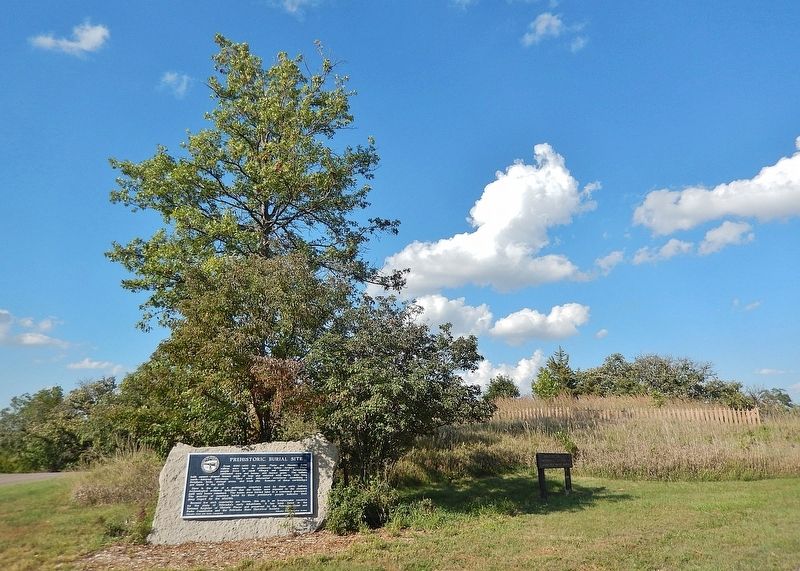
Near Eugene T. Mahoney State Park Road 1.4 miles north of State Highway 66.
From 1050-1400 the lower Platte and Missouri River valleys were home to prehistoric Indian farmers. These people lived in small villages and isolated farmsteads, cultivated corn and beans, and hunted game. The Indians built square-shaped houses . . . — — Map (db m298136) HM
On East F Street at 5th Street (Local Route F St), on the left when traveling north on East F Street.
"Love is more like a light that you carry .... that is what love is to a woman - a lantern in her hand," says Abbie Deal the courageous heroine in Bess Streeter Aldrich's novel about the pioneers who with dreams and hard work forged this great . . . — — Map (db m82510) HM
This Property
is listed in the
National Register
of Historic Places
By the United States
Department of the Interior
Blake Building 305 Main Street 1883 ca
John Blake, proprietor of a local saloon, erected this building. The . . . — — Map (db m78059) HM
This Property
is listed in the
National Register
of Historic Places
By the United States
Department of the Interior
Budweiser Building 1888
Anheuser-Busch Brewing Co built for $20,000 to house a saloon and liquor business. . . . — — Map (db m78051) HM
Near Main Street, on the right when traveling west.
Two markers, to the left and right of the front entrance.
Has been placed on the
National Register
of Historic Places
By the United States
Department of the Interior
1985
This Property
is listed in the
. . . — — Map (db m78049) HM
On Main Street west of North 6th Street, on the right when traveling west.
When the outbreak of war between the states became imminent in the spring of 1861, the citizens of Plattsmouth were quick to respond to the impending crisis. Without waiting for President Lincoln's call for volunteers, Dr. Robert R. Livingston . . . — — Map (db m78024) HM
This Property
is listed in the
National Register
of Historic Places
By the United States
Department of the Interior
Drew/Weckbach 317, 321, 325 Main Street 1881 & 1886
Joseph V. Weckbach came to Plattsmouth in 1865. After . . . — — Map (db m78056) HM
This Property
is listed in the
National Register
of Historic Places
By the United States
Department of the Interior
Excelsior Building 313 Main Street 1884
Three business owners, in succession, J.C. & R. Peterson, brothers, . . . — — Map (db m78058) HM
On Livingston Highway (U.S. 34), on the right when traveling east.
This Property
is listed in the
National Register
of Historic Places
By the United States
Department of the Interior
Plattsmouth Bridge 1930
The bridge was built to replace the ferry service that had started in 1848. It was . . . — — Map (db m78061) HM
This Property
is listed in the
National Register
of Historic Places
By the United States
Department of the Interior
Vienna Bakery 329 Main Street 1881
Built by William Stadelman, First occupant was a bakery run by William . . . — — Map (db m78054) HM
This Property
is listed in the
National Register
of Historic Places
By the United States
Department of the Interior
Wetenkamp Building 337 Main Street 1890
Many businesses occupied this site. Among them were various stores, . . . — — Map (db m78053) HM
On State Highway 50, on the left when traveling north.
This building was constructed by community effort in 1871 of native limestone as the Congregational Church and served in that capacity until a new brick church was constructed 1887-1890. The nearby stone parsonage, first occupied in 1867, was sold . . . — — Map (db m82521) HM
On 100 Street 0.3 miles south of West Saltillo Road, on the right when traveling north.
Thousands of oxen-drawn wagons passed here from 1860 to 1867, before completion of the Union Pacific Railroad across Nebraska. Carrying military and mining supplies, and emigrants moving west, they cut deep ruts across the tallgrass prairie and at . . . — — Map (db m223457) HM
On February 22, 1899, William Jennings Bryan gave one of the most renowned speeches in American History. The presentation, given in Washington, D.C., was entitled, "America's Mission". He spoke of purpose and direction and challenge, and . . . — — Map (db m66848) HM
The son of a Kentucky frontiersman, Lincoln had to struggle for a living and for learning. Five months before receiving his party's nomination for President, he sketched his life:
"I was born February 12, 1809, in Hardin County, . . . — — Map (db m179399) HM
On 14th Street at Lincoln Mall, on the right when traveling north on 14th Street.
Four score and seven years ago our fathers brought forth on this continent, a new nation, conceived in Liberty, and dedicated to the proposition that all men are created equal. Now we are engaged in a great civil war, testing whether that nation, . . . — — Map (db m287948) HM WM
On 27th Street north of W Street, on the right when traveling north.
The Elaine Hammer Bridge was dedicated on Sunday, June 28, 2009. Completion
of the bridge was the final link in the MoPac Trail that connects with the University
of Nebraska and Antelope Valley Trails on the west. The trail is continuous . . . — — Map (db m287949) HM
On Sumner Street west of South 50th Street, on the right when traveling west.
William Jennings Bryan was born in Salem, Illinois in 1860. He moved to Lincoln in 1887, entered into law practice and was elected to Congress in 1890. He won the first of three presidential nominations with his "Cross of Gold" speech at the . . . — — Map (db m254958) HM
On April 30, 1789, George Washington, standing on the balcony of Federal Hall on Wall Street in New York, took his oath of office as the first President of the United States.
Born in 1732, into a Virginia planter family, he learned the . . . — — Map (db m179401) HM
The Institute of Agriculture and Natural Resources fulfills the land-grant university mission of the University of Nebraska as mandated by the Morrill Act of 1862 by offering academic degrees through the College of Agricultural Sciences and . . . — — Map (db m66846) HM
Lincoln Army Air Field was constructed in 1942 on the former Lincoln Municipal Airport. The 2,750-acre property was leased to the army by the City of Lincoln. The base provided technical training for aircraft mechanics, basic training for army . . . — — Map (db m66966) HM
Mammoths roamed Nebraska's grasslands for more than one million years before mysteriously disappearing between 11,000 and 10,000 years ago. These extinct relatives of today's elephants were the largest mammals ever to walk the Great Plains. Adult . . . — — Map (db m54358) HM
On 27th Street south of Y Street, on the right when traveling south.
On July 4, 1851, at St Louis, Missouri, ground breaking for the Pacific Railroad marked the
beginning of this historic railway. The first section of track was completed in 1852. In 1872, the company was reorganized as the Missouri Pacific . . . — — Map (db m287951) HM
This bell tower was given
to the university by
Ralph Mueller
Class of 1898,
in grateful appreciation
of the free education
given him by the State
of Nebraska
Dedicated Nov. 4, 1949.
This tower
was designed in 1948
by . . . — — Map (db m54357) HM
On 27th Street north of W Street, on the left when traveling north.
Hartley
The Hartley neighborhood was named for the school superintendent Ellis T. Hartley. Once one of the earliest Lincoln suburbs, it is now centrally located. This neighborhood contains several parks and greenspaces, as well as the . . . — — Map (db m287952) HM
The Osborne Athletic Complex is named in honor of Tom and Nancy Osborne. Coach Osborne led the nation in winning percentage upon his retirement in 1997 after three national championships in a four year period (1994, 1995, 1997). He served as . . . — — Map (db m66849) HM
On East Campus Loop, on the right when traveling west on East Campus Loop.
This area dedicated to the memory of…
Beloved friend, teacher, dairy products judge and coach, creator of Husker Cheese and a pioneer of the Nebraska Dairy Industry. — — Map (db m66847) HM
On Vine Street at 14th Street, on the right when traveling west on Vine Street.
General John J. Pershing, commander of the American Expeditionary Forces to Europe in World War I, was Professor of Military Science at the University of Nebraska-Lincoln between September 1891 and June 1895. Upon his arrival in Lincoln, which was . . . — — Map (db m54351) HM
On North 16th Street just south of S Street, on the right when traveling south.
This historic building is home to Rho Chapter of Kappa Alpha Theta. It is the first sorority house planned and built on the University of Nebraska-Lincoln campus as a permanent resident to promote women's participation in a college education. . . . — — Map (db m212326) HM
On February 6, 1911, Ronald Wilson Reagan was born to Nelle and John Reagan in Tampico, Illinois. He attended high school in nearby Dixon and then worked his way through Eureka College. There, he studied economics and sociology, played on the . . . — — Map (db m179362) HM
On North 16th Street at U Street, on the right when traveling north on North 16th Street.
Elisha M. Lewis, early Nebraska pastor and missionary, built this French Second Empire style house in about 1878. The Syford family owned the property from 1904 until the daughter, Constance willed the house in 1965 to the Nebraska State Historical . . . — — Map (db m211109) HM
On R. Street just west of 16th Street, on the right when traveling west.
In 1878 public-spirited citizens, led by former governor Robert W. Furnas, organized the Nebraska State Historical Society. The legislature designated the Society a state institution in 1883 and began providing financial support.
The . . . — — Map (db m47377) HM
Chartered as a Land-Grant institution by the first regular session of the State Legislature on February 15, 1869, the University opened its doors to 20 collegiate students and 110 preparatory school pupils on September 7, 1871. Lincoln was then a . . . — — Map (db m211108) HM
Author of the Declaration of Independence and the Statute of Virginia for Religious Freedom, third president of the United States and founder of the University of Virginia - voiced the aspirations of a new America as no other individual of his . . . — — Map (db m179400) HM
Nebraska Historic Site
Lincoln Army Air Field
Regimental Chapel
1942
This property is listed in
the National Register of Historic Places — — Map (db m66968) HM
Near East O Street (U.S. 34) at North 10th Street, on the left when traveling east.
In the 1870’s, a well was drilled in the center of the block located northwesterly of 10th & “O” Streets to serve fire cisterns in the area. Water from the 1,000 foot deep artesian well proved to be too salty for the intended use. The . . . — — Map (db m158991) HM
On P Street at North 7th Street, on the right when traveling east on P Street.
Originally constructed in 1890 as the two-story Fitzgerald building, this structure received its upper floors in 1904, a very early example of a common haymarket occurrence. The upper floors were added on by Beatrice Creamery Company, the . . . — — Map (db m211304) HM
On South 14th Street just south of K Street, on the right when traveling south.
Sponsored by Senator Tom Brewer, legislative resolution 271 in the one hundred seventh legislature renamed the state office building located at 521 South 14th Street, Lincoln, Nebraska, as The Chief Standing Bear Justice Administration Building. The . . . — — Map (db m212117) HM WM
On South 14th Street just south of K Street, on the right when traveling south.
From his birth on the banks of the Niobrara River in Nebraska until his death in 1908, Chief Standing Bear spent his life in a constant struggle to gain equality and justice for our nation's Native Americans. Chief Standing Bear and the Ponca Tribe . . . — — Map (db m212118) HM
On March 6, 1855, Lancaster County was created by act of the Territorial Legislature. Many early settlers came for land, while others were attracted by the commercial possibilities of the nearby Salt Basin. In 1859, a site east of the Salt Basin was . . . — — Map (db m88549) HM
On Q Street at North 8th Street, on the right when traveling east on Q Street.
In the early 20th century, Haymarket was the
location of a half-dozen wholesale grocers, doing $4
million in trade over five states. This building
housed one of them, the H. P. Lau Company, Lau
was a German immigrant who began his . . . — — Map (db m211312) HM
On North 8th Street just south of R Street, on the right when traveling south.
Built in two stages, the first three floors and the loading docks of this warehouse were completed in 1920. The building was designed by architect Jesse B. Miller and built by Olson Construction Co., at a cost of $120,000, for the Lincoln Hide & . . . — — Map (db m211302) HM
On P Street near North 8th Street, on the right when traveling west.
In the early 20th century, as the saddlery industry
became mechanized, wholesalers who previously
supplied small harnessmakers moved into
manufacturing. The Harpham Brothers Company,
started in 1884, was one of three Lincoln
saddlery factories . . . — — Map (db m211315) HM
Near North 7th Street at P Street, on the right when traveling south.
The "Haymarket" name can be traced to Lincoln’s first decade. In the capital city’s original plat of 1867, a "market square" was identified, bounded by O and P, 9th and 10th streets. It served as an open-air market for produce and livestock, as well . . . — — Map (db m159097) HM
On Q Street at North 8th Street, on the right when traveling east on Q Street.
A date-stone high on the north façade proclaims
"1901 Huber". Huber Manufacturing Company.
constructed their sturdy factory with brick
bearing walls and tall work-spaces in the era of
steam-powered farm implements. In 1905 ten of
Lincoln's . . . — — Map (db m211314) HM
On Q Street at North 7th Street, on the right when traveling west on Q Street.
This fountain was donated by the National Humane Alliance in 1908 after formation of Lincoln’s Humane Society in January, 1907.
It is one of at least 70 similar fountains placed in communities throughout the United States.
The fountain includes . . . — — Map (db m101878) HM
On North 8th Street at P Street, on the right when traveling east on North 8th Street.
About a half dozen Haymarket buildings gained added
stories after their initial construction. This sturdy
warehouse is probably the district's most successful
design example of vertical addition. The fact that the
same architect, Ferdinand . . . — — Map (db m212136) HM
On P Street at North 9th Street, on the right when traveling west on P Street.
Lincoln Fixture Building was the last of the major Haymarket buildings designed by F. C. Fiske. It
displays clearly the contrast often seen in Haymarket
warehouses between stylish fronts and utilitarian,
plain side and rear walls. The . . . — — Map (db m212131) HM
On Q Street at North 7th Street, on the right when traveling west on Q Street.
Although known as the Lincoln Hide & Fur
Building, this structure was originally built for
the Carter Transfer & Storage Company, one of
several moving and storage companies located in
the haymarket It was constructed in 1909 at a
cost of . . . — — Map (db m212121) HM
On North 7th Street at P Street, on the right when traveling south on North 7th Street.
The Burlington and Missouri River Railroad entered
Lincoln in 1870 - the first line to serve the young capital
city, established just three years earlier. Seven other
railroads followed in the next thirty years. Trade expanded
as the . . . — — Map (db m211301) HM
On Q Street west of 10th Street (U.S. 34), on the left when traveling west.
The Territorial Legislature at Omaha drew the boundaries of Lancaster County in 1855. Settlers first arrived in 1856 and a county government was established "on paper" in 1859. Methodist Elder John M. Young arrived at the head of a colony in . . . — — Map (db m66883) HM
On Lincoln Mall east of South 12th Street, on the right when traveling west.
Mari Sandoz (1896-1966), Nebraska historian and novelist, lived at this site, 1226 J Street, from 1925 to 1937. Here in 1928, she began writing Old Jules, the biography of her father. From the J Street curb, she often wrote and watched . . . — — Map (db m223459) HM
From 1854 to 1867 the seat of territorial and state government was in Omaha. In 1867 the State Legislature appointed a Capital Commission to select a location for the new state capital. Commission members Governor David Butler, Auditor John . . . — — Map (db m87800) HM
On P Street at North 7th Street, on the right when traveling east on P Street.
The Old Woods Bros. Companies building was built in
1914 by Mark, George and Frank Woods, Lincoln's
preeminent land developers of the early 20th century.
It was designed by A. W. Woods (no known relation)
and was built for an estimated $8,600. . . . — — Map (db m211309) HM
When the Kennard House was built in 1869, a rear wing was attached to the house. This wing was torn down in 1923 for unknown reasons. In 1992 an archaeological dig revealed the following key features that are explained here.
Key Features . . . — — Map (db m211107) HM
On P Street 0.1 miles east of North 8th Street, on the right when traveling east.
The Ridnour Building was one of the last factory
warehouses built during the Haymarket District's
principal period of development. J. C. Ridnour
used the building to manufacture work clothes
and overalls and as a wholesale warehouse . . . — — Map (db m212132) HM
The previous building on the site was constructed in 1885
as the Tremont House, a hotel providing sixty-two rooms.
The establishment was a favorite of visiting theatrical
companies for its location near the Depot and its rates,
starting at . . . — — Map (db m212137) HM
On Q Street at North 8th Street, on the right when traveling east on Q Street.
Seaton & Lea Ironworks of Atchison and Topeka, Kansas, established their third branch in Lincoln in 1881, building a complex that included this three-story machine and pattern shop, plus a single story foundry, ovens and sheds to the north. The . . . — — Map (db m211300) HM
The Stacy Brothers Fruit Company warehouse, built
in 1912 at an estimated cost of $25,000 is typical of
the handsome warehouses of architect Ferdinand C.
Fiske. The long-lived Lincoln architect designed six
major warehouses in Haymarket . . . — — Map (db m212135) HM
On South 16th Street at H Street on South 16th Street.
William Henry Ferguson, Lincoln businessman and investor built this house in 1909 - 11. It is one of the best examples of the Second Renaissance Revival style in Lincoln and perhaps in Nebraska. Architects were Searles, Hirsh, and Gavin of . . . — — Map (db m87762) HM
Near South 12th Street at Lincoln Mall, on the right when traveling north.
Built on this site in 1860
The Imhoffs as hoteliers, bankers, and supporters of Nebraska Wesleyan University, contributed to the development of Lincoln as the State Capital.
Century House
1201 Lincoln Mall
Built 1964
Brick mural by . . . — — Map (db m255043) HM
On K Street west of South 16th Street, on the left when traveling east.
The Protecting Hand sculpture, created by artist Lawrence Tenney Stevens, was dedicated on October 6, 1955 on the façade of the late Woodmen Accident and Life Company building located at 1526 K Street. The sculpture weighs in at roughly 200 tons . . . — — Map (db m212112) HM
On O Street (U.S. 34) west of 10th Street, on the right when traveling west.
In 1874 construction began on Lincoln's first U.S. Post Office and Courthouse on a block originally intended as a market square. The building was completed by 1879 at a cost of about. $200,000. Alfred B. Mullet, supervising architect of the U.S. . . . — — Map (db m66884) HM
On P Street near North 8th Street, on the right when traveling west.
The Veith Building ranks as Lincoln's best example of
the small shops common throughout downtown in the
1880s and '90s, and as such it is individually listed on the
National Register of Historic Places. The building
displays an abundance of . . . — — Map (db m212126) HM
On South 27th Street at C Street, on the right when traveling north on South 27th Street.
Displays of roses have been grown in Lincoln's parks since the 1930s. Initially roses were grown in Sunken Gardens. The first municipal rose display garden was established at this location in Antelope Park in the early 1940's. The Lincoln Journal . . . — — Map (db m211106) HM
Near West Branched Oak Road 0.5 miles east of North 126th Street, on the right when traveling east.
Crounse was once a small village named for Lorenzo Crounse, Nebraska Supreme Court justice (1867-73), congressman (1873-77), and governor (1893-95). The village had a school (1870-1962), post office (1873-1901), church, general store, and creamery. . . . — — Map (db m223461) HM
On Silver Street at North 10th Street, on the right when traveling west on Silver Street.
Second son and child of Gilbert Belnap and Adaline Knight, Mormon Pioneers, who was born 11 May 1849 in Fremont county, Iowa. He departed for Utah with his parents and his older brother Gilbert Rosel Belnap, age 3, on 15 June 1850 in a wagon built . . . — — Map (db m49071) HM
On the Westbound Rest Stop (Interstate 80 at milepost 431), on the right when traveling west.
The Lower Platte River valley landscape is dotted with villages affiliated with the Central Plains Tradition—the term used by archaeologists to define the vast prehistoric Native American population that lived in Nebraska from A.D. 1000 to 1400. . . . — — Map (db m2147) HM
Near Interstate 80 at milepost 425, on the right when traveling east.
Eastbound travelers will soon cross the Platte River, which has paralleled the Interstate across most of Nebraska. It has long been noted for its great width and shallow depth. The Platte is a major tributary of the Missouri River, which it flows . . . — — Map (db m78022) HM
On U.S. 6 at Silver Street, on the right when traveling east on U.S. 6.
This marker sits astride the Ox-Bow Trail, also known as the Old Fort Kearny or Nebraska City Road. Beginning in the 1840's, this route carried thousands of emigrants and millions of pounds of freight destined for the settlements, mining camps, or . . . — — Map (db m80433) HM
On Silver Street, on the right when traveling north.
The Mormon Pioneer Trail
Fleeing heated religious and political hostility and persecution, many members of The Church of Jesus Christ of Latter-day Saints (widely known as Mormons) abruptly fled their homes in Nauvoo, Illinois in February . . . — — Map (db m299060) HM
On County Road 10 at County Road J, on the left when traveling north on County Road 10.
During the height of the Cold War, the Soviet Union launched the world’s first artificial satellite, Sputnik I, in October 1957. A perceived “missile gap” led to the massive construction of Intercontinental Ballistic Missile (ICBM) sites in the . . . — — Map (db m287890) HM
Near County Road J just east of County Road 8, on the right when traveling east.
During the height of the Cold War, the Soviet Union launched the world’s first artificial satellite, Sputnik I, in October 1957. A perceived “missile gap” led to the massive construction of Intercontinental Ballistic Missile (ICBM) sites in the . . . — — Map (db m287891) HM
The Armour and Company Icehouse was built in 1897-98 northwest of Memphis, Nebraska. It
was one of the largest icehouses in the country, measuring approximately 180 feet wide, 700 feet
long, and 52 feet high. A 300-horsepower steam engine and two . . . — — Map (db m80432) HM
On North Chestnut Street (U.S. 30A&77) south of West 5th Street, on the right when traveling south.
Saunders County was originally Oto Indian territory, and a large earthlodge village under Chief Itan was located here during the early historic period. Later, the Pawnee established villages in the area and in 1855 held peace conferences with . . . — — Map (db m80430) HM
In Memory of U.S.S. Wahoo SS 238 and her gallant crew who sank 20 Japanese ships before being sunk by enemy action October 11, 1943.
Crew of the U.S.S. Wahoo still on patrol. — — Map (db m93184) WM
In memory of all submarines and crews on eternal patrol.
Honoring all U.S. Navy Submarine Sailors.
In memory of the USS Wahoo SS238 and her gallant crew who sank 20 Japanese ships before being sunk by action on October 11, 1943.
During . . . — — Map (db m80431) HM WM
On County Road M (State Highway 92) just west of 2nd Street (Yutan Road), on the right when traveling west.
Spanish colonial correspondence from 1777 noting the presence of an Oto Indian village on the Platte likely refers to the Yutan site, named after the Chief Iatan. Yutan would have been the first Indian settlement seen by fur trappers and military . . . — — Map (db m293375) HM
The original site of Beaver Crossing was located about three miles to the northwest. Here a trail from Nebraska City to Fort Kearny crossed Beaver Creek. John Leonard and Daniel Millspaugh were the first settlers in this area in 1862. Roland Reed . . . — — Map (db m76748) HM
This millstone is believed to be from the gristmill built by William Smith in 1871 on the Big Blue River south of Beaver Crossing. W. J. Thompson took over the mill in 1873, and it continued to operate until about 1917.
Gristmills were an . . . — — Map (db m76747) HM
Near Interstate 80 at milepost 381, 2 miles east of Exit 379 (State Highway 15), on the right when traveling east.
Most of Nebraska was once virgin grasslands. The first settlers often lived in crude sod huts, known as "soddies," and many worked for years transforming the prairie into producing cropland. Water was often scarce, especially in the drier climate . . . — — Map (db m265998) HM
On B Street at 2nd Street, on the right when traveling south on B Street.
Founded by J. L Davison in 1864 near the limestone ford where the Nebraska City to Fort Kearny "Steam Wagon Road" crossed the Blue River, Milford is the oldest town in Seward County, serving as the first county seat until 1871. Milford was home to . . . — — Map (db m76765) HM
The Purple Heart medal was originated by General George Washington on August 7, 1782 for distinguished valor and is now awarded only to members of the armed forces of the United States who have been wounded in combat against an armed . . . — — Map (db m92535) WM
Near Interstate 80 at milepost 381, 2 miles east of Exit 379 (State Highway 15), on the right when traveling east.
In 1877 the Ponca Tribe and Chief Standing Bear were forced from their Nebraska homeland along the Niobrara River to an Oklahoma reservation. Hardships followed them during the more than 500-mile trek. Standing Bear’s daughter Prairie Flower died . . . — — Map (db m179391) HM
This rest site is near the center of Nebraska's tall-grass prairie on the eastern edge of the hunting grounds once used by the Pawnee Indians. Nebraska's largest tribe, the Pawnee located villages on major area streams, including the Blue, Loup, and . . . — — Map (db m92536) HM
Near Interstate 80 at milepost 380.5, on the right when traveling east.
Except for the occasional Indian or white hunting parties, the scenic valley of the Big Blue River was seldom visited prior to 1860. The establishment of the Nebraska City-Fort Kearny Cutoff in 1861 brought through the region thousands of overland . . . — — Map (db m78021) HM
On McKelvie Road (U.S. 34) 0.1 miles west of Crooked Mile Road, on the left when traveling west.
On this day, a "bomb cyclone" dropped up to 4 inches of rain on several inches of wet snow on frozen soil. The rapidly melting snow caused flooding on the Big Blue River and Plum Creek. Traffic on Highway 34 west of town was closed, flood water . . . — — Map (db m182040) HM
On U.S. 34 0.1 miles west of Crooked Mile Road, on the right when traveling east.
On January 2, 1863, Robert T. Gale filed the first homestead in Seward County, then “Greene County.”
A surveyor, he chose an irregular tract along Plum Creek that provided shelter from the north winds and fresh spring water . . . — — Map (db m101844) HM
On U.S. 34 at South 6th Street, on the left when traveling east on U.S. 34.
Since 1868, Seward has, with but few interruptions, sponsored a yearly 4th of July celebration which has gained national attention. This square, the original site of the festival, is today its focal point. Special trains once brought revelers here . . . — — Map (db m101843) HM
Near Seward Street at South 6th Street (Nebraska Route 15), on the right when traveling east.
The Seward statue is a memorial commissioned by the family of Suzanne Geis Kolterman, who was a lifelong resident of Seward County. This memorial commemorates the 150th anniversary of the City of Seward, Seward County, and the State of . . . — — Map (db m255061) HM
On Hillcrest Drive west of North Third Street, on the right when traveling east.
Five feet beneath this Pyramid is a Time Capsule dedicated in 1975 (10'x22'x8'). Pyramid was built in 1983.
Object of the time capsule To preserve the present for future generations. To be opened July 4th, 2025.
Contents of Time . . . — — Map (db m277949) HM