575 entries match your criteria. The first 100 are listed. Next 100 ⊳
Entries Containing the Phrase «district of columbia»
This list will also include matches for inflectional* forms of the words. The following noise* word you entered was ignored: of. If this word is required for a successful search, go to the Advanced Searches page and use the Google Search from there.
On Independence Avenue Southwest west of 17th Street Southwest, on the right when traveling west. Reported permanently removed.
[Panel 1: northeast corner wayside.]
“This monument stands for men who fought not alone for their country, but to establish the principles of justice and peace. We pay tribute here to their valor. We honor them for their . . . — — Map (db m76573) HM
On Independence Avenue Southwest east of West Basin Drive Southwest, on the right when traveling west.
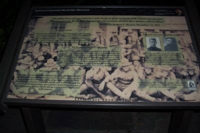
A memorial to the armed forces from the District of Columbia who served their country in the World War
This memorial was erected through the voluntary subscriptions of the people of Washington • It was dedicated on Armistice Day Nineteen . . . — — Map (db m211379) WM
Near East West Highway (Route 410) 0.3 miles west of 16th Street (Route 390), on the right when traveling east.
Original Federal Boundary Stone
District of Columbia
Placed 1791-1792
Protected by Maryland Chapter
Daughters of the American Revolution
1916 — — Map (db m154844) HM
On Eastern Avenue Northeast at Southern Avenue Northeast, on the left when traveling east on Eastern Avenue Northeast.
Original Federal Boundary Stone
District of Columbia
Placed 1791-1792
Protected by Dist. of Co. Chapter
Daughters of the American Revolution
1916 — — Map (db m190187) HM
On Eastern Avenue Northeast 0 miles south of Sheriff Road Northeast, on the left when traveling south.
Original Federal Boundary Stone
District of Columbia
Placed 1791-1792
Protected by Capt Molly Pitcher Chapter
Daughters of the American Revolution
1916 — — Map (db m154786) HM
On Eastern Avenue 0.1 miles north of Varnum Street, on the right when traveling north.
Original Federal Boundary Stone
District of Columbia
Placed 1791-1792
Protected by Constitution Chapter
Daughters of the American Revolution
1916 — — Map (db m154781) HM
On Southern Avenue south of Rail Street, on the right when traveling north.
Original Federal Boundary Stone
District of Columbia
Placed 1791-1792
Protected by Marcia Burns Chapter
Daughters of the American Revolution
1916 — — Map (db m154789) HM
On Eastern Avenue 0 miles north of Georgia Avenue, on the right when traveling north.
This plaque marks the site
of the
District of Columbia
North-East
Boundary Stone No. 1
originally placed here
1791 - 1792
Presented by
The Mary Washington Chapter
Daughters of the American Revolution
and
United States . . . — — Map (db m154777) HM
On Orren Street Northeast at Florida Avenue Northeast on Orren Street Northeast.
This fire station originally opened on December 29, 1925, as the newly organized Truck Company 13. Engine Company 10 (organized on July 2, 1895, located at 1341 Maryland Avenue, NE) moved to these quarters on June 4, 1940, joining Truck Company 13. . . . — — Map (db m119516) HM
Near New Hampshire Avenue Northwest just south of Georgia Avenue Northwest (U.S. 29), on the right when traveling south.
The facade of the original house for Engine Company 24 was located at 3702 Georgia Avenue, N.W. just north of this site. Built in 1911, the firehouse was designed by Luther Leisenring and Charles Gregg. It originally housed horses and horse-drawn . . . — — Map (db m149476) HM
PFC Will C. Barnes, USA • PVT Dennis Bell, USA • BGEN Daniel Butterfield, USA
CAPT Bernard A. Byrne, USA • MAJ Charles E. Capehart, USA • 1LT Benjamin H. Cheever, USA
SURG James R. Church, USA • SGT Benjamin F. McAlwee, USA • 1LT Robert M. . . . — — Map (db m237006) WM
Near 38th Street North 0.2 miles west of 37th Road North.
No. 2 Stone of N.W. Leg
Washington-Lee Society
Children of
The American Revolution
Thomas Nelson Chapter D.A.R.
October 12, 1969 — — Map (db m154765) HM
Near U Street Northwest west of Vermont Avenue Northwest, on the right when traveling east.
The first African Masonic order south of the Mason-Dixon line was founded in the District of Columbia in 1825. Social Lodge No. 7, as it was known, combined with two other lodges in 1848 to form the Union Grand Lodge. Later, the name was changed to . . . — — Map (db m33737) HM
On East Capitol Street Southeast east of 19th Street Southeast, on the right when traveling east.
The venerable UH-I “HUEY” helicopter was a beloved work horse for the District of Columbia Army National Guard, safely and reliably supporting the Nation’s Capital for over 40 years. With 2-4 crew members, HUEYs carried up to 6 litter patients . . . — — Map (db m73785) HM WM
On South Jefferson Street 0.1 miles south of Columbia Pike (Virginia Route 244), in the median.
The U.S. Government erected 40 sandstone markers on the boundaries of the District of Columbia in 1791 and 1792. The boundary survey was initiated by President George Washington and executed by Andrew Ellicott, who became Surveyor General of the . . . — — Map (db m172542) HM
Near Westwood Drive west of Wetherill Road, on the left when traveling west.
Original Federal Boundary Stone
District of Columbia
Placed 1791 - 1792
Protected by John Hall Chapter
Daughters of the American Revolution
1916 — — Map (db m154768) HM
On King Street (Virginia Route 7) 0.1 miles west of South Wakefield Street, on the right when traveling west.
Original Federal Boundary Stone
District of Columbia
Placed 1791-1792
Protected by Continental Chapter
Daughter of the American Revolution
1918
— — Map (db m154755) HM
On Indian Head Highway (Maryland Route 210) at Southern Avenue when traveling north on Indian Head Highway.
Original Federal
Boundary Stone Southeast 7
District of Columbia
Placed in 1791-1792
This plaque placed here on
the 222nd anniversary
of the founding of
Washington, DC
1790-2012 — — Map (db m154911) HM
On Eastern Avenue at 34th Street, on the right when traveling north on Eastern Avenue.
Original Federal Boundary Stone
District of Columbia
Placed 1791–1792
Protected by Livingston Manor Chapter
Daughters of the American Revolution
1916 — — Map (db m154782) HM
On Western Avenue east of Park Avenue, on the right when traveling west.
In 1790, Congress authorized the establishment of a territory 10 miles square on the Potomac River to be the Capital of the United States. It was President Washington's recommendation to use land on both sides of the river. Surveyor Andrew Ellicott, . . . — — Map (db m154770) HM
Placed in 1791-1792, this is one of forty Aquia Creek sandstone markers outlining the original boundaries of the Federal District as commissioned by President Washington. In 1916, The District of Columbia Daughters of the American Revolution . . . — — Map (db m154783) HM
On Russell Road near King Street & Callahan Drive, on the right when traveling north.
Original Federal Boundary Stone
District of Columbia
Placed 1791-1792
Protected by Mt. Vernon Chapter
Daughters of the American Revolution
1916 — — Map (db m154753) HM
On Payne Street at Wilkes Street, on the right when traveling north on Payne Street.
Original Federal Boundary Stone
District of Columbia
Placed 1791 - 1792
Protected by Mt. Vernon Chapter
Daughters of the American Revolution
1916 — — Map (db m154752) HM
On Thrift Road south of D Street Southeast, on the right when traveling north.
Original Federal Boundary Stone
District of Columbia
Placed 1791-1792
Protected by Sarah Franklin Chapter
Daughters of the American Revolution
1916 — — Map (db m154788) HM
On Eastern Avenue at New Hampshire Avenue Northeast, on the left when traveling south on Eastern Avenue.
Original Federal Boundary Stone
District of Columbia
Placed 1791-1792
Protected by Our Flag Chapter
Daughters of the American Revolution
1916 — — Map (db m154779) HM
On Eastern Avenue north of Sargent Road, on the right when traveling north.
Original Federal Boundary Stone
District of Columbia
Placed 1791-1792
Protected by Elizabeth Jackson Chapter
Daughters of the American Revolution
1916 — — Map (db m154780) HM
On North Van Buren Street at 18th Street North, on the left when traveling south on North Van Buren Street.
Original Federal Boundary Stone
District of Columbia 1791
Protected by
Falls Church Chapter, NSDAR
Dedication 1916 Rededication 1989 — — Map (db m154760) HM
On Capital Cresent Trail, on the right when traveling north.
Original Federal Boundary Stone
District of Columbia
Placed • 1791 • 1792
Protected by Columbia Chapter
Daughters of the American Revolution
July 12, 1915 — — Map (db m154767) HM
Original Federal Boundary Stone
District of Columbia
Placed - 1791 - 1792
Protected by the Margaret Whetten Chapter
Daughters of the American Revolution
1916 — — Map (db m154774) HM
On Southern Avenue south of 23rd Parkway, on the right when traveling north.
Original Federal Boundary Stone
District of Columbia
Placed 1791-1792
Protected by Louisa Adams Chapter
Daughters of the American Revolution
1916 — — Map (db m154927) HM
On South Walter Reed Drive, on the right when traveling west.
Original Federal Boundary
Stone 1921 - 1952
District of Columbia
Placed 1791-1792
Protected by Keystone Chapter
Daughters of the American Revolution — — Map (db m154756) HM
On King Street (Virginia Route 7) near Scroggins Road, on the right when traveling south.
Original Federal
Boundary Stone Southwest 3
District of Columbia
Placed 1791-1792
This plaque placed here on the 200th anniversary of the founding of the City of Washington D.C.
Placed here and protected by Colonel John Washington . . . — — Map (db m154929) HM
On Southern Avenue south of Wheeler Road, on the right when traveling north.
Original Federal Boundary Stone Southeast 6 District of Columbia 1791–1792 Plaque placed in 2014 by Martha Washington Chapter NSDAR Washington, DC — — Map (db m154793) HM
On Southern Avenue Southeast north of Suitland Terrace Southeast, on the right when traveling north.
Original Federal Boundary Stone
District of Columbia
Placed 1791-1792
Protected by Ruth Brewster Chapter
Daughters of the American Revolution
1916 — — Map (db m154790) HM
Near North Powhatan Street 0.2 miles north of North Rockingham Street, on the right when traveling north.
Original Federal Boundary Stone
District of Columbia
Placed - 1791 - 1792
Protected by Richard Arnold Chapter
Daughters of the American Revolution
1916 — — Map (db m154764) HM
Original Federal
Boundary Stone
District of Columbia
Place 1791 - 92
Protected by
Patriots' Memorial Chapter
Daughters of the
American Revolution
1965 — — Map (db m154771) HM
On Pennsylvania Avenue Northwest east of 14th Street Northwest, on the right when traveling east.
Governor, Territory of the District of Columbia (1873-1874)
Born Washington, D.C. January 31, 1835
Died Batopilas, Mexico, September 12, 1902
Buried Rock Creek Cemetery, Washington, D.C.
Civil War Union veteran, entrepreneur, civil leader . . . — — Map (db m65158) HM
Near Wilson Boulevard at Patrick Henry Drive, on the left when traveling west.
The U.S. Government erected 40 sandstone markers on the boundaries of the District of Columbia in 1791 and 1792. The boundary survey was initiated by President George Washington and executed by Andrew Ellicott, who became Surveyor General of the . . . — — Map (db m154759) HM
Near 15th Street Northwest north of Constitution Avenue Northwest (Route 50), on the left when traveling north.
To the original Patentees prior to 1700 whose land grants embrace the site of the Federal City. This Monument is erected by the National Society of the Daughters of the American Colonists, April 25, 1936. — — Map (db m241797) HM
On Sherier Place Northwest just south of Edmunds Place Northwest, on the right when traveling south.
Inhabitants
When Captain John Smith first sailed up the Potomac in 1608, he encountered several Native American villages on both sides of the river in what was later to become the District of Columbia. Various names have been assigned to . . . — — Map (db m144993) HM
On S Street Northwest at 22nd Street Northwest, on the right when traveling west on S Street Northwest.
Mitchell Park was the site of the two-story brick Holmead farmhouse built in 1795 by Anthony Holmead. The house remained in the hands of the Holmead descendants until the 20th century. In 1929 the house was razed by the German government which . . . — — Map (db m113372) HM
On East Capitol Street Northeast west of 4th Street Northeast, on the right when traveling west.
A Legacy Rooted in the Heart of Capitol Hill
The building at 326 East Capitol Street was constructed before 1857, originally owned by Dr. Samuel C. Busey and purchased by Louis Huber after the Civil War. The building was home to a diverse . . . — — Map (db m294013) HM
On Rhode Island Avenue Northeast (U.S. 1) east of 20th Street Northeast, on the right when traveling south.
Congregation began about 1722, when Catholics first attended mass at chapel within Queen family mansion, on site approximately at present Evarts Street, N.E., near 20th Street. Building came to be called Queen’s Chapel. Destroyed by fire three . . . — — Map (db m143950) HM
On South Dakota Avenue Northeast north of New Hampshire Avenue Northeast, on the right when traveling north.
The Legacy Memorial Park is dedicated to honor the nine lives lost on June 22, 2009 as a result of an unprecedented train collision. Designed collaboratively by Hunt Laudi Studio with sculptor Barbara Liotta and built through a partnership . . . — — Map (db m115359) HM
Near College Street Northwest east of 6th Street Northwest, on the right when traveling west.
In Recognition of
Sara Winifred Brown, M.D.
Her medical degree was awarded by Howard University in 1904. She served as the first female graduate trustee of Howard University, 1924-1948.
In 1910, she was one of the founders of the . . . — — Map (db m112010) HM
You are following a segment of the Potomac Heritage National Scenic Trail, an evolving network that includes the C&O Canal Towpath. An enterprise of many partners, the Trail celebrates the heritage of the Potomac and upper Ohio river basins and . . . — — Map (db m60568) HM
Near Mount Vernon Trail. Reported permanently removed.
In the distance is Jones Point, designated as the southern corner of the District of Columbia by President George Washington. In 1790 Congress established the nation’s capital with a ten-mile square of land ceded by Virginia and Maryland. . . . — — Map (db m303102) HM
On Bladensburg Road 0.2 miles south of 37th Street, on the left when traveling south.
Fort Lincoln Cemetery was chartered in 1912 by an act of the Maryland General Assembly and presently contains 178 acres.
Here, at Fort Lincoln Cemetery, masterworks of marble, granite and bronze stand in solemn dignity and provides a . . . — — Map (db m151234) HM
On Workhouse Way 0.1 miles north of Ox Road ( Route 123), on the right when traveling north.
The first 29 prisoners were housed in tents by the Occoquan River when they arrived from D.C. The first buildings were made of wood cut on the site and built by the prisoners. These gradually replaced during the 1920s by the buildings seen here . . . — — Map (db m145080) HM
On 20th Street Northwest at N Street Northwest, on the right when traveling north on 20th Street Northwest.
Myrtilla Miner (1815-1864), born near Brookfield, NY, was an idealistic white teacher who came to Washington to teach African Americans. In 1853, with funding from northern abolitionists, she paid $4,000 for a three-acre site at 20th and N . . . — — Map (db m89607) HM
On East Capitol Street Southeast west of 22nd Street Southeast, on the right when traveling east.
The F-16 became the D.C. Air National Guard alert duty aircraft on Sept. 11, 2001. For twelve years, this capable fighter has responded to more than 4,000 individual alert missions over the District of Columbia. The U.S. Air Force has flown the . . . — — Map (db m74097) HM WM
On Elmira Street Southwest 0.1 miles west of Martin Luther King Jr. Avenue Southwest, on the right when traveling west.
Slave states and Confederate sympathizers surrounded the District of Columbia when the Civil War broke out. Every road, bridge, and waterway leading into the capital needed defending. Union troops built a 37-mile-long circle of forts and trenches . . . — — Map (db m295018) HM
On Pennsylvania Avenue Northwest just west of 13 1/2 Street Northwest, on the right when traveling east.
The John A. Wilson Building is the headquarters of the local government that serves over 600,000 citizens who call the nation's capital their home. The Mayor and the 13-member Council, elected by the residents of the District of Columbia, . . . — — Map (db m218235) HM
On 14th Street Northwest at Corcoran Street Northwest, on the right when traveling north on 14th Street Northwest.
United States
Department of the Interior
National Park Service
National Register
of Historic Places
John Wesley A.M.E. Zion Church
"The National Church of Zion Methodism"
14th and Corcoran Streets, NW
Washington, . . . — — Map (db m110914) HM
On E Street Southeast just east of Potomac Avenue Southeast, on the right when traveling east.
Welcome to Congressional Cemetery, a place where American heritage comes to life every day.
There are about 65,000 people buried on these 35 acres, and about half of them are children. Historic Congressional Cemetery predates Arlington . . . — — Map (db m141882) HM
On Elmira Street Southwest at Martin Luther King Jr. Avenue Southwest, on the right when traveling west on Elmira Street Southwest. Reported permanently removed.
Earthworks of Fort Greble are visible beyond this exhibit. Fort Greble was named in honor of Lt. John T. Greble, slain at the Battle of Big Bethel, June 10, 1861, the first U.S. Military Academy graduate killed in the Civil War. — — Map (db m295019) HM
On District Square Southwest at Wharf Street Southwest, on the right when traveling west on District Square Southwest.
Originally constructed in 1809 as a mile-long wooden toll bridge connecting the District with Virginia, Long Bridge has seen many transformations and additions. In 1861, five days after the fall of Fort Sumpter, Robert E. Lee rode south on Long . . . — — Map (db m109421) HM
Near Fort Washington Road, on the right when traveling south.
Troubles with Britain caused Congress in 1807 to authorize an improved system of forts along the Atlantic Coast to guard harbors, rivers, and seaports. The first fort, Fort Warburton, was completed in 1809. Located near the river in front of the . . . — — Map (db m7980) HM
Near Jones Point Drive east of South Royal Street, on the right when traveling east.
In 1791, surveyors on Jones Point began to lay out the ten-mile square that would become Washington, D.C. The first marker for the survey—the south cornerstone—was set in place on this spot. Although the stone within this protective . . . — — Map (db m60162) HM
On Indiana Avenue Northwest east of 5th Street Northwest, on the right when traveling west.
witness
to the end of slavery
in the nation’s capital.
This imposing Greek Revival building was Washington’s first city hall, designed by George Hadfield and built between 1820 and 1850. It house the city court and an elected mayor . . . — — Map (db m29655) HM
On Jefferson Street, on the right when traveling west.
Marion Barry received his Master's Degree in Chemistry from Fisk University. While in Nashville, he became the first chairman of the Student Nonviolent Coordinating Committee (SNCC). He continued his civil rights activism in the South until 1965, . . . — — Map (db m209053) HM
On Chevy Chase Circle Northwest at Connecticut Avenue Northwest, in the median on Chevy Chase Circle Northwest.
Senator from Nevada
His statesmanship held true regard for the interests of all men
Founder of Chevy Chase
This fountain erected in 1933 authorized by Act of Congress — — Map (db m154285) HM
On Main Drive Northwest 0.2 miles east of 16th Street Northwest, on the left when traveling west.
Until the early 20th century, the Army largely relied on untrained civilian women for temporary medical care for the sick and wounded. Shortages in medical staff set the stage for greater involvement of women in Army medical care and made a . . . — — Map (db m143701) HM
Near Pennsylvania Avenue Northwest 0.1 miles east of 14th Street Northwest (U.S. 1). Reported permanently removed.
The John A. Wilson Building is the headquarters of the local government that serves the nearly 600,000 citizens who call the Nation's capital their home. The Mayor and the 13-member Council, elected by residents of the District of Columbia, . . . — — Map (db m65712) HM
Near 19th Street Northwest at H Street Northwest, on the left when traveling south.
This was the site of the Union Engine House, which served as the headquarters of The Association of the Oldest Inhabitants of the District of Columbia from July 7, 1911 until July 4, 1956. The building was later dismantled to make room for the . . . — — Map (db m87549) HM
On O Street Northwest west of 29th Street Northwest, on the right when traveling west.
Alfred Pope and his mother, Jedidah, moved from South Carolina and lived with Congressman John Carter at 3013 Q Street. Hannah worked as a lady's maid at Tudor Place. She was the daughter of Barbara Cole, whose family was enslaved to George . . . — — Map (db m234906) HM
On 33rd Street Northwest at N Street Northwest, on the left when traveling south on 33rd Street Northwest.
This tablet marks the last home of Stephen Bloomer Balch, D.D. An officer in the Revolution 1747-1833 To the youth under his academic guidance he gave military training and led them in active service. For fifty years he was a leader in the . . . — — Map (db m97760) HM
On Boylston Street at Boylston Place, on the left when traveling east on Boylston Street.
One of America's earliest native born (Boston) composers who greatly enhanced a musical awareness within the Colonies. By respected tradition, his final resting place is believed to be an unmarked grave within this area of the Common. Presented . . . — — Map (db m176196) HM
On Indiana Avenue Northwest east of 5th Street Northwest, on the right when traveling west.
This imposing, Greek Revival style structure was designed by George Hadfield as Washington's first City Hall/Courthouse. Throughout its history, the building has housed the local and federal courts for DC, presided over by judges appointed by . . . — — Map (db m58366) HM
Near Silver Street at 2nd Street (County Road 20), on the right when traveling north.
Colorado Stone Quarries, a subsidiary of the international Italian stone quarry corporation R.E.D. Graniti, extracted and donated this 2,300-lb. marble slab from the company's Colorado Yule Marble Quarry in Gunnison County. The slab is displayed at . . . — — Map (db m292298) HM
Near Allison Street Northwest east of 3rd Street Northwest, on the right when traveling west.
This plaque recognizes the designation of St. Paul's Episcopal Church (Rock Creek Parish) and its churchyard known as Rock Creek Cemetery, in the National Register of Historic Places.
Founded originally as a preaching mission, with first . . . — — Map (db m70947) HM
On Sherman Avenue Northwest just south of Euclid Street Northwest, on the right when traveling north.
Dedicated in memory of the first African American to serve the citizens of the District of Columbia as Fire Chief.
Chief Johnson was appointed to Engine Company #4 on January 16, 1943 and retired as Fire Chief of the department on March 1, . . . — — Map (db m142337) HM
Near Boundary Channel Drive. Reported permanently removed.
England's King Charles I granted the entire Potomac River to Maryland in 1632. Four centuries later Maryland, Virginia, and the District of Columbia were still arguing over their mutual boundary. Alexander's Island was one controversial site. It . . . — — Map (db m181396) HM
Near West Paces Ferry Road NW west of Slaton Drive NW, on the left when traveling west.
The Union Army used this cannon during the American Civil War, which was fought between 1861 and 1865. Called a siege cannon, it was too big and heavy to be used in most battles. Instead, it was used during sieges, which were lengthy assaults . . . — — Map (db m88227) HM
On E Street Southeast east of Potomac Avenue Southeast, on the right when traveling east.
This marker commemorates the men and women who achieved American independence. These Patriots, believing in the noble cause of liberty, fought valiantly to found a new nation.
1775 - 1783
Presented by
District of Columbia . . . — — Map (db m266032) WM
On Great Hill Road south of Long Hill Road, on the right when traveling south.
Mother of
Abraham Baldwin
Georgia signer of the U.S. Constitution
Born in N. Guilford Connecticut 1754
Died while serving as a U.S. Senator from Georgia in 1807
Buried in Rock Creek Cemetery Washington D.C.
Placed by the District of . . . — — Map (db m299082) HM
Near Nebraska Avenue Northwest south of Van Ness Street Northwest, on the right when traveling north.
In reverent memory
of
Alan Ogilvie Clephane
Elias Quereau Horton
Guy Wilkinson Stuart Castle
who willingly gave their lives
for their country in
the World War
This memorial is erected by
The Society of Colonial Wars . . . — — Map (db m130125) WM
On Pennsylvania Avenue Northwest (Alternate U.S. 1) at 4th Street Northwest, on the right when traveling west on Pennsylvania Avenue Northwest.
Site of the residence of John Marshall Chief Justice of the United States Plaque erected under the auspices of the Columbia Historical Society and the Bar Association of the District of Columbia.
[Inscription on wall below the marker . . . — — Map (db m58625) HM
On Kingman Island Trail east of Anacostia Riverwalk Trail, on the right when traveling east.
Wood Thrush
In 1967, the Wood Thrush, a medium-sized thrush with the posture of an American Robin, but a slightly smaller body, became the District of Columbia's official bird. Sexes are alike, and adults are a cinnamon-brown color on their . . . — — Map (db m237160) HM
On Fort Negley Boulevard 0.2 miles north of Chestnut Street, on the right when traveling north.
From October - December 1862, on this hill, black laborers helped the Union Army build Fort Negley. In November, blacks helped defend the unfinished fort against Confederate attack. During the Battle of Nashville (December 1864), nearly 13,000 black . . . — — Map (db m41483) HM
Near Battlefield Park Road 0.1 miles south of Picnic Road.
By November 1864, several thousand African American soldiers, designated as United States Colored Troops or USCT, held Fort Harrison and the nearby earthworks. Many of these men had survived the bloody combat at New Market Heights, Fort Gilmer, and . . . — — Map (db m164295) HM
On 44th Street Northwest just south of Reservoir Road Northwest, on the left when traveling north.
Welcome to Foxhall Village, one of Washington DC's most charming and distinctive residential neighborhoods. Construction of the English Tudor style homes began in 1925. To protect the architectural integrity of the neighborhood, the community . . . — — Map (db m187487) HM
On 10th Street Northeast just south of Franklin Street Northeast, on the left when traveling north.
This building, completed in 2004, is an addition to and renovation of an earlier school building constructed on this site in 1931. — — Map (db m197692) HM
575 entries matched your criteria. The first 100 are listed above. Next 100 ⊳
Thin black lines indicate changes in relevance. Between each pair of lines entries are ordered geographically but all have the same relevance.
* Inflectional forms of words are their plurals, singulars, and possessives as well as gramatical tenses and similar variations.
* A noise word is a word that has been deemed too common to index. “The,” “to,” and “then” are examples of noise words. You will find a full list on the Advanced Searches page, in the Rules and Options link of the Keyword Search.