By Richard Denney, February 4, 2021
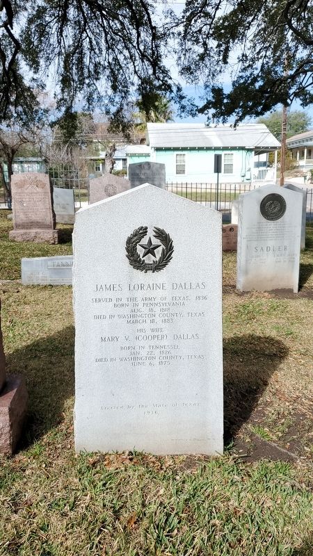
James Loraine Dallas Marker
RANKED BY RELEVANCE
| Near Navasota Street at Inks Avenue, on the right when traveling north. |
| Near Park Road 12 0.5 miles east of Farm to Market Road 1155. |
| On Congress Avenue just south of East 18th Street. |
| On Park Road 12, on the right when traveling west. |
| Near Boonville Road (Farm to Market Road 158) 0.1 miles east of Austins Colony Parkway. |
| On State Highway 14 0.5 miles north of County Highway 662, on the right when traveling north. |
| On Farm to Market Road 1603 at Rice Road on Route 1603. |
| Near Farm to Market Road 50 at Hood Hotel Road. |
| On County Route 203 at Peaceful Valley Road, on the right when traveling west on County Route 203. |
| Near Farm to Market Road 183 0.7 miles south of U.S. 84, on the left when traveling south. |
| Near Navasota Street at East 8th Street, on the right when traveling north. |
| On Waters Lane at Old Baylor College Road, on the left when traveling west on Waters Lane. |
| Near Park Road 12 0.5 miles east of Farm to Market Road 1155. |
| On West Buck Street south of South Main Street (Loop State Highway 83), on the right when traveling west. |
| On Farm to Market Road 1363 0.1 miles east of Front Street (County Highway 315), on the right when traveling west. |
| On East Main Street (Business U.S. 290), on the left when traveling west. |
| On Century Circle at Heritage Drive, on the left when traveling west on Century Circle. |
| On South Missouri Street just south of West High Street (State Route 8), on the right when traveling south. Reported missing. |
| Near Lt Billy Webb Avenue 0.1 miles north of Cook Street. Reported unreadable. |
| Near Bryan Street at East Cedar Avenue. |
| Near Avenue K west of 40th Street. |
| On South Main Street (U.S. 77) at East Richmond Street, on the right when traveling north on South Main Street. |
| Near MP Daniel Esplanade at South 5th Street, on the right when traveling north. |
| Near 27th Street at Wichita Street. |
| On Old Masonic Cemetery Road (County Highway 56) 0.1 miles north of Duprie Drive, on the right when traveling north. |
| On State Highway 36 south of Jungle Lane, on the right when traveling north. |
| On Farm to Market Road 1155 0.6 miles south of Farm to Market Road 2193, on the left when traveling north. |
| Near Buchanan Drive (State Highway 29) at Fort Croghan Drive. |
| On Ebenezer Cemetery Rd (County Road 714) 1 mile south of State Highway 7, on the right when traveling south. |
| On Ebenezer Cemetery Rd (County Road 714) 1 mile south of State Road 7, on the right when traveling south. |
| On Wesley Church Lane 0.4 miles south of Farm to Market Road 2502, on the left when traveling south. |
| On Market Street at South Elm Street, on the right when traveling east on Market Street. |
| On State Highway 7 at Ebenezer Church Road (County Highway 462), on the right when traveling east on State Highway 7. |
| On Century Circle at Heritage Drive, on the left when traveling west on Century Circle. |
| Near Poplar Street at Church Street, on the right when traveling east. |
| Near Park Road 12 1 mile Farm to Market Road 1155. |
| Near Park Road 12 5 miles east of 23400 Park Road 12. |
| Near Park Road 12 0.5 miles east of Farm to Market Road 1155. |
| Near Park Road 12 0.5 miles east of Farm to Market Road 1155. |
| Near Park Road 12 0.5 miles east of Farm to Market Road 1155. |
| On Farm to Market Road 2502 0.1 miles north of Farm to Market Road 332, on the right when traveling south. |
| On Farm to Market Road 539 0.2 miles south of Polly Lane, on the left when traveling north. |
| Near 2nd Street at Farm to Market Road 1458. |
| Near 2nd Street at Farm to Market Road 1458. |
| Near East 26th Street at North Washington Avenue, on the right when traveling west. |
| On West Buck Street at South Main Street (Loop State Highway 83), on the right when traveling west on West Buck Street. |
| Near North Street (Business U.S. 59) north of Griffith Boulevard, on the right when traveling north. |
| On Waul's Legion Road (County Road 51) 1 mile west of State Highway 36, on the left when traveling west. |
| On Old Baylor College Road at Waters Lane on Old Baylor College Road. |
| On W Buck Street at S Hill Street, on the right when traveling south on W Buck Street. |
| On West Buck Street at South Moore Street, on the right when traveling west on West Buck Street. |
| On County Highway 271 0.5 miles north of Farm to Market Road 60, on the right when traveling north. |
| Near Landa Park Drive at Monument Drive, on the right when traveling north. |
| Near Speight Avenue east of South 7th Street, on the left when traveling east. |
| On East 9th Street at Navasota Street, on the right when traveling west on East 9th Street. |
| On Boehenmann Road (County Highway 19) 1 mile west of Farm to Market Road 389, on the right when traveling west. |
| On Cottonwood Street at Botts Street, on the right when traveling north on Cottonwood Street. |
| On Crockett Street 0.1 miles east of Gay Hill Street, on the right when traveling west. |
| Near North Park Street at Davis Street. |
| On State Road 53 at Airville Road, on the left when traveling east on State Road 53. |
| On Loop State Highway 540 at South 4th Street, on the left when traveling west on State Highway 540. |
| On South Main Street (Loop State Highway 429) at West Buffington Avenue, on the left when traveling south on South Main Street. |
| On Church Street at Johnson Street, on the left when traveling north on Church Street. |
| On State Road 21 3.1 miles west of Old San Antonio Road, on the right when traveling east. |
| On North Memorial Street (State Highway 6) at East Frederick Street, on the left when traveling north on North Memorial Street. |
| On Rabon Chapel Road 0.4 miles west of South Pine Lake Road, on the left when traveling east. |
| On 124 near County Road 248, on the left when traveling north. |
| Near Locust Street at Main Street (Business U.S. 82). |
| On West Alamo Street at Joseph Street, on the left when traveling east on West Alamo Street. |
| On West High Street (Missouri Route 8) at South Missouri Street, on the right when traveling east on West High Street. |
| On Sempronius Road at Phillipsburg Church Road, on the left when traveling west on Sempronius Road. |
| Near North Front Street at East Shell Avenue. |
| On County Road 344 near Highway 3442, on the left when traveling west. |
| On Farm to Market Road 531 0.2 miles south of Alternate U.S. 77, on the left when traveling north. |
| On East Stone Street at South Market Street (Business U.S. 290), on the left when traveling east on East Stone Street. |
| On Crockett Street 0.1 miles east of Gay Hill Street, on the right when traveling west. |
| On West Third Street at South Day Street, on the left when traveling west on West Third Street. |
| On East Alamo Street (Business U.S. 290) at South Baylor Street, on the left when traveling east on East Alamo Street. |
| On East Main Street (Business U.S. 290) west of South Baylor Street, on the left when traveling west. |
| Near Farm to Market Road 50 at Hood Hotel Road. |
| On Flat Prairie Road (County Highway 112) 1 mile east of Farm to Market Road 2726, on the right when traveling east. |
| On Alexander Road 1 mile west of Farm to Market Road 974. |
| On County Highway 225 0.2 miles north of County Highway 208, on the left when traveling north. |
| On Thornberry Drive at 8th Street, on the right when traveling east on Thornberry Drive. |
| On 8th Street at Avenue L, on the right when traveling south on 8th Street. |
| On Farm to Market Road 1772 0.2 miles south of State Road 53, on the right when traveling south. |
| On Harbor View Boulevard at Tri City Beach Road, in the median on Harbor View Boulevard. |
| On Mt. Olive Street 0.1 miles south of State Highway 105, on the right when traveling east. |
| On Farm to Market Road 390 south of Longpoint Road, on the right when traveling west. |
| On Lakeview Parkway near Shoosmith Road, on the left when traveling north. |
| On Charles Street at Sumans Avenue, on the left when traveling west on Charles Street. |
| On Farm to Market Road 1094 at Swearingen Road, on the right when traveling west on Highway 1094. |
| Near Navasota Street near East 7th Street, on the right when traveling north. |
| On Main Street (Farm to Market Road 1155) north of Cedar Street, on the right when traveling south. |
| On Lee Highway (U.S. 11). |
| Near North Park Street at Davis Street. |
Thin black lines indicate changes in relevance. Between each pair of lines entries are ordered geographically but all have the same relevance.* Inflectional forms of words are their plurals, singulars, and possessives as well as gramatical tenses and similar variations.
Nov. 13, 2026
