94 entries match your criteria.
Historical Markers and War Memorials
in Greater Lincoln Region
By Cosmos Mariner, September 15, 2025
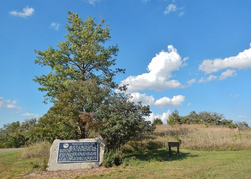
Prehistoric Burial Site Marker
1 ► Nebraska, Cass County, Ashland — 314 — Prehistoric Burial Site —  |
| Near Eugene T. Mahoney State Park Road 1.4 miles north of State Highway 66. | |||
| 2 ► Nebraska, Cass County, Elmwood — 41 — Bess Streeter Aldrich, 1881-1954 — |
| On East F Street at 5th Street (Local Route F St), on the left when traveling north on East F Street. | |||
| 3 ► Nebraska, Cass County, Plattsmouth — Blake Building — |
| On Main Street, on the right when traveling east. | |||
| 4 ► Nebraska, Cass County, Plattsmouth — Budweiser Building 1888 — |
| On Main Street, on the right when traveling east. | |||
| 5 ► Nebraska, Cass County, Plattsmouth — Cass County Courthouse — |
| Near Main Street, on the right when traveling west. | |||
| 6 ► Nebraska, Cass County, Plattsmouth — 242 — Company A – First Nebraska Volunteer Infantry — 1861-1866 — |
| On Main Street west of North 6th Street, on the right when traveling west. | |||
| 7 ► Nebraska, Cass County, Plattsmouth — Drew/Weckbach — |
| On Main Street, on the right when traveling east. | |||
| 8 ► Nebraska, Cass County, Plattsmouth — Excelsior Building — |
| On Main Street, on the right when traveling east. | |||
| 9 ► Nebraska, Cass County, Plattsmouth — Plattsmouth Bridge 1930 — |
| On Livingston Highway (U.S. 34), on the right when traveling east. | |||
| 10 ► Nebraska, Cass County, Plattsmouth — Vienna Bakery — |
| On Main Street, on the right when traveling east. | |||
| 11 ► Nebraska, Cass County, Plattsmouth — Wetenkamp Building — |
| On Main Street, on the right when traveling east. | |||
| 12 ► Nebraska, Cass County, Weeping Water — 118 — Weeping Water Academy — |
| On State Highway 50, on the left when traveling north. | |||
| 13 ► Nebraska, Lancaster County, Denton — 143 — Nebraska City-Fort Kearny Cutoff — |
| On 100 Street 0.3 miles south of West Saltillo Road, on the right when traveling north. | |||
| 14 ► Nebraska, Lancaster County, Lincoln — "America's Mission" — |
| Near 10th Street. | |||
| 15 ► Nebraska, Lancaster County, Lincoln — Abraham Lincoln — 1809 - 1865 — |
| On Pine Lake Road near South 30th Street. | |||
| 16 ► Nebraska, Lancaster County, Lincoln — Abraham Lincoln Memorial — Gettysburg Address — |
| On 14th Street at Lincoln Mall, on the right when traveling north on 14th Street. | |||
| 17 ► Nebraska, Lancaster County, Lincoln — Elaine Hammer Bridge — North 27th Street — Project Information • Funding — |
| On 27th Street north of W Street, on the right when traveling north. | |||
| 18 ► Nebraska, Lancaster County, Lincoln — 20 — Fairview — Home of William Jennings Bryan — |
| On Sumner Street west of South 50th Street, on the right when traveling west. | |||
| 19 ► Nebraska, Lancaster County, Lincoln — George Washington — 1732 - 1799 — |
| On Pine Lake Road near South 30th Street. | |||
| 20 ► Nebraska, Lancaster County, Lincoln — Institute of Agriculture and Natural Resources — |
| Near East Campus Loop. | |||
| 21 ► Nebraska, Lancaster County, Lincoln — 376 — Lincoln Army Air Field / Lincoln Air Force Base — |
| Near NW 44th St at W. Cuming St. | |||
| 22 ► Nebraska, Lancaster County, Lincoln — Mammuthus Columbi — |
| On Vine Street, on the right when traveling east. | |||
| 23 ► Nebraska, Lancaster County, Lincoln — Missouri Pacific History — |
| On 27th Street south of Y Street, on the right when traveling south. | |||
| 24 ► Nebraska, Lancaster County, Lincoln — Mueller Tower at University of Nebraska-Lincoln — |
| On Vine Street, on the right when traveling east. | |||
| 25 ► Nebraska, Lancaster County, Lincoln — Neighborhood History — |
| On 27th Street north of W Street, on the left when traveling north. | |||
| 26 ► Nebraska, Lancaster County, Lincoln — Osborne Athletic Complex — |
| Near Stadium Drive. | |||
| 27 ► Nebraska, Lancaster County, Lincoln — Paul A. "Doc" Downs — 1891 - 1979 — |
| On East Campus Loop, on the right when traveling west on East Campus Loop. | |||
| 28 ► Nebraska, Lancaster County, Lincoln — 290 — Pershing Rifles — |
| On Vine Street at 14th Street, on the right when traveling west on Vine Street. | |||
| 29 ► Nebraska, Lancaster County, Lincoln — RHO Chapter House — Kappa Alpha Theta — "The first Greek letter fraternity known among women." — |
| On North 16th Street just south of S Street, on the right when traveling south. | |||
| 30 ► Nebraska, Lancaster County, Lincoln — Ronald Reagan — 1911 - 2004 — |
| On Pine Lake Road near South 30th Street. | |||
| 31 ► Nebraska, Lancaster County, Lincoln — 231 — The Lewis-Syford House — |
| On North 16th Street at U Street, on the right when traveling north on North 16th Street. | |||
| 32 ► Nebraska, Lancaster County, Lincoln — 436 — The Nebraska State Historical Society — |
| On R. Street just west of 16th Street, on the right when traveling west. | |||
| 33 ► Nebraska, Lancaster County, Lincoln — 72 — The University of Nebraska — |
| Near R Street near North 12th Street. | |||
| 34 ► Nebraska, Lancaster County, Lincoln — Thomas Jefferson — 1743 - 1826 — |
| On Pine Lake Road near South 30th Street. | |||
| 35 ► Nebraska, Lancaster County, Lincoln, Arnold Heights — Lincoln Army Air Field Regimental Chapel — |
| Near NW 48th Street at W. Douglas Street. | |||
| 36 ► Nebraska, Lancaster County, Lincoln, Downtown — Artesian Well Fountain — |
| Near East O Street (U.S. 34) at North 10th Street, on the left when traveling east. | |||
| 37 ► Nebraska, Lancaster County, Lincoln, Downtown — Beatrice Creamery Building — 1890 / 1904 — |
| On P Street at North 7th Street, on the right when traveling east on P Street. | |||
| 38 ► Nebraska, Lancaster County, Lincoln, Downtown — Chief Standing Bear — Justice Administration Building — |
| On South 14th Street just south of K Street, on the right when traveling south. | |||
| 39 ► Nebraska, Lancaster County, Lincoln, Downtown — Chief Standing Bear — |
| On South 14th Street just south of K Street, on the right when traveling south. | |||
| 40 ► Nebraska, Lancaster County, Lincoln, Downtown — 105 — County - City Building — Lincoln, Lancaster County, Nebraska — |
| On S. 10th Street. | |||
| 41 ► Nebraska, Lancaster County, Lincoln, Downtown — H. P. Lau Building — 1904 (corner building); Cox & Schoentgen, architect — 1906 (west annex); architect unknown — |
| On Q Street at North 8th Street, on the right when traveling east on Q Street. | |||
| 42 ► Nebraska, Lancaster County, Lincoln, Downtown — Hardy Building — 1919-20 / 1927 — |
| On North 8th Street just south of R Street, on the right when traveling south. | |||
| 43 ► Nebraska, Lancaster County, Lincoln, Downtown — Harpham Building — 1903/1912 — |
| On P Street near North 8th Street, on the right when traveling west. | |||
| 44 ► Nebraska, Lancaster County, Lincoln, Downtown — Historic Haymarket District — |
| Near North 7th Street at P Street, on the right when traveling south. | |||
| 45 ► Nebraska, Lancaster County, Lincoln, Downtown — Huber Building — 801 Q Street — 1901 — |
| On Q Street at North 8th Street, on the right when traveling east on Q Street. | |||
| 46 ► Nebraska, Lancaster County, Lincoln, Downtown — Humane Society Fountain — Refreshment for Dog, Horse and Human… — |
| On Q Street at North 7th Street, on the right when traveling west on Q Street. | |||
| 47 ► Nebraska, Lancaster County, Lincoln, Downtown — Lincoln Drug Company Building — 1905;Fiske & Dieman, architec — 1919 (top story); Fiske & Meginnis — |
| On North 8th Street at P Street, on the right when traveling east on North 8th Street. | |||
| 48 ► Nebraska, Lancaster County, Lincoln, Downtown — Lincoln Fixture Building — 1922 — Fiske & Meginnis, architect — |
| On P Street at North 9th Street, on the right when traveling west on P Street. | |||
| 49 ► Nebraska, Lancaster County, Lincoln, Downtown — Lincoln Hide & Fur Building — 1909 — |
| On Q Street at North 7th Street, on the right when traveling west on Q Street. | |||
| 50 ► Nebraska, Lancaster County, Lincoln, Downtown — Lincoln Station — 1927; W.T. Krausch, engineer — |
| On North 7th Street at P Street, on the right when traveling south on North 7th Street. | |||
| 51 ► Nebraska, Lancaster County, Lincoln, Downtown — 254 — Lincoln's Founding Block — |
| On Q Street west of 10th Street (U.S. 34), on the left when traveling west. | |||
| 52 ► Nebraska, Lancaster County, Lincoln, Downtown — 541 — Mari Sandoz in Lincoln — |
| On Lincoln Mall east of South 12th Street, on the right when traveling west. | |||
| 53 ► Nebraska, Lancaster County, Lincoln, Downtown — 90 — Nebraska Statehood Memorial — |
| On H Street just east of 16th Street. | |||
| 54 ► Nebraska, Lancaster County, Lincoln, Downtown — Old Woods Bros. Companies Building — 1914 — |
| On P Street at North 7th Street, on the right when traveling east on P Street. | |||
| 55 ► Nebraska, Lancaster County, Lincoln, Downtown — Original Site of St. Paul Methodist Church — 1867 — |
| On 10th Street (U.S. 34) at Q Street, on the left when traveling north on 10th Street. | |||
| 56 ► Nebraska, Lancaster County, Lincoln, Downtown — Rediscovering The Rear Wing — |
| Near H Street at South 17th Street. | |||
| 57 ► Nebraska, Lancaster County, Lincoln, Downtown — Ridnour Building — 1925 — |
| On P Street 0.1 miles east of North 8th Street, on the right when traveling east. | |||
| 58 ► Nebraska, Lancaster County, Lincoln, Downtown — Salvation Army Building — 749 P Street — 1966 — |
| On North 8th Street near P Street. | |||
| 59 ► Nebraska, Lancaster County, Lincoln, Downtown — Seaton and Lea Ironworks — 301 North 8th Street — 1881 — |
| On Q Street at North 8th Street, on the right when traveling east on Q Street. | |||
| 60 ► Nebraska, Lancaster County, Lincoln, Downtown — Site of Holy Trinity Church — |
| On Lincoln Mall east of South 12th Street, on the right when traveling west. | |||
| 61 ► Nebraska, Lancaster County, Lincoln, Downtown — Stacy Brothers Building — 1912 — F.C. Fiske, architect — |
| On P Street at North 8th Street on P Street. | |||
| 62 ► Nebraska, Lancaster County, Lincoln, Downtown — 253 — The Ferguson House — |
| On South 16th Street at H Street on South 16th Street. | |||
| 63 ► Nebraska, Lancaster County, Lincoln, Downtown — The James Imhoff Family Residence — |
| Near South 12th Street at Lincoln Mall, on the right when traveling north. | |||
| 64 ► Nebraska, Lancaster County, Lincoln, Downtown — The Nebraska Governor's Residence — Nebraska Historic Site — |
| On H Street. | |||
| 65 ► Nebraska, Lancaster County, Lincoln, Downtown — The Protecting Hand Sculpture — |
| On K Street west of South 16th Street, on the left when traveling east. | |||
| 66 ► Nebraska, Lancaster County, Lincoln, Downtown — 441 — U.S. Post Office and Courthouse (Old City Hall) — |
| On O Street (U.S. 34) west of 10th Street, on the right when traveling west. | |||
| 67 ► Nebraska, Lancaster County, Lincoln, Downtown — Veith Building — 1884 — |
| On P Street near North 8th Street, on the right when traveling west. | |||
| 68 ► Nebraska, Lancaster County, Lincoln, Near South — Roses For Lincoln — |
| On South 27th Street at C Street, on the right when traveling north on South 27th Street. | |||
| 69 ► Nebraska, Lancaster County, Raymond — 432 — Crounse — |
| Near West Branched Oak Road 0.5 miles east of North 126th Street, on the right when traveling east. | |||
| 70 ► Nebraska, Saunders County, Ashland — In Honor Of John McBride Belnap — |
| On Silver Street at North 10th Street, on the right when traveling west on Silver Street. | |||
| 71 ► Nebraska, Saunders County, Ashland — Native Americans in the Lower Platte Valley — |
| On the Westbound Rest Stop (Interstate 80 at milepost 431), on the right when traveling west. | |||
| 72 ► Nebraska, Saunders County, Ashland — Platte River — |
| Near Interstate 80 at milepost 425, on the right when traveling east. | |||
| 73 ► Nebraska, Saunders County, Ashland — 219 — The Ox-Bow Trail — |
| On U.S. 6 at Silver Street, on the right when traveling east on U.S. 6. | |||
| 74 ► Nebraska, Saunders County, Ashland, Ashland Township — The Mormon Pioneer Trail — A Fork In The Road — |
| On Silver Street, on the right when traveling north. | |||
| 75 ► Nebraska, Saunders County, Mead — 459 — Atlas D Missile Site A-1 — |
| On County Road 10 at County Road J, on the left when traveling north on County Road 10. | |||
| 76 ► Nebraska, Saunders County, Mead — 460 — Atlas D Missile Site A-1 — |
| Near County Road J just east of County Road 8, on the right when traveling east. | |||
| 77 ► Nebraska, Saunders County, Memphis — 409 — The Armour and Company Icehouse — |
| On State Highway 63. | |||
| 78 ► Nebraska, Saunders County, Wahoo — 82 — Saunders County — |
| On North Chestnut Street (U.S. 30A&77) south of West 5th Street, on the right when traveling south. | |||
| 79 ► Nebraska, Saunders County, Wahoo — U.S.S. Wahoo SS 238 — |
| On N. Chestnut St. | |||
| 80 ► Nebraska, Saunders County, Wahoo — USS Wahoo SS238 — |
| On Chestnut Street south of West 5th Street. | |||
| 81 ► Nebraska, Saunders County, Yutan — 353 — The Yutan Oto Indian Village — |
| On County Road M (State Highway 92) just west of 2nd Street (Yutan Road), on the right when traveling west. | |||
| 82 ► Nebraska, Seward County, Beaver Crossing — 363 — Beaver Crossing, Nebraska — |
| On Elk Street, on the left when traveling east. | |||
| 83 ► Nebraska, Seward County, Beaver Crossing — 394 — The Beaver Crossing Mill — |
| Near Elk Street. | |||
| 84 ► Nebraska, Seward County, Milford — Farming in Nebraska — |
| Near Interstate 80 at milepost 381, 2 miles east of Exit 379 (State Highway 15), on the right when traveling east. | |||
| 85 ► Nebraska, Seward County, Milford — 454 — Historic Milford — |
| On B Street at 2nd Street, on the right when traveling south on B Street. | |||
| 86 ► Nebraska, Seward County, Milford — Purple Heart Trail — Freedom is not free — |
| On I-80 Rest Stop. | |||
| 87 ► Nebraska, Seward County, Milford — 535 — Standing Bear and the Ponca Tribe — |
| Near Interstate 80 at milepost 381, 2 miles east of Exit 379 (State Highway 15), on the right when traveling east. | |||
| 88 ► Nebraska, Seward County, Milford — 179 — Tall Grass Prairie — |
| On I-80 Rest Stop. | |||
| 89 ► Nebraska, Seward County, Milford — 180 — The Big Blue River — |
| Near Interstate 80 at milepost 380.5, on the right when traveling east. | |||
| 90 ► Nebraska, Seward County, Seward — Big Blue River, Seward — March 14, 2019 — |
| On McKelvie Road (U.S. 34) 0.1 miles west of Crooked Mile Road, on the left when traveling west. | |||
| 91 ► Nebraska, Seward County, Seward — 421 — Plum Creek Prairie Historic Site — |
| On U.S. 34 0.1 miles west of Crooked Mile Road, on the right when traveling east. | |||
| 92 ► Nebraska, Seward County, Seward — 221 — Seward, 4th of July City — |
| On U.S. 34 at South 6th Street, on the left when traveling east on U.S. 34. | |||
| 93 ► Nebraska, Seward County, Seward — William Henry Seward / Artists David and Judith Rubin — 1801-1872 — |
| Near Seward Street at South 6th Street (Nebraska Route 15), on the right when traveling east. | |||
| 94 ► Nebraska, Seward County, Seward — Worlds Largest Time Capsule and Pyramid — |
| On Hillcrest Drive west of North Third Street, on the right when traveling east. | |||