575 entries match your criteria. The first 100 are listed. ⊳
Entries Containing the Phrase «district of columbia»
The following noise* word you entered was ignored: of.
If this word is required for a successful search, go to the Advanced Searches page and use the Google Search from there.
► Are you looking for a list of all entries in a place called District Of Columbia? Or in a state or province called District Of Columbia?
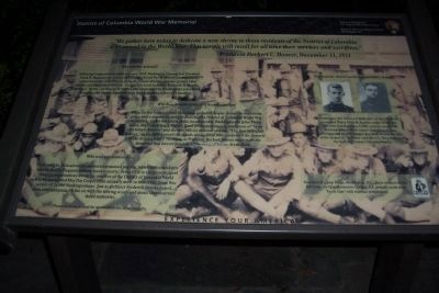
By Richard E. Miller, July 1, 2008
District of Columbia World War Memorial Marker, Panel 2
RANKED BY RELEVANCE
| 1 ► District of Columbia, Washington, Southwest Washington, The National Mall — District of Columbia World War Memorial — National Park Service, U.S. Department of the Interior — National Mall & Memorial Parks |
| On Independence Avenue Southwest west of 17th Street Southwest, on the right when traveling west. Reported permanently removed. | |||
2 ► District of Columbia, Washington, Southwest Washington, The National Mall — District of Columbia War Memorial —  |
| On Independence Avenue Southwest east of West Basin Drive Southwest, on the right when traveling west. | |||
| 3 ► Maryland, Montgomery County, Silver Spring, Woodside — Original Federal Boundary Stone, District of Columbia, North Cornerstone — |
| Near East West Highway (Route 410) 0.3 miles west of 16th Street (Route 390), on the right when traveling east. | |||
| 4 ► District of Columbia, Washington, Northeast Washington, East Corner — Original Federal Boundary Stone, District of Columbia, East Cornerstone — |
| On Eastern Avenue Northeast at Southern Avenue Northeast, on the left when traveling east on Eastern Avenue Northeast. | |||
| 5 ► Maryland, Prince George's County, Fairmount Heights — Original Federal Boundary Stone, District of Columbia, Northeast 9 — |
| On Eastern Avenue Northeast 0 miles south of Sheriff Road Northeast, on the left when traveling south. | |||
| 6 ► Maryland, Prince George's County, Mount Rainier — Original Federal Boundary Stone, District of Columbia, Northeast 5 — |
| On Eastern Avenue 0.1 miles north of Varnum Street, on the right when traveling north. | |||
| 7 ► Maryland, Prince George's County, Capitol Heights — Original Federal Boundary Stone, District of Columbia, Southeast 2 — |
| On Southern Avenue south of Rail Street, on the right when traveling north. | |||
| 8 ► Virginia, Arlington County, Arlington, East Falls Church — Original Federal Boundary Stone, District of Columbia, West Cornerstone — |
| On North Arizona Street when traveling north. | |||
| 9 ► District of Columbia, Washington, Southwest Washington, The National Mall — District of Columbia War Memorial — National Mall and Memorial Parks — National Park Service, U.S. Department of the Interior — |
| On Independence Avenue Southwest west of 17th Street Southwest, on the right when traveling west. | |||
| 10 ► Maryland, Montgomery County, Silver Spring, Downtown Silver Spring — Original Federal Boundary Stone, District of Columbia, Northeast 1 — |
| On Eastern Avenue 0 miles north of Georgia Avenue, on the right when traveling north. | |||
| 11 ► District of Columbia, Washington, Northeast Washington, Trinidad — District of Columbia Fire Department — Engine Company 10, Truck Company 13, Ambulance 10 — |
| On Orren Street Northeast at Florida Avenue Northeast on Orren Street Northeast. | |||
| 12 ► District of Columbia, Washington, Northwest Washington, 16th Street Heights — The Former Engine Co 24 of the District of Columbia Fire Department — |
| Near New Hampshire Avenue Northwest just south of Georgia Avenue Northwest (U.S. 29), on the right when traveling south. | |||
| 13 ► Maryland, Prince George's County, Forest Heights — Original Federal Boundary Stone, District of Columbia, Southeast 8 — |
| Near no nearby street. | |||
| 14 ► Pennsylvania, Chester County, Phoenixville — District of Columbia Medal of Honor Recipients — |
| Near Valley Forge Road. | |||
| 15 ► Virginia, Fairfax County, McLean — NW2 — Original Federal Boundary Stone, District of Columbia, Northwest 2 — |
| Near 38th Street North 0.2 miles west of 37th Road North. | |||
| 16 ► District of Columbia, Washington, Northwest Washington, U Street Corridor — Most Worshipful Prince Hall Grand Lodge of the District of Columbia — 1000 U Street, NW — African American Heritage Trail, Washington DC — |
| Near U Street Northwest west of Vermont Avenue Northwest, on the right when traveling east. | |||
| 17 ► District of Columbia, Washington, Southeast Washington, Barney Circle — UH-IV Iroquois — Army National Guard — District of Columbia Armory — |
| On East Capitol Street Southeast east of 19th Street Southeast, on the right when traveling east. | |||
| 18 ► Virginia, Arlington County, Arlington, Columbia Forest — Original Federal Boundary Stone, District of Columbia, Southwest 6 — Southwest No. 6 Boundary Marker — |
| On South Jefferson Street 0.1 miles south of Columbia Pike (Virginia Route 244), in the median. | |||
| 19 ► District of Columbia, Washington, Northwest Washington, Judiciary Square — Old City Hall and District of Columbia Court House — |
| On Indiana Avenue Northwest west of 4th Street Northwest, on the right when traveling west. | |||
| 20 ► Maryland, Montgomery County, Bethesda — NW5 — Original Federal Boundary Stone, District of Columbia, Northwest 5 — |
| Near Westwood Drive west of Wetherill Road, on the left when traveling west. | |||
| 21 ► Virginia, Arlington County, Arlington, Shirlington — SW4 — Original Federal Boundary Stone, District of Columbia, Southwest 4 — |
| On King Street (Virginia Route 7) 0.1 miles west of South Wakefield Street, on the right when traveling west. | |||
| 22 ► Maryland, Prince George's County, Glassmanor — Original Federal Boundary Stone, District of Columbia, Southeast 7 — |
| On Indian Head Highway (Maryland Route 210) at Southern Avenue when traveling north on Indian Head Highway. | |||
| 23 ► Virginia, Alexandria, Old Town — Original Federal Boundary Stone, District of Columbia, South Cornerstone — District of Columbia |
| Near Jones Point Drive east of South Royal Street, on the right when traveling east. Reported permanently removed. | |||
| 24 ► Virginia, Arlington County, Arlington, Boulevard Manor — Original Federal Boundary Stone, District of Columbia, Southwest 8 — |
| Near Patrick Henry Drive north of Willston Drive, on the left when traveling north. | |||
| 25 ► Maryland, Prince George's County, Mount Rainier — Original Federal Boundary Stone, District of Columbia, Northeast 6 — |
| On Eastern Avenue at 34th Street, on the right when traveling north on Eastern Avenue. | |||
| 26 ► District of Columbia, Washington, Southwest Washington, Bellevue — Original Federal Boundary Stone, District of Columbia, Southeast 9 — |
| Near Kenilworth Avenue Freeway. | |||
| 27 ► Maryland, Montgomery County, Bethesda — The District of Columbia Boundary Stones — [Original Federal Boundary Stone, District of Columbia, Northwest 6] — |
| On Western Avenue east of Park Avenue, on the right when traveling west. | |||
| 28 ► Maryland, Prince George's County, Capitol Heights — Original Federal Boundary Stone, District of Columbia, Northeast 8 — |
| Near Kenilworth Avenue NE 0.1 miles north of Kenilworth Avenue NE, on the right when traveling north. | |||
| 29 ► Maryland, Prince George's County, Temple Hills — Original Federal Boundary Stone, District of Columbia, Southeast 4 — |
| On Southern Avenue 0.1 miles south of Naylor Road SE (State Route 637), on the right when traveling north. | |||
| 30 ► Maryland, Prince George's County, Brentwood — Original Federal Boundary Stone, District of Columbia, Northeast 7 — |
| Near Fort Lincoln Drive Northeast. | |||
| 31 ► Virginia, Alexandria, Potomac West — Original Federal Boundary Stone, District of Columbia, Southwest 2 — |
| On Russell Road near King Street & Callahan Drive, on the right when traveling north. | |||
| 32 ► Virginia, Alexandria, Southwest Quadrant — Original Federal Boundary Stone, District of Columbia, Southwest 1 — |
| On Payne Street at Wilkes Street, on the right when traveling north on Payne Street. | |||
| 33 ► Maryland, Prince George's County, Capitol Heights — Original Federal Boundary Stone, District of Columbia, Southeast 1 — |
| On Thrift Road south of D Street Southeast, on the right when traveling north. | |||
| 34 ► District of Columbia, Washington, Northwest Washington, Takoma — Original Federal Boundary Stone — District of Columbia — Northeast 2 — |
| On Maple Avenue just north of Carroll Street, NW, on the left when traveling north. | |||
| 35 ► Maryland, Prince George's County, Chillum — Original Federal Boundary Stone, District of Columbia, Northeast 3 — |
| On Eastern Avenue at New Hampshire Avenue Northeast, on the left when traveling south on Eastern Avenue. | |||
| 36 ► Maryland, Prince George's County, Chillum — Original Federal Boundary Stone, District of Columbia, Northeast 4 — |
| On Eastern Avenue north of Sargent Road, on the right when traveling north. | |||
| 37 ► Virginia, Arlington County, Arlington, East Falls Church — Original Federal Boundary Stone, District of Columbia, Southwest 9 — |
| On North Van Buren Street at 18th Street North, on the left when traveling south on North Van Buren Street. | |||
| 38 ► Maryland, Montgomery County, Bethesda, Brookmont — Original Federal Boundary Stone, District of Columbia, Northwest 4 — |
| On Capital Cresent Trail, on the right when traveling north. | |||
| 39 ► Maryland, Montgomery County, Chevy Chase — Original Federal Boundary Stone, District of Columbia, Northwest 9 — |
| Near Daniel Road at Western Avenue. | |||
| 40 ► Maryland, Prince George's County, Temple Hills — SE5 — Original Federal Boundary Stone, District of Columbia, Southeast 5 — |
| On Southern Avenue south of 23rd Parkway, on the right when traveling north. | |||
| 41 ► Virginia, Arlington County, Arlington, Claremont — Original Federal Boundary Stone, District of Columbia, Southwest 5 — |
| On South Walter Reed Drive, on the right when traveling west. | |||
| 42 ► Virginia, Alexandria, Taylor Run — Original Federal Boundary Stone, District of Columbia, Southwest 3 — |
| On King Street (Virginia Route 7) near Scroggins Road, on the right when traveling south. | |||
| 43 ► Maryland, Montgomery County, Chevy Chase — Original Federal Boundary Stone, District of Columbia, Northwest 8 — |
| On Pinehurst Circle 0.1 miles north of Western Avenue when traveling west. | |||
| 44 ► Maryland, Prince George's County, Temple Hills — Original Federal Boundary Stone, District of Columbia, Southeast 6 — |
| On Southern Avenue south of Wheeler Road, on the right when traveling north. | |||
| 45 ► Maryland, Prince George's County, Forest Hills — Original Federal Boundary Stone, District of Columbia, Southeast 3 — |
| On Southern Avenue Southeast north of Suitland Terrace Southeast, on the right when traveling north. | |||
| 46 ► Virginia, Fairfax County, McLean — Original Federal Boundary Stone, District of Columbia, Northwest 3 — |
| Near North Tazewell Street north of 40th Street North, on the right when traveling north. | |||
| 47 ► Virginia, Arlington County, Arlington, Williamsburg — Original Federal Boundary Stone, District of Columbia, Northwest 1 — |
| Near North Powhatan Street 0.2 miles north of North Rockingham Street, on the right when traveling north. | |||
| 48 ► Maryland, Montgomery County, Chevy Chase — Original Federal Boundary Stone, District of Columbia, Northwest 7 — |
| Near Western Avenue at Cedar Parkway. | |||
| 49 ► District of Columbia, Washington, Northwest Washington, Federal Triangle — Alexander Robey Shepherd — |
| On Pennsylvania Avenue Northwest east of 14th Street Northwest, on the right when traveling east. | |||
| 50 ► Virginia, Arlington County, Arlington, Glencarlyn — Original Federal Boundary Stone, District of Columbia, Southwest 7 — Arlington County Virginia Bicentennial 1801-2001 — 200 Years of Community — |
| Near 5th Road South (Virginia Route 714) at Olds Drive. | |||
| 51 ► Virginia, Arlington County, Arlington, Boulevard Manor — Southwest No. 8 Boundary Marker — [Original Federal Boundary Stone, District of Columbia, Southwest 8] — |
| Near Wilson Boulevard at Patrick Henry Drive, on the left when traveling west. | |||
| 52 ► District of Columbia, Washington, Northwest Washington, The Ellipse — Original Patentees Memorial — Settlers of the District of Columbia Memorial — |
| Near 15th Street Northwest north of Constitution Avenue Northwest (Route 50), on the left when traveling north. | |||
| 53 ► District of Columbia, Washington, Northwest Washington, The Palisades — Palisades Recreation Center — District of Columbia Parks & Recreation — |
| On Sherier Place Northwest just south of Edmunds Place Northwest, on the right when traveling south. | |||
| 54 ► District of Columbia, Washington, Northwest Washington, Sheridan-Kalorama — Anthony Holmead Site — National Register of Historic Places — District of Columbia Landmark — |
| On S Street Northwest at 22nd Street Northwest, on the right when traveling west on S Street Northwest. | |||
| 55 ► District of Columbia, Washington, Northeast Washington, Capitol Hill — Grubb's Pharmacy — The Oldest Operating Pharmacy in the District of Columbia 326 E. Capitol Street, NE — Est. 1867 — |
| On East Capitol Street Northeast west of 4th Street Northeast, on the right when traveling west. | |||
| 56 ► District of Columbia, Washington, Northeast Washington, Langdon — St. Francis de Sales Church — Catholic Church with Oldest Continuing Congregation in District of Columbia — |
| On Rhode Island Avenue Northeast (U.S. 1) east of 20th Street Northeast, on the right when traveling south. | |||
| 57 ► District of Columbia, Washington, Northeast Washington, Riggs Park — Legacy Memorial Park — District of Columbia Parks & Recreation — |
| On South Dakota Avenue Northeast north of New Hampshire Avenue Northeast, on the right when traveling north. | |||
| 58 ► District of Columbia, Washington, Northwest Washington, Pleasant Plains — Sara Winifred Brown, M.D. — The National Association of University Women — Incorporated 1924, District of Columbia — |
| Near College Street Northwest east of 6th Street Northwest, on the right when traveling west. | |||
| 59 ► Maryland, Washington County, Williamsport — Connecting People and Places — Potomac Heritage National Scenic Trail — District of Columbia, Maryland, Pennsylvania, Virginia |
| On West Potomac Street. Reported missing. | |||
| 60 ► Virginia, Fairfax County, Alexandria, Belle View — Historic Jones Point — Mount Vernon Trail — George Washington Memorial Parkway, National Park Service |
| Near Mount Vernon Trail. Reported permanently removed. | |||
| 61 ► Maryland, Prince George's County, Colmar Manor — Historic Fort Lincoln Cemetery — |
| On Bladensburg Road 0.2 miles south of 37th Street, on the left when traveling south. | |||
| 62 ► Virginia, Fairfax County, Lorton — Prisoners at the Workhouse — Workhouse Prison Museum at Lorton — |
| On Workhouse Way 0.1 miles north of Ox Road ( Route 123), on the right when traveling north. | |||
| 63 ► District of Columbia, Washington, Northwest Washington, Dupont Circle — 326 — Myrtilla Miner — Dupont Circle — Diverse Visions | One Neighborhood — |
| On 20th Street Northwest at N Street Northwest, on the right when traveling north on 20th Street Northwest. | |||
| 64 ► District of Columbia, Washington, Southeast Washington, Barney Circle — The Fighting Falcon — [113 Wing, D.C. Air National Guard] — |
| On East Capitol Street Southeast west of 22nd Street Southeast, on the right when traveling east. | |||
| 65 ► District of Columbia, Washington, Southwest Washington, Bellevue — Defending the Capital — Fort Greble — Civil War Defenses of Washington — |
| On Elmira Street Southwest 0.1 miles west of Martin Luther King Jr. Avenue Southwest, on the right when traveling west. | |||
| 66 ► District of Columbia, Washington, Northwest Washington, Federal Triangle — The John A. Wilson Building — |
| On Pennsylvania Avenue Northwest just west of 13 1/2 Street Northwest, on the right when traveling east. | |||
| 67 ► District of Columbia, Washington, Northwest Washington, Logan Circle — John Wesley A.M.E. Zion Church — 1616 14th Street Northwest — |
| On 14th Street Northwest at Corcoran Street Northwest, on the right when traveling north on 14th Street Northwest. | |||
| 68 ► District of Columbia, Washington, Southeast Washington, Barney Circle — Welcome — Congressional Cemetery — |
| On E Street Southeast just east of Potomac Avenue Southeast, on the right when traveling east. | |||
| 69 ► District of Columbia, Washington, Southwest Washington, Bellevue — Fort Greble — Civil War Defenses of Washington — 1861-1865 |
| On Elmira Street Southwest at Martin Luther King Jr. Avenue Southwest, on the right when traveling west on Elmira Street Southwest. Reported permanently removed. | |||
| 70 ► District of Columbia, Washington, Southwest Washington, Southwest Waterfront — Long Bridge — |
| On District Square Southwest at Wharf Street Southwest, on the right when traveling west on District Square Southwest. | |||
| 71 ► Maryland, Prince George's County, Fort Washington — Capital Guardian — The First Fort — |
| Near Fort Washington Road, on the right when traveling south. | |||
| 72 ► Virginia, Alexandria, Old Town — D.C.'s First Building Block — Jones Point Park — National Park Service, U.S. Department of the Interior — |
| Near Jones Point Drive east of South Royal Street, on the right when traveling east. | |||
| 73 ► District of Columbia, Washington, Northwest Washington, Judiciary Square — e.2 — Old City Hall — Civil War to Civil Rights — Downtown Heritage Trail — |
| On Indiana Avenue Northwest east of 5th Street Northwest, on the right when traveling west. | |||
| 74 ► Tennessee, Davidson County, Nashville, Hadley Park — Marion Barry — |
| On Jefferson Street, on the right when traveling west. | |||
| 75 ► District of Columbia, Washington, Northwest Washington, Chevy Chase — Francis Griffith Newlands — 1878 - 1917 — |
| On Chevy Chase Circle Northwest at Connecticut Avenue Northwest, in the median on Chevy Chase Circle Northwest. | |||
| 76 ► District of Columbia, Washington, Northwest Washington, Former Walter Reed Army Medical Center — 5 — Army Nurse Corps Training — Former Walter Reed Army Medical Center — Walking Tour — |
| On Main Drive Northwest 0.2 miles east of 16th Street Northwest, on the left when traveling west. | |||
| 77 ► District of Columbia, Washington, Northwest Washington, Washington Hospital Center — The National Veterans Christmas Tree — |
| Near 1st Street Northwest at Hospital Center Drive Northwest, on the right when traveling north. | |||
| 78 ► District of Columbia, Washington, Northwest Washington, Federal Triangle — The John A. Wilson Building |
| Near Pennsylvania Avenue Northwest 0.1 miles east of 14th Street Northwest (U.S. 1). Reported permanently removed. | |||
| 79 ► District of Columbia, Washington, Northwest Washington, Foggy Bottom — Union Engine House — |
| Near 19th Street Northwest at H Street Northwest, on the left when traveling south. | |||
| 80 ► District of Columbia, Washington, Northwest Washington, Georgetown — Alfred and Hannah Pope — Georgetown African American Historic Landmark — 2020 — |
| On O Street Northwest west of 29th Street Northwest, on the right when traveling west. | |||
| 81 ► District of Columbia, Washington, Northwest Washington, Georgetown — The Last Home of Stephen Bloomer Balch, D.D. — |
| On 33rd Street Northwest at N Street Northwest, on the left when traveling south on 33rd Street Northwest. | |||
| 82 ► Massachusetts, Suffolk County, Boston, Beacon Hill — William Billings — 1746-1800 — |
| On Boylston Street at Boylston Place, on the left when traveling east on Boylston Street. | |||
| 83 ► Maryland, Montgomery County, Chevy Chase — Colonel Joseph Belt — 1680 Maryland 1761 — |
| On Western Avenue at Chevy Chase Circle, on the right when traveling west on Western Avenue. | |||
| 84 ► District of Columbia, Washington, Northwest Washington, Judiciary Square — e.4 — Sitting in Judgment — Civil War to Civil Rights — Downtown Heritage Trail — |
| On Indiana Avenue Northwest east of 5th Street Northwest, on the right when traveling west. | |||
| 85 ► Colorado, Hinsdale County, Lake City — Colonel Channing Franklin Meek — |
| Near Silver Street at 2nd Street (County Road 20), on the right when traveling north. | |||
| 86 ► District of Columbia, Washington, Northwest Washington, Petworth — St. Paul's Episcopal Church — Rock Creek Parish — |
| Near Allison Street Northwest east of 3rd Street Northwest, on the right when traveling west. | |||
| 87 ► District of Columbia, Washington, Northwest Washington, Pleasant Plains — The Burton W. Johnson House — Engine Company 4 — Organized February 21, 1870 — |
| On Sherman Avenue Northwest just south of Euclid Street Northwest, on the right when traveling north. | |||
| 88 ► District of Columbia, Washington, Southwest Washington, Columbia Island — The Boundary Channel — George Washington Memorial Parkway — National Park Service, U.S. Department of the Interior |
| Near Boundary Channel Drive. Reported permanently removed. | |||
| 89 ► Georgia, Fulton County, Atlanta, Buckhead — Civil War Siege Cannon — |
| Near West Paces Ferry Road NW west of Slaton Drive NW, on the left when traveling west. | |||
| 90 ► District of Columbia, Washington, Southeast Washington, Barney Circle — Revolutionary War Patriots — |
| On E Street Southeast east of Potomac Avenue Southeast, on the right when traveling east. | |||
| 91 ► Virginia, Fairfax County, Clifton — Susan Riviere Hetzel — |
| On Pendleton Avenue at Chapel Street, on the left when traveling west on Pendleton Avenue. | |||
| 92 ► Connecticut, South Central Region, Guilford — Lucy Dudley Baldwin 1721 – 1758 — |
| On Great Hill Road south of Long Hill Road, on the right when traveling south. | |||
| 93 ► District of Columbia, Washington, Northeast Washington, Lamond Riggs — June 22, 2009 Memorial — |
| On New Hampshire Avenue Northeast 0.1 miles north of South Dakota Avenue Northeast. | |||
| 94 ► District of Columbia, Washington, Northwest Washington, American University Park — World War I Memorial — |
| Near Nebraska Avenue Northwest south of Van Ness Street Northwest, on the right when traveling north. | |||
| 95 ► District of Columbia, Washington, Northwest Washington, Judiciary Square — John Marshall — John Marshall Park — |
| On Pennsylvania Avenue Northwest (Alternate U.S. 1) at 4th Street Northwest, on the right when traveling west on Pennsylvania Avenue Northwest. | |||
| 96 ► District of Columbia, Washington, Northeast Washington, Kingman and Heritage Islands — Native Birds of Kingman and Heritage Islands — |
| On Kingman Island Trail east of Anacostia Riverwalk Trail, on the right when traveling east. | |||
| 97 ► Tennessee, Davidson County, Nashville, South Nashville — 3A 132 — Nashville Blacks in the Civil War — |
| On Fort Negley Boulevard 0.2 miles north of Chestnut Street, on the right when traveling north. | |||
| 98 ► Virginia, Henrico County, Henrico — Freedom Fighters — |
| Near Battlefield Park Road 0.1 miles south of Picnic Road. | |||
| 99 ► District of Columbia, Washington, Northwest Washington, Foxhall — 4 — Foxhall Village Now and Then — |
| On 44th Street Northwest just south of Reservoir Road Northwest, on the left when traveling north. | |||
| 100 ► District of Columbia, Washington, Northeast Washington, Brookland — Crosby S. Noyes Elementary School — Dedicated in memory of Crosby Noyes. — Children first: Their Future is Now — |
| On 10th Street Northeast just south of Franklin Street Northeast, on the left when traveling north. | |||
575 entries matched your criteria. The first 100 are listed above. Next 100 ⊳
Thin black lines indicate changes in relevance. Between each pair of lines entries are ordered geographically but all have the same relevance.
* Inflectional forms of words are their plurals, singulars, and possessives as well as gramatical tenses and similar variations.
* A noise word is a word that has been deemed too common to index. “The,” “to,” and “then” are examples of noise words. You will find a full list on the Advanced Searches page, in the Rules and Options link of the Keyword Search.
* A noise word is a word that has been deemed too common to index. “The,” “to,” and “then” are examples of noise words. You will find a full list on the Advanced Searches page, in the Rules and Options link of the Keyword Search.
Nov. 10, 2026