(front:)
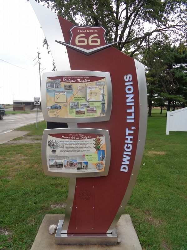
Route 66, the Mother Road, is an American icon that symbolizes romance and freedom of the open road. Born in 1926, Route 66 was one of the first numbered U.S. highways, journeying 2,500 miles from Chicago to Los Angeles. Today, . . . — — Map (db m158308) HM
The Ambler-Becker Texaco Station operated longer than any service station on Route 66. It was run by local families for 66 years, from 1933-1999. Flats were fixed, breakdowns towed, and at times, the spirits of weary travelers restored. . . . — — Map (db m158375) HM
During the heyday of Route 66 from the 1930s to the 50s, there were no motel chains. Instead, local families operated small campgrounds, cabins, and motor courts. The Paulsen-Strufe Motel, built in 1935, was more than just a place to stay; it . . . — — Map (db m158384) HM
Lions Lake is a testament to the changing face of Route 66. Dwight started as a farming community on the Chicago & Alton Railroad. When automobiles began replacing horses, people demanded better roads. Borrow pits, like Lions Lake, supplied the . . . — — Map (db m158382) HM
This restoration is a project of the Route 66 Association of Illinois Preservation Committee. Identified November 9, 1997 on the National Register of Historic Places. — — Map (db m157019) HM
From 1926 to 1946 this road was known as the "Mother Road" or Route 66
During this period traffic was so congested that it became necessary to build an underground passage to safely cross church goers and school children. You are now standing . . . — — Map (db m157023) HM
This venerable old bridge enters its golden years serving slow traffic on a city street, but it started life in the fast lane of the "hard road." In 1924, Illinois Route 4 became the first paved road to connect Chicago with St. Louis. Only two . . . — — Map (db m158825) HM
Civic leaders welcomed Route 66 through Pontiac in 1926 as a boon for business. However, parents were concerned about their children crossing this "dangerous speedway.' As a solution, the State Highway Commission excavated a tunnel under the . . . — — Map (db m158311) HM
The original bridge was built in 1926 as part of Route 4. On November 11, 1926, the alignment of Route 4 through Pontiac became US Route 66. In early days, the highways were marked with paint using a stencil on utility poles and on bridge end . . . — — Map (db m157015) HM
You are traveling on one of the most famous roads in the world. On September 25, 2005, Illinois Route 66 was designated as a National Scenic Byway by the U.S. Department of Transportation. — — Map (db m158309) HM
Route 66 has become a nostalgic symbol of Americana. This display honors just one of the many mom & pop businesses that served weary travelers on the Mother Road. At it's original location, many thousands of people from around the world stopped to . . . — — Map (db m163373) HM
For decades the bricks to build this pathway were covered by asphalt on Washington St. in Pontiac. They were unearthed during a road work project in 2008. Until 1930 this stretch of Washington Street was the detour route for Illinois Route 4 (SBI . . . — — Map (db m163376) HM
Route 66 was one of the most dangerous roads in the nation, earning it the nickname “Bloody 66.” From this District 6 Headquarters building, State Police patrolled the hard road between Dwight and McLean. They enforced safety laws . . . — — Map (db m158312) HM
(front:)
Route 66, the Mother Road, is an American icon that symbolizes romance and freedom of the open road. Born in 1926, Route 66 was one of the first numbered U.S. highways, journeying 2,500 miles from Chicago to Los Angeles. Today, . . . — — Map (db m158306) HM
This building was home to state troopers who risked their lives every day patrolling Route 66.
By the 1940s, Route 66 carried more traffic than any other highway in the state. The Illinois District 6 State Police Headquarters was built . . . — — Map (db m158812) HM
Bob Waldmire was born near Springfield in 1945. His prolonged passion for Route 66 began in 1962 when his parents took the entire family on a motoring trip to California via Route 66. During that trip, Bob fell in love with the Mother Road and . . . — — Map (db m163377) HM
Route 66 provided a steady income for family businesses like Joe and Victor "Babe" Selotis' Log Cabin Inn. Joe barbecued beef and pork on a spit out back, while Babe filled gas tanks and fixed flats. When Route 66 was relocated to the backside . . . — — Map (db m158821) HM
The Illinois State Police was formed in 1922 to protect motorists.
Twenty officers patrolled the state on surplus World War I Harley-Davidson motorcycles. Radio-equipped cycles revolutionized communications in the 1930s. The ISP shifted . . . — — Map (db m158810) HM
Designed by Bill Diaz of Pontiac, Illinois, the "Atlanta: Midway on Illinois' Mother Road" mural captures the spirit of Atlanta's place on Rt. 66. Located approximately 150 miles from both Chicago and St. Louis, Atlanta occupies a central spot in . . . — — Map (db m160819) HM
In its early days, weekly dances and bingo nights accompanied the blue-plate specials served at the Palms Grill Café. The "Grill" was also Atlanta's Greyhound bus-stop. You just turned the light on above the door if you wanted the bus to pick you . . . — — Map (db m160588) HM
During the heyday of Rt. 66, travelers passed hundreds of signs, murals, and other forms of roadside advertising, each hoping to grab its share of attention. Among the more famous of these stood the fiberglass giants created during the 1960s by . . . — — Map (db m160586) HM
Known as the "Great Illini Boulevard," Illinois State Road 4 was laid through Atlanta in 1922-23. It was the first paved road connecting Chicago and St. Louis. In 1926, it was re-designated as U.S. Route 66 taking travelers all the way to Los . . . — — Map (db m266921) HM
Inspiration for this mural comes from Atlanta's geographic location on Route 66, approximately 150 miles from both Chicago and St. Louis. Bill Diaz of Pontiac, IL designed the original mural in 2003 during "LetterRip on Route 66." The current . . . — — Map (db m293925) HM
In the 20th century, road travel became the predominant means of going from point a to point b. With the increase of cars on the road, “attention getters,” items attracting the attention of passengers and drivers with the intended result being to . . . — — Map (db m312093) HM
As a respite for Rt. 66 travelers and other visitors, the City of Atlanta invites you to relax and enjoy the Atlanta Route 66 Park.
This Information Booth is here to provide you with information about sites to see and things to do in . . . — — Map (db m162544) HM
Atlanta boomed when Route 66 was built in the 1920s.
It didn't last. By 1947 the busy road was rebuilt to bypass town to the east. New businesses flourished on the bypass only to fail again when I-55 replaced the Mother Road in 1977. . . . — — Map (db m162545) HM
Operated for over 54 years by Ernest L. Edwards, Jr. & Family
Home of the celebrated Pig Hip Sandwich - baked fresh pork with tomato & lettuce on a toasted bun with the secret sauce
The Pig Hip Restaurant Museum with Ernie's fine personal . . . — — Map (db m156868) HM
Downtown businesses thrived when Route 66 ran through Elkhart. In 1938, The House by the Side of the Road cafe had an unforgettable customer when actress Shirley Temple stopped for lunch. Afterward, owner J. Smith put a cardboard likeness of the . . . — — Map (db m156874) HM
(front:)
Route 66, the Mother Road, is an American icon that symbolizes romance and freedom of the open road. Born in 1926, Route 66 was one of the first numbered U.S. highways, journeying 2,500 miles from Chicago to Los Angeles. Today, . . . — — Map (db m158187) HM
Abraham Lincoln practiced law here from 1840-1847. This site is located on the original alignment of Route 66 through Lincoln, Illinois. Free admission. — — Map (db m156851) HM
Route 66 promised travelers fun and adventure along the road. The Railsplitter Covered Wagon honors Abraham Lincoln in the only town named for him before he became president. It holds the Guinness World Record as the largest covered wagon and . . . — — Map (db m159307) HM
The Mill opened in 1929 on the original alignment of Route 66, it became famous as a sandwich stand and then a Bar/Restaurant. The Mill is now being restored as a museum. Open by appointment. — — Map (db m156855) HM
A Family Business - The Early Years
Vince Schwenoha opened the Tropics in 1950, naming it in remembrance of his military tour of duty spent in Hawaii. In 1951, Lewis Lee Johnson came to Lincoln from Macomb, Illinois as a meat cutter with . . . — — Map (db m159304) HM
The Coliseum Ballroom on Route 66 was a hopping place on Saturday nights. Benld's ballroom boasted the biggest dance floor between Chicago and St. Louis. People gathered from throughout the region to dance to big bands such as Duke Ellington, . . . — — Map (db m157936) HM
Route 66, the Mother Road, is an American icon that symbolizes romance and freedom of the open road. Born in 1926, Route 66 was one of the first numbered U.S. highways, journeying 2,500 miles from Chicago to Los Angeles. Today, you can still "get . . . — — Map (db m144544) HM
The first hard road connecting Chicago and St. Louis passed through the heart of Carlinville. In 1926, Route 66 opened from Chicago to Los Angeles and followed Route 4 through Illinois. The “Mother Road” Circled the Carlinville Square . . . — — Map (db m144482) HM
This is the second oldest building on the Square. It was built in 1854 and was also the first building on the Square to be three stories tall.
In 1924, Greek immigrant Pete Adam opened the Ariston Restaurant here. Business boomed two years . . . — — Map (db m144480) HM
(2332 E. Side Square)
A hallmark of Route 66 in Illinois, the Ariston Café was originally established in Carlinville in 1924.
Continue to Trail 1 or Trail 2 to Site 4. Continue east down East Main Street to 210 East Main . . . — — Map (db m229837) HM
Russell Soulsby built this station in 1926 with his father, Henry
He ran it with his sister Ola until 1991. For its 65 years of operation; they only sold Shell gasoline. — — Map (db m138433) HM
The advent of a national road system in 1926 ushered in a golden age for small-time entrepreneurs. In Mt. Olive, Illinois, it inspired miner Henry Soulsby to put down his pick and shovel and erect a gas station along what would soon become Route . . . — — Map (db m308406) HM
You are traveling on one of the most famous roads in the world. On September 25, 2005, Illinois Route 66 was designated as a National Scenic Byway by the U.S. Department of Transportation. — — Map (db m144781) HM
Electrified interurban railways were the rage in the early 1900s before Route 66. They offered clean and efficient service, an advantage over locomotives and horses. The Illinois Traction System connected residents in towns like Staunton to . . . — — Map (db m188715) HM
Miserable wages and working conditions in coal mines made conflict between miners and coal companies inevitable in the 1890s. The battle that erupted here immortalized Virden in the history of labor rights. On October 12, 1898, eight miners, four . . . — — Map (db m149885) HM
Virtually every older city in America was first populated by immigrants. In Edwardsville, the Czech Hall was built in 1906 by Czechoslovakian settlers as a gym and meeting hall. In 2002, it was named to the National Register of Historic Places. . . . — — Map (db m281138) HM
Route 66, the Mother Road, is an American icon that symbolizes romance and freedom of the open road. Born in 1926, Route 66 was one of the first numbered U.S. highways, journeying 2,500 miles from Chicago to Los Angeles. Today, you can still "get . . . — — Map (db m144542) HM
Known as the "Mother Road" and the "Main Street of America," Route 66 made its mark in history books, pop culture, and thousands of families' scrapbooks.
Route 66 was established in 1926 as one of the first roads in the United States . . . — — Map (db m287003) HM
Route 66 winds through historic Edwardsville. This storied road inspired a wave of eager travelers who found cafes, shops and stops that served up local flavors, a place to rest, and fuel, tires and services. Many of these spots remain standing . . . — — Map (db m281135) HM
For nearly four decades, this charming brick building served as a bustling automobile service station on America's most iconic highway, US Route 66 - which ran right past this location through the heart of Edwardsville. Travelers and locals by the . . . — — Map (db m228142) HM
Roy Hudson moved to Granite City in 1940 and began working at Skotty's Jewelry Shop. In 1944, Roy Hudson purchased Alfred T. Aten's Jewelry and Watch Repair Shop, located at 1915 1/2 State Street. At first the shop was referred to as Roy D. . . . — — Map (db m253710) HM
Standing Tall along Route 66
Earl is a 14-foot muffler man, a larger than life figure watching over travelers on Historic Route 66. With his firm grip and steady stance, Earl isn't just a roadside novelty - he's a proud symbol of America's . . . — — Map (db m280668) HM
Route 66, the Mother Road, is an American icon that symbolizes romance and freedom of the open road. Born in 1926, Route 66 was one of the first numbered U.S. highways, journeying 2,500 miles from Chicago to Los Angeles. Today, you can still "get . . . — — Map (db m144521) HM
With locations in all of the Tri-Cities (Granite City, Madison and Venice), the first Reese Drug Store was started in Granite City on Niedringhaus Ave. in 1923 by druggist Walter A. Reese. Previous to this time, Mr. Reese, was a manager and buyer . . . — — Map (db m253707) HM
Before GPS, travelers found adventure not just in the destination - but in the stops along the way. Roadside attractions were born from a spirit of curiosity, creativity, and good old-fashioned American ingenuity. Whether it was a ball of twine, . . . — — Map (db m281011) HM
The first Washington Theatre was opened on December 21, 1910. Louis Landau, Jr. was the manager. It seated 750 people. Several years later a balcony was added making the seating capacity of 1,200. In 1911 the Air Dome was added next to the . . . — — Map (db m253709) HM
Standing tall at 20 feet, this muffler man isn't just a roadside icon - he's a tribute to every blue-collar worker who built the city from the ground up. Clad in a hard hat and steel-toed boots, with a lunchbox proudly marked "Made in . . . — — Map (db m288809) HM
It Began with Four Cars
Cassens Transport began in 1931 when Albert and Arnold hauld four new cars from Detroit to their father George's dealership in Hamel. By 1941, Cassens had a fleet of 35 car transporters operating from its terminal . . . — — Map (db m144481) HM
From Chicago to Los Angeles, Route 66 was routed over the streets of cities and towns both large and small. Thus its nickname "The Main Street of America." In Illinois, the first state to have all of Route 66 paved, the infamous highway was routed . . . — — Map (db m139428) HM
(front:)
Route 66, the Mother Road, is an American icon that symbolizes romance and freedom of the open road. Born in 1926, Route 66 was one of the first numbered U.S. highways, journeying 2,500 miles from Chicago to Los Angeles. Today, . . . — — Map (db m158214) HM
Illinois Route 66 was dangerous. Curves, crossroads, and bridge abutments doomed many speeding motorists, giving rise to the nickname, "Bloody 66." After World War II, curves were straightened, towns bypassed, and four lanes built to improve . . . — — Map (db m57555) HM
Most early roads were not paved. As a result, after it rained they became almost impossible to drive on. This 1926 section of road is a good example of what was called the "Good Roads Movement." This piece of Route 66 was only 16 feet wide, but . . . — — Map (db m294087) HM
Ulysses & Rosie
Ulysses S. Grant was famous for his love of horses. He also had more pets in the White House than any other president, including a gamecock, a parrot, several dogs, and a multitude of horses and ponies. But if you wandered . . . — — Map (db m294090) HM
Having a Picnic.
By the 1920s the automobile picnic outing had become a national phenomenon. Cars allowed people to escape from crowded cities, and rural residents also took advantage of the increased mobility furnished by the . . . — — Map (db m163357) HM
This original section of Historic Route 66 was dedicated in 1926. The alignment was first known as Route 4. Memory Lane is open to drive on during Lexington's annual Route 66 reunion, car show/parade and other special Route 66 events.
We . . . — — Map (db m163090) HM
In 1926, construction began on a 2,448-mile highway from Chicago to Santa Monica, California. Route 66 reflected the increased use of motorized vehicles. The road, which cut diagonally across Illinois, passed through Lexington. Sleek restaurants, . . . — — Map (db m157028) HM
Illinois' oldest truck stop, the Dixie Trucker's Home offered Southern hospitality for weary Route 66 travelers. J.P. Walters and his son-in-law John Geske opened the Dixie in 1928 in the corner of a mechanic's garage. Route 66's first truckers . . . — — Map (db m156953) HM
Opened in 1930 by William Sprague, this is the only two-story Tudor Revival service station on Route 66. Although the station was built in the depth of the Great Depression, Sprague knew that travelers still needed food, gas, and car repairs. He . . . — — Map (db m163009) HM
(front:)
Route 66, the Mother Road, is an American icon that symbolizes romance and freedom of the open road. Born in 1926, Route 66 was one of the first numbered U.S. highways, journeying 2,500 miles from Chicago to Los Angeles. Today, . . . — — Map (db m316253) HM
Native American groups in the area included the Illini, Peoria, Sauk, and Kickapoo, along with several others. Due to historical erasure of these marginalized peoples, it is difficult to find detailed information about their involvement in this . . . — — Map (db m266944) HM
You are standing on the pavement of the original Route 66 that was commissioned in 1926. The width of the original hard road was only 16' wide and constructed from Portland cement. The road immediately in front of you is the upgraded Route 66 known . . . — — Map (db m157604) HM
The Towanda, Il. Route 66 Parkway stretches 1 mile in front of you and 2.5 miles behind you. You are standing on the 1954 alignment of Route 66. The original 1926 two lane Route 66 is behind you and to the right and just up this road and to the . . . — — Map (db m157605) HM
Ahead of you is Dead Man's Curve, the site of many disastrous accidents from the late 1920s through the 1950s. This curve was part of the original Route 66 that was constructed around Towanda in 1927. Behind you to the east approximatley 1/4 . . . — — Map (db m157594) HM
Dead Man's curve is directly down the road 400 feet north of this sign. It is along Old Route 4, the "Original 66" constructed in 1926, and has a sharp 90 degree curve. No more than 18 feet wide, this 2-way road was the site of many disastrous . . . — — Map (db m294194) HM
Your experience of this portion of Historic Route 66 is eight tenths of one mile of the 2448 miles stretching from Chicago, Illinois to Santa Monica, California. As the primary road connecting Chicago to the west coast, Route 66 was called the Main . . . — — Map (db m157589) HM
Directly ahead is the location of the former Fern's Café and Texaco Station which were opened by Fern and Mac McCurdie in 1951 after Route 66 became a four lane highway.
For 18 years, McCurdies have successfully owned the café and gas . . . — — Map (db m294094) HM
Directly ahead lay the remnants of Henderson's Dairy, which was closed in 1942 due to a calling to war. Upon Jerry Henderson's return home from World War II in 1945, the Standard Service Station was built and opened. It was a small, family owned . . . — — Map (db m157603) HM
Ahead of you is the former location of the Delco Truck Stop, a historic landmark opened in 1952. Three years later, the name changed to Pure Oil Truck Stop with gasoline selling at 17.9 cents per gallon. Pure Oil also featured a restaurant that . . . — — Map (db m157602) HM
(all photo captions)
• Like many in our community, Louis Sedentop made his living as a farmer. Arriving in America from Germany in 1835, he settled on eighty acres of land in Montgomery County. He married Honora Leonard in 1859 and they . . . — — Map (db m281220) HM
During intermission, hotdogs dance across the screen, luring moviegoers to the Sky View's concession stand.
Like most outdoor theaters, the Sky View always had a busy playground below the screen where the children played before the movie began. . . . — — Map (db m138390) HM
The Shifting Highway
In 1924, Pete Adam opened the first Ariston in Carlinville next to the original alignment of Route 66. When the highway was rerouted in 1929, Pete moved his cafe next to the new 66 in Litchfield (across the street from . . . — — Map (db m147474) HM
Dave Jackson, lifelong resident, and former editor of the Litchfield News Herald, wanted Litchfield to have a museum. Jackson had a large collection of Litchfield memorabilia which he hoped to share and preserve. He died in May of 2010 before his . . . — — Map (db m159654) HM
Route 66, the Mother Road, is an American icon that symbolizes romance and freedom of the open road. Born in 1926, Route 66 was one of the first numbered U.S. highways, journeying 2,500 miles from Chicago to Los Angeles. Today, you can still "get . . . — — Map (db m144543) HM
Route 66, one of the original highways in the US Highway System, was established on November, 11, 1926. It became one of the most famous roads in the US, passing through Illinois, Missouri, Kansas, Oklahoma, Texas, New Mexico, Arizona and . . . — — Map (db m159643) HM
The cornerstone of the American Radiator plant was laid on June 9, 1904. The plant occupied 28 acres on the southeast edge of town and produced cast iron radiators. During World War II, it converted to the manufacture of sand-molded magnesium . . . — — Map (db m147469) HM
Satisfying local patrons and international travelers since 1924, this landmark stop continues to attract diners who "remember where good food is served"
Route 66 Roadside Attraction Recognized by Hampton Hotels Save-A-Landmark program as . . . — — Map (db m138435) HM
Vic Suhling first leased this property from Charles and Maude Modlin. He built a new gas station and erected this Vic Suhling/Gas for Less sign. He later purchased this property from them in 1961. The business closed in 1968…. but not for long. It . . . — — Map (db m147386) HM
Even though it was wonderful to have a paved, hard road to travel on, many motor vehicle accidents did occur on Route 66.
In 1959, this shrine was erected to remind motorists of the potential dangers and offered a place to say a prayer for a . . . — — Map (db m156780) HM
The rumble of trains determined the fate of
early Illinois towns. The original Auburn site was
founded in 1835 about a mile to the north. When the
Alton & Sangamon Railroad built a station to the south
in 1852, businesses picked up and moved to . . . — — Map (db m271169) HM
Sherman Wayside Park is one of a few remaining waysides that once dotted "The Mother Road" from Chicago to California.
Wayside parks offered a break from sunbaked highways and Depression-era cars lacking air conditioning. Weary travelers . . . — — Map (db m267653) HM
Enjoy the "original" deep fried hot dog on a stick. Ed Waldmire invented the Cozy Dog while stationed in Amarillo, Texas, during World War II. Originally called "crusty cur," the battered hot dogs were a hit with the GIs at the airfield. In 1950, . . . — — Map (db m312091) HM
You are traveling on one of the most famous roads in the world. On September 25, 2005, Illinois Route 66 was designated as a National Scenic Byway by the U.S. Department of Transportation. — — Map (db m152713) HM
Route 66, the Mother Road, is an American icon that symbolizes romance and freedom of the open road. Born in 1926, Route 66 was one of the first numbered U.S. highways, journeying 2,500 miles from Chicago to Los Angeles. Today, you can still "get . . . — — Map (db m156803) HM
The 66 Drive-In Theatre was originally opened on June 6th, 1952, and was operated by Kerasotes Theatres. Despite only having one screen, it could house up to 1000 cars. It closed in 1986, and was tragically burnt down in 1991. Today, FitClub . . . — — Map (db m267656) HM
(set of 11 signs lined up next to each other, left to right:)
Harley Man
Livingston, Illinois
While indoors, this smaller (14") statue was wearing a dark blue button-up shirt (with a "Hank" name patch) and gray trousers. Now . . . — — Map (db m268981) HM
Zipping down the Giant Slide has been a State Fair tradition since 1968. Thousands of people travel Route 66 every year to visit the Illinois State Fair in August. This is one of the original 42 Giant Slides created by Fred Pittroff, an . . . — — Map (db m281234) HM
Experience the wonders of Illinois Route 66!
This walk-through exhibit highlights the 92 communities along Illinois Route 66 from Chicago to the Chain of Rocks Bridge in Madison. Discover vintage billboards, a drive-in movie theater, Legends . . . — — Map (db m267478) HM
Get a bird's-eye view of Route 66! The Sky Glider made its debut at the Illinois State Fair in 1968. The next year, it became a permanent fixture with new and refurbished parts installed by O.D. Hopkins Associates, Inc. (now SkyTrans). Perched . . . — — Map (db m281235) HM
Bill Shea and his Gas Station Museum became a Route 66 icon. In 1955, Bill opened this Marathon service station on Route 66, just down the road from a Texaco station he had operated for 9 years. When the station closed in 1982, he began filling it . . . — — Map (db m267470) HM
437 entries matched your criteria. Entries 101 through 200 are listed above. ⊲ Previous 100 — Next 100 ⊳