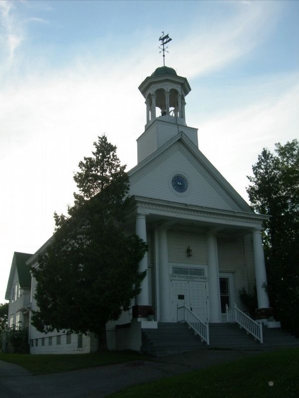
Erected in 1867 as the Lyndon Union Meeting House, and serving several denominations for two decades, until acquired by the Universalists in 1904. — — Map (db m306580) HM
Français:
La frontière actuelle entre le Canada et les États-Unis résulte de plus de 200 ans de traités et de négociations. L'histoire et le développement de la région du Transcontinental sont inhérents à cette frontière. . . . — — Map (db m304033) HM
English:
Wabanaki Native Americans were this area's original inhabitants, hunting, gathering and traveling along these waterways. In the 1780's, the Upper St. John Valley began to be settled by French-Canadians and Acadians. By . . . — — Map (db m148193) HM
(right panel) This site denotes the first mile of U. S. Route 1, designated on November 11, 1926. The first mile extends from the Fort Kent, Maine / Clair, New Brunswick international border to the Dube House - built in 1840, one of the . . . — — Map (db m137375) HM
Fort Kent has been designated a National Historic Landmark. This site possesses National significance in commemorating the history of the United States. — — Map (db m2088) HM
English:
To St. John Valley residents, the river was never a dividing boundary. In 1842, distant governments finally agreed to divide the U.S. and Canada along the St. John River. Generations before, Acadians had settled the . . . — — Map (db m148168) HM
English:
1902: The arrival of the Bangor and Aroostook in Fort Kent marked a time of rapid economic growth. Potatoes, hay, lumber, and people were able to move efficiently south. Now, this remote French-speaking Valley with . . . — — Map (db m148188) HM
The Aroostook War was an undeclared, bloodless “war” that occurred in 1839.
The peace treaty that ended the American Revolution in 1783 had not satisfactorily determined the boundary between New Brunswick and what is now Maine.
The . . . — — Map (db m102463) HM
English:
Before bridges, railways, and paved roads, the St. John River unified communities, culture, and commerce across the entire Valley — north and south. The genealogical roots of many Valley families cross the river . . . — — Map (db m148184) HM
English: —Local storytellers continue, “it was a crime but not a sin.” Of course, since lying is a sin, “Do not get caught!” Some priests may not have believed that your grandmother taking a ham “across” under her . . . — — Map (db m148075) HM
English: Acadian settlers claimed fertile lands along the river first, raising oats, wheat, and buckwheat, then potatoes. Savvy farmers fertilized with manure and rotated crops with pastureland. By 1905 railroads make it . . . — — Map (db m148074) HM
1843 — 1993 Hommages aux pionniers Français qui ont eu le courage d’établir la paroisse Ste. Luce. In tribute to the French pioneers who had the courage to establish the Parish of St. Luce. Upper Frenchville, Maine Ste. Luce Parish . . . — — Map (db m148299) HM
English:
Did you know? Water towers were once a common sight along rail tracks. Frenchville’s 55,000 gallon 1910 water tower is one of the last remaining in the U.S. Coal heat kept it from freezing. When diesel engines . . . — — Map (db m148076) HM
English: ”Making do” with creativity: French-Acadian inventiveness, ingenuity, & lapatente Here in the Valley, a person who can make or fix just about anything is called le patenteux in the local . . . — — Map (db m148296) HM
English: Two years of flooding, early frosts, and harsh winters forced many settlers to flee in the winter of 1797. While the remaining men were away hunting, an eight day storm descended. Tante Blanche strapped on snowshoes and . . . — — Map (db m148300) HM
English: Hidden solid timber homes. Bricks disguise the timber structure of the house across the field, built using a practice once common here called "piece on piece" [above]. This method used square-hewn horizontal timbers . . . — — Map (db m148298) HM
Plaque commémorative du premier débarquement des Acadiens àu Madawaska, en juin 1785. Hommages de Leurs Descendants. 15 Août 1934.
English (Google translate): Commemorative plaque of the first landing of the Acadians in Madawaska . . . — — Map (db m148295) HM
English:
Genealogy, massive French & Acadian family reunions link past and future
While some Americans proudly trace their roots to the Mayflower, here Valley roots lead back to 1785 and the first 17 Acadian families. . . . — — Map (db m148199) HM
English:
—Acadians settling where faith, farms, and family could grow— British encourage the settlement of the Madawaska Territory. The British — having lost many American colonies in 1783 — wanted . . . — — Map (db m148194) HM
In 1983 the Southern California Motorcycle Association decided to sponsor a
"Motorcycle Tour". Motorcyclists who would like to attempt the tour register at
www.usa4corners.org, receive their tour package and begin their adventure. The
four (4) . . . — — Map (db m296651) HM
English: Renowned carver Aurelle Collin's handmade crooked knives employ used razor blades. “You see, he had a neighbor who had a barber shop — so he would use his old razor blades to make his knives. Pretty . . . — — Map (db m148297) HM
You are part of Northern Maine’s Aroostook County 40-mile long scale model of the Solar System. At this scale, one mile along U.S. Route 1 equals the distance from the Earth to the Sun, known as an “astronomical unit”. The Sun is located . . . — — Map (db m58942) HM
The northern portion of present-day Route 11 from Sherman to Fort Kent was planned and constructed in many stages from 1826 to the 1850s.
This stretch of road includes two historical routes: the Aroostook Road, which ran 75 miles from Molunkus . . . — — Map (db m102464) HM
Unearthed during excavation for UMF's ground-source heating
system, this large boulder caught the attention of Dr. Thomas Eastler,
Professor Emeritus of Geology (1942-2018). "Dr. Rock," as he was
fondly known, became intrigued by its enigmatic . . . — — Map (db m286703) HM
Farmington Graduate
1853-1943
He changed the face of the Earth
This memorial is dedicated to a quiet and impressive man whose early years
of study and discipline were spent on this campus.
John Frank Stevens was born on a . . . — — Map (db m286485) HM
Established in 1864 as Maine's first public institution of higher
education, the "Western State Normal School", as it was originally
called, was dedicated to the professional training of teachers.
Today, Farmington may be best known . . . — — Map (db m285793) HM
Franklin Co. Equal Suffrage, with Isabel Greenwood, Pres., hosted Maine Woman Suffrage Ass. annual convention At Old South church October, 1907 — — Map (db m288453) HM
English: Farm, tavern, dance hall, boarding house, post office, or library? First explored by Europeans in 1760, settlers came to Rangeley in the early 1800s to farm and to harvest the abundant timber in the mountains. Early . . . — — Map (db m148395) HM
English: Fishing frenzy changes Rangeley forever By the mid-1850s the "discovery" of Rangeley's large brook trout by outsiders forever changed the character of the community. Advertisements, articles, and exhibits on the trout . . . — — Map (db m148397) HM
A US Navy radio station here at Otter Cliffs served as the most important World War I facility for receiving transatlantic messages – including the first bulletin about the armistice. Alessandro Fabbri, a wealthy island resident and inventor, . . . — — Map (db m106555) HM
George B. Dorr, a gentleman scholar and lover of nature, devoted most of his adult life to the creation, maintenance, and expansion of Acadia National Park. The son of affluent Bostonians, Dorr first visited Mount Desert Island in 1868 and later . . . — — Map (db m106594) HM
Mount Desert Island's coastal waters have always held dangers for boats and ships - rocky shoreline, hidden ledges, and small islands that hide in the fog.
Since 1875, Egg Rock Lighthouse perched on the craggy island before you, has helped . . . — — Map (db m25481) HM
Agamont Park is named after the Agamont House, built by Tobias Roberts in 1857 as Bar Harbor's first hotel. It burned down in 1888. The unusual name was supposedly given by his granddaughter who called this hill on the water "Aqua . . . — — Map (db m260524) HM
A resident and lover of Mount Desert Island who commanded the United States Naval Radio Station upon this site from its establishment on August 28, 1917 until December 12, 1919.
At the end of the World War he was awarded the Navy Cross. His . . . — — Map (db m54436) WM
The sea was the original "Highway" for many coming to Bar Harbor, the steamboats and Navy ships celebrating the Fourth of July. In 1925, the dirigible Shenandoah made a stop in Bar Harbor. It was 680 feet long and weighed 36 tons. That September 3, . . . — — Map (db m259838) HM
The large boulder on the shore in front of you is an excellent example of a glacial erratic and has been popular with the photographers for years. It has a different makeup than the surrounding rock, as can be seen by the color and . . . — — Map (db m259837)
The Gazebo at the Bar Harbor Inn is an authentic recreation of an original design built by noted architect
Calvin Ryder in 1840 on the "White House" lawn in Belfast, Maine. Listed on the National Historic Register,
Ryder's Gazebo was the only one . . . — — Map (db m254603) HM
Now the municipal building, the Fred Savage-designed brick structure in front of you was built in 1908 for $90,000 as a high school. The last class graduated from this school in 1968, and now all students attend the Mount Desert Island . . . — — Map (db m260530) HM
Two surviving Rodman/Dahlgren Cannon mounted on nearby Egg Rock in 1898 as part of the Coastal Defense Battery at Frenchman’s Bay, Bar Harbor.
This plaque honors those men and women who have fought in the defense of our country. — — Map (db m105401) HM WM
After being privately owned by several families such as the Rodicks and Pineos, the long period of arguments over its development and ideas to build a bridge to Bar Harbor lasted until John D. Rockefeller, Jr. quietly purchased the . . . — — Map (db m105932) HM
Bar Island lies within one of the many harbors of Frenchman Bay. Consisting of 157 acres of woodland and pasture, it rises abruptly above the ocean to 175 feet at its more elevated eastern end. At the western end is its most distinctive feature, a . . . — — Map (db m259955) HM
Cadillac Mountin is Acadia National Park's highest elevation and most comprehensive viewpoint. It is also the highest point on the United States Atlantic Coast (1,500 feet/466m). If you stood here alone at dawn you might be the first person in . . . — — Map (db m54448) HM
Like small towns across America, Bar Harbor has endured its share of growing pains and seen many changes to the village streetscape since its permanent settlement by Europeans in 1763. Gone are the early settlers' homes, the old boarding houses, the . . . — — Map (db m184635) HM
The Criterion Theatre opened June 6, 1932 with a vaudeville and picture show. The building was built by George McKay at a cost of $150,000. The original Art Deco interior is one of its most outstanding features. The “flying” . . . — — Map (db m184667) HM
DeGregoire Green was designed and built by the Bar Harbor Village Improvement Association in 2018. The park was named after the DeGregoire Hotel which was on this site until burning to the ground in the Great Fire of 1947. Funding was provided by . . . — — Map (db m260186) HM
“What wondrous stories a water molecule could tell, of wild peaks visited on stormy nights, of quiet rivulets and raging rivers . . . peaceful fogs . . . glaciers . . . ” David Cavagnaro, Living Water
As you explore Acadia National Park, you will discover private property interspersed with park lands. Many large national parks, like Yellowstone and Grand Canyon, were carved from the public domain as single, vast tracts of land. Acadia, in . . . — — Map (db m54410) HM
Vessels of all types have plied the waters of Frenchman Bay for centuries. Five thousand years ago, indigenous people may have paddled dugout canoes into the bay to reach fishing grounds or hunt sea mammals and swordfish. More recently, Wabanaki . . . — — Map (db m25475) HM
This gated lodge was built in 1932 to keep motor vehicles off of John D. Rockefeller, Jr.’s carriage roads and out of Acadia’s interior. Rockefeller hired New York architect Grosvenor Atterbury to design the building in harmony with the natural . . . — — Map (db m77194) HM
When the ice that covered this land slowly melted, it dropped in its tracks great accumulations of gravel and rocks. Boulders transported and deposited by glaciers are called "erratics." Erratics are rounded and noticeably different in . . . — — Map (db m25491)
Rounded mountains, a deep lake, and sheer cliffs reveal this valley’s icy past. But long before glaciers sculpted Acadia’s surface, the granite foundation was forged deep in the Earth. Over 500 million years ago, colliding continents created a mass . . . — — Map (db m106544) HM
Grant Park is named after Harry Allen Grant, who built the second summer cottage in Bar Harbor in 1869. (The first cottage was built in 1868 for Alpheus Hardy of Boston.) Grant, an attorney from Tarrytown, New York, paid $400 for the lot. Along . . . — — Map (db m260197) HM
The Holy Redeemer Catholic Church was built in 1907 at a cost of $44,000 contributed almost entirely by the maids and workmen of the town. The church has its own patron, Saint Katharine Mary Drexel, canonized in 2000 during a . . . — — Map (db m184669) HM
Beneath the ocean’s surface lies a rugged seafloor much like the mountainous terrain around you. Over the last two million years, a series of glaciers scoured and shaped this land. The last of these icy bulldozers left a mound of rocky debris . . . — — Map (db m106584) HM
Constructed in 1903 by Mr. George Sullivan Bowdoin, a partner in J.P. Morgan Co., this Georgian Revival style mansion was called "La Rochelle," French for "the Little Rocks." The design boasted 35 rooms, 15 bathrooms, 11 fireplaces and . . . — — Map (db m260107) HM
Mary Shannon of Newton, Massachusetts summered in Bar Harbor for 30 years from 1871 until her death in 1901. Ms. Shannon donated a sizeable portion of her land to the Village Improvement Association for the children of Bar Harbor. To this day the . . . — — Map (db m260206) HM
Bar Harbor has many amenities not usually found in a small town such as the hospital, YWCA, YMCA, Jesup Library and Abbe Museum due to the foresight and generosity of the large summer community. From its inception in 1897, the hospital has been a . . . — — Map (db m260202) HM
Like a giant magnet, Cadillac Mountain's summit has attracted people for thousands of years. Sightseers journey here to enjoy magnificent views of the ocean and islands, and scientists come to record topographical and environmental data. Before the . . . — — Map (db m260518) HM
In 1947, the State of Maine suffered its largest forest fire disaster in modern history. The state experienced over 90 consecutive days of record breaking high temperatures and drought. By mid-October, many small wildfires started and spread out of . . . — — Map (db m260536) HM
Frenchman Bay extends seven miles between Mount Desert Island and the Schoodic Peninsula, which lies beyond the Porcupine Islands. For centuries, humans have plied these bountiful waters to fish, trade, and enjoy the scenery. In the long struggle . . . — — Map (db m105628) HM
Since the early 1800s, Otter Creek has been the site of a fishing village with wharfs and fish houses on the waterfront and homes on the hills. Residents caught fish, dried them on racks along the cove, and shipped them to Boston and other cities. . . . — — Map (db m106553) HM
The recovery of the peregrine falcon is one of the great environmental success stories of our time. Although they once nested on the east face of Champlain Mountain above you, by 1964 peregrines had become extinct throughout the eastern United . . . — — Map (db m54409) HM
Sometimes air pollution obscures views like this from Cadillac Mountain and poses a threat to human health, Acadia’s water quality, and vegetation. A large percentage of the pollution comes from out of state. Converging air currents from the South . . . — — Map (db m105914)
Along Acadia National Park's rocky shores, there is only one sand beach. Over 15,000 years ago glacial ice carved out this valley. Melting glaciers and rising sea waters flooded it, creating a protected cove. A headland and a rock shelf offshore . . . — — Map (db m54411) HM
Inspired to protect the beauty and diversity of Mount Desert Island from encroaching development, a passionate group of local and summer residents waged a campaign to conserve this landscape for public use. With varied backgrounds but a common . . . — — Map (db m260519) HM
Explore the beach and discover a complex mix of marine life – and former lives – revealed in each handful of sand. As much as 70% of the sand consists of broken shells of mussels, sea urchins, barnacles, and periwinkles – signs of . . . — — Map (db m106590) HM
This spring was truly a magnificent one...wonderfully placed, with the mountains rising steeply up beside it, contrasting with the Great and Little Meadow lands on either side.
George B. Dorr, 1942
Like others before him, George B. . . . — — Map (db m54408) HM
As Acadia’s seasons change, so too does this view. Spring signals tightly wound ferns to unfurl their feathery foliage. Warming weather teases luna moths from their cocoons. As long summer days approach, bright green leaves of the birch trees . . . — — Map (db m105906) HM
In 1918 Saint Katherine Drexel's sister, Louise, and her husband Colonel Edward Morrell established both the Convent and St. Edward's School directly behind it. The Sisters of Mercy ran the school and lived in the convent until 1970. The Morrell's . . . — — Map (db m260205) HM
Hearing the thunder here is all about timing. The best time to witness the boom and spray is two hours before high tide. If the ocean is calm or the tide is low, you may just hear gurgling. What causes the thunder? Over eons the restless forces of . . . — — Map (db m106582) HM
History
The founders of this parish named their congregation in honor of the Holy Saviour, Jesus, and in recognition of the first Christian mission, St. Sauveur, on the island by French Jesuits in 1613.
The Heartbeat of Life
God . . . — — Map (db m54407) HM
He laid the foundation of the National Park Service defining and establishing the policies under which its areas shall be developed and conserved unimpaired for future generations. There will never come an end to the good that he has done. — — Map (db m54441) HM
In 1903, a young Beatrix Farrand (née Jones) designed and produced plans for the iron and brickwork of La Rochelle, the remnants of which you can see today. Throughout her life, Beatrix spent most of her summers at Reef Point, her family's cottage . . . — — Map (db m314054) HM
In October 1947 a series of fires lasting 26 days blazed across more than 25 square miles of Mount Desert Island. The fire seriously threatened Bar harbor, and transformed most of the landscape before you into an apparent wasteland. It consumed . . . — — Map (db m25478) HM
The original Abbe Museum, which still exists at Sieur de Monts Spring, was founded by Dr. Robert Abbe, a surgeon from New York and a Bar Harbor summer resident, who assembled a collection of early Native American artifacts found in . . . — — Map (db m260208) HM
Built between winter-1929 and spring-1930, the Bar Harbor Club epitomized the "Gilded Age." Wealthy summer residents and power brokers of the 19 and 20° centuries, including personalities such as Henry Morgenthau, James Blaine, George . . . — — Map (db m260034) HM
The fire station was constructed in 1911 following Fred L. Savage's design. The police station was added in 1989. The Great Fire of 1947 will always be remembered as the Bar Harbor Fire Department's most daunting fight ever. For pure . . . — — Map (db m260537) HM
This is the south entrance to the Shorepath as is explained on the green sign at the head of the path. The Briars Cottage was built in 1881 by the founder of Sears, J. Montgomery Sears of Boston. John D. Rockefeller Jr. rented the cottage for the . . . — — Map (db m260204) HM
By the late 1890s, more than 175 summer homes stood in Bar Harbor. The term "cottage" understates the magnificent manor houses erected in Bar Harbor. Either because "cottages" seemed rustic compared to their winter homes or because they . . . — — Map (db m260528) HM
This fine example of English Tudor design and pink granite construction was the work and home of famed local architect Fred Savage, who designed many of the larger homes and public buildings in the area. All of the pink granite was quarried right . . . — — Map (db m260199) HM
Frenchman Bay, in front of you, and other prominent names commemorate the region’s rich French heritage, “Acadia” stems from “Arcadia,” a term used by Giovanni Verrazano’s expedition to describe the Atlantic coast in 1524. . . . — — Map (db m105626) HM
The Great Fire of 1947 came this close to burning down the town of Bar Harbor before a shift in wind forced it around the village. The fire started October 17 near an open burning landfill, Dolliver's dump, in a bog about eight miles from here. . . . — — Map (db m260170) HM
As the cottage era came into its own, the hotel age went into decline. In 1888, there were 18 hotels in Bar Harbor that could accommodate 2,500 guests. The local hotel moguls included the four Higgins brothers, Fountain Rodick, Captain . . . — — Map (db m260201) HM
Formerly the Veazie Cottage < Lower Marker : > This property has been placed on the National Register of Historic Places by the United States Department of the Interior — — Map (db m105933) HM
In 1874, a club was opened "...for the purpose of establishing and Maintaining a reading room at Bar Harbor, in the town of Eden, Hancock County, and for the promotion of literary and social culture among its members." Its membership, which peaked . . . — — Map (db m259836) HM
This is the north entrance of Bar Harbor's famous Shorepath made possible by the generosity of the landowners who granted, passage. In 1920, the Village Improvement Association (VIA) planning committee chaired by Beatrix Farrand saw the need for . . . — — Map (db m254605) HM
Established before 1790 holds in many unmarked and unknown graves the remains of those courageous men and women pioneers on the frontier of downeast Maine. Sea captains, fishermen and farmers, shipwrights and hotelmen, selectmen and legislators, . . . — — Map (db m54389) HM
The Village Green was originally the site of the 350-room Grand Hotel. Many stories have been told about the immature Boston boys and the cultured Philadelphia girls who socialized around the “fish pond” at the nearby Rodick House. . . . — — Map (db m105922) HM
Tobias Roberts built the first pier large enough to accommodate steamboats like the passenger carrier Rockland that began making regular stops here in 1857. Here is an excerpt from the 1881 Bar Harbor Blue Book: "During the past winter, . . . — — Map (db m259954) HM
5649 entries matched your criteria. The first 100 are listed above. Next 100 ⊳