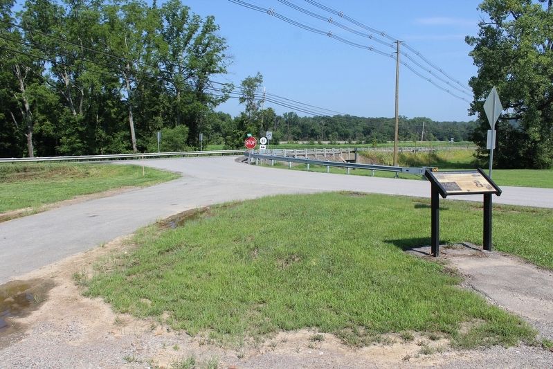
John Hunt Morgan's command of some 2,500 men left Bardstown and moved west. The raid, to this point, simply had not gone as planned. Morgan had fought two pitched battles at Green River Bridge and at Lebanon and had been held up for hours by Union . . . — — Map (db m122941) HM
Stood one mile west. It was a stone stack 33 ft. high with a maximum inner diameter of 10 ft. Its fuel was charcoal, and its air blast machinery was driven by a steam engine, blowing preheated air through the stack. Built in 1832, perhaps by John H. . . . — — Map (db m122030) HM
By early December 1862 stockades had been constructed along the L&N at Shepherdsville, Bardstown Junction, Belmont and Cain Run, just north of Lebanon Junction. These wooden fortifications were designed to protect against an attack by cavalry or . . . — — Map (db m122943) HM
The 294-acre Samuels property had been in the Samuels family since the late 1800's.
It was purchased from the family of Walter and Helen Samuels by Louisville Metro government in December, 2005. Thank you to the Samuels family and to our . . . — — Map (db m204270) HM
Welcome to the Baker Beam Home, named after Jim Beam's great-nephew, Baker, who lived & worked here as the Clermont plant distiller.
Built in 1911, the Beam family has called this house "home" since 1934 - the year Jim Beam's son T. Jeremiah . . . — — Map (db m237767) HM
The legendary sixth generation master distiller, seen here with his faithful dog and pal, Dot.
Spent more than 50 years overseeing the production of his family's whiskies.
In 1988 Booker introduced his private stock small batch whiskey, . . . — — Map (db m237869) HM
James Beauregard "Jim" Beam was the fourth generation bourbon distiller and most recognized member of the dynastic Beam family. Utilizing the Beam signature mash bill and knowledge passed down through generations of Beams since they began distilling . . . — — Map (db m237873) HM
Decades-old graveyard discovered near here. Graves, with unmarked headstones, believed to be those of itinerant railroad workers struck down by cholera epidemic during the construction of the Bardstown-Springfield-Louisville Railroad around 1854, or . . . — — Map (db m171587) HM
Belmont Furnace
Stone stack 500 yds. east, 33 ft. high originally, 10 ft. across inside. Built in 1844, perhaps by John H. Baker, rebuilt in 1853, it burned charcoal fuel, smelted iron ore from Cane Run. The air blast machinery was powered . . . — — Map (db m174393) HM
The American Civil War was the first conflict to utilize railroads for the movement of troops and supplies. Consequently, protecting the railroads was an important aspect of military strategy on both sides. In Kentucky this task fell to the Union . . . — — Map (db m122944) HM
USA Gen. William T. Sherman with 4,000 troops made headquarters here, late September, 1861. Object to secure Muldraugh's Hill against anticipated onrush of Confederates toward Louisville and to rally Kentuckians to Union cause. CSA Gen. Simon B. . . . — — Map (db m122002) HM
The antebellum log cabin built on this spot predated the city of Mt. Washington, orginally called Crossroads in the early 19th century. Known much later as the Bridwell Cabin, it is the city's oldest surviving structure, albeit in another location. . . . — — Map (db m255430) HM
In 1885 Albert Miller opened a stock owned General Store on this site named "Cyclone", being unique in name. James "Buddy" Gentry, who worked there as a youth, bought the store from Miller in 1906. In 1913 Clarence Porter and Hubert Wigginton . . . — — Map (db m307594) HM
In 1906, on this site, the Fraternal Order of Maccabees began
construction of the depicted three story building called Tent #3 under the supervision of W. A. King. Maccabee Hall soon became the centerpiece of the community. The first floor included . . . — — Map (db m307596) HM
Along the early turnpikes the law required mile posts. Some were cut from stone and some cast in iron. They showed the distance to each end of the turnpike. Typical of the stone markers are 14 along the east side of the present highway, at their . . . — — Map (db m204267) HM
The Union army began protecting the L&N Railroad from the beginning of the war. Once Nashville was taken the railroad became a vital supply line for Federal troops in Tennessee. It was equally important for the Confederacy to disrupt that line of . . . — — Map (db m278325) HM
An explorer and surveyor, he was born in Pennsylvania on March 21, 1757. He came to Kentucky ca. 1781 to survey land for his father. Named a justice of the peace in 1793, he founded Shepherdsville on 50 acres on the north side of the Salt River that . . . — — Map (db m122012) HM
Side A A pioneer of the contemporary crafts movement, Lesch was an internationally exhibited textile teacher and artist, noted for work with fabric and found objects. Wrote influential book, Vegetable Dyeing, in 1970. Named Master Craftsman . . . — — Map (db m122017) HM
An early station on the Wilderness Road between the Falls of the Ohio (Louisville) and
Harrodsburg, Brashear's Station was a haven for pioneer hunters and travelers. It was built at mouth of Floyd's Fork near bank of Salt River, 1779. Founded by . . . — — Map (db m174444) HM
Brooks' Spring
The spring here, first called Stewart's or Phillips' and then Brooks' Spring, was a well-known camping place in the early 1780s on the main route from the Falls of the Ohio & Beargrass Creek to Bullitt's Lick and Harrodsburg. . . . — — Map (db m174479) HM
In Memoriam
To all those from Bullitt County who have made the supreme sacrifice and given their lives while serving their country in the defense of the liberty, justice and freedoms of us all.
Since the independence of our beloved nation . . . — — Map (db m278327) WM
Located by Captain Thomas Bullitt, 1773. Site of early commercial production of salt in Kentucky. This lick provided salt for Kentucky settlements and the Illinois country. — — Map (db m174439) HM
For Alexander Scott Bullitt, a leader in the political formation of Kentucky. Member conventions, 1788, seeking statehood and, 1792, drafting first Ky. Constitution. President Ky. Senate, 1792-99, and second constitutional convention, 1799. Elected . . . — — Map (db m122013) HM
Annie Reed
Annie Reed faced limited options in a segregated society. She was a
dressmaker, laundress, caretaker for the Hurst family's children, and a survivor of Kentucky's 1917 train accident. Although physically unharmed by the . . . — — Map (db m269330) HM
Destroyed 3 times by CSA. Partially razed on Sept. 7, 1862, by troops under Col. John Hutcheson. During the occupation of Shepherdsville, Sept. 28 Braxton Bragg's troops again destroyed it, but new bridge was up by Oct. 11. After Battle of . . . — — Map (db m136632) HM
July 2, 1863, CSA Gen. J.H. Morgan began raid to prevent USA move to Tenn. and Va. Repulsed at Green River, July 4. Defeated USA force at Lebanon, July 5. Moved through Bardstown, July 6. After night march, crossed here July 7. Rested troops few . . . — — Map (db m71984) HM
The Shepherdsville Pioneer Graveyard (the word "cemetery” was not commonly used until sometime later) was established circa 1799 and abandoned in 1909 following a flood. The Hebron Cemetery was opened in northern Bullitt County in the 1890s, . . . — — Map (db m174404) HM
Look at the railroad tracks before you.
On December 20, 1917, these tracks witnessed a terrible tragedy that killed or injured nearly a hundred people, changing the lives of their families and communities forever.
The local train, known as the . . . — — Map (db m174394) HM
Home of Colonel Richard C. Anderson 1750-1826, American Rev. patriot. Aide to Lafayette, wounded at siege of Trenton and Savannah, captured at Charleston, fought at Yorktown, where surrender of Lord Cornwallis to Washington in 1781 completed the . . . — — Map (db m161982) HM
Home of Gen. George Rogers Clark from 1809 until his death, 1818. Built by William and Lucy Clark Croghan about 1790. Visited by Presidents Monroe, Jackson, Taylor. Clark and his 175 frontiersmen defeated British-Indians during Revolution: won . . . — — Map (db m161987) HM
The first Lutherans in and around Brunerstown, now Jeffersontown, were early settlers from Va., Md., Pa., and N.C. Samuel Mau, licensed to preach in Kentucky in 1789, served German-speaking churches in Jeffersontown, Nelson County, and Danville . . . — — Map (db m161800) HM
Front:
Wilson P. Lilly.
Rev. Sherwood Hatley.
Confederate soldiers
October 25, 1864.
Robbed of the glory of death on the field
of battle by Stephen G. Burbridge who
ordered them shot without cause or trial
Erected to the . . . — — Map (db m266740) WM
Conrad-Seaton House
Constructed in 3 phases, the oldest part of this Federal style house was built by Valentine Conrad in 1803. Ca. 1805-10, a two-story addition with two chimneys was built. In 1844, John & Mary Hikes Seaton bought the . . . — — Map (db m161799) HM
This small family cemetery is all that remains of what was once Joseph Hite's 1000 acre estate. Joseph's son and intended heir, Stephen Hite (1700-1828), is buried here. Stephen's wife, Martha (1798-1830), and daughter, Sarah (1824-1827), are also . . . — — Map (db m223424) HM
St. Edward Church began on this site on May 15, 1878, as St. Agnes Mission when 30 Catholic families gathered for Mass in a small log cabin on Market Street (Taylorsville Rd). By 1881 they had raised $700 to purchase a small plot of land 132 feet . . . — — Map (db m161797) HM
Roscoe Goose, 1891-1971, rode the 1913 Derby Winner Donerail, which paid biggest odds in Derby history. Born near here, Goose became a trainer and aided many jockeys. Active in all aspects of racing. One of first 10 men named to Ky. Athletic Hall of . . . — — Map (db m161796) HM
In 1873, the Commonwealth of Kentucky established the Fourth Kentucky Lunatic Asylum (now known as Central State Hospital) on what is currently E.P. "Tom” Sawyer State Park. The asylum was to take the incurable patients from across Kentucky and . . . — — Map (db m161781) HM
Four score and seven years ago our fathers brought forth on this continent, a new nation, conceived in liberty, and dedicated to the proposition that all men are created equal.
Now we are engaged in a great civil war, testing whether that . . . — — Map (db m214825) HM WM
Alonzo "Lonnie" Clayton
Born in Kansas City, Mo. in 1876, he followed his brother into the riding profession. At age 12, he went to Chicago to become an exercise rider. With his first win in 1891, he came to Louisville to ride for Bashford . . . — — Map (db m162005) HM
Nicola Marschall designed the Stars and Bars, official flag of Confederacy, and gray uniform of the Southern army, March 1861. Born, 1829, St. Wendel, Germany, he came to U.S. (Alabama) in 1849 to continue professionally in art. Noted portraits: . . . — — Map (db m161302) HM
Purchased the Lincoln 400 acre patent from Mordecai Lincoln, the 16th president's uncle, on January 12th, 1797 for $400. Bridges, a member of the church, permitted the Long-Run Baptist Church to use this acre-plus site. On July 4, 1954,(sic) . . . — — Map (db m203139) HM
This eastern Jefferson County community began with five acres purchased in 1874 by Alfred Berry, a freedman. Other Berrytown founders were Wm. Butler, Sallie Carter, and Kidd Williams, all of whom bought land from Samuel L. Nock, a wealthy . . . — — Map (db m161778) HM
This cemetery became focal point for the Berrytown community, which began when Alfred Berry purchased five acres in 1874. Berrytown Cem. was purchased on June 23, 1890, by United Brothers of Friendship Lodge No. 83. As trustees, Lodge members . . . — — Map (db m161779) HM
Louisville is not just known for its Bourbon, it's also one of the world's great racing destinations. But in the early 1800s, decades before the city's most famous racetrack opened. Louisville's settlers, merchants, gamblers, and traders used to . . . — — Map (db m260705) HM
First named Chenoweth Run, church formally organized June 16, 1792, about 12 mi. S. E. of Louisville. Log church built 1798 on land given by William Fleming to Moses Tyler, trustee. Moved to this community after changing name to Cedar Creek, 1846. . . . — — Map (db m174480) HM
(obverse) Early in 1792, Revolutionary War veteran, Richard Taylor, bought 175 acres bounded by Rudy Lane. Land was given to Isaac Shelby for his father's Colonial Wars service. Here Taylor built a brick house, which he sold to George Rudy in late . . . — — Map (db m133910) HM
Born in Dublin he arrived in America c. 1768. Present at 1776 Delaware crossing and battles of Trenton, Princeton, Brandywine, Germantown & Monmouth; wintered 1777-78 at Valley Forge: captured at Charleston 1780 with Lt. Col. Jon. Clark: witnessed . . . — — Map (db m127917) HM
The Temple was created in 1976 by uniting Reform congregations Adath Israel and Brith Sholom. Adath Israel was chartered by Kentucky in 1842; it was the oldest Jewish congregation in Ky., 7th Reform in U.S., a founder of Union of American Hebrew . . . — — Map (db m161986) HM
Born a slave, he was a member of the Long Run church. A bachelor, he remained in the employ of his former master during his life; when he died in 1923, Gregg was the last negro member of the congregation. — — Map (db m203143) HM
For most of the 19th century this house was center of prosperous Ohio River farm with an active riverboat landing. Built circa 1837 by Gabriel Farnsley (1800-1849). House and 200-acre farm site purchased, 1862, by Alanson Moremen (1803-90). . . . — — Map (db m161672) HM
Built on land purchased from S. A. Stivers; school opened with 25 pupils, Sept. 17, 1923. Established as alternative to distant Louisville schools, Fern Creek was a two-year school at first but later adopted a four-year program. The first four year . . . — — Map (db m204265) HM
Dedicated to those men of the First Marine Division, FMF who gave their lives in the service of their country World War II Korea Vietnam Southwest Asia — — Map (db m214826) WM
The Forest School was originally built in 1905 as one room, located between Anchorage and Obannon Road. The school was later relocated to two lots on Berrytown Road. In 1912 an additional room was added and in 1928 another room was added giving the . . . — — Map (db m161777) HM
Here was westernmost fort of 11-fort system designed to protect Louisville from the Confederates during Civil War. Construction began August 1, 1864; almost complete by war's end. Funded by the city and the federal government, Fort Southworth, . . . — — Map (db m202273) HM
Side 1 After fall of Ruddle's and Martin's stations, Clark led expeditions against Indians in 1780 and 1782. In later years Clark was plagued by poor health and war debts incurred for his country. He died at Locust Grove, his sister's home. . . . — — Map (db m100711) HM WM
George Rogers Clark At Locust Grove
George Rogers Clark moved to Locust Grove in 1809 following amputation of his right leg. He lived here with his sister Lucy and her husband William Croghan until Clark's death in 1818. Clark recognized by . . . — — Map (db m101463) HM
Lawyer, legislator, soldier, and governor, he was born on Jan. 3, 1817, in present Clinton County. During Civil War he raised and was colonel of 3rd Ky. Union Inf. In 1862, Pres. Lincoln appointed him US Dist. Attorney for Ky. The next year he . . . — — Map (db m161301) HM
This handmade stone of James Holston (1739 - 1835) records the date of the oldest man (age 95 years) with an existing stone in the Long Run Cemetery. — — Map (db m203145) HM
Isaac Hite's Home
This log house, which appears as Hite's house on John Filson's map printed in 1784, was on the plantation, Cave Spring, owned by Isaac Hite, an early surveyor. Hite (1753-1794) was born in Virginia. He came to Kentucky in . . . — — Map (db m161776) HM
This statesman and entrepreneur fostered Louisville's growth from small town in 1810 to nation's 10th largest city in 1850. Promoted building of Portland Canal and the first R.R. bridge over Ohio River. As president of the University . . . — — Map (db m161205) HM
Company town of Kentucky’s only Portland cement manufacturer. Philadelphia industrialist Samuel Horner Jr. developed housing for white and black workers of his Kosmos Portland Cement Co. in rural Jefferson County. A rail station, post office, . . . — — Map (db m161670) HM
In 1873, the fourth Kentucky state mental hospital was established here. From a single brick building housing 370 patients, grew a campus of 15 buildings and 5000 patients, including a working farm & orchards. Buildings constructed in Tudor and . . . — — Map (db m161780) HM
Lewis and Clark in Kentucky. Charles Floyd (ca. 1782-1804).
Born at or near Floyd's Station in present St. Matthews. In August 1803 Floyd joined the Lewis and Clark Expedition. He was appointed a sergeant in Corps of Discovery . . . — — Map (db m161998) HM
Louisville Water Works
Corner Stone
of
Engine House
Laid September 6, 1858
Water Supplied to the City
October 16, 1860
A. Harris, President
D.S. Benedict · J.S. Lithgow · B.J. Adams · William Inman
Directors
T.R. Scowden, Chief . . . — — Map (db m104118) HM
Archaeological excavation conducted during the construction of the levee in the 1970's revealed that this region was host to Native American peoples as long ago as 12,000 years. We pay tribute to the early inhabitants of this region of the country . . . — — Map (db m137016) HM
Dedicated to the memory of those United States Military personnel who have given their lives in the line of duty, under conditions other than those of declared hostile action.
2nd Plaque
Patriots Peace Memorial dedicated November . . . — — Map (db m227936) WM
Two largest skirmishes of Civil War in Jefferson County occurred here Sept. 27 and 30, 1862. CSA forces, already in control of the State Capital, were threatening Louisville. In first clash the Confederates were driven back to Floyds Fork. Three . . . — — Map (db m26316) HM
Born in Jefferson Co., Stonestreet was the first woman to be elected superintendent of Jefferson Co. schools. An 1877 graduate of Nazareth Academy, she became a teacher in 1889. In 1897 she was elected superintendent by 845 votes, defeating two men. . . . — — Map (db m161669) HM
St. Andrew's Catholic Church
On this site in 1848-51, one of the first rural Catholic churches in Jefferson County was built on Cardinal Hill by German and French immigrants. It was on 1.3 acres donated to the Archdiocese of Louisville by . . . — — Map (db m161574) HM
Named for Peter A'Sturgus, early Kentucky pioneer, who settled on 2,000-acre tract of land surveyed, 1774, and granted to Col. William Christian by patent dated June 2, 1780. One of the five important pioneer stations on Middle Fork of Beargrass . . . — — Map (db m203184) HM
is erected
as a testimonial of affection
for their beloved father
by his daughters
Mary, Augusta and Sarah.
Born December 5, 1792;
died March 13, 1869.
He was president of the convention which
in 1850 formed the new . . . — — Map (db m164846) HM
By 1785, Edward Tyler patented some 1,000 acres on Chenoweth Run. Sons Moses, William, Edward III, and nephew Robert Tyler established farms on this land, each productive and self sufficient by the 1790s, forming a rural community. The three . . . — — Map (db m161794) HM
This memorial is in commemoration of those who gave their lives for their country when the U.S.S. Canberra was torpedoed while operating in battle against Japanese aircraft off the coast of Formosa on October 13, 1944. — — Map (db m214822) WM
The Walton's occupied a storehouse which was used during the Civil War in the 1860's. The structure was located north of this spring on the site which is now Section R. This improved spring maintained a temperature of 53°F and was used for drinking . . . — — Map (db m244640) HM
Water Filtration Experiments
On this site, 1895-1897, George Warren Fuller, now known as "the father of sanitary engineering,” conducted the first scientific testing of water filtration. For a year, four companies tested filter devices to . . . — — Map (db m104119) HM
~Front~ Louisville Water Co. incorporated in 1854. Its first pumping station, in Classical Revival style, blends beauty and utility. The classic structures were designed and built by Theodore R. Scowden and his assistant, Charles Hermany. . . . — — Map (db m71979) HM
Wisertown
Area once known as Wisertown. Descendants and extended family of John (1793-1877) and Luzanna Wiser(1804-1873) lived here, including Gagels, Arnolds, and Webers. John came here 1817, married Luzanna 1821, bought farm 1838. They . . . — — Map (db m161573) HM
In Memoriam We dedicate this memorial to these honored dead who gave that last full measure of devotion in the service of their beloved country Killed in Action Pfc Ernest L. Alexander (WI) • Ssg George M. Armstrong (OH) • Ssg Arthur . . . — — Map (db m214824) WM
This spot was frequented by the ancestors of two presidents of the United States of America, namely Abraham Lincoln (1809-1865) and Harry S. Truman (1884-19 ).
The old church ruins occupy a site selected by Captain Abraham Lincoln . . . — — Map (db m203147) HM
Col. Richard Taylor of Va., veteran of French and Indian War and the Revolution, built original part of "Springfield" ca. 1790. Boyhood home of son "Old Rough and Ready" Zachary Taylor (1784-1850), veteran of 1812 and Black Hawk wars. Mex. War hero . . . — — Map (db m100859) HM
Gen. Zachary Taylor (1784 – 1850), distinguished lifelong soldier and twelfth President of the United States, buried here in family cemetery. Commissioned Lt. in 1808. Served in War of 1812; Black Hawk War, 1832; Seminole War, 1836 – 43. . . . — — Map (db m21405) HM
Fenley Family
By 1841, John H. Fenley owned an 1,100 acre farm south of Louisville. His son Isaac inherited the property and, by 1858, it was known as Hickory Grove. Isaac was a botanist, who had several orchards. The Fenley apple originated . . . — — Map (db m161572) HM
City of Audubon Park
The city was built on land granted to Col. William Preston in 1773 for service in French and Indian War. Its residential development (1912-45) proceeded from Audubon Country Club's incorporation, 1908. Credit is given to . . . — — Map (db m161326) HM
Lewis and Clark in Kentucky — Mulberry Hill
Home of William Clark from 1785 to 1803, who was a leader of Lewis and Clark Expedition to the west 1803-6. Also home to York, his slave who went with the Corps of Discovery on the . . . — — Map (db m161324) HM
Designed for J. B. Wilder by Henry Whitestone, the residence was built in 1874. Wilder named Bashford Manor after an ancestral home in Maryland. In 1887 George J. Long purchased the farm and turned it into a nationally known racing stable. It was . . . — — Map (db m162006) HM
Developed and owned by Col. Jim Douglas, it opened in 1895 as a trotting track. Directly competed with Churchill Downs after 1906, when it changed to a Thoroughbred racing venue. Track drew national praise, from 1912-18, as home of the renowned . . . — — Map (db m161566) HM
Louisville's first electric rail cars began operating in 1889. Originally the Bardstown Road Line terminated closer to town. In 1912, the Louisville Railway Company extended the city line to Douglass Boulevard. The streetcars ran along Bardstown . . . — — Map (db m251492) HM
Lewis and Clark in Kentucky Trough Spring
While on the Corps of Discovery's expedition to the Pacific Ocean, coleader William Clark wrote six letters to his brother Jonathan at Trough Spring. In 1805 he sent over 30 expedition artifacts here . . . — — Map (db m162011) HM
Bray Place
Major Samuel Bray surveyed here in 1779 & returned with his family in 1796. He built original two-story house ca. 1800. Bray served in the Ky. legislature in 1820. In 1851, former slaves Henry & Eliza Tevis bought 40 acres from . . . — — Map (db m162007) HM