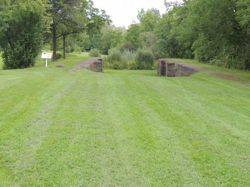
On River Street at Bridge Street E, on the right when traveling south on River Street.
The Great World War
1914 [British and Canadian flags logo] 1918
In loving memory of our fallen heroes
who gave their lives
and in honor of those who served overseas from Thorold Township
that freedom and the Empire might endure . . . — — Map (db m278625) WM
On Sullivan Avenue just south of Towpath Road, on the right when traveling east.
British by birth - January 13, 1910, Canadian by conviction, World War II veteran, noted photographer. Over 25 years dedicated municipal service on the Board of Education, Public Utilities Commission and Municipal Council with one term as Reeve. His . . . — — Map (db m54109) HM
On Davis Road at Old Thorold Stone Road, on the right when traveling north on Davis Road.
The Historic Sites and Monuments Board Of Canada erected a stone cairn on this location in 1923, designating the Battlefield of Beaverdams as a National Historic Site. The cairn was relocated to The Battle Of Beaverdams Park in downtown Thorold . . . — — Map (db m274857) HM
On Sullivan Avenue, on the right when traveling east.
The History of Lock 25
Lock 25, located in the Battle of Beaverdams Park in downtown Thorold, is one of the 27 stone locks of the 2nd Welland Canal, which were constructed between 1841 and 1845 to replace the 40 inferior wooden locks . . . — — Map (db m279932) HM
Near Sullivan Avenue south of Towpath Road, on the right when traveling east.
Following their repulse at Stoney Creek the Americans sent a force from Fort George to destroy a British advanced post at Beaver Dams. Warned of their approach by an Indian scout and by Laura Secord, a force of Indians from Caughnawaga . . . — — Map (db m276498) HM
On Marlatts Road 0.2 kilometers east of Beaverdams Road, on the right when traveling east.
Early in the 1790's a group of settlers in this area had been converted to Methodism and formed a Class which, in 1795, was included in the newly-established Niagara Circuit. Services were held in the home of a prominent local settler, Israel . . . — — Map (db m284458) HM
On Canby Street east of South Street North, on the right when traveling west.
The history of and the people associated with this site highlight the prominent position the village of Port Robinson enjoyed in Upper Canadian and early post-Confederation Canadian history.
The site initially belonged to the descendant of a . . . — — Map (db m284318) HM
On Carleton Street South at Portland St, on the right when traveling south on Carleton Street South.
This imposing Italianate style brick home was built for James Calcott who used it for a rental property, an early tenant being John H. Thompson, proprietor of the Thorold Post and publisher of the 1897 Jubilee History of Thorold. The house was . . . — — Map (db m279929) HM
On Canby Street 0.1 kilometers east of River Street, on the right when traveling west.
This fine Ontario Cottage-style house showcases a central-gabled façade, pagoda-roofed verandah and Gothic gingerbread ornamentation. Built in c. 1855 probably for William Dundonald Ross,
the one-and-a-half storey frame house nonetheless has become . . . — — Map (db m260476) HM
On Albert Street East 0.1 kilometers west of Chapel Street South, on the right when traveling east.
The Battle of the Atlantic was the longest battle of WWII.
12,000 Canadian men and women, many of them too young, too old or medically unfit for the Armed Forces, served on Canadian and Allied merchant ships in countless convoys maintaining . . . — — Map (db m284440) HM WM
Here lies 75 unmarked graves. This one acre of Crown land was set aside for a burying ground in 1978 by U.E.L. John Carl 1755-1836. He came to Niagara from Woodstock,N.Y., with Butler's Rangers during the American revolution. He married Elizabeth . . . — — Map (db m280616) HM
On Carleton Street North at Vine Street, on the right when traveling north on Carleton Street North.
Originally part of a Crown grant to the Quaker
John Hill Sr in 1801, the property on which this
house stands later formed part of Dr Henry Rolls'
village subdivision. The Georgian style building
appears to have been erected by Matthew . . . — — Map (db m280319) HM
On Welland Street South at Portland Street, on the right when traveling south on Welland Street South.
This Gothic Revival and Italianate style home
was built by Henry Carter, a mason, a firefighter
and member of Council, who organized what later became the well-known
and successful Thorold Reed Band.
This house has many exquisite untouched . . . — — Map (db m275396) HM
On Lundy's Lane, on the right when traveling east.
Celebrating 200 Years of the Welland Canal
On November 30, 1824, near this site,
the first shovel went into the ground to
begin the construction of the
First Welland Canal.
George Keefer, President of the Welland
Canal . . . — — Map (db m278630) HM
On Ormond Street at Vine Street, on the right when traveling north on Ormond Street.
This stone home was built for Irish-born John McDonagh, a miller and lumber merchant, who was Village Reeve and Mayor 1881-84. It was left to St.John's Anglican Church who sold it in 1920 to the Great War Veterans' Assoc. (Royal Cdn. Legion).
From . . . — — Map (db m260664) HM
Near Sullivan Avenue, on the right when traveling east.
This time capsule was sealed on
July 1, 2000
in commemoration of
Thorold's 150th Anniversary
and in recognition of
its Millennium Celebrations.
It is to be re-opened on July 1, 2100 — — Map (db m279809) HM
On Chapel Street South near Service Road West, on the right when traveling north.
Construction of the Welland Canals
The Welland Canals have long provided an important navigation link between Lake
Ontario and Lake Erie, which helped foster the growth of trade, industry, and cities around the Great Lakes. . . . — — Map (db m284320) HM
Near Decew Road, on the right when traveling west.
Decew House Heritage Park is a City of Thorold War of 1812 bicentennial project. Obtained from Ontario Power Generation, the City of Thorold, through the work of their War of 1812 Bicentennial Committee, restored the house foundation and . . . — — Map (db m280023) HM
On DeCew Road 1.5 kilometers west of Merrittville Highway (Ontario Highway 50), on the right when traveling west.
This house of Captain John DeCou (the name was variously spelled by his relatives and descendants and latterly as DeCew) was the Headquarters of the British outpost under Lieut. James Fitzgibbon to which came Laura Secord through the woods and . . . — — Map (db m279974) HM
On Pine Street North at St. David Street W, on the right when traveling north on Pine Street North.
It is tempting to think that Scottish immigrant Archibald
Dobbie had a vision of the great things he would achieve
in Thorold when he settled here shortly after marrying
Christianna Zavitz in 1853. Within two decades, he had
established the . . . — — Map (db m279967) HM
On Front Street North 0.1 kilometers north of Albert Street East, on the right when traveling north.
Constructed in 1935, officially opened in May 1936, this landmark building was enlarged in 1957 by increasing the size from 6 to 10 bays. It was one of more than 240 federal buildings erected in the 2nd half of the 1930s under the Public Works . . . — — Map (db m260639) HM
On Towpath Street 0.1 kilometers north of Sullivan Avenue, on the right when traveling north.
Erected in 1879, this bell served the Thorold community at the old Fire Hall until 1964 when the Protection Hose Company relocated it to the Towpath location. It was purchased in 1878 from the Meneely Bell Company of Troy, New York, a foundry . . . — — Map (db m260661) HM
On Albert Street West at Towpath Street, on the right when traveling west on Albert Street West.
The first cotton goods produced in this province were being manufactured in Thorold in 1847. The mill, a joint stock company founded by local citizens, included Jacob Keefer as president and James Munro as secretary, and was located near here. About . . . — — Map (db m284408) HM
Near Decew Road, on the right when traveling west.
Welcome -
Bienvenue
- Wa'tkwanonhwerá:ton
First Nations Peace Monument
Decew House Heritage Park
This land is the traditional territory of the
Neutral Nation, . . . — — Map (db m279972) HM
On Portland Street at Welland Street S, on the right when traveling west on Portland Street.
This house was built for Matthew & Agnes Flannery within
the year after Matthew, at age 26, purchased the land in 1859,
for $235. Matthew was one of Thorold's early artisans;
not only was he a painter by trade, he specialized in "sign,
carriage . . . — — Map (db m275394) HM
On River Street, on the right when traveling south.
Port Robinson, the southern terminus of the original Welland
Canal, opened in 1829, was named for John Beverley Robinson,
Chief Justice of Upper Canada. The village grew rapidly
when hundreds of Irish immigrants laboured on the "Deep Cut" between . . . — — Map (db m274970) HM
During the construction of the original Welland Canal, 1824-1829, a number of communities sprung up along its length. Here, on land belonging to George Keefer, a village known as Thorold had developed by 1828. A large flouring mill was built on the . . . — — Map (db m54088) HM
On Portland Street at Carleton Street S, on the left when traveling west on Portland Street.
The conspicuous Fraser-McMann House was built to showcase the prominence of the entrepreneur Dr. Henry Rolls, who was responsible for subdividing this Thorold neighbourhood in the mid-nineteenth century. Notwithstanding, the house is more commonly . . . — — Map (db m275393) HM
On Queen Street South, on the left when traveling north.
Referring to both Classical and Gothic revival styles, this
house was built by the Irish-born miller Thomas Spinks as
a rental property. Although associated with the Grenville
family from 1871, the house was not actually used as a
residence by . . . — — Map (db m275410) HM
On Decew Road, on the right when traveling west. Reported missing.
The construction of Griffiths House must be seen in connection with the subdivision of the village of Beaver Dams Centre and Thorold’s burgeoning “industrial district” after WWI. Modeled by George Griffiths on DeCew House in which he grew up, the . . . — — Map (db m278803) HM
Near Sullivan Avenue just south of Towpath Road, on the right when traveling east.
John Bean was born in Attercliffe, Ontario, on September 8, 1901. He attended Stratford Collegiate Institute in Ontario and Northwestern College before transferring to the University of Michigan, where he earned his degrees and spent the rest of . . . — — Map (db m272151) HM
On Pine Street North at Townline Road West, on the left when traveling north on Pine Street North.
Built around 1870, the property surrounding this
stately Italianate house was owned by Irish-Born
William Beatty Sr. and his eldest son James.
One of Thorold's most celebrated families, the
Beattys established a steamship fleet that plied
the . . . — — Map (db m276977) HM
Near Sullivan Avenue, on the right when traveling south.
The JB Stone
This stone is from the Thorold Cement Works, which formerly stood in this location alongside the Welland Canal. Founded by John Brown in about 1840, the factory processed stone from his quarries east of town and its hydraulic cement . . . — — Map (db m271467) HM
On Welland Street South, on the right when traveling north.
This imposing brick house was built for
Wm. Waud, a carpenter and joiner and has
elements of neo-Classical and Classical Revival
styles with a symmetrical 3-bay façade,
central doorway and substantial portico.
In 1871 it was sold to John Morley . . . — — Map (db m275397) HM
On Sullivan Avenue just south of Towpath Road, on the right when traveling east.
Who set out from her home in Queenston early in the morning of June 22, 1813, to walk an arduous nineteen miles to warn the British outpost at DeCew Falls of an impending American attack. The information enabled the local British commander, . . . — — Map (db m53392) HM
Lock 25, constructed from locally quarried limestone
between 1841 and 1845, is the only Second Welland
Canal mountain lock in Thorold that remains visible
today. Demonstrating its engineering and functional
design, it is part of the built . . . — — Map (db m274971) HM
On Chapel Street South at Portland Street, on the left when traveling north on Chapel Street South.
This Edwardian brick structure with many fine features,
built by the Lynch brothers, has a commanding location
in relation to the Welland Canal. As tradesmen and
tending locks on the canal, the Lynchs were all involved
in the early years of . . . — — Map (db m275386) HM
On Front Street South 0.03 kilometers south of Albert Street West, on the right when traveling south.
This landmark building has been a drug store since 1872 when it was purchased by Wm. Macartney who sold drugs, toys, fancy goods and steamship tickets. It remained in that family until 1939 when it was bought by Edward Henderson; the business was . . . — — Map (db m279945) HM
Near Saint David Street West, on the right when traveling west.
Built by Hugh Keefer overlooking the 2nd Welland
Canal, this outstanding landmark was designed by
C.W. Mulligan in dramatic Richardsonian-Romanesque
style, and built of red Grimsby sandstone and gray
limestone from Queenston. It replaced the . . . — — Map (db m275428) HM
On Welland Street South, on the right when traveling south.
The original owner of this brick house was William England
who sold it in 1901 to James Millar, a local tailor and
merchant, and it remained in the Millar family until 1992.
James, who had a family of 6 children, had a business at
31 Front St. . . . — — Map (db m275388) HM
On Clairmont Street west of Chapel Street S, on the left when traveling east.
This one and one-half storey "Ontario Classic Revival
House" with pillastered door case and shuttered
double-hung windows was built for Jones Moore and
Caroline Pew (U.E.L.).
Jones Moore was an importer and wholesale merchant
originally . . . — — Map (db m275402) HM
On Ormond Street South, on the right when traveling south.
James Munro operated a department store on
Front Street but lost it and his home in the
great fire of 1866. He rebuilt the store and
erected this splendid brick house with a
variety of architectural styles, including
Italianate, Regency and . . . — — Map (db m275408) HM
On Albert Street East 0.1 kilometers west of Chapel Street South, on the right when traveling east.
An Act Respecting a National Peacekeepers’ Day
Bill C-289 SC 2008, c,27-2008-06-18
WHEREAS in 1956 the Minister of External Affairs, the Right Honourable Lester B. Pearson, proposed the first
United Nations peacekeeping mission and, . . . — — Map (db m284441) HM
On Albert Street West at Ekins Lane, on the right when traveling west on Albert Street West.
[Top plaque]
City of Thorold
The Old Firehall
1878
Designated under
the Ontario Heritage Act
[Bottom plaque]
Thorold's Old Firehall
1878
Designed by John Latshaw in red and yellow brick, this . . . — — Map (db m196305) HM
On Hwy 20 (Lundy's Lane) just east of Holland Road, on the right when traveling east.
Originally conceived in 1818 by its promoter, William Hamilton Merritt, to divert trade from the Erie Canal and New York and built under private auspices, the canal was opened to traffic in 1829. After additional work in 1833, the . . . — — Map (db m283010) HM
On Chapel Street South at Service Road West, on the right when traveling north on Chapel Street South.
In 1912, the Ontario Paper Company was incorporated as a subsidiary of the Chicago Tribune newspaper under the direction of publisher Robert McCormick. A paper mill was constructed south of here on the banks of the Welland Canal. On . . . — — Map (db m284319) HM
On Welland Street South, on the right when traveling south.
This two storey Italianate style house was constructed by noted Thorold builder Isaac Usher in 1875, for St John's Anglican Church, on lots purchased from Dr. Henry Rolls. Known as "the Parsonage", it was in use as the rectory for the church until . . . — — Map (db m275390) HM
Near Decew Road, on the right when traveling west.
This historic park includes the stone foundation of DeCew House (1808), used as a detachment
Headquarters by the British Army during the War of 1812, and the First Nations Peace Monument
(2017) that recognizes the Crown's alliances with Indigenous . . . — — Map (db m279971) HM
On South Street South 0.1 kilometers south of Bridge Street East, on the right when traveling north.
The Pew House is associated with a village blacksmithing precinct that operated from the third quarter of the nineteenth century to the first years of the twentieth century and extended over roughly an acre from this location to today's Bridge . . . — — Map (db m260526) HM
This is the original headstone of
Private John Carl U.E.L., Butler's Rangers
Upper Canada (Niagara Region)
Born 1755 in Hempstead, Long Island, New York
Died 1836 in Pelham Twp, Welland County, Ontario
John emigrated . . . — — Map (db m280623) HM
On Front Street South 0.1 kilometers Clairmont street, on the right when traveling north.
Although this building served the Thorold community as a bank for nearly a century from its opening in 1875 until the early 1960's, its tenure as a branch of the Quebec Bank was short-lived - from 1897 to 1912. Built in the Second Empire style by . . . — — Map (db m260641) HM
On Canby Street 0.5 kilometers west of Allanburg Road, on the right when traveling west.
A fine hybrid example of vernacular Classical and Gothic revival styles,
this house has significant heritage value through its association with the prominent Ross family. The Edinburgh-born William Dundonald Ross and his sons built up and managed a . . . — — Map (db m260585) HM
On Clairmont Street at Ormond Street S, on the right when traveling west on Clairmont Street.
The congregation of St. Andrew's was founded
in 1802, with Peter Lampman, Adam Hutt, and
George Miller as trustees. Worship first took
place at the Town Hall, and later at a brick
church building erected in 1859 at 17 Ormond
Street North. In . . . — — Map (db m284399) HM
On Clairmont Street at Ormond Street S, on the right when traveling west on Clairmont Street.
City of Thorold
St. Andrew's Presbyterian Church 1883
(Congregation established 1802)
Designated under the Ontario Heritage Act — — Map (db m284400) HM
Near Clairmont Street at Carleton Street South, on the right when traveling west.
Cornerstone 1853
First Service September 1856
First Rector - Thomas Brock Fuller
Architect - Kivas Tulley
A community of faith
Sesquicentennial 2003 — — Map (db m276994) HM
On Holland Road at Hollow Road, on the left when traveling east on Holland Road.
A sawmill built in 1792 on nearby Twelve Mile Creek by Benjamin Canby, an early entrepreneur, formed the nucleus of a settlement, which by 1799 was called St. Johns. Other enterprising businessmen, notably John Darling and John Street, developed . . . — — Map (db m284317) HM
On Front Street South 0.1 kilometers north of Clairmont Street, on the right when traveling north.
This block was part of the reconstruction of Front St. South after the fire of 1866. Amantus Schwaller was born in France in 1810. He came to Canada at the age of 20, became a prosperous entrepreneur, a member of Municipal council and was on the . . . — — Map (db m280727) HM
On Sullivan Avenue, on the right when traveling east.
Born in Thorold, Beatty attended the University of Toronto
and Osgoode Hall. In 1898, he joined the legal department
of Canadian Pacific Railway (CPR) in Montreal and became
the company's first Canadian-born president at the age of
41. He led . . . — — Map (db m275409) HM
On Vine Street near Welland Street N, on the right when traveling west.
Built by Alfred Murch Smerdon, whose great
uncle James Weeks founded the Thorold Reed
Band in the 1850s. The house went through
two other families - the Dunns from 1919-20
and the Tincknells from 1920-27, before being
sold to Paul & Louise Buss . . . — — Map (db m275407) HM
On Albert Street East 0.1 kilometers east of Carleton Street North, on the right when traveling west.
50 Albert Street East was build around a section of "Squire" James Black's grand two-story house c. 1835 after it was subdivided into two separate dwellings in 1914. In spite of passing through several owners after the Squire's death in 1844, the . . . — — Map (db m260721) HM
On Albert Street East, on the left when traveling east.
At this site, the Secretary of the Welland
Canal Company - "Squire" James Black
built a two-story, stucco-clad frame house
in c. 1835 - one of the first domestic
dwellings in Old Town Thorold. Although
altered significantly in 1915, features . . . — — Map (db m275404) HM
On Chapel Street South, on the left when traveling south.
This attractive stone house (and its neighbour) maintained their original locations, in spite of the expropriation of land in 1913 for the expansion of the 4th Welland Canal. James Stewart, born in Scotland, was a stonecutter, contracting on the old . . . — — Map (db m275381) HM
On Front Street South at Sullivan Avenue, on the right when traveling south on Front Street South.
This was the site of the Niagara, St. Catharines and Toronto Railway (NS&T) Thorold Station. The NS&T was an electric freight and passenger railway serving communities primarily along the Welland Canal corridor plus Niagara Falls. It was an . . . — — Map (db m260650) HM
On Regent Street at Front Street N, on the right when traveling west on Regent Street.
Commemorating Holy Rosary School that educated so many of our fine Thorold citizens over the meany years of its existence. This flagpole stood at the front entrance of the school and the brick was part of the building before being take down to make . . . — — Map (db m276984) HM
On Pine Street North 0.1 kilometers north of Albert Street East, on the right when traveling north.
Believed to have been one of Upper Canada’s largest flour mills, this substantial limestone structure was erected in 1846-47 by Jacob Keefer. It was constructed on the Second Welland Canal, a channel which has since been filled in, and . . . — — Map (db m284409) HM
On Welland Canals Parkway, on the right when traveling north.
Welland Ship Canal
Throughout history the Niagara Escarpment has been a barrier to traffic between the Great Lakes. To overcome the difficult portages around Niagara Falls the first Welland Canal was built in 1829. Since then the canal has been . . . — — Map (db m271401) HM
On Welland Street North, on the right when traveling north.
The Williams-Daboll House 1876
Built for John Collier Williams by George and Joseph McFarland,
this house represents the hybrid Gothic Revival/Italianate style
popularized throughout much of small-town southern Ontario
in the second . . . — — Map (db m276973) HM