375 entries match your criteria. Entries 101 through 200 are listed.⊲ Previous 100 — Next 100 ⊳
Covered Bridges Historical Markers
Wooden bridges were covered to protect the bridge flooring from the elements. It was more economical to re-roof a bridge than to replace the flooring. Concrete and Steel spans replaced covered bridges when they became cheaper to build.
On Jones Lane (Route 1262) (County Route 1262 at milepost 3), 1 mile south of Switzer Road (County Route 1689), on the left when traveling south.
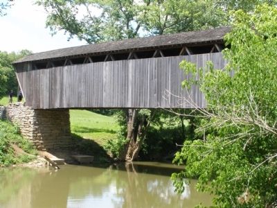
Franklin County's only covered bridge spans North Elkhorn Creek and is 120 ft. long and 11 ft. wide. It was built by George Hockensmith circa 1855. each entrance has a sawtooth edge; the lattice is pinned with trunnels (treenasil). Restored in 1906 . . . — — Map (db m11614) HM
Near Frazer Branch Road, 0.2 miles south of KY-1, on the left when traveling south.
Oldtown Covered Bridge is an
Official Covered Bridge of Kentucky
Bridge built circa 1880 (builder unknown)
Reconstructed in 1999
[Remainder of marker non-historical and omitted] — — Map (db m212008) HM
On Kentucky Route 7 at Brown Cover Bridge Road (Kentucky Route 1215), on the right when traveling south on State Route 7.
One of Kentucky’s longest wooden one-span covered bridges, length 195 feet. B.F. Bennett and his brother Pramley built the bridge in 1855 or 1856 to accommodate customers at their mill. It has withstood severe floods through the years. Original . . . — — Map (db m144392) HM
On Kentucky 3 at East Fork Road (Kentucky Route 1496), on the left when traveling north on Kentucky 3. Reported missing.
East Fork Covered Bridge Built in 1924 by John and George Riffe, this covered bridge is 42 feet long and has modified king posts. The single-span, wooden structure crosses the East Fork of Little Sandy River near Fallsburg. The bridge has . . . — — Map (db m212009) HM
On Cabin Creek Road, 3.6 miles east of Mason Lewis Road (Kentucky Route 10), on the left when traveling west.
Built circa 1870, this 114ft.
covered bridge spans Cabin Creek.
Name of the builder is unknown.
It was constructed on Burr truss
design, with laminated arches and
truss rods added later. Louis
Bower employed arches in early
1900s. Lack of . . . — — Map (db m180444) HM
On Mary Ingles Highway (Kentucky Route 8) at Lees Creek Road, on the right when traveling east on Mary Ingles Highway.
One of the oldest covered bridges in Kentucky still in use. Erected in 1835, it was originally a toll bridge. The 62-foot span was built in an unusual Queenspost truss design similar to early barn construction. Major repairs were made by Bower . . . — — Map (db m136339) HM
On South Main Street (U.S. 231) 0.1 miles north of East Union Street, on the right when traveling south.
Site of the first covered bridge here, built in 1823, thought to be the first across the Rough River. This was later replaced by another similar one after the decay of the first. Earlier crossings were by ford or ferry. An iron bridge was . . . — — Map (db m159287) HM
On Mt. Zion Road (Kentucky Route 458), on the left when traveling north. Reported missing.
The covered bridge over Little Beech Fork is 211 feet long and 16 feet wide. It utilizes the Burr truss design and is one of the longest multi-spans in Ky. The contractors were H. I. and William F. Barnes of Mount Washington. Original cost of . . . — — Map (db m121604) HM
On Hemlock Bridge Road, 1.1 miles south of Frog Alley, on the right when traveling east.
Oldest surviving example of a Paddleford truss system
used in a Maine covered bridge.
Built in 1857 — Designated on January 17, 2002 — — Map (db m198708) HM
On Lowe's Bridge Road at Water Street (State Highway 16), on the left when traveling south on Lowe's Bridge Road.
Low's Bridge sits adjacent to land once owned by Robert Low, one of Guilford's early settlers. The towns of Guilford and Sangerville built the original structure in 1830 to make travel between the two areas of commerce easier. A flood destroyed the . . . — — Map (db m147970) HM
On North East Road (Route 272) 0.3 miles north of Old Bayview Road, on the right when traveling north.
Built circa 1860, the bridge is one of the few covered ones left in Maryland and the only one on public ground in Cecil County. The area to the East has been the site of several mills, the earliest Samuel Gilpin’s flour mill circa 1735. . . . — — Map (db m1692) HM
On Catoctin Mountain Highway (U.S. 15) 0.5 miles south of Business U.S. 15, on the right when traveling south.
Each year, thousands of visitors come to the Thurmont area to enjoy the Great Outdoors. Uniquely positioned amidst a cavalcade of authentic recreational experiences, the Maryland Main Street designee of over 6,000 residents proudly caters to . . . — — Map (db m159918) HM
Near Urbana Pike (Maryland Route 355) at Araby Church Road, on the right when traveling north.
On July 9, 1864, a wooden covered bridge spanned the Monocacy River where you see the present-day Urbana Pike Bridge. The covered bridge provided easy movement for the Confederates, intent on speeding 15,000 troops with their horses, wagons, and . . . — — Map (db m194547) HM
On Old Frederick Road, on the right when traveling south.
Late in June 1863, the Union Army of the Potomac pursued Gen. Robert E. Lee's Army of Northern Virginia as it invaded the North for the second time in as many years. On Sunday, June 28, Union Gen. Oliver O. Howard's XI Corps broke camp in the . . . — — Map (db m3487) HM
Near Stafford Road at Rock Run Road, on the right when traveling west.
Construction & Destruction
The Susquehanna Bridge and Banking Company began construction in 1813 and opened the bridge in 1818, connecting Harford and Cecil Counties.
The bridge was covered to protect the wooden decking and trusses from . . . — — Map (db m194866) HM
On Covered Bridge Lane east of S Main Street (U.S. 7), on the right when traveling east.
“THE OLDEST COVERED BRIDGE IN MASSACHUSETTS” was ordered to be built in 1854. At a meeting in late 1853 the Sheffield Selectmen were directed to advertise for proposals. They were voted full power to move forward and make contracts, as . . . — — Map (db m37504) HM
This bridge, named in memory of Randy Rapson, was built by the community with
materials donated by his family.
Randy
was a lifelong resident
and businessman of Harbor
Beach. He was born February
5, 1955, to George and . . . — — Map (db m226068) HM
On North Whites Bridge Road, 1 mile north of Richmond Road, on the right when traveling north.
This picturesque covered bridge, one of the last of its kind in Michigan, was built in 1867 by Jared N. Brazee and J.N. Walker, builders of several covered bridges in this area. The name of the bridge derives from the White family, a prominent . . . — — Map (db m55246) HM
On Thornapple River Drive Southeast at Fase Street Southeast, on the right when traveling south on Thornapple River Drive Southeast.
An act of the legislature in 1867 authorized Ada Township to borrow up to $3000 for the purpose of building or repairing bridges in the township. This bridge was built about that time, apparently by William Holmes. The design for the trusses was . . . — — Map (db m182789) HM
On Covered Bridge Road Northeast at Beckwith Drive NE, on the left when traveling east on Covered Bridge Road Northeast.
John W. and Silas S. Fallas settled here in 1837, founding a village which soon boasted a chair factory, sawmill, and gristmill. About 1840 the first of several wooden bridges was placed across the Flat River, but all succumbed in a short time to . . . — — Map (db m55253) HM
On Schweitzer Road at Covered Bridge Road (County Highway 133), on the left when traveling east on Schweitzer Road.
This is the longest of Michigan's few remaining covered bridges. It is 282 feet long with three, 94-foot spans of the Howe-truss construction. The bridge was built in 1887 by Pierce (?) Bodner of Parkville, using the best quality white pine for . . . — — Map (db m212484) HM
On West Avenue, 0.1 miles north of West 2nd Street, on the right when traveling north.
This bridge spans the time from
the 19th to the 21st century
This authentic 116 foot long covered bridge is the last in Minnesota. It was moved to this location in the city of Zumbrota on March 4, 1997.
The restoration and relocation of . . . — — Map (db m203008) HM
Constructed over Zumbro River in 1869 · cost $5,800. Original site Highway 58 about 1,000 feet from present location.
120 feet long town lattice truss design plans by A.J. Thatcher · construction supervised by E.L. Kingsbury.
Served as . . . — — Map (db m49209) HM
On West Avenue, 0.1 miles north of West 2nd Street, on the right when traveling north.
A vital river crossing for 63 years
1869
The new bridge was designed to be "high enough and strong enough", because spring floods had destroyed earlier river crossings.
1871
A roof and sidewalls were added to protect the . . . — — Map (db m203016) HM
On West Avenue, 0.1 miles north of West 2nd Street, on the right when traveling north.
A multi-purpose building at the Goodhue County Fairgrounds for 37 years
1932-1969
The fair board selected a site for the bridge on the north side of the fairgrounds next to the barns, and it housed poultry exhibits for several years. . . . — — Map (db m203014) HM
On West Avenue, 0.1 miles north of West 2nd Street, on the right when traveling north.
Centerpiece of Covered Bridge Park for 27 years
1970
The first annual Chicken Barbecue was sponsored by local businesses and was held on the bridge. Proceeds helped to fund a new swimming pool which was also located in the park. . . . — — Map (db m203011) HM
On West Avenue, 0.1 miles north of West 2nd Street, on the right when traveling north.
Minnesota's only original historic covered bridge
1997
Supported by two I-beams, the covered bridge was lifted and moved a distance of 100 yards. New piers and abutments had been built to ensure a secure river crossing.
2019 . . . — — Map (db m203009) HM
On County Road 360, 0.1 miles east of State Highway OO, on the right when traveling east.
(Front): Bollinger Mill
Maj. George Frederick Bollinger built the first mill here in 1800, on a 640-acre grant from Louis Lorimier, Spanish Commandant of Cape Girardeau district of Upper Louisiana. A German Swiss from North Carolina, . . . — — Map (db m35367) HM
In Missouri, the covered bridge was first used in the 1850s when roads, railroads and overland transportation in general became a practical and important mode of travel. The first covered bridge in the state was built in 1851 in Boone County over . . . — — Map (db m211580) HM
Covered bridges have existed for nearly all of man's recorded history. Ancient Babylonians are credited with having erected the first such structure over the Euphrates River about 783 B.C. It continued to be a popular bridging method with similar . . . — — Map (db m214354) HM
Sandy Creek Covered Bridge is one of three historic Howe-truss bridges in Missouri. The bridge is 74 feet, 6 inches long and 18 feet, 10 inches wide with an entrance height of 13 feet. The original bridge was built in 1872 by John Hathaway Morse and . . . — — Map (db m211581) HM
Why Restore a Covered Bridge?
Quite a few people asked that question when plans were made to start restoration on Sandy Creek Covered Bridge. Some of the more important reasons include the following:
•Many covered bridges are . . . — — Map (db m211579) HM
Truss Structures
Kingpost
The kingpost was the first and simplest truss structure used in America. Its basic idea consists of a center post, the kingpost, with compression beams slanting downward and outward toward each shore. The . . . — — Map (db m67182) HM
On Pershing Drive north of Front Street, on the left when traveling north.
Laclede, Mo. was established in 1853. Conveniently located with access from the railroads, Laclede was at one time quite a prosperous town. general stores, banks, factory work, appliance retail, implement dealerships, upholstery, beauticians, . . . — — Map (db m67078) HM
Though its present setting suggests otherwise, this bridge was part of "Route 8," the first transcontinental highway in the United States and the primary east-west artery in Linn County. Prior to that designation, "Route 8" played an important . . . — — Map (db m67180) HM
Near Passaconaway Road east of Kancamagus Highway (New Hampshire Route 112) when traveling east.
Local Ideas
Builder Amzi Russell who lived at what is now the Russell-Colbath homestead, was an industrious and versatile nearby builder.
His crew of three to thirty local hands were not engineers. But they were extremely skilled craftsmen . . . — — Map (db m116180) HM
On West Side Road at Hillside Avenue, on the right when traveling north on West Side Road.
Restored in
1991
Through generous donations
of many private citizens
and the taxpayers of
the Town of Conway
uniting to preserve a symbol
of our community heritage. — — Map (db m162705) HM
On Main Street west of Spring Street, on the left when traveling west.
Originally constructed in 1832 by Zadoc Taft
Reconstructed in 1993 and dedicated on August 14, 1993
with the cooperation of the
citizens of Swanzey
Selectmen
Kenneth P. Colby, Jr. • Bonnie J. Tolman • Francis W. Faulkner, Jr.
Wright . . . — — Map (db m198714) HM
On Rum Hill Road (U.S. 302), on the right when traveling south.
Settled in 1766 by Jaasiel Harriman whose cabin was near the Great Rock. His nine year old daughter Mercy carried dirt in her apron to the top of this unique rock formation. Here she planted corn, pumpkins and cucumbers, making the first garden . . . — — Map (db m74569) HM
On Blair Road, 0.1 miles west of Daniel Webster Highway (U.S. 3), on the right when traveling west.
Hiram W. Merrill (1822-1898) of Plymouth, N. H., built this bridge in 1870 to replace a span of 1829 that had been burned by an arsonist. The bridge employs a truss design patented by Col. Stephen Harriman Long (1784-1864) of Hopkinton, N. H. It is . . . — — Map (db m198713) HM
On Monroe Road (New Hampshire Route 135) 0.1 miles north of Central Street (U.S. 302), on the right when traveling north.
Constructed in 1829 by the towns of Bath and Haverhill at a cost of about $2,400, this is one of the oldest covered bridges in the United States. Built with 3-by-10-inch planks that were probably sawn at an adjacent mill, the span is the earliest . . . — — Map (db m77800) HM
On Daniel Webster Highway (U.S. 3) 0.2 miles north of Connector Road, on the right when traveling north.
Quinten E. Mulleavey born Dec. 16, 1948 Friend and dedicated member of the covered bridge project. One of three high school students who at the age of 16 helped move this massive covered bridge over the Pemigewasset River. Missing in . . . — — Map (db m97239) HM WM
Near Bridge Street west of Union Street, on the left when traveling north.
The 2009 renovation of the
New England College Covered Bridge
was made possible by generous gifts
from the following:
The General William Mayer Foundation and Cynthia M. Benfield '81 and Daniel P. Benfield '81 · Mr. and Mrs. Barry C. . . . — — Map (db m162670) HM
On Chase Road (SR 12A) at Bridge Street on Chase Road (SR 12A).
Built in 1866 at a cost of $9,000, this is the longest wooden bridge in the United States and the longest two-span covered bridge in the world. The fourth bridge at this site, the 460-foot structure was built by Bela J. Fletcher (1811-1877) of . . . — — Map (db m74586) HM
On New Hampshire Route 12A south of the Cornish-Windsor Covered Bridge, on the left when traveling north.
In the second half of the 1980's it became clear that this
Bridge would need substantial repairs if it was to continue
in service for vehicular traffic.
Many in state government wanted to close the bridge, and
build something up river. . . . — — Map (db m230109) HM
On Burlington Pike (U.S. 130), on the right when traveling west.
Originally a ferry site, a covered bridge was erected here in 1793. Rebuilt in 1838 and replaced with a concrete span in 1928. The current bridge was opened in 1986. — — Map (db m102897) HM
On Rosemont Ringoes Road at Upper Creek Road, on the right when traveling east on Rosemont Ringoes Road.
This is the last public covered bridge in New Jersey. It was erected in 1872 on abutments dating back to colonial times. Damaged in 1960, the superstructure of this bridge was completely dismantled and removed to make way for a conventional span. . . . — — Map (db m16828) HM
On Fitches Bridge Road at Delhi-South Kortright Road (County Route 18), on the right when traveling north on Fitches Bridge Road.
Built in 1870 by James Frazier & James
Warren, it originally spanned the
Delaware at Kingston Street in Delhi.
Replaced by an iron bridge in 1885, it was
moved by David Wright and a town crew to
this site known as Fitches Crossing. . . . — — Map (db m137499) HM
On Fitches Bridge Road near Delhi South Kortright Road, on the right when traveling south.
Placed on the State and National
Registers of Historic Places in 1999
Rehabilitated in 2001 by Delaware
County Department of Public Works.
Donated By Greater Delhi Area Chamber Of Commerce
— — Map (db m101315) HM
On Bridge Street (New York State Route 30) 0.1 miles south of New York State Route 206, on the right.
Built in 1854 by Robert Murray
To Span 174 of the East Branch
at a Cost of $1,700. Restored in
1998 For $1,000,000 as a Tribute
to the Skills of the Past. — — Map (db m154887) HM
On Bridge Street (New York State Route 30) 0.3 miles north of River Road, on the left when traveling south.
Built 1854.
Has Been Placed on the National
Register of Historic Places
By the United States Department
of the Interior. May 20, 1999. — — Map (db m154888) HM
On New York State Route 10 at Basin Clove Road on State Route 10.
Side A
Hamden Covered Bridge Built in 1859 and placed on the state and national registers of historic places in 1999. Side B
Built in 1859 by Robert Murray to span 128' of the west branch at a cost of $1,000. Restored in 2000 . . . — — Map (db m93306) HM
Near New York State Route 10, on the left when traveling south.
For nearly one hundred fifty years, the Hamden Covered Bridge has stood as a testament tot the ingenuity and resilience of both Delaware Country structures and the engineers who built them. The story of the Hamden Covered Bridge’s original . . . — — Map (db m137657) HM
Near River Street north of Dunham Street, on the right when traveling west.
This replica of the Covered Bridge over the Susquehanna River at the end of Bridge St., Sidney, N.Y. has been generously donated and built by the Unadilla Laminated Products, a Division of the Unadilla Silo Co., Inc. of Sidney and Unadilla, Craig . . . — — Map (db m220631) HM
On Mill Hill Road south of John Fountain Road, on the right when traveling south.
Erected in 1857 by George Burt,
the Jay Covered Bridge is the
sole remaining wooden Howe Truss
Bridge in the Adirondack Park.
Restored to its original site in 2006. — — Map (db m236864) HM
On South Shore Road (County Route 110) at Fish House Road (County Route 109), on the right when traveling south on South Shore Road.
Erected 1818, by state, at Fish House over Sacandaga River. D. Stewart, builder. Jacob Shew, Assemblyman. Torn down 1930. 2000 Ft. North — — Map (db m44404) HM
On Glimmerglass State Park Road, 0.4 miles north of County Road 31, on the right when traveling north.
Built by Andrew Alden, Lorenzo Bates and Cyrenus Clark in 1825, the Hyde Hall Covered Bridge is not only the oldest existing covered bridge in New York State, but in the United States. Restored in 1967 by the State of New York and placed on the . . . — — Map (db m43340) HM
The Hyde Hall Covered Bridge was built in 1825 as part of the 1817-1835 construction of George Clark's country estate, Hyde Hall. Built by Cyrenus Clark, Andrew Alden, and Lorenzo Bates, this 53-foot-long, single span structure incorporates the Burr . . . — — Map (db m123261) HM
On North Shore Road (County Route 4), on the right when traveling east.
Built by Arad Copeland
below Beecher Falls in 1879.
Only NYS Queenpost Truss
Bridge. Placed on NYS and
National Register in 1998 — — Map (db m35154) HM
On New York State Route 30 at Eastside Road, on the right when traveling north on State Route 30.
Longest single span wooden bridge in world. Built by Blenheim Bridge Company, incorporated 1828. Last of its kind in this region. — — Map (db m46984) HM
On Eastside Road at Mountain Road, on the left when traveling south on Eastside Road.
Built in 1854, it is the longest single-span covered bridge in the world. The covered portion of the bridge is 232 feet long, the trusses are 228 feet long, and the span between abutments is 210 feet. The two lanes are 26 feet wide. . . . — — Map (db m192748) HM
On Eastside Road, on the right when traveling south.
Erected 1854 - 1855 by
Nicholas Montgomery Powers
Famous bridge builder
Born Pittsford, Vermont, August 30, 1817
Died Clarendon, Vermont, 1897
This bridge, 232 feet in length, the
longest covered single-span wooden
bridge in the . . . — — Map (db m46983) HM
On Fort Road north of N Main Street when traveling north.
Bridge No. 1
Town of Schoharie
1982
Dedicated To
Dr. Wim Van Eekeren
Who Conceived The
Idea Of A Covered Bridge
And Made It A Reality — — Map (db m145448) HM
Near Covered Bridge Road, on the right when traveling north.
Formerly Mott’s Flat bridge
later known as the “Vantran”
original towne lattice truss
Built by John Davidson in 1860
Erected by town of Rockland — — Map (db m105861) HM
On Covered Bridge Road, on the left when traveling north. Reported missing.
The bridge was originally known as Motts Flat Bridge, more recently called the Vantran Bridge. It is the oldest of four remaining Catskill type patented town-lattice covered bridges in Sullivan County built by John Davidson in 1860.
The bridge . . . — — Map (db m180631) HM
On Craigie Clair Road, 0.1 miles east of Berry Brook Road, on the right when traveling west.
This stretch of the Beaverkill
was a favorite of Theodore Gordon
(1854-1915). Fly fisher, fly-tier and
creator of the Quill Gordon, one of
the first purely American dry flies. — — Map (db m180652) HM
On Craigie Clair Road, 0.1 miles east of Berry Brook Road, on the left when traveling west.
Welcome to
The Beaverkill Covered Bridge
The historic Beaverkill Covered Bridge is one
of just a few covered bridges remaining of the
more than 300 that once linked New York Stater
communities. The bridge was constructed in
1865, an . . . — — Map (db m180647) HM
On Bridge Street just north of Main Street, on the right when traveling north.
Today the Covered Bridge is Newfield's most prized icon, rich with memories of those whose travels have taken them through this historic site. If it could only talk, what extraordinary stories we would hear...
The Newfield Covered . . . — — Map (db m143201) HM
On Bridge Street north of Main Street, on the right when traveling north.
For Their Dedication to the Preservation of the Newfield Covered Bridge
Marie and Grant Musser, long time residents of Thompkins County have actively pursued the preservation of the Newfield Covered Bridge since 1969. Their perseverance . . . — — Map (db m159638) HM
On Bridge Street just north of Main Street, on the right when traveling north.
Built in 1853 and dedicated to Elijah Moore, son of an early settler, this bridge is the oldest Covered Bridge in daily use in New York state. Constructed at the cost of $800.00, the distinctive diamond pattern of the "Town Lattice Truss" is pinned . . . — — Map (db m19677) HM
On Mill Brook Road at Davis Road, on the right when traveling east on Mill Brook Road.
Erected in 1902 by E.A. Marks & W. Alton
Last restoration completed in 1992
Funded by community donations
Listed in the
National Register of Historic Places
This plaque donated by the Town of Hardenburgh — — Map (db m167259) HM
On Buskirk Road (County Route 59) at Firehouse Road (County Route 103), on the right when traveling east on Buskirk Road.
Buskirk's Red
Covered Bridge
Rehabilitated in 2004.Built
Circa 1850 to Replace A
Previous Bridge Built in 1804.
This Crossing Served The
Great Northern Turnpike
Beginning In 1799.
— — Map (db m13751) HM
On Rexleigh Road at Camp Road, on the left when traveling south on Rexleigh Road.
Rehabilitated in 2007. The Rexleigh bridge is a Howe Truss with cast iron shoes built in 1874. This is the third bridge on this site. — — Map (db m58531) HM
Near U.S. 70, 0.2 miles east of Bridgewood Drive, on the left when traveling east.
County commissioners, in 1894, called local land owners to build and maintain a bridge across Lyles Creek. In response, landowners hired the services of Andy J. Ramsour, keeper of Horse Ford covered bridge over the Catawba River, at Hickory. In . . . — — Map (db m70563) HM
Near U.S. 70, 0.2 miles east of Bridgewood Drive, on the left when traveling east.
Why Covered Bridges:
They protect exposed wooden superstructures from rot resulting from exposure to the elements (rain, sleet, snow, and blazing sun).
An uncovered wooden bridge's life span would be 15-20 years; but with a roof and . . . — — Map (db m70562) HM
Near U.S. 70, 0.2 miles east of Bridgewood Drive, on the left when traveling east.
In 1862, the Secretary of War called on Haupt to assist in the reconstruction of railroads destroyed by retreating Confederates. Haupt was able to both rebuild the rail system and organize an efficient rail operation to resupply the Union. In nine . . . — — Map (db m70564) HM
On State Road South (County Road 25) 0.3 miles north of Plymouth Ridge Road, on the right when traveling west.
At one time, hundreds of covered bridges dotted the northeast Ohio countryside. A popular construction in 18th century Connecticut, the early settlers of the (Connecticut) Western Reserve brought this charming architecture with them from New . . . — — Map (db m213951) HM
On State Road Street (County Road 25) 0.3 miles north of Plymouth Ridge Road, on the right when traveling west.
Ashtabula County is rich in history from Conneaut Township Park Beach to the Ashtabula Lighthouse and the Harbor's Bascule Lift Bridge. From Geneva-on the-Lake to the County seat of Jefferson, from Pymatuning Lake to the Grand Valley area. . . . — — Map (db m213952) HM
On Harpersfield Road at State Road, on the left when traveling north on Harpersfield Road.
Replacing an earlier bridge that was carried away in a spring flood, the Harpersfield Covered Bridge was built in 1868 and spans the Grand River, a state-designated wild, and scenic river. This bridge, which currently carries County Road #154 . . . — — Map (db m121531) HM
On West Liberty Street west of South Broadway (Ohio Route 534), on the right when traveling east.
Welcome To Geneva, Ohio
The first covered bridges in Kentucky, Ohio and West Virginia were built by private stock corporations and were toll bridges. Geneva has carried this history forward by providing a toll booth at the Nation's Shortest . . . — — Map (db m214246) HM
Front One of the few remaining covered bridges in southwestern Ohio and the only one in Butler County on its original site, this bridge was built in 1868-1869 to give access to a saw and grist mill owned by James B. Pugh on Four Mile . . . — — Map (db m86977) HM
Built in 1878. It is 140' long supported by a 12 panel Howe Truss. Howe patented this truss (crossed wooden members with vertical iron rods) in 1840. Last covered bridge in Clermont County. Placed on National Register of Historical Places 1974. — — Map (db m86889) HM
On Calcutta-Smith Ferry Road (County Route 430) 0.8 miles north of Harvey Avenue (Ohio Route 39), on the right when traveling north. Reported missing.
First Paper Mill
The first paper mill in Ohio and the Northwest Territory was established in the valley below in 1807 by John Coulter of Virginia, Jacob Bowman and John Beaver of Pennsylvania. The mill was in St. Clair Township on the East . . . — — Map (db m62960) HM
On Echo Dell Road (Local Route 929) north of Bell School Road (Local Route 1131), on the left when traveling north.
"Thomas J. Malone Bridge"
This covered bridge stood in the 1870s over Middle Run, on State Route 154, between Lisbon and Elkton, Elkrun Township. It was converted to a storage shed and moved twice by the Elkrun Township Trustees. Mr. . . . — — Map (db m44754) HM
On Ohio Route 154 east of Scroggs Road (Local Route 795), on the right when traveling east.
Church Hill Bridge Road. This covered bridge, over Middle Run, Elkrun Township, Columbiana County, is the shortest covered bridge in the United States still standing on a once-used public highway, having a clear span of 19 feet and 3 inches. . . . — — Map (db m206008) HM
On Eagleton Road, 0.1 miles south of Teegarden Road, on the right when traveling north.
Side A:Teegarden-Centennial Covered Bridge
The Teegarden-Centennial Covered Bridge, constructed primarily of white oak is of Multiple King Post design spanning 67 feet. It was built nearly 100 years after the birth of the nation. . . . — — Map (db m66539) HM
On County Road 25 near County Road 343, on the right when traveling north.
Built 1863
Original Contractor
John Shrake
Restored 1996
Restoration Contractor
W.M. Brode Co.
Restoration Design By
Richland Engineering, Ltd.
Don Timmer
The restoration of the last remaining covered bridge in Coshocton County . . . — — Map (db m166035) HM
375 entries matched your criteria. Entries 101 through 200 are listed above. ⊲ Previous 100 — Next 100 ⊳