375 entries match your criteria. Entries 201 through 300 are listed.⊲ Previous 100 — The final 75 ⊳
Covered Bridges Historical Markers
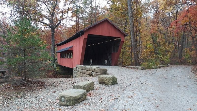
Wooden bridges were covered to protect the bridge flooring from the elements. It was more economical to re-roof a bridge than to replace the flooring. Concrete and Steel spans replaced covered bridges when they became cheaper to build.
Originally crossed Clear Creek at Strickler Road Near Zane's Trace. Rebuilt in the year 2000 by Park Maintenance Staff using 30% original materials. — — Map (db m161347) HM
Built in 1881, John Bright #2 covered bridge
originally spanned Poplar Creek on Bish Road near
Baltimore, Ohio. It is named after pioneer settler
John Bright, whose family farm was located near
the original site. August Borneman of . . . — — Map (db m224964) HM
(Side A)
In March, 1887, the Franklin County Commissioners announced the building of a bridge in Madison Township over Little Walnut Creek at Kramer's Ford. Area citizens had petitioned for a bridge to transport agricultural products to the . . . — — Map (db m178530) HM
Built in 1877 and spanning approximately ninety-five feet, the Stevenson Road Covered Bridge carried vehicular traffic until 2003. it is one of a few Smith truss bridges left in the United States. The Smith Bridge Company manufactured the bridge . . . — — Map (db m214660) HM
In 1883, James E. Brown built this seven-panel Howe truss bridge over the North Branch of Caesar Creek, near the site of Lyman Ballard’s grist mill and on the property of William C. Dean. At the time it was built, iron, concrete, and steel . . . — — Map (db m106267) HM
Built in 1877 and spanning 136 feet, the Engle Mill Road Covered Bridge carried vehicular traffic until 2003. The bridge is named after the nearby Levi Engle Mill. It is one of a few dozen Smith Truss bridges in the United States. The Smith Bridge . . . — — Map (db m106266) HM
Near This Spot
The Old Covered Bridge
Spanned Wills Creek
On the Old National Road
1828 – 1913
Near It Was the Ferry Cabin
The First House
Built in Cambridge
1798 – 1800
This Marker is Erected
By Anna Asbury Stone . . . — — Map (db m81828) HM
The covered bridge era in America was from the nineteenth century. The last covered bridge
of this period was built by the State of Ohio in Vinton County in 1919, Bridges were enclosed
to protect the wooden structural parts and decks from rain . . . — — Map (db m166684) HM
Eldean Bridge is the only covered bridge left of about 30
that once crossed Miami County streams. The bridge, built in
1860, is one of Ohio's oldest. With a deck length of 222 feet,
it is also the state's second longest covered . . . — — Map (db m166799) HM
Originally known as Allen's Mill Bridge, the Eldean Covered Bridge was built over the Great Miami River in 1860 for Miami County by the Hamilton Brothers of nearby Piqua. Its 224 feet place it among Ohio's longest covered bridges and the longest in . . . — — Map (db m28339) HM
The Eldean Bridge
has been designated a
National Historic Landmark
Built in 1860, the Eldean bridge possesses national
significance as an excellent example of covered
bridge construction. Its span is a rare surviving Long
Truss, . . . — — Map (db m166800) HM
Bridges to the Past
On a backroad the sight of a covered bridge today may
remind us of ghost stories and legends that tingled the scalp
of many a small child who walked its gloomy length as the
sun was sinking from sight.
For some, it . . . — — Map (db m166040) HM
A covered bridge was often used for more than just travel.
Robbers and lovers took advantage of the darkness
created by its enclosed sides.
Early wooden bridges were often covered with a roof and siding to protect their
structure from the . . . — — Map (db m173742) HM
Restored in 1963, the Germantown Covered Bridge on East Center Street, spanning Little Twin Creek, was 93 years old and is reputed to be the only existing covered bridge of its kind in the world. For 41 years this unique inverted bow string truss . . . — — Map (db m28553) HM
This bridge spanned Caesar Creek on Jasper Road in Greene County. It was plucked from certain destruction and placed here by the action and forethought of Huston Brown. This plaque commemorates the 20th anniversary of the move.
July 27th, . . . — — Map (db m157094) HM
Built in 1870 reputed to be the only one of its kind in the world restored in 1963 by Covered Bridge Committee
Dedicated and officially opened to traffic by Senator Charles Whalen October 17, 1964 John B. McGuff Mayor — — Map (db m229191) HM
Side A: Salt Creek Bridge
This covered bridge, spanning Salt Creek in Perry Township, Muskingum County was erected in the 1870s. It is a splendid example of an Ohio covered bridge built with Warren type trusses. It is being preserved as an . . . — — Map (db m13344) HM
This covered bridge once spanned Brannon's Fork near Young Hickory in Muskingum County. The bridge was dismantled in the 1960's because land surrounding it was to be strip mined.
Arthur Wesner purchased the bridge in 1967 and reassembled it on . . . — — Map (db m166064) HM
This covered bridge once spanned Brannon's Fork
near Young Hickory in Muskingum County. The bridge
was dismantled in the '60s because land surrounding
it was to be strip-mined.
Arthur Wesner purchased the bridge in 1967
and reassembled it . . . — — Map (db m166065) HM
Ohio's oldest and only standing double-barreled covered bridge and the oldest of six remaining in the nation.
Built by Orlistus Roberts and James Campbell over Seven Mile Creek on Old Camden Pike South of Eaton.
Relocated and restored in . . . — — Map (db m19937) HM
Roberts Bridge. This covered bridge is the oldest still (1962) standing in the state and the last of the "double-barreled" spans in Ohio. It was built across Seven Mile Creek on the Old Camden Road in 1829-30 by Orlistus Roberts and J.L. . . . — — Map (db m20331) HM
Mull Covered Bridge The Mull Covered Bridge was built in 1851 by the
Henry Mull Family to allow for safe passage across
Wolf Creek and easy access for trade to the Mull
mill. The bridge was open for traffic until 1962 when
the road was . . . — — Map (db m165701) HM
Built in 1874, the Otway Covered Bridge is the only remaining
covered bridge in Scioto County.
When the State of Ohio relocated State Route 348 West, the bridge
was slated to be demolished. A local group of citizens formed a
preservation . . . — — Map (db m132962) HM
Otway Bridge. This bridge, spanning Brush Creek in Brush Creek Township, Scioto County, was erected in 1874 by the Smith Bridge Company of Toledo, Ohio. Robert W. Smith was granted patents for timber trusses in 1867 and 1869, and the design . . . — — Map (db m225776) HM
Bridge understructure built in 1966
Designed by AI Wheeler
Constructed by Frantz Brothers
Covering for bridge erected in 1971
Designed by Ereytag and Freytag, A.1:A
Detailed by C.A. Bickel
Constructed by Robert Hulsmeyer
Overall . . . — — Map (db m166785) HM
An 1834 survey map provides the earliest evidence of a bridge crossing the Cuyahoga River at this site. This rendering, based on a 1890's postcard, shows a covered bridge connecting the Akron-Cleveland Road (now Riverview Road) to the village of . . . — — Map (db m48996) HM
The reconstructed Everett Covered Bridge stands as a
reminder of a common 19th-century Ohio scene. While its
original date of construction is uncertain, it is patterned on
the 1869 Smith Truss design. In the 19th century, Ohio led
the nation . . . — — Map (db m166145) HM
The Newton Falls covered bridge was built over the east branch of the Mahoning River around 1831. A crosswalk was added in 1921 for children crossing the bridge on their way to the school on Center Street. The Newton Falls bridge is considered . . . — — Map (db m73215) HM
The Newtown Falls Covered Bridge was originally built about 1831 on this site, which is now known as Arlington Street, over the East Branch of the Mahoning River. This bridge structure is the second oldest covered bridge in the State of Ohio and . . . — — Map (db m165706) HM
Mural by Curtis W. M. Goldsein, born 1966, Columbus, Ohio
Reuben L. Partridge (1823- 1900) designed and constructed hundreds of bridges in Central Ohio, many of which are in Union County. Mr. Partridge received a United States Patent for the . . . — — Map (db m108854) HM
Bigelow Bridge Ax Handle Road Constructed in 1873, the Bigelow Bridge spans approximately 100 feet across Little Darby Creek. Reuben Partridge built the superstructure at a cost of $12.50 per linear foot ($1,500). Bercupile & Snell built the . . . — — Map (db m93467) HM
Culbertson Covered Bridge Culbertson Covered Bridge was built in 1872-1873 by Reuben L. Partridge at a cost of $1,375, using his "Partridge Block" truss design. This bridge was originally constructed across Treacle's Creek on State Route 4, . . . — — Map (db m93429) HM
The Spain Creek Covered Bridge was designed and constructed by Reuben Partridge in the 1870s. Partridge began his bridge building career in 1866. At a length of 64 feet, the bridge is the smallest of Union County's historic covered bridges. Spain . . . — — Map (db m34085) HM
The Cox Covered Bridge was built in 1884 by the Diltz and Steel Company and uses a variation of the Vinton County Queenpost truss system. In late August 1992, workers from the Vinton County Engineer's office used an innovative method to move the . . . — — Map (db m26500) HM
The Mill Branch Covered Bridge spanned the Mill Branch of the Little Hocking River, 0.3 mile East of Ohio 339 in Belpre Twp. This 19th Century "multiple king post" truss bridge
consisted of one span of 59', with 5' overhang at each end, 12' of . . . — — Map (db m149733) HM
Lowell was the site of one of ten wooden covered bridges, built from 1820 to 1887, that crossed the Muskingum River from Marietta to Coshocton. The Lowell bridge was built in 1881. Bridges were built out of wood because there was plenty of lumber . . . — — Map (db m18016) HM
Built on the existing piers as a covered bridge in 1856, converted to railroad use in 1873, back to foot traffic in 1962, it was rebuilt after floods four times. — — Map (db m210090) HM
Once we had the most!
Ohio once had more covered bridges than any other state! A conservative guess is that Ohio once had over 2,000 of these bridges. Today, the national leader is Pennsylvania, but Ohio's remaining covered bridges are . . . — — Map (db m159735) HM
The first bridge across the Little Muskingum in this location was built in
1871. It was destroyed in a flood, but replaced by a covered bridge built
by the Smith Bridge Company in 1876. Built using the Smith Truss design
it was sturdy enough to . . . — — Map (db m166304) HM
Why were bridges covered?
Why do you think covered bridges were covered? To
keep the rain or snow off of travelers? Maybe to protect
the plank roadways of the bridges? No - roofs were put
on the bridges to keep the main structural timbers . . . — — Map (db m166302) HM
Bridge Destroyed by fire 5-17-91
Cross Over The Bridge Committee
formed 7-29-91 to raise $150,000
to restore the Parker Bridge
& also the Swartz Bridge.
Committee's goal was achieved and
the bridge was dedicated 10-25-92
Federal & . . . — — Map (db m166053) HM
Covered Bridge 202 originally was the Yankee Creek Covered Bridge carrying vehicle traffic across Antelope Creek on Yankee Creek Road. The City of Eagle Point obtained Bridge 202 from Jackson County and moved it to the Little Butte Creek location in . . . — — Map (db m113902) HM
This covered bridge is the one remaining covered bridge in Josephine County. It was constructed by Elmer J. Nelson in 1920 as part of the new Pacific Highway project at a cost of $21,128.65. It was built on Josephine County’s first donation land . . . — — Map (db m63153) HM
"Move one mile to camp (on Grave Creek), having none last night, and spent the day burying Mr. Cowley's daughter (Martha), who died yesterday evening, age about 14 years." - Virgil K. Pringle, Oct. 19, 1846 — — Map (db m112854) HM
Oregon's rivers echoed with the sound of saws, axes, and the other industrious banging of hammers as work crews erected hundreds of bridges during the height of the covered bridge era. Bridge construction typically started with the abutments that . . . — — Map (db m112924) HM
At the turn of the 20th century, wagonloads of settlers and supplies traveling along the old Oregon Central Military Wagon Road stopped here to board Amos D. Hyland's ferry to cross the Willamette River. As more and more settlers traveled the route, . . . — — Map (db m112920) HM
Powerful floods, heavy traffic loads, vandalism, and neglect have led to the demise of hundreds of historic covered bridges. As vehicles and logging trucks got bigger, covered bridges, such as this one, were built with wider and higher portals. . . . — — Map (db m112919) HM
(panel 1) The Goodpasture Bridge is a reminder of an earlier era, when covered bridges were common sights for motorists on Oregon’s back roads. But this bridge is more than just a quaint remnant — it’s still an . . . — — Map (db m113714) HM
Ritner Creek Bridge, one of the covered bridges remaining in Oregon west of the Cascades, almost became a memory in 1974.
Declared structurally unsafe, it was scheduled for removal.
The children of Pedee School along with the citizens in the . . . — — Map (db m113502) HM
The Jacks Mountain Road Covered Bridge has been placed on the National Register of Historic Places by the United States Department of the Interior — — Map (db m136403) HM
Built for the County by workers under David Stoner in 1852, the Sachs Bridge is an Adams County landmark. It was crossed by both armies during the battle of Gettysburg in 1863, and carried parts of the Army of Northern Virginia as it retreated. . . . — — Map (db m170489) HM
The Sachs Bridge, built in 1852 by David S. Stoner, is one of the few remaining bridges built using Connecticut architect Ithiel Town's lattice system of support trusses. Part of the Confederate Army of Northern Virginia began its retreat to . . . — — Map (db m8198) HM
Located just SE of here on the intersecting road. Built in 1852 by David S. Stoner, this lattice-truss bridge (based on a design patented by Connecticut architect Ithiel Town) extends 100 feet across Marsh Creek. Both Union and Confederate troops . . . — — Map (db m11771) HM
WGC8 38-05-24
Rehabilitated in 1996 Co. Commissioners: Norma C. Ickes, Chairperson; Dick M. Rice; Gary W. Ebersole
Co. Engineer: P. Joseph Lehman, Inc.
Contractor: Kee Ta Qyah Construction
History of the Bridge
Constructed . . . — — Map (db m8286) HM
An Early Riverside Settlement
The Schuylkill River played an important role in the settlement and growth of Amity and Union Townships. A shallow crossing at this location allowed people and wagons to ford the river and may have been one . . . — — Map (db m160535) HM
Pictured here is the east end of the covered bridge that crossed both the canal and Schuylkill River about one hundred yards north of the present bridge that allows State Street to extend into Tilden Township. In the fall and winter the east and . . . — — Map (db m138474) HM
At one time there were thirty-seven covered bridges throughout Berks County. Today the Wertz's covered Red Bridge is one of only five that remain. It was built in 1867 by Amandas Knerr for $7,450.
The "Red” Bridge is the longest single span . . . — — Map (db m208711) HM
One of the most important public improvements of Towanda's early days was completion of the first Towanda river bridge. A company incorporated under an Act of Legislature March 24, 1831 built the Old Wagon Bridge. John Bottom, a practical bridge . . . — — Map (db m109674) HM
Only remaining covered bridge over any branch of the Susquehanna River. Thomas McGee built this single span Burr arch truss bridge in 1873 for $175 using hand hewed white pine timbers from the area. It was the last covered bridge built in . . . — — Map (db m106713) HM
Plaque 1
This property
has been placed on the
National Register
of Historic Places
By the United States
Department of the Interior
Plaque 2
Rupert Covered Bridge
Columbia County Commissioners
. . . — — Map (db m163642) HM
Rupert Covered Bridge was built in 1847 by Jesse M. Beard at a cost of $1,637. It is located in the village of
Rupert named after Leonard Rupert who established a ferry across the river and his home became a
popular stopping off place for . . . — — Map (db m163644) HM
This 30 foot span Queen Post wooden covered bridge crossed the West Branch of Briar Creek approximately three miles southwest of this site from 1886 to 1986. The bridge was moved to this site by the Pennsylvania Department of Transportation . . . — — Map (db m226478) HM
At one time in Pennsylvania there were at least 1,526 covered bridges, also referred to as "kissing bridges". Today only about 200 remain, which is still more than any other state in the US. The Fowlersville Covered Bridge was built in 1886 by . . . — — Map (db m226481) HM
(Plaque 1)
This property
has been placed on the
National Register
of Historic Places
by the United States
Department of the Interior
(Plaque 2)
Hollingshead Covered Bridge
Columbia County Commissioners
Leroy . . . — — Map (db m163637) HM
The newest Old Covered Bridge in the world, built 1975. "The Park's Beginning" was 100 feet upstream where the original Knoebels Groves Covered Bridge and old swimming hole were located. That bridge was replaced by the modern highway bridge in 1940. — — Map (db m122643) HM
First Block of North Pitt Street
Carlisle, PA (You are here)
The first block of North Pitt Street has seen many changes over the years. On the northeast corner of North Pitt and West High streets sits the Hamilton . . . — — Map (db m217335) HM
William Jennings - President Christian W. Lynch - Vice-president William Wills - Secretary Patrick F. Duncan - Treasurer Frank M. Masters - Chief Engineer Ralph Modjeski - Consulting Engineer Paul P. Cret - Consulting Architect The Vang . . . — — Map (db m19710) HM
A covered wooden bridge, designed by Theodore Burr, was built here in 1813-17; called "Camel Back" because of its unique arch design. The structure, partly rebuilt in 1847 and 1867, was replaced after severe flood damage in 1902. — — Map (db m6375) HM
The bridge river crossing at this spot is Harrisburg's oldest and most historic. First to be erected was the Camelback Bridge, known for its irregular and "rolling" covered bridge profile and the first bridge to ever cross the Susquehanna River that . . . — — Map (db m6376) HM
This is the last covered bridge in Dauphin County standing in its original location. Constructed about 1880, it was reconstructed in 2003 after a fire. The bridge has a Burr arch truss as its structural support system. Like all covered bridges, it . . . — — Map (db m218064) HM
Built by Ferdinand Wood
Designed that the portals be
“Hi and wide as a load of hay”
Cost shared by Delaware and Chester Counties
Named for Mordecai Bartram
— — Map (db m92214) HM
The Pomeroy-Academia bridge is a two span covered timber burr arch truss bridge built by James M. Groninger in 1902. At 270 feet it is the longest remaining covered bridge in the Commonwealth. It was erected to replace another wooden bridge damaged . . . — — Map (db m167610) HM
Proposals Received for Inter-County Bridge.
The Commissioners of Lancaster county
met the Commissioners of Chester county
at Christiana, on Tuesday, to receive proposals
for the erection of a wooden bridge
over the Octorara, between . . . — — Map (db m175355) HM
Hunsecker Covered Bridge
Lancaster County
Hunsecker Road
SR 1029 Seg 0020 Off 1114
Year 1843 Length 180'
Conestoga River
Upper Leacock Twp.
To Report Damage:
717 299 7621 — — Map (db m188636) HM
In January 1861, citizens of West Hempfield and Rapho Townships petitioned for a bridge "at the place where the public highway leading from the Marietta pike to the village of Maytown" near the lands of Henry Copenhoeffer and John K. Forry. Ihe . . . — — Map (db m201339) HM
Also Known As the Log Cabin Bridge
In April 1849, the County of Lancaster placed an advertisement seeking proposals to build a bridge near Henry Zook's Mill on the Cocalico Creek. The county bridge docket, a record of bridge . . . — — Map (db m175098) HM
In 1845 citizens of Little Britain and Colerain Township petitioned for a bridge at "the road from Oak Hill to Union Meeting house.” The courts agreed that a bridge at this location was "necessary for the accommodation of the public” and . . . — — Map (db m171870) HM
This is a combination of two bridges.
1) The Millers Farm Bridge, linking Providence
and Strasburg Townships was built in 1871, at the
cost of $1, 875.00 and was 75 feet long.
2) The Goods Ford Bridge, crossing the
Pequea Creek was built . . . — — Map (db m172330) HM
This covered bridge originally stood over the Conestoga River near Hinkletown in Earl Township before it was destroyed by Hurricane Agnes in 1972. It was relocated to this site and rebuilt in 1975. Prior to its relocation here this bridge was also . . . — — Map (db m173675) HM
In 1797, Wendel and Anne Bowman built a three-story stone mill that once stood adjacent to this bridge for over two hundred years. Bowman petitioned the courts to build a road or "cartway" near this bridge to the village of Strasburg so farmers . . . — — Map (db m177205) HM
In 1885, bridge viewers reported that a bridge was necessary near Samuel Erb's farm where the Hammer Creek crossed the public road leading from the village of Rothsville to the village of Lincoln. Lancaster County Commissioners visited this site . . . — — Map (db m161148) HM
A New Home for the White Bridge
White is an unusual color for covered bridges in Lancaster County. In fact, this bridge is the only one of the county's covered bridges that is not painted red.
This same bridge once spanned the . . . — — Map (db m126296) HM
Crossing the Conestoga since 1868
The first covered bridge at this location was built by Elias McMellen, a well-known local bridge builder. Specifications drawn up in October 1867 state that the bridge is "to be built in one span, on . . . — — Map (db m175091) HM
Linking Mount Joy and Lititz
This bridge is named for a whiskey distillery operated by at least two generations of the Kauffman family, including Jacob S. Kauffman (1794-1849) and Henry M. Kauffman (1821-94). The distillery was once . . . — — Map (db m201338) HM
In August 1846, citizens of East Hempfield and Rapho Township petitioned for a bridge where the public roads from the Harrisburg Turnpike and from Sporting Hill to the New Holland Road cross the same near Henry Shenk's Mill. Charles Melhorn built . . . — — Map (db m213290) HM
Built by James C. and Henry Carpenter
In July 1885, the Lancaster County Board of Commissioners signed a contract with James C. and Henry Carpenter to build a covered bridge at this location, described as being "at or near Moore's . . . — — Map (db m168295) HM
Court appointed bridge viewers met here on September 25, 1867 and determined that a bridge was "indispensably necessary." Well known bridge builder, Elias McMellen, built this bridge in 1873 for $969 near the Landis Mill. The three-story stone mill . . . — — Map (db m173992) HM
Prior to the construction of the Pennsylvania Railroad only Henry Leaman's small farmhouse stood near here. In 1835, Mr. Leaman built a hotel and soon after a railroad station was established. A small village gradually sprung up and by the 1880s . . . — — Map (db m162445) HM
This covered bridge was originally built in 1847 by Jacob Clare, at a cost of about $600, over Chickies Creek in Lancaster County. It was rebuilt in 1855 and stayed there until it was moved four miles in 1971 to its present location at Manheim . . . — — Map (db m213289) HM
In June 1860 Lancaster County Commissioners acceptéd proposals for building
a bridge here at Benjamin Harnish's mill between Martic and Pequea Townships.
Davis Kitch Sr. (1812-1895) who was a blacksmith by trade built the original
bridge at this . . . — — Map (db m176937) HM
The Colemanville Covered Bridge was originally built in 1856 by James C. Carpenter at a cost of
$2,244. After being damaged twice by flooding, it was partially rebuilt in 1938 by Edmund Gardner
and in 1973 by David Esh. The bridge was completely . . . — — Map (db m173520) HM
The last of the wooden bridges to be
erected across the Susquehanna be
tween Harrisburg and tidewater was
located about one-half mile downstream.
It was built by Black & Huber in 1856.
During construction four spans of the
section between Bair . . . — — Map (db m202187) HM
In April 1867, Bart Township residents petitioned for the construction of this covered bridge at the place where the "highway leading from the Valley road to Bartville crosses the said creek… near Boon & Harley's Mill.” The bridge was finally . . . — — Map (db m171592) HM
In 1880 residents petitioned for a bridge on the road leading from Reamstown Station to Reamstown near Bucher's Mill. Lancaster County Commissioners met on September 19, 1881 and approved this bridge which Elias McMellen built for $1,167.00. . . . — — Map (db m175097) HM