By Christopher Light, June 17, 2008
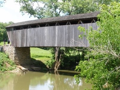
Switzer Covered Bridge
GEOGRAPHIC SORT WITH USA FIRST Geographic Sort Title Sort Marker Number Sort Marker Number Sort N Marker Number Sort T Publication Order Sort Publication Order Sort A Erected Year Sort Most Viewed Sort Most Recent-Interest Sort Most Recently Changed Sort SEE FAQ #33 FOR DESCRIPTIONS
On Jones Lane (Route 1262) (County Route 1262 at milepost 3), 1 mile south of Switzer Road (County Route 1689), on the left when traveling south.
Near Frazer Branch Road, 0.2 miles south of KY-1, on the left when traveling south.
On Kentucky Route 7 at Brown Cover Bridge Road (Kentucky Route 1215), on the right when traveling south on State Route 7.
On Kentucky 3 at East Fork Road (Kentucky Route 1496), on the left when traveling north on Kentucky 3. Reported missing.
On Cabin Creek Road, 3.6 miles east of Mason Lewis Road (Kentucky Route 10), on the left when traveling west.
On Mary Ingles Highway (Kentucky Route 8) at Lees Creek Road, on the right when traveling east on Mary Ingles Highway.
On South Main Street (U.S. 231) 0.1 miles north of East Union Street, on the right when traveling south.
On Mt. Zion Road (Kentucky Route 458), on the left when traveling north. Reported missing.
On Framingham Road, 0.3 miles east of Carson Road, on the left when traveling east.
On Hemlock Bridge Road, 1.1 miles south of Frog Alley, on the right when traveling east.
On Covered Bridge Road, 0.1 miles south of Fitz Lane, on the right when traveling south.
On Lowe's Bridge Road at Water Street (State Highway 16), on the left when traveling south on Lowe's Bridge Road.
On North East Road (Route 272) 0.3 miles north of Old Bayview Road, on the right when traveling north.
On Catoctin Mountain Highway (U.S. 15) 0.5 miles south of Business U.S. 15, on the right when traveling south.
Near Urbana Pike (Maryland Route 355) at Araby Church Road, on the right when traveling north.
Paid Advertisement
Near Dwight D. Eisenhower Highway (Interstate 70) 2 miles west of Maryland Route 17, on the right when traveling west.
On Old Frederick Road, on the right when traveling south.
Near Stafford Road at Rock Run Road, on the right when traveling west.
On Covered Bridge Lane east of S Main Street (U.S. 7), on the right when traveling east.
On North Whites Bridge Road, 1 mile north of Richmond Road, on the right when traveling north.
On Thornapple River Drive Southeast at Fase Street Southeast, on the right when traveling south on Thornapple River Drive Southeast.
On Covered Bridge Road Northeast at Beckwith Drive NE, on the left when traveling east on Covered Bridge Road Northeast.
On Schweitzer Road at Covered Bridge Road (County Highway 133), on the left when traveling east on Schweitzer Road.
On West Avenue, 0.1 miles north of West 2nd Street, on the right when traveling north.
Near West Avenue north of 2nd Street West.
On West Avenue, 0.1 miles north of West 2nd Street, on the right when traveling north.
On West Avenue, 0.1 miles north of West 2nd Street, on the right when traveling north.
On West Avenue, 0.1 miles north of West 2nd Street, on the right when traveling north.
On West Avenue, 0.1 miles north of West 2nd Street, on the right when traveling north.
On County Road 360, 0.1 miles east of State Highway OO, on the right when traveling east.
Paid Advertisement
On State Highway 125, 0.1 miles east of Main Street, on the right when traveling east.
Near Old Lemay Ferry Road.
Near Old Lemay Ferry Road.
Near Old Lemay Ferry Road.
Near Old Lemay Ferry Road.
On Pershing Drive north of Front Street, on the left when traveling north.
Near Passaconaway Road east of Kancamagus Highway (New Hampshire Route 112) when traveling east.
On West Side Road at Hillside Avenue, on the right when traveling north on West Side Road.
On Main Street (New Hampshire Route 16A) at Pinkham Notch Road (New Hampshire Route 16), on the right when traveling west on Main Street.
On Hinsdale Road (New Hampshire Route 119) at Gun Mountain Road, on the left when traveling west on Hinsdale Road.
On Main Street west of Spring Street, on the left when traveling west.
On Rum Hill Road (U.S. 302), on the right when traveling south.
On Blair Road, 0.1 miles west of Daniel Webster Highway (U.S. 3), on the right when traveling west.
On Monroe Road (New Hampshire Route 135) 0.1 miles north of Central Street (U.S. 302), on the right when traveling north.
Paid Advertisement
On Daniel Webster Highway (U.S. 3) 0.2 miles north of Connector Road, on the right when traveling north.
Near Bridge Street west of Union Street, on the left when traveling north.
On Chase Road (SR 12A) at Bridge Street on Chase Road (SR 12A).
On New Hampshire Route 12A south of the Cornish-Windsor Covered Bridge, on the left when traveling north.
On Burlington Pike (U.S. 130), on the right when traveling west.
On Rosemont Ringoes Road at Upper Creek Road, on the right when traveling east on Rosemont Ringoes Road.
On Fitches Bridge Road at Delhi-South Kortright Road (County Route 18), on the right when traveling north on Fitches Bridge Road.
On Fitches Bridge Road near Delhi South Kortright Road, on the right when traveling south.
On Bridge Street (New York State Route 30) 0.1 miles south of New York State Route 206, on the right.
On Bridge Street (New York State Route 30) 0.3 miles north of River Road, on the left when traveling south.
On New York State Route 10 at Basin Clove Road on State Route 10.
Near New York State Route 10, on the left when traveling south.
Near River Street north of Dunham Street, on the right when traveling west.
On Bridge Street at Water Street, on the left when traveling south on Bridge Street.
On Mill Hill Road south of John Fountain Road, on the right when traveling south.
On South Shore Road (County Route 110) at Fish House Road (County Route 109), on the right when traveling south on South Shore Road.
Paid Advertisement
On Quaker Road (New York State Route 251) 0.7 miles east of River Road (New York State Route 251).
On W Main St (New York State Route 94) 0 miles south of Patricia Lane, on the right when traveling south.
On Glimmerglass State Park Road, 0.4 miles north of County Road 31, on the right when traveling north.
On North Shore Road (County Route 4), on the right when traveling east.
On New York State Route 30 at Eastside Road, on the right when traveling north on State Route 30.
On Eastside Road at Mountain Road, on the left when traveling south on Eastside Road.
On Eastside Road, on the right when traveling south.
On Fort Road north of N Main Street when traveling north.
On New York State Route 7 at Beards Hollow Road (County Route 23), on the right when traveling west on State Route 7.
Near Covered Bridge Road, on the right when traveling north.
On Covered Bridge Road, on the left when traveling north. Reported missing.
On Craigie Clair Road, 0.1 miles east of Berry Brook Road, on the right when traveling west.
On Craigie Clair Road, 0.1 miles east of Berry Brook Road, on the left when traveling west.
On Bridge Street just north of Main Street, on the right when traveling north.
On Bridge Street north of Main Street, on the right when traveling north.
Paid Advertisement
On Bridge Street just north of Main Street, on the right when traveling north.
On Mill Brook Road at Davis Road, on the right when traveling east on Mill Brook Road.
On Buskirk Road (County Route 59) at Firehouse Road (County Route 103), on the right when traveling east on Buskirk Road.
On Rexleigh Road at Camp Road, on the left when traveling south on Rexleigh Road.
On Eagleville Road at Binninger Road, on the left when traveling south on Eagleville Road.
Near U.S. 70, 0.2 miles east of Bridgewood Drive, on the left when traveling east.
Near U.S. 70, 0.2 miles east of Bridgewood Drive, on the left when traveling east.
Near U.S. 70, 0.2 miles east of Bridgewood Drive, on the left when traveling east.
On Pisgah Covered Bridge Road, on the left when traveling south.
On State Road South (County Road 25) 0.3 miles north of Plymouth Ridge Road, on the right when traveling west.
On State Road Street (County Road 25) 0.3 miles north of Plymouth Ridge Road, on the right when traveling west.
On Harpersfield Road at State Road, on the left when traveling north on Harpersfield Road.
On West Liberty Street west of South Broadway (Ohio Route 534), on the right when traveling east.
On Corso Road, on the right.
On Stonelick Williams Corner Road.
Paid Advertisement
On Calcutta-Smith Ferry Road (County Route 430) 0.8 miles north of Harvey Avenue (Ohio Route 39), on the right when traveling north. Reported missing.
On Echo Dell Road (Local Route 929) north of Bell School Road (Local Route 1131), on the left when traveling north.
On Ohio Route 154 east of Scroggs Road (Local Route 795), on the right when traveling east.
On Eagleton Road, 0.1 miles south of Teegarden Road, on the right when traveling north.
On County Road 25 near County Road 343, on the right when traveling north.
375 entries matched your criteria. Entries 101 through 200 are listed above.
⊲ Previous 100 —
Next 100 ⊳