4087 entries match your criteria. Entries 101 through 200 are listed.⊲ Previous 100 — Next 100 ⊳
Exploration Topic
By Bill Kirchner, May 17, 2016
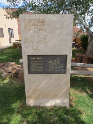
Impossible Canyons Marker
| 101 ► Arizona, Coconino County, Marble Canyon — Impossible Canyons — Dominguez y Escalante Expedition 1776-1976 — |
| On U.S. 89A at milepost 538.3, on the right when traveling west. | |||
| 102 ► Arizona, Coconino County, Page — Crossing of the Fathers — Dominguez y Escalante Expedition 1776-1976 — |
| On Lake Powell Boulevard at Navajo Drive, on the right when traveling north on Lake Powell Boulevard. | |||
| 103 ► Arizona, Coconino County, Page — Emma Dean — |
| On Lake Powell Boulevard at Navajo Drive, on the right when traveling north on Lake Powell Boulevard. | |||
| 104 ► Arizona, Coconino County, Page — Major John Wesley Powell — 1834-1902 — |
| Near U.S. 89. | |||
| 105 ► Arizona, Coconino County, Sunset Crater Volcano National Monument — "The Peaks" — |
| 106 ► Arizona, Coconino County, Sunset Crater Volcano National Monument — Geological Infant — |
| 107 ► Arizona, Coconino County, Walnut Canyon National Monument — A Time of Change — |
| 108 ► Arizona, Coconino County, Williams — Bill Williams Mountain — Elevation 9,264 Ft — |
| On West Bill Williams Avenue/West Route 66, on the left when traveling east. | |||
| 109 ► Arizona, Coconino County, Williams — William Sherley Williams — Sculpture by B.R. Pettit — |
| On East Railroad Avenue near South 9th Street, in the median. | |||
| 110 ► Arizona, Graham County, Safford — The Gila Valley |
| On U.S. 70 at milepost 341, on the right when traveling east. Reported missing. | |||
| 111 ► Arizona, Greenlee County, Clifton — San Francisco River — |
| On The Coronado Trail (U.S. 191 at milepost 163), on the right when traveling north. | |||
| 112 ► Arizona, La Paz County, Quartzsite — The Last Camp of Hi Jolly — Camel Driver, Packer, Scout — |
| Near Cemetery Street (Business U.S. 10) 0.1 miles north of West Main Street (U.S. 95) when traveling north. | |||
| 113 ► Arizona, Maricopa County, Phoenix, Central City — Jacob Waltz — |
| On 13th Avenue at West Jefferson, on the right when traveling north on 13th Avenue. | |||
| 114 ► Arizona, Maricopa County, Sentinel — Oatman Massacre Site — |
| Near Oatman Road, 8.8 miles north of Agua Caliente Road. | |||
| 115 ► Arizona, Mohave County, Fredonia — A Good Drink of Water — Pipe Spring National Monument — |
| Near North Pipe Spring Road, 0.3 miles north of Arizona Route 389, on the left when traveling north. | |||
| 116 ► Arizona, Mohave County, Fredonia — Powell’s Surveyors at Pipe Spring — Pipe Spring National Monument — |
| Near North Pipe Spring Road, 0.3 miles north of Arizona Route 389, on the left when traveling north. | |||
| 117 ► Arizona, Mohave County, Grand Canyon National Park — Separation Canyon — |
| 118 ► Arizona, Mohave County, Littlefield — 121 — The Old Spanish Trail — 1829 - 1848 — |
| On County Highway 91 at Old Pioneer Road on County Highway 91. | |||
| 119 ► Arizona, Mohave County, Wikieup — Big Sandy Valley |
| On U.S. 93, on the right when traveling north. Reported missing. | |||
| 120 ► Arizona, Navajo County, Holbrook — Early Explorers — |
| Near Petrified Forest Road, on the left when traveling east. | |||
| 121 ► Arizona, Navajo County, Holbrook — Historic Wagon Road — |
| On Joy Nevin Avenue west of 2nd Street, on the right when traveling west. | |||
| 122 ► Arizona, Navajo County, Winslow — Historic Wagon Road — |
| On East 2nd Street (Old Highway 66) at North Williamson Avenue (State Road 87), on the right when traveling east on East 2nd Street. | |||
| 123 ► Arizona, Pima County, Sikul Himatk — Quijotoa — |
| On Tucson Ajo Highway (State Highway 86) near Indian Route 32, on the right when traveling east. | |||
| 124 ► Arizona, Pima County, Tucson, Downtown — Garcés Footbridge — Puente de Garcés — Historic Site — |
| 125 ► Arizona, Pima County, Tucson, El Presidio — Hugo O'Conor — |
| Near West Paseo Redondo. | |||
| 126 ► Arizona, Pima County, Tucson, El Presidio — Padre-Eusebio-Francisco-Kino, S.J. — |
| On West Alameda Street, on the right when traveling east. | |||
| 127 ► Arizona, Pima County, Tucson, Menlo Park — Sentinel Peak — |
| On South Sentinel Peak Road, on the left when traveling north. | |||
| 128 ► Arizona, Pima County, Tucson, West University — Eusebio Francisco Kino, S. J. — 1645-1711 — |
| On East 2nd Street, on the right when traveling west. | |||
| 129 ► Arizona, Pinal County, Apache Junction — Jacob Von Walzer — 1808 – 1891 — Lost Dutchman Gold Route — |
| Near North Apache Trail at Old West Highway. | |||
| 130 ► Arizona, Pinal County, Picacho — Juan Bautista de Anza National Historic Trail / Camp 21: El Aquituni — |
| 131 ► Arizona, Santa Cruz County, Lochiel — Fray Marcos De Niza — |
| On Duquesne Road, 0.5 miles north of US / Mexico border, on the left when traveling west. | |||
| 132 ► Arizona, Santa Cruz County, Nogales — Padre Eusebio Francisco Kino SJ — |
| Near West Kino Park Place. | |||
| 133 ► Arizona, Santa Cruz County, Tubac — Juan Bautista de Anza — 1734 - 1788 — |
| On Burruel Street, on the right when traveling north. | |||
| 134 ► Arizona, Yavapai County, Bumble Bee — Mining in Arizona — |
| 135 ► Arizona, Yavapai County, Prescott — Pauline Weaver — Truly a Great Man — |
| Near West Gurley Street. | |||
| 136 ► Arizona, Yavapai County, Prescott — Prescott's Beginnings: The First Mining District in Yavapai County — |
| On South Montezuma Street (Arizona Route 89), on the right when traveling west. | |||
| 137 ► Arizona, Yavapai County, Rimrock — Chaves Historic Trail — |
| On Beaver Creek Road (County Road 77) 1.1 miles east of Interstate 17, on the right when traveling west. | |||
| 138 ► Arizona, Yuma County, Yuma — Crossing Into History — Juan Bautista de Anza National Historic Trail — National Park Service, U.S. Department of the Interior — |
| Near Prison Hill Road. | |||
| 139 ► Arizona, Yuma County, Yuma — Juan Bautista de Anza National Historic Trail — |
| Near Prison Hill Road, 0.5 miles north of Harold C. Giss Parkway. | |||
| 140 ► Arizona, Yuma County, Yuma — U.S. Army of the West — Mormon Battalion — Longest Sustained March in U.S. Military History, 1846-1847 — |
| Near 12th Avenue, 0.8 miles west of Water Street. | |||
| 141 ► Arkansas, Arkansas County, Arkansas Post — The European Settlement — |
| Near Old Post Road south of State Route 169. | |||
| 142 ► Arkansas, Arkansas County, Arkansas Post National Memorial — First Post of Arkansas — 1686 — 1700 — The French Settlement of Henri de Tonti — |
| Near Old Post Road, 0.8 miles south of State Route 169. | |||
| 143 ► Arkansas, Benton County, Bella Vista — Lewis & Clark Expedition — |
| 144 ► Arkansas, Boone County, Harrison — The Montgomery Ward Building — |
| On North Willow Street south of West Rush Avenue, on the right when traveling south. | |||
| 145 ► Arkansas, Conway County, Russellville — Arkansas River of Yesterday — |
| Near Stouts Point. | |||
| 146 ► Arkansas, Conway County, Russellville — The Legend of Petit Jean — |
| Near Stouts Point. | |||
| 147 ► Arkansas, Crawford County, Van Buren — CSI: Van Buren — |
| Near North 3rd Street, 0.1 miles south of Knox Street, on the right when traveling south. | |||
| 148 ► Arkansas, Crittenden County, Marion — Father Jacques Marquette and Louis Joliet's French expedition arrived in Arkansas — |
| Near Cypress Drive. | |||
| 149 ► Arkansas, Crittenden County, Marion — Hernando De Soto's expeditionary force entering Arkansas — |
| Near East Military Road. | |||
| 150 ► Arkansas, Cross County, Parkin — Welcome to the Village Trail — |
| On Ark. State Hwy 184, 0.1 miles Us Hwy 64, on the left. | |||
| 151 ► Arkansas, Desha County, Dumas — Arkansas Indians — |
| On Pickens Street (U.S. 165) east of Jack Dante Drive, on the right when traveling east. | |||
| 152 ► Arkansas, Faulkner County, Conway — 450th Commemoration De Soto Expedition — 1541 – 1991 — |
| Near State Highway 319, 1.6 miles west of Old Morrilton Highway (U.S. 64). | |||
| 153 ► Arkansas, Garland County, Hot Springs — “An Open Log Cabin and a Few Huts” — Hot Springs Central Avenue Historic District — |
| On Central Avenue (Arkansas Route 7) at Whittington Avenue, on the right when traveling south on Central Avenue. | |||
| 154 ► Arkansas, Garland County, Hot Springs — DeSoto Camp — |
| On Central Avenue (Arkansas Route 7) at Fountain Street, on the right when traveling north on Central Avenue. | |||
| 155 ► Arkansas, Hot Spring County, Donaldson — 18 — Military Road / Settlement of Midway — |
| On Midway Road (County Road 15) south of Jim Bray Drive (County Highway 628), on the right when traveling north. | |||
| 156 ► Arkansas, Jefferson County, Pine Bluff — Bayou Bartholomew — |
| On South Main Street at South Olive Street (Business U.S. 63), on the right when traveling north on South Main Street. | |||
| 157 ► Arkansas, Monroe County, Holly Grove — Life in the Swamp — Louisiana Purchase Historic State Park — |
| Near State Highway 362, 1.8 miles east of U.S. 49. | |||
| 158 ► Arkansas, Monroe County, Holly Grove — The Opening of the American West — Louisiana Purchase Historic State Park — |
| Near State Highway 362, 1.8 miles east of U.S. 49. | |||
| 159 ► Arkansas, Monroe County, Holly Grove — The Survey: 1815 — Louisiana Purchase Historic State Park — |
| Near State Highway 362, 1.8 miles east of U.S. 49. | |||
| 160 ► Arkansas, Monroe County, Holly Grove — Two Lines Mark the Future of the United States — Louisiana Purchase Historic State Park — |
| Near State Highway 362, 1.8 miles east of U.S. 49. | |||
| 161 ► Arkansas, Montgomery County, Caddo Gap — De Soto at Caddo Gap — |
| On Indian Valley Road at Vaught Street, on the right when traveling east on Indian Valley Road. | |||
| 162 ► Arkansas, Phillips County, Helena — Battery C Revealed — Battle of Helena — |
| Near Yorkshire Drive, 0.1 miles east of Audubon Drive. | |||
| 163 ► Arkansas, Phillips County, Helena — Hernando De Soto — |
| On Cherry Street. | |||
| 164 ► Arkansas, Phillips County, Helena — Those who have come before — |
| On Elm Street. | |||
| 165 ► Arkansas, Pope County, Russellville — Exploring the Arkansas — |
| Near Lock and Dam Road (Highway 7) just west of Sheppard Drive. | |||
| 166 ► Arkansas, Pulaski County, Little Rock — The Point of Rocks — |
| Near President Clinton Avenue. | |||
| 167 ► Arkansas, Pulaski County, Little Rock, Downtown — The "Little Rock" — 1722 — |
| Near Ottenheimer Plaza. | |||
| 168 ► Arkansas, Randolph County, Pocahontas — Sir Henry Morton Stanley — |
| On North Marr Street at West Broadway Street (State Route 90), on the right when traveling south on North Marr Street. | |||
| 169 ► Arkansas, Randolph County, Pocahontas — The River Basin — |
| On U.S. 62/67 north of South Bettis Street, on the right when traveling north. | |||
| 170 ► Arkansas, Saline County, Benton — De Soto Trail — |
| On E. Carpenter Street (State Highway 35) at Military Road, on the right when traveling east on E. Carpenter Street. | |||
| 171 ► Arkansas, Sebastian County, Fort Smith — Major Long Surveys the Western Frontier — Fort Smith National Historic Site — National Park Service, U.S. Department of the Interior — |
| Near Parker Avenue at South 3rd Street. | |||
| 172 ► Arkansas, Sebastian County, Fort Smith — A-33 — Sebastian County California Gold Seekers — |
| Near Rogers Avenue east of 6th Street (Arkansas Highway 255), on the right when traveling east. | |||
| 173 ► Arkansas, Union County, El Dorado — Oil in Arkansas — The Discovery — |
| Near South Jefferson Avenue at East Cedar Street, on the right when traveling south. | |||
| 174 ► California, Alameda County, Berkeley — Don Pedro Fages Expedition — |
| Near Center Street east of Oxford Street. | |||
| 175 ► California, Alameda County, Fremont, Canyon Heights - Vallejo Mills — Paths Through a Varied Landscape — Anza Expedition of 1776 — |
| Near Old Canyon Road. | |||
| 176 ► California, Alameda County, Fremont, Mission San Jose — De Anza Expedition 1775 - 1776 — |
| Near Mission Boulevard. | |||
| 177 ► California, Alameda County, Fremont, Vineyards - Avalon — The Ohlones and the Mission San Jose — Rancho Higuera Historical Park — |
| On Rancho Higuera Road south of Curtner Road, on the left when traveling south. | |||
| 178 ► California, Alameda County, Fremont, Vineyards - Avalon — The Rancho del Agua Caliente and The Higuera Adobe — Rancho Higuera Historical Park — |
| On Rancho Higuera Road near Curtner Road, on the left when traveling south. | |||
| 179 ► California, Alameda County, Hayward — A Chance Encounter — Un Encuentro Casual — |
| On City Center Drive near 2nd Street, on the right when traveling north. | |||
| 180 ► California, Alameda County, Hayward — Juan Bautista de Anza Expedition Campsite #98 — |
| On Foothill Boulevard (U.S. 238) at City Center Drive, on the right when traveling north on Foothill Boulevard. | |||
| 181 ► California, Alameda County, Hayward — Legacy of Change — |
| On City Center Drive near 2nd Street, on the right when traveling north. | |||
| 182 ► California, Alameda County, Hayward — Search for Water — |
| On City Center Drive near 2nd Street, on the right when traveling east. | |||
| 183 ► California, Alameda County, Livermore — William M. Mendenhall 1823 – 1911 / De Anza Expedition Campsite — |
| Near Livermore Avenue. | |||
| 184 ► California, Alameda County, Oakland, Downtown Oakland — Masters of Navigation — |
| On 10th Street east of Harrison Street, on the right when traveling west. | |||
| 185 ► California, Alameda County, Oakland, Joaquin Miller Park — John C. Fremont Monument — Built 1904 — |
| Near Sanborn Drive, on the right when traveling east. | |||
| 186 ► California, Alameda County, Oakland, Mills College — First Latitude Sighting of the Golden Gate — 27 March 1772 — |
| On Underwood Avenue, on the right when traveling south. | |||
| 187 ► California, Alameda County, Oakland, Mountain View Cemetery — Rev. Laurentine Hamilton — 1826 – 1882 — |
| Near Main Avenue near Piedmont Avenue, on the right when traveling east. | |||
| 188 ► California, Alameda County, Oakland, Peralta Hacienda — Anza Expedition of 1776 — |
| On 34th Avenue near Hyde Street, on the left when traveling north. | |||
| 189 ► California, Alameda County, Pleasanton — Changing Landscape — |
| Near Old Foothill Road near Foothill Road. | |||
| 190 ► California, Alameda County, San Leandro, Farrelly Pond District — De Anza Expedition 1775 - 1776 — |
| Near East 14th Street (State Highway 185) near Toler Avenue. | |||
| 191 ► California, Alameda County, Union City — Signs of Change — Anza Expedition of 1776 — |
| Near May Road. | |||
| 192 ► California, Alpine County, Alpine Village — CR-37 — Carson Trail - To West Carson Canyon — |
| On Carson Pass Highway (California Route 88) at Emigrant Trail, on the left when traveling east on Carson Pass Highway. | |||
| 193 ► California, Alpine County, Bear Valley — Old Emigrant Road — |
| Near Station House Road just west of Toll Gate Road. | |||
| 194 ► California, Alpine County, Kirkwood — 315 — Kit Carson — |
| Near Carson Pass Scenic Byway (State Highway 88), on the right. | |||
| 195 ► California, Alpine County, Kirkwood — Naming of Carson Pass — |
| On The "Additional Parking" Road at Carson Pass Scenic Byway (California Highway 88) on The "Additional Parking" Road. | |||
| 196 ► California, Alpine County, Kirkwood — Snowshoe Thom(p)son — (John Tostensen) — A True Pioneer — |
| On Carson Pass Scenic Byway (State Highway 88), on the right when traveling east. | |||
| 197 ► California, Alpine County, Markleeville — Beautiful Hot Springs Valley — draws people now as it has for thousands of years — |
| Near Hot Springs Road. | |||
| 198 ► California, Alpine County, Markleeville — 318 — Ebbetts Pass — Historical Landmark — |
| On Ebbetts Pass Scenic Byway (State Highway 4), on the left when traveling east. | |||
| 199 ► California, Alpine County, Markleeville — Grover Hot Springs — |
| Near Hot Springs Road. | |||
| 200 ► California, Alpine County, Markleeville — The Emigrant Trail — |
| On Carson Pass Highway (California Route 88 at milepost 6.4) east of Red Vista Road, on the right when traveling east. | |||
4087 entries matched your criteria. Entries 101 through 200 are listed above. ⊲ Previous 100 — Next 100 ⊳