Long before Columbus reached America, Indians extracted native copper in the Lake Superior region and worked it into articles which were used by tribes throughout the continent. French explorers learned of the vast copper deposits but were not able . . . — — Map (db m201426) HM
"White Rock" is steeped in history and oral traditions. Henry Schoolcraft, in his Travels of 1820, speaks of the White Rock and its prominence. He says, "White Rock, an enormous detached mass of transition limestone standing in the lake at the . . . — — Map (db m68867) HM
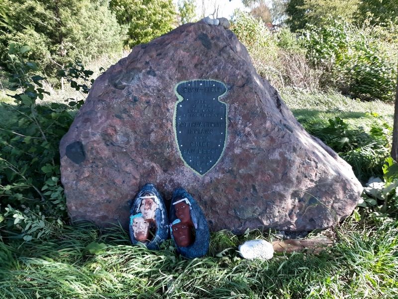
In the early 1800s, "White Rock", a point well known to the Indians and early voyagers, played a significant role in defining settlements.
The Act establishing the Territory of Michigan was passed January 11, 1805, and took effect June . . . — — Map (db m68866) HM
The White Rock in Lake Huron, opposite this stone, long venerated by the Indian tribes of Michigan, marks the northern line of the territory released by them to the United States under the treaty made at Detroit, Nov. 17, 1807. This plaque replaces . . . — — Map (db m213219) HM
Named after a boulder in Lake Huron that was used as a landmark in the Indian Treaty of 1807, the village was settled about 1860. Destroyed in the Great Fire of 1871, the town was soon rebuilt, including a schoolhouse. The present building was . . . — — Map (db m154098) HM
Here, on July 1, 1845, three Lutheran missionaries, Rev. Johann J.F. Auch, Rev. J. Simon Dumser, and Rev. George Sinke, arrived. The Lutheran leader, Rev. Friedrich Schmid, sent them from Ann Arbor to evangelize the Chippewa Indians. A log chapel . . . — — Map (db m131772) HM
Side 1
The small depression between Beaumont Tower and the Music Practice Building, known today as Sleepy Hollow, is the last vestige of a small, spring-fed brook entering the campus from the north and draining into the Red . . . — — Map (db m106834) HM
Educated first in Odawa (Ottawa) skills and traditions, Andrew J. Blackbird struggled to find the resources to Euro-American schools. He eventually studied at Ypsilanti State Normal School. His command of English enabled him to work as an . . . — — Map (db m103710) HM
Chief Okemos
Okemos was born in Shiawassee County around 1775. He distinguished himself at the Battle of Sandusky during the War of 1812 and won the respect of the Saginaw Chippewa people. Chief Okemos later signed several treaties on behalf . . . — — Map (db m84683) HM
Erected to the memory
of
Chief Okemos
of the Chippewas
whose tribe once occupied the ground
upon which this school now stands.
* Brave in battle * Wise in council *
* Honorable in peace *
After his people became . . . — — Map (db m103011) HM
About 1839 Joseph H. Kilbourne settled in this vicinity on land previously occupied by Chief Okemos and several hundred Indians. He became the first postmaster of Sanford (present-day Okemos) in 1840 and served in the Michigan legislature from 1847 . . . — — Map (db m176008) HM
July 4th 1661 As a matter of conjecture
Father Menard somewhere along this river either died or
was murdered while on his way
southward from L’Anse to visit the Menominee Indians — — Map (db m125036) HM
Here, in 1851, U.S. surveyor Guy H. Carleton discovered an Ojibwa (Chippewa) Indian village, cemetery and camp ground. Chief Edwards, last ruler at Chicaugon Lake, received a patent for this land in 1884. Selling it in 1891, he and his wife Pentoga, . . . — — Map (db m103462) HM
Discover the site of a pre-European Native American settlement and permanent area headquarters where Ojibwe bands congregated. Wooden burial structures protect and mark graves of these ancient bands. When Chief Edwards moved towards Lac Vieux Desert . . . — — Map (db m103463) HM
In the 1850s, the Methodist Episcopal (Indian) Church established the Bradley Mission School and Indian Cemetery in this area. The cemetery served the mission until the late 1860s. Only a few grave markers are visible and it is not known how many . . . — — Map (db m91737) HM
This boulder
marks the site where
John Batteese Berrard
built the first
Indian trading post
in
Jackson County
Erected by
Thomas Wincad
William E. Flemming
1816 — 1985 — — Map (db m88896) HM
December 4, 1844, Michigan Central College, under
the auspices of the Free-Will Baptists, enrolled five
students and started classes near this location.
Earlier, the newly-chosen president, David M. Graham,
a graduate of Oberlin College, had . . . — — Map (db m165360) HM
Huron Potawatomi Village
As early as 1825 large numbers of Potawatomi encamped at this location. One of the most prominent Huron Potatwatomi located here was Wabkezhik (Whapcazeek), who was wounded during the 1811 Battle of Tippicanoe Creek . . . — — Map (db m84726) HM
I am thinking of old Spring Arbor and when we first came to Michigan in 1831. I do not
remember the exact date that we left Allen, Allegheny County, New York, but we reached
Detroit the last day of May or first of June and lived near Fort Dearborn . . . — — Map (db m165352) HM
The great chiefs are gone. Their peace pipes are in the sands of the four winds, cold and forlorn, waiting again to be born. There are no Indian ponies, unshod, rushing to the beat of war drums in the sky. There are no wigwams warmed by . . . — — Map (db m210905) HM
This survey map was done by Sheridan Surveyors in
2011, which establishes the Potawatomi
burial site described in local abstracts. A letter written by James Taylor, June 4, 1835 (shown here
at the right) describes this historic site.
The . . . — — Map (db m165359) HM
In 1992, this 15 ton granite boulder was moved
from a field north of Hammond Road near the
Potawatomi Indian Village "of five lodges” to this
location near the Potawatomi burial ground. An
Indian profile was sandblasted into this rock . . . — — Map (db m165358) HM
The view to the northeast shows the contour of the mound
containing the Potawatomi burial site, an area measuring 4
rods square (66 feet), marked by 4 cairns. Is this a natural
contour mound or did the natives enhance this site by . . . — — Map (db m165361) HM
Kalamazoo River Environmental Importance
Native Americans harvested vast fields of wild rice near the mouth of the Kalamazoo and drank its crystal waters. But by the mid 1800s the river served as a drain for industrial pollutants and urban . . . — — Map (db m216864) HM
This locality, known as Indian Fields, was the site of a large Potawatomie village. The tract included about four square miles. The early white settlers found here fine examples of the famed garden beds. A short distance southwest of this terminal a . . . — — Map (db m190193) HM
David Kinsey, the founder of Caledonia village, settled on this site on April 13, 1856. He replaced his temporary lodging, a board shanty, with a plank house shortly after he arrived. Occasionally, Indians would be found sleeping on the first floor . . . — — Map (db m216775) HM
This tablet marks the site of the first Baptist mission station for the Ottawa Indians on Grand River established in 1827 conducted by Rev. Leonard Slater under the auspices of the American Baptist Missionary Union — — Map (db m240644) HM
The Grand, Michigan’s longest river, rises from a spring-fed pond near Jackson and flows 270 miles westward before emptying into Lake Michigan. Formed more than 13,000 years ago by melting glaciers of the last Ice Age, the ancient Grand changed its . . . — — Map (db m153294) HM
This area is dedicated to the Ottawa Indian village site that existed along this riverbank, many centuries before the coming of non-natives in this area. It is the heart of a large native community that continues in this region.
Descendants of the . . . — — Map (db m176510) HM
Long before contact with Euro-Americans, Native Americans lived near Baw-wa-ting, “the rapids.” Some 2000 years ago Hopewellian Indians built numerous burial mounds in the area. This mound group became known as the Converse Mounds. As early as the . . . — — Map (db m176443) HM
Noahquageshik, also referenced as Nawquageezhig and "Chief Noonday," was a very influential Grand river Ottawa Anishinabe (Original People) leader. At the turn of the 19th century, he was one of the Ogemuk (Chiefs) who led bands of the Ottawa . . . — — Map (db m176441) HM
Joseph LaFramboise Sr.
1765-1806
The first trading post in the Lowell area was built by Joseph LaFramboise who traded along the Grand River as early as 1793. While its exact location is not known, it was built on the north bank, west of . . . — — Map (db m216759) HM
The Odawa were the people living in the Lowell area when white settlers arrived. They would have said they were Anishinabe, meaning the first people or the original people. The area was heavily forested with an abundance of wild animals such as . . . — — Map (db m217481) HM
The Lowell Area Historical Museum invites you to explore the history of Lowell. Look for interpretive boards throughout town. Learn about different events, people and places that have shaped this community.
Imagine a landscape covered with . . . — — Map (db m216761) HM
Isle Royale is an archipelago comprising more than 200 islands 45 miles north of Keweenaw County. The main island is the largest in Lake Superior, 45 miles long and 9 miles wide. There are 70 lakes on Isle Royale, the largest, Siskiwit Lake. Rock . . . — — Map (db m152894) HM
Early Indian footpaths became the trails for explorers, missionaries and fur traders, who came to carve out homes in Michigan’s wilderness. The early settlers began to widen and improve these trails, which became the majority of Michigan’s primary . . . — — Map (db m152799) HM
An ancient vanished race mined native copper hundreds of years ago in countless pits and trenches scattered among the hills from Copper Harbor to Ontonagon and on Isle Royale. The explorer, Jacques Cartier, reported in 1536 that Indians on the St. . . . — — Map (db m154000) HM
For thousands of years, the view from here was of a densely forested landscape. American Indians hunted, fished, and collected copper for centuries. But in 1843, the Keweenaw mining rush was on, and everything changed. Sheltered by Porters . . . — — Map (db m153991) HM
…scarcely had we gotten out into Lake Michigan than we were beset by a horrible tempest and in an instant out rudder was broken to pieces…Not being able to control our course, we were during the night the toy of gigantic waves which . . . — — Map (db m208025) HM
Once, long ago, in the land called Wisconsin across the great lake, there was terrible hunger and many people died. A bear and two little cubs were trying to leave that place and come around the lake where there would be more food.
They . . . — — Map (db m208029) HM
In 1839 the Reverend Peter Dougherty founded Old Mission, the first Protestant mission in the Grand Traverse area. The church, comprising Indians and whites, was organized in 1843. After 1850 the Indians were allowed to buy land; they and the . . . — — Map (db m204938) HM
Lenawee County was first settled in 1824 at Tecumseh, which the Territorial Legislature subsequently made the county seat. Pioneers, mostly from upper New York State, then established Blissfield and Adrian, the later called Logan. The largest Indian . . . — — Map (db m102761) HM
,br>The oldest evidence of the use of a bow and arrow was
found in South Africa from about 64,000 years ago. The
earliest use of the bow and arrow in the Americas was by
the Native Americans for hunting and tribal warfare.
Archery was very . . . — — Map (db m228010) HM
In 1829, Geronimo was born in southern Arizona given the name Goyathlay, meaning "one who owns yawns." The Mexicans later gave him the name Geronimo, which is Spanish for Jerome. After his mother, wife, and children were massacred by Mexicans in . . . — — Map (db m228021) HM
Lassos are typically used to catch large animals like horses and bulls. Some people say Native Americans invented the lasso, but others say ancient Greeks used them first. Ancient Greeks were said to use them to fight people in wars, but in the . . . — — Map (db m228052) HM
Born in the Grand River Valley in what is now South Dakota, Sitting Bull, or Tatanka Yotanka, received early recognition from his tribe as a warrior and man of vision. During his youth he joined in the usual tribe as a warrior and man of vision. . . . — — Map (db m228008) HM
The Potawatomi and Wyandot lived along the river Giwitatigweisibi, known today as the Huron River. They traveled the waterway in birchbark canoes as they caught fish, harvested wild rice or bartered with other tribes. Lightweight canoes were easy . . . — — Map (db m202076) HM
Biddle House. The Biddle House is one of the oldest structures on Mackinac Island, dating to the 1780s. It is an example of piece sur piece en coulisse construction, a frame structure with a log infill fitted into slots. This French Canadian . . . — — Map (db m204427) HM
Mackinac Island has long been a burial location for the Anishnaabek (Odawa, Ojibway and Potawatomi). Some of the burials on the island are more than one thousand years old. It is a common practice for the Anishnaabek to bury their dead near water . . . — — Map (db m204415)
Indian Dormitory. The Treaty of 1836 transferred 15 million acres of Ojibway (Chippewa) and Odawa (Ottawa) land in Michigan Territory to the federal government. It also required improvements to the Mackinac Island Indian Agency, including "a . . . — — Map (db m204277) HM
This is one of Michigan's oldest Protestant churches. It was built in 1829-30 by the Presbyterian flock of Rev. Wm. M. Ferry, founder in 1823 of a nearby Indian mission. Robert Stuart and Henry Schoolcraft were lay leaders. About 1838 private owners . . . — — Map (db m34913) HM
According to tradition this is the cave in which the English fur-trader Alexander Henry hid out during the Indian uprising of 1763. The floor of the cave, he claimed, was covered with human bones, presumably Indian. — — Map (db m204412) HM
Ancient Anishinabe Path
The route that U.S. 2 follows today has served as an important transportation corridor from the earliest inhabitants of the Michigan Peninsulas to the present.
When the Federal Highway System was established . . . — — Map (db m139359) HM
The Anishinaabe village preserved their meat
and fish proteins by using drying racks
agwaawaanaak. Meats such as venison
waawaashkeshiwi-wiiyaas, beaver amiko-wiyaas
and bear mako-wiyaas were cut into thin strips
and . . . — — Map (db m214031) HM
Fishing in Lake Huron and Lake Michigan for the
Fisherman gigoonyikewinini was vital to the
Anishinaabe survival. During warm seasons these
large lakes required nets namewasab made of
bark fiber cord and nettle-stalk twine which . . . — — Map (db m214030) HM
The Three Sisters garden gitigaan was a
traditional way of planting three main agricultural
crops: corn mandaamin, beans mashkodesimin,
and squash okanakosimaan. Each crop
benefitted from one another. The corn seed . . . — — Map (db m214034) HM
The traditional healers nenaandawi'iwed or
medicine men were highly respected individuals
among the village due to their medicinal and
spiritual knowledge passed down for thousands of
years. Illness was cured both of the body and
spirit. . . . — — Map (db m214032) HM
An Anishinaabe woman anishinaabekwe plays
many important roles in the village. Other than
childbearing she builds, farms, crafts, hunts,
cooks and as this sculpture represents gathers
moozhaginan. She collects over 250 species . . . — — Map (db m214033) HM
The Jesuits
Black Robes of the Wilderness
In the 17th century the Society of Jesus (The Jesuits) sent missionaries to the far reaches of Asia, Africa, and the Americas. The Roman Catholic order was founded in 1537 by the Basque priest, . . . — — Map (db m139445) HM
The French Come to the Straits
The Straits of Mackinac has been a gathering place for hundreds of years. An abundance of whitefish, lake trout and sturgeon attracted Native people who established seasonal villages on Mackinac and Bois Blanc . . . — — Map (db m139634) HM
The Great Lakes are known for delicious freshwater fish.
Before the white man came, Native Indian tribes supplied their needs with fresh and dried fish from these lakes.
Later, others joined in the fishing business, many of them from the . . . — — Map (db m130127) HM
Some of the Hurons, who were driven from Ontario and the East by hostile Iroquois, finally found refuge in 1671 beside Marquette's new St. Ignace Mission. (Also called Huron Mission). They remained here with the French and Ottawas until 1701, when . . . — — Map (db m139395) HM
Man, in search of game, first entered North America during the Ice Age by crossing the Bering land bridge that once linked present-day Siberia and Alaska. Beginning about 9,000 B.C., melting glaciers raised the sea level 300 feet, flooding the . . . — — Map (db m139661) HM
Here on West Moran Bay, a large 17th century Ottawa village was directly connected by trail and water with Michilimackinac center on Moran Bay, Lake Huron. Both bays were named for Trader Morin whose post was at this settlement. The original burial . . . — — Map (db m104013) HM
The Past
10,000 years ago the last Pleistocene glacier retreated across this region, leaving behind the Great Lakes and their drainage basin. The first human inhabitants arrived soon thereafter, living off abundant game, fertile soil and . . . — — Map (db m139794) HM
One of the oldest archaeological sites in the country is located in St. Ignace at the Museum of Ojibwa Culture (across the street from here). The Huron village, which was located there, is believed to have looked like this in the 1600s. These . . . — — Map (db m139513) HM
When Huron refugees settled on this site in 1671 they established a village similar to the ones they had built for centuries in lower Ontario, their homeland.
The most striking feature in a Huron village is the very tall and very long bark . . . — — Map (db m139625) HM
French traders established themselves in the Upper Great Lakes region after 1644 and were welcome among the Indians. They sought harmony with the native people, learning their language and respecting their customs.
The French adopted useful . . . — — Map (db m139530) HM
In 1782 marauding American militia massacred nearly one hundred Christian Delaware Indians at their village in eastern Ohio. Seeking refuge, the Delaware settled on the Clinton River two and one-half miles north of here, on land granted by the . . . — — Map (db m85632) HM
More than 10,000 years ago, people began living on the land we now call Michigan. They arrived after the last glaciers retreated. Caribou, mastodons, mammoths and other animals roamed the plains and marshes in a cool, wet climate. Anishinaabek . . . — — Map (db m234999) HM
As early as 10,000 years ago, nomadic people were following the bountiful harvests of fish and game the Manistee River provided. By 500 B.C., natives began settling this land, setting up camps and farming.
The lands were controlled by the . . . — — Map (db m97439) HM
Following the fur traders into this region came a few adventurous lumbermen looking for saw-mill sites. Interested by what he saw in 1840, Joseph Stronach built a dam and water mill on the swift, natural outlet of Portage Lake.
Soon homesteaders . . . — — Map (db m97445) HM
Frederic Baraga was a lawyer, an artist and a Roman Catholic priest who came to the U.S. from present-day Slovenia in 1830. Baraga (1797-1868) served Native Americans in the Great Lakes region and wrote A Dictionary of the Otchipwe Language . . . — — Map (db m206057) HM
During the seventeenth century, dedicated Jesuit missionaries forged into the North American wilderness to live and work among the native peoples of the Great Lakes region. In September 1666, at age twenty-nine, Father Jacques Marquette arrived in . . . — — Map (db m206171) HM
On this spot on Sept. 19, 1844, William A. Burt, a deputy government surveyor, was the first to discover the great Lake Superior iron ore deposits. Peculiar fluctuations in his magnetic compass led Burt to ask his men to seek the cause, and they . . . — — Map (db m76314) HM
Among the earliest settlers in the Republic area, circa 1870, were the Munsons, Polkinghornes, Pascoes, Gibsons, Wilsons, Doyles, Gambels, Petersons, Bergstroms and Dodges. They had made their way from Cornwall County, England; Sweden, Finland, . . . — — Map (db m154298) HM
This
tablet marks the
Bay de Nocquet
Trail
of the Menominee
and other Indian tribes
U.S. Mail runners
and earliest fur traders
also Indian cemetery — — Map (db m88828) HM
Stanislaus Chaput, a French-Canadian fur trader sometimes called Louis Chappee, became the first settler at the mouth of the Menominee River in the early 1800s. He fought, along with most of the Green Bay traders, in the British attack on Fort . . . — — Map (db m88829) HM
This was the home of the Menominee Indians. Nicolet, the French explorer, visited them in 1634 on his futile search for Cathay. Conflict over fishing rights brought on the Sturgeon War here between the Menominee and Chippewa tribes. During the . . . — — Map (db m4414) HM
In 1831 the first white settlers in the area built a fur trading post near this site, called “Little Forks” by the Indians. When Midland County was organized in 1850, 65 people lived here. In 1856, Henry C. Ashmun, the county’s first . . . — — Map (db m163599) HM
When the War of 1812 began, LaPlaisance Bay settlement consisted of 14 homes along the creek. Medard LaBadie, considered a hero for his participation in the Battles of the River Raisin and those at Fort Meigs and Thames, was a French settler here. . . . — — Map (db m165272) HM
This land was occupied for centuries by people who lived in close harmony with their natural surroundings. The Indians, or Native Americans, who lived here belonged to various nations or tribes. In particular, the Ottawa (Odawa), Potawatomi, . . . — — Map (db m212668) HM
Hull's Treaty of 1807 gave the Potawatomi and other Indian tribes nine sections of land in Dundee Township, "where the Macon flows into th River Raisin". Main Street, Neiman, Day and Dundee-Azalia Roads were the original boundaries.
The Indians . . . — — Map (db m200517) HM
As a part of westward expansion, the United States began occupying lands in southeast Michigan in 1796. The Potawatomi Indians called the vast fertile lands along the River Raisin from Lake
Erie westward home. As the U.S. moved into their new . . . — — Map (db m165523) HM
The Native Americans called it Nummasepee (River of Sturgeon), after the great fish that once thrived here. The first French speaking settlers called it Rivière Aux Raisins (River of Grapes) after the many wild grape vines lining its banks. Now . . . — — Map (db m201608) HM
In the words of Laurent Durocher, "after the defeat of Winchester, many of the inhabitants fled with their families to the frontier of Ohio. Others went to Detroit. The British made several attempts to persuade the Indians to destroy what was left . . . — — Map (db m20905) HM
On this property in 1812 was the trading post of John Anderson, famed Scottish pioneer of the River Raisin.
Anderson, Colonel of the Militia in 1812, was taken prisoner at Detroit, later escaped.
Mrs. Anderson, alone at the time of the . . . — — Map (db m236276) HM
Beneath this fountain are the remains of Native Americans who lived here about the year 900 A.D. and have been respectfully re-interred. — — Map (db m201616) HM
From near this spot on Jan. 22, 1813, 525 British soldiers and Canadian militiamen from Fort Malden under Col. Henry Proctor and some 800 Indians under Chiefs Roundhead and Walk-In-The-Water launched a pre-dawn attack on the sleeping American camp a . . . — — Map (db m236279) HM
Over this ground, Jan. 18, 1813, 667 Kentuckians and nearly 100 local Frenchmen charged across the frozen river toward the British and Indian positions. The 63 British and Canadian soldiers and 200 Potawatomi Indians made a brief stand there, then . . . — — Map (db m27660) HM
Here in the log house of Jean Baptiste Jereaume the Federal Court of the Erie District, Territory of Michigan, held its first session July 3, 1805. President Thomas Jefferson named Judge Augustus B. Woodward to preside.
Beginning in 1807 the . . . — — Map (db m20909) HM
From the earliest days of Michigan settlement this corner has witnessed travel of many sorts signaling important events in the history of Michigan.
East lies Monroe’s port on Lake Erie where waves of immigrant traffic came from New England . . . — — Map (db m127984) HM
The Second Battle of the River Raisin Jan. 22, 1813, found nearly 400 American soldiers caught in retreat down this old road to Ohio. Those few who made it to this point, over a mile south of their camp, were ambushed by hidden Indians. The 40 . . . — — Map (db m27294) HM
Named for the Erie Indians, this was the last of the Great Lakes discovered by white men. The French were exploring the upper lakes as early as 1615, but they avoided the region to the south which was the realm of hostile Iroquois Indians. Then in . . . — — Map (db m107150) HM